Embed Size (px)
Citation preview
© Boardworks Ltd 20051 of 401 of 40
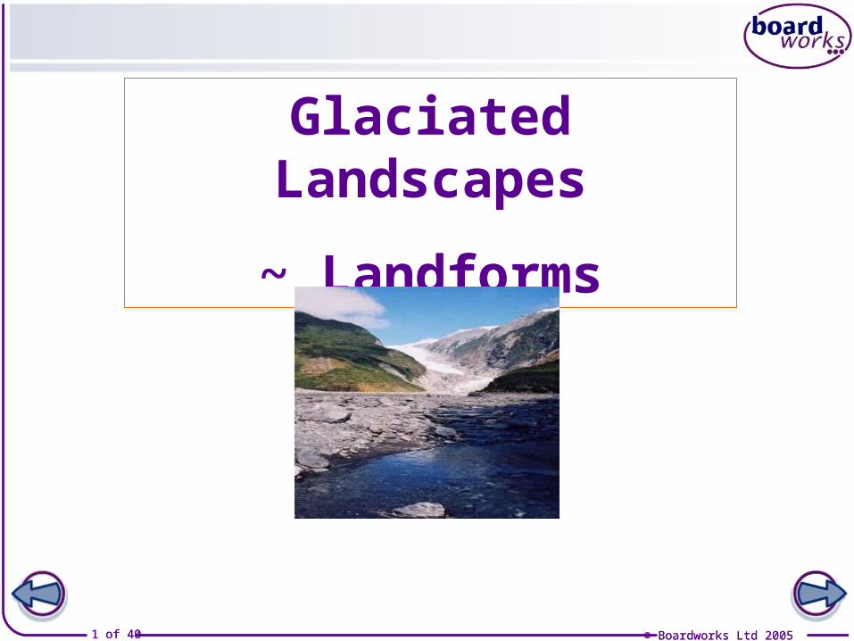
Glaciated Landscapes
~ Landforms
© Boardworks Ltd 2005
© Boardworks Ltd 20052 of 40
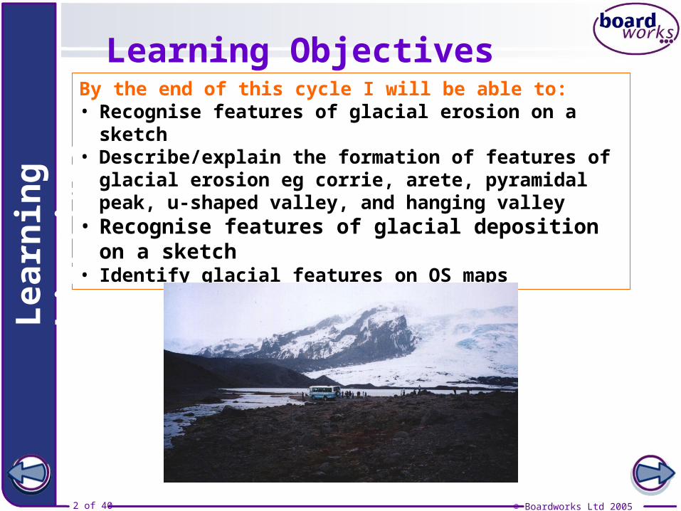
By the end of this cycle I will be able to:• Recognise features of glacial erosion on a sketch• Describe/explain the formation of features of glacial
erosion eg corrie, arete, pyramidal peak, u-shaped valley, and hanging valley
• Recognise features of glacial deposition on a sketch• Identify glacial features on OS maps
Lea
rnin
g o
bje
ctiv
esLearning Objectives
© Boardworks Ltd 20053 of 40
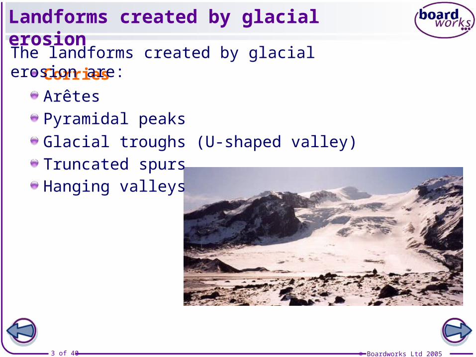
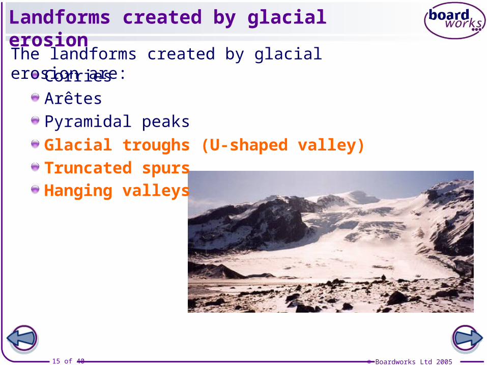
Landforms created by glacial erosion
CorriesThe landforms created by glacial erosion are:
Arêtes
Pyramidal peaks
Glacial troughs (U-shaped valley)
Truncated spursHanging valleys
© Boardworks Ltd 20054 of 40
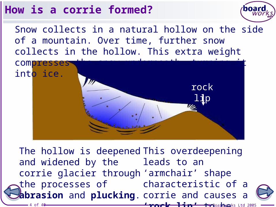
How is a corrie formed?
Snow collects in a natural hollow on the side of a mountain. Over time, further snow collects in the hollow. This extra weight compresses the snow underneath, turning it into ice.
The hollow is deepened and widened by the corrie glacier through the processes of abrasion and plucking.
rock lip
This overdeepening leads to an ‘armchair’ shape characteristic of a corrie and causes a ‘rock lip’ to be formed.
© Boardworks Ltd 20055 of 40
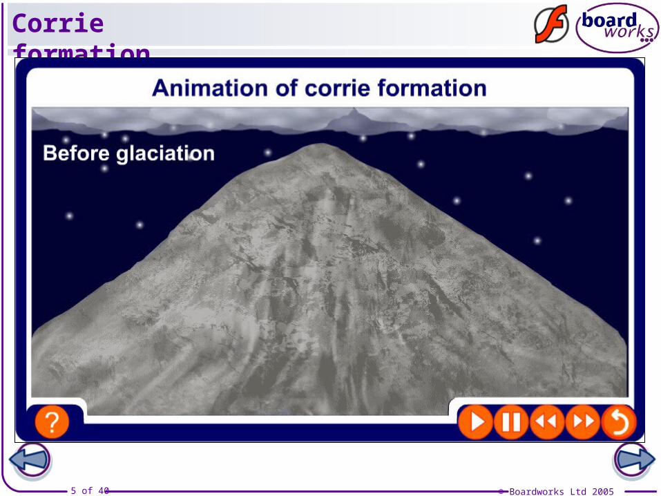
Corrie formation
© Boardworks Ltd 20056 of 40
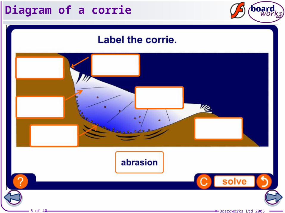
Diagram of a corrie

© Boardworks Ltd 20057 of 40
Explain the formation of a corrie
© Boardworks Ltd 20058 of 40
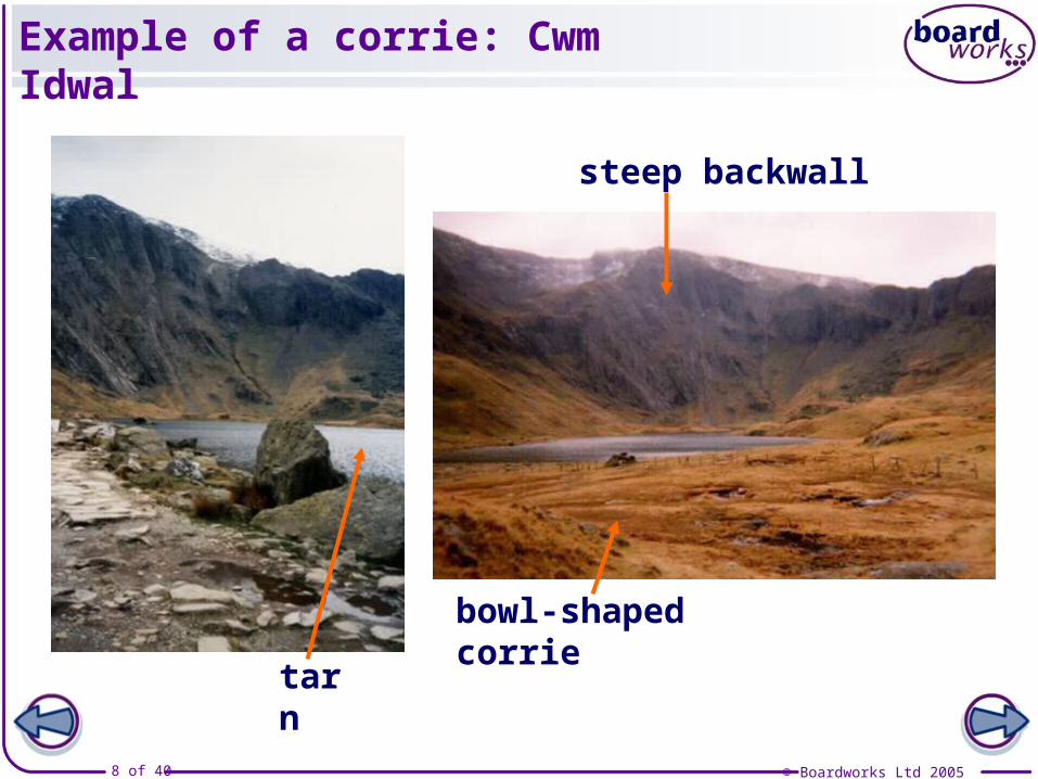
tarn
bowl-shaped corrie
steep backwall
Example of a corrie: Cwm Idwal

© Boardworks Ltd 20059 of 40
Drawing a fieldsketch of Cwm Idwal
© Boardworks Ltd 200510 of 40
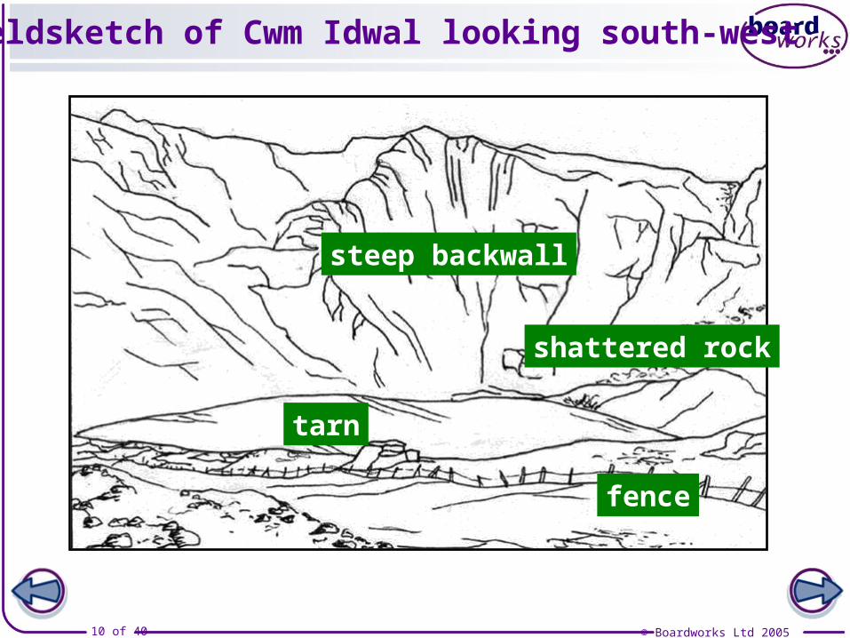
Fieldsketch of Cwm Idwal looking south-west
tarn
steep backwall
fence
shattered rock
© Boardworks Ltd 200511 of 40
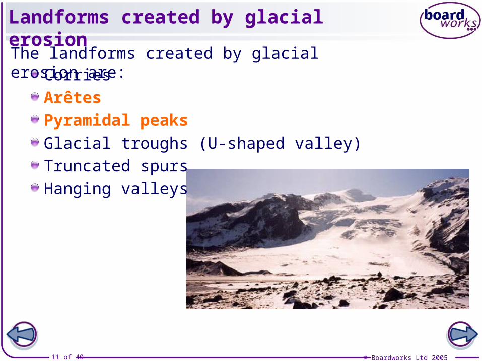
Landforms created by glacial erosion
CorriesThe landforms created by glacial erosion are:
Arêtes
Pyramidal peaks
Glacial troughs (U-shaped valley)
Truncated spursHanging valleys

© Boardworks Ltd 200512 of 40
Formation of an arête
Arêtes are ‘knife-edged’ ridges formed between two corries.
© Boardworks Ltd 200513 of 40
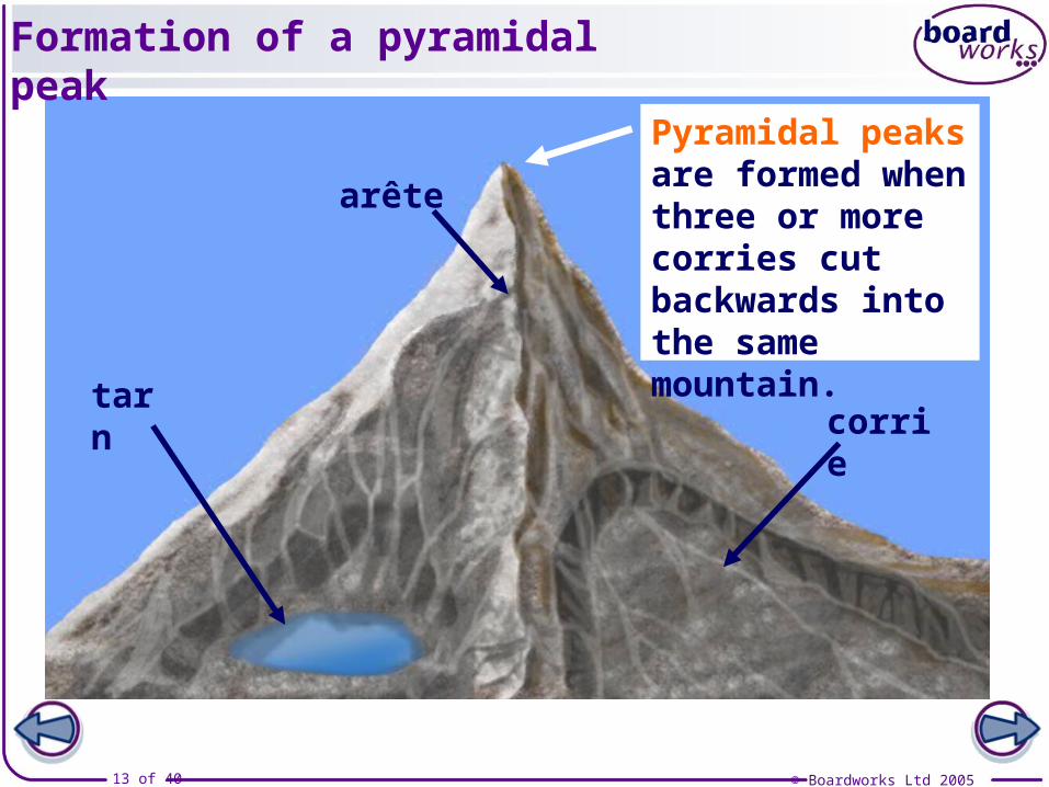
Pyramidal peaks are formed when three or more corries cut backwards into the same mountain.
Formation of a pyramidal peak
corrietarn
arête
© Boardworks Ltd 200514 of 40
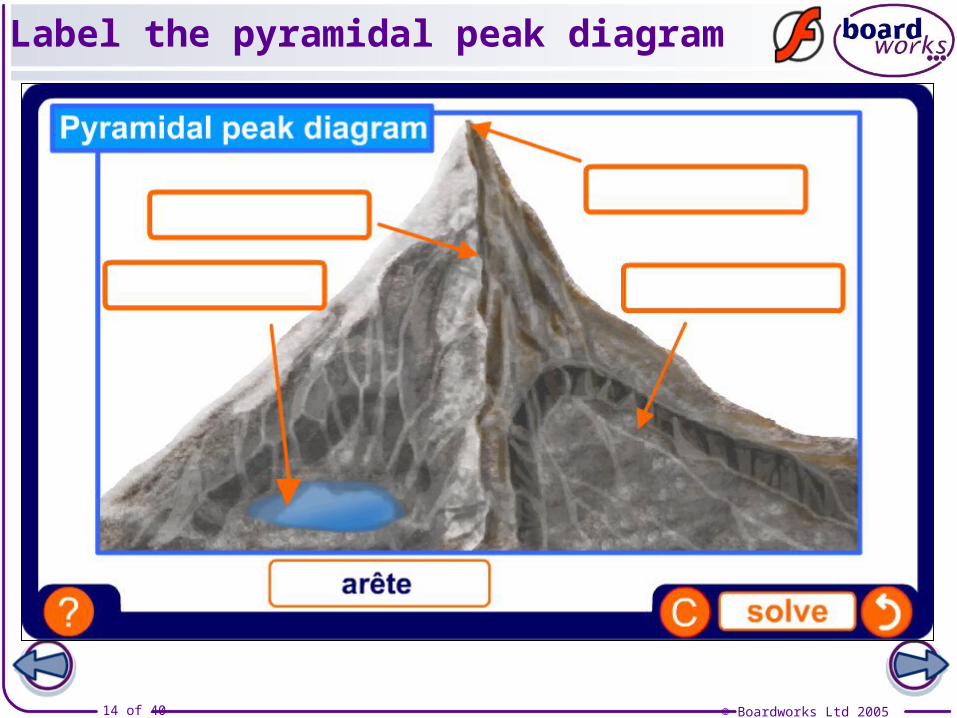
Label the pyramidal peak diagram
© Boardworks Ltd 200515 of 40
Landforms created by glacial erosion
CorriesThe landforms created by glacial erosion are:
Arêtes
Pyramidal peaks
Glacial troughs (U-shaped valley)
Truncated spursHanging valleys
© Boardworks Ltd 200516 of 40
Formation of a glacial trough
© Boardworks Ltd 200517 of 40
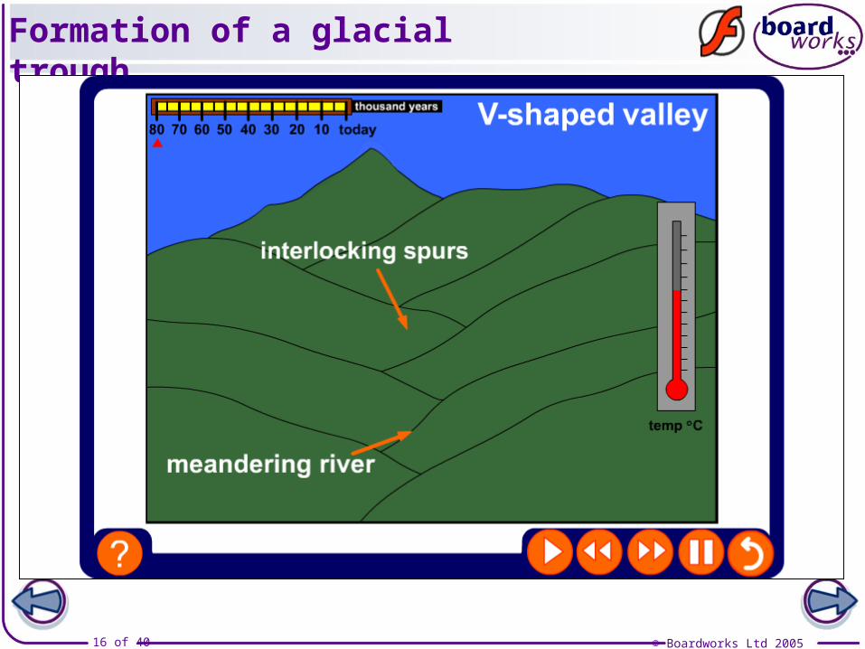
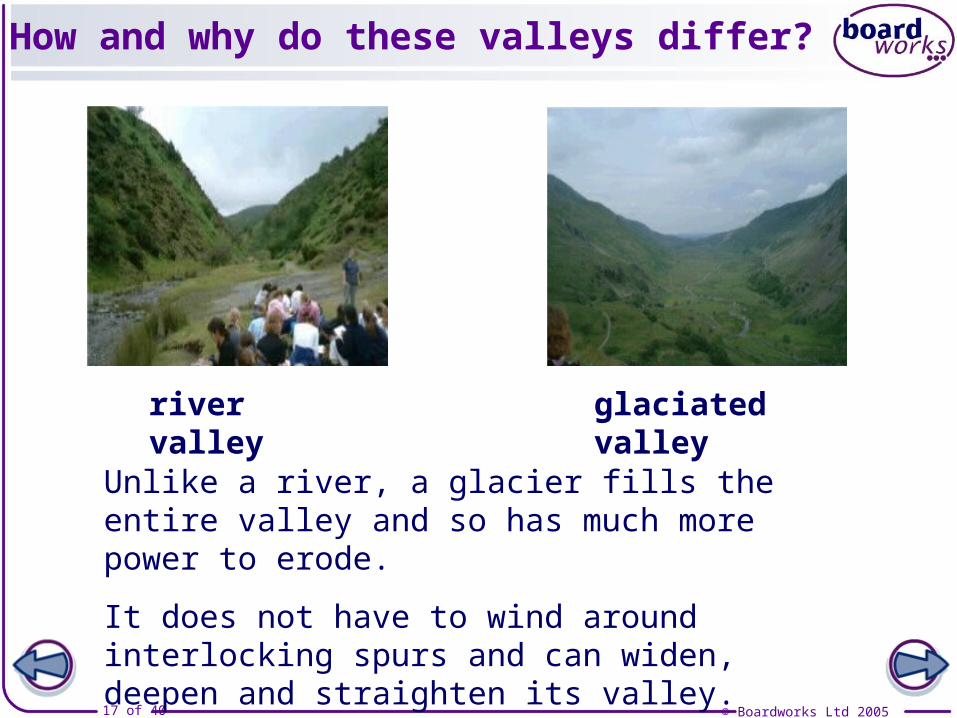
How and why do these valleys differ?
Unlike a river, a glacier fills the entire valley and so has much more power to erode.
It does not have to wind around interlocking spurs and can widen, deepen and straighten its valley.
river valley glaciated valley
© Boardworks Ltd 200518 of 40
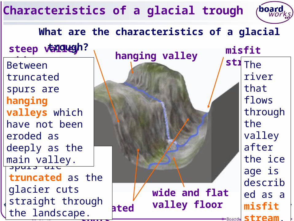
Characteristics of a glacial trough
truncated spurs
hanging valley misfit stream
wide and flat valley floor
steep valley sides
What are the characteristics of a glacial trough?
Interlocking spurs are truncated as the glacier cuts straight through the landscape.
Between truncated spurs are hanging valleys which have not been eroded as deeply as the main valley.
The river that flows through the valley after the ice age is described as a misfit stream.
© Boardworks Ltd 200519 of 40
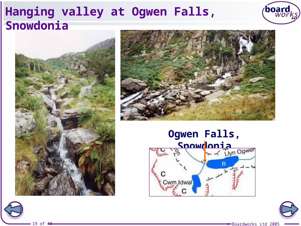
Hanging valley at Ogwen Falls, Snowdonia
Ogwen Falls, Snowdonia
© Boardworks Ltd 200520 of 40
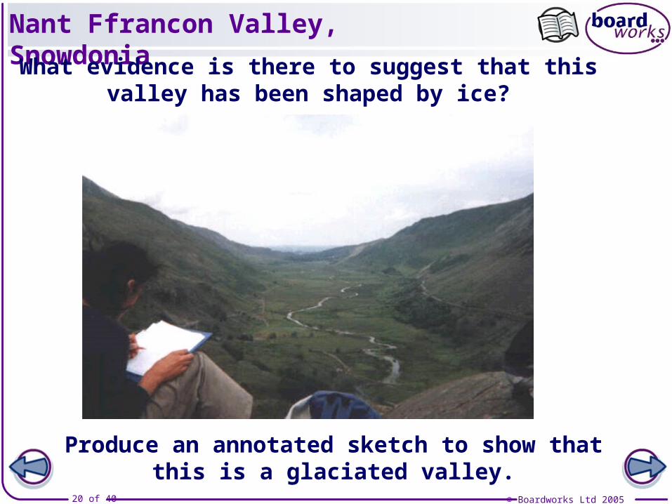
Nant Ffrancon Valley, Snowdonia
Produce an annotated sketch to show that this is a glaciated valley.
What evidence is there to suggest that this valley has been shaped by ice?
© Boardworks Ltd 200521 of 40
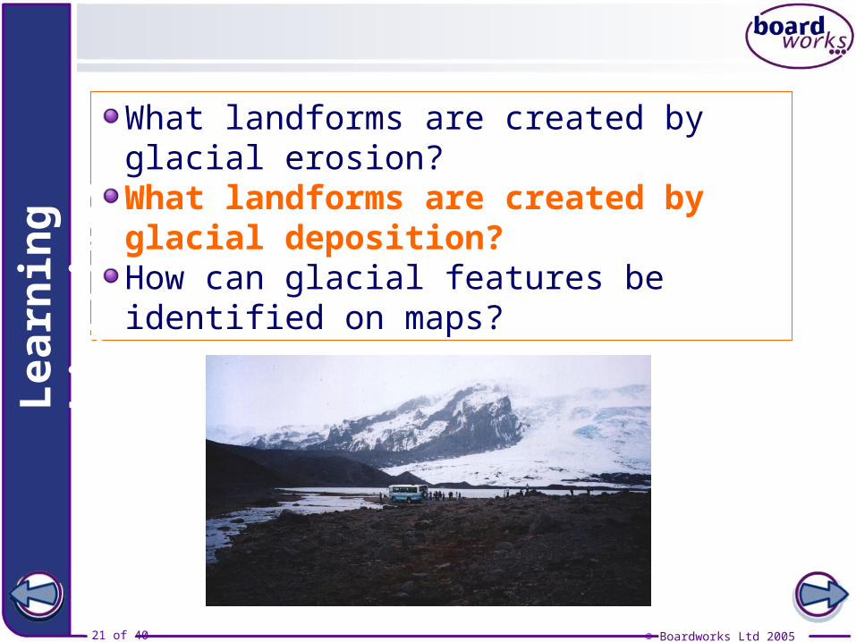
What landforms are created by glacial erosion?What landforms are created by glacial deposition?How can glacial features be identified on maps?
Lea
rnin
g o
bje
ctiv
es
© Boardworks Ltd 200522 of 40
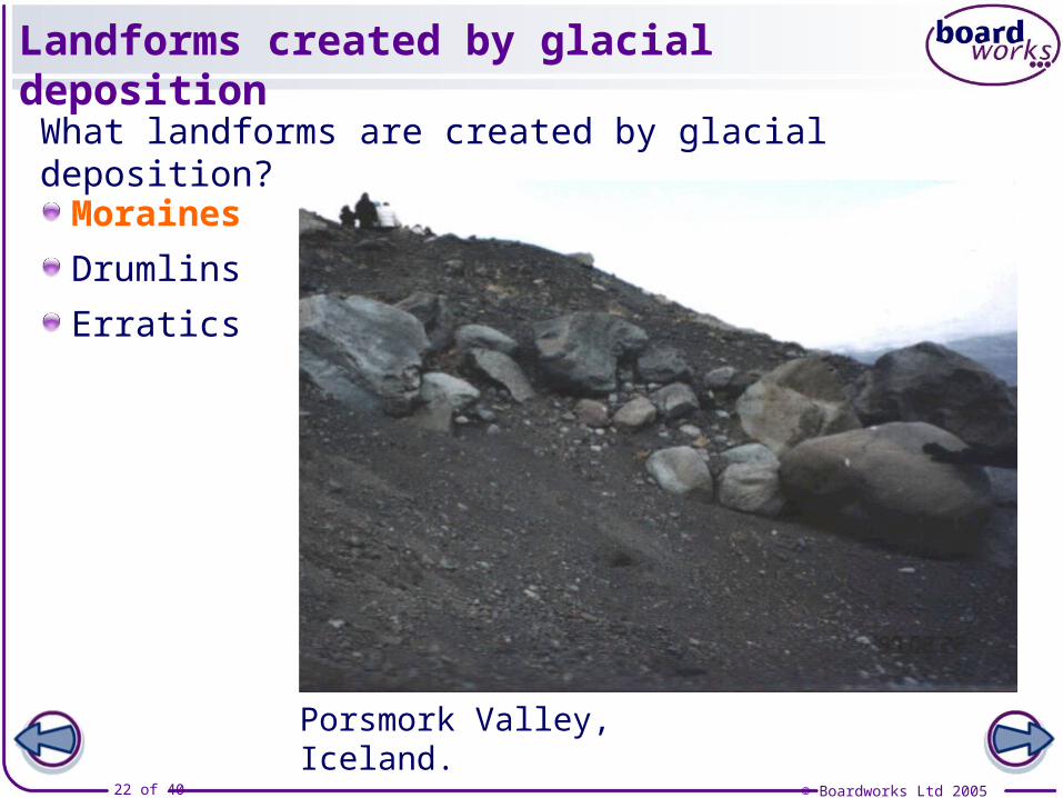
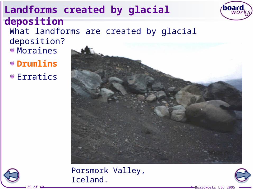
Landforms created by glacial deposition
Moraines
Drumlins
Erratics
Porsmork Valley, Iceland.
What landforms are created by glacial deposition?
© Boardworks Ltd 200523 of 40
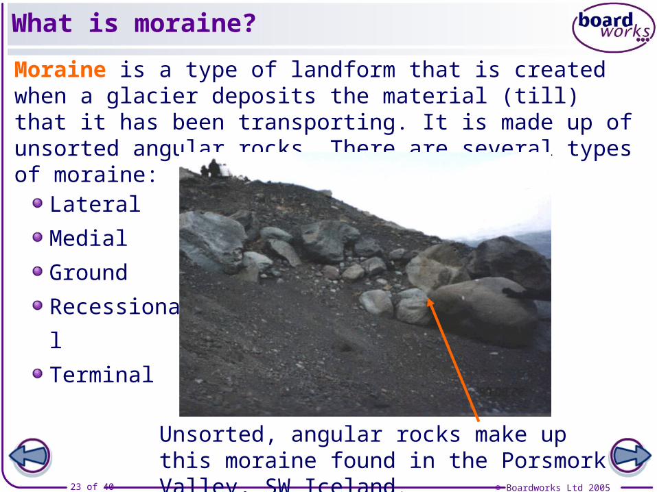
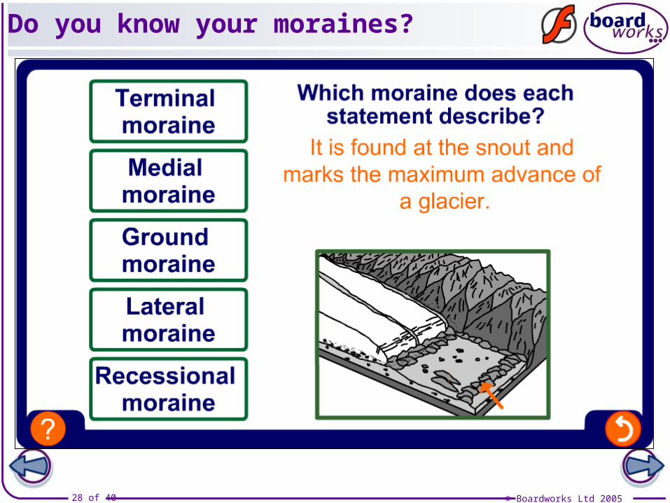
What is moraine?
Moraine is a type of landform that is created when a glacier deposits the material (till) that it has been transporting. It is made up of unsorted angular rocks. There are several types of moraine:
Lateral
Medial
Ground
Recessional
Terminal
Unsorted, angular rocks make up this moraine found in the Porsmork Valley, SW Iceland.
© Boardworks Ltd 200524 of 40
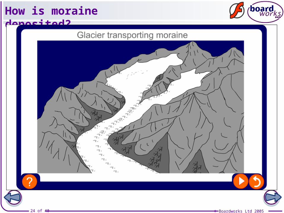
How is moraine deposited?
© Boardworks Ltd 200525 of 40
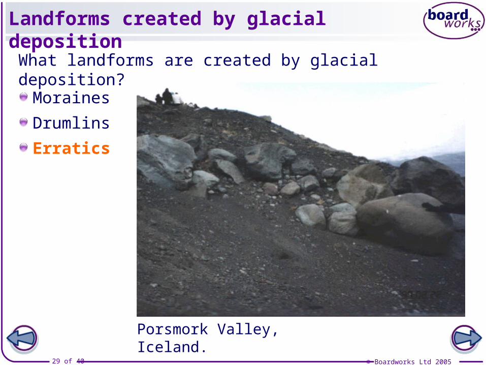
Landforms created by glacial deposition
Moraines
Drumlins
Erratics
Porsmork Valley, Iceland.
What landforms are created by glacial deposition?
© Boardworks Ltd 200526 of 40
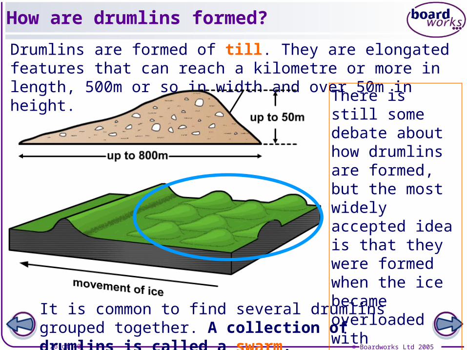
How are drumlins formed?
Drumlins are formed of till. They are elongated features that can reach a kilometre or more in length, 500m or so in width and over 50m in height.
There is still some debate about how drumlins are formed, but the most widely accepted idea is that they were formed when the ice became overloaded with sediment.
It is common to find several drumlins grouped together. A collection of drumlins is called a swarm.

© Boardworks Ltd 200527 of 40
Features of glacial deposition
© Boardworks Ltd 200528 of 40
Do you know your moraines?
© Boardworks Ltd 200529 of 40
Landforms created by glacial deposition
Moraines
Drumlins
Erratics
Porsmork Valley, Iceland.
What landforms are created by glacial deposition?
© Boardworks Ltd 200530 of 40
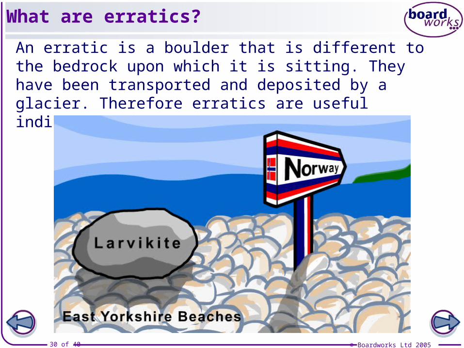
What are erratics?
An erratic is a boulder that is different to the bedrock upon which it is sitting. They have been transported and deposited by a glacier. Therefore erratics are useful indicators of patterns of former ice flow.
© Boardworks Ltd 200531 of 40
Examination question
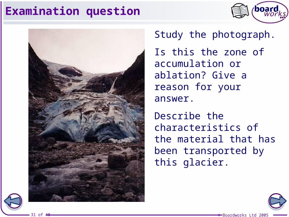
Study the photograph.
Is this the zone of accumulation or ablation? Give a reason for your answer.
Describe the characteristics of the material that has been transported by this glacier.
© Boardworks Ltd 200532 of 40
What landforms are created by glacial erosion?What landforms are created by glacial deposition?How can glacial features be identified on maps?
Lea
rnin
g o
bje
ctiv
es
© Boardworks Ltd 200533 of 40
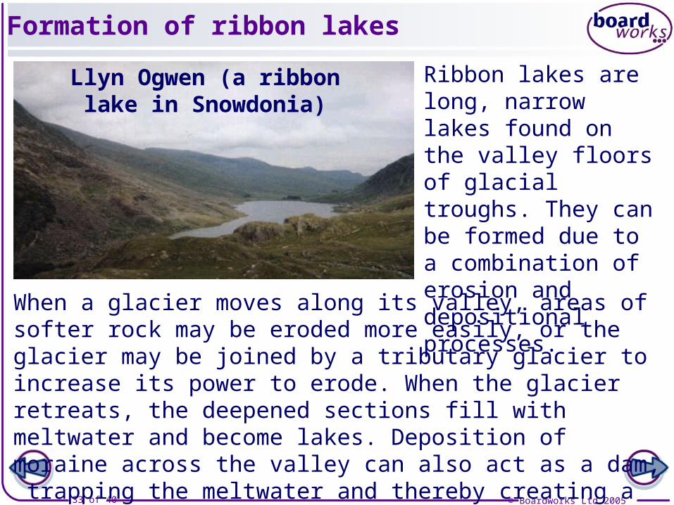
Formation of ribbon lakes
When a glacier moves along its valley, areas of softer rock may be eroded more easily, or the glacier may be joined by a tributary glacier to increase its power to erode. When the glacier retreats, the deepened sections fill with meltwater and become lakes. Deposition of moraine across the valley can also act as a dam, trapping the meltwater and thereby creating a ribbon lake.
Ribbon lakes are long, narrow lakes found on the valley floors of glacial troughs. They can be formed due to a combination of erosion and depositional processes.
Llyn Ogwen (a ribbon lake in Snowdonia)

© Boardworks Ltd 200534 of 40
How are ribbon lakes formed?
© Boardworks Ltd 200535 of 40
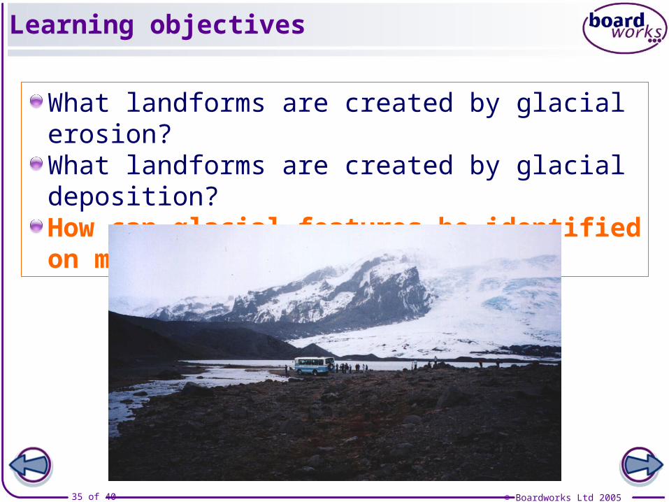
Learning objectives
What landforms are created by glacial erosion?What landforms are created by glacial deposition?How can glacial features be identified on maps?
© Boardworks Ltd 200536 of 40
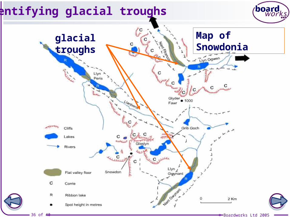
Identifying glacial troughs
glacial troughs Map of Snowdonia
© Boardworks Ltd 200537 of 40
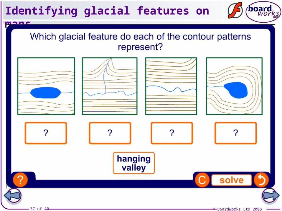
Identifying glacial features on maps
© Boardworks Ltd 200538 of 40
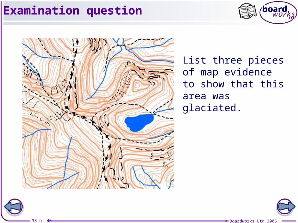
List three pieces of map evidence to show that this area was glaciated.
Examination question
© Boardworks Ltd 200539 of 40
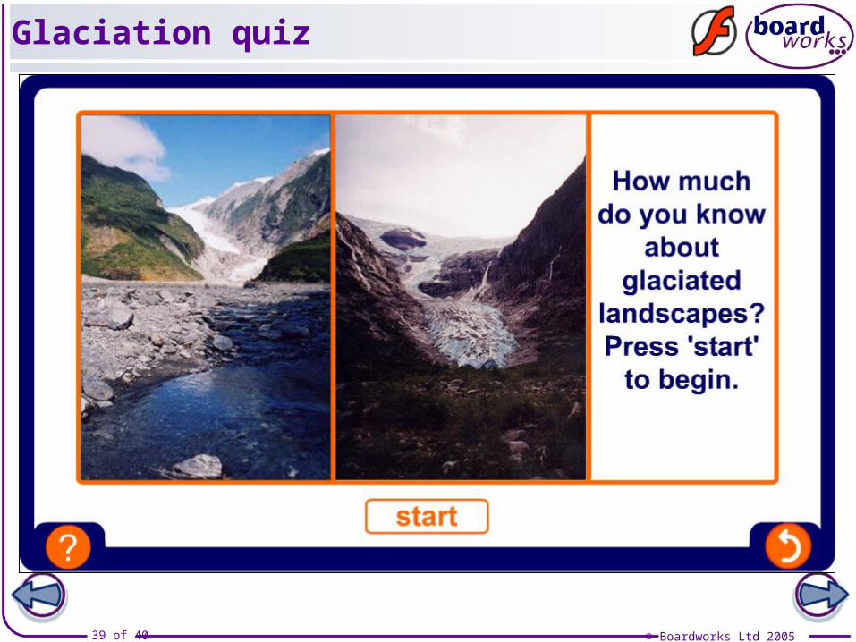
Glaciation quiz
© Boardworks Ltd 200540 of 40
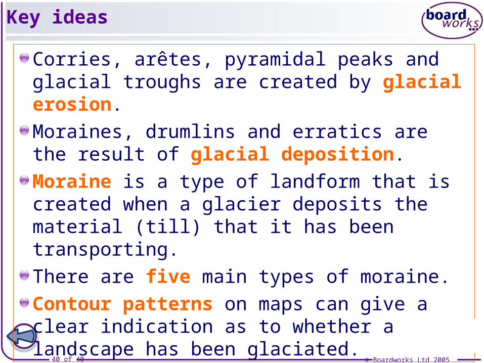
Key ideas
Corries, arêtes, pyramidal peaks and glacial troughs are created by glacial erosion.
Moraines, drumlins and erratics are the result of glacial deposition.
Moraine is a type of landform that is created when a glacier deposits the material (till) that it has been transporting.
There are five main types of moraine.
Contour patterns on maps can give a clear indication as to whether a landscape has been glaciated.