Embed Size (px)
Citation preview
INTRODUCTION TO METEOROLOGY AND CLIMATOLOGY
Meteorology is the interdisciplinary scientific study of the atmosphere. Aristotle defined (384-322B. C. ) Meteorology as a study of lower atmosphere. [Meteor- Lower atmosphere and logus- means science]. It is the science of atmosphere and its phenomena, especially those phenomena which we call collectively as weather and climate. Generally, Meteorology can be defined as the Science of atmosphere which deals with the physics, chemistry and dynamics of atmosphere and also their direct and indirect effects upon the earth surface, oceans and thereby Life in general.
Climatology is the study of long-term trends in the Earth’s weather and also tends to focus on larger areas, such as continents or the entire globe. It is the science which studies average condition of weather or the state behavior of the atmosphere over a place or region for a long period of time. It can also be defined as a scientific study of climate. It discovers, describes, & interprets the climate on the basis of causes processes that generate them
Scales of Study of Meteorology:
The study of the atmosphere can be divided into distinct areas that depend on both time and spatial
scales. At one extreme of this scale is climatology. In the timescales of hours to days, meteorology
separates into micro-, meso-, and Macro (synoptic and planetary) scale meteorology. Respectively,
the geospatial size of each of these three scales relates directly with the appropriate timescale.
1. Micro scale:
A process operating within vegetation canopies near earth surface its size is in 1km or less
and Life span is few seconds example is the cloud, local turbulence caused by buildings and
other obstacles.
2. Mesoscale:
The systems are approximately 1 - 1000km in size and a lifetime is of few hours [up to5 hrs]
to weeks eg. Thunder storm. Sea and land breezes, squallines etc
3. Macro scale: It is divided into two scales.
A) Synoptic scale:
These systems have a diameter of few thousand km. and life time of about 5 days to month
Eg. Tropical storm, cyclones. Synoptic scale meteorology predicts atmosperic changes at scales
up to 1000 km and 105 sec (28 days), in time and space. The phenomena typically described by
synoptic meteorology include events such as extratropical cyclones, baroclinic troughs and ridges,
frontal zones, and to some extent jet streams.
B) Planetary scale:
These systems have a diameter of 5000 to 10000km and persist for several weeks
Eg. Waves in the atmosphere circulation. It shows weather patterns related to the transport of
heat from the tropics to the poles. Very large scale oscillations are of importance at this scale. These
oscillations have time periods typically on the order of months, such as the Madden–Julian
oscillation, or years, such as the El Niño–Southern Oscillation and the Pacific decadal oscillation.
Applications of Meteorology
Meteorology has application in many diverse fields such as;
- military - marine and water resources- energy production - transport (aviation)- environmental management - Agriculture- construction .
Importance and Scope of Meteorology
Almost all social, industrial, agricultural, commercial, transports etc. Activities directly or indirectly are affected by weather and climate. The atmosphere affects and sustains human life, animal, micro- organisms, insects, pests, plants, tree’s forests and marine culture at all times during every stage of growth and development Meteorology has therefore, greatest scope on every human enterprise in the modern Life.
The fields of applications are given below to illustrate the scope of meteorology.
1. Safe Navigation:For safe navigation on sea the knowledge of adverse weather i.e. large tidal waves, ocean waves, high speed wind, cyclonic storms etc is needed which is supplied in weather forecast from meteorology.
2. Safe aviation:For transport through air, the pilots need the information about atmospheric conditions such as the electric lightening, high speed winds and their directions, thunder storms, foggy atmosphere etc. So pilots can go safely. For this purpose accurate forecasts are needed and are only possible from meteorology.
3. Industry:Many industries for their raw material depend on agricultural produce and accordingly location of industry is decided, so it is necessary to consider the weather and climate e.g. sugar mill, distillery, jute mill etc.
4. Animal Production:Beef, poultry and milk production also depend on weather and meteorology provides the information for successful animal production and animal husbandry.
5. Fisheries:Fishermen need information of atmospheric and oceanic changes before they proceed on sea for fishing and this is possible from meteorological knowledge.
6. Irrigation and water resources:Meteorological and hydrological information assists in planning the location size and storage capacities of dams to ensure water supply for irrigation and domestic needs. When and how much to irrigate is also decided from the meteorological information.
7. Land use planning:The meteorological data supplemented with soil and topographic information help to plan the sites for the specific land use for drop production, forests, urban residence, industry etc.
8. Human Life:Human being tries to acclimatize himself with the prevailing weather conditions, for this they manage for type of clothing, housing food habit etc.
8.1 Clothing: Warm cloths during winter and thin cloth during summer are used.
8.2 Housing:
Direction of windows, doors for proper ventilation, roofing-plain in low rainfall region whereas. Slanting roof in the areas where rainfall is more and frequent in occurrence.
8.3 Food habits:
Heavy diet during winter season is recommended whereas during summer season more quantum of water consumption is needed.
9. Human health:If any sudden change in the climatic conditions is experienced it results into equdemics of material fever. Asthma patent suffers more during cloudy conditions.
10. Commerce:
Trading of any item is made according to need of the people in relation to weather prevailing e.g. Gum shoes, umbrella and raincoats are generally traded in rainy season only, woolen cloths in winter season and white cotton cloths. Cold drinks etc. are in more demand in summer season.
Importance and Scope of Meteorology in Agriculture
Weather and climate is a resource and considered as basic input or resources in agricultural planning, every plant process related with growth development and yield of a crop is affected by weather.
Similarly every farm operation such as ploughing harrowing, land preparation, weeding, irrigation, manuring, spraying, dusting, harvesting, threshing, storage and transport of farm produce are affected by weather.The scope of Agril Meteorology can be illustrated through the following few applications.
1. Characterization of agricultural climate: For determining crop growing season, solar radiation, air temperature, precipitation, wind, humidity etc. are important climatic factors on which the growth, development and yield of a crop depends Agro-meteorology considers and assess the suitability of these parameters in a given region for maximum crop production and economical benefits.
2. Crop planning for stability in production: To reduce risk of crop failure on climatic part, so as to get stabilized yields even under weather adversity, suitable crops/cropping patterns/contingent cropping planning can be selected by considering water requirements of crop, effective, rainfall and available soil moisture.
3. Crop management:Management of crop involves various farm operations such as, sowing fertilizer application. Plat protection, irrigation scheduling, harvesting etc. can be carried out on the basis of specially tailored weather support. For this the use of operational forecasts, available from agro met advisories, is made
e.g. 1) Weeding harrowing, mulching etc are undertaken during dry spells forecasted.2) Fertilizer application is advisable when rainfall is not heavy wind speed is<30 km/hr and soil moisture is between 30 to 80%3) Spraying/dusting is undertaken when there is no rainfall, soil moisture is 90% and wind speed is<25km/hr.
4. Crop Monitoring:To check crop health and growth performance of a crop, suitable meteorological tools such as crop growth models. Water balance technique or remote sensing etc. Can be used.
5. Crop modeling and yield –climate relationship:Suitable crop models, devised for the purpose can provide information or predict te results about the growth and yield when the current and past weather data is used.
6. Research in crop –climate relationship:Agro-meteorology can help to understand crop-climate relationship so as to resolve complexities of plant process in relation to its micro climate.
7. Climate extremities:Climatic extremities such a frost floods, droughts, hail storms, high winds can be forecasted and crop can be protected.
8. Climate as a tool to diagnose soil moisture stress:Soil moisture can be exactly determined from climatic water balance method, Which is used to diagnose the soil moisture stress, drought and necessary protective measures such as irrigation, mulching application of antitranspirant, defoliation, thinning etc. can be undertaken.
9. Livestock production:Livestock production is a part of agriculture. The set of favorable and unfavorable weather conditions for growth, development and production of livestock is livestock is studied in Agril. Meteorology. Thus to optimize milk production poultry production, the climatic normal are worked out and on the suitable breeds can be evolved or otherwise can provide the congenial conditions for the existing breeds.
10. Soil formation:Soil formation process depend on climatic factors like temperature, precipitation, humidity, wind etc, thus climate is a major factor in soil formation and development.
METEOROLOGICAL VARIABLES RELATING TO AGRICULTURE
Meteorological phenomena are described and quantified by the variables of Earth's atmosphere:
temperature, air pressure, water vapor, mass flow, and the variations and interactions of those
variables, and how they change over time. These variables in the environment are essential in agricultural
meteorology. Meteorological considerations enter into assessing the performance of plants and animals because
their growth is a result of the combined effect of genetic characteristics (nature) and their response to the
environment (nurture). Therefore, these variables are important in that,
1. without quantitative information about the parameters, agrometeorological planning, forecasting,
research and services by agrometeorologists cannot properly assist agricultural producers to survive and to meet
the ever-increasing demands for food and agricultural by-products.
2. Such observations are also needed to assess the impacts of agricultural activities and processes on the
environment and climate.
3. The observations required depend on the purpose for which they will be used. For the characterization of
agroclimate, for climate monitoring and prediction, and for the management of natural resources, national coverage
over periods of many years is required.
4. These variables also provide the background for the shorter-term decision-making involved in activities
such as response farming, monitoring of, and preparedness and early warning for, natural disasters, along with
forecasts for pests and diseases.
5. The preparation of advisories and services on farming methods, including irrigation and microclimate management and manipulation.
6. Finally, for research purposes
Basic meteorological variables relating to Agriculture
Solar radiation
Agriculture is the exploitation of solar energy under adequate supply of nutrients and water by maintaining plant growth. So it is but natural that any efforts of thoroughly understanding
of solar radiation will be immense use for its fullest exploitation by the crop plants in terms of their growth and yield.
The sun is the primary source of energy. Supplying about 99.9% out of total energy available at the earth surface. The temperature of the Sun is 6000 K and gives out energy about 5.6 x10 27 cal per minute. The Sun radiates its energy in the form of wave lengths from 0.15 to 4.0 u and are generally called as short wave lengths. On contrary after absorption of solar energy, earth emits its energy between 4 to 100 u and is categorized as long wave length.
There are three methods of transfer of heat or energy that means there are three different ways by which heat can flow from one point to another are:1. Conduction 2. Convection3. Radiation.
For conduction and convection of heat, material medium is necessary. But for radiation material medium is not necessary, because radiation takes place in the form of Electro magnetic waves.
The ultimate source of all the energy for physical and biological processes occurring on the earth is radiation received from the sun that is why it is commonly called solar radiation. The primary meteorological measurements, done in virtually every network, are those of global solar radiation, called pyranometer, and of sunshine duration. The choice of instruments for the measurement of solar radiation largely depends on the application. There are three classes of pyranometers: secondary standard (the highest), first class and second class. The pyranometer is standardised according to ISO9060.
In agricultural and surface energy balance studies not only the incoming but also the reflected radiation play a role. The instruments necessary for this are called net-radiometers (total radiation budget) and pyrgeometers (Far Infra Red only). In agriculture the measurement of PAR (Photosynthetically Active Radiation, or the part of the solar radiation that can be used by an average plant) is very common.
Solarimeters can be used to measure the short-wave radiation reflected from a crop surface as well. An additional sensor is inverted, fitted with a shield to eliminate diffuse sky radiation, and mounted high enough over the surface so that the shadow it casts is a very small part of the surface area (crop canopy) being investigated. A pair of upward and downward facing solarimeters forms an albedometer. Research results show that shade influences photosynthesis and temperature. At the macro level, shade occurs due to clouds, mountain slopes, and so on. At the micro level, shade varies due to the plant canopy itself, intercropping choices, surrounding trees, and the like. Photosynthesis is the major metabolic process in agriculture that depends on solar radiation. As a result, occurrences of shade and its distribution, duration and intensity influence photosynthesis and therefore the production processes. Shade and light also cause many morphological processes in plants and behavioural changes in animals. Though more shade reduces agricultural production in many field crops, it improves quality in many cases. In many fruit crops, fruit quality is improved with partial shade treatments.
Radiation Balance Or Net Radiation
The net radiation is the difference between the total downward and upward radiation fluxes and is a measure of the energy available at the ground surface. The balance of energy after gain and loss of both short wave and long wave radiation fluxes is known as net radiation. Net radiation represents the amount of energy, which is used for various kinds of activities. It is dispensed as sensible heat, latent heat and also in physiological processes such as photosynthesis and respiration.
The importance of this parameter is that it is the fundamental quantity of energy available at the earth’s surface to drive he processes of evaporation, air and soil heat fluxes as well as other smaller energy consuming processes like photosynthesis etc.If we consider the extra terrestrial radiation reaching annually (338wm-2) as 100%; Then out of this- The net radiation reaching (SW) =100-28+25) - 47% the earth surface. = 114%Long wave radiation reaching at earth surface = +96%Therefore, Net long wave radiation = -114+96 = -18% Net all wave radiation at earth surface = +47-18 = 29%This surplus energy is used at the earth surface for a) Sensible heat (QH) = 4%b) Latent heat (Eva)(QE) = 25% ----------- 29%
Factors Affecting Solar Radiations
The amount of insulation received at particular place and time depends on the following factors:1. Distance from the sun. 2. Duration of daily sunlight period.3. Solar elevation or inclinations of the solar rays to the horizon.4. Transparency of the atmosphere towards heat radiation and 5. Output of solar radiation.
Significance Of Radiation In Agriculture
The importance of the radiation in crop production is as follow:1. It provides the necessary energy for all the phenomena concerning biomass production.2. Photo synthetically Active Radiations (PAR) are the real source of energy for photosynthesis process. Plants are the efficient biological converters of solar energy into biomass. Radiation defines the yield of crop in particular region.3. It laso provides the energy for the physical processes taking place in plants, soil and atmosphere.4. It conditions the distribution of temperature and hence crop distribution on the earth surface.
Atmospheric Temperature
The degree of hotness is known as temperature increases Temperature is a fundamental element of climate from many points of view, the most important in controlling the distribution of life on the earth. Most of the weather elements are dependent on it, directly or indirectly. Air of atmosphere receives the heat energy from the sun and its temperature increases. Due to different amount of heat energy received at different places, the air temperature at different places also vary. The variation in air temperature basically results into air motion, so as to equalize the energy content of the different regions of the earth. Thus temperature of air can be regarded as the basic cause for weather changes.
Quatification of Atmospheric Temperature:
Atmospheric temperature is continuously changing; it is never steady or constant for a long time. Therefore quantification of atmospheric temperature is very important aspect. The atmospheric temperature can be quantified in the following ways.
1. Maximum temperature:It is the highest temperature attained by the atmosphere in diurnal variation.
2. Minimum temperature:It is the lowest temperature attained by the at by the atmosphere in diurnal variation.
3. Average temperature:It represents the average temperature condition of the atmosphere during 24 hours of the day.
The temperature of the air should be measured in representative places, at different levels in the layer adjacent to the soil. Measurements should be made at principal agricultural meteorological stations from ground level up to about 10 m above the upper limit of the prevailing vegetation because air temperature affects leaf production, expansion and flowering.
Factors Affecting The Air Temperature
The distribution of temperature over the earth surface depends on following factors:1. Latitude:Highest temperatures are generally at the equator and the lowest at the poles. The temperature decreases with the increase of latitude.
2. Altitude: Temperature decreases with height in troposphere.
3. Season:Coldest temperatures are in winter and highest temperatures are in summer seasons.
4. Distribution of land and water:Water bodies are great moderators of temperature. Because of high Specific heat of water, so on the oceans, the regularity in temperature is more as compared to continents.

5. Topogrtaphy: Mountain ranges affect the temperature by acting as obstacles to the Flow of cold air cold air near the surface and they often set conditions of warm winds.
6. Ocean currents: Hot and cold ocean currents affect temperature e.g. Gulag Stream (Warm) in North Atlantic, Benguela current (cold) along West coast of South Africa, Peru Current (cold) along West Coast of South America.
7. Winds: Various types of wind affect temperature.
8. Clouds and rains:Clouds by obstructing the heat from the Sun and rains by cooling the Atmosphere, affect the temperature.
9. Color of the soil: Black color of soils absorbs more radiations and other types reflect them.
10. Slope of the soil: Black color of soils absorbs more radiations and other types reflect them.
11. Forest and vegetation: Due to Evapotranspiration and interception of sun – rays, temperatures are moderated.
Significance
Air temperature is important to agriculture because it influences plant growth through photosynthesis and respiration, affects soil temperature, and controls available water in the soil. Farmers use soil temperatures and soil moisture to decide when to plant, what varieties of crops to choose, and to determine the likely development of key plant characteristics like flowering as well as emergence of insect pests and plant diseases. The occurrence of freezing temperatures in fall generally heralds the end of the growing season for most plants.
Temperature affects all of the biochemical reactions of photosynthesis. As the temperature increases, the plant respiration rates increase. Plants are classified as either C3 or C4 plants (a classification of how they fix carbon) and their response to temperature is different. A C4 plant (such as corn) can photosynthesize and yield equally at any place in the range of 10 to 40 degrees C. Conversely, a C3 plant responds negatively to high air temperatures, and yield declines as temperature increases.
Most plants have a range of temperature at which growth occurs. Some plants are more adaptable (such as grass) and can grow throughout the range, while other plants have more specific temperature requirements. When the temperature reaches the upper end of the spectrum, in general, plant photosynthesis declines. Optimal temperatures are different from plant to plant, and can even be different within one species.
Air temperature can also affect the availability of some nutrients (phosphate is less available in the chloroplast of the plant at low temperatures), which in turn reduces the level of
photosynthesis. Low air temperatures can also negatively affect plant growth. Growers of small fruit crops (strawberries) and tree crops (peaches) go to great efforts to protect their crops when a damaging freeze is predicted. Sometimes they irrigate the crop so that a thin layer of ice forms on the crop (the act of water freezing actually releases energy that can raise the air temperature slightly). Sometimes the farmers can cover the crop with plastic or cloth to protect the crop, and other times the farmer might run fans or propane heaters to try and raise the air temperature slightly around the crop. Low air temperatures also affect soil temperatures and freezing soil temperatures can cause “frost heaving” of plants that overwinter in the soil.
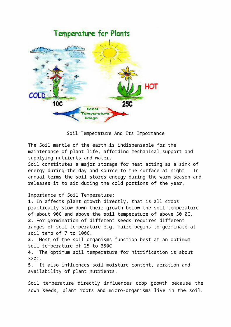
Soil Temperature And Its Importance
The Soil mantle of the earth is indispensable for the maintenance of plant life, affording mechanical support and supplying nutrients and water.Soil constitutes a major storage for heat acting as a sink of energy during the day and source to the surface at night. In annual terms the soil stores energy during the warm season and releases it to air during the cold portions of the year.
Importance of Soil Temperature:1. In affects plant growth directly, that is all crops practically slow down their growth below the soil temperature of about 90C and above the soil temperature of above 50 0C.2. For germination of different seeds requires different ranges of soil temperature e.g. maize begins to germinate at soil temp of 7 to 100C.3. Most of the soil organisms function best at an optimum soil temperature of 25 to 350C4. The optimum soil temperature for nitrification is about 320C.5. It also influences soil moisture content, aeration and availability of plant nutrients.
Soil temperature directly influences crop growth because the sown seeds, plant roots and micro-organisms live in the soil. The physicochemical as well as life processes in agriculture are also directly affected by the temperature of the soil. Under low soil temperature
conditions, nitrification is inhibited and the intake of water by roots is reduced. Extreme soil temperatures injure plants and thereby affect growth. The levels at which soil temperatures are observed should include the following depths: 5, 10, 20, 50 and 100 cm. At the deeper levels (50 and 100 cm), where temperature changes are slow, daily readings are generally sufficient. At shallower depths the observations may comprise, in order of preference, either continuous values, daily maximum and minimum temperatures, or readings at fixed hours (preferably not more than six hours apart).
Factors Affecting The Soil Temperature And Its Control
1. Solar radiation:
The amount of heat from the Sun that reaches the earth is 2.0 cal/cm2 min -1 the amount of radiation received by the soil depends on angles with which the soil faces the Sun.
2. Condensation:
Whenever water vapour from soil depths or atmosphere condenses in the soil, its heat increases noticeably.
3. Evaporation:
The greater the rate of evaporation, the more the soil is cooled.
4. Rainfall:
Rainfall cools down the soil.
5. Vegetation:
A bare soil quickly absorbs heat and becomes very hot during the summer and become very cold during the winter. Vegetation acts as a insulating agent. It does not allow the soil to become either too hot during the summer and two cold during the winter.
6. Colour of the soil:
Black colored soils absorbs more heat than light closured soils Hence black color soils are warmer than light colored soils.
7. Moisture content:
A soil with higher moisture content is cooler than dry soil.
8. Tillage:
The cultivated soil has greater temperature amplitude as compared to the uncultivated soil.
9. Soil texture:
Soil textures affect the thermal conductivity of soil. Thermal conductivity decreases with reduction in particle size.
10. Organic matter content:
Organic matter reduces the heat capacity and thermal conductivity of soil, increases its water holding capacity and has a dark color, which increases its heat absorbability.
11. Slope of land:Solar radiation that reaches the land surface at an angle is scattered over a wider area than the same amount of solar radiation reaching the surface of the land at right angles. Therefore, the amount of solar radiation reaching per unit area of the land surface decreases as the slope of the land is increases.
Soil temperature can be controlled by:
1. Regulating soil moisture.2. Proper soil management practices so a to have good drainage.3. Application /use of mulching.4. Sufficient addition of organic matter.
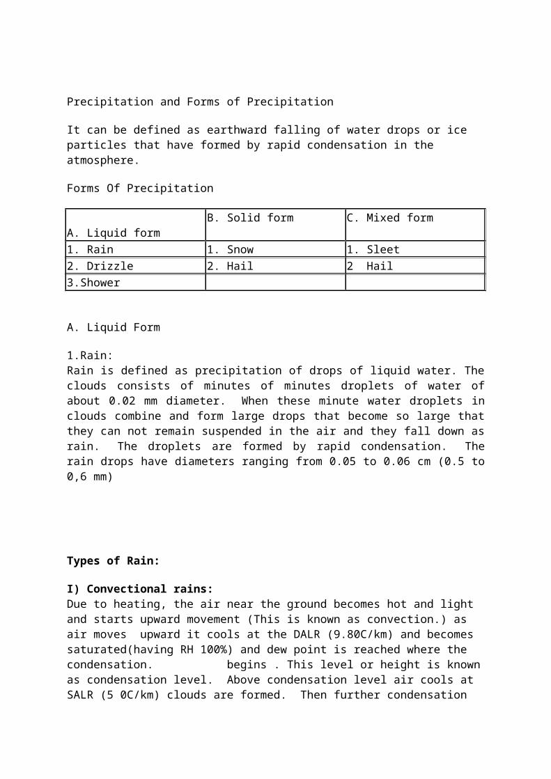
Precipitation and Forms of Precipitation
It can be defined as earthward falling of water drops or ice particles that have formed by rapid condensation in the atmosphere.
Forms Of Precipitation
A. Liquid form B. Solid form C. Mixed form
1. Rain 1. Snow 1. Sleet 2. Drizzle 2. Hail 2 Hail 3.Shower
A. Liquid Form
1.Rain:Rain is defined as precipitation of drops of liquid water. The clouds consists of minutes of minutes droplets of water of about 0.02 mm diameter. When these minute water droplets in clouds combine and form large drops that become so large that they can not remain suspended in the air and they fall down as rain. The droplets are formed by rapid condensation. The rain drops have diameters ranging from 0.05 to 0.06 cm (0.5 to 0,6 mm)
Types of Rain:
I) Convectional rains:Due to heating, the air near the ground becomes hot and light and starts upward movement (This is known as convection.) as air moves upward it cools at the DALR (9.80C/km) and becomes saturated(having RH 100%) and dew point is reached where the condensation. begins . This level or height is known as condensation level. Above condensation level air cools at SALR (5 0C/km) clouds are formed. Then further condensation results into precipitation. These rains are known convectional rains.
II) Ographic or relief rains:When the moist air coming from sea encounters mountain or relief barrier, it can not move horizontally and has to overcome mountain. When this air rises upward, cools down, cloud is formed and condensation starts and giving precipitation. These rains are known as or orographic rains thus high rains are possible on the windward side of the mountain. After crossing the mountain divide, when air descends downward, the air is compressed and it warmed up at DALR. This warm air does not give any precipitation on the leeward region. This is known as rain shadow region.
III) Frontal and Convergent rains:Frontal precipitation is produced when two opposing air currents with different temperature meet, vertical lifting takes place which gives rise to condensation and precipitation. When the humid and warm air mass meets the cold air mass, the colder air being denser tends to push below the warmer air and replace it. The boundary zones along which two air masses meet are called as fronts. When the mixing of warm and moist air with cold air mass takes place, the temperature of the warm and air falls down, saturation occurs and may give precipitation and it also responsible for cyclone formation and rains received from cyclones are called cyclonic reins.
Factors influencing precipitation:-
1. Only blowing of winds coming even over the sea is not enough to produce precipitation. 2. Horizontal movement is not conductive to precipitation. 3. The rain bearing clouds, hills, mountains, slanting slopes of the river ralleys lake dynamic cooling of the clouds. 4. Water vapour in atmosphere and moat conditions which promote greater precipitation.5. Regiour covered with thick forest contributes more water vapour by transportation and thus provide favorable condition for preciption. 6. The prevalence of dry winds, higher temperature absence of barriers and cutting of monsoon currents these are unfavorable for precipitation. 7. Long & short breaks in the monsoon caused due to prevalence of dry winds slowing over land or desert plains from North East. 8. On the other hand geographical position, physical configuration and meteorological conditions are responsible for precipitation.
Rainfall, Its Distribution And Its Effectiveness In Rainfed Agriculture
Distribution of Rainfall: - The amount of rainfall received at periodic intervals like weeks, months, seasons etc. indicate distribution. In addition distribution of rainfall can be known by the length of dry spell, wet spells land rainy days. Distribution of rainfall is more important than total rainfall.
Rainfall distribution is based on:
1. Weekly or monthly rainfall will give distribution of rainfall in weeks during a crop season. 2. Wet and dry spells - A wet spell is a number of continuous days of rainfall. A dry spell is a number od continuous rainless days. 3. Rainy days: If the rainfall received is more than 2.5 mm on any day. This particular day is called rainy day. 4. Periodicity of rainfall. 5. Onset of monsoon.6. Recurrence of rainfall events. 7. Dependability of rainfall8. Certificient of variation. If C.V. is more variation in rainfall is more and vice - a - versa. 9. Length of the growing season (LGS): If LGS is less a short duration crop should be selected. L.G.S. depends on duration of rainy season and moisture retention.
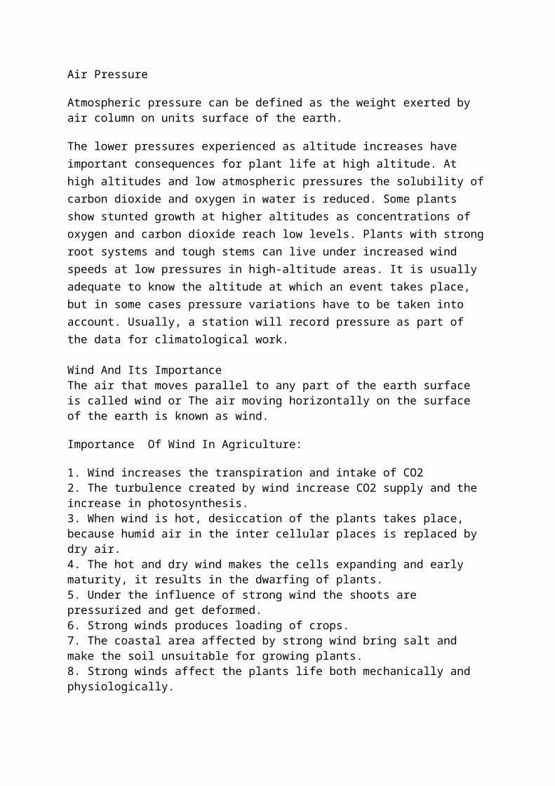
Air Pressure
Atmospheric pressure can be defined as the weight exerted by air column on units surface of the earth.
The lower pressures experienced as altitude increases have important consequences for plant life at high altitude. At high altitudes and low atmospheric pressures the solubility of carbon dioxide and oxygen in water is reduced. Some plants show stunted growth at higher altitudes as concentrations of oxygen and carbon dioxide reach low levels. Plants with strong root systems and tough stems can live under increased wind speeds at low pressures in high-altitude areas. It is usually adequate to know the altitude at which an event takes place, but in some cases pressure variations have to be taken into account. Usually, a station will record pressure as part of the data for climatological work.
Wind And Its ImportanceThe air that moves parallel to any part of the earth surface is called wind or The air moving horizontally on the surface of the earth is known as wind.
Importance Of Wind In Agriculture:
1. Wind increases the transpiration and intake of CO22. The turbulence created by wind increase CO2 supply and the increase in photosynthesis.3. When wind is hot, desiccation of the plants takes place, because humid air in the inter cellular places is replaced by dry air.4. The hot and dry wind makes the cells expanding and early maturity, it results in the
dwarfing of plants.5. Under the influence of strong wind the shoots are pressurized and get deformed.6. Strong winds produces loading of crops.7. The coastal area affected by strong wind bring salt and make the soil unsuitable for growing plants.8. Strong winds affect the plants life both mechanically and physiologically.
Wind transports heat in either sensible or latent form between lower and higher layers of the atmosphere and from lower to higher latitudes. Moderate turbulence promotes the consumption of CO2 by crops during photosynthesis. Wind prevents frost by disrupting a temperature inversion. Wind dispersal of pollen and seeds is natural and necessary for certain agricultural crops, natural vegetation, and so on. As far as the action of wind on soil is concerned, it causes soil erosion and transport of particles and dust. Extreme winds cause mechanical damage to crops (for example, lodging or leaf damage) and forests (windthrow). Knowledge of the wind is also necessary for environmentally sensitive spray application and for the design of wind protection. For the main regional crops, it may be useful to make observations of wind profiles inside and above the crop canopies for a better understanding of exchange properties.Agricultural meteorological stations need toposcale reference observations of both wind speed and direction, preferably at 10 m height, but at least at three times the height of any nearby vegetation (for instance, crops) and any nearby obstacles, in order to be above significant flow interference. Lower-level wind measurements are not representative at toposcale and cannot be properly corrected either, so they cannot be used as local reference or for comparison with other stations (WMO, 2001b). Horizontal distance to obstacles should be at least 10 times their height. When possible, the wind speed gustiness should be obtained along with average wind, for instance by recording the largest three-second gust in each averaging period.
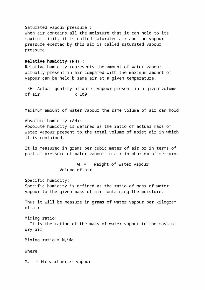
Atmospheric HumidityWater vapor present in the atmosphere is known as humidity.
Vapour pressure:When water vapour mixes with other gases of atmosphere, it exerts a pressure in all directions as do the other gases. This partial pressure exerted by vapour is known as the vapour pressure.
Saturated vapour pressure :When air contains all the moisture that it can hold to its maximum limit, it is called saturated air and the vapour pressure exerted by this air is called saturated vapour pressure.
Relative humidity (RH) :Relative humidity represents the amount of water vapour actually present in air compared with the maximum amount of vapour can be held b same air at a given temperature.
RH= Actual quality of water vapour present in a given volume of air x 100
Maximum amount of water vapour the same volume of air can hold
Absolute humidity (AH):Absolute humidity is defined as the ratio of actual mass of water vapour present to the total volume of moist air in which it is contained.
It is measured in grams per cubic meter of air or in terms of partial pressure of water vapour in air in mbor mm of mercury.
AH = Weight of water vapour Volume of air
Specific humidity:Specific humidity is defined as the ratio of mass of water vapour to the given mass of air containing the moisture.
Thus it will be measure in grams of water vapour per kilogram of air.
Mixing ratio: It is the ration of the mass of water vapour to the mass of dry air
Mixing ratio = MV/Ma Where
MV = Mass of water vapour
Ma = Mass of dry air
Psychometric: Measurement of humidity with different instruments is called psychometric.
Humidity is closely related to rainfall, wind and temperature. Different humidity-related parameters such as relative humidity, vapour pressure, dewpoint and other derived characteristics are explained in many textbooks. They play a significant role in crop production and strongly determine the crops grown in a region. Internal water potentials, transpiration and water requirements of plants are dependent on humidity. Extremely high humidity is harmful as it enhances the growth of some saprophytic and parasitic fungi, bacteria and pests, the growth of which causes extensive damage to crop plants. Extremely low humidity reduces the yield of crops.Like temperature and for the same reasons, the humidity of the air should be measured in representative places, at different levels in the layer adjacent to the soil at principal agricultural meteorological and other category stations. The procedures for air temperature
should also be followed for this weather variable, including taking measurements above and within vegetation.
Soil moisture
In scheduling irrigation, the estimation of moisture content is the basic requirement. The soil water content can be determined by direct methods, such as gravimetric and volumetric determinations, and indirect methods, which may include the use of devices such as tensiometers, resistance blocks, neutron moisture meters and time domain reflectometry
The following additional parameters will contribute to a better understanding of soil moisture conditions:
(a) Field capacity and other hydrological constants of the soil;(b) Permanent wilting point;
(c) Depth of groundwater.
Leaf wetness and dew
The weather provides liquid water not only in the form of precipitation, but also in the form of dew, which is not the same as leaf wetness but is one of its possible causes. Dew (fall) occurs in a humid atmosphere when temperature falls and wind is weak, resulting in condensation both on the vegetation and on the soil. Dew often occurs due to distillation of water from (wet) soil (dew rise). Guttation occurs on vegetation when its internal water pressure is excessive. In some very dry regions dew may well be a significant source of moisture in maintaining plant life (Acosta Baladon, 1995). Leaf wetness can result from precipitation, from dew or from guttation. Knowledge of leaf wetness duration is vital information for the protection of crops against fungi and diseases (Technical Note No. 192), and it cannot be deduced usefully with rules of thumb such as RH > 90 per cent. Actual monitoring has so far been carried out only in a few countries on a routine basis with specific agrometeorological requirements in mind. Studies and recordings of leaf wetness duration (LWD) also help in developing early warning systems and plant protection, in understanding soil evaporation and in improving leaf-surface water evaporation modelling. Calibration of sensors is also enhanced in this way.
Clouds, It's Types and Their Classification
Cloud:Cloud can be defined as a mass of tiny water droplets ice crystals OR both condensed on hygroscopic nuclei and suspending in the atmosphere.
Clouds and fogs are composed of water droplets or ice crystals or both of the order of size 20 to 60 microns (0.008-0.024 millimeter).
Principles of cloud classification :
The great variety of cloud forms necessitates a classification of weather reporting. The internationally adopted system is based upon (a) The general shape; structure and vertical extend of the clouds and (b) their altitude. Types of clouds: There are four basic types of clouds:
1. Clrrus (CI):Meaning “cur” and is recognized by its veil, like fibrous or featery form. It is the highest type of cloud, ranging from approximately 7-12 km in altitude. (20,000 to 35,000 feet).
2. Cumulus (Cu):Meaning “heap”, is the wooly, bundly cloud with rounded top and flat base. It is the most common in the summer season and in latitudes where high temperature prevail and it always results from convection Its height is variable and depends on relative humidity of the air.
3. Stratus (St): It is a sheet type cloud without any form to distinguish it. It is usually lower than cumulus.
4. Nimbus (Nb):It is any dark and ragged cloud and from which precipitation occurs.
Classification Of CloudsClouds have been classified according to their height and appearance by world Meteorological organization (WHO) into 10 categories.
Cloud family and Height
Name of cloud and abbreviation
Composition Possible weather change
Description and appearance
1 2 3 4 5Family A High clouds 7 to 12 km
1 Cirrus (Ci) Ice crystals May Indicate storm showery weather
It is wispy and feathery, sun shines without shadow. It does not produce precipitations
2. Cirrocumulus
(CC)Ice crystals Possible storm Meekerel sky,
often fore renners of cyclone, look like sippled sand
3. Cirrostratus(Cs)
Ice crystals Possible storm Meekeral sky, often fore runners of cyclone, look

like sippled sand.Family B middle clods 3 3-7 km
4. Altocumulus (As)
Ice & water Steady rain or snow
Looks like wool peak, sheep bulk clouds.
5. Atmostratus (As)
Water and ice Impending rain or snow
Fibrous veil or sheet, grey or bluish, produce coronos, usually ct.st shadow.
Family C low clouds from ground to km
6. Stratocumulus (Se)
Water Rain possible Long parallel rolls, pushed together or broken masses which look soft and grey but with darker parts, air is smooth above but strong updrafts occur below.
7. straus (St) Water May produce drizzle
A low uniform layer, resembling fog, but resting not on the ground, chief winter cloud.
8.Nimbostrauts Water or Ice Impending rain or snow
Fibrous veil or sheet, grey, grey or bluish produce coronas, usually
Family D clouds with vertical development from 0.5 to 16 km
9.Cumu-lus (Cu) Water Fair weather Looks like wool pack, dark below due to shadow, may develop into cumulous –Nimbus flat base.
10, Cumulous –Nimbus (Cb)
Ice in upper level and water in lower level.
Violet winds rain, all possible thunderstorm hail lighting possible
Thunder head, towering anvil top, violet up and down drafts, aviators avoid them, develop from cumulus, chief precipitation makers.
10 cumulo-Nimbus(Cb)
Ice in upper level and water in lower level
Violet winds rain, all possible thunderstorm hail lighting possible
Thunder head, towering anvil top, violet up and down drafts, aviators avoid
them, develop from cumulus chief precipitation makers.
Evaporation Water can exist in the natural environment in three different forms or
states — solid (ice), liquid and gas. The process by which water changes from a liquid to a gas is known as evaporation. We are all familiar with liquid water as we drink, bath and irrigate with it daily. The gaseous form of water, known as water vapor, is less familiar since it exists as an invisible gas. However, we all have a feel for water vapor during the late summer months when it is called by the more common name of humidity. To the irrigation manager, the most important points about evaporation are 1) it is the process by which most of the liquid water we apply as irrigation leaves vegetation and 2) that evaporation requires energy (Fig. 1).
Two common household items — the clothes dryer and the evaporative cooler — clearly show the energy requirement of evaporation. In the case of the dryer, a gas burner or an electric heating element provides the heat energy required to evaporate water from the wet clothes. The evaporative cooler works in a somewhat opposite manner. Energy stored in the hot, dry, outside air is consumed by the evaporation process as the air passes through the wet pads. This energy consumption reduces the temperature of the air and allows us to use evaporative cooling as a means of air conditioning.Energy is also required for evaporation to proceed from vegetation. Meteorological conditions impact the amount of energy available in the natural world and therefore play a key role in regulating evaporation from vegetation.
Evapotranspiration (ET) Evaporation from vegetation is generally given a more specific term —
evapotranspiration or ET for short. By definition, ET is the loss of water from a vegetated surface through the combined processes of soil evaporation and plant transpiration (Fig. 2). The term evapotranspiration comes from combining the prefix “evapo” (for soil evaporation) with the word transpiration. Both soil evaporation and plant transpiration represent evaporative processes; the difference between the two rests in the path by which water moves from the soil to the atmosphere. Water lost by transpiration must enter the plant via the roots, then pass to the foliage where it is vaporized and lost to the atmosphere through tiny pores in the leaves known as stomata. In contrast, waterlost through soil evaporation passes directly from the soil to the atmosphere. Evapotranspiration data are usually presented as a depth of water loss
over a particular time period in a manner similar to that of precipitation. Common units for ET are inches/ day or millimeters/day.
The rate of ET for a given environment (vegetation) is a function of four critical factors. The first and most critical factor is soil moisture. Evaporation (ET) simply can not take place if there is no water in the soil. However, if adequate soil moisture is available, three additional factors — plant type, stage of plant development and weather — affect ET rate.
Plant type refers to the species or variety of plant being grown and can greatly influence the rate of ET. Grass and many non-native plants require considerable water when grown in the desert. In contrast, many native plants are adapted to the desert and require much less water.
Stage of plant development also plays a critical role in determining ET. Plant development encompasses both the relative activity of the plant (e.g. dormant vs. actively growing) and plant size. For example, dormant plants use and therefore need very little water, while lush, actively growing plants (under similar conditions) will require considerably more water. Plant size and density also impact ET. Small plants and areas with sparse plant canopies use far less water than large plants and areas with dense plant canopies.
Weather is the fourth and last of the critical factors affecting ET. Weather conditions dictate the amount of energy available for evaporation and therefore play a crucial role in determining ET rate. Four weather parameters — solar radiation (amount of sunshine), wind speed, humidity and temperature — impact the rate of ET. Solar radiation contributes huge amounts of energy to vegetation in the desert and thus is the meteorological parameter with the greatest impact on ET on most days. In actuality, solar radiation is one component of the total radiant energy balance of vegetation referred to as net radiation. Invisible, infrared radiation represents the other component of net radiation. On most days, however, solar radiation is the dominant component of net radiation because the infrared balance is negative and often small.
Wind is the second most important factor in determining ET rate. The wind has two major roles; first, it transports heat that builds up on adjacent surfaces such as dry desert or asphalt to vegetation which accelerates evaporation (a process referred to as advection). Wind also serves to accelerate evaporation by enhancing turbulent transfer of water vapor from moist vegetation to the dry atmosphere. In this case, the wind is constantly replacing the moist air located within and just above the plant canopy with dry air from above. Humidity and temperature work in concert with each other to determine the dryness or drying power of the atmosphere. The vapor pressure deficit (VPD) is the meteorological variable used to quantify the drying power of the atmosphere. The VPD estimates the difference (or gradient) in vapor pressure (concentration of water vapor) between the moist vegetation and the drier atmosphere above. Relative humidity, the humidity variable most commonly reported in weather forecasts, is a
poor indicator atmospheric dryness. For example, the drying power (VPD) of an atmosphere with a 30% relative humidity and a 86°F temperature is 2 times that of an atmosphere with the same 30% relative humidity and a 68°F temperature. The final parameter affecting ET rate is temperature. We have already indicated that temperature impacts ET through its impact on VPD and advection. In addition to these factors temperature impacts ET is some more subtle ways. When all other factors are equal, ET will be higher for warm as compared to cool vegetation because less energy is required to evaporate water from the warm vegetation. Temperature also impacts the relative effectiveness of the radiant energy and wind in evaporating water. Radiant energy is more effectively utilized for ET when temperatures are high. In contrast, wind has more impact on ET when temperatures are low.
evaporation from free water surfaces and from the soil, and of transpiration from vegetation, remains of great importance in agricultural meteorology. Potential evapotranspiration is defined as the amount of water that evaporates from the soil–air interface and from plants when the soil is at field capacity. Actual evapotranspiration is defined as the evaporation at the soil–air interface, plus the transpiration of plants, under the existing conditions of soil moisture.
Weather is the state of the atmosphere, to the degree that it is hot or cold, wet or dry, calm or stormy, clear or cloudy.[1] Most weather phenomena occur in the troposphere,[2][3] just below the stratosphere. Weather refers to day-to-day temperature and precipitation activity