Embed Size (px)
Citation preview
12 Point Mashups
Mapping in the CloudPeterson
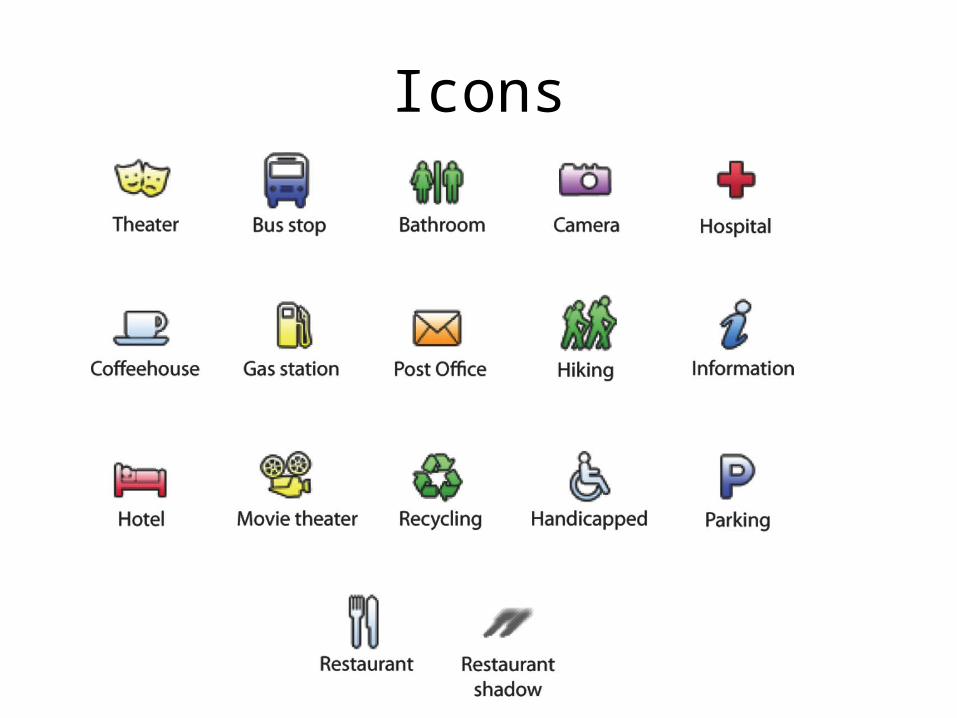
Icons
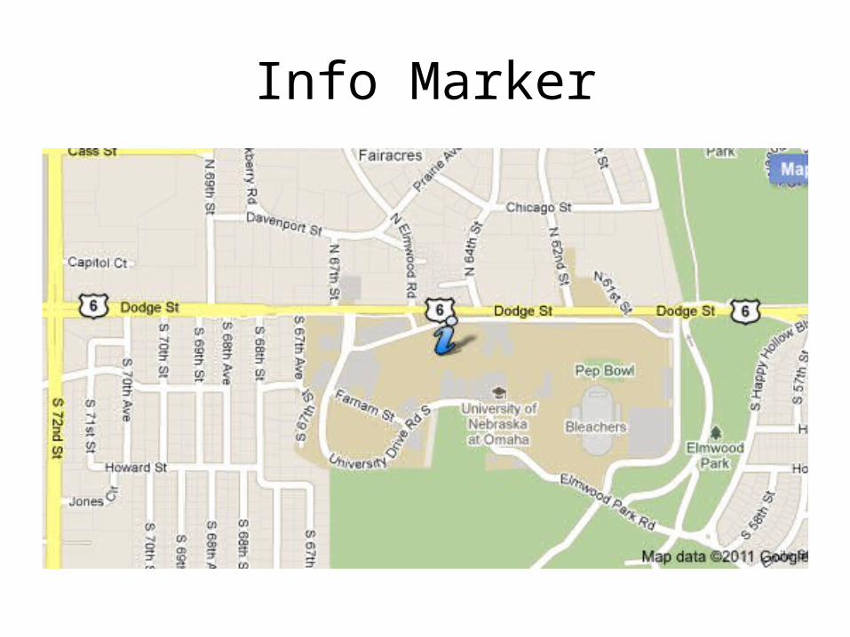
Info Marker
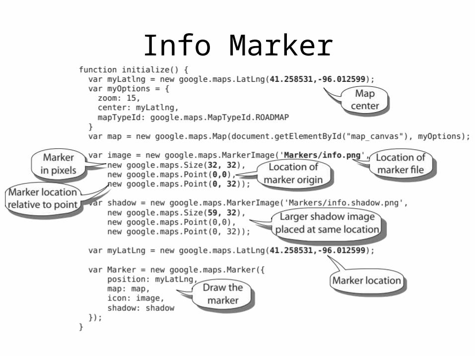
Info Marker
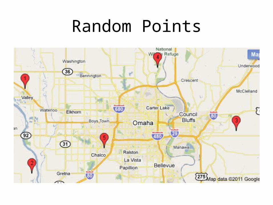
Random Points
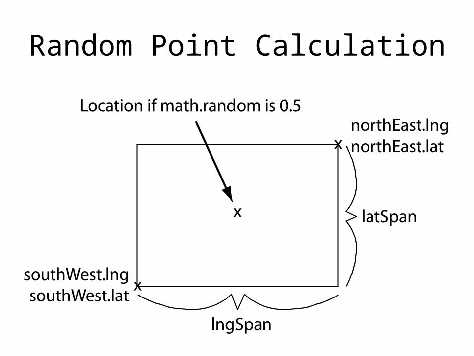
Random Point Calculation
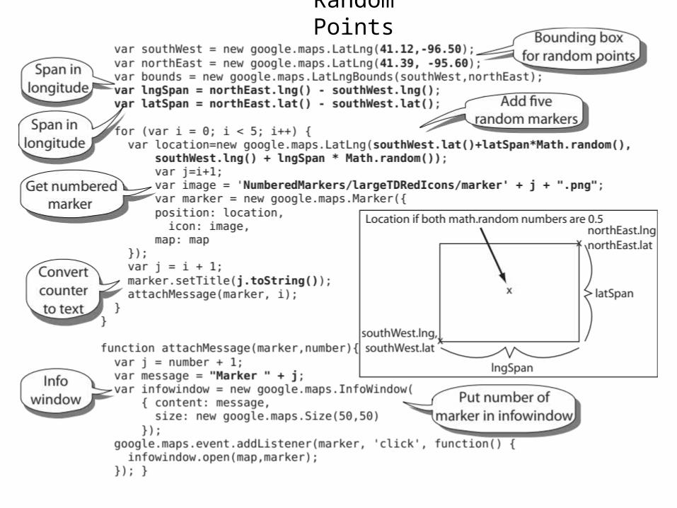
Random Points
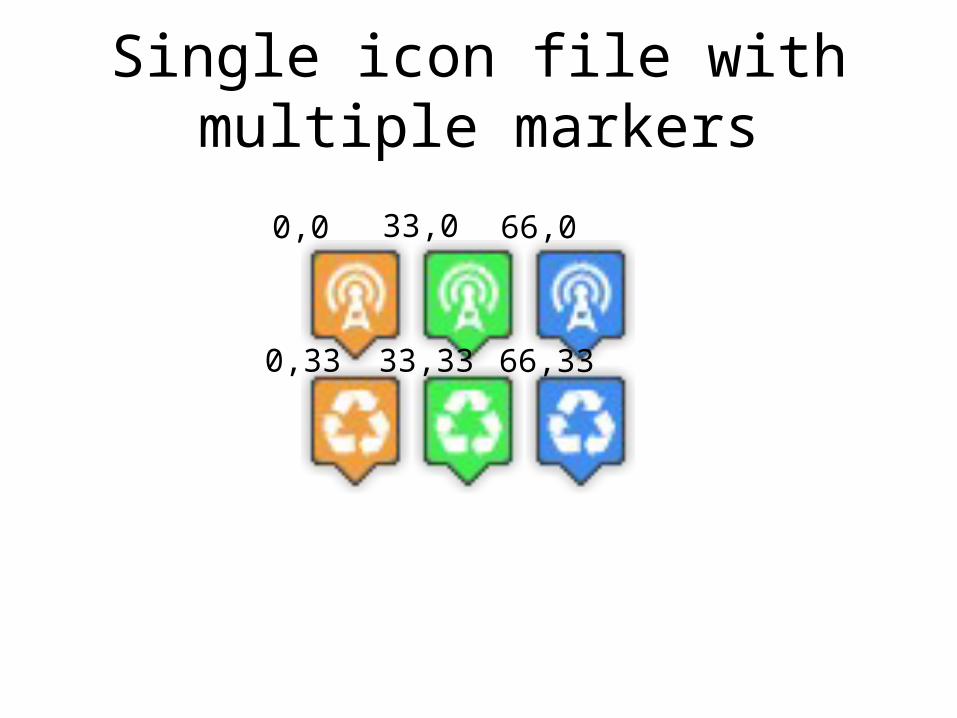
Single icon file with multiple markers
0,0 33,0 66,0
0,33 33,33 66,33
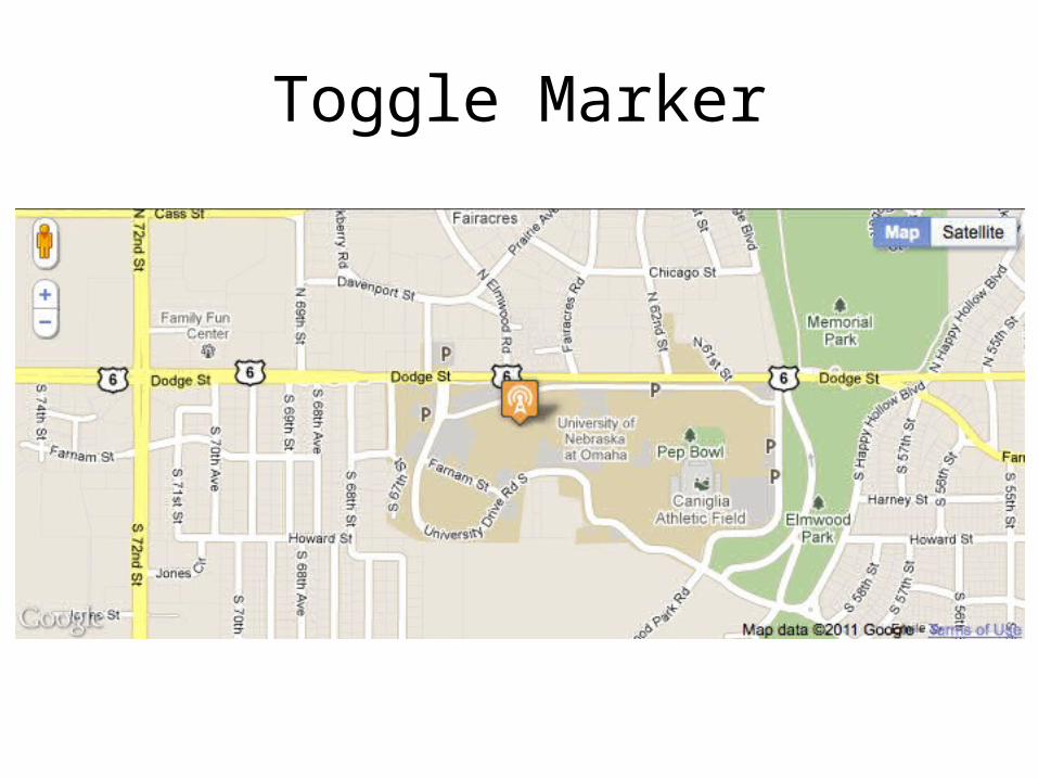
Toggle Marker
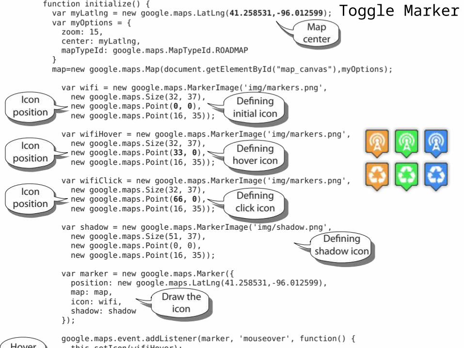
Toggle Marker
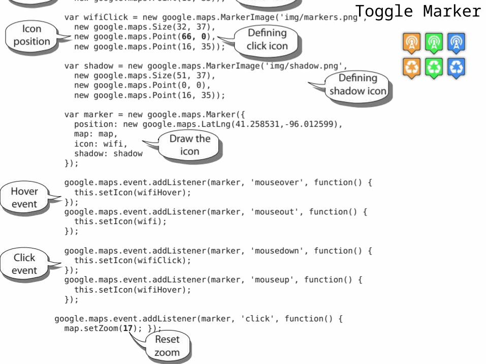
Toggle Marker
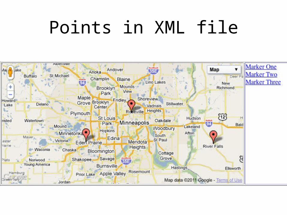
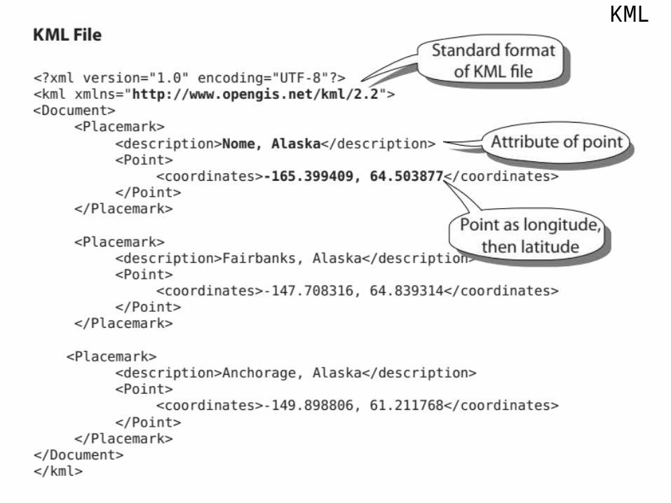
Points in XML file
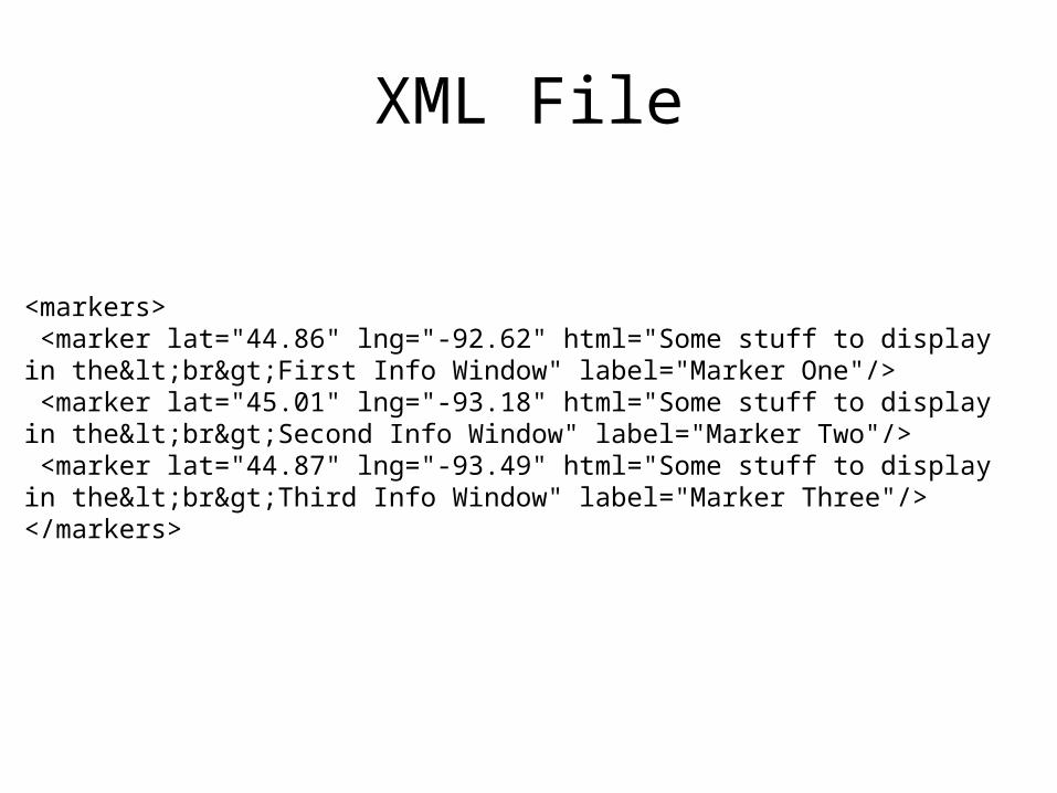
XML File
<markers> <marker lat="44.86" lng="-92.62" html="Some stuff to display in the<br>First Info Window" label="Marker One"/> <marker lat="45.01" lng="-93.18" html="Some stuff to display in the<br>Second Info Window" label="Marker Two"/> <marker lat="44.87" lng="-93.49" html="Some stuff to display in the<br>Third Info Window" label="Marker Three"/></markers>
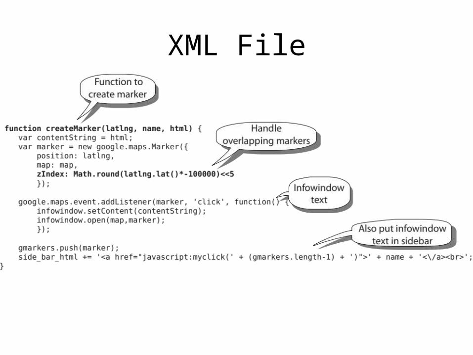
XML File
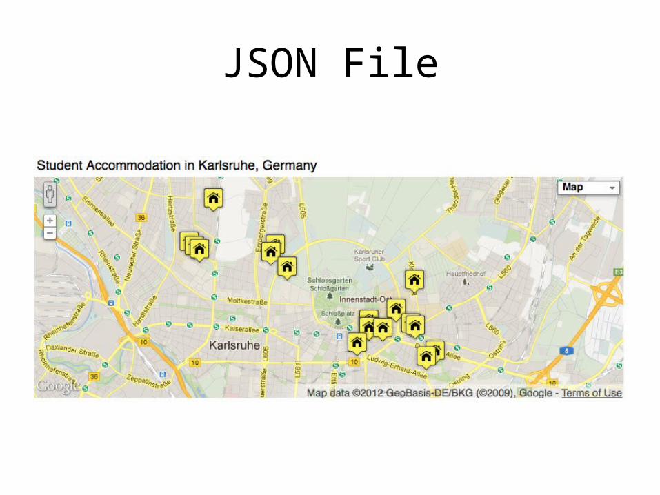
JSON File
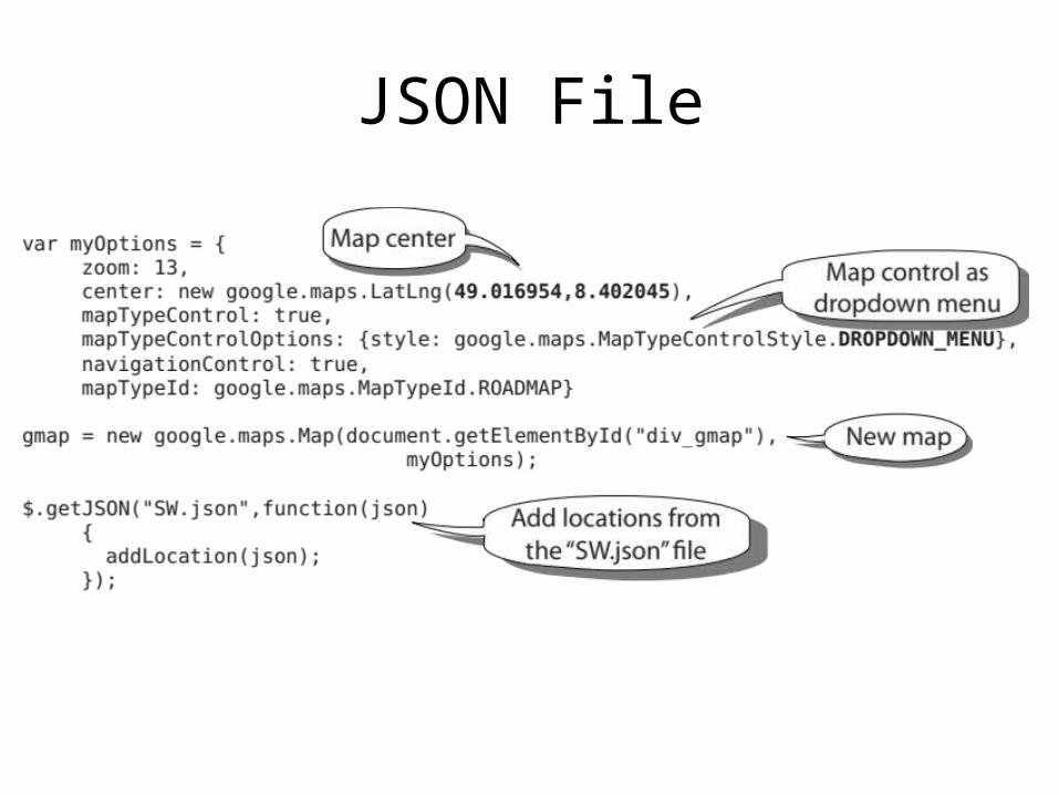
JSON File
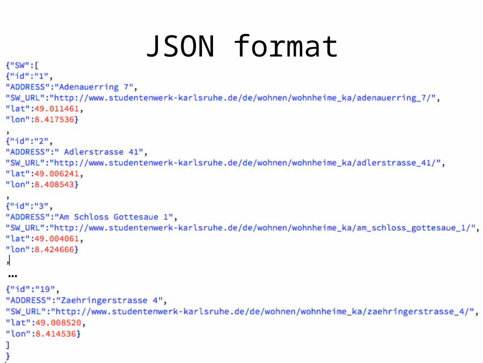
JSON format
…
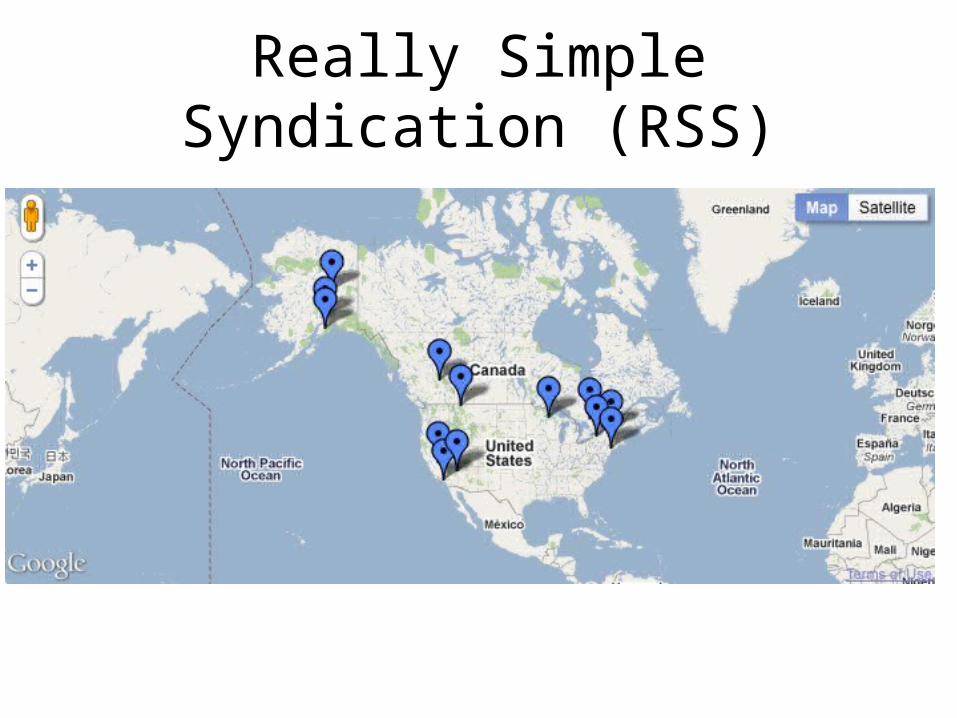
Really Simple Syndication (RSS)
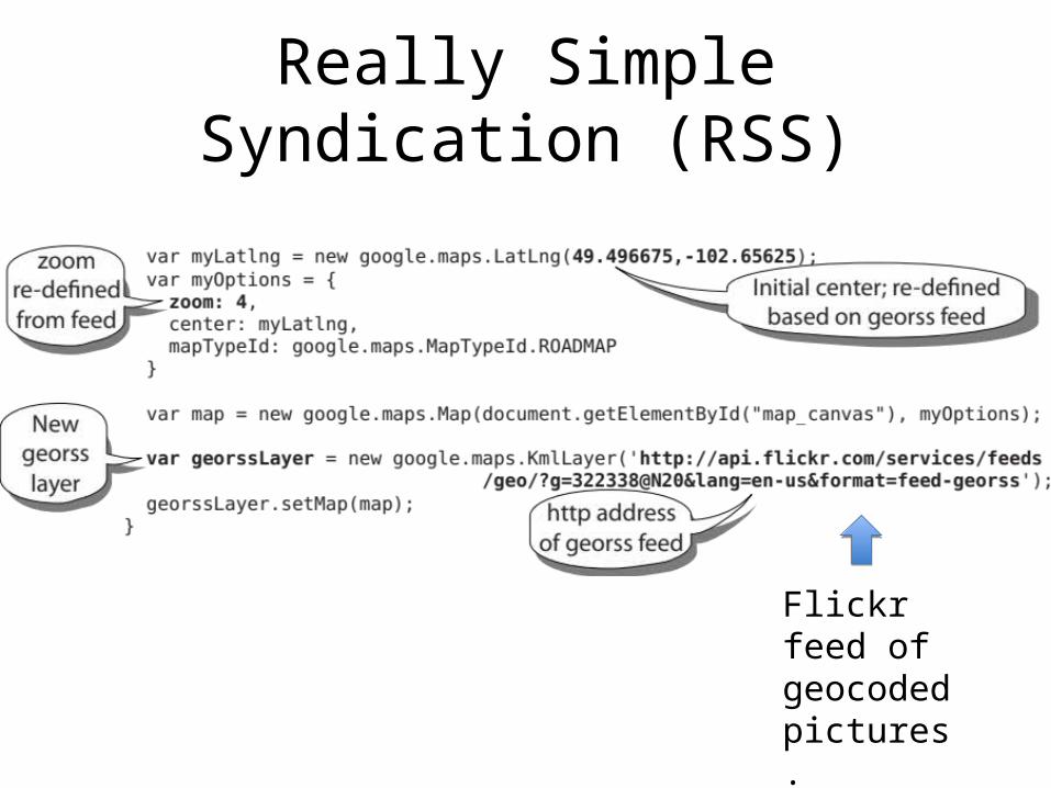
Really Simple Syndication (RSS)
Flickr feed of geocoded pictures.
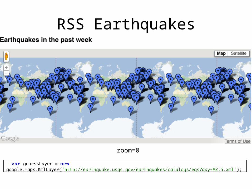
RSS Earthquakes
zoom=0
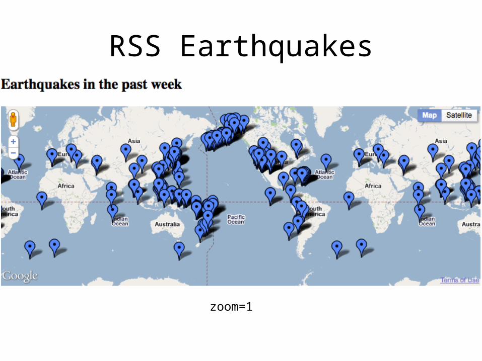
RSS Earthquakes
zoom=1
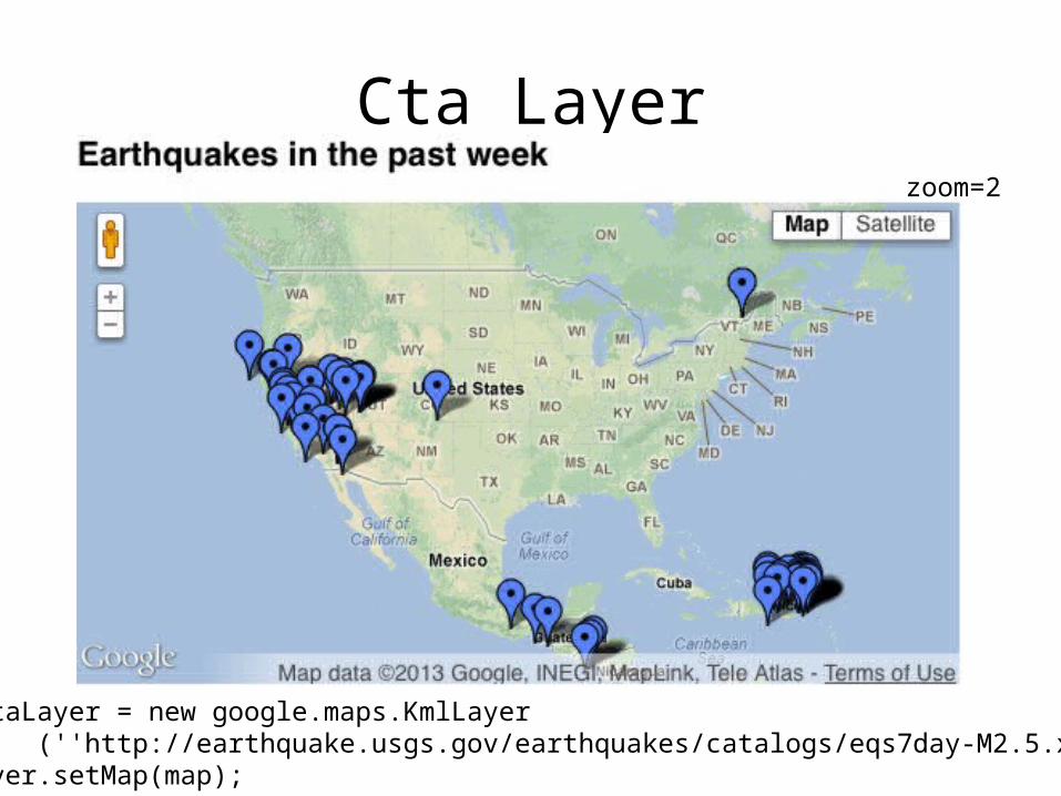
Cta Layerzoom=2
var ctaLayer = new google.maps.KmlLayer (''http://earthquake.usgs.gov/earthquakes/catalogs/eqs7day-M2.5.xml'');ctaLayer.setMap(map);
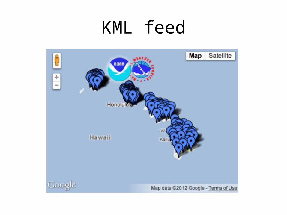
KML feed
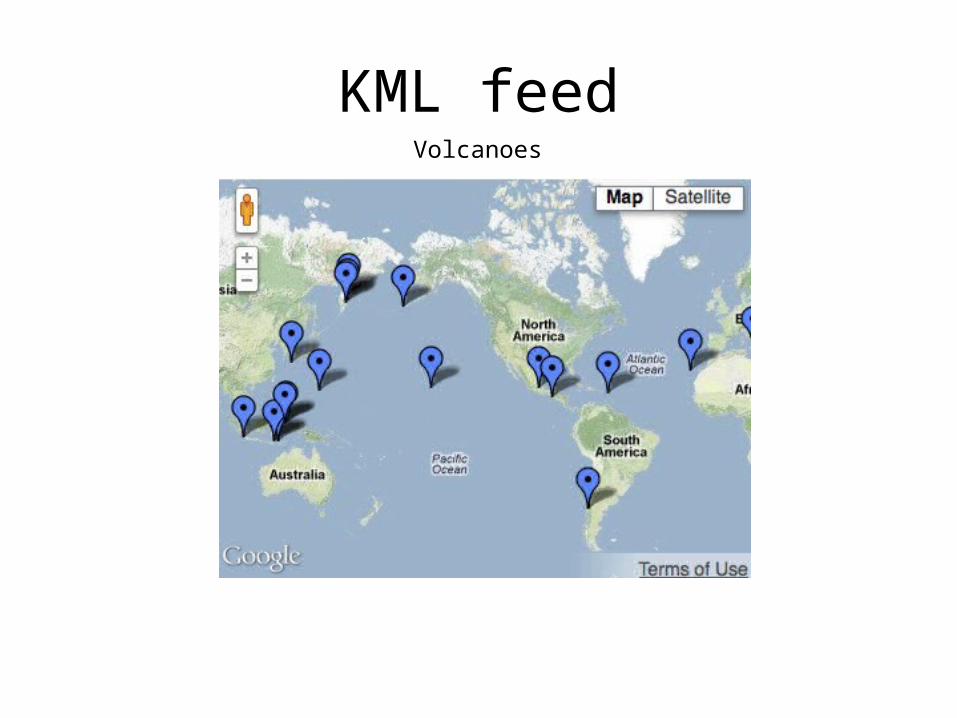
KML feedVolcanoes
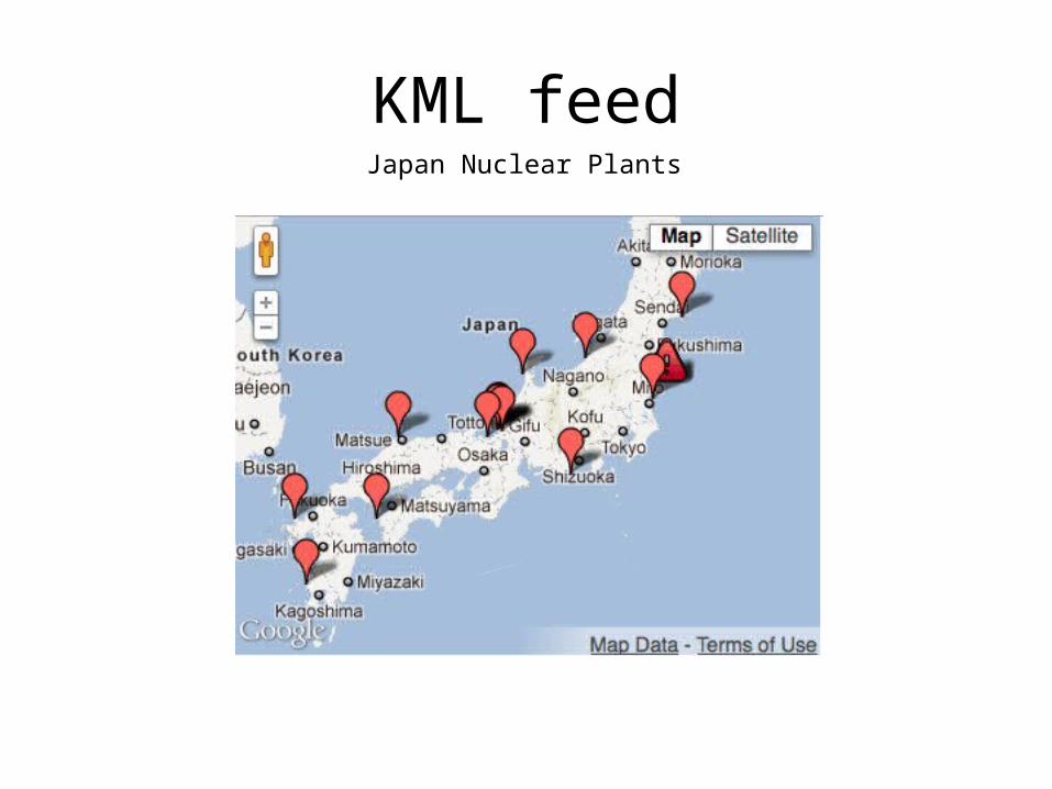
KML feedJapan Nuclear Plants
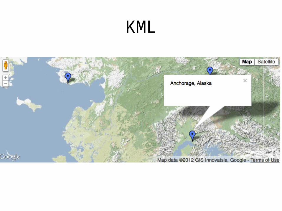
KML
KML
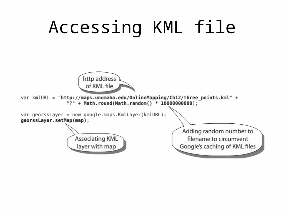
Accessing KML file
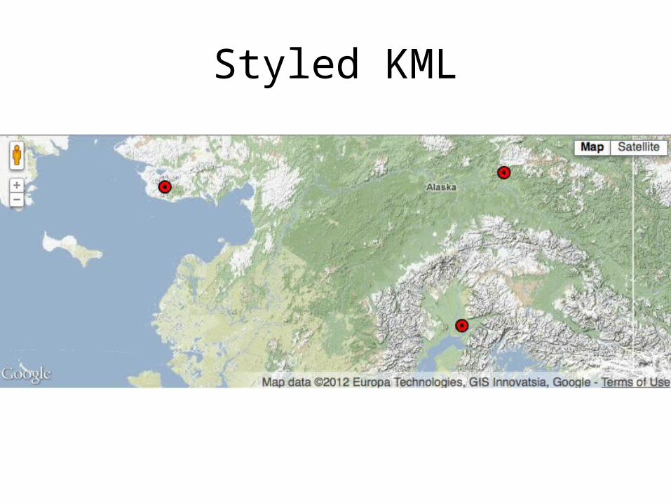
Styled KML
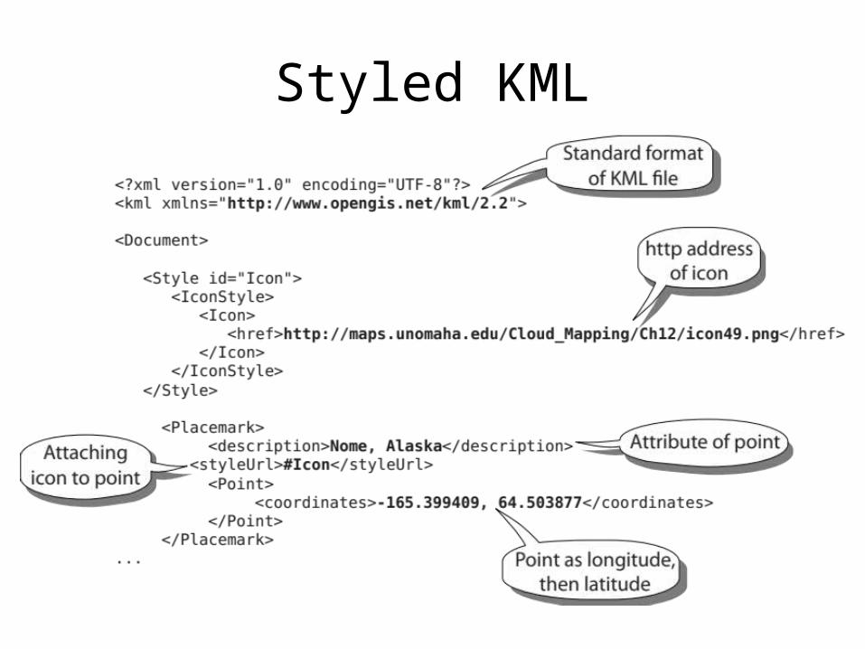
Styled KML
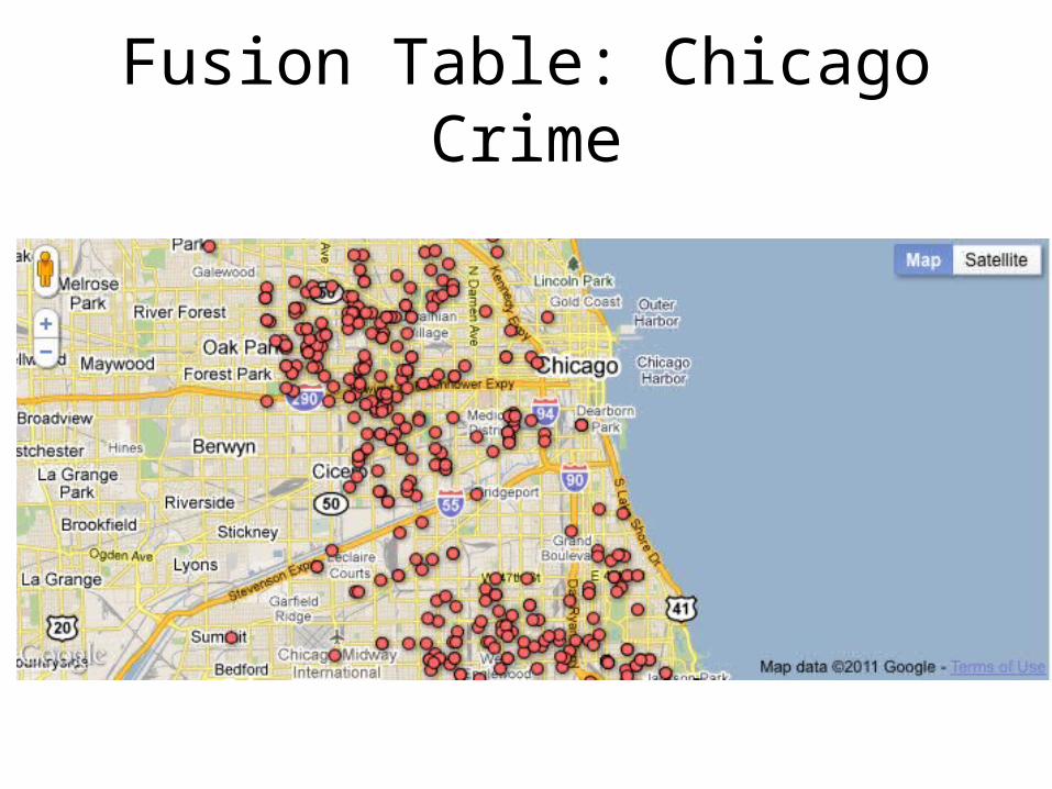
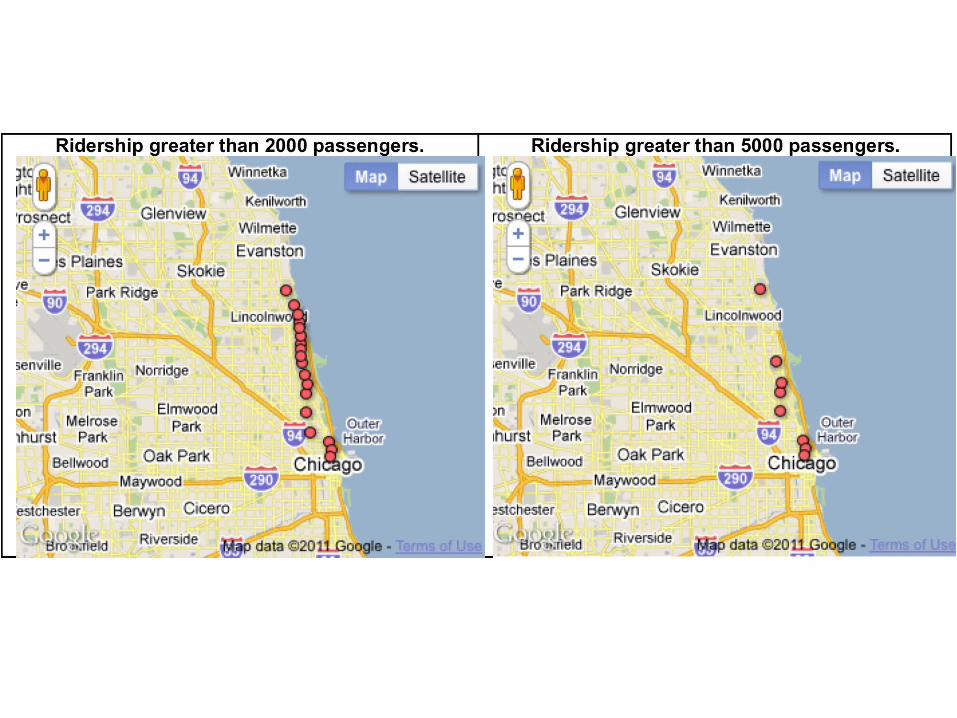
Fusion Table: Chicago Crime
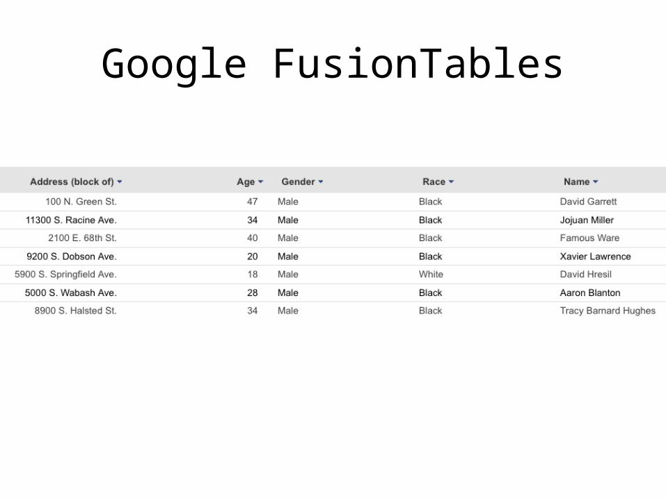
Google FusionTables

Fusion Table: Chicago Crime
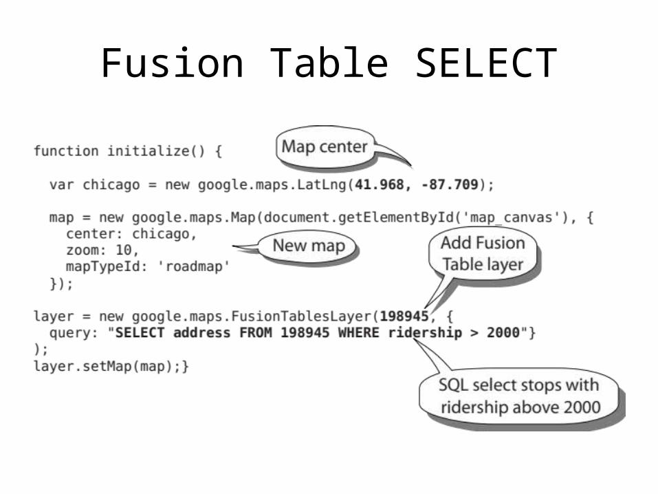
Fusion Table SELECT
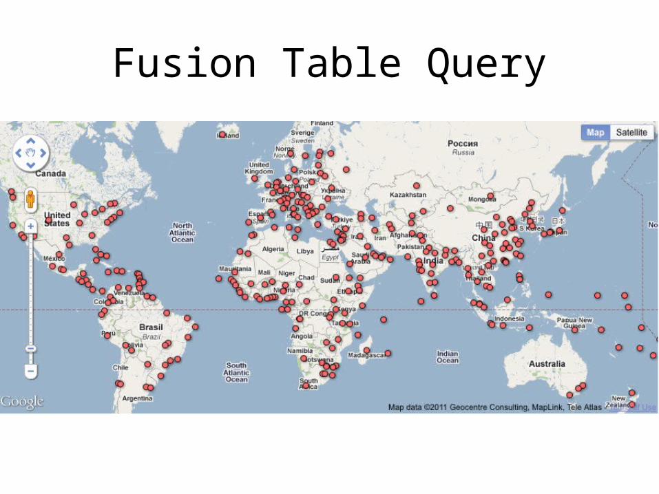
Fusion Table Query
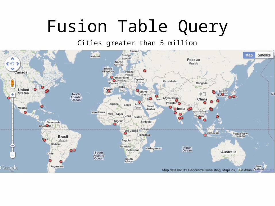
Fusion Table QueryCities greater than 5 million
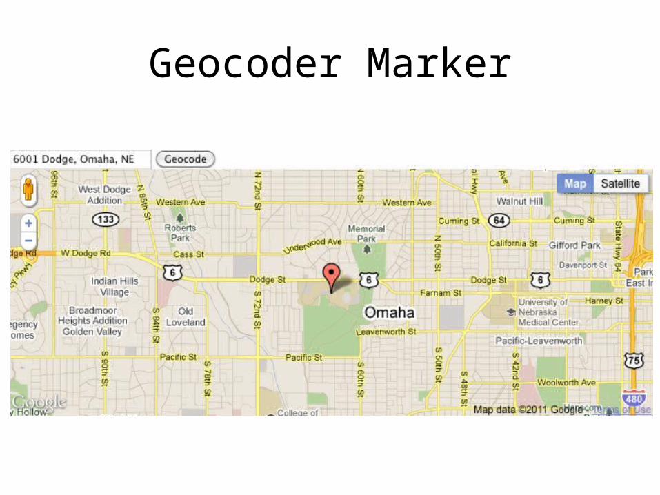
Geocoder Marker
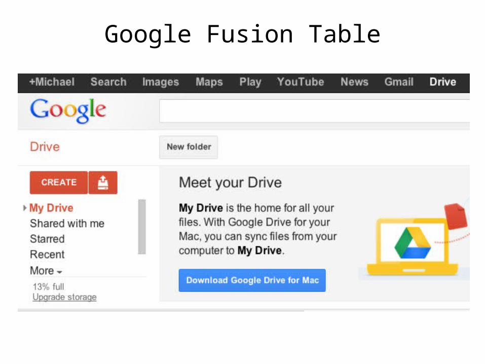
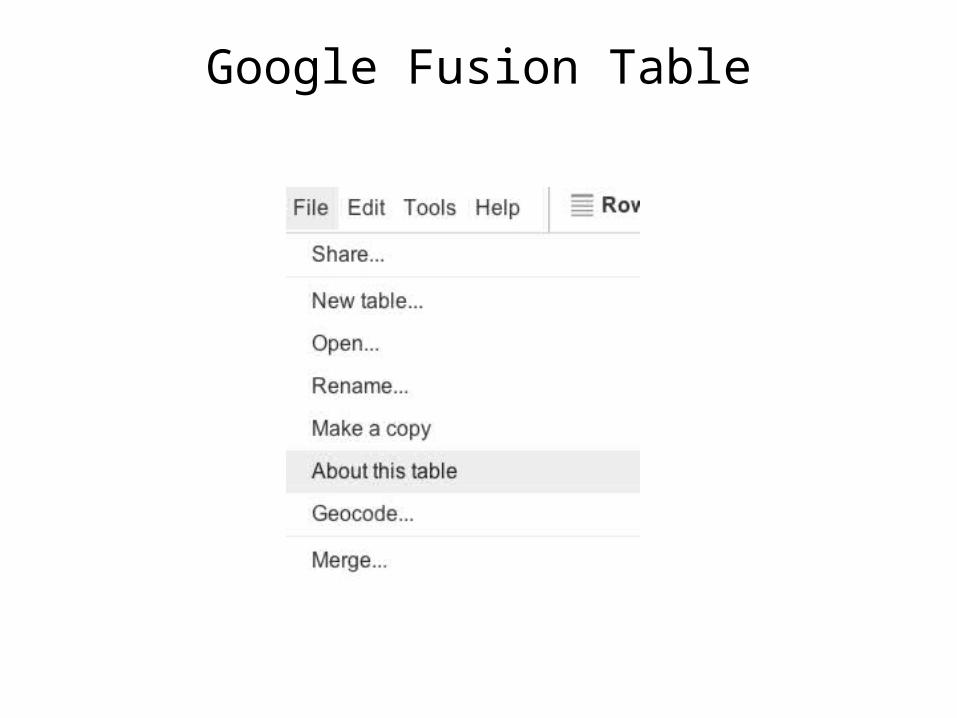
Google Fusion Table
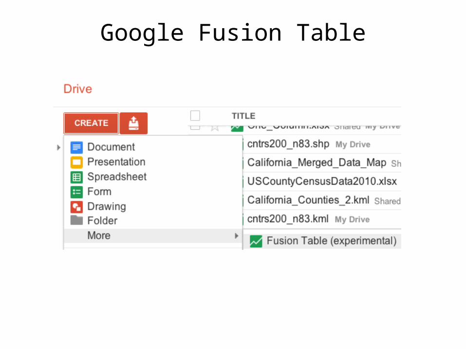
Google Fusion Table
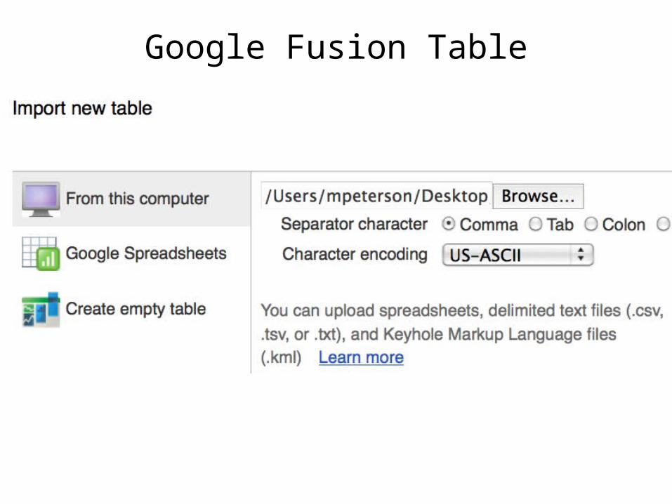
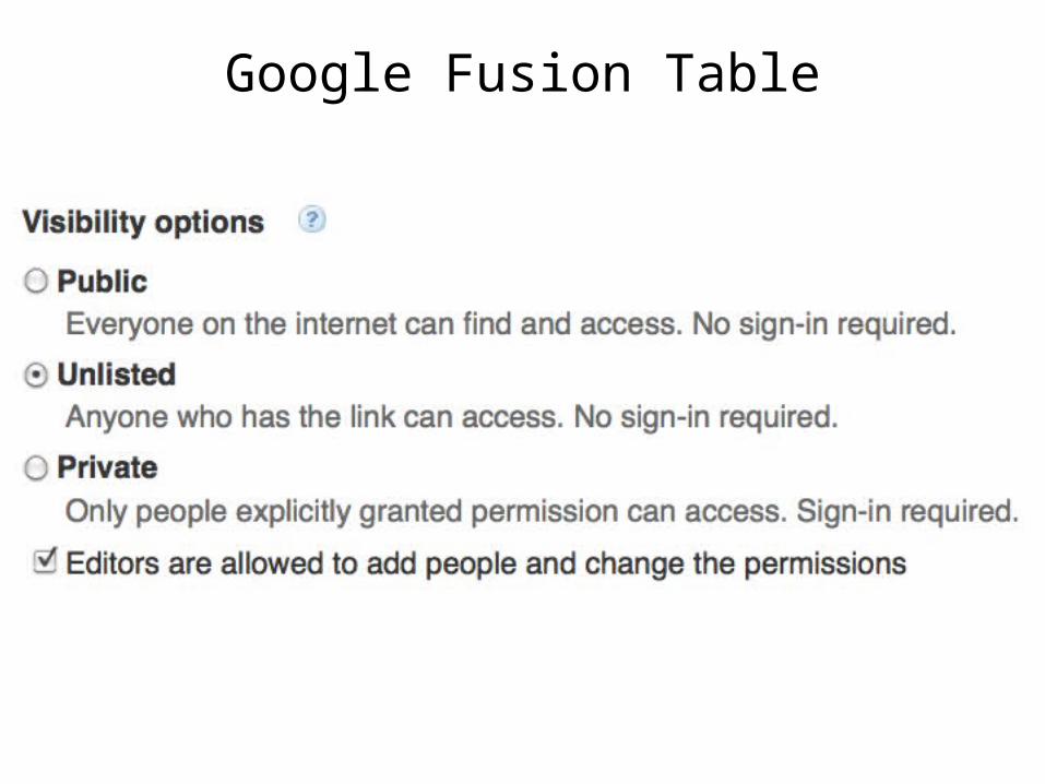
Google Fusion Table
Google Fusion Table
Google Fusion Table
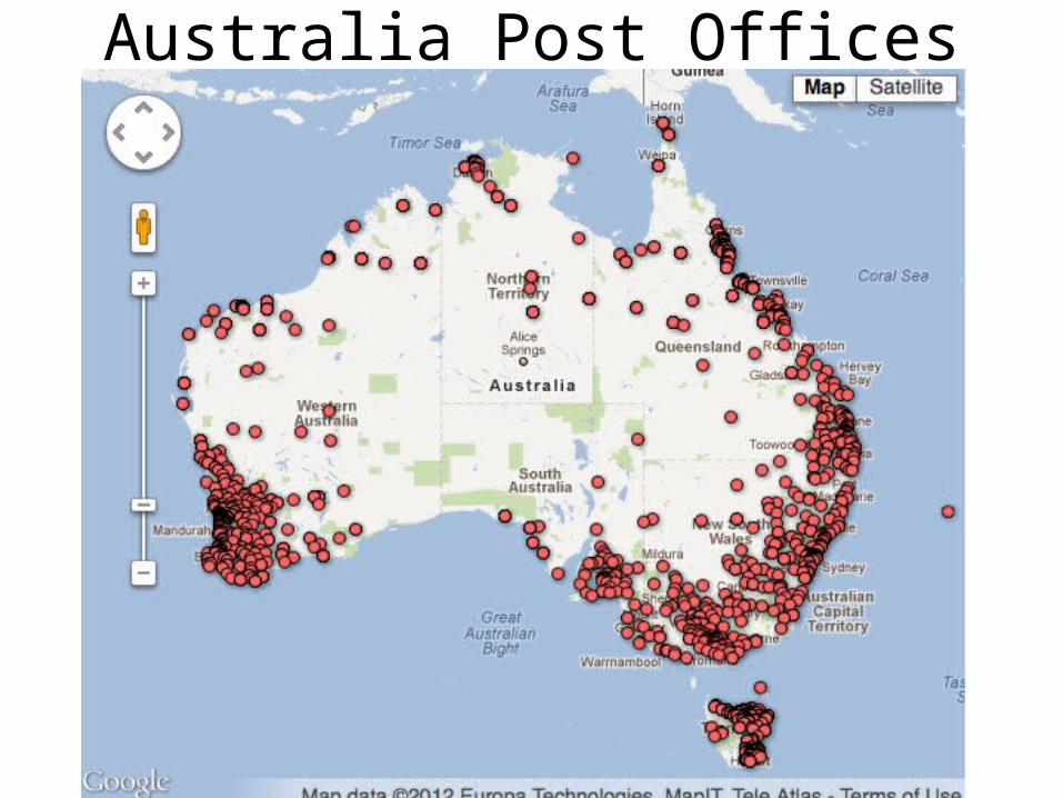
Australia Post Offices
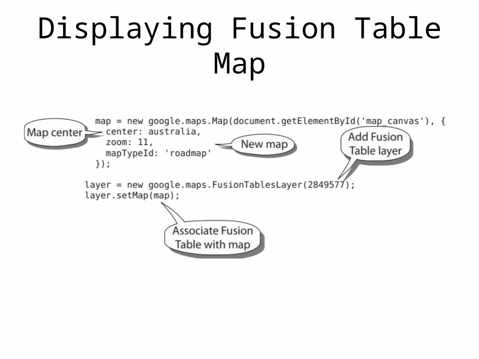
Displaying Fusion Table Map
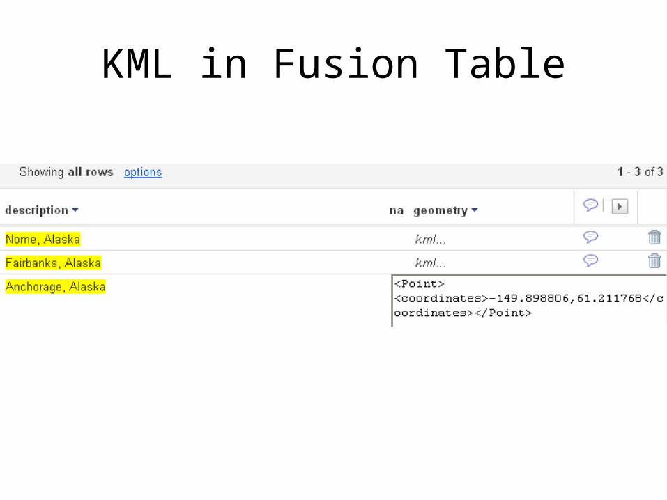
KML in Fusion Table
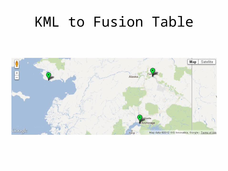
KML to Fusion Table
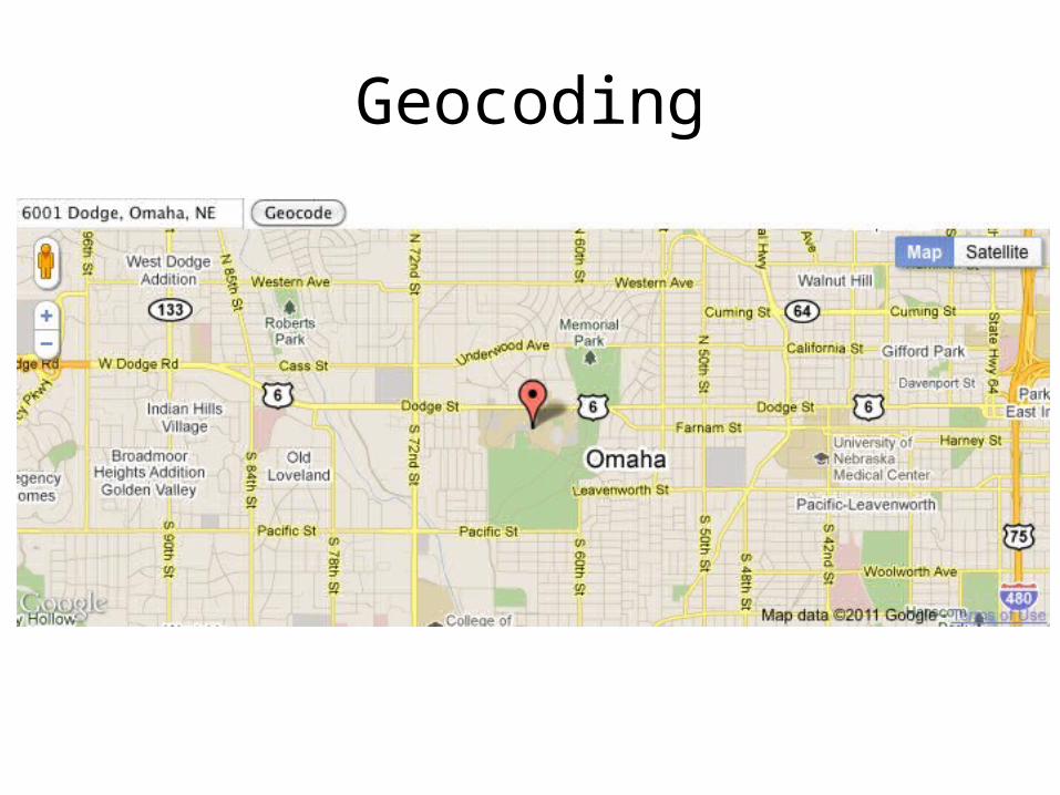
Geocoding
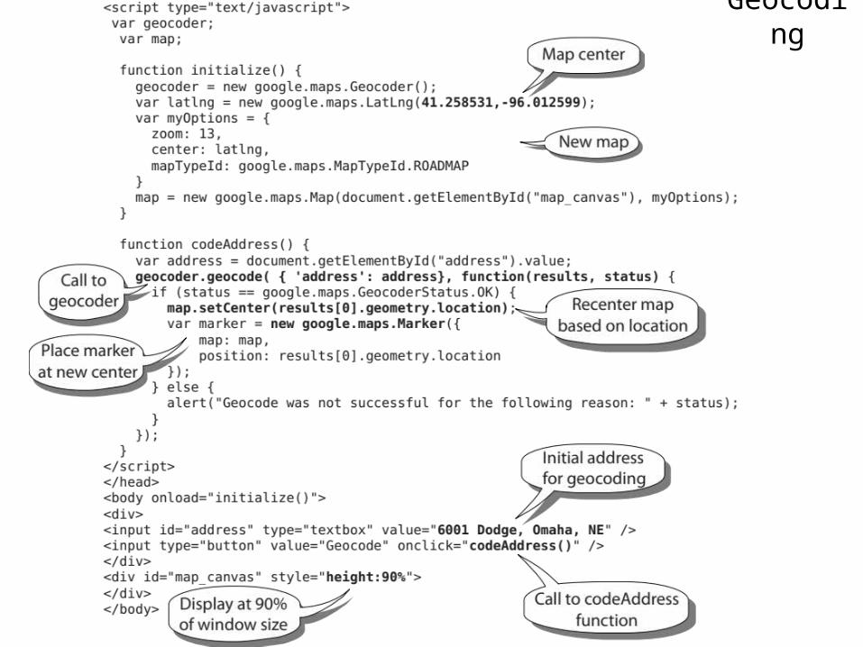
Geocoding
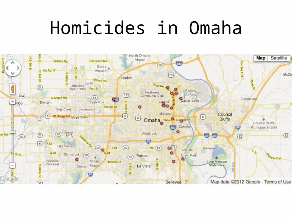
Homicides in Omaha
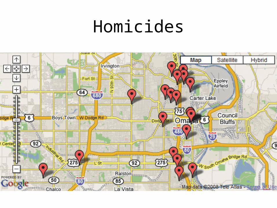
Homicides
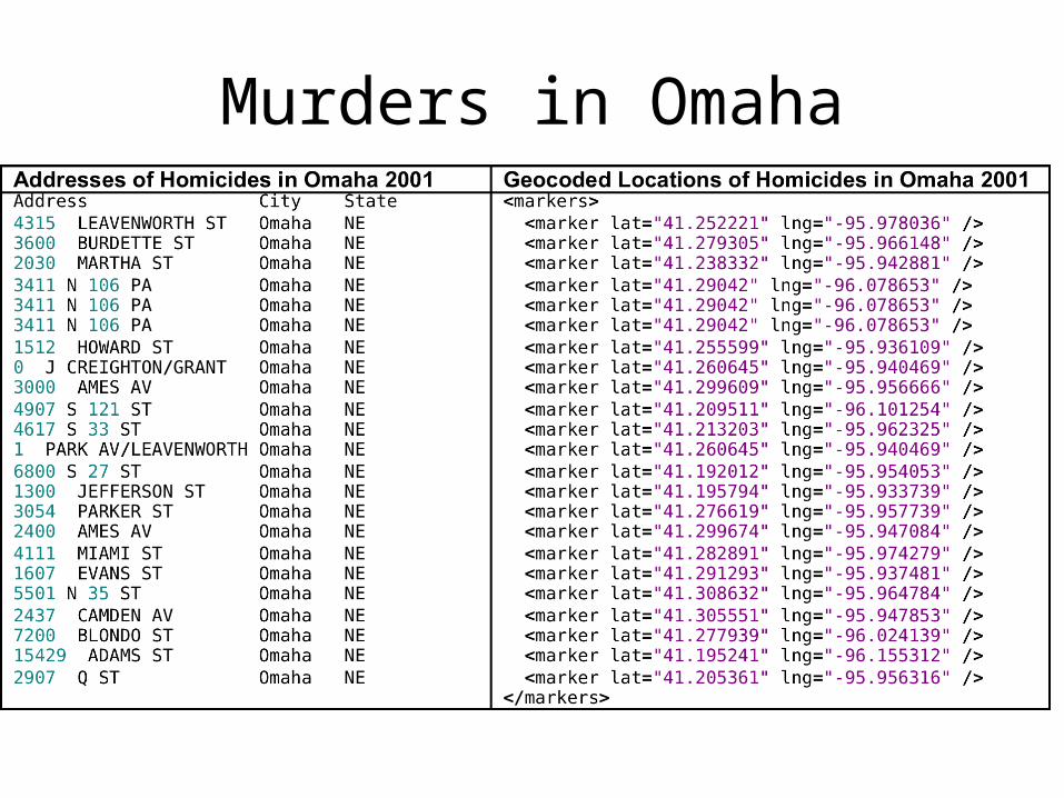
Murders in Omaha
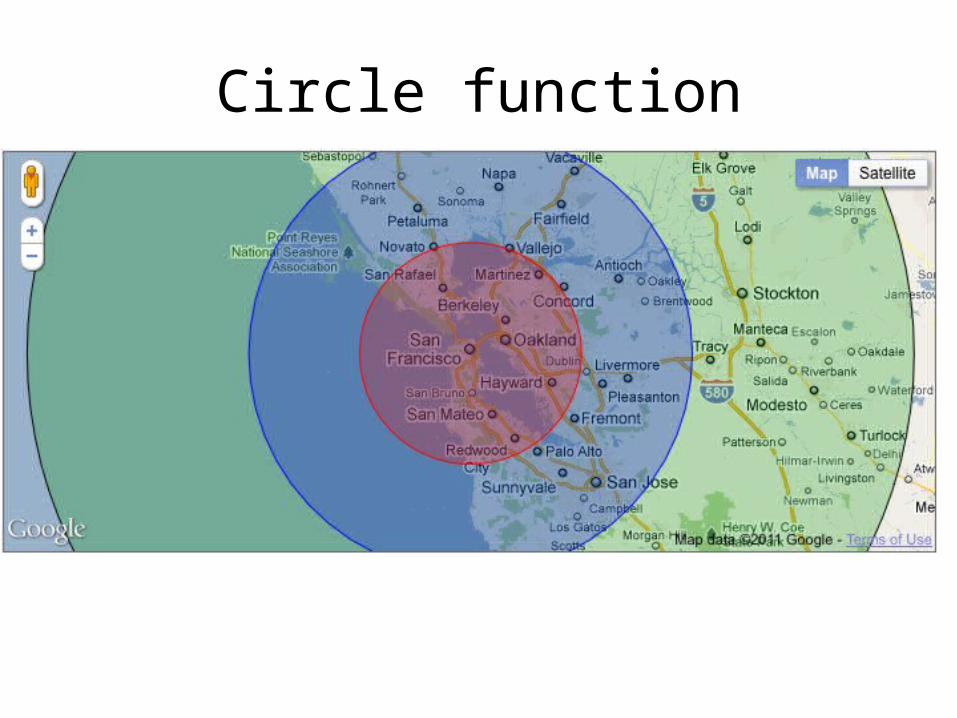
Circle function
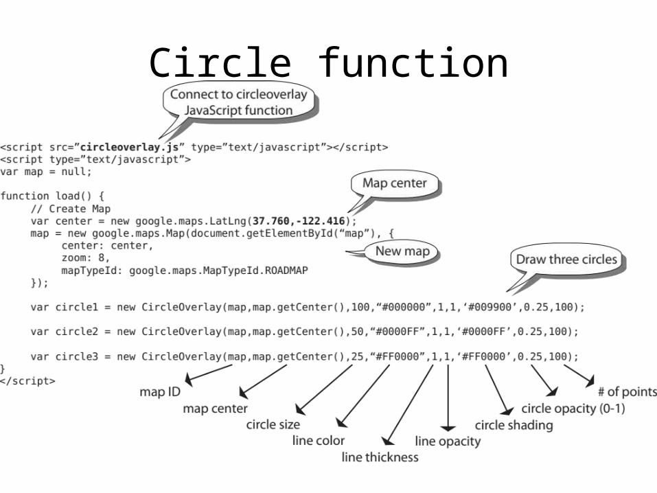
Circle function
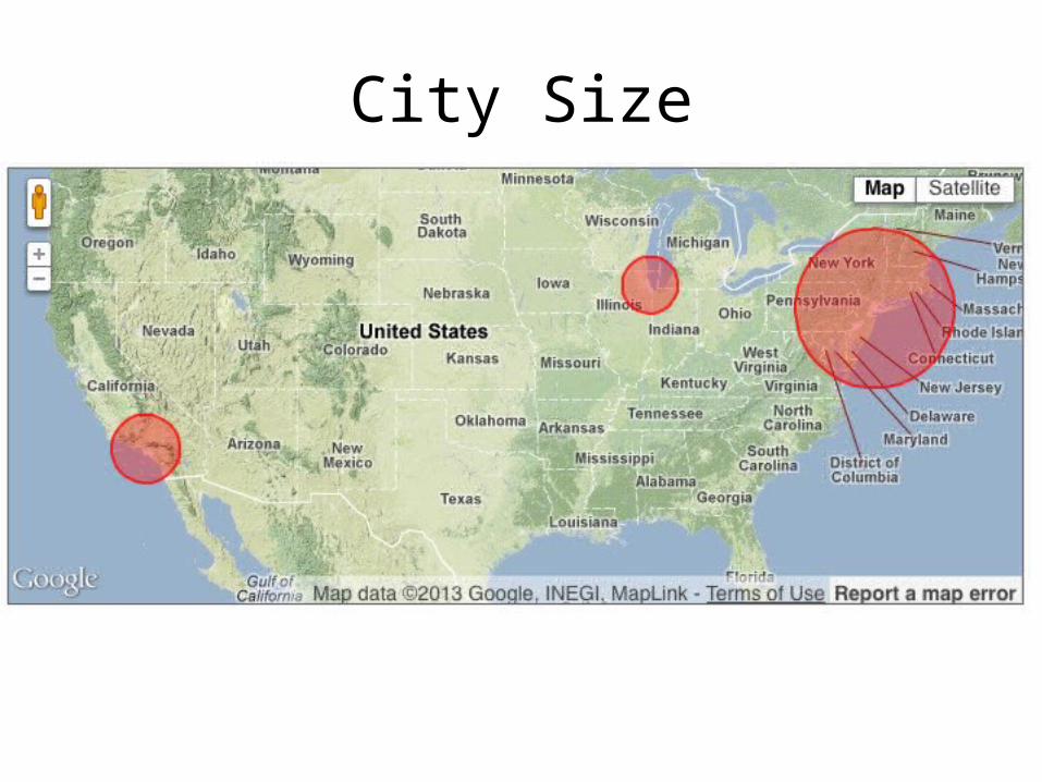
City Size
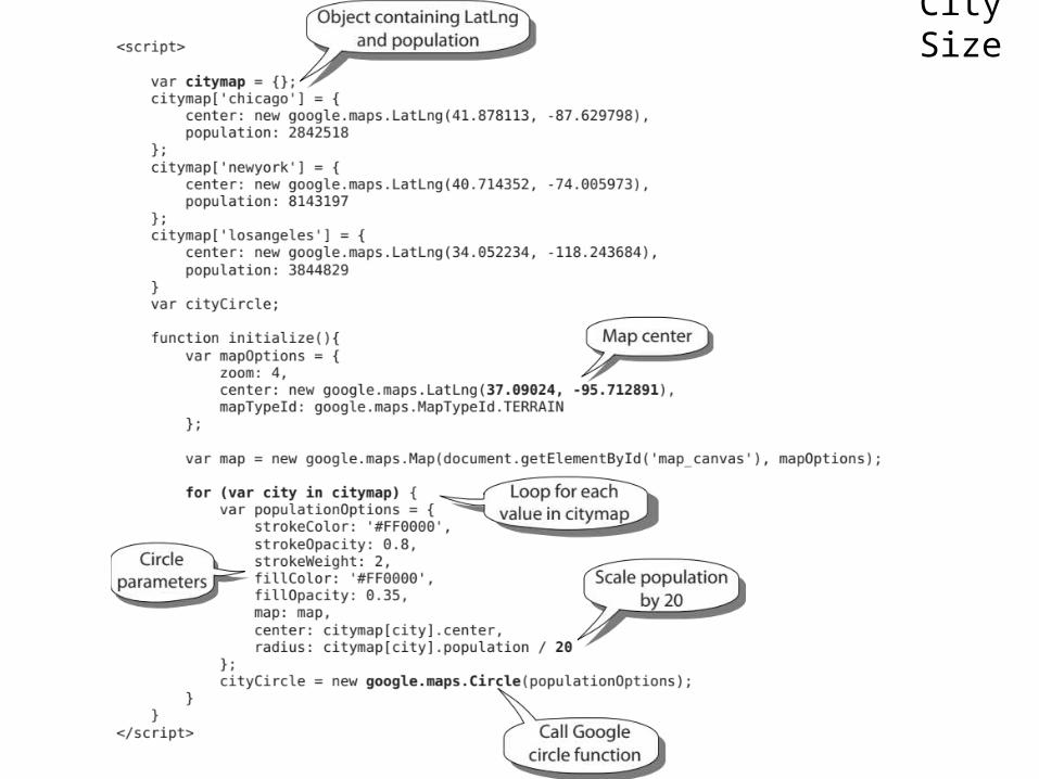
City Size
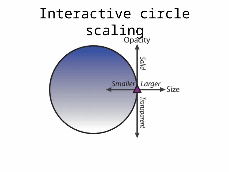
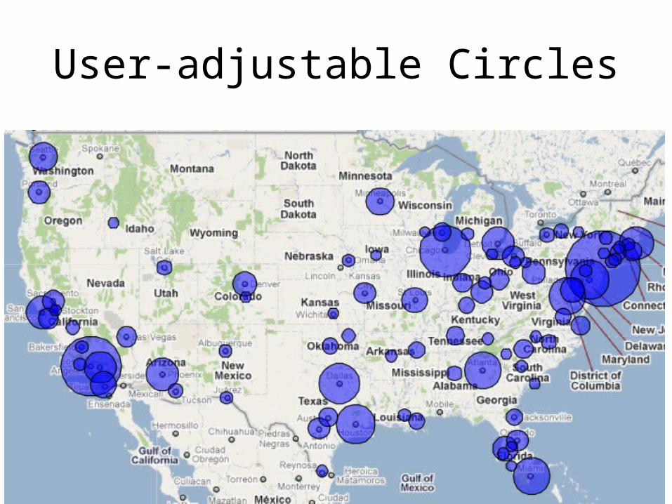
Interactive circle scaling
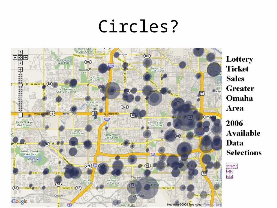
Circles?
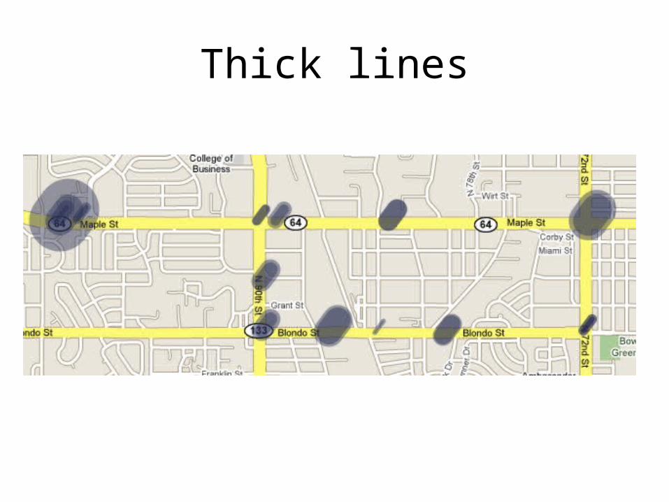
Thick lines
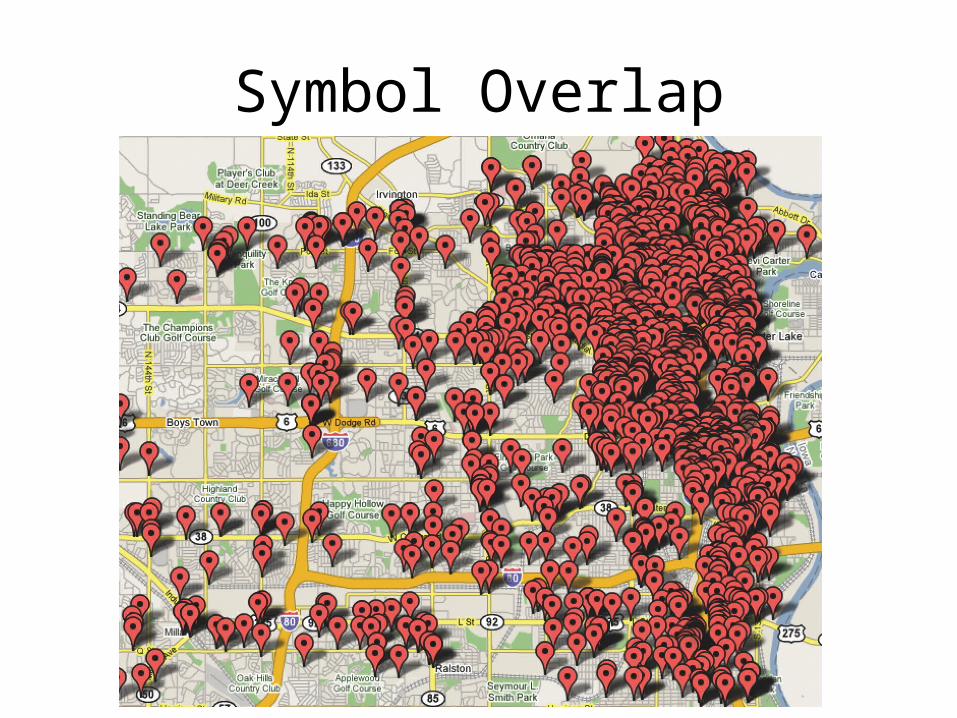
Symbol Overlap