Embed Size (px)
Citation preview
to the Housatonic Riverin Connec cut
A Paddling Guide

IMPORTANT!PLEASE READ INFORMATION ON PAGE 10
ON HOW TO CLEAN YOUR BOATS
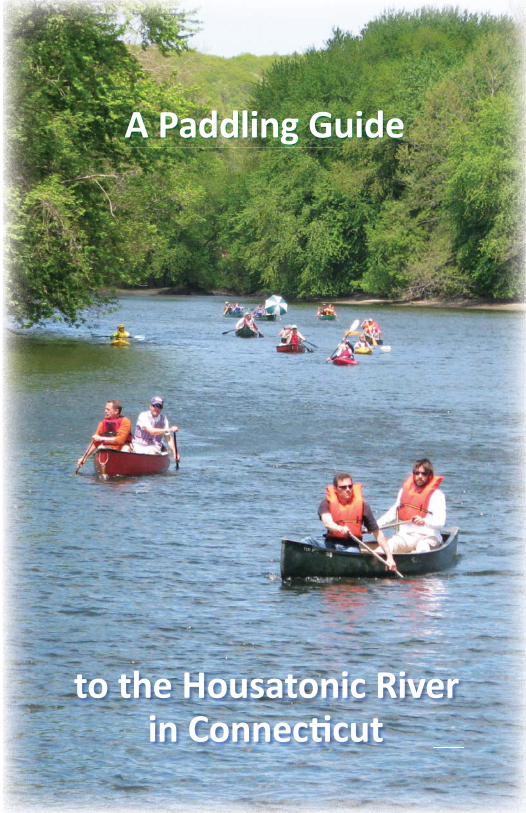
Canoeists nego a ng the rapids on the Housatonic River.
Bal more Oriole
LAURA GOOCH PHOTO
Wood DucksU.S. FISH AND WILDLIFE
SERVICE PHOTO
Wood DucksU S FISH AND WILDLIFE
Red FoxROY CHANG
1
With sincere thanks to our generous funders who made “A Paddling Guide to the Housatonic River
in Connec cut” possible.

A Paddling Guideto the Housatonic River
in Connec cutFirst Edi on, 2012
The Housatonic Valley Associa onP.O. Box 28, 150 Kent RoadCornwall Bridge, CT 06754
860-672-6678 or [email protected]
HVA Berkshire offi ceP.O. Box 251, 1383 Pleasant Street
Lee, MA 01260413-394-9796 or [email protected]
HVA New York offi ceP.O. Box 315, 19 Furnace Bank Road
Wassaic, NY 12592845-789-1381 or [email protected]
www.hvatoday.org
Generously Funded by:The Geoff rey C. Hughes Founda on, Inc.
Iroquois Gas Transmission SystemHousatonic Heritage – A Na onal Heritage Area
Connec cut Light and Power, Northeast U li es SystemConnec cut Community Founda on
Kent School
4
845
2
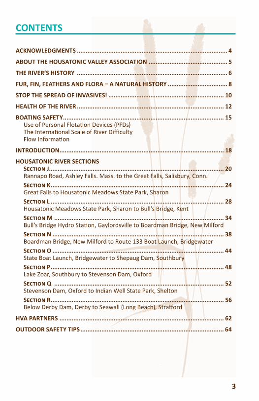
CONTENTS
ACKNOWLEDGMENTS ...................................................................................... 4
ABOUT THE HOUSATONIC VALLEY ASSOCIATION ............................................. 5
THE RIVER’S HISTORY ...................................................................................... 6
FUR, FIN, FEATHERS AND FLORA A NATURAL HISTORY .................................. 8
STOP THE SPREAD OF INVASIVES! .................................................................. 10
HEALTH OF THE RIVER .................................................................................... 12
BOATING SAFETY ............................................................................................ 15Use of Personal Flota on Devices (PFDs)The Interna onal Scale of River Diffi cultyFlow Informa on
INTRODUCTION .............................................................................................. 18
HOUSATONIC RIVER SECTIONSS J.................................................................................................... 20Rannapo Road, Ashley Falls. Mass. to the Great Falls, Salisbury, Conn.S K ................................................................................................... 24Great Falls to Housatonic Meadows State Park, SharonS L ................................................................................................... 28Housatonic Meadows State Park, Sharon to Bull’s Bridge, KentS M ................................................................................................. 34Bull’s Bridge Hydro Sta on, Gaylordsville to Boardman Bridge, New MilfordS N .................................................................................................. 38Boardman Bridge, New Milford to Route 133 Boat Launch, BridgewaterS O .................................................................................................. 44State Boat Launch, Bridgewater to Shepaug Dam, SouthburyS P ................................................................................................... 48Lake Zoar, Southbury to Stevenson Dam, Oxford S Q ................................................................................................. 52Stevenson Dam, Oxford to Indian Well State Park, SheltonS R ................................................................................................... 56Below Derby Dam, Derby to Seawall (Long Beach), Stra ord
HVA PARTNERS .............................................................................................. 62
OUTDOOR SAFETY TIPS .................................................................................. 64
3
ACKNOWLEDGMENTS
This fi rst edition entitled “A Paddling Guide to the Housatonic River in Connecticut” celebrates the popularity of canoeing and kayaking on the Housatonic River.
The Housatonic Valley Association (HVA) gratefully acknowledges the following funders for making this guide possible: the Geoffrey C. Hughes Foundation, Inc., Iroquois Gas Transmission System, Housatonic Heritage – A National Heritage Area, Connecticut Light and Power – The Northeast Utilities System, the Connecticut Community Foundation, and Kent School.
We extend thanks to several HVA staff including Tim Abbott, Jane Bakker, Alison Dixon, Sam Dziekan, Elaine LaBella, Dennis Regan, Meghan Ruta, Dick Sears, Brenda Singer, and Lynn Werner for paddling, mapping, writing, editing and graphic design.
We also extend our deepest appreciation to Joe Ruggiero from Southbury, Connecticut; Schuyler Thomson from Norfolk, Connecticut; Bill Tingley, Sharon, Connecticut; Joe Marbec, Derby Dam manager, McCallum Enterprises; and Gary Smolen, Senior Engineer, and Brian Wood, Land Manager, FirstLight Power Resources who provided extensive input and technical support in creating this guide.
Thank you to all of our partners who work for a healthier Housatonic River in Connecticut. See page 62 for a complete list of these agencies and organizations.
In 2011, HVA published the Fourth Edition of “A Paddling Guide to the Housatonic River in Berkshire County” (see hvatoday.org). We dedicate this fi rst edition paddling guide for the Connecticut section of the Housatonic River to all those who contributed to the fi rst four versions of the Berkshire Guide.
Finally, thank you to all the paddlers and river enthusiasts who care about the Housatonic River. Get out and enjoy it!
4
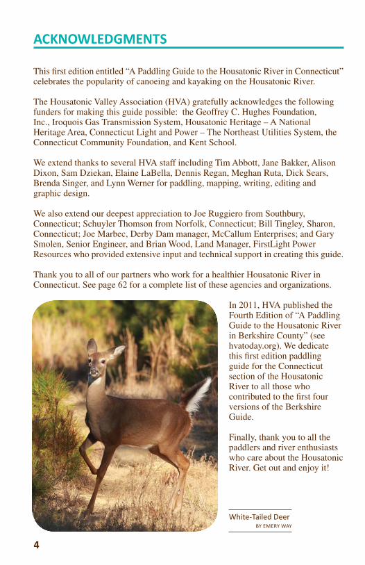
White-Tailed DeerBY EMERY WAY
ABOUT THE HOUSATONIC VALLEY ASSOCIATION
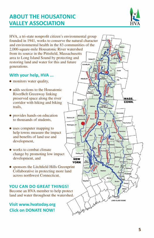
HVA, a tri-state nonprofi t citizen’s environmental group founded in 1941, works to conserve the natural character and environmental health in the 83 communities of the 2,000-square-mile Housatonic River watershed from its source in the Pittsfi eld, Massachusetts area to Long Island Sound by protecting and restoring land and water for this and future generations.
With your help, HVA ... monitors water quality,
adds sections to the Housatonic RiverBelt Greenway linking preserved space along the river corridor with hiking and biking trails,
provides hands-on education to thousands of students,
uses computer mapping to help towns measure the impact and benefi ts of land use and development,
works to combat climate change by promoting low impact development, and
sponsors the Litchfi eld Hills Greenprint Collaborative in protecting more land across northwest Connecticut.
YOU CAN DO GREAT THINGS!Become an HVA member to help protect land and water throughout the watershed.
Visit www.hvatoday.org Click on DONATE NOW!
5
HVA

THE RIVER’S HISTORY
PRE COLUMBIAN ERA NATIVE AMERICANSThere has been a human presence in the Housatonic Valley of Connecticut for many thousands of years. Native American place names such as Weatogue, Aspetuck and Naromiyocknowhusunkatankshunk occur throughout the watershed. The name “Housatonic” itself derives from the Mohican “Usiadienuk” and has been translated as “place of stones” or “beyond the mountain place” or “river of the mountain place.” The Schaghticoke reservation in Kent, established in 1736, is one of the oldest in America.
EARLY EUROPEAN SETTLEMENTSettlements in Puritan Connecticut initially concentrated near the coast and along fertile valleys served by navigable rivers. Milford and Stratford at the mouth of the Housatonic were fi rst settled by European colonists in 1639, but towns were not incorporated in the hilly interior until the 18th century.
The border between Connecticut and New York remained in dispute until after the Revolution. At issue were several passes through the Highlands between the Housatonic and Hudson River valleys, as well as signifi cant mineral deposits, including high quality iron ore and the limestone needed to refi ne it.
The Housatonic River represented another barrier to East-West travel, and colonial roadways made use of a few shallow fords and bridges. Two 19th century covered bridges survive today at
West Cornwall and Bull’s Bridge.
INDUSTRIALIZATIONThe Housatonic River and its tributaries in Connecticut were instrumental in the development of early Connecticut industry. The watershed provided the raw power to pioneer new technolo-gies that enhanced the production of iron, brass and textiles. Blast furnaces driven by wood and water power operated in the 18th and 19th centuries in communities from Roxbury to Salisbury, where in 1762 Ethan Allen was a partner in the region’s fi rst iron furnace.
Farther downriver, Derby was a shipping and fi shing port, where shipbuilding fl ourished for almost 200 years. The Naugatuck River valley, the
W
T Co pgaac
p
Ffia
6
VNAoibm
i
WigwamCOURTESY OF THE
INSTITUTE OF AMERICAN INDIAN
STUDIES
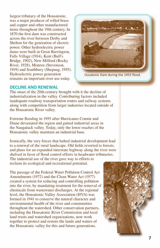
largest tributary of the Housatonic, was a major producer of rolled brass and copper and other manufactured items throughout the 19th century. In 1870 the fi rst dam was constructed across the river between Derby and Shelton for the generation of electric power. Other hydroelectric power dams were built in Great Barrington, Falls Village (1914), Kent (Bull’s Bridge, 1902), New Milford (Rocky River, 1928), Monroe (Stevenson, 1919) and Southbury (Shepaug, 1955). Hydroelectric power generation remains an important river use today.
DECLINE AND RENEWAL The onset of the 20th century brought with it the decline of industrialization in the valley. Contributing factors included inadequate roadway transportation routes and railway systems along with competition from larger industries located outside of the Housatonic River valley.
Extreme fl ooding in 1955 after Hurricanes Connie and Diane devastated the region and gutted industrial areas in the Naugatuck valley. Today, only the lower reaches of the Housatonic valley maintain an industrial base.
Ironically, the very forces that halted industrial development lead to a renewal of the rural landscape. Old fi elds reverted to forests, and plans for an expanded interstate highway along the river were shelved in favor of fl ood control efforts in headwater tributaries. The industrial use of the river gave way to efforts to reclaim its ecological and recreational potential.
The passage of the Federal Water Pollution Control Act Amendments (1972) and the Clean Water Act (1977) created a system for reducing and controlling pollution into the river, by mandating treatment for the removal of chemicals from wastewater discharges. At the regional level, the Housatonic Valley Association (HVA) was formed in 1941 to conserve the natural character and environmental health of the river and communities throughout the watershed. Other conservation partners, including the Housatonic River Commission and local land trusts and watershed organizations, now work together to protect and restore the lands and waters of the Housatonic valley for this and future generations.
77
Ousatonic Dam during the 1955 fl ood.Ousatonic Dam during the 1955 flood
FUR, FIN, FEATHERS AND FLORA A NATURAL HISTORY
The Housatonic River watershed boasts a diverse and abundant array of plant and wildlife species. Due to the changes in topography, geology, soils and climate the watershed provides the ideal setting for many types of habitat.
The watershed provides a number of “critical habitats,” or those which support the survival of rare and endangered species. Among the most important critical habitats are the marble ridges and ledges, caves, calcareous (calcium-rich or limy) wetlands and lakes and ponds found in the central portion of the watershed. Since the soil and surface water is less acidic, these areas are very fertile and rich in nutrients and are especially suited to agriculture.
Marble ridges and ledges, such as the Great Falls area in Canaan and the Bull’s Bridge area in Kent, are home to many types of uncommon ferns, including the narrow-leaved spleenwort and the slender cliffbrake. Caves, predominantly found in Salisbury, are home to bats, invertebrates and salamanders.
Calcareous wetlands, such as Robbins Swamp in Canaan and Beeslick Pond and State Line Swamp in Salisbury, while supporting such lush and diverse plant species as the spreading globe fl ower and showy lady slipper, also attract an abundance of insects and game and non-game bird species.
Marl (hard water) lakes and ponds provide the ideal setting for many unique aquatic plants, such as pondweeds, and algal and fi sh species. Examples found in the Housatonic region are Twin Lakes in Salisbury and Mudge Pond in Sharon.
Other habitats, and their associated species, include fl ood plain forests, which were once abundant in the region until extensively cleared for agricultural uses. Today, only remnants remain from Falls Village to Kent. Dominant trees include cottonwood, black willow, sycamore and silver maple. Uncommon plants such as box elder, ostrich fern and variegated horsetail are found, along with a wide variety of songbirds.
The wind-swept high summits in the northwest corner, Canaan Mountain, Bear Mountain in Salisbury and Mohawk Mountain in Cornwall, contain rare pitch
pine – scrub oak plant communities that host scientifi cally
8
Showy Lady Slipper
BY ARIEH TAL
MCmsfs
Casgo
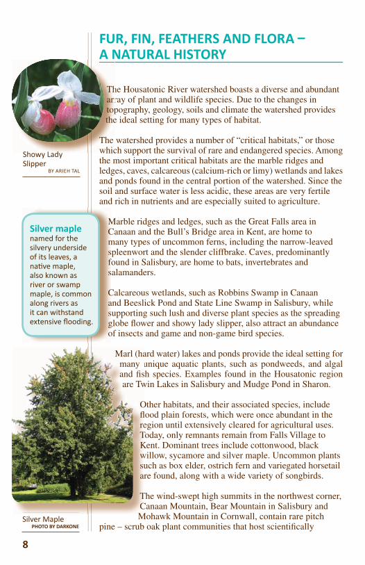
Silver maple named for the silvery underside of its leaves, a na ve maple, also known as river or swamp maple, is common along rivers as it can withstand extensive fl ooding.
Silver MaplePHOTO BY DARKONE
Marl (hamany uand fi sare Tw
Ofl reTKwsua
TCM
Tharrtopthe
The whicSh L d
important woody and herbaceous plants as well as lichens and mosses some of which are found nowhere else in the world.
Bogs (poorly drained acid wetlands) are characterized by a luxuriant cover of mosses, black spruce and larch. Several unusual and rare species of orchids and sedges are found here. The bog areas are extremely fragile and easily destroyed. Examples are Bingham Pond in Salisbury, Spectacle Pond in Kent and Black Spruce Bog atop Mohawk Mountain in Cornwall.
The valley’s grassland areas include open meadows, pastureland, grassy meadows, golf courses and hayfi elds. Several rare breeding birds are limited to this habitat in the Housatonic region, such as the upland sandpiper and the short-billed marsh wren.
As the river approaches Long Island Sound, the estuary includes coastal salt marshes and mud fl ats that support cord-grasses, spikegrass, sedges and eelgrass.
The presence of wildlife is also associated with the diverse habitat found within the river valley. Ringnecked pheasant, cottontail rabbit, red fox and woodchuck are found in openland habitat, while white-tailed deer, gray fox, gray squirrel, snowshoe hare, porcupine, ruffed grouse and woodcock are found in woodland habitat.
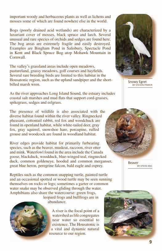
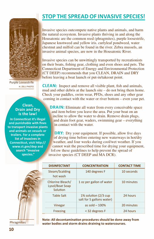
River edges provide habitat for primarily furbearing species, such as the beaver, muskrat, raccoon, river otter and mink. Waterfowl found in the area include the Canada goose, blackduck, woodduck, blue-winged teal, ringnecked duck, common goldeneye, hooded and common merganser, great blue heron, peregrine falcon, bald eagle and osprey.
Reptiles such as the common snapping turtle, painted turtle and an occasional spotted or wood turtle may be seen sunning themselves on rocks or logs; sometimes a garter or common water snake may be observed gliding through the water. Amphibians also share the watercourse: green frogs,
leopard frogs and bullfrogs are in abundance.
A river is the focal point of a watershed as life congregates near water so essential to existence. The Housatonic is
a vital and dynamic natural resource to our region.
abu
A
are
99
BeaverBY STEVE HDC
d
Snowy EgretBY STEVEN PINKER
STOP THE SPREAD OF INVASIVE SPECIES!
Invasive species outcompete native plants and animals, and harm the natural ecosystem. Invasive plants thriving in and along the Housatonic are the common reed (phragmites), purple loosestrife, Japanese knotweed and yellow iris. curlyleaf pondweed, water chestnut and milfoil can be found in the river. Zebra mussels, an invasive animal species, are now in the Housatonic River.
Invasive species can be unwittingly transported by recreationists on their boats, fi shing gear, clothing and even shoes and pets. The Connecticut Department of Energy and Environmental Protection (CT DEEP) recommends that you CLEAN, DRAIN and DRY before leaving a boat launch or put-in/takeout point.
CLEAN: Inspect and remove all visible plant, fi sh and animals, mud and other debris at the launch site – do not bring them home. Check your paddles, swim wear, PFDs, shoes and any other gear coming in contact with the water or river bottom – even your pet.
DRAIN: Eliminate all water from every conceivable space and item before you leave the area. Put your boat on an incline to allow the water to drain. Remove drain plugs, and drain foot gear, waders, swimming gear – everything in contact with the water.
DRY: Dry your equipment. If possible, allow fi ve days of drying time before entering new waterways in hot/dry weather, and four weeks during cool/wet weather. If you cannot wait the prescribed time for drying your equipment,
follow these guidelines to help prevent the spread of invasive species (CT DEEP and MA DCR).
DISINFECTANT CONCENTRATION CONTACT TIME
Steam/Scaldinghot wash
140 degrees F 10 seconds
Chlorine Bleach/Lysol/Boat Soap
Solu on
1 oz per gallon of water 10 minutes
Table Salt 1% solu on (2/3 cup salt for 5 gallons water)
24 hours
Vinegar as sold – 100% 20 minutes
Freezing < 32 degrees F 24 hours
Note: All decontamina on procedures should be done away from water bodies and storm drains draining to watercourses.NowPhragmites
ItHJci
IoC(b
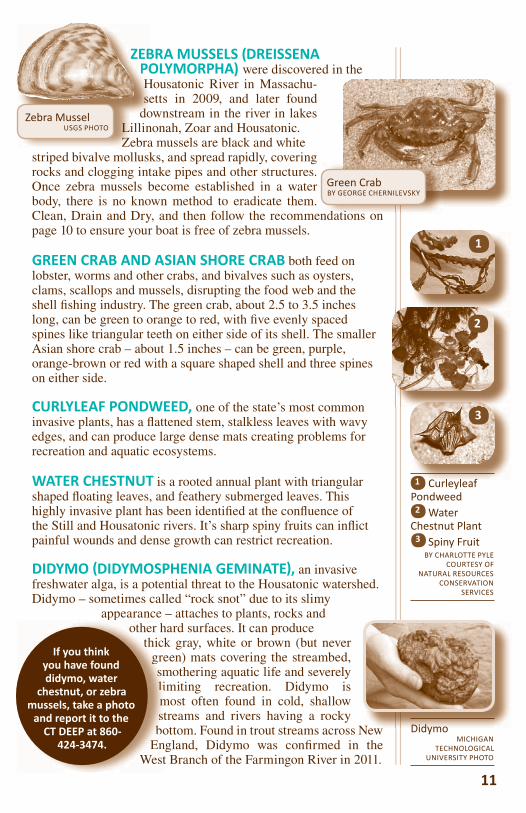
Purple LoosestrifeH. ZELL PHOTO
10
Check yocoming
DRAandinanin
DDowca
follinvas
Clean, Drain and Dry
is the law!In Connec cut it’s illegal
and punishable with fi nes to transport invasive plants and animals on vessels or
trailers. For a complete list of invasives in
Connec cut, visit h p://www.ct.gov/dep and
search “invasive species.”
Green CrabBY GEORGE CHERNILEVSKY
ZEBRA MUSSELS (DREISSENA POLYMORPHA) were discovered in the Housatonic River in Massachu-setts in 2009, and later found
down stream in the river in lakes Lillinonah, Zoar and Housatonic. Zebra mussels are black and white
striped bivalve mollusks, and spread rapidly, covering rocks and clogging intake pipes and other structures. Once zebra mussels become established in a water body, there is no known method to eradicate them. Clean, Drain and Dry, and then follow the recommendations on page 10 to ensure your boat is free of zebra mussels.
GREEN CRAB AND ASIAN SHORE CRAB both feed on lobster, worms and other crabs, and bivalves such as oysters, clams, scallops and mussels, disrupting the food web and the shell fi shing industry. The green crab, about 2.5 to 3.5 inches long, can be green to orange to red, with fi ve evenly spaced spines like triangular teeth on either side of its shell. The smaller Asian shore crab – about 1.5 inches – can be green, purple, orange-brown or red with a square shaped shell and three spines on either side.
CURLYLEAF PONDWEED, one of the state’s most common invasive plants, has a fl attened stem, stalkless leaves with wavy edges, and can produce large dense mats creating problems for recreation and aquatic ecosystems.
WATER CHESTNUT is a rooted annual plant with triangular shaped fl oating leaves, and feathery submerged leaves. This highly invasive plant has been identifi ed at the confl uence of the Still and Housatonic rivers. It’s sharp spiny fruits can infl ict painful wounds and dense growth can restrict recreation.
DIDYMO DIDYMOSPHENIA GEMINATE , an invasive freshwater alga, is a potential threat to the Housatonic watershed. Didymo – sometimes called “rock snot” due to its slimy
appearance – attaches to plants, rocks and other hard surfaces. It can produce
thick gray, white or brown (but never green) mats covering the streambed, smothering aquatic life and severely limiting recreation. Didymo is most often found in cold, shallow streams and rivers having a rocky bottom. Found in trout streams across New
England, Didymo was confi rmed in the West Branch of the Farmingon River in 2011.
N
ZEBPOHse
do
DidymoMICHIGAN
TECHNOLOGICAL UNIVERSITY PHOTO
LiZe
Zebra MusselUSGS PHOTO
11
ppother h
thickgresmlimstbo
EnWest
If you think you have found didymo, water
chestnut, or zebra mussels, take a photo
and report it to the CT DEEP at 860-
424-3474.
1
3
Curleyleaf Pondweed Water Chestnut Plant Spiny Fruit
BY CHARLOTTE PYLECOURTESY OF
NATURAL RESOURCES CONSERVATION
SERVICES
1
3
2
2
HEALTH OF THE RIVER
Like many rivers and streams throughout the nation, water quality in the Housatonic has improved dramatically due to the mandates of the state and federal Clean Water Acts. Today, the Housatonic River is a nationally ranked fi shing, boating and hiking destination.
Connecticut has a history as a national leader in water quality management, passing the Connecticut Clean Water Act
(CWA) in 1967 – fi ve years before the federal Clean Water Act. The state CWA marked the establishment of Connecticut’s water
pollution control program requiring stringent wastewater treatment for municipal sewers and
industrial discharges from factories.
In 1972, the national Clean Water Act eliminated direct piping of pollutants into all of the nation’s waters and required that point source discharges (from factories and sewage pipes) be monitored, treated and controlled by permits. Consequently, municipal and industrial water treatment plants were built.
A burst of pro-environment laws followed the CWA. The state’s Inland Wetlands and Watercourses Act (1972) ensured greater protection of rivers, small streams and wetlands. The Connecticut Department of Environmental Protection (formed 1971) was allowed to levy civil penalties against polluters. Large volumes of water were no longer allowed to be taken out of the river without a permit, water was protected from construction runoff, and the Clean Water Fund provided funding to cities and towns to upgrade or install new water treatment facilities. Later laws include the 2005 Act Concerning Minimum Water Flow Regulations and the 2011 Stream Flow Standards and Regulations.
Swi s Bridge in Sharon
12
management, pas(CWA
Clth
powastewate
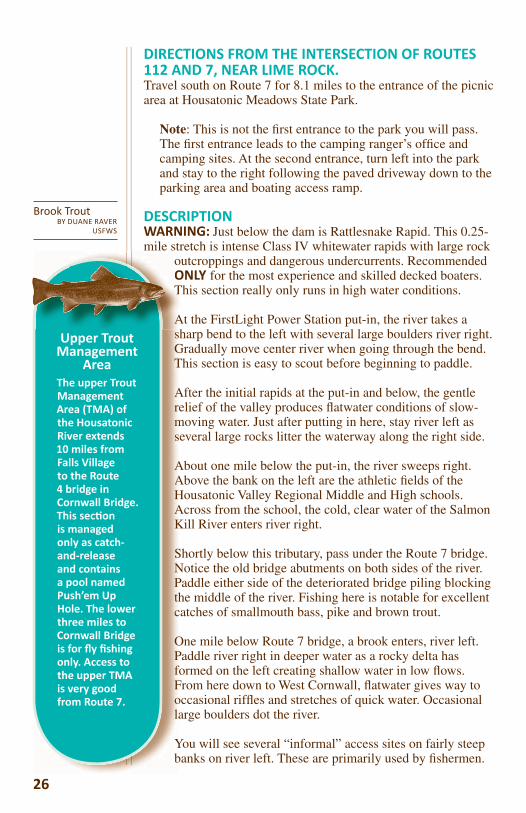
industrial discharges fBrook TroutBY DUANE RAVER
USFWS

Although the Housatonic River is cleaner, a great deal of work still needs to be done to protect and improve our river resource.
One of the greatest contaminants affecting the Housatonic River are polychlorinated biphenyls, a family of chemicals more commonly known as PCBs. The manufacture and use of PCBs, used chiefl y as a coolant in electrical transformers, capacitors and heat exchangers beginning in 1929, has been banned in the United States since 1977. For a period of 40 years before the ban, General Electric’s Transformer Division discharged PCBs into the upper Housatonic River and contaminated fi ll was used within the watershed.
Due to its stable nature, PCBs persist in the environment creating a long-lasting concern. PCBs are heavy and not very soluble in water and accumulate in undisturbed river sediments. PCBs then enter the food chain through fi sh and aquatic invertebrates that reside in and feed on the river bottom. As these benthic fauna are eaten by other fi sh, fowl or reptiles, the concentrations of PCBs rise as they are stored in the fatty tissue of the predator and can build up in fi sh to levels of a thousand times higher than in the water.
In 1977, Connecticut issued a health advisory against eating fi sh from the Housatonic River. Currently, the Connecticut Department of Public Health advises against eating trout, catfi sh, eel, carp and northern pike caught in the Housatonic. Limited consumption of bass, white perch, bullheads and panfi sh (yellow perch, sunfi sh, etc.) is also advised especially for pregnant women and young children. For more information visit www.ct.gov/dph/fi sh or call 1-877-458-FISH (3474).
Unlike with fi sh consumption, the Connecticut Department of Energy & Environmental Protection (DEEP) and the EPA has assessed that risks from PCB exposure to paddlers using the Housatonic access areas on a frequent basis are very low. The agencies recommend minimizing skin contact with sediment and washing it from your skin as soon as possible. Visit http://www.epa.gov/region1/ge/pcbshealthandenviro/pcbfact.pdf for more information.
Negotiations to clean up the Housatonic River began in 1991 and a settlement was memorialized in a Consent Decree between the EPA, the State of
13
reat deal of work our river resource.
e Housatonic of chemicals
acture and use of
years before ion discharged ntaminated fi ll was
13
The Housatonic at Bull’s Bridge in Kent
MallardBY KEITH OF PHEANIX’S
PHOTOSTREAM
Connecticut, the State of Massachusetts, and General Electric in 2000. Two phases of cleanup have since been completed: the fi rst one-half mile of river adjacent to the GE facility in Pittsfi eld, Massachusetts in 2002 and the next 1.5-mile stretch in 2007. Planning for the long-term monitoring of the rest of the river, including the Connecticut section of the Housatonic River, and additional cleanup of the remaining heavily contaminated areas, is underway. For more information visit http://www.epa.gov/region01/ge.
With PCB cleanup underway, polluted runoff has become the greatest threat to the future health of the river. Polluted runoff is caused by rainfall and snowmelt moving over the ground (stormwater) picking up natural and human-made pollutants, eventally depositing them into stormdrains which empty into
rivers. Stormwater collects excess fertilizer, pesticide, oil, road sand, salt, chemical deicer, and animal waste in its path, heating up as it travels along which can be lethal to fi sh and other aquatic wildlife. Because stormwater is from many sources, it is diffi cult to control.
Polluted runoff can also lead to excessive sedimentation in the lower river and estuary, which can bury critical estuary habitat in the river and Long Island Sound.
Also a threat is an excess of nutrients (phosphorous and nitrogen) which leads to reduced water quality, low dissolved oxygen and fi sh kills, and water conditions undesirable for recreation. Nutrients fl owing downstream cause similar problems in the estuary and Long Island Sound.
Commonly found in stormwater, nutrients were recognized as a source of impairment to the river as early as the 1970s, when the federal CWA was fi rst passed, and noticeable nuisance algae
blooms fi rst began occurring in Lake Lillinonah. Nutrients also accumulate in the river from municipal sewage treatment plants and other discharges, erosion and runoff from agricultural operations, failing septic systems, leaking sewer systems and atmospheric deposition such as acid rain.
In 2012, after decades of documented nutrient-related impairments in the river, HVA spearheaded a project to work with its partners in the watershed as well as state and federal agencies to develop a plan to reduce the amount of nutrients fl owing into the river each year. Together, we are working to make sure that the Housatonic River continues toward a path of optimal river health.
14
acdug
Witgi(evivanp
wilo c
Polowhe
AlswhandNu
PlaPlaincaddis ureg
W
risaupwto
Ploth
Awa
bN
a
d
Iit
tyHr
14

15
BOATING SAFETY
Before beginning a paddling trip, be sure you know the fundamentals of boating safety. For additional information about boating safely, including their top ten paddling tips, visit the American Canoe Association’s website: www.americancanoe.org.
USE OF PERSONAL FLOTATION DEVICES PFDSThe Connecticut Department of Energy and Environmental Protection’s website offers these safety rules for paddlers (www.ct.gov/dep/cwp/view.asp?a=2686&q=322304&Nav_GID=1620):
• Wear your life jacket (personal fl otation device or PFD)! Is it the proper size and in good condition? There must be a
wearable life jacket aboard for each person. From October 1st through May 31st, you must wear a life jacket (state law). All
children 12 and under must wear a life jacket at all times. • Don’t stand up in a manually propelled vessel, such as a
canoe, kayak or rowboat. • Always paddle directly into or away from the wake of larger
boats. • If you CAPSIZE, stay with the manually propelled vessel. If
you are in a strong current or whitewater, fl oat down river feet fi rst and toes up with the vessel ahead of you.
• Do not drink alcohol before or while operating a manually propelled vessel. Alcohol affects balance, coordination, and judgment.
• For more stability in rough conditions, kneel on the bottom instead of sitting on the seats.
• The most experienced paddler should take the stern position.
• Know the conditions before you set out. Always paddle within your abilities.
• Load the manually propelled vessel evenly, fore and aft and side to side.
• Be sure that you have the right boat for the conditions.
• Wear proper clothing, including a hat. If you end up in the water, do not remove your clothes. They help you fl oat and protect you against hypothermia.
• Stay away from low head dams. They are extremely dangerous from both up and down stream.
15
Great Falls DamBY TIM ABBOTT
16
• Rough water, whitewater, or rapids are no place for beginners. Always wear a solid, correctly fi tted helmet when whitewater canoeing or kayaking.
• Paddle near shore, out of channels. • Paddle with a partner. • Always leave a FLOAT PLAN with someone ashore. Be
specifi c about where you plan to go and when you will be back. Be sure to report back in when you return.
Remember that the major causes of boating accidents are improper loading, overloading, disregard for weather or water conditions, improper lookout, capsizing or falling overboard – and – failure to wear a PFD.
WEAR YOUR LIFE JACKET! IT FLOATS! YOU DON’T!
PFDs not only provide additional fl otation in case of capsizing or unexpected swim, they also provide an essential layer of warmth in cold water and protection for your body against rocks or other boats.
THE INTERNATIONAL SCALE OF RIVER DIFFICULTYFlatwater – There is little or no current. The river’s surface is smooth and unbroken. Paddling upstream is easy.
Class I – Moving water with a few riffl es and small waves. Few or no obstructions.
Class II – Easy rapids with waves up to three feet and wide, clear channels that are obvious without scouting. Some maneuvering required.
Class III – Rapids with high, irregular waves often capable of swamping an open canoe. Narrow passages that often require complex maneuvering. May require scouting from shore.
Class IV – Long, diffi cult rapids with constricted passages that often require precise maneuvering in very turbulent waters.
Scouting from shore is often necessary and conditions make rescue diffi cult. Generally not possible for open canoes. Boaters in covered canoes and kayaks should be able to Eskimo roll.
The Housatonic River in Connecticut has stretches of fl atwater intermixed with stretches of Class I, II, III and IV rapids. For each river section described in this guide, the level of diffi culty is indicated for average river fl ow and
16
Scpc
T
o
d
R
wc
Pcef
THTHEE ININTEPhragmitesBY PETER MULLIGAN
should be respected. The level of fl ow, measured in cubic feet per second (cfs), can greatly change river conditions: Higher fl ows and fl ood conditions can greatly increase the level of diffi culty, to the point of being dangerous.
At fl ood conditions, the river becomes silt-laden and submerged obstacles are not visible. Water quality can also become unhealthy due to overfl owing sewage systems and polluted stormwater runoff. All paddlers must determine for themselves whether they are adequately skilled and physically able to paddle each section.
If you still choose to paddle during these conditions, be sure to wear your life jacket and travel with experienced paddlers. Class levels in the descriptions increase at higher levels of river fl ow.
Due to changing weather, fl ow and river conditions, the publisher, authors and sponsors cannot accept responsibility for the accuracy of the river section descriptions provided at any specifi c time.
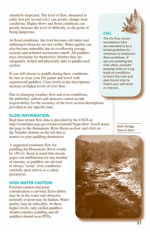
FLOW INFORMATION Real time stream fl ow data is provided by the USGS at http://waterdata.usgs.gov/ct/nwis/current/?type=fl ow. Scroll down the page to the Housatonic River Basin section, and click on the Number Station on the left that is nearest to your paddling destination.
A suggested minimum fl ow for paddling the Housatonic River would be 150 cfs. Keep in mind that stream gages can malfunction for any number of reasons, so paddlers are advised to always “scout” river conditions carefully upon arrival as a safety precaution.
HIGH WATER CAUTIONExtreme caution and great consideration is advised. Extra debris may be in the water and obstacles normally evident may be hidden. Water quality may be unhealthy. At these higher levels, only skilled paddlers should consider paddling and all paddlers should wear PFDs.
17
CSFsThe cfs fl ow recom-menda ons here are intended to be a broad guideline for minimum or maximum fl ow condi ons. If you are paddling the river o en, consider keeping notes or a log book on condi ons to learn the river and plan future trips to match your skill level or interest.
17
Bull’s Bridge Dam in Kent
INTRODUCTION
The Housatonic River begins its 149-mile journey in southwestern Massachusetts. The main stem of the river, formed by the joining of the West and Southwest branches of
the Housatonic River in Pittsfi eld, fl ows 132 miles in a southerly direction, dropping 959 feet in elevation on
its way to its outfall at Long Island Sound at Milford Point in Connecticut.
The river and its tributaries drain an area of 1,948 square miles. This area is referred to as the
watershed. From its headwaters fl owing south toward Great Barrington, the valley is narrow and the
river fl ows quickly, characterized by several swift drops in elevation, before it emerges from the Berkshire Hills.
Below Great Barrington, the valley fl attens and broadens out. This region is rich in farmland, and through this section the river fl ows more slowly, meandering its way through the valley to Falls Village in Connecticut.
As the Housatonic River moves into Connecticut, the valley changes dramatically. The valley walls narrow and are fl anked by hills on either side. The river now fl ows through a much harder substrate consisting of limestone, quartz and granite, and the river bottom becomes much rockier. There are still some agricultural activities in this northwestern part of Connecticut due to the presence of the river’s nutrient rich fl oodplains.
Just south of Bull’s Bridge power station in Gaylordsville, water is diverted from the river and pumped uphill, through a penstock, to Candlewood Lake in New Milford, the fi rst pump storage reservoir built in the country. Constructed in 1926, it is the largest (5,400 acres) lake in Connecticut. When river levels
are too low to support the power generation at the Rocky River Power Station in New Milford, lake water is sent
rushing down the penstock and through the generators.
Upon leaving New Milford, the river again changes dramatically, becoming a series of three in-stream lakes. Each lake is formed by a hydroelectric power dam. The Shepaug Dam forms Lake Lillinonah (1,900 acres) in
Bridgewater. Farther south in Monroe, the Stevenson Dam, which is the largest, creates Lake Zoar (975 acres).
The third lake is Lake Housatonic (328 acres), formed by the Derby Dam between Derby and Shelton.
are toRiv
ru
UdES
BrDam
The thD b D
River Right, River Le
In this guide these terms refer to your le
or right as you face downstream.
Asthnrcrson
J t
Strainer is a downed tree blocking whole or part of the channel. Due to poten ally strong currents at strainers, exercise great cau on.
the Housouth
its Po
Ts
wtow
riverin elevat
Belo Great B
Be responsible river stewards!
Pick up some trash on every trip and become
an advocate for the Housatonic River.
18
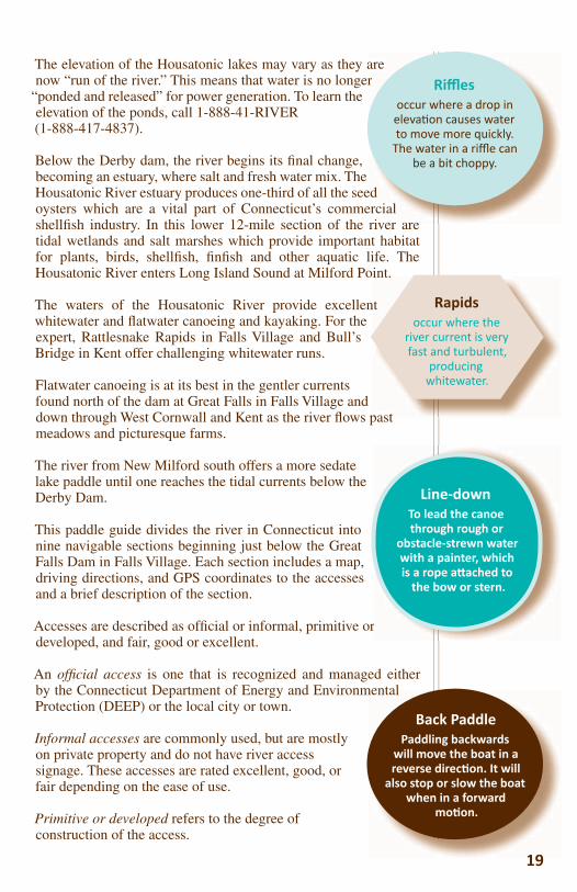
The elevation of the Housatonic lakes may vary as they are now “run of the river.” This means that water is no longer
“ponded and released” for power generation. To learn the elevation of the ponds, call 1-888-41-RIVER (1-888-417-4837).
Below the Derby dam, the river begins its fi nal change, becoming an estuary, where salt and fresh water mix. The Housatonic River estuary produces one-third of all the seed oysters which are a vital part of Connecticut’s commercial shellfi sh industry. In this lower 12-mile section of the river are tidal wetlands and salt marshes which provide important habitat for plants, birds, shellfi sh, fi nfi sh and other aquatic life. The Housatonic River enters Long Island Sound at Milford Point.
The waters of the Housatonic River provide excellent whitewater and fl atwater canoeing and kayaking. For the expert, Rattlesnake Rapids in Falls Village and Bull’s Bridge in Kent offer challenging whitewater runs.
Flatwater canoeing is at its best in the gentler currents found north of the dam at Great Falls in Falls Village and down through West Cornwall and Kent as the river fl ows past meadows and picturesque farms.
The river from New Milford south offers a more sedate lake paddle until one reaches the tidal currents below the Derby Dam.
This paddle guide divides the river in Connecticut into nine navigable sections beginning just below the Great Falls Dam in Falls Village. Each section includes a map, driving directions, and GPS coordinates to the accesses and a brief description of the section.
Accesses are described as offi cial or informal, primitive or developed, and fair, good or excellent.
An offi cial access is one that is recognized and managed either by the Connecticut Department of Energy and Environmental Protection (DEEP) or the local city or town.
Informal accesses are commonly used, but are mostly on private property and do not have river access signage. These accesses are rated excellent, good, or fair depending on the ease of use.
Primitive or developed refers to the degree of construction of the access.
int.
nt
past
Rapidsoccur where the
river current is very fast and turbulent,
producing whitewater.
are r
ed ercial river are
Riffl esoccur where a drop in
eleva on causes water to move more quickly.
The water in a riffl e can be a bit choppy.
19
r
Line-downTo lead the canoe through rough or
obstacle-strewn water with a painter, which is a rope a ached to
the bow or stern.
mental
19
Back PaddlePaddling backwards
will move the boat in a reverse direc on. It will
also stop or slow the boat when in a forward
mo on.
20

Distance: 8.6 milesTime: 4–5 hoursTowns: Ashley Falls, Mass.Tributaries: Konkapot, Blackberry, and Hollenbeck brooksUSGS Maps: Ashley Falls, South CanaanDiffi culty: Flatwater, Class II rapids at the breached Canaan dam, portage trail available.
PUT IN Access 23 – Rannapo Road, Ashley Falls, Mass. (N42.05869; W73.34895)Informal Access (good, primi ve); limited road-side parking.
DIRECTIONS FROM THE NORTHERN INTERSECTION OF ROUTE 7 AND ROUTE 7A ASHLEY FALLS ROAD IN MASSACHUSETTSTravel south on Route 7A for 3.2 miles towards Ashley Falls. Take a right onto Rannapo Road and continue for about two miles. After crossing the river, pull up on the right shoulder. There is a steep bank leading down to a backwater stream. Launch into this channel; within a few yards, it connects with the river.
TAKE-OUTAccess 24 – Great Falls Dam, Salisbury, Conn. (N41.96384; W73.37174)Offi cial access (primi ve, excellent); off -road parking.
DIRECTIONS FROM ACCESS 23RANNAPO ROAD TO ACCESS 24 GREAT FALLS DAM
Head west on Rannapo Road for about 500 feet toward Weatogue Road. Take a left onto Weatogue Road. Follow Weatogue Road for 3.5 miles. At the intersection of Twin Lakes Road and Weatogue Road, bear left onto Twin Lakes Road and continue on Twin Lakes Road for 0.8 miles until the intersection with Route 44. Take a sharp right onto US 44 W/Canaan Road and continue on Route 44 W for 0.5 miles. Take the fi rst left onto Housatonic River
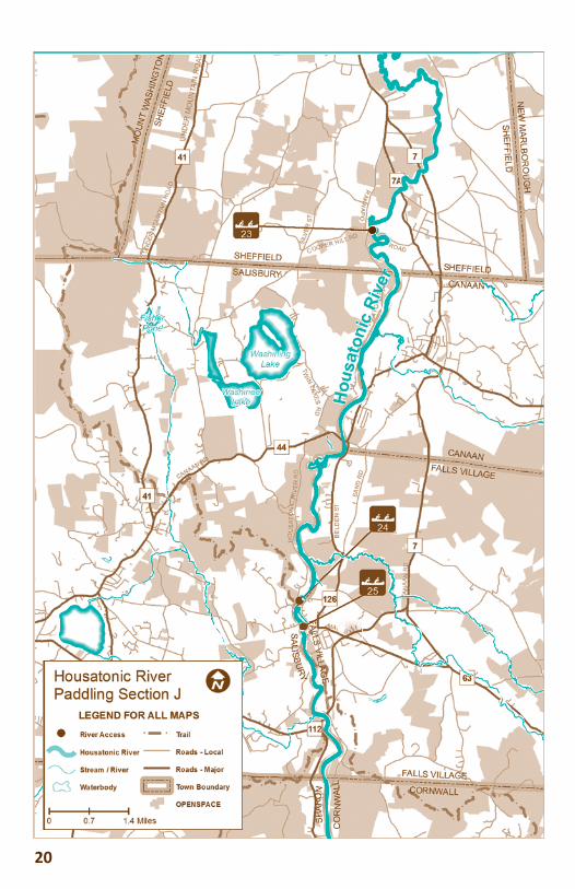
HOUSATONIC RIVER SECTION JRannapo Road, Ashley Falls, Mass. to theGreat Falls, Falls Village, Conn.
21
Bald EaglesDon’t be surprised to spot a bald eagle! Once federally listed as endangered, bald eagles were removed from the federal endangered species list in 2007. In Connec cut they are listed as threatened.
side parking.
ERSECTIONLLS ROAD
Ashley Falls. about two
t shoulder. er stream.onnects
Bald EagleGARY ROTHSTEIN PHOTO
Sec ons A through Jare in “A Paddling Guide to the Housatonic River in Berkshire County” published in 2011 by the Housatonic Valley Associa on.

Road. Follow Housatonic River Road for three miles. Turn left into the gated parking area upstream of the dam at Great Falls. The access is managed by FirstLight Power Resources. At this access, enjoy riverside trails including an interpretive trail, views of Great Falls and picnic area.
DESCRIPTIONIn this section the Housatonic is predominantly fl atwater fl owing in wide meandering bends. After launching, paddle down the channel and, upon entering the Housatonic River, turn right to continue downstream under the Rannapo Road Bridge. For some this is considered the most beautiful stretch of the Housatonic. Initially, river left, and later on both sides, cow pastures extend into the fl oodplain.
On river right, paddle past the fl oodplain forest and ledges of Bartholomew’s Cobble, a property of The Trustees of Reservations. You may even see a hiker on the trails that follow the river. The alkaline (sweet) soils and marble bedrock of the Cobble support a great diversity of fl ora – especially spring wildfl owers and ferns (among the most diverse in North America – making this a National Natural Landmark).
At 1.3 miles, Konkapot River enters river left. Just downstream of this confl uence, you paddle into Connecticut. The high banks on the inside of the meanders show evidence of bank swallow nest entrances.
As you proceed downstream, river left becomes more forested. At 2.4 miles the Blackberry River enters river left and soon after the confl uence you will paddle past an old railroad bridge pier in the middle of the river. Cars pass along Weatogue Road which parallels the river for more than a half mile.
After Weatogue Road, the old Canaan dam is across the river with rapids that run river right
around an island. DO NOT ATTEMPT to go over the dam because of the danger of debris and rebar in the water. Portage river left is the prudent route. Around the dam is a small trail, about 200 feet long a few hundred yards upstream of the
dam. If there is a wooden dock, skip the temptation to use it! It is not very stable
and is marked private. Access to the trail behind the dock is a steep and sandy bank.
22
RTdPip
IflpHucIe
OlTo
dfm
The Salisbury Associa on Land Trustworks to protect important places in and around Salisbury. With several other conserva on partners, including HVA, more than fi ve linear miles of riverfront have been protected.
After Weatacross
arougoofrida
datem
and ibehind t
22
Ames Iron WorksA er taking out, consider taking
a short, interpre ve walk along the river to learn about Ames Iron Works (established 1832) which once existed at this site and Amesville (now Falls Village), a village which grew across
the river in response to the ironworks.
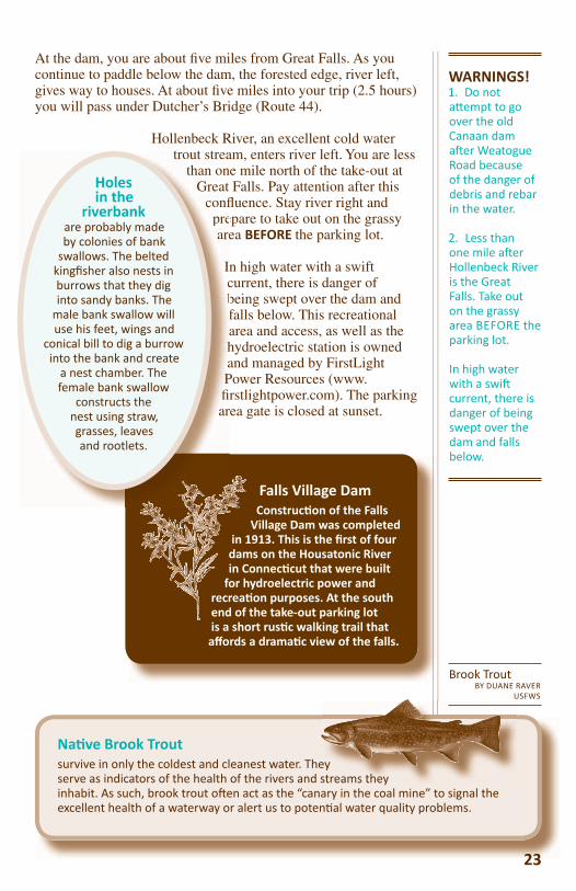
At the dam, you are about fi ve miles from Great Falls. As you continue to paddle below the dam, the forested edge, river left, gives way to houses. At about fi ve miles into your trip (2.5 hours) you will pass under Dutcher’s Bridge (Route 44).
Hollenbeck River, an excellent cold water trout stream, enters river left. You are less
than one mile north of the take-out at Great Falls. Pay attention after this
confl uence. Stay river right and prepare to take out on the grassy area BEFORE the parking lot.
In high water with a swift current, there is danger of being swept over the dam and falls below. This recreational area and access, as well as the hydroelectric station is owned and managed by FirstLight Power Resources (www.fi rstlightpower.com). The parking area gate is closed at sunset.
23
Falls Village Dam Construc on of the Falls
Village Dam was completed in 1913. This is the fi rst of four dams on the Housatonic River in Connec cut that were built
for hydroelectric power and recrea on purposes. At the south end of the take-out parking lot is a short rus c walking trail that aff ords a drama c view of the falls.
23
Na ve Brook Troutsurvive in only the coldest and cleanest water. They serve as indicators of the health of the rivers and streams they inhabit. As such, brook trout o en act as the “canary in the coal mine” to signal the excellent health of a waterway or alert us to poten al water quality problems.
ey streams they
Brook TroutBY DUANE RAVER
USFWS
WARNINGS!1. Do not a empt to go over the old Canaan dam a er Weatogue Road because of the danger of debris and rebar in the water.
2. Less than one mile a er Hollenbeck River is the Great Falls. Take out on the grassy area BEFORE the parking lot.
In high water with a swi current, there is danger of being swept over the dam and falls below.
trout streathan on
Great conflpreare
IncbfahaPfi rar
Holes in the
riverbankare probably made by colonies of bank
swallows. The belted kingfi sher also nests in burrows that they dig into sandy banks. The
male bank swallow will use his feet, wings and
conical bill to dig a burrow into the bank and create
a nest chamber. The female bank swallow
constructs the nest using straw, grasses, leaves and rootlets.

24
HOUSATONIC RIVER SECTION KGreat Falls, Falls Village to Housatonic Meadows State Park, Sharon
2525
Kayaker at Great Falls
BY TIM ABBOTT
Hanging GatesJust down-stream from Great Falls are gates hanging above the river, which are used for whitewater races.
Distance: 9.5 milesTime: 4.5 hoursTowns: Falls Village, Canaan, Lime Rock, West Cornwall, Sharon, Cornwall BridgeTributaries: Hollenbeck River, Factory Brook, Salmon KillRa ng: Occasional riffl es and boulders, technical, whitewater, intermediate whitewater experience recommended.
PUT IN Access 25 – Below Great Falls Dam at FirstLight Falls Village Sta on Canoe Access; (N41.957272; W73.370154)Formal access (good); limited parking.
DIRECTIONS FROM THE INTERSECTION OF ROUTES 7 AND 44 IN CANAANTravel south on Route 7 for 7.67 miles to traffi c light at the intersection with Warren Turnpike (Warren No. 1 Turnpike on some maps) and Lime Rock Station Road. Take a right turn onto Warren Turnpike and travel 1.4 miles to stop sign. Go left onto Water Street and cross the Amesville Bridge (a one-lane bridge). Take an immediate left after the bridge onto Dugway Road and then left into the FirstLight Falls Village Station Dam Canoe Access site.
ALTERNATIVE DIRECTIONSThe Amesville Bridge may be closed occasionally for repairs from 2012 to 2014. If so, continue south through the traffi c light on Route 7 at Warren Turnpike and Lime Rock Station Road for another 0.2 miles and bear right onto Route 112 toward Lime Rock. At 0.8 miles, take a right turn at the Trinity Episcopal Church onto Dugway Road. Travel 2.1 miles and make a right turn into the FirstLight Falls Village Station Canoe Access.
NOTE: If the warning horn sounds from the power station (river left), water will be rising.
TAKE-OUTAccess 26, Housatonic Meadows State Park picnic area, just north of intersec ons of Routes 7 and 4; (N41.823637; W73.37275). Formal access (good, developed); adequate parking.
DIRECTIONS FROM THE INTERSECTION OF ROUTES 112 AND 7, NEAR LIME ROCK.Travel south on Route 7 for 8.1 miles to the entrance of the picnic area at Housatonic Meadows State Park.
Note: This is not the fi rst entrance to the park you will pass. The fi rst entrance leads to the camping ranger’s offi ce and camping sites. At the second entrance, turn left into the park and stay to the right following the paved driveway down to the parking area and boating access ramp.
DESCRIPTIONWARNING: Just below the dam is Rattlesnake Rapid. This 0.25-mile stretch is intense Class IV whitewater rapids with large rock
outcroppings and dangerous undercurrents. Recommended ONLY for the most experience and skilled decked boaters. This section really only runs in high water conditions.
At the FirstLight Power Station put-in, the river takes a sharp bend to the left with several large boulders river right. Gradually move center river when going through the bend. This section is easy to scout before beginning to paddle.
After the initial rapids at the put-in and below, the gentle relief of the valley produces fl atwater conditions of slow-moving water. Just after putting in here, stay river left as several large rocks litter the waterway along the right side.
About one mile below the put-in, the river sweeps right. Above the bank on the left are the athletic fi elds of the Housatonic Valley Regional Middle and High schools. Across from the school, the cold, clear water of the Salmon Kill River enters river right.
Shortly below this tributary, pass under the Route 7 bridge. Notice the old bridge abutments on both sides of the river. Paddle either side of the deteriorated bridge piling blocking the middle of the river. Fishing here is notable for excellent catches of smallmouth bass, pike and brown trout.
One mile below Route 7 bridge, a brook enters, river left. Paddle river right in deeper water as a rocky delta has formed on the left creating shallow water in low fl ows. From here down to West Cornwall, fl atwater gives way to occasional riffl es and stretches of quick water. Occasional large boulders dot the river.
You will see several “informal” access sites on fairly steep banks on river left. These are primarily used by fi shermen.
26
Brook TroutBY DUANE RAVER
USFWS
sGT
Arms
AAHAK
SNPthc
OPfFola
Yb
o
Upper Trout Management
Area The upper Trout Management Area (TMA) of the Housatonic River extends 10 miles from Falls Village to the Route 4 bridge in Cornwall Bridge. This sec on is managed only as catch-and-release and contains a pool named Push’em Up Hole. The lower three miles to Cornwall Bridge is for fl y fi shing only. Access to the upper TMA is very good from Route 7.
OT
Ah
OT
A
27
Another mile and you will pass a small stream, entering river left, the site of “Push’em-up” hole – a renowned fl y-fi shing spot. Along this section of river notice the prominence of the Housatonic Railroad on the eastern shore (river left). Just below “Push’em-up” hole see another informal access spot, recognizable next to an old crumbling bridge abutment, river left.
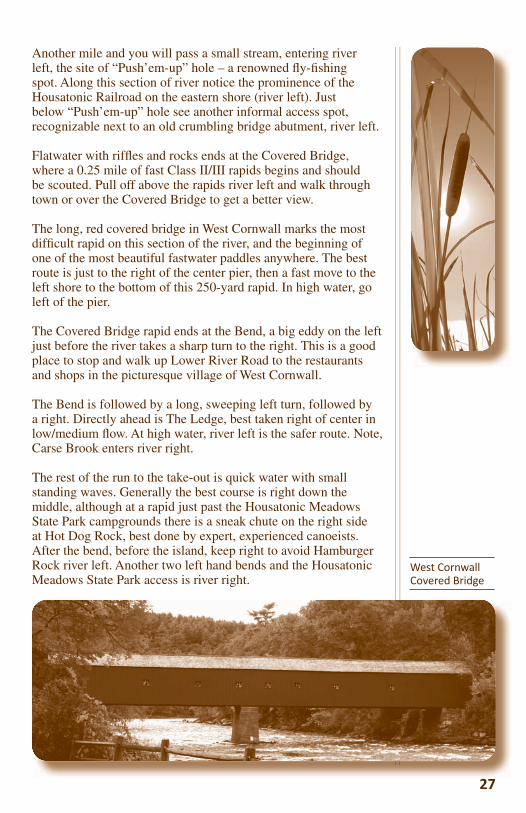
Flatwater with riffl es and rocks ends at the Covered Bridge, where a 0.25 mile of fast Class II/III rapids begins and should be scouted. Pull off above the rapids river left and walk through town or over the Covered Bridge to get a better view.
The long, red covered bridge in West Cornwall marks the most diffi cult rapid on this section of the river, and the beginning of one of the most beautiful fastwater paddles anywhere. The best route is just to the right of the center pier, then a fast move to the left shore to the bottom of this 250-yard rapid. In high water, go left of the pier.
The Covered Bridge rapid ends at the Bend, a big eddy on the left just before the river takes a sharp turn to the right. This is a good place to stop and walk up Lower River Road to the restaurants and shops in the picturesque village of West Cornwall.
The Bend is followed by a long, sweeping left turn, followed by a right. Directly ahead is The Ledge, best taken right of center in low/medium fl ow. At high water, river left is the safer route. Note, Carse Brook enters river right.
The rest of the run to the take-out is quick water with small standing waves. Generally the best course is right down the middle, although at a rapid just past the Housatonic Meadows State Park campgrounds there is a sneak chute on the right side at Hot Dog Rock, best done by expert, experienced canoeists. After the bend, before the island, keep right to avoid Hamburger Rock river left. Another two left hand bends and the Housatonic Meadows State Park access is river right.
West Cornwall Covered Bridge
28
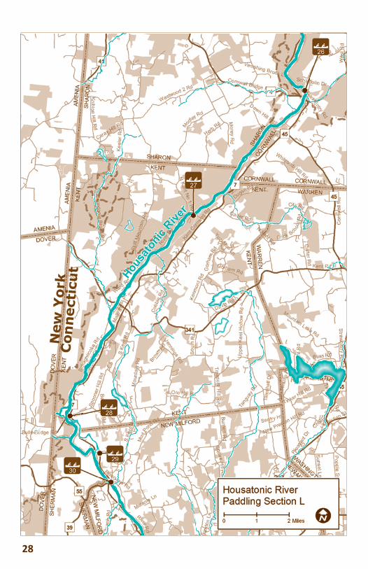
Distance: 13.1 milesApproximate Time: 4 hoursTowns: Sharon/Cornwall Bridge, South KentTributaries: NoneRa ng: Technical, whitewater, intermediate whitewater experience recommended
PUT IN Access 26, Housatonic Meadows State Park Picnic Area, Sharon; (N41.823637; W73.37275). Formal access (excellent); limited parking.
DIRECTIONS FROM INTERSECTION OF ROUTES 7 AND 44 IN CANAANTravel south on Route 7 for 9.6 miles passing through Canaan, Falls Village, West Cornwall to the Housatonic Meadows State Park picnic area located along Route 7 in the Town of Sharon near the border of Cornwall Bridge. The park is approximately four miles south of the West Cornwall Covered Bridge and is just north of the intersection with Route 4.
Note: This is not the fi rst entrance to the park. The fi rst entrance leads to the camping ranger’s offi ce and camping sites. At the second entrance, turn left into the park and stay to the right following the paved driveway down to the parking area and boating access ramp.
ALTERNATIVE ACCESSAccess 27, Housatonic River Wildlife Management Area, North Kent Road, Kent; (N41.766927; W73.437847). Informal access (diffi cult, primi ve); limited parking. Distance from Put-In at Access 26: 5.5 river miles
DIRECTIONS FROM HOUSATONIC MEADOWS STATE PARK IN SHARONTravel south on Route 7 into Sharon to the junction of Route 4. Bear left and follow routes 7 and 4 over the Housatonic River, then bear right after the bridge to continue south on Route 7 for approximately 5.0 miles. Take a right onto North Kent Road (unpaved), follow the road over the railroad tracks and enter the Housatonic
HOUSATONIC RIVER SECTION LHousatonic Meadows State Park, Sharon to Bull’s Bridge, South Kent
2929
Appalachian Trail Housatonic RiverwalkAt the bend in the river in Sharon, which is the former site of Swi ’s Bridge, begins a sec on of the Appalachian Trail. Approximately fi ve miles long, this is the longest riverfront sec on of the 2,100-mile AT. The trail is for foot travel only; no bikes, ATVs or horses. Backpacker camping only at designated sites. Stove only, no fi res. Carry in/carry out. For more informa on, visit www.appalachiantrail.org.
River Wildlife Management Area. Parking lot is at the end of the road next to the river.
TAKE-OUTAccess 28, Bull’s Bridge Road, South Kent; (N41.67558; W73.508363). Offi cial access (good with a carry to parking area of approximately 0.3 mile). Distance from put-in at Access 26: 13 river miles
DIRECTIONS FROM THE INTERSECTION OF ROUTES 7 AND 341 IN THE VILLAGE OF KENTFrom the traffi c light in the center of Kent at the junction of routes 7 and 341, follow Route 7 south for approximately 3.0 miles to a traffi c light. Take a right onto Bull’s Bridge Road and before going over the covered bridge turn left into the parking lot. The take-out point is on the upstream side of Spooner Island before the dam. Portage is 0.4 miles from the northern tip of the island to Bull’s Bridge Road.
DESCRIPTION From the put-in at Housatonic Meadows State Park the next 9.0 miles have fast current, many small rapids and in low water may be rocky and diffi cult or impossible to traverse. This section has some challenges but is not highly technical. Intermediate skill is required.
A short distance after putting in, the river goes through the village of Cornwall Bridge. Notice the train station and Furnace Brook
3030
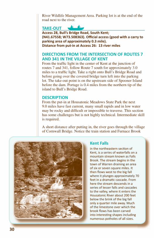
Kent Fallsin the northeastern sec on of Kent, is a series of waterfalls on a mountain stream known as Falls Brook. The stream begins in the town of Warren draining an area of six or seven square miles. It then fl ows west to the big fall where it plunges approximately 70 feet in a drama c cascade. From here the stream descends in a series of lesser falls and cascades to the valley, where it enters the Housatonic River about 200 feet below the brink of the big fall only a quarter mile away. Much of the limestone over which the brook fl ows has been carved into interes ng shapes including numerous potholes of all sizes.
31
entering the river on the left. There are some riffl es just before going under the Route 7 bridge. Approximately 1.5 miles into this section just after a big bend to the right is the site of the old Swifts Bridge and the river takes a sharp swing to the left. If the water is running swift, paddlers might want to stop river right just before the bend and walk down the shoreline to scout the rapids. These can be Class III or IV rapids.
The rest of the way is easy going with occasional short stretches of riffl es and rapids, with shallow areas. At mile 4.2 note the culvert river left that runs under Route 7. This is a conduit for Falls Brook coming from Kent Falls State Park.
Mile 5.5 brings the paddler to Alternative Access 27 at the Housatonic River Wildlife Management Area, river left. There are two possible exit points here. Each presents a mild challenge. There is a steep bank to manage at the fi rst exit; and while the second one, just around the bend, offers a sandy beach, there is a long carry-up to the parking area.
In general there are not a lot of specifi c features throughout this paddle except for trees, water and wildlife. There is little to no development; just the occasional home spotted on the mountainside. Just before entering the village of Kent, the Sloane/Stanley Museum is river left at mile 8.0. During low water, paddlers may have to walk their boats through the rocky area behind the museum. The dirt road river right is River Road.
Kent School, a private, co-educational college preparatory school, owns the docks located under the Route 341 bridge at mile 9.2. The current slows here at the Kent School rowing docks along River Road. This is the head of the Bull’s Bridge Dam impoundment, and the next 3.8 miles to Spooner Island and the Bull’s Bridge Dam are passable in all seasons and a very pleasant trip. The river meanders through the village of Kent and then straightens out to parallel Route 7 river left and Schaghticoke Road on the right. Note the dramatic rise of Schaghticoke Mountain river right. Herons, kingfi shers, mallards, Canada geese, red tail hawks and bald eagles are often spotted feeding along this section.
At the approach to the Bull’s Bridge dam area, keep river right. Stay clear of buoys on the left denoting the canal. Stay in the middle of the river and land on the north side of Spooner Island that splits the Housatonic in half. Keep right of Spooner Island, and an improved FirstLight take-out is clearly marked immediately on the left. Carry is 0.4 mile to Bull’s Bridge Road. Parking lot is on the right after passing through the covered bridge.
Eric Sloane was a prolifi c ar st, author, illustrator and avid collector of Americana. His extensive collec on of hand tools is displayed in the Sloane Stanley Museum , a building that once housed Stanley Works, a Connec cut-based tool manufacturing company. The Kent Iron Furnace, part of the museum, began produc on of pig iron in 1826 and con nued for almost 70 years. The remains of the granite blast furnace with its Gothic arches can be seen just below the museum.
efore into he old If the
ight just rapids.
. This is ark.

32
Wes
t Cor
nwal
l Cov
ered
Brid
ge
Kaya
ker a
t Gr
eat F
alls
33
Hous
aton
ic in
Str
a o
rd
Love
r’s L
eap
Brid
ge
Bull’
s Brid
gein
Ken
t
34
3535
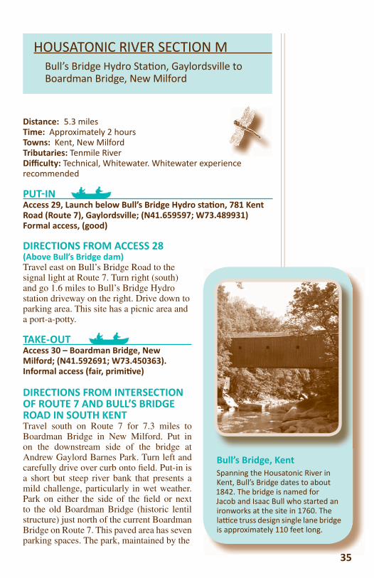
Bull’s Bridge, KentSpanning the Housatonic River in Kent, Bull’s Bridge dates to about 1842. The bridge is named for Jacob and Isaac Bull who started an ironworks at the site in 1760. The la ce truss design single lane bridge is approximately 110 feet long.
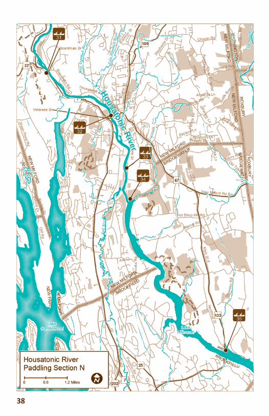
Distance: 5.3 milesTime: Approximately 2 hoursTowns: Kent, New MilfordTributaries: Tenmile RiverDiffi culty: Technical, Whitewater. Whitewater experience recommended
PUT IN Access 29, Launch below Bull’s Bridge Hydro sta on, 781 Kent Road (Route 7), Gaylordsville; (N41.659597; W73.489931)Formal access, (good)
DIRECTIONS FROM ACCESS 28(Above Bull’s Bridge dam)Travel east on Bull’s Bridge Road to the signal light at Route 7. Turn right (south) and go 1.6 miles to Bull’s Bridge Hydro station driveway on the right. Drive down to parking area. This site has a picnic area and a port-a-potty.
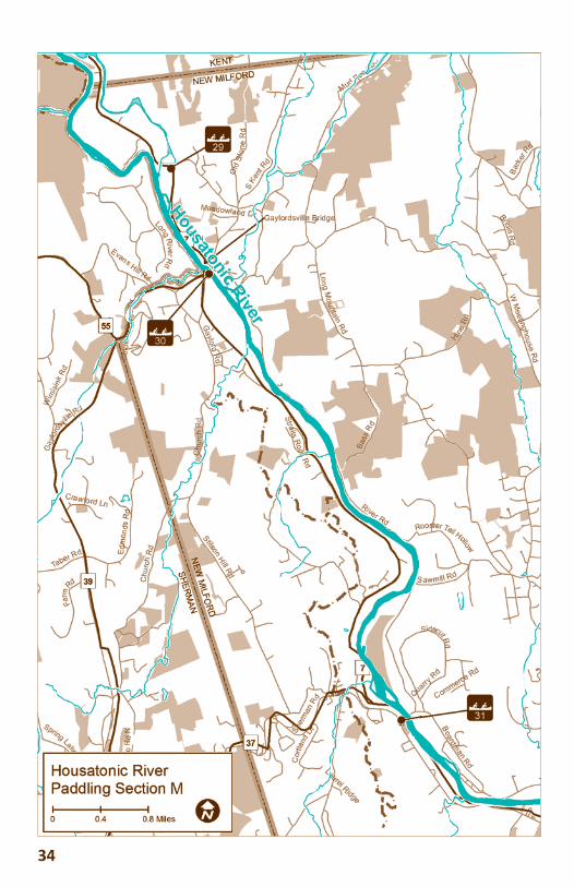
TAKE-OUTAccess 30 – Boardman Bridge, New Milford; (N41.592691; W73.450363). Informal access (fair, primi ve)
DIRECTIONS FROM INTERSECTION OF ROUTE 7 AND BULL’S BRIDGE ROAD IN SOUTH KENTTravel south on Route 7 for 7.3 miles to Boardman Bridge in New Milford. Put in on the downstream side of the bridge at Andrew Gaylord Barnes Park. Turn left and carefully drive over curb onto fi eld. Put-in is a short but steep river bank that presents a mild challenge, particularly in wet weather. Park on either the side of the fi eld or next to the old Boardman Bridge (historic lentil structure) just north of the current Boardman Bridge on Route 7. This paved area has seven parking spaces. The park, maintained by the
HOUSATONIC RIVER SECTION MBull’s Bridge Hydro Sta on, Gaylordsville toBoardman Bridge, New Milford
Town of New Milford Parks and Recreation Department, has one picnic table near the put-in.
NOTE: Parking at any New Milford town park requires a valid park sticker or day pass which can be obtained at the New Milford Parks & Recreation Department, 47 Bridge Street, New Milford, 860-355-6050; 7:30 a.m. to 4 p.m., Monday through Friday, newmilford.org/content/57/101/default.aspx. A day-pass sticker (available to non-residents, too) can be purchased in advance to use on a weekend.
DESCRIPTIONWARNING: Just below the Bull’s Bridge Dam are technical
rapids (whitewater paddling). This section should ONLY be attempted by highly skilled paddlers in a decked boat.
Nearly 0.5 mile after the FirstLight Power Station put-in is a large ledge across the entire river. In high water (Class IV), it is possible to take it on the left, back-paddling steadily. In high or medium water (Class III), it is advisable to run river left, but care must be exercised and scouting is essential. In low water, it is a rock garden and you may have to carry your boat.
Another 200 yards downriver is the Gaylordsville Bridge at the intersection with Route 55. This section can be tricky and is best taken on the right and one must stay there for the ensuing 100 yards. Various take-outs are available on the right during the last 75 yards of this rapid.
The rest of the run to Boardman Bridge is gentle Class I water, alternating with fl atwater.
3636
Bank Beavers live on a river and make their home in a riverbank burrow with an underwater entrance. Beavers that live in quiet streams, lakes, and ponds build lodges and dams. By building dams and fl ooding areas, beavers create important and necessary wetland habitat for a variety of wildlife, including moose, o er, and mink.
aa
a
Bank Beavers
WAWAraa
Nea
BBBBank Beavers
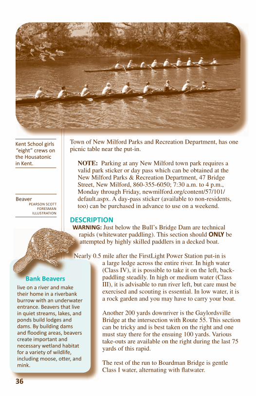
Kent School girls “eight” crews on the Housatonic in Kent.
BeaverPEARSON SCOTT
FORESMAN ILLUSTRATION
In just under 1.0 mile from the launch, pass under the Route 7 Bridge in Gaylordsville. Alternative Access 30 is river right, just past the bridge. This is an easier launch site for those who want to avoid the Class II and Class III waters upstream.
Just 0.19 mile into this section is an island river left; stay river right. At about mile 0.88, notice a dirt road on the left. This is River Road and it follows the river all the way down to Boardman Bridge with Route 7 on the right.
A little over 2.5 miles along this section is a rocky area. At the end of a 0.5-mile long bend to the east is another set of rocks to get through.
Two more islands are reached in another 0.5 mile and can usually be taken on either side of the river. From this to the next island is less than 0.5 mile. If paddling in low water, it is easiest to get around this island river right. From the southern tip of the island to the take-out at Boardman Bridge (river right) is less than 0.25 mile.
ALTERNATIVE ACCESSAccess 30: (N41.65854; W73.49198); Paddlers wishing to avoid Class II and III whitewater below the Bull’s Bridge Dam (access 29) may choose to launch here. (Cau on: immediately upon launching, there is a short stretch of Class II then fl atwater, Class 1, all the way to Boardman Bridge.)
DIRECTIONSGaylordsville Route 7 Bridge – traveling south on route 7, turn left immediately after crossing Gaylordsville Bridge. Go down steep grade to parking and primitive put-in on west bank of the river.
3737
Storm Drains lead to the River! When the rain pours, stormwater runs off of impervious surfaces (parking lots, sidewalks, driveways, etc.) picking up contaminants such as motor oil, animal waste, excess fer lizer and pes cides, road salt and more. To prevent fl ooding, stormwater drains away via storm drains which lead straight to the nearest water body, which could be a river, stream, or even pond or lake. You may encounter drainage pipes leading into the river. Stormwater is the greatest contributor to the
degrada on of the water quality of our na on’s water bodies. Visit
EPA’s Stormwater Web site for more informa on: h p://cfpub.epa.gov/npdes/. Also check out h p://www.hvatoday.
org/show.cfm?page=water/stormdrainmain.htm.
38
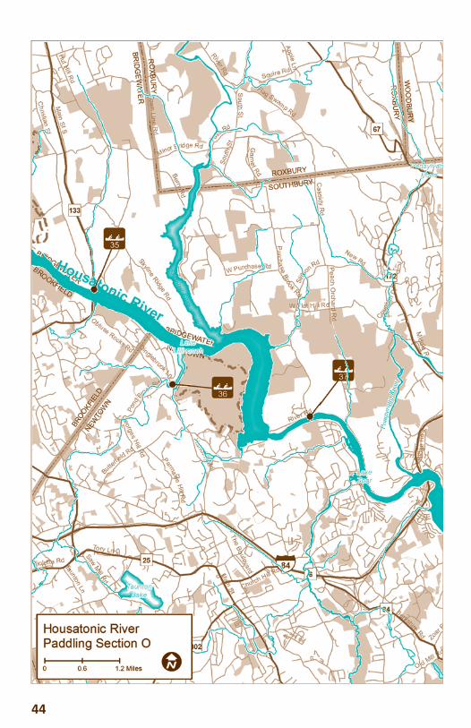
Distance: 10.73 milesTime: 4–5 hoursTowns: New Milford, BridgewaterTributaries: S ll River, Aspetuck RiverDiffi culty: Flatwater, one portage
PUT IN Access 31 – Boardman Bridge, New Milford; (N41.592691; W73.450363). Offi cial access (fair, primi ve)
DIRECTIONS FROM INTERSECTION OF ROUTE 7 AND BULL’S BRIDGE ROAD IN SOUTH KENT.Travel south on Route 7 for 7.3 miles to Boardman Bridge in New Milford. Turn left just past the bridge into Andrew Gaylord Barns Park. Unload and park either along the side of the grassy area or in the paved area in front of the Boardman Bridge, an historic lenticular structure, just north of the current bridge. There is a waterside picnic table but no other facilities. Put-in is a short but steep river bank that presents a mild challenge, particularly in wet weather.
The park is maintained by the Town of New Milford. NOTE: Parking at any New Milford town park requires a valid park sticker or day pass which can be obtained at the New Milford Parks & Recreation Department, 47 Bridge Street, New Milford, 860-355-6050 – 7:30 a.m. to 4:00 p.m., Monday thru Friday, newmilford.org/content/57/101/default.aspx. A day pass sticker (available to nonresidents, too) can be purchased in advance to use on a weekend.
TAKE-OUTAccess 35, State boat launch, Route 133 Bridge, Bridgewater; (N41.480981, W73.35037)Formal access, (Excellent, developed)
DIRECTIONS FROM INTERSECTION ROUTE 7 AND BOARDMAN BRIDGE IN NEW MILFORDTravel south on Route 7 for 2.2 miles to the traffi c light at Veterans Bridge. Turn left to cross the bridge
39
HOUSATONIC RIVER SECTION NBoardman Bridge, New Milford to Route 133 State Boat Launch, Bridgewater.
39
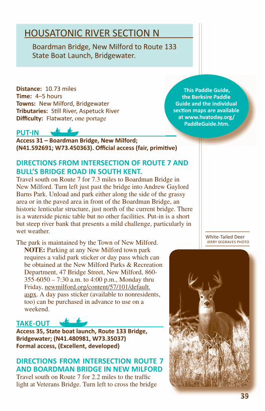
White-Tailed DeerJERRY SEGRAVES PHOTO
)
This Paddle Guide, the Berksire Paddle
Guide and the individual sec on maps are available
at www.hvatoday.org/PaddleGuide.htm.
40
(Route 202E/Bridge Street) and go straight on Bridge Street going past three traffi c lights and the Village Green to intersection
with routes 202 and 67. Travel straight through the light to Route 67E toward Bridgewater. At 3.5 miles, take right onto Route 133 and follow through the village of Bridgewater. State boat launch is on the left just before the bridge.
DESCRIPTIONEasy, lake paddling. The paddling distance from Boardman Bridge to Young’s Field Road (Access 32) at Veterans Bridge
is 2.42 miles. About half way between the two points, the Rocky River hydroelectric station, a national historical mechanical engineering landmark, sits on the west bank (river right). In dry season, just south of the power plant, the water can become very shallow.
A short way south of here, the Aspetuck River feeds in from river left. In the wet season, this section of the Aspetuck is navigable for about 0.33 to 0.5 mile.
The town of New Milford installed an access on the north side of the Veterans Bridge (river left). See more information about Access 32 further on.
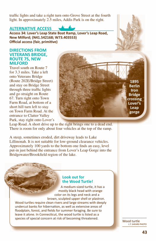
Lover’s Leap State ParkLover’s Leap is a walk-in park with hiking trails, scenic vistas and historic ruins. The 160-acre park is divided into three sec ons, each featuring a diff erent apprecia on for the
park history. Trails through the park lead through centuries of land-use history. Heading northeast from the parking lot the trail uses the 1895 Berlin
Iron Bridge, one of fi ve remaining in Connec cut, to cross the Housatonic River. Across the bridge, the Lovers Leap Trail heads southeast 1,200 feet to the rock forma on that gives the park its name.
A thriving community of Na ve Americans occupied this strategic site for more than 8,000 years. Its loca on and eleva on allowed for observa on and signaling over great distances. The fer le fi elds of the river valley, and the abundance of game and migra on of salmon, shad, eel and other fi sh from Long Island Sound up to the “Great Falls” assured a reliable food source. The Great Falls blocked the passage of shad from migra ng further up river.
(Routgoing
wR
DEasBri
is 2.4Riverengin
At 0.5 mile below Veterans Bridge, boaters must portage around the Bleachery Dam. Pull river left approximately 75 yards above the dam. Carry boat over the neck of land and launch into the backwater and paddle back into the river.
Lake Lillinonah begins south of the Bleachery Dam. Part of the Housatonic River, this 1,547-acre lake is Connecticut’s second largest and is surrounded by rolling hills. The lake lies between the Bleachery Dam, at the north, and the Shepaug Dam at the south.
A leisurely paddle (just under 1.0 mile) to Addis Park (river left) which is 0.7 mile north of the mouth of the Still River, river right, and the Lover’s Leap Gorge on the left. A side trip up the Still is worth the time. A short trip brings the paddler to the falls in Harrybrooke Park, a private park held in trust for the residents of New Milford. A word of warning – just up from the mouth of the Still River, a pair of swans is usually in residence. Be respectful of their turf; the gander can be quite aggressive to paddlers when his cygnets are swimming in the area.
The high canyon walls of Lover’s Leap Gorge make for a unique paddling experience. Before the construction of the Shepaug Dam and creation of Lake Lillinonah, salmon, shad, eel and other anadromous fi sh migrated from Long Island Sound up to this point. The Great Falls now lie 14 feet below the water’s surface. At the south end of the gorge are the town of Bridgewater, river left and New Milford, river right. About 2.0 miles downstream the town of Brookfi eld is river right.
The scenery along the next 5.79 miles of paddling is beautiful. Lake Lillinonah’s shoreline is primarily wooded. The lake ranks as one of Connecticut’s premier fi shing lakes with excellent bass fi shing. The area is also popular with water skiers; hence it is a busy waterway.
The State Boat Ramp on Route 133 in Bridgewater, river left, is well marked from adjacent Route 133. It has a large and very active ramp primarily for fi shing and powerboats. It may be most suitable for small craft launching on weekday mornings. The parking is crowded on weekends, with a lot of traffi c in the parking lot and on Lake Lillinonah. The paddle distance from this boat ramp downstream to the portage at the Shepaug Dam is 4.07 miles.
41
Bridgeport Wood Finishing CompanyThe ruins of the Bridgeport Wood Finishing Company (1882 to 1927), whose grinding wheels were once powered by the mighty Housatonic River, are located in Lover’s Leap State Park. It is one of only 16 of Connec cut’s
“State Archaeological Preserves” and is listed on the State Register of Historic Places as an early manufacturing site. If one is agile enough, it is possible to paddle to an old factory retaining wall at the mouth of the S ll River and climb up to the ruins. Park access is on Grove Street off Route 67 in New Milford.
he d
ALTERNATIVE PUT INSAccess 32, Young’s Field, New Milford; (N41.576082; W73.415271); Offi cial car-top boa ng access (excellent, developed).
This access is a 2.42-mile paddle south of Boardman Bridge. Parking is available along Young’s Field Road. Put-in is
a handicapped accessible canoe/kayak ramp across Young’s Field Road from the playground and ball
fi elds. In the summer season, a port-a-potty is stationed at the south end of the playground near the tennis courts. Please note: this is a town park and rules described earlier in this section apply.
DIRECTIONS FROM INTERSECTION OF ROUTE 7 AND BOARDMAN
BRIDGE IN NEW MILFORDTravel south on Route 7 approximately 2.3
miles to traffi c light at Veterans Bridge. Turn left over the bridge and take the fi rst left onto Young’s
Field Road. The ramp is on the immediate left. Plenty of parking is available on the river side of the road as well as across the street, except during soft ball and/or soccer season. Parking on the east side of Young’s Field may be less open then.
ALTERNATIVE ACCESSAccess 33: Addis Park, Grove Street, New Milford; (N41.554709; W73.40605); Offi cial access (excellent, developed).
Addis Park is 0.93 miles from the Bleachery Dam river left. This picnic area, with a boat launch ramp, opens one half hour before sunrise and closes one half hour after sunset (except access to boat launch). Parking for a dozen vehicles/trailers maximum. A valid town park sticker or day pass is required.
DIRECTIONS FROM BOARDMAN BRIDGE, ROUTE 7, NEW MILFORDTravel south on Route 7 for 1.9 miles. Turn left onto Veterans Bridge, Route 202E/Bridge Street. Stay on Bridge Street through three
42
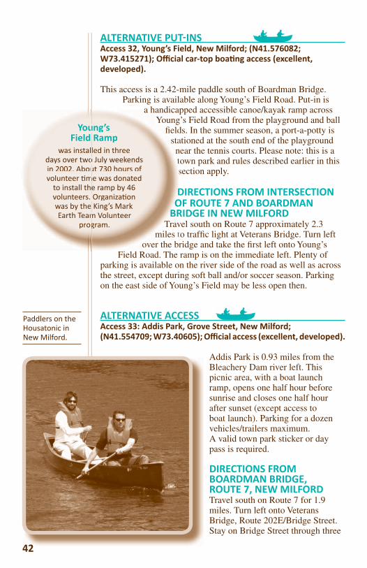
Paddlers on the Housatonic in New Milford.
42
a handicaYoung
fi eldstants
DO
BRTrav
miles tover the br
Young’suuField Rampd
was installed in three adays over two July weekendsooin 2002. About 730 hours of uovolunteer me was donated mm
to install the ramp by 46 ehvolunteers. Organiza on swas by the King’s Mark eEarth Team Volunteer ma
prp ogram. go
traffi c lights and take a right turn onto Grove Street at the fourth light. In approximately 2.5 miles, Addis Park is on the right.
ALTERNATIVE ACCESSAccess 34: Lover’s Leap State Boat Ramp, Lover’s Leap Road, New Milford; (N41.542168; W73.403553)Offi cial access (fair, primi ve)
DIRECTIONS FROM VETERANS BRIDGE, ROUTE 7S, NEW MILFORDTravel south on Route 7 for 3.3 miles. Take a left onto Veterans Bridge (Route 202E/Bridge Street) and stay on Bridge Street through three traffi c lights and go straight on Route 67. Turn right onto Town Farm Road, at bottom of a short hill turn left to stay on Town Farm Road. At the entrance to Clatter Valley Park, stay right onto Lover’s Leap Road. A short drive up to the right brings one to a dead end. There is room for only about four vehicles at the top of the ramp.
A steep, sometimes eroded, dirt driveway leads to Lake Lillinonah. It is not suitable for low-ground clearance vehicles. Approximately 100 yards to the bottom one fi nds an easy, level put-in just behind the entrance from Lover’s Leap Gorge into the Bridgewater/Brookfi eld region of the lake.
43
Look out forthe Wood Turtle!
A medium-sized turtle, it has a mostly black head with orange
color on its legs and neck and a brown, sculpted upper shell or plastron.
Wood turtles require clean rivers and large streams with deeply undercut banks for hiberna on, as well as extensive areas of fl oodplain, forest, and fi elds for summer foraging. Be sure to leave it alone. In Connec cut, the wood turtle is listed as a species of special concern at risk of becoming threatened.
Am
colorb
Wood turtleL.T. SHEARS PHOTO
o the right brings one to a dead end
1895 Berlin Iron
Bridgecrossing Lover’s
Leap gorge
44
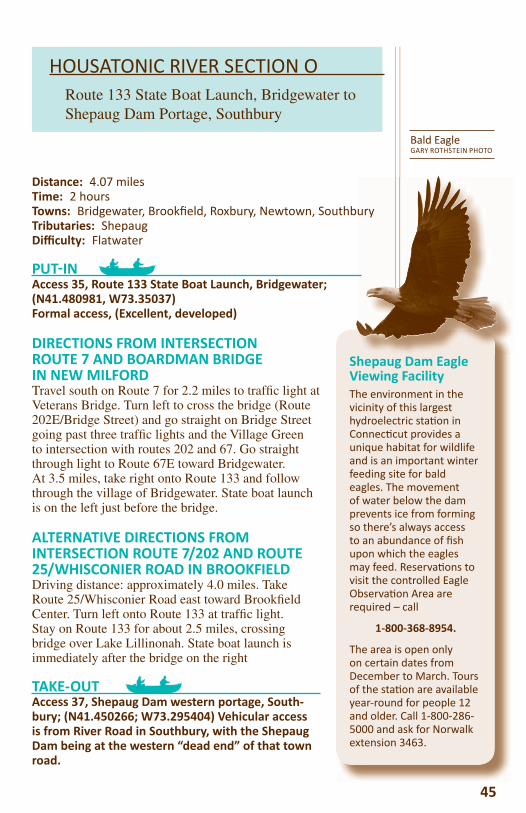
Shepaug Dam Eagle Viewing FacilityThe environment in the vicinity of this largest hydroelectric sta on in Connec cut provides a unique habitat for wildlife and is an important winter feeding site for bald eagles. The movement of water below the dam prevents ice from forming so there’s always access to an abundance of fi sh upon which the eagles may feed. Reserva ons to visit the controlled Eagle Observa on Area are required – call
1-800-368-8954.
The area is open only on certain dates from December to March. Tours of the sta on are available year-round for people 12 and older. Call 1-800-286-5000 and ask for Norwalk extension 3463.
Bald EagleGARY ROTHSTEIN PHOTO
HOUSATONIC RIVER SECTION ORoute 133 State Boat Launch, Bridgewater to Shepaug Dam Portage, Southbury
45
Distance: 4.07 milesTime: 2 hoursTowns: Bridgewater, Brookfi eld, Roxbury, Newtown, SouthburyTributaries: Shepaug Diffi culty: Flatwater
PUT IN Access 35, Route 133 State Boat Launch, Bridgewater; (N41.480981, W73.35037)Formal access, (Excellent, developed)
DIRECTIONS FROM INTERSECTION ROUTE 7 AND BOARDMAN BRIDGE IN NEW MILFORDTravel south on Route 7 for 2.2 miles to traffi c light at Veterans Bridge. Turn left to cross the bridge (Route 202E/Bridge Street) and go straight on Bridge Street going past three traffi c lights and the Village Green to intersection with routes 202 and 67. Go straight through light to Route 67E toward Bridgewater. At 3.5 miles, take right onto Route 133 and follow through the village of Bridgewater. State boat launch is on the left just before the bridge.
ALTERNATIVE DIRECTIONS FROM INTERSECTION ROUTE 7/202 AND ROUTE 25/WHISCONIER ROAD IN BROOKFIELDDriving distance: approximately 4.0 miles. Take Route 25/Whisconier Road east toward Brookfi eld Center. Turn left onto Route 133 at traffi c light. Stay on Route 133 for about 2.5 miles, crossing bridge over Lake Lillinonah. State boat launch is immediately after the bridge on the right
TAKE-OUTAccess 37, Shepaug Dam western portage, South-bury; (N41.450266; W73.295404) Vehicular access is from River Road in Southbury, with the Shepaug Dam being at the western “dead end” of that town road.
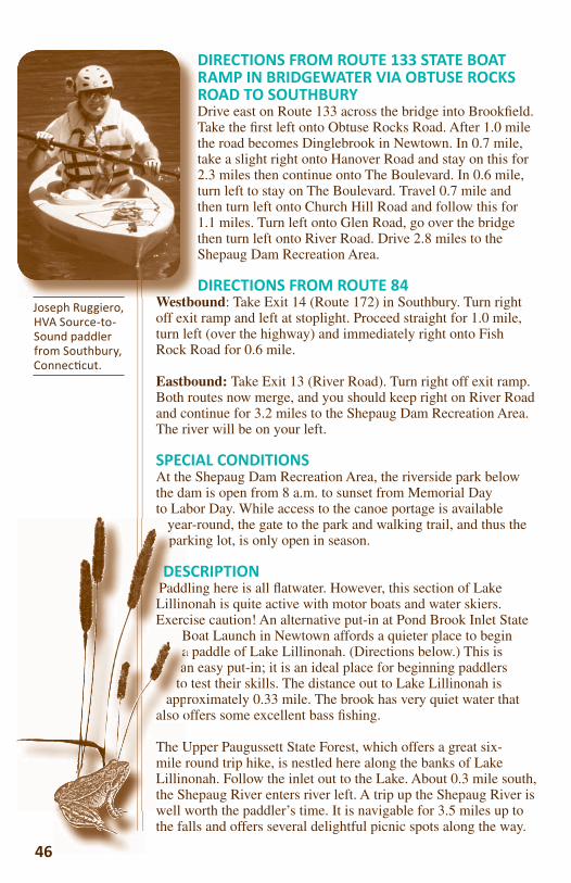
DIRECTIONS FROM ROUTE 133 STATE BOAT RAMP IN BRIDGEWATER VIA OBTUSE ROCKS ROAD TO SOUTHBURYDrive east on Route 133 across the bridge into Brookfi eld. Take the fi rst left onto Obtuse Rocks Road. After 1.0 mile the road becomes Dinglebrook in Newtown. In 0.7 mile, take a slight right onto Hanover Road and stay on this for 2.3 miles then continue onto The Boulevard. In 0.6 mile, turn left to stay on The Boulevard. Travel 0.7 mile and then turn left onto Church Hill Road and follow this for 1.1 miles. Turn left onto Glen Road, go over the bridge then turn left onto River Road. Drive 2.8 miles to the Shepaug Dam Recreation Area.
DIRECTIONS FROM ROUTE 84Westbound: Take Exit 14 (Route 172) in Southbury. Turn right off exit ramp and left at stoplight. Proceed straight for 1.0 mile, turn left (over the highway) and immediately right onto Fish Rock Road for 0.6 mile.
Eastbound: Take Exit 13 (River Road). Turn right off exit ramp. Both routes now merge, and you should keep right on River Road and continue for 3.2 miles to the Shepaug Dam Recreation Area. The river will be on your left.
SPECIAL CONDITIONSAt the Shepaug Dam Recreation Area, the riverside park below the dam is open from 8 a.m. to sunset from Memorial Day to Labor Day. While access to the canoe portage is available
year-round, the gate to the park and walking trail, and thus the parking lot, is only open in season.
DESCRIPTIONPaddling here is all fl atwater. However, this section of Lake Lillinonah is quite active with motor boats and water skiers. Exercise caution! An alternative put-in at Pond Brook Inlet State
Boat Launch in Newtown affords a quieter place to begin a paddle of Lake Lillinonah. (Directions below.) This is an easy put-in; it is an ideal place for beginning paddlers
to test their skills. The distance out to Lake Lillinonah is approximately 0.33 mile. The brook has very quiet water that
also offers some excellent bass fi shing.
The Upper Paugussett State Forest, which offers a great six-mile round trip hike, is nestled here along the banks of Lake Lillinonah. Follow the inlet out to the Lake. About 0.3 mile south, the Shepaug River enters river left. A trip up the Shepaug River is well worth the paddler’s time. It is navigable for 3.5 miles up to the falls and offers several delightful picnic spots along the way.
46
yeapar
DDDESPaddLillinExerc
Baa
toapp
also o
The Umile rLillinthe Shwell w
DTtt2tt
t
W tbJoseph Ruggiero, HVA Source-to-Sound paddler from Southbury, Connec cut.
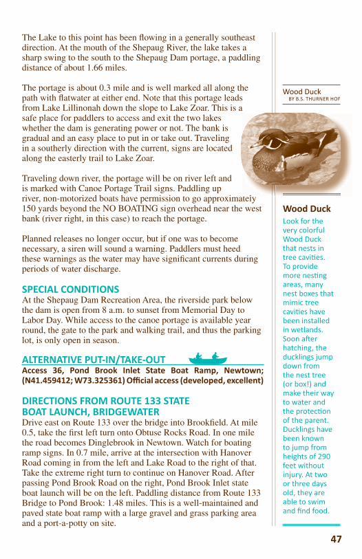
The Lake to this point has been fl owing in a generally southeast direction. At the mouth of the Shepaug River, the lake takes a sharp swing to the south to the Shepaug Dam portage, a paddling distance of about 1.66 miles.
The portage is about 0.3 mile and is well marked all along the path with fl atwater at either end. Note that this portage leads from Lake Lillinonah down the slope to Lake Zoar. This is a safe place for paddlers to access and exit the two lakes whether the dam is generating power or not. The bank is gradual and an easy place to put in or take out. Traveling in a southerly direction with the current, signs are located along the easterly trail to Lake Zoar.
Traveling down river, the portage will be on river left and is marked with Canoe Portage Trail signs. Paddling up river, non-motorized boats have permission to go approximately 150 yards beyond the NO BOATING sign overhead near the west bank (river right, in this case) to reach the portage.
Planned releases no longer occur, but if one was to become necessary, a siren will sound a warning. Paddlers must heed these warnings as the water may have signifi cant currents during periods of water discharge.
SPECIAL CONDITIONSAt the Shepaug Dam Recreation Area, the riverside park below the dam is open from 8 a.m. to sunset from Memorial Day to Labor Day. While access to the canoe portage is available year round, the gate to the park and walking trail, and thus the parking lot, is only open in season.
ALTERNATIVE PUT-IN/TAKE-OUT Access 36, Pond Brook Inlet State Boat Ramp, Newtown; (N41.459412; W73.325361) Offi cial access (developed, excellent)
DIRECTIONS FROM ROUTE 133 STATE BOAT LAUNCH, BRIDGEWATERDrive east on Route 133 over the bridge into Brookfi eld. At mile 0.5, take the fi rst left turn onto Obtuse Rocks Road. In one mile the road becomes Dinglebrook in Newtown. Watch for boating ramp signs. In 0.7 mile, arrive at the intersection with Hanover Road coming in from the left and Lake Road to the right of that. Take the extreme right turn to continue on Hanover Road. After passing Pond Brook Road on the right, Pond Brook Inlet state boat launch will be on the left. Paddling distance from Route 133 Bridge to Pond Brook: 1.48 miles. This is a well-maintained and paved state boat ramp with a large gravel and grass parking area and a port-a-potty on site.
Wood DuckBY B.S. THURNER HOF
Wood DuckLook for the very colorful Wood Duck that nests in tree cavi es. To provide more nes ng areas, many nest boxes that mimic tree cavi es have been installed in wetlands. Soon a er hatching, the ducklings jump down from the nest tree (or box!) and make their way to water and the protec on of the parent. Ducklings have been known to jump from heights of 290 feet without injury. At two or three days old, they are able to swim and fi nd food.
t l
47
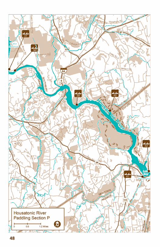
48

Distance: 9.6 milesTime: 4.5 hoursTowns: Southbury, Oxford, Newtown, MonroeTributaries: Tributaries: Pootatuck River (Newtown), Pomperaug River (Southbury), Halfway River (Monroe) Diffi culty: Class I near Shepaug Dam, otherwise fl atwater paddling
PUT IN Access 38, Shepaug Recrea on Area on east (Southbury) side of Lake Zoar, (N41.450266; W3.290666), below Shepaug Dam. Formal access, (Good)
DIRECTIONS FROM FROM ROUTE 84Take Exit 14 on I-84 to Route 172, north. First traffi c light is South Main St., go west. Travel 0.8 mile, crossing back over I-84 and take a right turn at stop onto Fish Rock Rd. Follow Fish Rock Rd, which turns into River Road as it crosses back over I-84 again. Continue for 1.1 miles until River Road bears right; do not go over Steel Bridge into Newtown. Travel an additional 2.0 miles to put-in location. The area is accessible from 8 a.m. to Sunset, Memorial Day to Labor Day (Free Access).
TAKE-OUTAccess 41 is the Lake Zoar Boat Ramp in Monroe west (river right) of Stevenson Dam, Route 34; (N41.381521; W73.175991). A portage is available to access Lake Housatonic south of the boat launch on the same side at the base of the dam which is also where the parking area is located.
DIRECTIONS FROM ROUTE 84Take Exit 11 on I-84 to Route 34 south. Travel 6.0 miles on Route 34. Lake Zoar Boat Launch is on the left 0.1 mile before it crosses over the Stephenson Dam in Monroe on the left side of the road.
.
84outh. e Zoar
Day to
Bal more OriolesIn spring, look for a fl ash of
bright orange and the lil ng song of the Bal more oriole fl i ng around in the
tall trees next to the river. These migratory birds prefer tall trees in open areas and are
seen along many stretches of the Housatonic.
49
HOUSATONIC RIVER SECTION PLake Zoar, (Downstream of Shepaug Dam) to Stevenson Dam, Oxford
Bal more OrioleLAURA GOOCH PHOTO
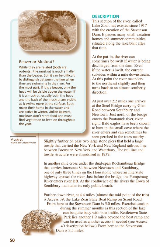
50
DESCRIPTIONThis section of the river, called Lake Zoar, has existed since 1917 with the creation of the Stevenson Dam. It passes many small vacation homes and summer communities situated along the lake built after that time.
At the put-in, the river can sometimes be swift if water is being discharged from the dam. Even if the water is swift, the current subsides within a mile downstream. At this point the river meanders to the northeast slightly and then turns back to an almost southerly direction.
At just over 2.2 miles one arrives at the Steel Bridge carrying Glen Road between Southbury and Newtown. Just north of the bridge enters the Pootatuck river, river right. Bald eagles have been known to hunt in the small cove where the river enters and can sometimes be seen perched in the trees nearby.
Slightly further on pass two large stone piers that held a large trestle that carried the New York and New England railroad line between Brewster, New York and Waterbury. The rail line and trestle structure were abandoned in 1939.
In another mile cross under the dual-span Rochambeau Bridge that carries Interstate 84 between Newtown and Southbury, one of only three times on the Housatonic where an Interstate highway crosses the river. Just before the bridge, the Pomperaug River enters river left. At the confl uence of the rivers the Town of Southbury maintains its only public beach.
Further down river, at 4.4 miles (almost the mid-point of the trip) is Access 39, the Lake Zoar State Boat Ramp on Scout Road.
From here to the Stevenson Dam is 5.0 miles. Exercise caution during the summer months as this section of the lake
can be quite busy with boat traffi c. Kettletown State Park lies another 1.9 miles beyond the boat ramp and can be used as another access if needed (see Access
40 description below.) From here to the Stevenson Dam is 3.5 miles.
Beaver or Muskrat?While they are related (both are rodents), the muskrat is much smaller than the beaver. S ll it can be diffi cult to dis nguish between the two when they are swimming in the river. For the most part, if it is a beaver, only the head will be visible above the water. If it is a muskrat, usually both the head and the back of the muskrat are visible as it swims more at the surface. Both make their home in the water and are ac ve in winter. Unlike beavers, muskrats don’t store food and must fi nd vegeta on to feed on throughout the year.
40Dam
MuskratHENRI SIVONEN PHOTO
About one-third of this section of the river is bounded by protected open space as it traverses the towns of Newtown and Southbury. The Lake Zoar Wildlife Area and Kettletown State Park provide serene settings on the east side of the river and the Paugussett State Forest, with at least three visible waterfalls emptying into the lake, borders the west side of the river,river left.
After Kettletown Park, Jackson Cove Park in Oxford (maintained by the Town of Oxford for its residents) appears further on, river left. Just after another mile the Halfway River empties into the lake on river left in Eichlers Cove in Monroe where a small marina is located.
One more 1.3 mile stretch and the take-out, which is the Lake Zoar Boat Ramp in Monroe, is river right.
ALTERNATIVE ACCESSAccess 39, Lake Zoar State Boat Launch, Southbury; (N41.427675; W73.236135); Formal access, (Developed, excellent)
DIRECTIONS FROM ROUTE 84 IN SOUTHBURYFrom I-84 take exit 14 in Southbury to CT-172, traveling south for a short distance. Bear right onto Lakeside Road, watching for signs leading to the boat ramp. Continue for 1.4 miles until a slight right turn onto Lee Farm Drive. Continue for 0.2 miles and make a slight right onto Scout Road. Follow this for 0.6 more miles until its end, which is the boat ramp area.
Access 40, Ke letown State Park, Southbury; (N41.424513; W73.206974); Offi cial access, (Good)
DIRECTIONS FROM ROUTE 84 IN SOUTHBURYTake I-84 to exit 14 in Southbury to CT-172 south for a short distance. Bear left (uphill) onto Georges Hill Road. Continue for 2.7 miles. Turn right into Kettletown State Park entrance. Canoe/kayak launching is accessible from dawn to dusk. The lake is accessible at the park cove beach area in another 0.6 miles. There are fees to use the park during the summer months.
USGS PHOTO
The Zebra Mussel,an aqua c invasive species, was found in the Housatonic River watershed in East and West Twin Lake in Salisbury, Connec cut in 1998, and then observed in 2009 in Laurel Lake in Lee, Massachuse s. They have since been found in Lake Lillinonah and Lake Zoar in Connec cut in 2011. Since these mussels dominate any area they inhabit, and there is no known method to eradicate them, eff orts must be made to stop their spread. Boats must be decontaminated a er paddling in the Housatonic! Instruc ons are on page 10.
51
GS PHOTO

52
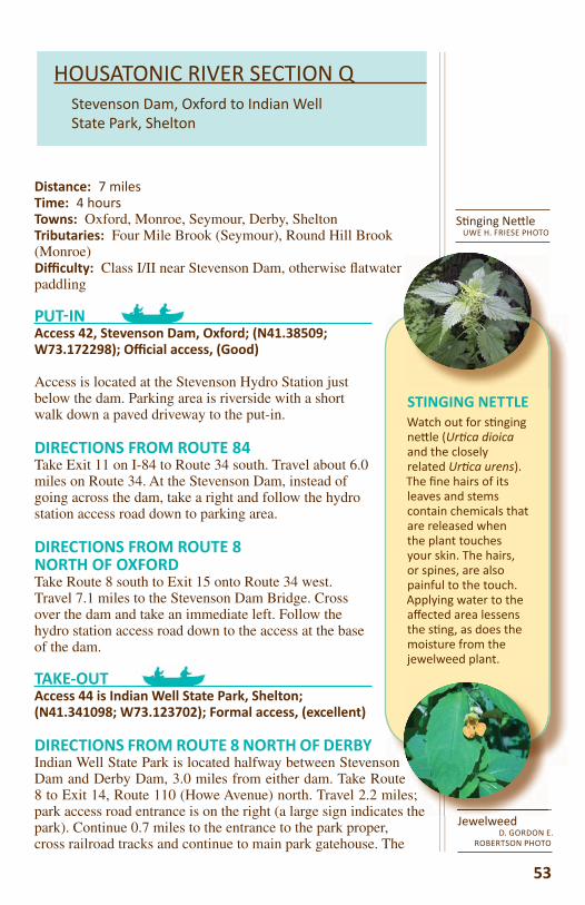
STINGING NETTLEWatch out for s nging ne le (Ur ca dioica and the closely related Ur ca urens). The fi ne hairs of its leaves and stems contain chemicals that are released when the plant touches your skin. The hairs, or spines, are also painful to the touch. Applying water to the aff ected area lessens the s ng, as does the moisture from the jewelweed plant.
Distance: 7 milesTime: 4 hoursTowns: Oxford, Monroe, Seymour, Derby, SheltonTributaries: Four Mile Brook (Seymour), Round Hill Brook (Monroe)Diffi culty: Class I/II near Stevenson Dam, otherwise fl atwater paddling
PUT IN Access 42, Stevenson Dam, Oxford; (N41.38509; W73.172298); Offi cial access, (Good)
Access is located at the Stevenson Hydro Station just below the dam. Parking area is riverside with a short walk down a paved driveway to the put-in.
DIRECTIONS FROM ROUTE 84Take Exit 11 on I-84 to Route 34 south. Travel about 6.0 miles on Route 34. At the Stevenson Dam, instead of going across the dam, take a right and follow the hydro station access road down to parking area.
DIRECTIONS FROM ROUTE 8NORTH OF OXFORDTake Route 8 south to Exit 15 onto Route 34 west. Travel 7.1 miles to the Stevenson Dam Bridge. Cross over the dam and take an immediate left. Follow the hydro station access road down to the access at the base of the dam. TAKE-OUTAccess 44 is Indian Well State Park, Shelton; (N41.341098; W73.123702); Formal access, (excellent)
DIRECTIONS FROM ROUTE 8 NORTH OF DERBYIndian Well State Park is located halfway between Stevenson Dam and Derby Dam, 3.0 miles from either dam. Take Route 8 to Exit 14, Route 110 (Howe Avenue) north. Travel 2.2 miles; park access road entrance is on the right (a large sign indicates the park). Continue 0.7 miles to the entrance to the park proper, cross railroad tracks and continue to main park gatehouse. The
53
HOUSATONIC RIVER SECTION QStevenson Dam, Oxford to Indian Well State Park, Shelton
S nging Ne leUWE H. FRIESE PHOTO
JewelweedD. GORDON E.
ROBERTSON PHOTO
es; the

boat ramp is located just past the gatehouse on the southern-most section of the park. There are fees to use this park during the summer season. Boat launch hours are 8 a.m. to sunset.
DESCRIPTIONLake Housatonic was created in 1870 with the construction of the Derby Dam. It has been a recreation mecca since that time.
Newspaper articles dating back to 1906 extol the virtues of boating and vacationing on this venerable lake when the many factories in the lower valley shut down for the summer months.
As the river fl attens into the lake in a short 0.5 mile, it makes a substantial 90 degree curve to the right (south). Webb Mountain Park is visible, river right, and a cute spot called “Otter Rock” is river left. Both areas sport several hiking trails. Camping is allowed in Webb Mountain Park. Visit the website at http://www.monroect.org/webmountain.aspx for information on camping permits.
Shortly after a set of rapids, keep a close lookout for a large boulder, painted with an Indian face, at the base of a stream entering river right. This is Round Hill Brook. For the next 1.0 mile several small streams enter on either side of the river but none with as much fl ourish as this one.
At approximately 1.8 miles, the New Haven Rowing Club building is river left with a large, new dock that is used for its many river activities and competitions.
At 0.5 mile downstream is a recent addition to the lake’s paddling experience; a new canoe/kayak access that was installed in 2011 by boy scouts implementing an Eagle Scout project. The new access was installed where Four Mile Brook enters river left. The scouts have created a gently-sloped access trail and gazebo with a free parking area. This access (43 – details below) is located on the extreme southerly section of Keith Mitchell Forest in Seymour. To stop and look, you must cross under the bridge carrying Roosevelt Drive where the stream enters to see this new area.
The next feature is Access 44 at Indian Well State Park which boasts almost 1.0 mile of river shoreline river right.
5454
Beware of Strainers! A strainer is the term used for a fallen tree which is blocking all or part of the river channel to the passage of boats, but the current s ll sweeps under. A strainer can create a dangerous situa on for paddlers.
boasectsum
DDESLakthe
Nebofac
As tsubsParkis riallomonperm
StrainerWALTER SIEGMUND
PHOTO
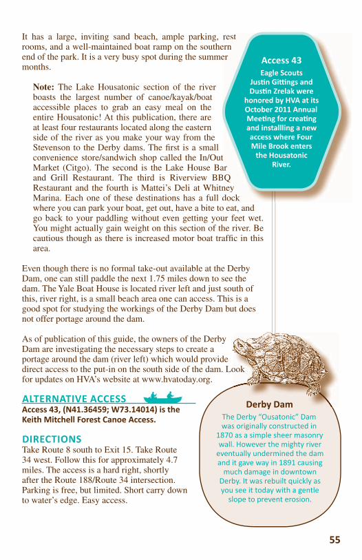
It has a large, inviting sand beach, ample parking, rest rooms, and a well-maintained boat ramp on the southern end of the park. It is a very busy spot during the summer months.
Note: The Lake Housatonic section of the river boasts the largest number of canoe/kayak/boat accessible places to grab an easy meal on the entire Housatonic! At this publication, there are at least four restaurants located along the eastern side of the river as you make your way from the Stevenson to the Derby dams. The fi rst is a small convenience store/sandwich shop called the In/Out Market (Citgo). The second is the Lake House Bar and Grill Restaurant. The third is Riverview BBQ Restaurant and the fourth is Mattei’s Deli at Whitney Marina. Each one of these destinations has a full dock where you can park your boat, get out, have a bite to eat, and go back to your paddling without even getting your feet wet. You might actually gain weight on this section of the river. Be cautious though as there is increased motor boat traffi c in this area.
Even though there is no formal take-out available at the Derby Dam, one can still paddle the next 1.75 miles down to see the dam. The Yale Boat House is located river left and just south of this, river right, is a small beach area one can access. This is a good spot for studying the workings of the Derby Dam but does not offer portage around the dam.
As of publication of this guide, the owners of the Derby Dam are investigating the necessary steps to create a portage around the dam (river left) which would provide direct access to the put-in on the south side of the dam. Look for updates on HVA’s website at www.hvatoday.org.
ALTERNATIVE ACCESSAccess 43, (N41.36459; W73.14014) is the Keith Mitchell Forest Canoe Access.
DIRECTIONSTake Route 8 south to Exit 15. Take Route 34 west. Follow this for approximately 4.7 miles. The access is a hard right, shortly after the Route 188/Route 34 intersection. Parking is free, but limited. Short carry down to water’s edge. Easy access.
55
resterner
arQ
ney dock
Access 43Eagle Scouts
Jus n Gi ngs and Dus n Zrelak were
honored by HVA at its October 2011 Annual Mee ng for crea ng and installling a new access where Four Mile Brook enters
the Housatonic River.
Derby DamThe Derby “Ousatonic” Dam was originally constructed in
1870 as a simple sheer masonry wall. However the mighty river
eventually undermined the dam and it gave way in 1891 causing
much damage in downtown Derby. It was rebuilt quickly as you see it today with a gentle
slope to prevent erosion.
ook
Derby Dam
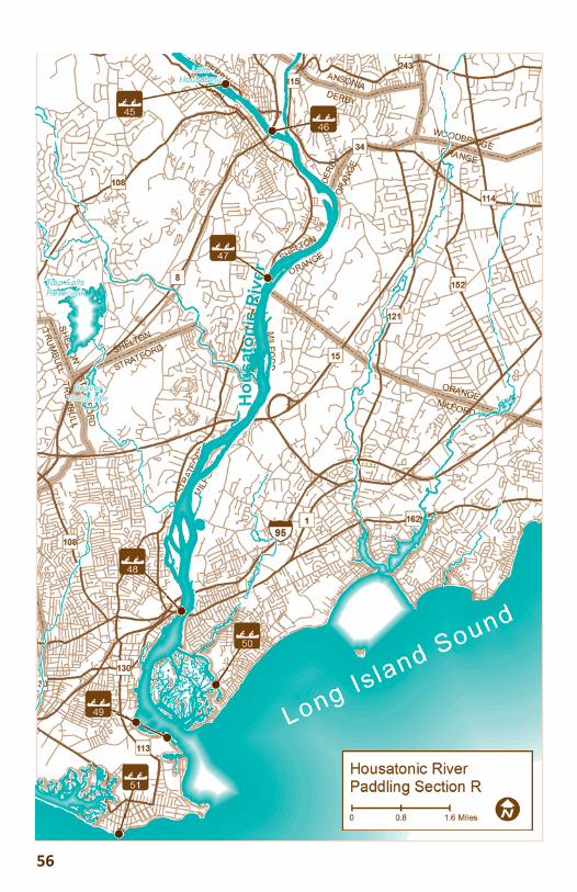
56
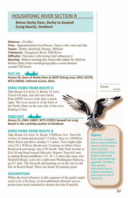
57
HOUSATONIC RIVER SECTION RBelow Derby Dam, Derby to Seawall (Long Beach), Stra ord
57
Ospreywere once in danger due to toxic pollutants which contaminated their food and accumulated in their bodies, poisoning birds and weakening eggshells. Numbers have greatly rebounded due to habitat restora on and reduced use of chemicals.
Osprey BY NASA
Distance: 15 milesTime: Approximately 6 to 8 hours. Varies with wind and tide.Towns: Derby, Stratford, Orange, MilfordTributaries: Naugatuck River, Mill RiverDiffi culty: Flatwater with strong tidal infl uence(s)Warning: Before star ng trip, check de tables for Milford Harbor (http://tides.mobilegeographics.com/calendar/month/3768.html)
PUT IN Access 45, base of Derby Dam at DEEP fi shing area; (N41.32576; W73.10036). Informal access, (fair).
DIRECTIONS FROM ROUTE 8Take Route 8 to Exit 15, Route 34 west. Travel 0.8 mile, turn left into Derby Dam DEEP Access road, then a quick right. The river access is at the base of the Derby Dam on the east side of the river. Parking is free.
TAKE-OUTAccess 51, (N41.14807; W73.12952) Seawall on Long Beach in the Lordship sec on of Stra ord.
DIRECTIONS FROM ROUTE 8Take Route 8 to Exit 14, Route 110/Howe Ave. Turn left at base of ramp and proceed 7.5 miles. Stay on 110S/East Main Street and drive another 1.3 miles. Turn slight right onto US-1 W/Ferry Boulevard. Continue to follow Ferry Boulevard and merge onto I-95 South. Take Surf Avenue at Exit 30 and head toward Sikorsky Airport. Turn left onto Lordship Boulevard/Route 113. At 1.2 miles this turns into Stratford Road. Look for a right onto Washington Parkway, go 0.3 mile. The Seawall and parking are at the end on the left on Beach Road. There are about 20 parking spots.
DESCRIPTION While the travel distance in this segment of the guide might seem to be a bit long, several additional alternate access points have been included to shorten the trip if needed.
O
r.
wall on Longd.
A T l ft
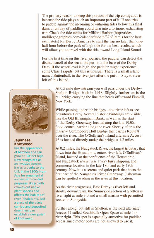
58
The primary reason to keep this portion of the trip contiguous is because the tide plays such an important part of it. If one tries to paddle against the incoming or outgoing tides below this fi nal dam, a fun day of paddling could turn into a tortuous, exhausting trip. Check the tide tables for Milford Harbor (http://tides.mobilegeographics.com/calendar/month/3768.html) for the best estimate(s) for Derby Dam. Try to start the trip no later than one-half hour before the peak of high tide for the best results, which will allow you to travel with the tide toward Long Island Sound.
For the fi rst time on this river journey, the paddler can detect the distinct smell of the sea at the put-in at the base of the Derby Dam. If the water level is high, the paddler might experience some Class I rapids, but this is unusual. There is a small island, named Buttonball, in the river just after the put-in. Stay to river left of this island.
At 0.5 mile downstream you will pass under the Derby-Shelton Bridge, built in 1918. Slightly further on is the rail bridge carrying the line that heads off toward Fishkill, New York.
While passing under the bridges, look river left to see downtown Derby. Several historic buildings are visible, like the Old Birmingham Bank, as well as the start of the Derby Greenway located atop the late 1950s fl ood control barrier along the river. Shortly after is the massive Commodore Hull Bridge that carries Route 8 over the river. The O’Sullivan’s Island alternate Access 46 is located directly under the bridge at 1.2 miles.
At 0.2 miles, the Naugatuck River, the largest tributary that fl ows into the Housatonic, enters river left. O’Sullivan’s Island, located at the confl uence of the Housatonic and Naugatuck rivers, was a very busy shipping and commerce location in the late 18th and early 19th century. Now it is a serene and quiet park that hosts the fi rst part of the Naugatuck River Greenway. Fisherman can be spotted wading in the river at this location.
As the river progresses, East Derby is river left and shortly downstream, the Sunnyside section of Shelton is river right at mile 3.0 and a small marina with permitted access in Sunnyside.
Further along, but still in Shelton, is the next alternate Access 47 called Southbank Open Space at mile 4.0, river right. This spot is especially attractive for paddler access since motor boats are not allowed to use it,
58
ASraN
Wdliofl mo4
Afl Isaccfi c
Asria
FAri a
Japanese Knotweedhas the appearance of bamboo and can grow to 10 feet high. Now recognized as an invasive species, it was brought to the U.S. in the 1800s from Asia for ornamental and erosion-control purposes. Its growth crowds out na ve plant species and aff ects the habitat of river inhabitants. Just a piece of the plant carried and deposited downriver can establish a new patch of knotweed.
H. ZELL PHOTO
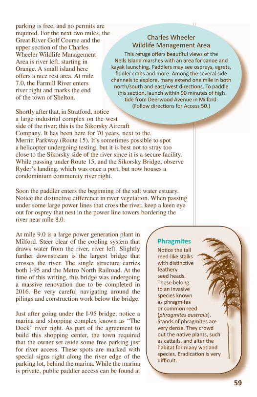
59
parking is free, and no permits are required. For the next two miles, the Great River Golf Course and the upper section of the Charles Wheeler Wildlife Management Area is river left, starting in Orange. A small island here offers a nice rest area. At mile 7.0, the Farmill River enters river right and marks the end of the town of Shelton.
Shortly after that, in Stratford, notice a large industrial complex on the west side of the river; this is the Sikorsky Aircraft Company. It has been here for 70 years, next to the Merritt Parkway (Route 15). It’s sometimes possible to spot a helicopter undergoing testing, but it is best not to stray too close to the Sikorsky side of the river since it is a secure facility. While passing under Route 15, and the Sikorsky Bridge, observe Ryder’s landing, which was once a port, but now houses a condominium community river right.
Soon the paddler enters the beginning of the salt water estuary. Notice the distinctive difference in river vegetation. When passing under some large power lines that cross the river, keep a keen eye out for osprey that nest in the power line towers bordering the river near mile 8.0.
At mile 9.0 is a large power generation plant in Milford. Steer clear of the cooling system that draws water from the river, river left. Slightly further downstream is the largest bridge that crosses the river. The single structure carries both I-95 and the Metro North Railroad. At the time of this writing, this bridge was undergoing a massive renovation due to be completed in 2016. Be very careful navigating around the pilings and construction work below the bridge.
Just after going under the I-95 bridge, notice a marina and shopping complex known as “The Dock” river right. As part of the agreement to build this shopping center, the town required that the owner set aside some free parking just for river access. These spots are marked with special signs right along the river edge of the parking lot, behind the marina. While the marina is private, public paddler access can be found at
59
PhragmitesNo ce the tall reed-like stalks with dis nc ve feathery seed heads. These belong to an invasive species known as phragmites or common reed (phragmites australis). Stands of phragmites are very dense. They crowd out the na ve plants, such as ca ails, and alter the habitat for many wetland species. Eradica on is very diffi cult.
tralis). mites are
crowd ants, such ter the wetland on is very
ethe
icee westky Aircraft0 years next to the
Charles Wheeler Wildlife Management Area
This refuge off ers beau ful views of the Nells Island marshes with an area for canoe and
kayak launching. Paddlers may see ospreys, egrets, fi ddler crabs and more. Among the several side
channels to explore, many extend one mile in both north/south and east/west direc ons. To paddle
this sec on, launch within 90 minutes of high de from Deerwood Avenue in Milford.
(Follow direc ons for Access 50.)
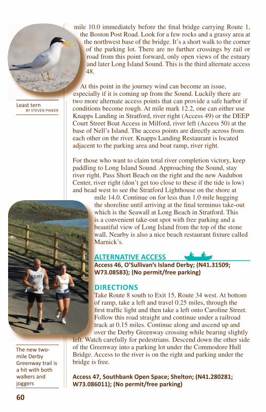
mile 10.0 immediately before the fi nal bridge carrying Route 1, the Boston Post Road. Look for a few rocks and a grassy area at
the northwest base of the bridge. It’s a short walk to the corner of the parking lot. There are no further crossings by rail or road from this point forward, only open views of the estuary and later Long Island Sound. This is the third alternate access 48.
At this point in the journey wind can become an issue, especially if it is coming up from the Sound. Luckily there are two more alternate access points that can provide a safe harbor if conditions become rough. At mile mark 12.2, one can either use Knapps Landing in Stratford, river right (Access 49) or the DEEP Court Street Boat Access in Milford, river left (Access 50) at the base of Nell’s Island. The access points are directly across from each other on the river. Knapps Landing Restaurant is located adjacent to the parking area and boat ramp, river right.
For those who want to claim total river completion victory, keep paddling to Long Island Sound. Approaching the Sound, stay river right. Pass Short Beach on the right and the new Audubon Center, river right (don’t get too close to these if the tide is low) and head west to see the Stratford Lighthouse on the shore at
mile 14.0. Continue on for less than 1.0 mile hugging the shoreline until arriving at the fi nal terminus take-out which is the Seawall at Long Beach in Stratford. This is a convenient take-out spot with free parking and a beautiful view of Long Island from the top of the stone wall. Nearby is also a nice beach restaurant fi xture called Marnick’s.
ALTERNATIVE ACCESSAccess 46, O’Sullivan’s Island Derby; (N41.31509; W73.08583); (No permit/free parking)
DIRECTIONSTake Route 8 south to Exit 15, Route 34 west. At bottom of ramp, take a left and travel 0.25 miles, through the fi rst traffi c light and then take a left onto Caroline Street. Follow this road straight and continue under a railroad track at 0.15 miles. Continue along and ascend up and over the Derby Greenway crossing while bearing slightly
left. Watch carefully for pedestrians. Descend down the other side of the Greenway into a parking lot under the Commodore Hull Bridge. Access to the river is on the right and parking under the bridge is free.
Access 47, Southbank Open Space; Shelton; (N41.280281; W73.086011); (No permit/free parking)
thwisbwM
AAAAW
DDTofi Ftro
left. Watc
60
The new two-mile Derby Greenway trail is a hit with both walkers and joggers
Least ternBY STEVEN PINKER
mile the
thora4
At espectwo m
DIRECTIONSTake Route 8 to Exit 14, Route 110/Howe Ave. Turn left at base of ramp and proceed approximately 4.0 miles. Southbank Open Space is located on the left side of Route 110. There is a small concrete building just inside the park below the parking area. Park at the top and carry boats down the short path to the river.
Access 48, “The Dock” Shopping Center, Boston Post Road, Route 1 Bridge, Stra ord; (N41.200954; W73.112066).
DIRECTIONSTake Route 8 south to Exit 8, Route 108 toward Stratford/Route 15. Keep right at the fork following signs for Route 108. Merge onto Route 108 W/Nichols Avenue Travel 2.9 miles then turn left onto Barnum Avenue; stay on Barnum for 0.2 mile until it becomes Barnum Avenue cutoff and travel another 1.0 mile. The shopping center is on the left. About 10 river parking spots are by the river marked with signs for free parking for river access.
Access 49, Knapps Landing; (N41.170788; W73.114832); (No permit/free parking), Stra ord.
DIRECTIONSTake Route 8 south to Exit 8, Route 108 toward Stratford/Route 15. Keep right at the fork following signs for Route 108. Merge onto Route 108 W/Nichols Avenue. Travel 2.9 miles then turn left onto Barnum Avenue. Continue for 0.2 mile, then turn right onto Main Street and go another 2.3 miles. Finally, turn left onto Sniffen Lane and go another 0.5 mile. The six free parking spots are just to the right of the boat ramp.
Access 50, Milford Boat Launch ramp at bo om of Nells Island, Court Street, Milford; (N41.183543; W73.100147).
DIRECTIONSTake Route 8 south to Exit 8, Route 108 toward Stratford/Route 15. Keep right at the fork following signs for Route 108. Merge onto Route 108 W/Nichols Avenue. Travel 2.9 miles then turn left onto Barnum Avenue. and stay on Barnum Avenue for 0.2 mile until it becomes Barnum Avenue cutoff; travel another 1.1 miles. Continue onto Bridgeport Avenue, cross over the river on Route 1. Go another 0.5 mile and turn right onto Naugatuck Avenue. Go 0.6 mile, then right onto Milford Point Road for 0.8 mile. Take a right onto Court Street. The boat launch is at the end of Court Street. There may be a chain across the driveway but visitors may carry boats to the river. Contact the CT DEEP for information, 860-485-0226.
61
How did the river get its name?It comes from the Mohican Indian phrase “usi-a-di-enuk”,translated as “beyond the mountain place.” So, at the end of your enjoyable journey, you have progressed in distance, mind and spirit way beyond the mountain place where this very special 149-mile river began. Paddle on!ward Stratford/Route
Dragonfl yBY STEVEN PINKER
Housatonic enters Long Island Sound at Stra ord
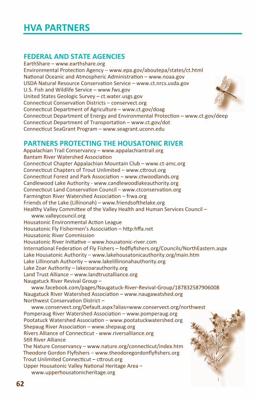
62
HVA PARTNERS
FEDERAL AND STATE AGENCIESEarthShare – www.earthshare.orgEnvironmental Protec on Agency – www.epa.gov/aboutepa/states/ct.htmlNa onal Oceanic and Atmospheric Administra on – www.noaa.govUSDA Natural Resource Conserva on Service – www.ct.nrcs.usda.govU.S. Fish and Wildlife Service – www.fws.govUnited States Geologic Survey – ct.water.usgs.govConnec cut Conserva on Districts – conservect.orgConnec cut Department of Agriculture – www.ct.gov/doagConnec cut Department of Energy and Environmental Protec on – www.ct.gov/deepConnec cut Department of Transporta on – www.ct.gov/dotConnec cut SeaGrant Program – www.seagrant.uconn.edu
PARTNERS PROTECTING THE HOUSATONIC RIVERAppalachian Trail Conservancy – www.appalachiantrail.orgBantam River Watershed Associa on Connec cut Chapter Appalachian Mountain Club – www.ct-amc.orgConnec cut Chapters of Trout Unlimited – www.c rout.orgConnec cut Forest and Park Associa on – www.ctwoodlands.orgCandlewood Lake Authority - www.candlewoodlakeauthority.orgConnec cut Land Conserva on Council – www.ctconserva on.orgFarmington River Watershed Associa on – frwa.orgFriends of the Lake (Lillinonah) – www.friendso helake.orgHealthy Valley Commi ee of the Valley Health and Human Services Council – www.valleycouncil.orgHousatonic Environmental Ac on LeagueHousatonic Fly Fishermen’s Associa on – h p:hff a.netHousatonic River CommissionHousatonic River Ini a ve – www.housatonic-river.comInterna onal Federa on of Fly Fishers – fedfl yfi shers.org/Councils/NorthEastern.aspxLake Housatonic Authority – www.lakehousatonicauthority.org/main.htmLake Lillinonah Authority – www.lakelillinonahauthority.orgLake Zoar Authority – lakezoarauthority.orgLand Trust Alliance – www.landtrustalliance.orgNaugatuck River Revival Group – www.facebook.com/pages/Naugatuck-River-Revival-Group/187832587906008Naugatuck River Watershed Associa on – www.naugawatshed.orgNorthwest Conserva on District – www.conservect.org/Default.aspx?alias=www.conservect.org/northwestPomperaug River Watershed Associa on – www.pomperaug.orgPootatuck Watershed Associa on – www.pootatuckwatershed.orgShepaug River Associa on – www.shepaug.orgRivers Alliance of Connec cut - www.riversalliance.orgS ll River AllianceThe Nature Conservancy – www.nature.org/connec cut/index.htmTheodore Gordon Flyfi shers – www.theodoregordonfl yfi shers.orgTrout Unlimited Connec cut – c rout.orgUpper Housatonic Valley Na onal Heritage Area – www.upperhousatonicheritage.org
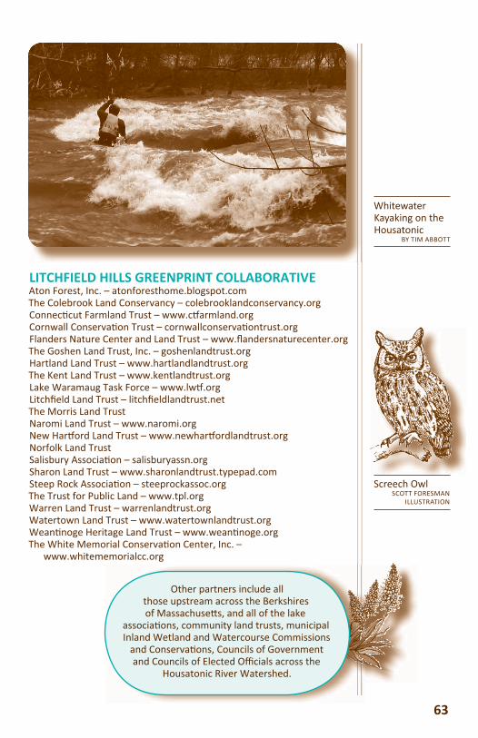
Whitewater Kayaking on the Housatonic
BY TIM ABBOTT
LITCHFIELD HILLS GREENPRINT COLLABORATIVEAton Forest, Inc. – atonforesthome.blogspot.comThe Colebrook Land Conservancy – colebrooklandconservancy.orgConnec cut Farmland Trust – www.c armland.orgCornwall Conserva on Trust – cornwallconserva ontrust.orgFlanders Nature Center and Land Trust – www.fl andersnaturecenter.orgThe Goshen Land Trust, Inc. – goshenlandtrust.orgHartland Land Trust – www.hartlandlandtrust.orgThe Kent Land Trust – www.kentlandtrust.orgLake Waramaug Task Force – www.lw .orgLitchfi eld Land Trust – litchfi eldlandtrust.netThe Morris Land TrustNaromi Land Trust – www.naromi.orgNew Har ord Land Trust – www.newhar ordlandtrust.orgNorfolk Land TrustSalisbury Associa on – salisburyassn.orgSharon Land Trust – www.sharonlandtrust.typepad.comSteep Rock Associa on – steeprockassoc.orgThe Trust for Public Land – www.tpl.orgWarren Land Trust – warrenlandtrust.orgWatertown Land Trust – www.watertownlandtrust.orgWean noge Heritage Land Trust – www.wean noge.orgThe White Memorial Conserva on Center, Inc. – www.whitememorialcc.org
63
Screech OwlSCOTT FORESMAN
ILLUSTRATION
Other partners include all those upstream across the Berkshires of Massachuse s, and all of the lake
associa ons, community land trusts, municipal Inland Wetland and Watercourse Commissions
and Conserva ons, Councils of Government and Councils of Elected Offi cials across the
Housatonic River Watershed.
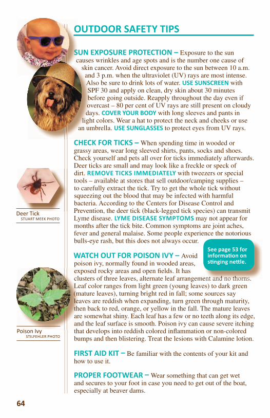
OUTDOOR SAFETY TIPS
SUN EXPOSURE PROTECTION – Exposure to the sun causes wrinkles and age spots and is the number one cause of
skin cancer. Avoid direct exposure to the sun between 10 a.m. and 3 p.m. when the ultraviolet (UV) rays are most intense. Also be sure to drink lots of water. USE SUNSCREEN with SPF 30 and apply on clean, dry skin about 30 minutes before going outside. Reapply throughout the day even if overcast – 80 per cent of UV rays are still present on cloudy days. COVER YOUR BODY with long sleeves and pants in
light colors. Wear a hat to protect the neck and cheeks or use an umbrella. USE SUNGLASSES to protect eyes from UV rays.
CHECK FOR TICKS – When spending time in wooded or grassy areas, wear long sleeved shirts, pants, socks and shoes. Check yourself and pets all over for ticks immediately afterwards. Deer ticks are small and may look like a freckle or speck of dirt. REMOVE TICKS IMMEDIATELY with tweezers or special tools – available at stores that sell outdoor/camping supplies – to carefully extract the tick. Try to get the whole tick without squeezing out the blood that may be infected with harmful bacteria. According to the Centers for Disease Control and Prevention, the deer tick (black-legged tick species) can transmit Lyme disease. LYME DISEASE SYMPTOMS may not appear for months after the tick bite. Common symptoms are joint aches, fever and general malaise. Some people experience the notorious bulls-eye rash, but this does not always occur.
WATCH OUT FOR POISON IVY – Avoid poison ivy, normally found in wooded areas, exposed rocky areas and open fi elds. It has clusters of three leaves, alternate leaf arrangement and no thorns. Leaf color ranges from light green (young leaves) to dark green (mature leaves), turning bright red in fall; some sources say leaves are reddish when expanding, turn green through maturity, then back to red, orange, or yellow in the fall. The mature leaves are somewhat shiny. Each leaf has a few or no teeth along its edge, and the leaf surface is smooth. Poison ivy can cause severe itching that develops into reddish colored infl ammation or non-colored bumps and then blistering. Treat the lesions with Calamine lotion.
FIRST AID KIT Be familiar with the contents of your kit and how to use it.
PROPER FOOTWEAR Wear something that can get wet and secures to your foot in case you need to get out of the boat, especially at beaver dams.
64
Poison IvySTILFEHLER PHOTO
Deer TickSTUART MEEK PHOTO
ent and no thorns
See page 53 for informa on on s nging ne le.
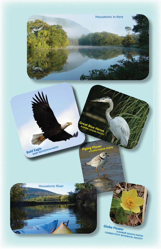
Bald EagleGARY ROTHSTEIN PHOTO
Housatonic in Kent
Great Blue HeronAARON LOGAN PHOTO
Piping PloverSTEVEN PINKER PHOTO
Housatonic River
Globe FlowerELEANOR SAULYS PHOTO
CONNECTICUT BOTANICAL SOCIETY
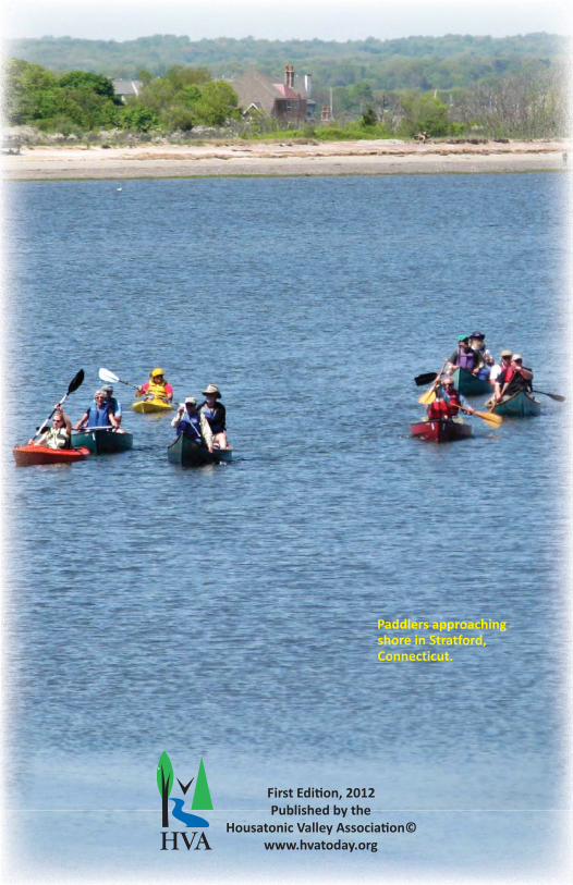
HVA
First Edi on, 2012Published by the
Housatonic Valley Associa on©www.hvatoday.org