Embed Size (px)
DESCRIPTION
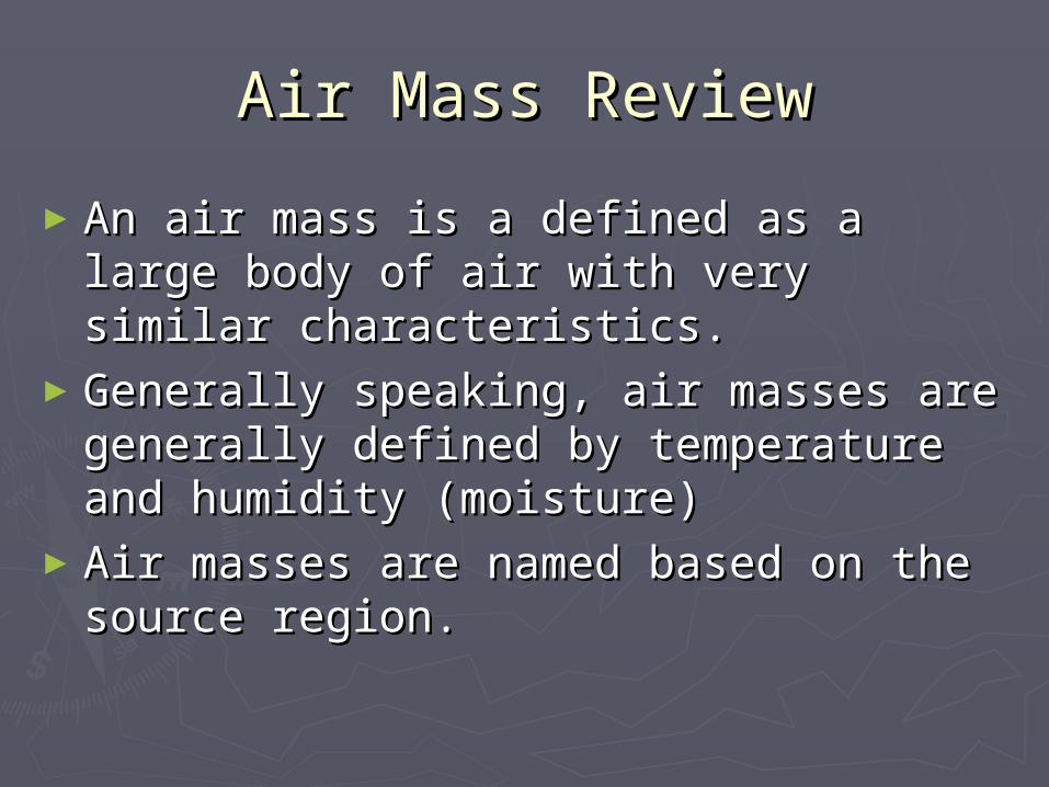
Air Mass Review. An air mass is a defined as a large body of air with very similar characteristics. Generally speaking, air masses are generally defined by temperature and humidity (moisture) Air masses are named based on the source region. Types of Air Masses. - PowerPoint PPT Presentation
Citation preview
Air Mass ReviewAir Mass Review
►An air mass is a defined as a large An air mass is a defined as a large body of air with very similar body of air with very similar characteristics. characteristics.
►Generally speaking, air masses are Generally speaking, air masses are generally defined by temperature and generally defined by temperature and humidity (moisture)humidity (moisture)
►Air masses are named based on the Air masses are named based on the source region.source region.
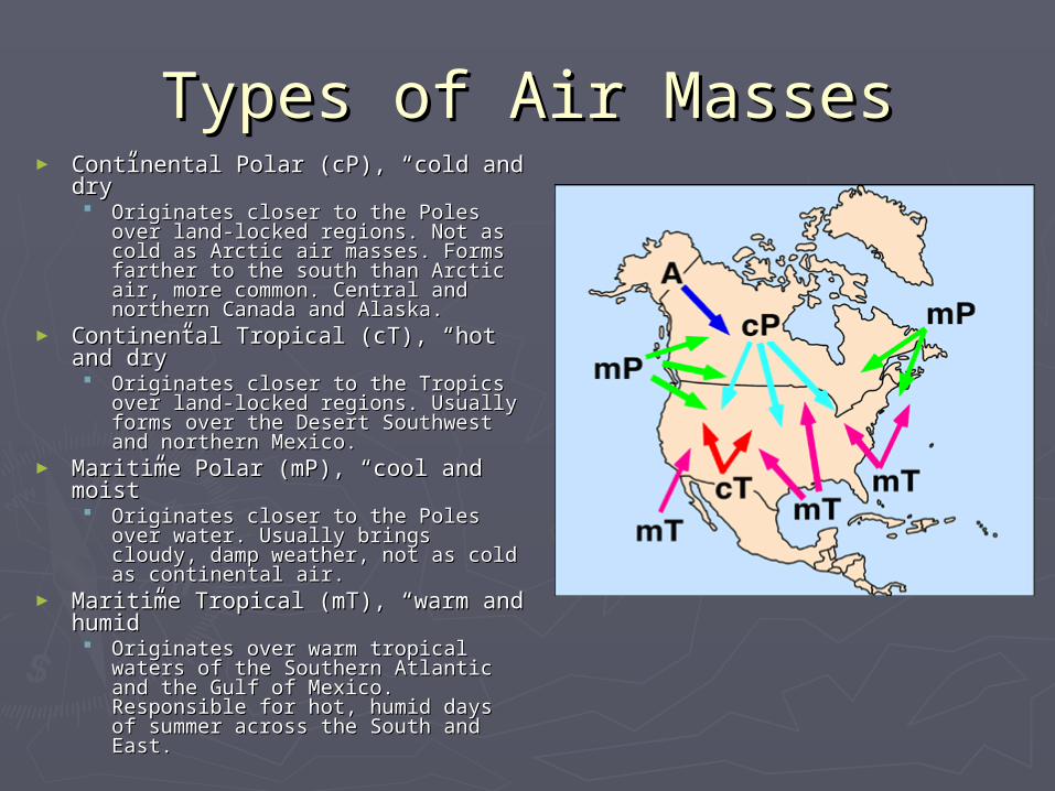
Types of Air MassesTypes of Air Masses► Continental Polar (cP), “cold and Continental Polar (cP), “cold and
dry”dry” Originates closer to the Poles over Originates closer to the Poles over
land-locked regions. Not as cold as land-locked regions. Not as cold as Arctic air masses. Forms farther to Arctic air masses. Forms farther to the south than Arctic air, more the south than Arctic air, more common. Central and northern common. Central and northern Canada and Alaska.Canada and Alaska.
► Continental Tropical (cT), “hot and Continental Tropical (cT), “hot and dry”dry” Originates closer to the Tropics over Originates closer to the Tropics over
land-locked regions. Usually forms land-locked regions. Usually forms over the Desert Southwest and over the Desert Southwest and northern Mexico. northern Mexico.
► Maritime Polar (mP), “cool and Maritime Polar (mP), “cool and moist”moist” Originates closer to the Poles over Originates closer to the Poles over
water. Usually brings cloudy, damp water. Usually brings cloudy, damp weather, not as cold as continental weather, not as cold as continental air.air.
► Maritime Tropical (mT), “warm and Maritime Tropical (mT), “warm and humid”humid” Originates over warm tropical waters Originates over warm tropical waters
of the Southern Atlantic and the Gulf of the Southern Atlantic and the Gulf of Mexico. Responsible for hot, of Mexico. Responsible for hot, humid days of summer across the humid days of summer across the South and East. South and East.
“Blue Ice Weather”Hypothesis:In your spiral notebook on the next available LEFT HAND SIDE PAGE, predict what you think will happen when you add the blue ice cube and red food coloring to water in the plastic container?
Procedure:1. Fill the plastic box two-thirds full with water at room temperature. 2. Wait until the water is completely still before doing step 3 3. Carefully drop a blue ice cube into the water at one end 4. Carefully drop three or four drops of red food coloring at the other end 5. Watch what happens!
Results:Describe what happened in your science spiral underneath your hypothesis.
Conclusion:Write a conclusion in your spiral notebook underneath the results.Why do you think this happened? How do you think this is related to air masses and/or weather?
Understanding Air Understanding Air Masses & FrontsMasses & Fronts
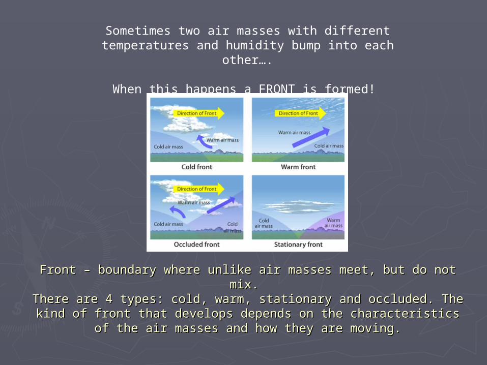
Front – boundary where unlike air masses meet, but do not mix. Front – boundary where unlike air masses meet, but do not mix. There are 4 types: cold, warm, stationary and occluded. The kind of There are 4 types: cold, warm, stationary and occluded. The kind of
front that develops depends on the characteristics of the air masses and front that develops depends on the characteristics of the air masses and how they are moving.how they are moving.
Sometimes two air masses with different temperatures and humidity bump into each other….
When this happens a FRONT is formed!
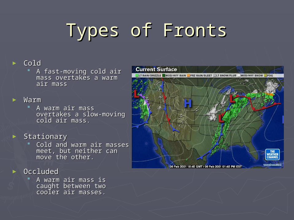
Types of FrontsTypes of Fronts
► Cold Cold A fast-moving cold air mass A fast-moving cold air mass
overtakes a warm air massovertakes a warm air mass
► Warm Warm A warm air mass overtakes A warm air mass overtakes
a slow-moving cold air a slow-moving cold air mass. mass.
► StationaryStationary Cold and warm air masses Cold and warm air masses
meet, but neither can move meet, but neither can move the other. the other.
► OccludedOccluded A warm air mass is caught A warm air mass is caught
between two cooler air between two cooler air masses.masses.
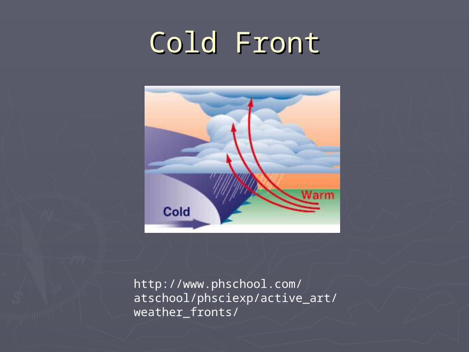
Cold FrontCold Front
http://www.phschool.com/atschool/phsciexp/active_art/weather_fronts/
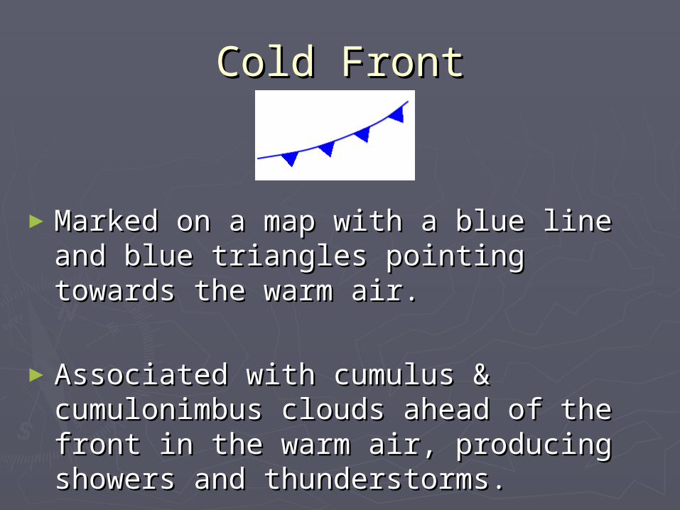
Cold FrontCold Front
►Marked on a map with a blue line and Marked on a map with a blue line and blue triangles pointing towards the blue triangles pointing towards the warm air. warm air.
►Associated with cumulus & Associated with cumulus & cumulonimbus clouds ahead of the cumulonimbus clouds ahead of the front in the warm air, producing front in the warm air, producing showers and thunderstorms. showers and thunderstorms.
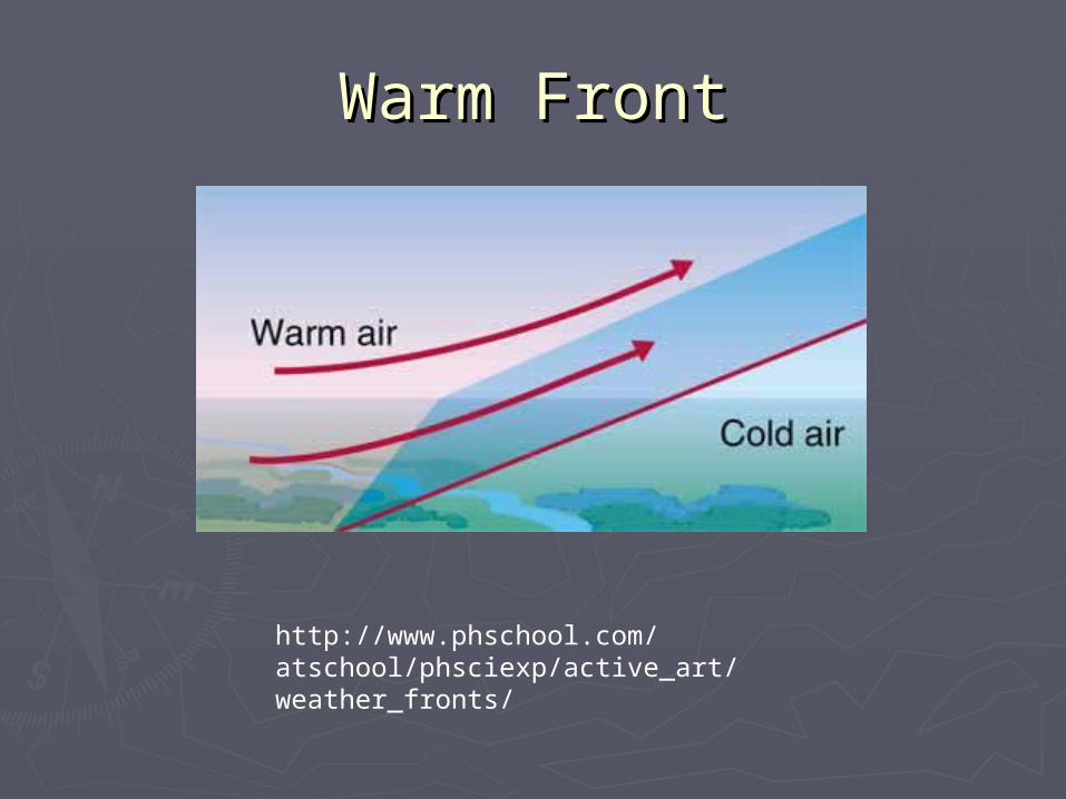
Warm FrontWarm Front
http://www.phschool.com/atschool/phsciexp/active_art/weather_fronts/
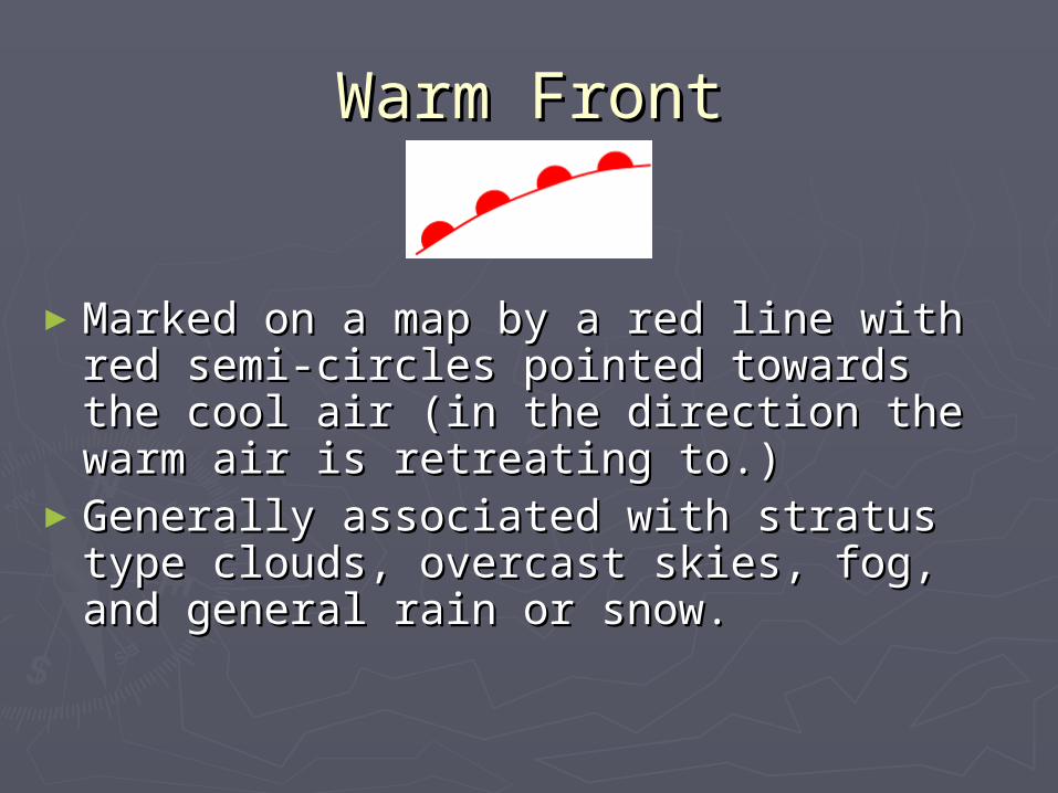
Warm FrontWarm Front
►Marked on a map by a red line with Marked on a map by a red line with red semi-circles pointed towards the red semi-circles pointed towards the cool air (in the direction the warm air cool air (in the direction the warm air is retreating to.)is retreating to.)
►Generally associated with stratus type Generally associated with stratus type clouds, overcast skies, fog, and clouds, overcast skies, fog, and general rain or snow. general rain or snow.
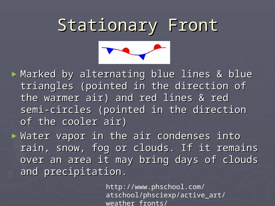
Stationary FrontStationary Front
►Marked by alternating blue lines & blue Marked by alternating blue lines & blue triangles (pointed in the direction of the triangles (pointed in the direction of the warmer air) and red lines & red semi-circles warmer air) and red lines & red semi-circles (pointed in the direction of the cooler air)(pointed in the direction of the cooler air)
►Water vapor in the air condenses into rain, Water vapor in the air condenses into rain, snow, fog or clouds. If it remains over an snow, fog or clouds. If it remains over an area it may bring days of clouds and area it may bring days of clouds and precipitation.precipitation.
http://www.phschool.com/atschool/phsciexp/active_art/weather_fronts/
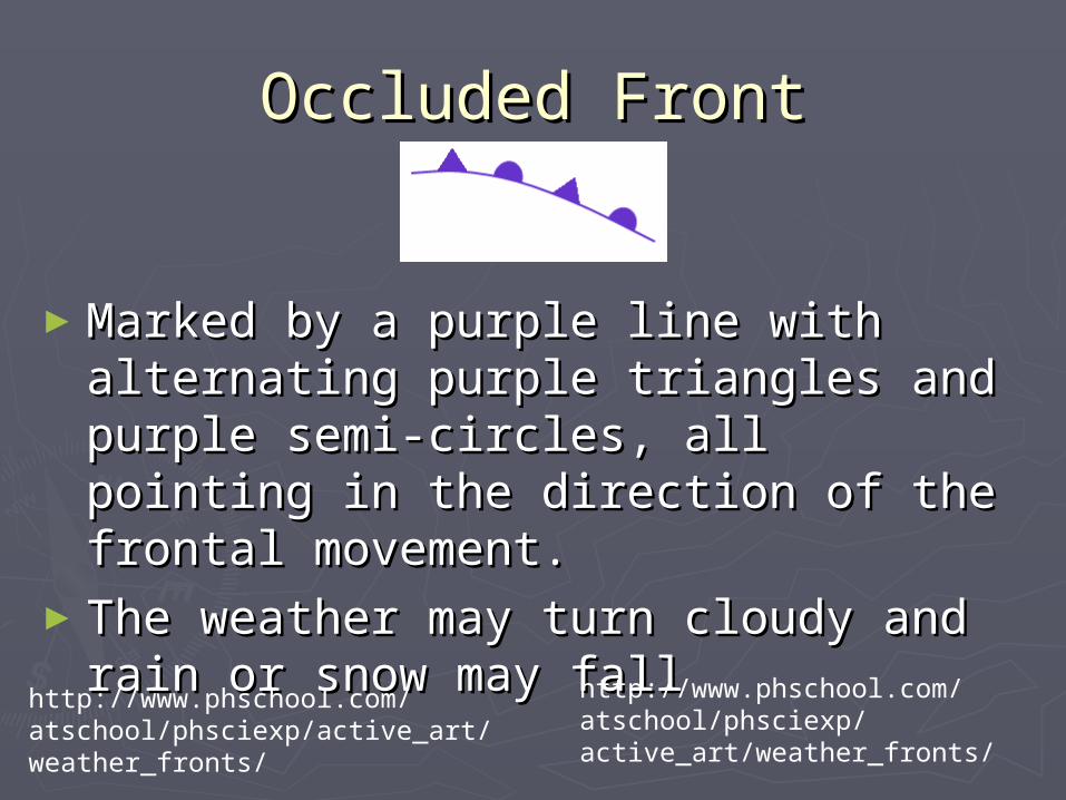
Occluded FrontOccluded Front
►Marked by a purple line with Marked by a purple line with alternating purple triangles and purple alternating purple triangles and purple semi-circles, all pointing in the semi-circles, all pointing in the direction of the frontal movement. direction of the frontal movement.
►The weather may turn cloudy and rain The weather may turn cloudy and rain or snow may fallor snow may fall
http://www.phschool.com/atschool/phsciexp/active_art/weather_fronts/
http://www.phschool.com/atschool/phsciexp/active_art/weather_fronts/