Embed Size (px)
Citation preview
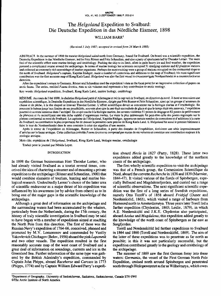
VOL. 41, NO, 3 (SEPTEMBER 1988) P. 203-214 ARCTIC
The Helgoland Expedition to Svalbard: Die Deutsche Expedition in das Nordliche Eismeer, 1898
WILLIAM BARR’
(Received 3 July 1987; accepted in revised form 24 March 1988)
ABSTRACT. In the summer of 1898 the trawler Helgoland sailed north from Germany, bound for Svalbard. On board was a scientific expedition, the Deutsche Expedition in das Nordliche Eismeer, led by Fritz Romer and Fritz Schaudinn, and also a party of sportsmen led by Theodor Lerner. The main foci of the scientific effort were marine biology and ornithology. Pushing the ship to its limit, often in quite heavy ice and foul weather, the expedition pursued a complicated course around the archipelago. In terms of marine biology her scientists occupied 51 dredging stations and 82 plankton stations and collected an extremely rich assemblage of marine organisms. Perhaps the most exciting were a group of stations occupied on the continental slope to the north of Svalbard. Helgoland‘s captain, Kapith Riidiger, made a number of corrections and additions to the map of Svalbard; his most significant contribution was the first accurate map of Kong Karls Land. Helgoland was also the first vessel to circumnavigate Nordaustlandet in a counterclockwise direction.
After the expedition’s return to Germany, Romer and Schaudinn used the expedition’s data as the focal point for an impressive collection of papers on arctic fauna. The series, entitled Fauna Arcrica, runs to six volumes and represents a key contribution to arctic zoology. Key words: Helgoland expedition, Svalbard, Kong Karls Land, marine biology, ornithology
&SUMÉ. Au cours de I’CtC 1898, le chalutier Helgolandpartit d’Allemagne et mit le cap vers le Svalbard, en direction du nord. À bord se trouvaient une exp6dition scientifique, la Deutsche Expedition in das Nordliche Eismeer, dirigée par Fritz Romer et Fritz Schaudinn, ainsi qu’un groupe d’amateurs de chasse et de @he, P la tête duquel se trouvait Theodor Lerner. L’effort scientifique devait se concentrer sur la biologie marine et l’ornithologie. En poussant le bateau jusqu’aux limites de ses possibilitks, souvent alors que la mer était encombke de glace et que le temps ktait t&s mauvais, I’ex@dition poursuivit sa route sinueuse dans l’archipel. En ce qui touche P la biologie marine, les savants visitkrent 5 1 postes de dragage et 82 postes de pdlbvement de plancton et ils recueillirent une tr&s riche variCt6 d’organismes marins. La visite la plus intéressante fut peut-être celle des postes regroup& sur le plateau continental au nord du Svalbard. IR capitaine de l’Helgoland, Kapith Riidiger, apporta un certain nombre de corrections et d’additions àla carte du Svalbard; sa contribution la plus importante fut de dresser la premibre carte prCcise de Kong Karls Land. L’Helgoland fut aussi le premier bâtimentà faire le tour du Nordaustlandet dans le sens contraire P celui des aiguilles d’une montre.
Aprks le retour de I’expkdition en Allemagne, Romer et Schaudinn, P partir des données de I’ex@dition, Ccrivirent une sCrie impressionnante d’articles sur la faune arctique. Cette collection intitulk Fauna Arctica ne comprend pas moins de six volumes et constitue une contribution majeure P la zoologie arctique. Mots clCs: exp5dition de l’Helgoland, Svalbard, Kong Karls Land, biologie marine, ornithologie
Traduit pour le journal par Nésida Loyer.
INTRODUCTION
In 1898 the German businessman Herr Theodor Lerner, who had already visited Svalbard as a tourist several times, con- ceived the idea of chartering a steamer and of mounting a private expedition to the archipelago (Romer and Schaudinn, 1900) that would combine elements of tourism, hunting and marine bio- logical research. Undoubtedly Lerner’s choice of the latter area of scientific endeavour as a major thrust of his expedition was influenced by his awareness (or by advice from others) as to its being one of the major gaps in the scientific knowledge of the archipelago.
Although a great deal of information on the archipelago and the surrounding waters had been accumulated by the whalers, particularly from the Netherlands, during the 17th century, the history of truly scientific investigation in Svalbard may be said to have begun with a number of exwt ions aimed at reaching the North Pole from this direction. The first of these was the Russian Navy’s expedition of 1764-66, conceived, planned and promoted by M.V. Lomonosov and commanded by Vasiliy Yakovlevich Chichagov (Belov, 1956) aboard thepinkhpomnik and two other vessels. The expedition resulted in the first reasonably accurate map of the west coast of Svalbard and a great deal of information on soundings, currents and ice in the Greenland Sea. Further information of the same type was gath- ered by the British Admiralty’s expedition, commanded by Captain John Phipps, aboard Racehorse and Carcass in 1773 (Phipps, 1774) and by Captain William Edward Parry’s expedi-
tion aboard ffeclu in 1827 (Parry, 1828). These latter two expeditions added greatly to the knowledge of the northern coasts of the archipelago.
The first wholly scientific expedition to visit the archipelago was that of a French group, the Commission Scientifique du Nord, aboard the corvette Recherche in 1838 and 1839 (Marmier, 1844-47). It visited various of the fiords of Spitsbergen, espe- cially Bellsund and Magdalenefjorden, and carried out a range of scientific observations. The next significant scientific expe- dition was the first of a long series of Swedish expeditions, namely Otto Torell’s of 1858 aboard Fridtjof (Duner and Nordenskiold, 1865), which visited a range of harbours from Hornsund north to AmsterdamZya. Three years later Torell led a further expedition (Chydenius, 1865; Leslie, 1879), in which A.E. Nordenskiold and J.K.E. Chydenius also participated, aboard Aeolus and Magdalena; this expedition added greatly to the knowledge of the north coast of Spitsbergen as far east as Sorgfjorden.
Torell and Nordenskiold led further expeditions to Svalbard in 1864 and 1868 (Torell and Nordenskiold, 1869). The aim of the latter of these expeditions was to penetrate as far north as possible; in this it was not particularly successful, but the expedition contributed greatly to the geology and ornithology of the archipelago.
The summer of 1869 saw the first German foray into these waters: Germania, the vessel of the First German North Pole Expedition, cruised north around Spitsbergen and penetrated south through Hinlopenstretet as far as Wilhelm~ya, which owes
‘Department of Geography, University of Saskatchewan, Saskatoon, Saskatchewan, Canada S7N OW0 @The Arctic Institute of North America
204 I W. BARR
its name to this expedition (Koldewey, 1871). A few years later Nordenskiold was back in Svalbard waters, leading a Swedish expedition in 1872-73 (Kjellman, 1875); this was the first scien- tific expedition to winter, at Mosselbukta at the entrance to Wijdefjorden. As part of this expedition Nordenskiold and A.A.L. Palander made an impressive sledge trip east to the northeast tip of Nordaustlandet, then back westward across that island, thus achieving one of the earliest major sledge trips across any of the arctic ice caps, namely across Austfonna.
The year 1882 saw the mounting of one of the most intensive scientific operations ever to focus on Svalbard. This was the Swedish contribution to the First International Polar Year, led by Nils Ekholm (Ekholm, 1887; Barr, 1985). It established itself in winter quarters at Kapp Thordsen on Isfjorden to carry out an intensive program of meteorological, geomagnetic and other observations.
Kong Karls Land had f i s t been sighted in 1872, and various Norwegian captains, especially Kaptein Hemming Andreassen, had repeatedly visited the island group during hunting trips (Pettersen, 1889). The first visit by a scientific expedition occurred in 1889; an expedition organized by the Bremen Geographical Society, aboard the yacht Berentine, and led by W. Kiikenthal (Kükenthal, 1890), made several attempts to reach the island group and produced the first map of some of the islands.
During the following summer (1890) yet another Swedish expedition visited Svalbard, that led by G.E.A. Nordenskiold, which concentrated on the geology, paleontology and zoology of parts of Spitsbergen; overland trips included a ski trip from Hornsund to Recherchefjorden (Nordenskiold, 1890). Two years later, in 1892, the French Navy's research vessel La Manche, under the command of Capitaine A.P.L. Bienaimé, carried out surveying, sounding and scientific work in Bellsund, Isfjorden and around Prins Karls Forland (Voyage de La Manche, 1894). Four years later Isfjorden was the focus of yet another Swedish expedition, led by geologist Baron G.J. de Geer (de Geer, 1896). Finally, this selective overview of the scientific explora- tion of Svalbard prior to 1898 would not be complete without reference to Conway's ski tri s across Spitsbergen in 1896 and 1897(Conway, 1897,1898). i onway'saccountsincludeagreat deal of valuable information on the geology and glaciology of the archipelago.
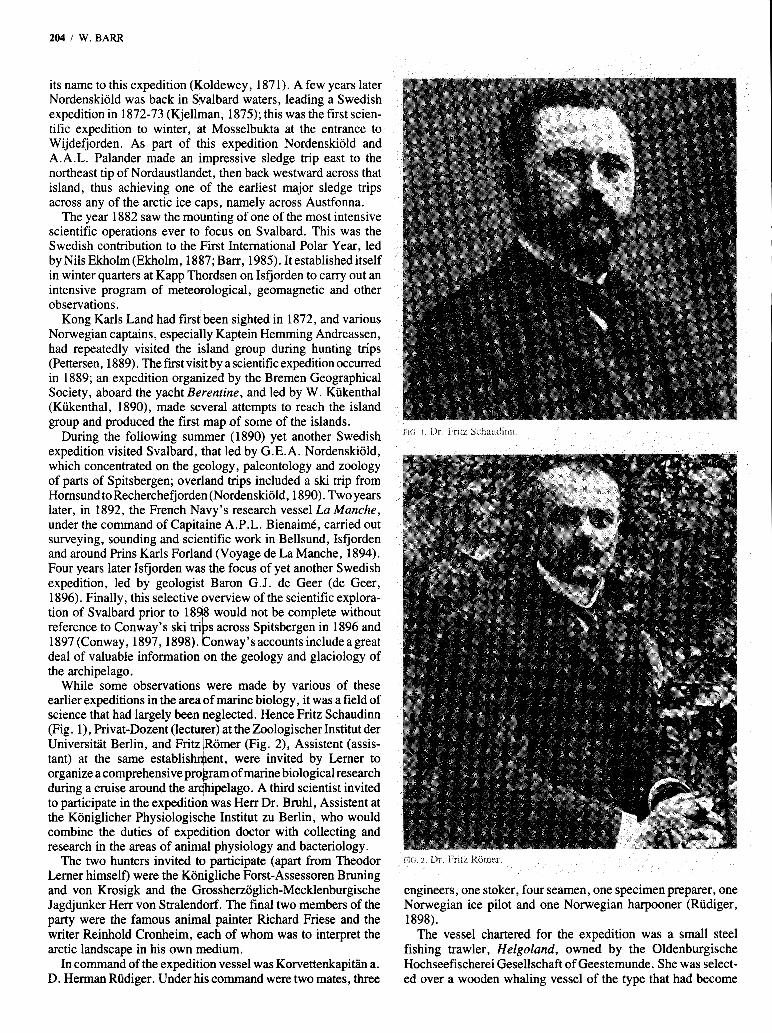
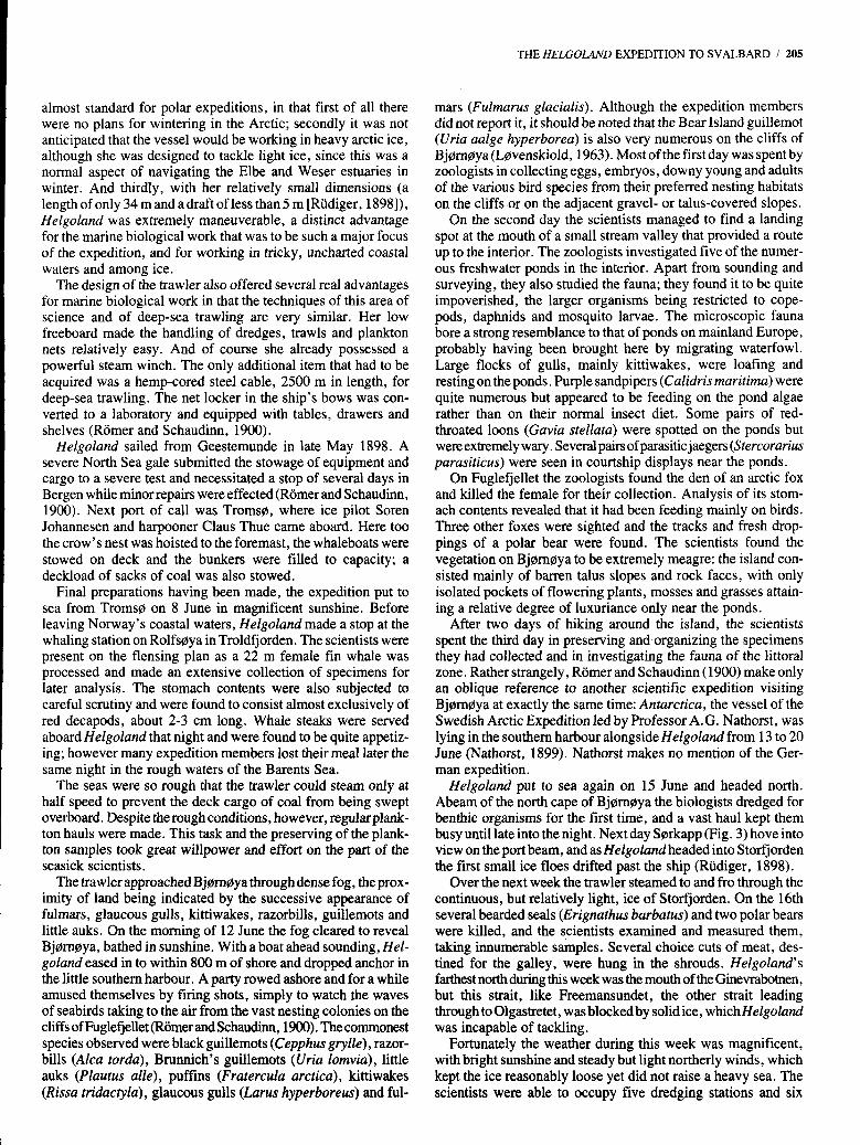
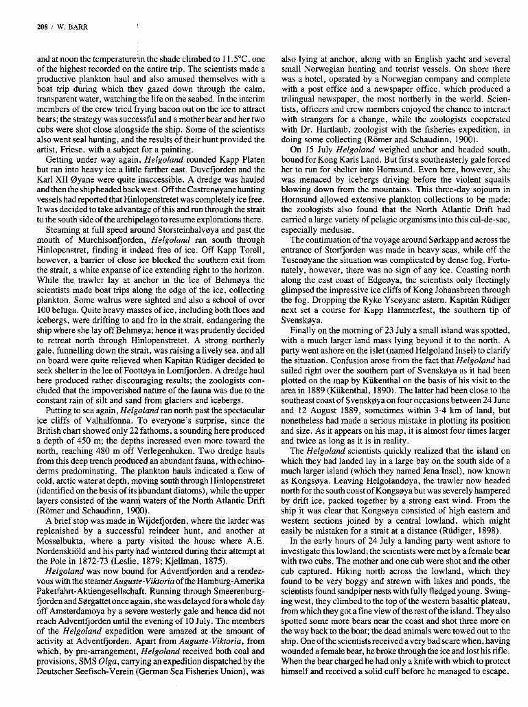
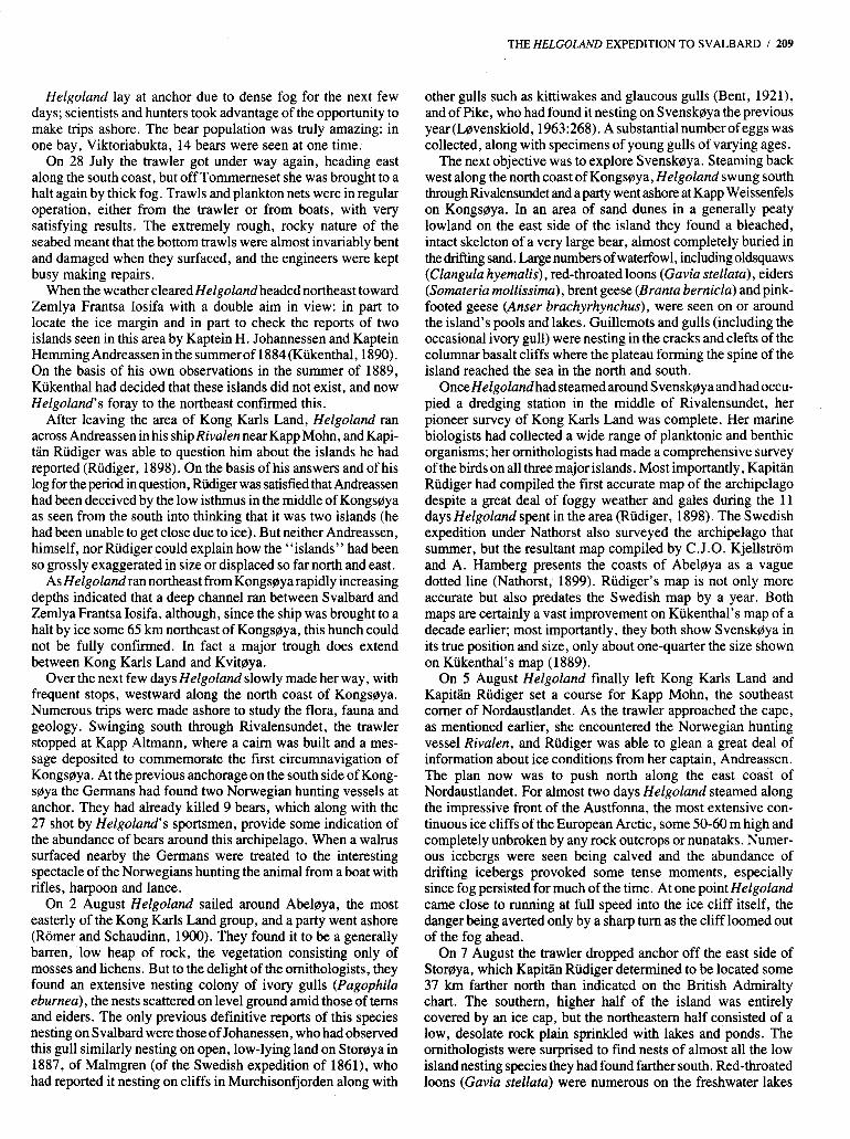
While some observations were made by various of these earlier expeditions in the area of marine biology, it was a field of science that had largely been neglected. Hence Fritz Schaudinn (Fig. l) , Privat-Dozent (lectuier) at the Zoologischer Institut der Universitat Berlin, and Fritz lRomer (Fig. 2), Assistent (assis- tant) at the same establishqient, were invited by Lerner to organize a comprehensive prokram of marine biological research during a cruise around the archipelago. A third scientist invited to participate in the expedition was Herr Dr. Bruhl, Assistent at the Koniglicher Physiologische Institut zu Berlin, who would combine the duties of expedition doctor with collecting and research in the areas of animal physiology and bacteriology.
The two hunters invited to participate (apart from Theodor Lerner himself) were the Konigliche Forst-Assessoren Bruning and von Krosigk and the Grossherzoglich-Mecklenburgische Jagdjunker Herr von Stralendorf. The final two members of the party were the famous animal painter Richard Friese and the writer Reinhold Cronheim, each of whom was to interpret the arctic landscape in his own medium.
In command of the expedition vessel was Korvettenkapitiin a. D. Herman Rüdiger. Under his command were two mates, three
FIG I Dr. Fritz Schaudinn.
FIG 2 Dr. Fritz RBmer.
engineers, one stoker, four seamen, one specimen preparer, one Norwegian ice pilot and one Norwegian harpooner (Riidiger, 1898).
The vessel chartered for the expedition was a small steel fishing trawler, Helgoland, owned by the Oldenburgische Hochseefischerei Gesellschaft of Geestemunde. She was select- ed over a wooden whaling vessel of the type that had become
almost standard for polar expeditions, in that first of all there were no plans for wintering in the Arctic; secondly it was not anticipated that the vessel would be working in heavy arctic ice, although she was designed to tackle light ice, since this was a normal aspect of navigating the Elbe and Weser estuaries in winter. And thirdly, with her relatively small dimensions (a length of only 34 m and a draft of less than 5 m [Rudiger, 1898]), Helgoland was extremely maneuverable, a distinct advantage for the marine biological work that was to be such a major focus of the expedition, and for working in tricky, uncharted coastal waters and among ice.
The design of the trawler also offered several real advantages for marine biological work in that the techniques of this area of science and of deep-sea trawling are very similar. Her low freeboard made the handling of dredges, trawls and plankton nets relatively easy. And of course she already possessed a powerful steam winch. The only additional item that had to be acquired was a hemp-cored steel cable, 2500 m in length, for deep-sea trawling. The net locker in the ship’s bows was con- verted to a laboratory and equipped with tables, drawers and shelves (Romer and Schaudinn, 1900).
Helgoland sailed from Geestemunde in late May 1898. A severe North Sea gale submitted the stowage of equipment and cargo to a severe test and necessitated a stop of several days in Bergen while minor repairs were effected (Romer and Schaudinn, 1900). Next port of call was Tromsa, where ice pilot Soren Johannesen and harpooner Claus Thue came aboard. Here too the Crow’s nest was hoisted to the foremast, the whaleboats were stowed on deck and the bunkers were filled to capacity; a deckload of sacks of coal was also stowed.
Final preparations having been made, the expedition put to sea from Tromso on 8 June in magnificent sunshine. Before leaving Norway’s coastal waters, Helgoland made a stop at the whaling station on Rolfsaya in Troldfjorden. The scientists were present on the flensing plan as a 22 m female fin whale was processed and made an extensive collection of specimens for later analysis. The stomach contents were also subjected to careful scrutiny and were found to consist almost exclusively of red decapods, about 2-3 cm long. Whale steaks were served aboard Helgoland that night and were found to be quite appetiz- ing; however many expedition members lost their meal later the same night in the rough waters of the Barents Sea.
The seas were so rough that the trawler could steam only at half speed to prevent the deck cargo of coal from being swept overboard. Despite the rough conditions, however, regularplank- ton hauls were made. This task and the preserving of the plank- ton samples took great willpower and effort on the part of the seasick scientists.
The trawler approached Bjornoya through dense fog, theprox- imity of land being indicated by the successive appearance of fulmars, glaucous gulls, kittiwakes, razorbills, guillemots and little auks. On the morning of 12 June the fog cleared to reveal Bjornaya, bathed in sunshine. With a boat ahead sounding, Hel- goland eased in to within 800 m of shore and dropped anchor in the little southern harbour. A party rowed ashore and for a while amused themselves by firing shots, simply to watch the waves of seabirds taking to the air from the vast nesting colonies on the cliffs of Fuglefjellet (Romer and Schaudinn, 1900). The commonest species observed were black guillemots (Cepphus grylle), razor- bills ( A h tordu), Brunnich’s guillemots (Vria lomvia), little auks (Plautus alle), puffins (Fratercula arctica), kittiwakes (Rissa tridacryla) , glaucous gulls (Larus hyperboreus) and ful-
THE HELGOLAND EXPEDITION TO SVALBARD / 205
mars (Fulmarus glacialis). Although the expedition members did not report it, it should be noted that the Bear Island guillemot (Uria aalge hyperborea) is also very numerous on the cliffs of Bjornoya (Lovenskiold, 1963). Most of the first day was spent by zoologists in collecting eggs, embryos, downy young and adults of the various bird species from their preferred nesting habitats on the cliffs or on the adjacent gravel- or talus-covered slopes.
On the second day the scientists managed to find a landing spot at the mouth of a small stream valley that provided a route up to the interior. The zoologists investigated five of the numer- ous freshwater ponds in the interior. Apart from sounding and surveying, they also studied the fauna; they found it to be quite impoverished, the larger organisms being restricted to cope- pods, daphnids and mosquito larvae. The microscopic fauna bore a strong resemblance to that of ponds on mainland Europe, probably having been brought here by migrating waterfowl. Large flocks of gulls, mainly kittiwakes, were loafing and resting on the ponds. Purple sandpipers (Calidris maritima) were quite numerous but appeared to be feeding on the pond algae rather than on their normal insect diet. Some pairs of red- throated loons (Gavia stellata) were spotted on the ponds but were extremely wary. Several pairs of parasitic jaegers (Stercorarius parasiticus) were seen in courtship displays near the ponds.
On Fuglefjellet the zoologists found the den of an arctic fox and killed the female for their collection. Analysis of its stom- ach contents revealed that it had been feeding mainly on birds. Three other foxes were sighted and the tracks and fresh drop- pings of a polar bear were found. The scientists found the vegetation on Bjorncbya to be extremely meagre: the island con- sisted mainly of barren talus slopes and rock faces, with only isolated pockets of flowering plants, mosses and grasses attain- ing a relative degree of luxuriance only near the ponds.
After two days of hiking around the island, the scientists spent the third day in preserving and organizing the specimens they had collected and in investigating the fauna of the littoral zone. Rather strangely, Romer and Schaudinn (1900) make only an oblique reference to another scientific expedition visiting Bjamaya at exactly the same time: Antarctica, the vessel of the Swedish Arctic Expedition led by Professor A.G. Nathorst, was lying in the southern harbour alongside Helgoland from 13 to 20 June (Nathorst, 1899). Nathorst makes no mention of the Ger- man expedition.
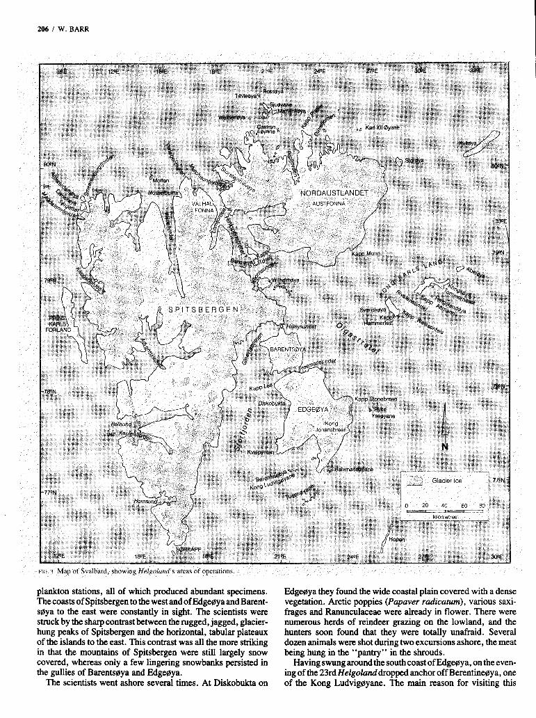
Helgoland put to sea again on 15 June and headed north. Abeam of the north cape of Bjamaya the biologists dredged for benthic organisms for the first time, and a vast haul kept them busy until late into the night. Next day Sarkapp (Fig. 3) hove into view on the port beam, and as Helgoland headed into Storfjorden the first small ice floes drifted past the ship (Rudiger, 1898).
Over the next week the trawler steamed to and fro through the continuous, but relatively light, ice of Storfjorden. On the 16th several bearded seals (Erignathus barbatus) and two polar bears were killed, and the scientists examined and measured them, taking innumerable samples. Several choice cuts of meat, des- tined for the galley, were hung in the shrouds. Helgoland’s fatthest north during this week was the mouth of the Ginevrabotnen, but this strait, like Freemansundet, the other strait leading through to Olgastretet, was blocked by solid ice, which Helgoland was incapable of tackling.
Fortunately the weather during this week was magnificent, with bright sunshine and steady but light northerly winds, which kept the ice reasonably loose yet did not raise a heavy sea. The scientists were able to occupy five dredging stations and six
206 I W. BARR
plankton stations, all of which produced abundant specimens. The coasts of Spitsbergen to the west and of Edgegya and Barent- sgya to the east were constantly in sight. The scientists were struck by the sharp contrast between the rugged, jagged, glacier- hung peaks of Spitsbergen and the horizontal, tabular plateaux of the islands to the east. This contrast was all the more striking in that the mountains of Spitsbergen were still largely snow covered, whereas only a few lingering snowbanks persisted in the gullies of Barentsgya and Edgegya.
The scientists went ashore several times. At Diskobukta on
Edgeaya they found the wide coastal plain covered with a dense vegetation. Arctic poppies (Papaver rudicatum), various saxi- frages and Ranunculaceae were already in flower. There were numerous herds of reindeer grazing on the lowland, and the hunters soon found that they were totally unafraid. Several dozen animals were shot during two excursions ashore, the meat being hung in the “pantry” in the shrouds.
Having swung around the south coast of Edgegya, on the even- ing of the 23rdHelgolunddropped anchor off Berentinegya, one of the Kong Ludviggyane. The main reason for visiting this
island was to inspect the cairn on its summit, erected by Profes- sor Wilhelm Kukenthal in 1889. While engaged in a very similar expedition to that aboard Helgoland, Kukenthal’s ship Berentine ran aground and was crushed by ice on this island on 11 June 1889 (Kukenthal, 1890). Fortunately he and his com- panions were rescued by the Tromso sealing vessel CecilieMaline only four days later. Kiikenthal was able to come to an arrange- ment with the captain of the latter vessel allowing him to continue his scientific investigations in Svalbard waters for the remainder of the season.
During the next few days Helgoland’s scientists investigated the abundant bird life of the Tusenoyane, an archipelago of low-lying marshy islands off the south coast of Edgeoya. They supported enormous breeding populations of king and common eiders (Somateria spectabilis and S . mollissima), brent geese (Branta bernicla), sandpipers (Calidris maritima), arctic terns (Sternaparadisea) and grey phalaropes (Phalaropusfulicarius). The scientists were intrigued to watch a polar bear raiding eider nests on Berentineoya; its stomach was later found to contain a vast quantity of eggs. The scientists also took careful notes on the phalaropes, determining that only the males incubated the eggs while the females loafed in flocks on the ice floes or on freshwater ponds. Numerous eggs and embryos of all the nest- ing species were collected.
From here the plan was to proceed northeast to investigate Kong Karls Land, but the trawler encountered heavy ice off. Halvmheoya; the skipper of a walrus-hunting vessel, Anna, with whom the Germans spoke here, reported that he had been dodging off this ice edge for three weeks in the hope of getting farther north and east (Romer and Schaudinn, 1900). Kapitiin Rudiger now took his vessel southeast in the hope of getting around the barrier on the south, but to no avail; the ice margin stretched persistently southeast toward Hopen. The scientists now decided to postpone their visit to Kong Karls Land and to head instead for the west coast of Spitsbergen. Hence Helgoland now headed west across the mouth of Storfjorden, although masses of ice forced her to swing quite far south. The voyage around Sorkapp and north up the coast to Bellsund was plagued by storms and fog; Kapitiin Riidiger was very grateful for the presence of numerous stranded bergs and floes off the tip of Sorkapp, in that they actedas very useful beacons marking shoals that could have been extremely hazardous given the poor visibil- ity (Rudiger, 1898).
On 27 June Helgoland ran before a gale into the shelter of Van Keulenfjorden, off Bellsund. Here again the ornithologists made a fruitful trip ashore; they found their first pink-footed geese (Anser brachyrhynchus) nesting on boggy, grassy meadows, while the coastal cliffs swarmed with gulls, guillemots and puffins. The marine biologists had barely finished hauling a dredge in a depth of 150 m in the entrance to Bellsund when a fierce southwest gale struck. Seas continually swept the deck and even filled the Crow’s nest on the foremast with water. Boxes, bottles, jars and instruments broke loose in the labora- tory and were hurled to and fro, producing utter chaos. Everyone was extremely relieved when, having swung around the north- ern tip of Prins Karls Forland, Helgoland again ran for shelter,this time in Kongsfjorden.
This involuntary stop was a welcome one for the marine biologists, giving them a chance to repair their nets and trawls, which had suffered some damage on the rocky bottoms. Once the rain had stopped a party also made a trip by boat to the head of the fiord. This entailed an exciting journey through a steady
THE HELGOLAND EXPEDITION TO SVALBARD I 207
stream of rolling, tossing bergy-bits calved from the glacier snouts around the fiord; these latter also caused some anxiety to the ship’s officers, concerned for the safety of the anchored vessel (Rudiger, 1898). At the head of the fiord the boat party visited some small bird islands, where they discovered the same range of nesting species as on Tusenoyane.
Since the storm had abated by next morning (30 June), Helgoland put to sea again. In the entrance to Kongsfjorden the zoologists were keen to investigate a “hole” marked on the chart as having a depth of 250 fathoms. After a prolonged search a round, narrow, steep-sided hole 395 m deep was found, whereas the general depth in the mouth of the fiord was 60-80 m. Very few organ- isms were found, mainly just dead worm tubes and the occasion- al echinoderm. Particularly striking was the stench of sulphuretted hydrogen given off by the mud. This is an interesting early reference to anoxic bottom water, which occurs relatively com- monly in the fiords of Norway and the Canadian Arctic.
Passing the mouth of Magdalenefjorden, Helgoland next ran through Sorgattet into Smeerenburgfjorden. At its southwest end, just off a glacier that was calving continuously and spectac- ularly, a rich haul of benthic and planktonic organisms was collected. The dredge brought up a very colourful selection of brown and red algae (Romer and Schaudinn, 1900). That eve- ning (30 June) several hours were devoted to a visit to the station at Virgohamna on Danskaya, from where AndrCe began his ill-fated balloon trip to the Pole in 1897 (Svenska Sallskspet for Antropologi och Geografi, 1930). The skeleton of AndrCe’s balloon house lay in a tangle of debris on the beach.
Heading east along the north coast of Spitsbergen in com- pletely ice-free seas, Helgoland next called at the low atoll-like island of Moffen. A boat party went ashore, running into the central lagoon via the entrance on the northwest side. There were large numbers of eider nests, but most had recently been robbed of their eggs by Norwegian hunters; the ducks were loafing in large numbers on the beach. Large quantities of driftwood and several Norwegian glass net floats were assumed to have been carried here from the Norwegian coast by the North Atlantic Drift.
Continuing northeastward, still in open water, Helgoland ran into heavy ice and dense fog almost simultaneously as she was approaching the high, rocky tower of Rossoya and the lower Tavleoya. While the trawler lay off the edge of the looser ice, a boat worked its way through the ice to a landing site on Rossoya. A study of the avifauna revealed that the following species were nesting: Plectrophenar nivalis, Cepphus grylle, Uria lomvia, Plautus alle, Larus hyperboreus, Rissa tridactyla, Pagophila eburnea, Fulmarus glacialis, Somateria mollissima, Branta bernicla and Clangula hyemalis. The landing party was forced to beat a hasty retreat when it was seen that the ice conditions were steadily deteriorating; the dense fog plus the fact that Kapitiin Riidiger had to retreat some distance westward due to the ice made the return boat trip an exciting one.
Pushing northward into the ice, Helgoland reached a latitude of 80”48’N, but the ice then forced her to turn back. Trawling in a depth of 85 m produced a rich haul of echinoderms. Despite the abundance of ice, the water temperature was still above 0°C and the air temperature between 3” and 4°C.
That evening, having extricated herself from the fog and the ice, Helgoland headed south (Rudiger, 1898) and dropped anchor for a few hours off Waldengya. Next Kapitiin Rudiger took his ship southeast to the mouth of Rijpfjorden, where he moored to the ice edge. It was a magnificent, SUMY day (Sunday, 3 July),
208 I W. BARR
and at noon the temperature'in the shade climbed to 11.5"C, one of the highest recorded on the entire trip. The scientists made a productive plankton haul and also amused themselves with a boat trip during which they gazed down through the calm, transparent water, watching the life on the seabed. In the interim members of the crew tried frying bacon out on the ice to attract bears; the strategy was successful and a mother bear and her two cubs were shot close alongside the ship. Some of the scientists also went seal hunting, and the results of their hunt provided the artist, Friese, with a subject for a painting.
Getting under way again, Helgoland rounded Kapp Platen but ran into heavy ice a little farther east. Duvefjorden and the Karl XI1 0yane were quite inaccessible. A dredge was hauled and then the ship headed back west. Off the Castrenoyane hunting vessels had reported that Hinlopenstretet was completely ice free. It was decided to take advantage of this and run through the strait to the south side of the archipelago to resume explorations there.
Steaming at full speed around Storsteinhalvoya and past the mouth of Murchisonfjorden, Helgoland ran south through Hinlopenstret, finding it indeed free of ice. Off Kapp Torell, however, a barrier of close ice blocked the southern exit from the strait, a white expanse of ice extending right to the horizon. While the trawler lay at anchor in the lee of Behmoya the scientists made boat trips along the edge of the ice, collecting plankton. Some walrus were sighted and also a school of over 100 beluga. Quite heavy masses of ice, including both floes and icebergs, were drifting to and fro in the strait, endangering the ship where she lay off Behmaya; hence it was prudently decided to retreat north through Hinlopenstretet. A strong northerly gale, funnelling down the strait, was raising a lively sea, and all on board were quite relieved when Kapitan Rudiger decided to seek shelter in the lee of Foottaya in Lomfjorden. A dredge haul here produced rather discouraging results; the zoologists con- cluded that the impoverished nature of the fauna was due to the constant rain of silt and sand from glaciers and icebergs.
Putting to sea again, Helgoland ran north past the spectacular ice cliffs of Valhalfonna. To everyone's surprise, since the British chart showed only 22 fathoms, a sounding here produced a depth of 450 m; the depths increased even more toward the north, reaching 480 m off Verlegenhuken. Two dredge hauls from this deep trench produced an abundant fauna, with echino- derms predominating. The plankton hauls indicated a flow of cold, arctic water at depth, moving south through Hinlopenstretet (identified on the basis of its Bbundant diatoms), while the upper layers consisted of the waml waters of the North Atlantic Drift (Romer and Schaudinn, 1900).
A brief stop was made in Wijdefjorden, where the larder was replenished by a successful reindeer hunt, and another at Mosselbukta, where a party visited the house where A.E. Nordenskiold and his party had wintered during their attempt at the Pole in 1872-73 (Leslie, 1879; Kjellman, 1875).
Helgoland was now bound for Adventfjorden and a rendez- vous with the steamer Augusfe-Vikforia of the Hamburg-Amerika Paketfahrt-Aktiengesellschaft. Running through Smeerenburg- fjorden and Sorgattet once again, she was delayed for a whole day off Amsterdamoya by a severe westerly gale and hence did not reach Adventfjorden until the evening of 10 July. The members of the Helgoland expedition were amazed at the amount of activity at Adventfjorden. Apart from Augusre-Viktoriu, from which, by pre-arrangement, Helgoland received both coal and provisions, SMS Olga, carrying an expedition dispatched by the Deutscher Seefisch-Verein (German Sea Fisheries Union), was
also lying at anchor, along with an English yacht and several small Norwegian hunting and tourist vessels. On shore there was a hotel, operated by a Norwegian company and complete with a post office and a newspaper office, which produced a trilingual newspaper, the most northerly in the world. Scien- tists, officers and crew members enjoyed the chance to interact with strangers for a change, while the zoologists cooperated with Dr. Hartlaub, zoologist with the fisheries expedition, in doing some collecting (Romer and Schaudinn, 1900).
On 15 July Helgoland weighed anchor and headed south, bound for Kong Karls Land. But first a southeasterly gale forced her to run for shelter into Hornsund. Even here, however, she was menaced by icebergs driving before the violent squalls blowing down from the mountains. This three-day sojourn in Hornsund allowed extensive plankton collections to be made; the zoologists also found that the North Atlantic Drift had carried a large variety of pelagic organisms into this cul-de-sac, especially medusae.
The continuation of the voyage around Sorkapp and across the entrance of Storfjorden was made in heavy seas, while off the Tusencbyane the situation was complicated by dense fog. Fortu- nately, however, there was no sign of any ice. Coasting north along the east coast of Edgeoya, the scientists only fleetingly glimpsed the impressive ice cliffs of Kong Johansbreen through the fog. Dropping the Ryke Yseoyane astern, Kapitan Rudiger next set a course for Kapp Hammerfest, the southern tip of Svenskoya.
Finally on the morning of 23 July a small island was spotted, with a much larger land mass lying beyond it to the north. A party went ashore on the islet (named Helgoland Insel) to clarify the situation. Confusion arose from the fact that Helgoland had sailed right over the southern part of Svenskoya as it had been plotted on the map by Kukenthal on the basis of his visit to the area in 1889 (Kukenthal, 1890). The latter had been close to the southeast coast of Svenskoya on four occasions between 24 June and 12 August 1889, sometimes within 3-4 km of land, but nonetheless had made a serious mistake in plotting its position and size. As it appears on his map, it is almost four times larger and twice as long as it is in reality.
The Helgoland scientists quickly realized that the island on which they had landed lay in a large bay on the south side of a much larger island (which they named.Jena Insel), now known as Kongsoya. Leaving Helgolandoya, the trawler now headed north for the south coast of Kongsoya but was severely hampered by drift ice, packed together by a strong east wind. From the ship it was clear that Kongsoya consisted of high eastern and western sections joined by a central lowland, which might easily be mistaken for a strait at a distance (Rudiger, 1898).
In the early hours of 24 July a landing party went ashore to investigate this lowland; the scientists were met by a female bear with two cubs. The mother and one cub were shot and the other cub captured. Hiking north across the lowland, which they found to be very boggy and strewn with lakes and ponds, the scientists found sandpiper nests with fully fledged young. Swing- ing west, they climbed to the top of the western basaltic plateau, from which they got a fine view of the rest of the island. They also spotted some more bears near the coast and shot three more on the way back to the boat; the dead animals were towed out to the ship. One of the scientists received avery bad scare when, having wounded a female bear, he broke through the ice and lost his rifle. When the bear charged he had only a knife with which to protect himself and received a solid cuff before he managed to escape.
Helgoland lay at anchor due to dense fog for the next few days; scientists and hunters took advantage of the opportunity to make trips ashore. The bear population was truly amazing: in one bay, Viktoriabukta, 14 bears were seen at one time.
On 28 July the trawler got under way again, heading east along the south coast, but off Tommerneset she was brought to a halt again by thick fog. Trawls and plankton nets were in regular operation, either from the trawler or from boats, with very satisfying results. The extremely rough, rocky nature of the seabed meant that the bottom trawls were almost invariably bent and damaged when they surfaced, and the engineers were kept busy making repairs.
When the weather cleared Helgoland headed northeast toward Zemlya Frantsa Iosifa with a double aim in view: in part to locate the ice margin and in part to check the reports of two islands seen in this area by Kaptein H. Johannessen and Kaptein Hemming Andreassen in the summer of 1884 (Kukenthal ,1890). On the basis of his own observations in the summer of 1889, Kukenthal had decided that these islands did not exist, and now Helgoland’s foray to the northeast confirmed this.
After leaving the area of Kong Karls Land, Helgoland ran across Andreassen in his ship Rivalen near Kapp Mohn, and Kapi- tan Rudiger was able to question him about the islands he had reported (Rudiger, 1898). On the basis of his answers and of his log for the period in question, Rudiger was satisfied that Andreassen had been deceived by the low isthmus in the middle of Kongsaya as seen from the south into thinking that it was two islands (he had been unable to get close due to ice). But neither Andreassen, himself, nor Rudiger could explain how the “islands” had been so grossly exaggerated in size or displaced so far north and east.
As Helgoland ran northeast from Kongsaya rapidly increasing depths indicated that a deep channel ran between Svalbard and Zemlya Frantsa Iosifa, although, since the ship was brought to a halt by ice some 65 km northeast of Kongsaya, this hunch could not be fully confirmed. In fact a major trough does extend between Kong Karls Land and Kvitaya.
Over the next few days Helgolund slowly made her way, with frequent stops, westward along the north coast of Kongsaya. Numerous trips were made ashore to study the flora, fauna and geology. Swinging south through Rivalensundet, the trawler stopped at Kapp Altmann, where a cairn was built and a mes- sage deposited to commemorate the first circumnavigation of Kongsaya. At the previous anchorage on the south side of Kong- saya the Germans had found two Norwegian hunting vessels at anchor. They had already killed 9 bears, which along with the 27 shot by Helgoland’s sportsmen, provide some indication of the abundance of bears around this archipelago. When a walrus surfaced nearby the Germans were treated to the interesting spectacle of the Norwegians hunting the animal from a boat with rifles, harpoon and lance.
On 2 August Helgoland sailed around Abelaya, the most easterly of the Kong Karls Land group, and a party went ashore (Romer and Schaudinn, 1900). They found it to be a generally barren, low heap of rock, the vegetation consisting only of mosses and lichens. But to the delight of the ornithologists, they found an extensive nesting colony of ivory gulls (Pagophila eburneu), the nests scattered on level ground amid those of terns and eiders. The only previous definitive reports of this species nesting on Svalbard were those of Johanessen, who had observed this gull similarly nesting on open, low-lying land on Storaya in 1887, of Malmgren (of the Swedish expedition of 1861), who had reported it nesting on cliffs in Murchisonfjorden along with
THE HELGOLAND EXPEDITION TO SVALBARD I 209
other gulls such as kittiwakes and glaucous gulls (Bent, 1921), and of Pike, who had found it nesting on Svenskaya the previous year(L@venskiold, 1963:268). A substantial number of eggs was collected, along with specimens of young gulls of varying ages.
The next objective was to explore Svenskaya. Steaming back west along the north coast of Kongsaya, Helgoland swung south through Rivalensundet and a party went ashore at Kapp Weissenfels on Kongsaya. In an area of sand dunes in a generally peaty lowland on the east side of the island they found a bleached, intact skeleton of a very large bear, almost completely buried in the drifting sand. Large numbers of waterfowl, including oldsquaws (Clangula hyemalis), red-throated loons (Cavia stellata), eiders (Somateria mollissima), brent geese (Brantu bernicla) and pink- footed geese (Anser brachyrhynchus), were seen on or around the island’s pools and lakes. Guillemots and gulls (including the occasional ivory gull) were nesting in the cracks and clefts of the columnar basalt cliffs where the plateau forming the spine of the island reached the sea in the north and south.
Once Helgoland had steamed around Svenskaya and had occu- pied a dredging station in the middle of Rivalensundet, her pioneer survey of Kong Karls Land was complete. Her marine biologists had collected a wide range of planktonic and benthic organisms; her ornithologists had made a comprehensive survey of the birds on all three major islands. Most importantly, Kapitan Rudiger had compiled the first accurate map of the archipelago despite a great deal of foggy weather and gales during the 11 days Helgoland spent in the area (Rudiger, 1898). The Swedish expedition under Nathorst also surveyed the archipelago that summer, but the resultant map compiled by C.J.O. Kjellstrom and A. Hamberg presents the coasts of Abelaya as a vague dotted line (Nathorst, 1899). Rudiger’s map is not only more accurate but also predates the Swedish map by a year. Both maps are certainly a vast improvement on Kukenthal’s map of a decade earlier; most importantly, they both show Svenskaya in its true position and size, only about one-quarter the size shown on Kukenthal’s map (1 889).
On 5 August Helgoland finally left Kong Karls Land and Kapitiin Rudiger set a course for Kapp Mohn, the southeast comer of Nordaustlandet. As the trawler approached the cape, as mentioned earlier, she encountered the Norwegian hunting vessel Rivalen, and Rudiger was able to glean a great deal of information about ice conditions from her captain, Andreassen. The plan now was to push north along the east coast of Nordaustlandet. For almost two days Helgoland steamed along the impressive front of the Austfonna, the most extensive con- tinuous ice cliffs of the European Arctic, some 50-60 m high and completely unbroken by any rock outcrops or nunataks. Numer- ous icebergs were seen being calved and the abundance of drifting icebergs provoked some tense moments, especially since fog persisted for much of the time. At one point Helgoland came close to running at full speed into the ice cliff itself, the danger being averted only by a sharp turn as the cliff loomed out of the fog ahead.
On 7 August the trawler dropped anchor off the east side of StorOya, which Kapitan Rudiger determined to be located some 37 km farther north than indicated on the British Admiralty chart. The southern, higher half of the island was entirely covered by an ice cap, but the northeastern half consisted of a low, desolate rock plain sprinkled with lakes and ponds. The ornithologists were surprised to find nests of almost all the low island nesting species they had found farther south. Red-throated loons (Cavia stellata) were numerous on the freshwater lakes

210 I W. BARR
and pools, many of them accompanied by young. Vast crowds of arctic terns (Sternaparadisaea) were still nesting on the beach ridges. Most exciting of all was the sighting of numbers of Sabine's gulls (Xema sabinei) mingling with the terns. Romer and Schaudinn (1900:30) described it as "a small, elegant gull with a blue-grey back, black wingtips and black head, which had completely adopted the behaviour and manner of flying of the terns. " The weather was very foggy and as a result the ornithologists were unable to locate any nests of the Sabine's gull, but two females that were shot had eggs in their oviducts. This was the first indication that the bird probably nested on Svalbard (Lavenskiold, 1963:256).
With the approval of the scientists, and on the basis of Andreassen's report that open water extended from the west to just north of the Karl XI1 0yane, Kapitan Rudiger decided to attempt the circumnavigation of Nordaustlandet. It was quite a risky undertaking since if Helgolund, whose iron hull was not heavily ice strengthened, were subjected to any significant ice pressures she would inevitably be crushed. Having weighed the odds at 10 p.m. on 7 August, Rudiger pointed the ship's bows north, steaming through broken ice. There was generally a fair number of leads and polynyas but at times Helgoland had to ram her way through ice barriers. The constant groaning, shrieking and creaking of the floes against the iron hull made sleep impossible, and most of the scientists spent the night on deck, enjoying a unique experience. Unfortunately dense fog greatly complicated Kapith Rudiger's task for most of the passage through this zone of pack ice. Suddenly at 9 a.m. a slight lifting of the fog revealed that a large stretch of water lay beyond a fairly massive ice barrier, while a swell on the water indicated that this was the start of the open sea (Rudiger, 1898). Helgoland cautiously pushed her way through the ice barrier, and when two Tromsd hunting vessels loomed out of the fog shortly afterward they were able to confirm that there was no further ice to the west. Shortly afterward the fog dispersed completely, revealing the Karl XI1 0yane to the southwest.
Helgoland had thus completed the first anticlockwise circum- navigation of Nordaustlandet. The feat had previously been achieved from west to east by Kaptein Carlsen in his brig Jan Mayen in 1863, but in following that route he was able to take full advantage of prevailing winds, currents and ice drift. And to give the Swedish expedition of 1898 its due, Dr. Nathorst's expedition ship Antarctic also completed a counterclockwise circumnavigation of Svalbard that summer and indeed called at the Karl XI1 0yane on 20 August, less than two weeks after Helgolund steamed by them (Nathorst, 1899).
On the evening of the 8th Helgoland crossed the 8 1st parallel, and here to celebrate the occasion a dredging station was occu- pied in a depth of 195 m. The aim now was to push north to locate the great depths reported by Nansen during Frum's drift across this area in 1896 - i.e., to penetrate beyond the edge of the continental shelf and into the deep waters of the Central Arctic Basin. But in this Helgolund was foiled by deteriorating weath- er; at 81'6'N she turned and, with a gale steadily increasing, ran back south and and took shelter in a small bay on the north side of MartensBya, one of the Sjueyane. During the two days which the ship spent here a party went ashore and managed to shoot a reindeer, undoubtedly one of the most northerly of its species in the world (Romer and Schaudinn, 1900; Rudiger, 1898).
By 10 August the storm had abated and Helgolund put to sea again, steering due north; she crossed the 81st parallel again, still in open water, and occupied a dredging station at 81"N,
21"E in a depth of 140 m. The bottom fauna was typical of all the other stations occupied thus far to the north of Svalbard. There- after, however, the depths steadily increased to 650 m and then 1000 m. The edge of the pack ice was reached at 81'32'N (Romer and Schaudinn, 1900; Rudiger, 1898), but no bottom could be reached with 1130 m of sounding wire (which was all that remained as a result of repeated breakages). Clearly Helgoland was now over the continental slope, and this was reflected in the nature of the bottom fauna, most of the species being new to the German scientists. The type species of this deep-sea fauna were sponges, especially Tetraxonier and Hexactinellidae. The bot- tom was covered with a dense mat of sponge needles, colonized by giant foraminifera with thick, fine ooze filling the gaps in the mesh. There was a similar marked change in the plankton collected: high arctic diatoms and such high arctic species as the siphonophores Diphyes arctica and Krohnia hamata predomi- nated here. By now there was no trace of North Atlantic Drift water; at the most northerly station (81"32'N, 20"53'E) on 11 August the surface water temperature was -0.8"C, the air temperature -1.2"C and the specific gravity of the water 1.0275.
Over a period of two days Helgoland cruised westward along the edge of the pack from 2 1'21 'E to 18"50'E, during which time four dredge stations and four plankton stations were occupied, three of the four in each case being in depths of lo00 mor greater. To the north stretched an unbroken expanse of multi-year pack ice. By now, however, the trawler's coal reserves were dwindl- ing rapidly, and on 12 August she was forced to turn south. The scientists still wanted to make further investigations in Olga- stretetbetweenEdgeayaandKongKarlsLand,andsinceHinlopen- stretet was ice free this was the route Kapitan Rudiger selected.
For a little variety it was decided to run through Bjarnsundet between Wilhelmaya and the mainland of Spitsbergen, since, as far as was known, no vessel had done so previously (Romer and Schaudinn, 1900). As she ran through the straitHelgoland expe- rienced in rapid succession some of the finest and some of the foulest weather of the entire cruise. The day started with superb warm sunshine and magnificent views of the mountains and glaciers on either side of the strait, but as the trawler emerged from the south end of Bjarnsundet a thick blizzard with an icy wind obscured all distant views. A dredging station was occu- pied in the strait and the scientists were coated with ice as they wrestled with the dredge and began organizing and classifying the abundant haul the dredge had brought up; indeed it was one of the largest and most varied hauls obtained anywhere in Svalbard waters. As a contribution to the charting of Hinlopen- stretet, Kapitan Rudiger was able to determine that Roonaya, marked on the earlier charts, did not exist (Rudiger, 1898).
As the trawler emerged from Bjarnsundet through the tangle of islands and skerries and a liberal scattering of icebergs, conditions were far from pleasant; after the blizzard had blown itself out it was followed by a dense fog that reduced visibility almost to zero. With a northeast gale rising, Kapitb Rudiger ran south to the entrance to Heleysundet (between Barentseya and Spitsbergen) and took shelter in the lee of a small island at its eastern entrance, which he named Kiikenthal Insel. The ornithologists made a survey of the bird species nesting on the basalt cliffs of the east end of the island. Intrigued by Heleysundet's reputation for fierce tidal currents, Romer, Schaudinn and two seamen rowed through the north arm of the strait in a small boat. The boat was thrown around in lively fashion by eddies and vortices, but they were certainly not as alarming as had been reported. A hunting party went ashore on the north shore (Spitsbergen) and killed a number of reindeer.
On the morning of 17 August Helgoland next ran into the eastern entrance of Freemansundet, where the marine biologists again wanted to sample the bottom fauna and the plankton. A dredge station was occupied off Kapp Lee in the middle of the strait in a depth of 38 m and then Helgoland headed back east, with the intention of running south past the Ryke Iseayane. A belt of heavy pack ice north of that island group caused some concern and almost forced Kapith Rüdiger to run through Freemansundet, but Helgolandmanaged to push her way through the ice; new ice was already starting to form between the floes. A landing was made on the Ryke Isedyane, where an ornithologi- cal survey was carried out; then Helgoland pressed on south. At midnight on 19 August as the trawler passed Kapp Stonebreen, the sun just touched the northern horizon for a moment.
After running close past the east side of Hopen, the trawler’s next stop was the Spitzbergen Bank, renowned for its good fishing. Dredging in a depth of 65 m, the marine biologists brought up a vast haul of sea cucumbers (Cucumariafrondosa), with a few large cod among them. Since the barometer was dropping alarmingly and bad weather was looming to the south, Helgoland quickly got under way again; dense fog soon envel- oped the ship as the wind strengthened and the seas rose.
On the morning of 22 August the Norwegian coast came into sight, just east of Nordkapp. Wind and current had set the ship 120 km to the east; as a result she was 10 hours late in reaching Tromsa.
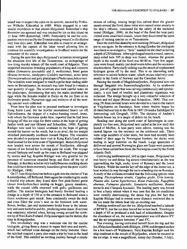
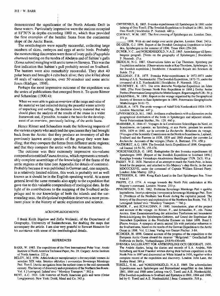
But even this was not the end of the expedition. A second cruise in the Barents Sea and along the coasts of Novaya Zemlya had been planned from the start, but since the Svalbard cruise had been considerably extended in order to take advantage of the remarkably favourable ice conditions, it was now necessary for the second cruise to be considerably curtailed. Helgoland put to sea again from Tromsd on 2 September (Romer and Schaudinn, 1900). The weather was extremely stormy, with very heavy seas, and the scientists quickly realized that dredging and plank- ton sampling in the open waters of the Barents Sea would be out of the question. Instead the expedition members contented them- selves with a coastwise cruise to Arkhangel’sk (Fig. 4) with stops at a number of points along the way.
The first of these was at Yeredika (Port Vladimir), a very sheltered little fishing harbourjust west of the mouth of Kol’skiy
FIG. 4. Map of northern Scandinavia and the White Sea, showing area of operation of Helgoland‘s second cruise in 1898.
THE HELGOLAND EXPEDITION TO SVALBARD I 211
Zaliv. The scientists dredged and made plankton hauls in shel- tered bays and straits in the vicinity of an abandoned whaling station. They found an extremely varied nearshore bottom fauna but an almost total absence of plankton. This paucity of plank- ton was observed along the entire Murman coast and the scientists linked the non-appearance of the usual herring shoals to this lack of plankton.
The next stop was at the new Russian naval port of Yekaterin- skaya Gavan’ (now Polyarnoye) on a side inlet off Kol’skiy Zaliv. The decision to establish the port had been taken only the previous summer, and the German scientists were intrigued to observe the phenomenon of an “instant” town of prefabricated houses and buildings under construction. The bulk of the popu- lation had still not arrived and the erection of the houses had outstripped the progress of street construction. Of particular interesttothemarinebiologists wasProfessorN.M. Knipovich’s newly established scientific station on which the Murmanskaya nauchno-promyslovaya ekspeditsiya (Murman scientific-com- mercial expedition) was based (Pinkhenson, 1962).
To their great delight, Romer and Schaudinn and their col- leagues discovered that the deputy director of the new station was the zoologist Dr. L.L. Breitfuss, who had trained at the Berliner Zoologische Institut. He gave them a warm welcome and acted as their guide on their local collecting trips.
Accompanied by Breitfuss, the German scientists next made a two-day visit to the relict Mogil’noye Ozero on Ostrov Kildin. The lake has clearly been cut off from the sea due to glacio- isostatic uplift, and the German scientists wanted to investigate the ecology of the lake. Using one of Helgoland’s heavy whale- boats plus a boat borrowed from a local farmedfisherman, the scientists surveyed the lake and carried out detailed measure- ments of salinity and temperature as well as biological investi- gations. Surface layers to a depth of 5 m were almost fresh but the salinity of the bottom layers was almost precisely that of sea water (c. 35%0). An abundant freshwater fauna was found in the surface layer but the saline bottom layer contained only an impoverished fauna.
Having taken Dr. Breitfuss back to Yekaterinskaya Gavan’, Helgoland next ran back east to Arkhangel’sk. After encounter- ing some of the roughest seas of the entire cruise in the shallow waters of the White Sea, the scientists were glad to spend a pleasant, relaxed stay at Arkhangel’sk, where they were the guests of the German pastor Herr. F. Bock. On her homeward voyage Helgoland stopped to make several dredge hauls in superb sunshine in the White Sea, then returned to Germany with brief stops at Vadsa, Hammerfest and Tromsa.
The achievements of this relatively short expedition are enor- mously impressive. Taking advantage of relatively good ice conditions, but at the same time hampered by persistent fogs and some severe storms, Kapith Rüdiger had taken his little vessel on a comprehensive tour of the Svalbard archipelago. In so doing he had achieved the first counterclockwise cifcumnaviga- tion of Nordaustlandet. In terms of true exploration he had produced the first accurate map of Kong Karls Land, correcting in particular the previous distorted representation of Svenskaya on earlier charts, and depicting Abeldya for the first time. Farther north, on the basis of his surveys the position of Storaya was moved north by some 37 km.
With regard to marine biology, the expedition scientists had occupied 51 dredging stations and 82 plankton stations in a dense network around the entire archipelago. The result was a vast range of specimens of arctic plankton and benthic fauna that
212 I W. BARR
demonstrated the significance of the North Atlantic Drift in these waters. Particularly impressive were the stations occupied at 81’30’N in depths exceeding IO00 m, which thus provided the first examples of the benthic fauna from the continental slope of the Arctic Basin.
The ornithologists were equally successful, collecting large numbers of skins, embryos and eggs of arctic birds. Probably the most exciting discoveries were those of ivory gulls (Pagophila eburnea) nesting on the tundra of Abelaya and of Sabine’s gulls (Xema sabini) mingling with arctic terns on Storaya. This was the first indication that Sabine’s gull probably nested on Svalbard. The hunters were also remarkably successful. They shot 40 polar bears and brought 4 cubs back alive; they also killed about 48 seals of various species, over 50 reindeer and some arctic foxes (Rudiger, 1898).
Perhaps the most impressive outcome of the expedition was the series of publications that emerged from it. To quote Romer and Schaudinn (19OO:4):
When we were able to gain an overview of the range and value of the material we had collected during the peaceful winter activity of unpacking and sorting, the decision slowly matured that we should place the analysis of the results of the cruise in a wider framework and, if possible, to make it the basis for the develop- ment of an overview, previously lacking, of the arctic fauna.
Hence Romer and Schaudinn made the following requests of the various experts who analyzed the specimens they had brought back from the Arctic: that they produce an inventory of all the previously known arctic species of the group they were han- dling; that they compare the forms from different arctic regions; and that they compare the arctic with the Antarctic forms.
The outcome was their extremely impressive six-volume compendium entitled Fauna Arcrica, which represents a remark- ably complete assemblage of the knowledge of the fauna of the arctic regions at the time (see Appendix for details of contents). Probably because it was published in German and, one suspects, in a relatively limited edition, this work is probably not as well known as it should be in the English-speaking world. At a more general level the same remarks also apply to the expedition that gave rise to this valuable compendium of zoological data. In the light of its contributions to the mapping of the Svalbard archi- pelago and to our knowledge of both the islands and the sur- rounding seas, the Helgoland expedition deserves a more prom- inent place in the history of arctic exploration and science.
ACKNOWLEDGEMENTS
I thank Keith Bigelow and Aofia Wolinski, of the Department of Geography, University of Sasljdtchewan, for drafting the maps that accompany the article. I am als4 very grateful to Stewart Houston for his assistance with some of the bmithological details.
RE+RENCES
BARR, W. 1985. The expeditions of the First International Polar Year. Arctic Institute of North America Technical Paper, No. 29. Calgary: Arctic Institute of North America. 222 p.
BELOV, M.I. 1956. Arkticheskoye moreplavaniye s drevneyshikh vremen do seredinu XIX veka. Istoriya otkrytiya i osvoyeniya Severnogo Morskogo Puti. Tom I. [Arctic navigation from the earliest times to the mid-nineteenth century. The history of discovery and exploitation of the Northern Sea Route. Vol. I.] Leningrad: Izdatel’stvo “Morskoy Transport.” 592 p.
BENT, A.C. 1921. Life histories of North American gulls and terns (Order Longipennes). New York Dodd, Mead and Co. 345 p.
CHYDENIUS, K. 1865. Svenska expeditionen till Spetsbergen &r 1861 under ledning af Otto Torell. [The Swedish Expedition to Svalbard in 1861, led by Otto Torell.] Stockholm: P. Norstedt. 480 p.
CONWAY, W.M. 1897. The first crossing of Spitzbergen etc. London: Dent. 371 p.
-. 1898. With ski and sledge over arctic glaciers. London: Dent. 240 p. DE GEER, G.J. 1896. Report of the Swedish Geological Expedition to Isfjor-
den, Spitsbergen in the summer,of 1896. Ymer 16(4):259-266. DUNER, N.C., andNORDENSKIOLD, N.A.E. 1865. AnteckningartillSpets-
bergens geografi. [Notes on the geography of Spitsbergen.] Stockholm: P. Norstedt. 15 p.
EKHOLM, N.G. 1887. Observations faites au Cap Thordsen, Spitzberg par I’expCdition sukdoise. [Observations made at KapThordsen, Spitsbergen, by the Swedish expedition.] Stockholm: 1’AcadCmie Royale des Sciences de Suhde. 55 p.
KJELLMAN, F.R. 1875. Svenska Polar-expeditionen ir 1872-1873 under ledning af A.E. Nordenskiold. [The Swedish Expedition, 1872-73, under the command of A.E. Nordenskiold.] Stockholm: P. Norstedt. 352 p.
KOLDEWEY, K. 1871. Die erste deutsche Nordpolar-Expedition im Jake 1868. [The First German North Pole Expedition in 1868.1 Gotha: Justus Perthes(PetermannsGeographischeMittheilungen, Erganzungsheft28). 56 p.
KUKENTHAL, W. 1890. Report on the voyage organized by the Geographical Society of Bremen to East Spitzbergen in 1889. Petermanns Geographische Mittheilungen 36:61-75.
LESLIE, A. 1879. The arctic voyages of Adolf Erik Nordenskiold 1858-1879. London: Macmillan. 447 p.
LBVENSKIOLD, H.L. 1963. Avifauna svalbardensis with a discussion on the geographical distribution of the birds in Spitsbergen and adjacent islands. Norsk Polarinstitutt Skrifter, No. 129. 460 p.
MARMIER, X. 1844-47. Voyages de la Commission Scientifique du Nord, en Scandinavie, en Laponie, au Spitzberg, et aux Feroe, pendant les annCes 1838, 1839 et 1840, sur la corvette La Recherche. Relations du voyage. [Voyages of the Scientific Commission on the North to Scandinavia, Lapland, Svalbard and the Faeroes in 1838, 1839 and 1840 aboard the corvette La Recherche. Accounts of the voyages.] Paris: A. Bertrand. 374,458 p.
NATHORST, A.G. 1899. The Swedish Arctic Expedition of 1898. Geographi- cal Journal 1,4:51-76, 155-176.
NORDENSKIOLD, G. 1892. Redogorelse for den Svenska expeditionen till Spetsbergen 1890. [Report of the Swedish Expedition to Svalbard 1890.1 Kungliga Svenska Vetenskaps-Akademiens Handlingar 17(Pt. 2)(3). 93 p.
PARRY, W.E. 1828. Narrative of an attempt to reach the North Pole, in boats fitted for the purpose, and attached to His Majesty’s ship Hecla, in the year MDCCCXXVII, under the command of Captain William Edward Parry. London: John Murray. 229 p.
PETTERSEN, K. 1889. Kong Karls Land in the East Spitzbergen Sea. Ymer
PHIPPS, C.J. 1774. A voyage towards the North Pole undertaken at His Majesty’s command. London: Nourse. 253 p.
PINKHENSON, D.M. 1962. Problema Severnogo Morskogo Puti v epokhu kapitalizma. Istoriya otkrytiya i osvoyeniya Severnogo Morskogo Puti. Tom 11. [Problems of the Northern Sea Route during the capitalist period. The history of the discovery and exploitation of the Northern Sea Route. Vol. 11.1 Leningrad: Izdatel’stvo “Morskoy Transport.” 766 p.
ROMER, F., and SCHAUDINN, F. 1900. Introduction, plan of the project and account of the voyage. In: Romer, F., and Schaudinn, F., eds. Fauna Arctica. Eine Zusammenstellung der arktischen Tierformen mit besonderer Beriicksichtigung des Spitzbergen-Gebietes, auf Grund der Ergebnisse der Deutschen Expedition in das Nordliche Eismeer im Jahre 1898. Band I. [Fauna Arctica. A synopsis of arctic animal life with particular reference to the Svalbard area, based on the results of the German Expedition to the Arctic Ocean in 1898. Vol. I.] Jena: Verlag von Gustav Fischer. 3-84.
RUDIGER, H. 1898. General account of the progress of the expedition to the European Arctic Ocean aboard the steamer “Helgoland.” Gesellschaft fur Erdkunde zu Berlin, Verhandlungen 25(8/9):430-448.
SVENSKA SALLSKAPET FOR ANTROPOLOGI OCH GEOGRAFI. 1930. The Andree diaries, being the diaries and records of S.A. AndrCe, Nils Strindberg and Knut Fraenkel written during their balloon expedition to the North Pole in 1897 and discovered on White Island in 1930, together with a complete record of the expedition and discovery. London: John Lane, the Bodley Head. 389 p.
TORELL, O.M., and NORDENSKIOLD, N.A.E. 1869. Die schwedischen Expeditionen nach Spitzbergen und Bkneiland ausgefiihrt in den Jahren 1861, 1864 und 1868 unter Leitung von 0. Torell und A.E. Nordenskiold. [The Swedish expeditions to Svalbard and Bjern0ya in 1861,1864 and 1868, led by 0. Torell and A.E. Nordenskiold.] Jena: Costenoble. 518 p.
9~64-67.
THE HELGOLAND EXPEDITION TO SVALBARD I 213
VOYAGE DE “LA MANCHE” A L’PLE JAN-MAYEN ET AU SPITZBERG KUKENTHAL, W. 1900. Die Wale. [The whales.] Vol. 1:179-234. (JUILLET-AOUT 1892). [Voyage of LaMnnche to Jan Mayen and Svalbard LINDER, F. 1932. Die Branchiopoden des arktischen Gebietes. [Branchiopoda (July-August 1892).] 1894. Paris: E. Leroux. 268 p. of the arctic region.] Vol. 6:182-204.
LINSTOW. 0. von. 1900. DieNematoden. lTheNematodes.lVol.1: 117-132. ~ ~ ~
APPENDIX. COMPLETE CONTENTS OF FA UNA ARCTICA LOHMAN,’H. 1900.DieAppendicularien. ‘[Appendicularia.j Vol. 1:363-378. LUDWIG, H. 1900. Arktische und subarktische Holothurien. [Arctic and sub-
ABRIKOSOV, G. 1933. Die Bryozoen. I1 Teil. Die Susswasserbryozoen des arktischen Gebietes. [Bryozoa, Part 2. The freshwater bryozoans of the arctic regions.] Vol. 6:383-388.
APSTEIN, C. 1910. Das Vorkommen von Salpem in den arktischen Gebieten. [The Occurrence of salpas in the arctic regions.] Vol. 55-12,
ARNDT, W. 1931. Die Susswasserschwhme des arktischen Gebietes. [The freshwater sponges of the arctic regions.] Vol. 6:33-40.
-. 193 1 . Die Copeognathen des arktischen Gebietes. [Copeognatha of the arctic region.] Vol. 659-66.
-and Grieg, J.A. 1933. Die Brachiopoden des arktischen Gebietes. [The brachiopods of the arctic region.] Vol. 6:477-488.
ATTEMS, C. 1903. Myriopoden. [Myriopoda.] Vol. 3:3-54. AUGENER, H. 1928. Die Polychaten von Spitzbergen. [The polychaetes of
BIDENKAP, 0. 1900. Die Bryozoen. I Teil. Die Bryozoen von Spitzbergen und Konig Karls Land. [Bryozoa, Part 1 . The bryozoa of Svalbard and Kong
BIRSTEIN, J. 1933. Die terrestrischen und Siisswasser-Isopoden der ark- tischen Gebietes. [Land and freshwater isopoda of the arctic region.] Vol.
BORG, F. 1933. Die Bryozoen. 111 Teil. Die marinen Bryozoen (Stenolaemata und Gymnolaemata) des arktischen Gebietes. [Bryozoans, Part 3. The marine bryozoans (Stenolaemata and Gymnolaemata) of the arctic region.] Vol.
BREDDIN, G. 1902. Die Hemipteen und Siphunculaten des arktischen . Gebietes. [HemipteraandSiphunculataofthearcticregions.]Vol. 2:529-560.
BREITFUSS, L.L. 1932. Die Kalkschwammfauna des arktischen Gebietes. [The calcareous sponges of the arctic region.] Vol. 6:235-252.
BROCH, H. 1910. Die Hydroiden der arktischen Meere. [Hydroidsof the arctic seas.] Vol. 5:127-248.
-. 1929. Oktokorallen der Arktis. [The Alcyonaria of the Arctic.] Vol. 5:
BURGER, 0. 1903. Die Nemertinen. [Nemertea.] Vol. 355-64. CARLGREN, 0. 1932. Die Ceriantharien, Zoantharien und Aktenarien des
arktkchenGebietes. [Ceriantharia, Zoanthariaand Actinaria.] Vol. 6:253-266. DERYUGIN, K.M. 1928. Der Reliktensee Mogilnoje (Insel Kildin im Barents-
Meer). [The relict lake, Ozero Mogil’noye (Ostrov Kildin in the Barents Sea).] Vol. 5:491-560.
DODERLEIN, L. 1905. Arktische Seeigel. [Arctic sea urchins.] Vol. 4:373- 394.
-. 1905. Arktische Crinoiden. [Arctic crinoids.] Vol. 4:395-406. DOFLEIN, F. 1900. Die Dekapodenkrebse der arktischen Meere. [The decapod
EHRENBAUM, E. 1901. Die Fische. [The fishes.] Vol. 2:65-168. FISCHER, W. 1928. Die Sipunculiden, Priapuliden und Echiuriden der Arktis.
[Sipunculida, Priapulida and Echiurida of the Arctic.] Vol. 5:451-490. FRIESE, H. 1902. Die arktische Hymenopteren, mit Ausschluss der Tenthred-
iniden. [Arctic Hymenoptera, except Tenthredin~dae.] Vol. 2:439-498. GRAN, H.H. 1903. Die Diatomen der arktischen Meere. [The diatoms of arctic
seas.] Vol. 3509-554. GRIEG, J.A. 1900. Die Ophiuriden der Arktis. [Ophiurids of the Arctic.] Vol.
GRIMPE, G. 1933. Die Cephalopoden des arktischen Gebietes. [The Cephal- opoda of the arctic region.] Vol. 6:489-514.
GURYANOVA, E. 1933. Die marinen Isopoden des arktischen Gebietes. [The marine isopods of the arctic region.] Vol. 6:391-470.
HARTMEYER, R. 1903. Die Ascidien der Arktis. [The Ascidiens of the Arctic.] Vol. 3:91-412.
HENTSCHEL, E. 1929. Die Kiesel- und Hornschwiimme des nordlichen Eis- meers. [The siliceous and horny sponges of the Arctic Ocean.] Vol. 5857-1042.
JORDAN, K. 1923. Die aus der arktischen Zone bekannten Flohe. [The fleas known from the Arctic.] Vol. 6:115-118.
KIAER, H. 1902. Die arktische Tenthrediniden. [Arctic Tenthredinidae.] Vol.
KOWARZIK, R. 1929. Der Moschusochs und seine Rassen usw. [The muskox
KRUMBACH, T. 1932. Kamptozoa und Brachiotrema des arktischenGebietes.
Svalbard.1 Vol. 5547-834.
Kark Land.] Vol. 1:503-540.
6:471-476.
6:515-551.
1043-1052.
crustaceans of the arctic seas.] Vol. 1:313-362.
1~259-286.
2:401-438.
and its races etc.] Vol. 5:87-126.
[Kamptozoa and Branchiotrema of the arctic region.] Vol. 6:81-92.
arctic holothurians.] Vol. 1:133-178. -. 1900. Arktische Seesterne. [Arctic starfishes.] Vol. 1:445-502. MAAS, 0. 1906. Die arktischen Medusen (ausschliesslich der Polypo-
medusen). [Arctic Medusae (except Polypomedusae).] Vol. 4:479-526. MAY, E. 1932. Die Odonaten des arktischen Gebietes. [Odonata of the arctic
region.] Vol. 6:175-182. MAY, W. 1900. Die arktische, subarktische und subantarktische Alcyona-
ceenfauna. [Arctic,subarcticandsubantarcticAlcyonaceae.]Vol. 1:379-408. MEUERE, J.C. de. Die Dipteren der arktischen Inseln. [Diptera of the arctic
islands.] Vol. 513-72. MEISENHEIMER, J. 1905. Die arktischen Pteropoden. [Arctic pteropods.]
MEYER, A. 1931. Die Acanthocephalen des arktischen Gebietes. [Acantho-
MOBIUS, K. 1901. Die arktischen und subantarktischen Pantopoden. [Arctic
MRAZEK, A. 1902. ArktischeCopepoden. [Arcticcopepods.] Vol. 2:499-528. MULLER, G.W. 1931. Die Ostracoden des arktischen Gebietes. [Ostracoda of
the arctic region.] Vol. 6:21-32. ODHNER, T. 1905. Die Trematoden des arktischen Gebietes. [Trematodes of
the arctic region.] Vol. 4:289-372. OKLAND, F. 1933. Die Thysanuren, Entotrophen and Proturen des arktischen
Gebietes. [Thysanura, Entognatha and Protura of the arctic region.] Vol.
PAGENSTECHER, A. 1902. Die arktischekpidopterenfauna. [Arctic Lepido- potera.] Vol. 2:197-400.
PAX, F. 1932. Die Antipatharien und Madreporarien des arktischen Gebietes. [Antipatharia and Madreporiaria of the arctic region.] Vol. 6:267-280.
POHLE, H. 1932. Die Saugetiere des arktischen Gebietes. [Mammals of the arctic region.] Vol. 6:67-80.
POPPIUS, B. 1910. Die Coleoptera des arktischen Gebietes. [Coleoptera of the arctic region.] Vol. 5:289-447.
RAMME, W. 1928. Die Orthopteren des arktischen Gebietes. [Orthoptera of the arctic region.] Vol. 5:639-646.
REMANE, A. 1932. Die Rotatorien, Gastrotrichen, Kinorrhynchen und Archi- anneliden der M s . [Rotatoria, Gastrotricha, Kinorhyncha and Archiaannelida of the Arctic.] Vol. 6:93-114.
RICHTER, W. 1928. Die Thysanopteren des arktischen Gebietes. [The Thysa- noptera of the arctic region.] Vol. 5:835-850.
RICHTERS, F. 1 9 0 4 . ArktischeTardigraden. [Arctic Tardigrada.] Vol. 3:493- 508.
RITTER-ZAHONY, R. v. 1910. Die Chaetognathen. [Chaetognaths.] Vol.
ROMER, F. 1901. Die Siphonophoren. [Siphonophora.] Vol. 2:169-184. -. 1903. Die Ctenophoren. [Ctenophora.] Vol. 3:65-90. - and SCHAUDINN, F. 1900. Einleitung, Plan des Werkes und Reise-
bericht. [Introduction, plan of work and narrative of the voyage.] Vol.
SCHAFFER, C. 1900. Die arktischen und subarktischen Collembola. [Arctic
SCHALOW, H. 1905. Die Vogel der Arktis. [Birds of the Arctic.] Vol.
SCHAUDINN, F. 1901. Die Tardigraden. [Tardigrada.] Vol. 2:185-196. SCHELLENBERG, A. 1932. DieLeptostrakendesarktischenGebietes. [Lepto-
SCHULZE, F.E. 1900. Die Hexactinelliden. [Hexactinellida.] Vol. 1:85-108. SCHULZE, P. 1931. Hydridae des arktischen Gebietes. [Hydridae of the arctic
region.] Vol. 655-58. SPREHN, C. 1928. Die Pentastomiden des arktischen Gebietes. [Pentastomida
of the arctic region.] Vol. 5851-854. STEINBOCK, 0. 1932. Die Turbellarien des arktischen Gebietes. [Turbellaria
of the arctic region.] Vol. 6:295-342. STEINER, G. 1932. Die arktischen Mermithiden, Gordioden und Nectonema-
toiden. [Arctic Mennithidae, Gordioidae and Nectonematoidea.] Vol.
STEPHENSEN, K. 1932. The Tanaidacea and Amphipoda of the Arctic. Vol.
STITZ, H. 1928. Die Neuropteren des arktischen Gebietes. [The Neuroptera of
Vol. 447-430 .
cephala of the arctic region.] Vol. 6:9-20.
and subarctic pantopods.] Vol. 2:35-64.
6~389-390.
5~249-288.
1:3-84.
and subarctic Collembola.] Vol. 1:235-258.
4~79-288.
straca of the arctic region.] Vol. 6:205-206.
61159-1174.
6:343-378.
the arctic region.] Vol. 5:633-638.
214 I W. BARR
- and RAMME, W. 1928. Nachtrag dem Neuroptern- und Orthoptern- Abschnitt. [Supplement to the Neuroptera and Orthoptera sections.] Vol.
STRAND, E. 1906. Die arktische Araneae, Opiliones und Chernetes. [Arctic
STUMMER-TRAUNFELS, R.V. 1910. Arktische Myzostomen usw. [Arctic
THIEL, M.E. 1932. Ubersicht iiber die Hydromedusen der Arktis. [Summary of
THIELE, J. 1900. Proneomeniu rhulensis nov. spec. Vol. 1:109-116. -. 1928. Arktische Loricaten, Gastropoden, Scaphopoden und Bivalven.
[Arctic Loricata, Gastropoda, Scaphopoda and bivalves.] Vol. 5561-632. -. 1932. Die Solenogastres des arktischen Gebietes. [Solenogastres of the
arctic region.] Vol. 6:379-382. TRAGARDH, I. 1905. Monographie der arktischen Akariden. [Monograph of
arctic Acinara.] Vol. 4:l-78. UDE, H. Die arktischen Enchytraiden und Lumbriciden sowie die geogra-
phische Verbreitung dieser Familien. [Arctic Enchytraeidae and Lumbricidae and their geographic distribution. ] Vol. 2: 1-34.
-. 193 1. Die Oligochaten der Arktis und ihre geographische Verbreitung. [Oligochaetaof the Arctic and theirgeographic distribution.] Vol. 6:411-454.
51855-856.
Araneae, Opiliones and Chernetes. ] Vol. 4:431-478.
myzostomes, etc.],,Vol. 5:73-86.
arctic Hydromedusae.] Vol. 6:119-158.
ULMER, G . 1932. Die Trichopteren, Ephemeropten und Plectoperen des arktischen Gebietes. [Trichoptera, Ephemoptera and Plecoptera of the arctic region.] Vol. 6:207-266.
ULRICH, W. 1929. Die nordlichste Verbreitung der Strepsipteren (Facher- fugler). [The most northern distribution of Strepsiptera (the Stylopids, or twisted-wing insects).] Vol. 5:1053-1060.
VIETS, K. 1931. Hydracarinen der Fauna arctica. [Hydracerina of the Fauna arctica.] Vol. 6:l-8.
WELTNER, W. 1900. Die Cirrepedien der Arktis. [Cirrepeds of the Arctic.]
WERNER, F. 1906. Die nordlichsten Reptilien und Batrachier. [Farthest north
WIEDEMANN, E. 1932. Die Egel der Arktis. [The leeches of the Arctic.] Vol.
ZIMMER, C. 1900. Die arktischen Cumaceen. [Arctic Cumacea.] Vol. 1:409-
-. 1904. Die arktischen Schizopoden. [Arctic schizopods.] Vol. 3:413-
ZSCHOKKE,F. 1903. DiearktischenCestoden. [Arcticcestodes.] Vol. 3:l-32. ZUNKER, M. 1932. Die Mallophagen des arktischen Gebietes. [Mallophaga of
Vol. 1:287-312.
reptiles and batrachians.] Vol. 4527-544.
6: 227-234.
444.
492.
the arctic region.] Vol. 5:281-294.


![· 2020-06-15 · Title (Microsoft PowerPoint - 0601KYOTO\212\372\212\324\214\300\222\350GRAND\203\201\203j\203\205\201[.ppt [\214\335\212\267\203\202\201[\203h]) Author: hrc1921_gm](https://img.pdfslide.net/doc/110x75/5f41ad9464ce8123fc30e056/2020-06-15-title-microsoft-powerpoint-0601kyoto212372212324214300222350grand203201203j203205201ppt.jpg)


![hardrockjapan.comhardrockjapan.com/pdf/limited_osaka.pdfTitle (Microsoft PowerPoint - 0601OSAKA&UCW\212\372\212\324\214\300\222\350GRAND\203\201\203j\203\205\201[.ppt [\214\335\212\267\203\202\201[\203h])](https://img.pdfslide.net/doc/110x75/5fa8efc087589458f33b54d3/title-microsoft-powerpoint-0601osakaucw212372212324214300222350grand203201203j203205201ppt.jpg)