Embed Size (px)
Citation preview
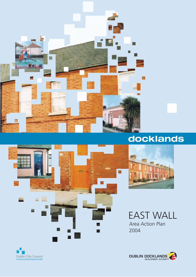
EAST WALL Area Action Plan 2004
East Wall Area Action Plan
Dublin Docklands Development Authority andDublin City Council
July 2004
Contents1 Context 11.1 Purpose and Objectives 1 1.2 The Area 21.3 Population and Employment 31.4 Policy Context 41.5 Consultation 7
2 Strategy 92.1 Issues 92.2 Goals 102.3 Strategy Elements 11
3 Social Infrastructure 133.1 Introduction 133.2 Community Objectives 133.3 Audit of Community Infrastructure 143.4 Proposed Actions 20
4 Transportation 234.1 Introduction 234.2 Context 234.3 Transportation Objectives 264.4 Proposed Actions 27
5 Land Use and Urban Design 315.1 Introduction 315.2 Land Use 325.3 Townscape 345.4 Land Use and Urban Design Objectives 365.5 Proposals for Key Roads and Focal Spaces 385.6 Development Sites 40
Appendices 43
I Action Programme 44II SWOT Analysis 45III Organisations, Education and Training 47IV Consultations 49
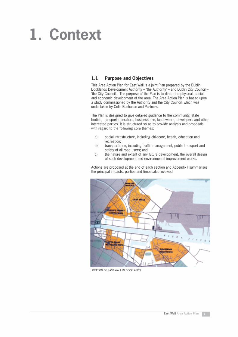
1.1 Purpose and ObjectivesThis Area Action Plan for East Wall is a joint Plan prepared by the DublinDocklands Development Authority – ‘the Authority’ – and Dublin City Council –‘the City Council’. The purpose of the Plan is to direct the physical, socialand economic development of the area. The Area Action Plan is based upona study commissioned by the Authority and the City Council, which wasundertaken by Colin Buchanan and Partners.
The Plan is designed to give detailed guidance to the community, statebodies, transport operators, businessmen, landowners, developers and otherinterested parties. It is structured so as to provide analysis and proposalswith regard to the following core themes:
a) social infrastructure, including childcare, health, education and recreation;
b) transportation, including traffic management, public transport and safety of all road users; and
c) the nature and extent of any future development, the overall design of such development and environmental improvement works.
Actions are proposed at the end of each section and Appendix I summarisesthe principal impacts, parties and timescales involved.
1. Context
East Wall Area Action Plan 1
LOCATION OF EAST WALL IN DOCKLANDS
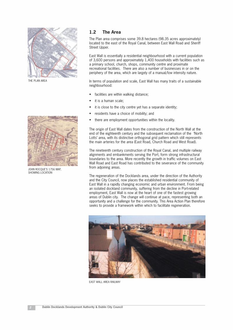
1.2 The AreaThe Plan area comprises some 39.8 hectares (98.35 acres approximately)located to the east of the Royal Canal, between East Wall Road and SheriffStreet Upper.
East Wall is essentially a residential neighbourhood with a current populationof 3,600 persons and approximately 1,400 households with facilities such asa primary school, church, shops, community centre and proximaterecreational facilities. There are also a number of businesses in or on theperiphery of the area, which are largely of a manual/low intensity nature.
In terms of population and scale, East Wall has many traits of a sustainableneighbourhood:
• facilities are within walking distance;
• it is a human scale;
• it is close to the city centre yet has a separate identity;
• residents have a choice of mobility; and
• there are employment opportunities within the locality.
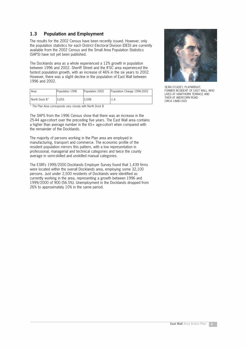
The origin of East Wall dates from the construction of the North Wall at theend of the eighteenth century and the subsequent reclamation of the ‘NorthLotts’ area, with its distinctive orthogonal grid pattern which still representsthe main arteries for the area (East Road, Church Road and West Road).
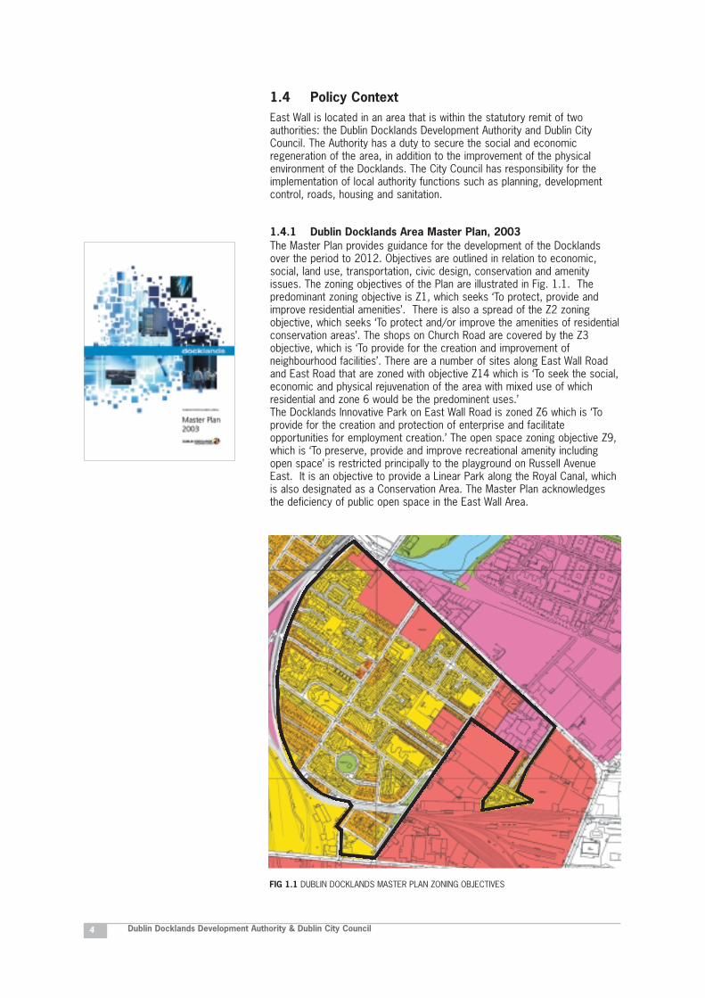
The nineteenth century construction of the Royal Canal, and multiple railwayalignments and embankments serving the Port, form strong infrastructuralboundaries to the area. More recently the growth in traffic volumes on EastWall Road and East Road has contributed to the severance of the communityfrom adjoining areas.
The regeneration of the Docklands area, under the direction of the Authorityand the City Council, now places the established residential community ofEast Wall in a rapidly changing economic and urban environment. From beingan isolated dockland community, suffering from the decline in Port-relatedemployment, East Wall is now at the heart of one of the fastest growingareas of Dublin city. The change will continue at pace, representing both anopportunity and a challenge for the community. This Area Action Plan thereforeseeks to provide a framework within which to facilitate regeneration.
THE PLAN AREA
2
JOHN ROCQUE’S 1756 MAP,SHOWING LOCATION
Dublin Docklands Development Authority & Dublin City Council
EAST WALL AREA RAILWAY
1.3 Population and EmploymentThe results for the 2002 Census have been recently issued. However, onlythe population statistics for each District Electoral Division (DED) are currentlyavailable from the 2002 Census and the Small Area Population Statistics(SAPS) have not yet been published.
The Docklands area as a whole experienced a 12% growth in populationbetween 1996 and 2002. Sheriff Street and the IFSC area experienced thefastest population growth, with an increase of 46% in the six years to 2002.However, there was a slight decline in the population of East Wall between1996 and 2002.
Area Population 1996 Population 2002 Population Change 1996-2002
North Dock B* 3,655 3,598 -1.6
* The Plan Area corresponds very closely with North Dock B
The SAPS from the 1996 Census show that there was an increase in the 25-44 age-cohort over the preceding five years. The East Wall area containsa higher than average number in the 65+ age-cohort when compared withthe remainder of the Docklands.
The majority of persons working in the Plan area are employed inmanufacturing, transport and commerce. The economic profile of theresident population mirrors this pattern, with a low representation inprofessional, managerial and technical categories and twice the countyaverage in semi-skilled and unskilled manual categories.
The ESRI’s 1999/2000 Docklands Employer Survey found that 1,439 firmswere located within the overall Docklands area, employing some 32,100persons. Just under 2,500 residents of Docklands were identified ascurrently working in the area, representing a growth between 1996 and1999/2000 of 900 (56.5%). Unemployment in the Docklands dropped from26% to approximately 10% in the same period.
East Wall Area Action Plan 3
SEÁN O’CASEY, PLAYWRIGHT,FORMER RESIDENT OF EAST WALL WHOLIVED AT HAWTHORN TERRACE ANDTHEN AT ABERCORN ROAD CIRCA 1888-1920
1.4 Policy ContextEast Wall is located in an area that is within the statutory remit of twoauthorities: the Dublin Docklands Development Authority and Dublin CityCouncil. The Authority has a duty to secure the social and economicregeneration of the area, in addition to the improvement of the physicalenvironment of the Docklands. The City Council has responsibility for theimplementation of local authority functions such as planning, developmentcontrol, roads, housing and sanitation.
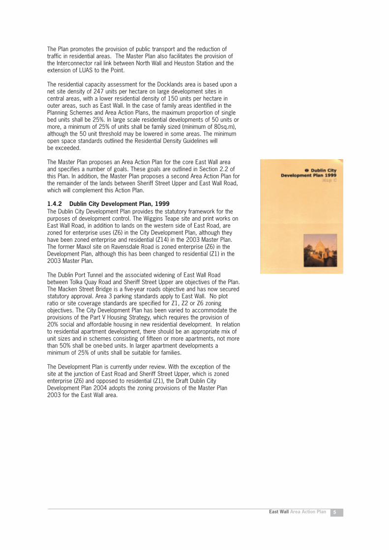
1.4.1 Dublin Docklands Area Master Plan, 2003The Master Plan provides guidance for the development of the Docklandsover the period to 2012. Objectives are outlined in relation to economic,social, land use, transportation, civic design, conservation and amenityissues. The zoning objectives of the Plan are illustrated in Fig. 1.1. Thepredominant zoning objective is Z1, which seeks ‘To protect, provide andimprove residential amenities’. There is also a spread of the Z2 zoningobjective, which seeks ‘To protect and/or improve the amenities of residentialconservation areas’. The shops on Church Road are covered by the Z3objective, which is ‘To provide for the creation and improvement ofneighbourhood facilities’. There are a number of sites along East Wall Roadand East Road that are zoned with objective Z14 which is ‘To seek the social,economic and physical rejuvenation of the area with mixed use of whichresidential and zone 6 would be the predominent uses.’The Docklands Innovative Park on East Wall Road is zoned Z6 which is ‘Toprovide for the creation and protection of enterprise and facilitateopportunities for employment creation.’ The open space zoning objective Z9,which is ‘To preserve, provide and improve recreational amenity includingopen space’ is restricted principally to the playground on Russell AvenueEast. It is an objective to provide a Linear Park along the Royal Canal, whichis also designated as a Conservation Area. The Master Plan acknowledgesthe deficiency of public open space in the East Wall Area.
4
FIG 1.1 DUBLIN DOCKLANDS MASTER PLAN ZONING OBJECTIVES
Dublin Docklands Development Authority & Dublin City Council
The Plan promotes the provision of public transport and the reduction oftraffic in residential areas. The Master Plan also facilitates the provision ofthe Interconnector rail link between North Wall and Heuston Station and theextension of LUAS to the Point.
The residential capacity assessment for the Docklands area is based upon anet site density of 247 units per hectare on large development sites incentral areas, with a lower residential density of 150 units per hectare inouter areas, such as East Wall. In the case of family areas identified in thePlanning Schemes and Area Action Plans, the maximum proportion of singlebed units shall be 25%. In large scale residential developments of 50 units ormore, a minimum of 25% of units shall be family sized (minimum of 80sq.m),although the 50 unit threshold may be lowered in some areas. The minimumopen space standards outlined the Residential Density Guidelines will be exceeded.
The Master Plan proposes an Area Action Plan for the core East Wall areaand specifies a number of goals. These goals are outlined in Section 2.2 ofthis Plan. In addition, the Master Plan proposes a second Area Action Plan forthe remainder of the lands between Sheriff Street Upper and East Wall Road,which will complement this Action Plan.
1.4.2 Dublin City Development Plan, 1999The Dublin City Development Plan provides the statutory framework for thepurposes of development control. The Wiggins Teape site and print works onEast Wall Road, in addition to lands on the western side of East Road, arezoned for enterprise uses (Z6) in the City Development Plan, although theyhave been zoned enterprise and residential (Z14) in the 2003 Master Plan.The former Maxol site on Ravensdale Road is zoned enterprise (Z6) in theDevelopment Plan, although this has been changed to residential (Z1) in the2003 Master Plan.
The Dublin Port Tunnel and the associated widening of East Wall Roadbetween Tolka Quay Road and Sheriff Street Upper are objectives of the Plan.The Macken Street Bridge is a five-year roads objective and has now securedstatutory approval. Area 3 parking standards apply to East Wall. No plotratio or site coverage standards are specified for Z1, Z2 or Z6 zoningobjectives. The City Development Plan has been varied to accommodate theprovisions of the Part V Housing Strategy, which requires the provision of20% social and affordable housing in new residential development. In relationto residential apartment development, there should be an appropriate mix ofunit sizes and in schemes consisting of fifteen or more apartments, not morethan 50% shall be one-bed units. In larger apartment developments aminimum of 25% of units shall be suitable for families.
The Development Plan is currently under review. With the exception of thesite at the junction of East Road and Sheriff Street Upper, which is zonedenterprise (Z6) and opposed to residential (Z1), the Draft Dublin CityDevelopment Plan 2004 adopts the zoning provisions of the Master Plan2003 for the East Wall area.
East Wall Area Action Plan 5
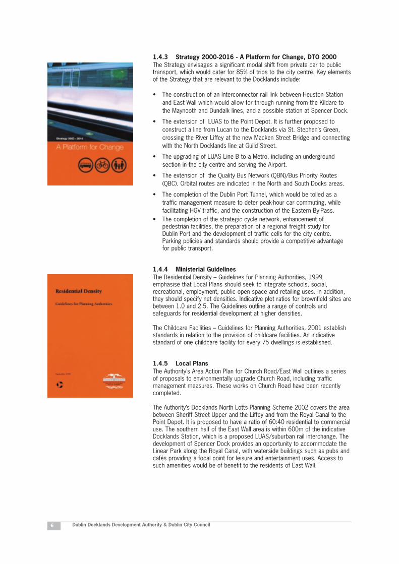
1.4.3 Strategy 2000-2016 - A Platform for Change, DTO 2000The Strategy envisages a significant modal shift from private car to publictransport, which would cater for 85% of trips to the city centre. Key elementsof the Strategy that are relevant to the Docklands include:
• The construction of an Interconnector rail link between Heuston Stationand East Wall which would allow for through running from the Kildare tothe Maynooth and Dundalk lines, and a possible station at Spencer Dock.
• The extension of LUAS to the Point Depot. It is further proposed toconstruct a line from Lucan to the Docklands via St. Stephen’s Green,crossing the River Liffey at the new Macken Street Bridge and connectingwith the North Docklands line at Guild Street.
• The upgrading of LUAS Line B to a Metro, including an undergroundsection in the city centre and serving the Airport.
• The extension of the Quality Bus Network (QBN)/Bus Priority Routes(QBC). Orbital routes are indicated in the North and South Docks areas.
• The completion of the Dublin Port Tunnel, which would be tolled as atraffic management measure to deter peak-hour car commuting, whilefacilitating HGV traffic, and the construction of the Eastern By-Pass.
• The completion of the strategic cycle network, enhancement of pedestrian facilities, the preparation of a regional freight study for Dublin Port and the development of traffic cells for the city centre. Parking policies and standards should provide a competitive advantagefor public transport.
1.4.4 Ministerial Guidelines The Residential Density – Guidelines for Planning Authorities, 1999emphasise that Local Plans should seek to integrate schools, social,recreational, employment, public open space and retailing uses. In addition,they should specify net densities. Indicative plot ratios for brownfield sites arebetween 1.0 and 2.5. The Guidelines outline a range of controls andsafeguards for residential development at higher densities.
The Childcare Facilities – Guidelines for Planning Authorities, 2001 establishstandards in relation to the provision of childcare facilities. An indicativestandard of one childcare facility for every 75 dwellings is established.
1.4.5 Local PlansThe Authority’s Area Action Plan for Church Road/East Wall outlines a seriesof proposals to environmentally upgrade Church Road, including trafficmanagement measures. These works on Church Road have been recentlycompleted.
The Authority’s Docklands North Lotts Planning Scheme 2002 covers the areabetween Sheriff Street Upper and the Liffey and from the Royal Canal to thePoint Depot. It is proposed to have a ratio of 60:40 residential to commercialuse. The southern half of the East Wall area is within 600m of the indicativeDocklands Station, which is a proposed LUAS/suburban rail interchange. Thedevelopment of Spencer Dock provides an opportunity to accommodate theLinear Park along the Royal Canal, with waterside buildings such as pubs andcafés providing a focal point for leisure and entertainment uses. Access tosuch amenities would be of benefit to the residents of East Wall.
6 Dublin Docklands Development Authority & Dublin City Council
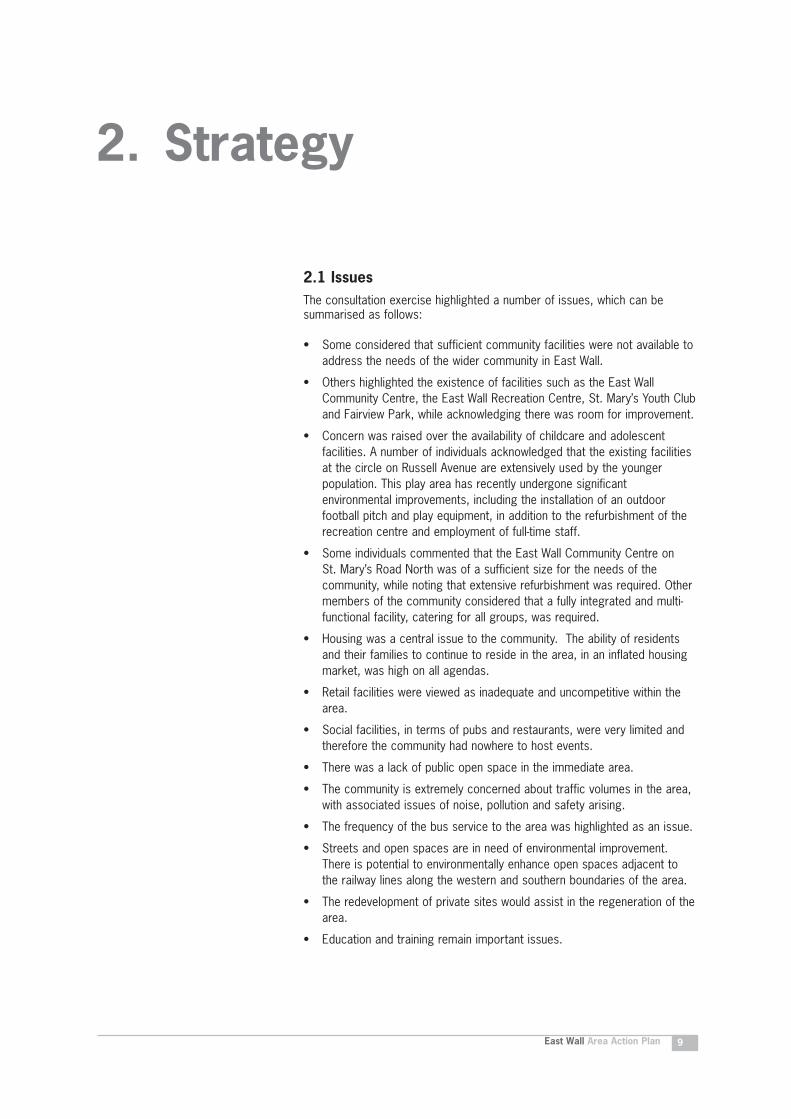
1.5 ConsultationComprehensive consultation was a fundamental element of the Action Planprocess. It was considered essential to consult to a wide degree with thelocal community, businesses, community representatives and variousstakeholders in order to allow for ownership of the Plan and itsrecommendations. The consultation process comprised four fundamentalelements:
• Stakeholder Consultation – This initial stage provided direction on the approach and subject matter of the Plan, in addition to providing essential data. Initial stakeholder meetings were carried out withcommunity representatives, community groups and the Authority’s andCity Council’s officers.
• Public Consultation Event – Following the initial stakeholder meetings apublic consultation event was held in the East Wall Community Centre.
• Focus Group Consultation – The purpose of the forum was to investigatethe requirements of businesses within the area.
• Public Display of Draft Plan – The Draft Plan was placed on public displayin February 2004 and representations were invited.
Two reports on the public consultation process were prepared summarisingthese discussions and submissions. The findings of the consultation exerciseform the core of all proposals contained in this Plan and are summarised inthe SWOT analysis in Appendix II. This analysis forms the basis for theformulation of the Strategy outlined in Section 2.
East Wall Area Action Plan 7
PUBLIC CONSULTATION EVENT

8 Dublin Docklands Development Authority & Dublin City Council
2.1 IssuesThe consultation exercise highlighted a number of issues, which can be summarised as follows:
• Some considered that sufficient community facilities were not available toaddress the needs of the wider community in East Wall.
• Others highlighted the existence of facilities such as the East WallCommunity Centre, the East Wall Recreation Centre, St. Mary’s Youth Cluband Fairview Park, while acknowledging there was room for improvement.
• Concern was raised over the availability of childcare and adolescentfacilities. A number of individuals acknowledged that the existing facilitiesat the circle on Russell Avenue are extensively used by the youngerpopulation. This play area has recently undergone significantenvironmental improvements, including the installation of an outdoorfootball pitch and play equipment, in addition to the refurbishment of therecreation centre and employment of full-time staff.
• Some individuals commented that the East Wall Community Centre onSt. Mary’s Road North was of a sufficient size for the needs of thecommunity, while noting that extensive refurbishment was required. Othermembers of the community considered that a fully integrated and multi-functional facility, catering for all groups, was required.
• Housing was a central issue to the community. The ability of residentsand their families to continue to reside in the area, in an inflated housingmarket, was high on all agendas.
• Retail facilities were viewed as inadequate and uncompetitive within thearea.
• Social facilities, in terms of pubs and restaurants, were very limited andtherefore the community had nowhere to host events.
• There was a lack of public open space in the immediate area.
• The community is extremely concerned about traffic volumes in the area,with associated issues of noise, pollution and safety arising.
• The frequency of the bus service to the area was highlighted as an issue.
• Streets and open spaces are in need of environmental improvement.There is potential to environmentally enhance open spaces adjacent tothe railway lines along the western and southern boundaries of the area.
• The redevelopment of private sites would assist in the regeneration of thearea.
• Education and training remain important issues.
2. Strategy
East Wall Area Action Plan 9
2.2 GoalsMany of the issues raised during the consultation exercise are addressed inthe Plan through a targeted strategy, with key proposals for improvement.Social, health and community issues will require a co-ordination of initiatives.
The principal goals of the Area Action Plan are to:
1. Ensure that the social needs and the provision of community facilities are addressed.
2. Support education and training programmes that will enable local residents to avail of new job opportunities.
3. Promote the refurbishment or redevelopment of the East Wall Community Centre.
4. Seek to reduce extraneous through traffic within the area and ensure a safe system for pedestrians, cyclists and vehicles.
5. Promote the upgrading of public transport in the area, including the upgrading of the public bus service through East Wall.
6. Ensure that new developments are well designed and integrated into the existing area, with a preference for mixed use developments on larger sites.
7. Promote the enhancement of retail and social facilities, where possible.
8. Ensure the adequate provision of housing for all in the community, including social and affordable housing.
9. Promote the improvement of existing open space, developing linkages to adjoining areas, and examine the potential for pocket parks within the area.
10. Seek the environmental upgrading of streets and the public domain in the area.
10 Dublin Docklands Development Authority & Dublin City Council
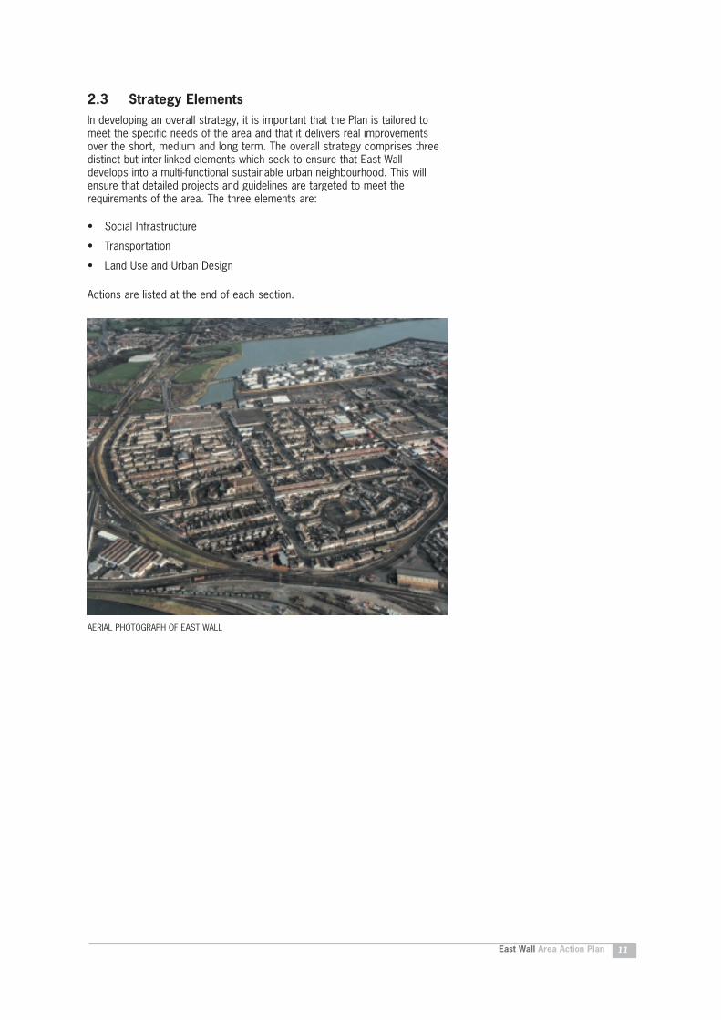
2.3 Strategy ElementsIn developing an overall strategy, it is important that the Plan is tailored tomeet the specific needs of the area and that it delivers real improvementsover the short, medium and long term. The overall strategy comprises threedistinct but inter-linked elements which seek to ensure that East Walldevelops into a multi-functional sustainable urban neighbourhood. This willensure that detailed projects and guidelines are targeted to meet therequirements of the area. The three elements are:
• Social Infrastructure
• Transportation
• Land Use and Urban Design
Actions are listed at the end of each section.
East Wall Area Action Plan 11
AERIAL PHOTOGRAPH OF EAST WALL

12 Dublin Docklands Development Authority & Dublin City Council

3.1 IntroductionThe Dublin Docklands Development Area Master Plan 2003 states that ‘ Theoverall objective of the Master Plan must be to secure the sustainable socialand economic regeneration of the Area, with improvements to the physicalenvironment being a vital ingredient’.
To ensure consistency with this objective, a core theme is to address thesocial infrastructural needs of the area, including those relating to childcare,health, education and recreation. This section of the Plan seeks to addressthese issues in an integrated manner. The following stages are required:
• Establishment of community objectives
• Audit of existing and proposed community infrastructure
• Proposed actions
3.2 Community ObjectivesIn order to achieve the sustainable social and economic regeneration of thearea, community development must be supported and encouraged at alllevels. The consultation process identified a number of issues which wereviewed as fundamental to the continued development of East Wall.Community development needs to be inclusive, dynamic and creative, with anequitable access to funding and resources. The following objectives aim toaddress these issues in a coherent and comprehensive manner.
1. Education and Training objectives are to:
a) promote life-long learning within the community, by supporting co-ordinated forums between the main training providers and potential students;
b) encourage accessibility for all to educational and training service providers; and
c) encourage the adoption of new technologies to assist education and training.
2. Youth and Children objectives are to:
a) place emphasis on those who are at ‘risk’ of isolation, exclusion or early school leaving;
b) assist in the provision of essential services such as recreational, educational and childcare facilities; and
c) encourage personal development opportunities to all children in the area.
3. Social Infrastructure
East Wall Area Action Plan 13