Embed Size (px)
Citation preview
Ft Pickett Regulation 95-1
ARMY NATIONAL GUARD
MANEUVER TRAINING CENTER FORT PICKETT
BLACKSTONE, VIRGINIA 23824-9000
ARNG Maneuver Training Center Fort Pickett 1 November 2010
Regulation 95-1
Directorate of Plans, Training, and Security
Aviation
GENERAL PROVISIONS AND LOCAL FLYING RULES
Table of Contents
CHAPTER 1 GENERAL PARAGRAPH
Purpose 1
References 2
Authority 3
Responsibilities 4
Use of Blackstone Army Airfield (BAAF)
and Fort Pickett Helipads 5
Weather Briefings 6
Flight Plans 7
CHAPTER 2 AIRSPACE AND AIRSPACE PROCEDURES
Local Flying Area 1
Cantonment Area Helipads 2
Tactical Landing Areas 3
Flight Rules 4
Flight Following Procedures 5
Tactical Terrain Flight 6
Operations of BAAF 7
Special Visual Flight Rule Operations 8
Blackstone Army Airfield 9
Helicopter Gunnery 10
CHAPTER 3 SAFETY
General 1
Fort Pickett Regulation 95-1 1 November 2010
2
Mishap Reporting 2
Fort Pickett Hazard Map 3
Pre-Accident Plan 4
Local Area Map-Fort Pickett 5
*This regulation supersedes Fort Pickett Regulation 95-1, dtd 1 June 2009.

Fort Pickett Regulation 95-1 1 November 2010
3
APPENDICES
Local Flying Area A
Tactical Landing Areas B
Flight Following Procedures C
Night Tactical Terrain Flight D
Operation of BAAF E
Fort Pickett Hazard Map F
Primary Crash Alarm System G
Local Area Map H
Close Air Support Operations I
Airborne Operations J
Operation of Unmanned Aerial Vehicles/Systems K
Fort Pickett Regulation 95-1 1 November 2010
4
CHAPTER ONE - GENERAL
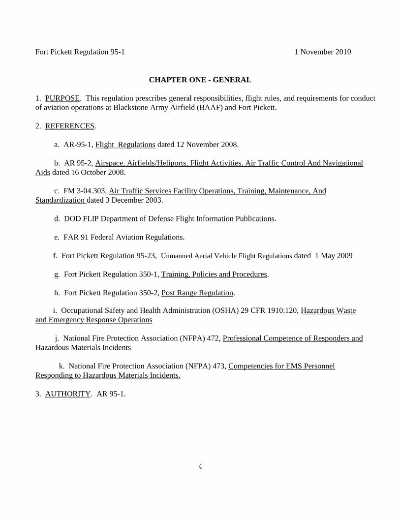
1. PURPOSE. This regulation prescribes general responsibilities, flight rules, and requirements for conduct
of aviation operations at Blackstone Army Airfield (BAAF) and Fort Pickett.
2. REFERENCES.
a. AR-95-1, Flight Regulations dated 12 November 2008.
b. AR 95-2, Airspace, Airfields/Heliports, Flight Activities, Air Traffic Control And Navigational
Aids dated 16 October 2008.
c. FM 3-04.303, Air Traffic Services Facility Operations, Training, Maintenance, And
Standardization dated 3 December 2003.
d. DOD FLIP Department of Defense Flight Information Publications.
e. FAR 91 Federal Aviation Regulations.
f. Fort Pickett Regulation 95-23, Unmanned Aerial Vehicle Flight Regulations dated 1 May 2009
g. Fort Pickett Regulation 350-1, Training, Policies and Procedures.
h. Fort Pickett Regulation 350-2, Post Range Regulation.
i. Occupational Safety and Health Administration (OSHA) 29 CFR 1910.120, Hazardous Waste
and Emergency Response Operations
j. National Fire Protection Association (NFPA) 472, Professional Competence of Responders and
Hazardous Materials Incidents
k. National Fire Protection Association (NFPA) 473, Competencies for EMS Personnel
Responding to Hazardous Materials Incidents.
3. AUTHORITY. AR 95-1.
Fort Pickett Regulation 95-1 1 November 2010
5
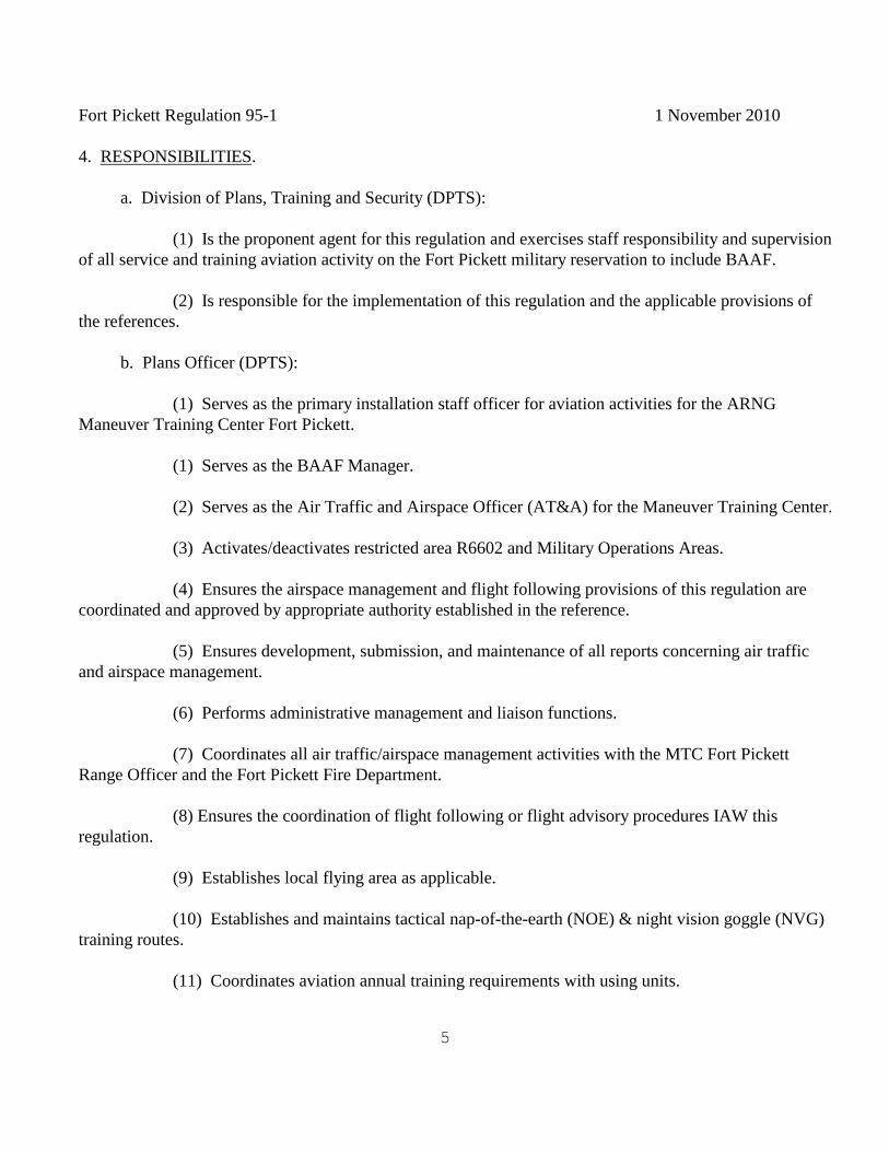
4. RESPONSIBILITIES.
a. Division of Plans, Training and Security (DPTS):
(1) Is the proponent agent for this regulation and exercises staff responsibility and supervision
of all service and training aviation activity on the Fort Pickett military reservation to include BAAF.
(2) Is responsible for the implementation of this regulation and the applicable provisions of
the references.
b. Plans Officer (DPTS):
(1) Serves as the primary installation staff officer for aviation activities for the ARNG
Maneuver Training Center Fort Pickett.
(1) Serves as the BAAF Manager.
(2) Serves as the Air Traffic and Airspace Officer (AT&A) for the Maneuver Training Center.
(3) Activates/deactivates restricted area R6602 and Military Operations Areas.
(4) Ensures the airspace management and flight following provisions of this regulation are
coordinated and approved by appropriate authority established in the reference.
(5) Ensures development, submission, and maintenance of all reports concerning air traffic
and airspace management.
(6) Performs administrative management and liaison functions.
(7) Coordinates all air traffic/airspace management activities with the MTC Fort Pickett
Range Officer and the Fort Pickett Fire Department.
(8) Ensures the coordination of flight following or flight advisory procedures IAW this
regulation.
(9) Establishes local flying area as applicable.
(10) Establishes and maintains tactical nap-of-the-earth (NOE) & night vision goggle (NVG)
training routes.
(11) Coordinates aviation annual training requirements with using units.
Fort Pickett Regulation 95-1 1 November 2010
6
(12) Establishes and maintains Fort Pickett hazard map.
(13) Establishes and maintains the Pre-accident Plan.
(14) Assumes limited responsibilities of the aviation safety officer if not otherwise provided.
(15) Drafts, staffs, reviews and updates and manages the Foreign Object Damage (FOD)
Prevention Program, Bird Airplane Strike Hazard (BASH) plan and Ice and Snow Removal plan.
d. Fort Pickett Range Officer:
(1) Establishes and maintains flight advisory procedures for the Fort Pickett military
reservation IAW this regulation.
(2) Coordinates all aviation activities on the Fort Pickett military reservation with the Plans
Officer and using aviation unit commander.
e. Commander, Using Aviation Unit:
(1) Request training areas by electronic mail (e-mail) to the DPTS IAW Fort Pickett
Regulation 350-1. The training site request form is available on the installation web site,
http://www.fortpickett.net
(2) Establishes liaison with AT&A.
(3) Ensures adherence to this regulation, references and applicable directives.
(4) Establishes a local flying area for unit use.
(5) Retains responsibility for accident reporting.
(6) Coordinates unit operations schedule with DPTS, BAAF and Range Operations.
5. USE OF BLACKSTONE ARMY AIRFIELD (BAAF) AND FORT PICKET HELIPADS.
a. All requests for training areas on the Fort Pickett military reservation will be submitted in
electronic format to the DPTS IAW Fort Pickett Reg 350-1.
b. Coordination will be effected in person with the Airfield Manager by the using unit commander or
his designated representative.
Fort Pickett Regulation 95-1 1 November 2010
7
6. WEATHER BRIEFINGS.
a. DD Form 175-1 (Flight Weather Briefing) are available at BAAF operations. Weather briefings
can be obtained from:
Automated Flight Service Station 1-800-992-7433
15th Operational Weather Squadron (618) 256-9755/9702
b. Weather reports, maps, and hourly observations are not available. No forecaster is on duty at
BAAF.
7. FLIGHT PLANS.
a. Local VFR flights within the boundaries of Fort Pickett will be filed with BAAF operations.
Aviation unit commanders may establish a local flying area IAW applicable regulations using the unit’s
internal flight operations section after prior coordination with the Airfield Manager. In either case the
following information will be filed:
(1) Aircraft designation and serial (tail) number.
(2) Aircraft type.
(3) Place and time of departure.
(4) Purpose of the flight.
(5) All intermediate destinations and duration of the mission.
(6) Final destination and estimated time of arrival (ETA).
b. Cross-country VFR and all IFR flight plans will be filed with the Automated Flight Service Station
1-(800) 992-7433. IFR may also be relayed through BAAF tower.
c. Pilots may close flight plans by relaying to BAAF tower.
Fort Pickett Regulation 95-1 1 November 2010
8
CHAPTER TWO - AIRSPACE AND AIRSPACE PROCEDURES
1. LOCAL FLYING AREA. See Appendix A.
2. CANTONMENT AREA HELIPADS.
a. Headquarters Helipad:
Grid coordinates: 18 S TG 358054
Dimensions 40' x 40'
Lighted
Prior permission required
Wire hazards are marked
Controlled by BAAF tower when operational; Range Operations when BAAF non-operational.
b. Range Operations Helicopter landing zone (HLZ Aries):
Grid coordinates: 18 S TG 392029
Dimensions 400' x 300' (Open Field)
Not Lighted
Prior permission required
Wire hazards are not marked
Controlled by BAAF tower when operational; Range Operations When Blackstone tower is closed.
c. Dispensary Helipad:
Grid coordinates: 18S TG 382043
Dimensions 40' x 40'
Lighted
Prior permission required
Wire hazards are not marked
Controlled by BAAF tower when operational, Range Operations when BAAF tower non-operational.
d. Prior permission for landing at the above helipads must be obtained 24 hours in advance by calling
DPTS, DSN 441-2193 or (434) 292-2193.
3. TACTICAL LANDING AREAS. See Appendix B.
4. FLIGHT RULES.
a. Nap of the Earth (NOE) and Terrain flight: - Defined as flight close to the earth's surface during which
airspeed, height and/or altitude are adapted to the contours and cover of the ground in order to avoid enemy
detection and fire. Terrain flight is authorized on Fort Pickett. The altitude, heading and airspeed are
variable and the installation imposes no restriction of them – it is the responsibility of the pilot in command
to safely negotiate terrain following or nap-of the-earth flight.
Fort Pickett Regulation 95-1 1 November 2010
9
b. VFR. (As prescribed by Department of Defense (DOD) Flight Information Publication (FLIP), FAR
91, and AR 95-1.)
(1) Fort Pickett Reservation. Helicopter: Clear of clouds and 1/2 statute mile visibility.
(2) All aircraft operations on the Fort Pickett reservation are conducted on a "see and be
seen" basis except aircraft conducting NVG training inside restricted airspace.
(3) All aircraft will turn on their landing lights when entering BAAF area. The landing
light should remain on until clear of the airfield or the aircraft has landed. The landing lights must be
turned on immediately after departure and may be turned off on short final. Pilots may turn off the
landing light whenever excessive cockpit glare exists. All pilots must notify tower when turning off the
landing light. Tower will alert other aircraft in close proximity to the aircraft without a landing light.
The landing light will be extended to a position that does not interfere with crew vision or safety. NOTE:
During formation flights, only the lead ship must turn on the landing lights or searchlights.
(4) When approaching oncoming aircraft, pilots will utilize rules of the road by steering
right of oncoming traffic IAW FAR 91-67, Right of Way Rules.
c. IFR. (As prescribed in DOD FLIP, FAR 91, AR 95-1.)
5. FLIGHT FOLLOWING PROCEDURES.
a. Aircraft entering or originating flights on the reservation will contact Blackstone tower or Range
Operations (if the tower is closed) and furnish the following information:
(1) Aircraft identification (tail number and type) and number of aircraft in flight (if
applicable).
(2) Number of persons on board (POB).
(3) Entry point.
(4) Requested routing.
(5) Requested altitude (if above 300 feet AGL).
(6) Destination.
(7) Fuel on board.
b. Routing will be requested using any of the following means:
(1) Route color identifier and/or corridor number.
Fort Pickett Regulation 95-1 1 November 2010
10
(2) Direct to destination (known point, common name or grid coordinates).
c. Current location or destination will be specified using any of the following:
(1) Known point number designation (Appendix).
(2) Common name.
(3) Distance and direction from known point.
(4) Military Grid Reference System coordinates.
d. Aircraft landing at BAAF or in the cantonment area will be handed off from Range Operations
to BAAF tower prior to entering the BAAF traffic pattern.
e. BAAF tower will notify aircraft on initial contact if the BAAF is below VFR minimums. The pilot
must obtain a special VFR clearance from BAAF tower if the weather is less than 1000 feet ceiling, three
miles visibility prior to entering BAAF traffic pattern
f. During hours of operation, all aircraft will be under the positive control of BAAF tower while in the
BAAF traffic pattern or within the Class D airspace. When the tower is closed, all aircraft will remain
with Range Operations.
g. Pilots will clarify any portion of an advisory that is not understood and will report reaching
destinations and any checkpoints requested by Range Operations.
h. Pilots arriving in an area for training will advise Blackstone Tower/Range Operations of their
intentions, i.e., conducting NOE training in area Echo will call at (time). A position report will be made
every 15 minutes.
i. Aircraft terminating at field locations will terminate with Blackstone Tower/Range Operations and
request Blackstone Tower/Range Operations to close the flight plan if applicable.
j. Aircraft landing for extended periods will report their expected departure time and reestablish
communication with Blackstone tower/Range Operations prior to takeoff.
(1) If in the vicinity of live fire ranges, utilize ground communications to request and receive
advisories prior to departure.
(2) If not in the vicinity of live fire ranges, may take off, climb to altitude, remain in the vicinity of
the landing zone (LZ), and contact Blackstone Tower/Range Operations prior to departing the area.
Fort Pickett Regulation 95-1 1 November 2010
11
k. Aviators unable to establish communication with Blackstone Tower/Range Operations prior to
departing a LZ will make all calls in the blind on Range Operations frequency (34.1 Mhz/36.1 Mhz
alternate and/or Blackstone UNICOM 122.95) to alert other aircraft in the area. After takeoff, establish
communications with Range Operations.
1. Range operations will identify the flight path and when range fans or "HOT" firing points interfere
with the route of flight, Blackstone Tower/Range Operations will advise the aircraft to stay clear of that
area. The pilot may ask for grid coordinates in the event the information is not clear.
m. Aircraft operations within the Fort Pickett military airspace.
(1) Will maintain radio contact with Blackstone Tower/Range Operations while in Fort Pickett
military reservation airspace.
(2) Perform flight following.
n. For Range Operations flight following procedures see Appendix C.
7. NIGHT TACTICAL TERRAIN FLIGHT. See Annex D.
8. OPERATIONS OF BAAF. See Appendix E.
9. SPECIAL VFR OPERATIONS BAAF
a. Aircraft operating within the Fort Pickett military reservation airspace will maintain VFR IAW
this regulation.
b. Aircraft desiring to enter BAAF traffic pattern when conditions are less than 1000' ceiling and 3
miles visibility will contact tower and request special VFR clearance.
c. Special VFR minimums for BAAF:
Day
(1) Ceiling 300 feet MSL
(2) Visibility 1/2 mile statute
Night
(1) Ceiling 500 feet MSL
(2) Visibility 1 mile statute
Fort Pickett Regulation 95-1 1 November 2010
12
CHAPTER THREE - SAFETY
1. GENERAL.
a. Each unit utilizing Fort Pickett aviation facilities will have an appointed aviation safety officer
ON ORDERS. The safety officer will coordinate safety procedures with airfield manager to ensure
compliance with published safety regulations and directives. The most stringent possible safety standards
must be maintained at all times.
b. Each aviation unit/element will be briefed on Fort Pickett's aircraft pre-accident plan.
c. The unit safety officer will ensure there are sufficient copies of the crash grid map available for
all missions.
d. The Chief, Fort Pickett Fire Department will assure that each emergency response vehicle will
have a copy of the installation and the airfield crash grid maps.
2. DRIVERS TRAINING. Pilots, unit safety officers and commanders should be aware that “B” ramp,
“C” taxiway and runway 1-19 are frequently used for law enforcement basic driving skills and advanced
pursuit training.
3. MISHAP REPORTING. Aircraft mishaps/incidents will be reported and investigated IAW AR 385-
95, and AR 385-40. Responsibility for mishap reporting remains with the unit commander.
4. FORT PICKETT HAZARD MAP. See Appendix F.
5. PRE-ACCIDENT PLAN. See Appendix G.
6. LOCAL AREA MAP - FORT PICKETT. See Appendix H
Fort Pickett Regulation 95-1 1 November 2010
13
APPENDIX A
LOCAL FLYING AREA
This installation does not meet the requirements for the establishment of a local flying area.
Commanders using the Fort Pickett military reservation for aviation training are directed to establish a
local flying area IAW applicable directives.
Fort Pickett Regulation 95-1 1 November 2010
14
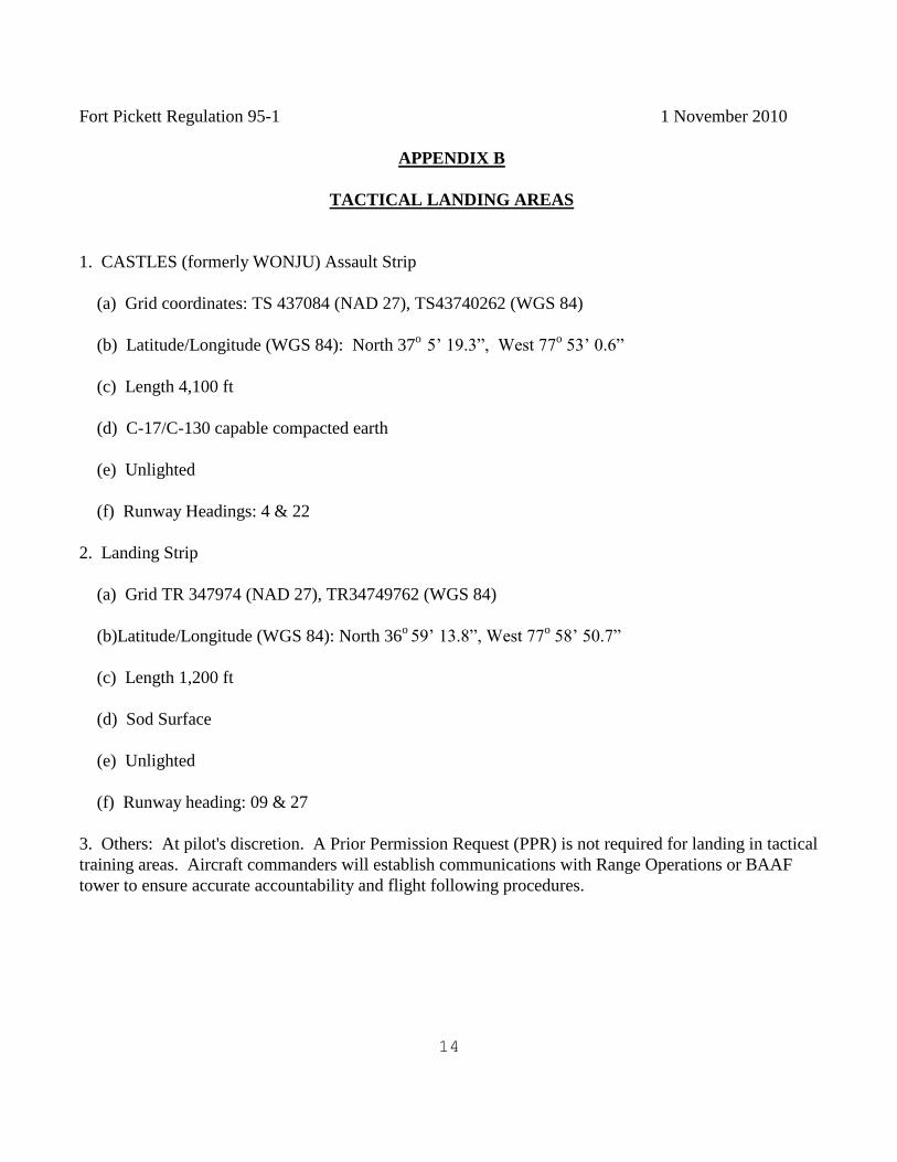
APPENDIX B
TACTICAL LANDING AREAS
1. CASTLES (formerly WONJU) Assault Strip
(a) Grid coordinates: TS 437084 (NAD 27), TS43740262 (WGS 84)
(b) Latitude/Longitude (WGS 84): North 37o
5’ 19.3”, West 77o 53’ 0.6”
(c) Length 4,100 ft
(d) C-17/C-130 capable compacted earth
(e) Unlighted
(f) Runway Headings: 4 & 22
2. Landing Strip
(a) Grid TR 347974 (NAD 27), TR34749762 (WGS 84)
(b)Latitude/Longitude (WGS 84): North 36o 59’ 13.8”, West 77
o 58’ 50.7”
(c) Length 1,200 ft
(d) Sod Surface
(e) Unlighted
(f) Runway heading: 09 & 27
3. Others: At pilot's discretion. A Prior Permission Request (PPR) is not required for landing in tactical
training areas. Aircraft commanders will establish communications with Range Operations or BAAF
tower to ensure accurate accountability and flight following procedures.
Fort Pickett Regulation 95-1 1 November 2010
15
APPENDIX C
FLIGHT FOLLOWING PROCEDURES
1. PURPOSE: This appendix establishes procedures for providing flight following for aircraft operating
in the Fort Pickett airspace.
2. GENERAL: Flight following is provided to aircraft operating within the Fort Pickett airspace IAW
AR 95-1, AR 95-50 and FAR PART 91.
3. REFERENCES: AR 385-40, AR 385-95 and Fort Pickett Reg 95-1.
4. Flight following is initiated to prevent accidents through proper airspace management. The
Continental United States has a system of airspace management known as the National Airspace System
(NAS). This system is regulated by the Federal Aviation Administration (FAA). Fort Pickett airspace is
part of the NAS and is divided into two airspace management areas. Blackstone Army Airfield controls
that airspace within a five-statute mile radius of the geographical center of the airfield during periods of
time when the airfield tower is operational. Part 91.126 requires establishing communications within
Class D airspace if a control tower is operational. During periods of time when the tower is non-
operational, the airspace is uncontrolled, (any aircraft can use the airspace). The majority of the
remaining airspace at Fort Pickett is uncontrolled airspace. However, by agreement with the FAA, the
Department of Defense has established a restricted area, R6602, and when activated, restricts the use of
that airspace to participating aircraft only. In order to manage the airspace within the Fort Pickett
military reservation, including R6602, these flight following procedures are established.
5. RESPONSIBILITIES:
a. Range Operations officer will:
(1) Establish a flight advisory procedure within Range Operations using this regulation and
applicable directives.
(2) Coordinate with DPTS concerning all aviation operations within the Fort Pickett
Military reservation airspace.
(3) Maintain two separate FM frequencies to be used as:
(a) Primary Range frequency.
(b) Alternate range frequency.
Fort Pickett Regulation 95-1 1 November 2010
16
(c) MEDEVAC frequency.
(d) Flight Advisory frequency.
(7) Post a flight following map with known routes and corridors when provided by the
training unit.
b. Range Operations personnel will:
(1) Log each flight into the daily DA 1594 journal with the following information:
Aircraft tail number/type
Type operation; i.e., NVG route 2, etc.
Location; i.e., start point or six-digit coordinates
Number of persons on board
Time aircraft departed Fort Picket airspace
(2) Flight follows all aircraft operating in the Fort Pickett military reservation.
(3) Plot and track aircraft on maps posted in the operations.
(4) Initiate radio contact with aircraft over 30 minutes from previous transmission.
(5) Retain flight strips as required for daily traffic count.
(6) Activate Crash Rescue/Fort Pickett Pre-accident Plan when applicable.
(7) Coordinate with tower during periods of tower operation at extension (434) 292-2047.
(8) Notify DPTS immediately of aircraft down on the reservation.
(9) PROCEDURES FOR OVERDUE AIRCRAFT WHEN A LOCAL FLIGHT PLAN IS
FILED THROUGH RANGE OPERATIONS:
(a) When an aircraft (helicopter) becomes overdue, Range Operations firing desk
personnel will make a FM 34.1 radio check for late aircraft if the aircraft is on an inbound flight plan.
For an aircraft destined for another airfield, Range Operations should wait another 15 minutes before
initiating ramp search phone calls. The aircrew may have been delayed in closing their flight plan for any
number of legitimate reasons.
Fort Pickett Regulation 95-1 1 November 2010
17
(b) When an aircraft (helicopter) becomes 30 minutes overdue, phone calls will be
initiated to the destination airfield for a ramp search. If the aircraft and/or aircrew have not been located
by ramp search, surrounding airfields will be contacted along with Flight Service Station (FSS), (800)
992-7433 to assist in locating the crew and aircraft.
c. Range Corridor.
(1) Description - Flight Path - counterclockwise one way: Beginning at known
point 1, (KP1, Wilson Township - TG 454140), west along railroad tracks until reaching western military
reservation boundary, then south along military reservation boundary to Hwy 46 to known point 2, (KP2,
bridge at TF363976), then eastbound along Hwy 628 & military reservation boundary turning north on
Hwy 613 to known point 3, (KP3, Gills Bridge at TF473979), continuing northbound along Hwy 613 to
Hwy 40 then westbound along Hwy 40 to known point 4, (KP4, Observation Tower at TG 405066)
continuing westbound until reaching Dearing Avenue.
(2) Procedures:
(a) Aircraft will fly on the right side and remain within 500 meters of the
established route.
(b) Aircraft will contact Blackstone tower for clearance through the traffic pattern.
When tower is closed, traffic advisories will be received from Range Operations before proceeding along
the route.
(c) Deviation from these procedures is not authorized unless coordination is made
with Range Operations and with the approval of the installation AT & A.
(d) Lateral limits: 500 meters right of Centerline.
(e) Altitude: 300 feet above ground level (AGL).
(f) All aircraft operations on the Fort Pickett reservation are conducted on a "see
and be seen" basis except aircraft conducting NVG training inside restricted airspace.
Fort Pickett Regulation 95-1 1 November 2010
18
APPENDIX D
NIGHT TACTICAL TERRAIN FLIGHT
1. REFERENCE: Fort Pickett Regulation 350-2.
2. OBJECTIVE: Establish procedures for aviation units performing night tactical terrain flight at Fort
Pickett.
3. APPLICABILITY: This applies to all aviation units training at Fort Pickett.
4. RESPONSIBILITIES:
a. Unit commanders will request training routes and areas IAW reference 1c, para 1-3e. Request
for Air Traffic Control (ATC) and flight operation support should be made no later than Thursday the
week prior to training.
b. Training officer/unit operation officer will verify all coordination and preparation is complete
prior to commencing training. All equipment to support training must be provided by using unit.
Training officer must have copy of unit's SOP that covers night training and provide ATC one set of
Night Vision Goggles (NVG).
c. BAAF manager:
(1) Will conduct safety survey of training area and routes and provide the unit
training/operations officer a current hazards map of Fort Pickett.
(2) Ensure that ATC and operation support is provided to unit.
(3) Coordinate with post fire chief for crash/fire rescue support.
5. COORDINATION: Units desiring use of BAAF will coordinate with BAAF operation and provide
the following information:
a. Date and time of training.
b. Number of aircraft.
c. Type training (unaided or NVG).
Fort Pickett Regulation 95-1 1 November 2010
19
d. Fuel requirements.
e. Name of training officer.
6. FACILITY PREPARATION:
a. Reduction of lighting. The following airfield lights should be turned off prior to start of
UNAIDED/NVG training:
(1) Airfield rotating beacon - master switch at base of beacon tower. *
(2) Runway lights - as required from tower.
(3) Hangar lights - civilian and military.
(4) Tower security lighting – switch on north side of tower catwalk railing.
*Notice to Airmen (NOTAM) required with Flight Service Station (FSS).
b. Fuel truck. Parking lights only on the airfield. Truck must be ground guided last fifty feet to
aircraft. Ground guide will use standard issue flashlight with red filter.
c. Tactical sites. Training officer will inspect field sites for FOD and suitability prior to sunset.
Sites that have had a survey by the airfield commander and area diagrams are located in Appendix D.
c. Airfield. Hard surface runways will be used for emergency procedures. Runway lights will be
used for UNAIDED training. Beanbag, Infrared or chemical lights will be used for NVG training. These
must be provided and positioned by the using units.
7. WEATHER REQUIREMENTS:
a. Initial qualification. NVG qualification training will not be conducted with ceiling and visibility
less than 1000 and three miles and forecast to remain the same or improve. If lower weather is
encountered, training will terminate immediately.
b. Mission qualification and mission training. Mission qualifications and mission training will not
be conducted with ceiling and visibility less than 1000 and three miles and forecast remains the same or
improves.
c. Training will terminate one-hour prior if conditions forecast go below weather requirements.
Fort Pickett Regulation 95-1 1 November 2010
20
8. TRAINING EQUIPMENT:
a. Aircraft will be modified IAW the latest NVG modification if possible.
b. All aircraft will be equipped with pink light filter during NVG training.
9. TRAINING AREAS:
a. Safety inspection and instructor pilot (IP) familiarization flights will be conducted during
daylight hours prior to NVG training. IPs will become familiar with any hazards along the routes of
flight prior to conducting NVG training.
b. Training routes used will be those that are approved by the Air Traffic and Airspace Manager
and Range Operations. IPs should be able to fly routes without aid of map.
10. FLIGHT BRIEFINGS: Prior to beginning each night flight, aviators will attend a formal night
briefing, to be given by using unit’s training/operation officer. Briefing will include but not necessarily
limited to:
(1) ID/Aviation Life Support Equipment (ALSE) inspection
(2) Review of local hazard map
(3) Safety
(4) Weather: A complete weather briefing to include sunset and sunrise, ambient light available.
(5) Crank, off and down time will be provided to aircrews and flight operations at BAAF.
11. OPERATIONS:
a. Aircraft conducting training at BAAF will report the following to BAAF tower:
(1) Movement on the airfield
(2) Ready for take-off
(3) Base leg
(4) Departing for NOE Route 3 or SPs 1 and 2
b. Aircraft conducting training on NOE 1 and 2 will report the following:
Fort Pickett Regulation 95-1 1 November 2010
21
(1) Start point
(2) Phase line
(3) Short final to LZs (LZs location provided to BAAF operations before flight begins)
(4) Airborne from LZs
(5) Release point
c. Aircraft conducting training on NOE 3 must have cover/buddy ship and two-way
communications. Reports are the same as para 11b.
d. ATC will provide normal flight following for aircraft working NOE and the following items.
(1) NOE routes that are in use.
(2) Firing points that are active (hot or going hot) and changes to firing point status.
(3) Standard airfield data.
(4) Status of other aircraft training.
e. Emergencies: Aircraft declaring emergency will notify tower the type of emergency, location
and intention. Aircrew will, if possible, go to flashing bright position light. ATC will direct other
aircraft/MEDEVAC to location of emergency.
f. Lost communications: Aircraft conducting training will climb to an altitude 200 AGL or higher
and try to make contact with BAAF tower. If communications cannot be established, go to flashing
bright position light and return to BAAF and enter standard traffic.
12. CLOSING OF TRAINING AREAS: Training officer will conduct debriefing of aircrews and ensure
that all equipment is removed from LZs.
Fort Pickett Regulation 95-1 1 November 2010
22
APPENDIX E
OPERATIONS OF BAAF
1. Facility.
a. BAAF is a joint use facility with Allen C. Perkinson Municipal Airport. The active runway
headings are 1-19 and 4-22. Runway and taxiway medium intensity 5-step lighting is controlled by a
photoelectric cell, manually operated by tower personnel or pilot operated on UNICOM 122.95 can be
turned off at the base of the tower. The beacon is operated by a photoelectric cell and can be turned off
manually.
b. Runway 1-19 Dimensions:
Length: 4032 feet
Width: 76 feet
Surface: Asphalt over concrete
c. Runway 4-22 Dimensions
Length: 5332 feet
Width: 150 feet
Surface: Concrete
d. Runways 1-19 are closed to C-130 aircraft due to age and the weight bearing limitation of the
runway. Runway 4-22 is C-130 and C-17 capable.
e. The airfield has an operational tower, Monday through Friday, 0800-1630 local time, except
Federal holidays.
f. Tower frequencies:
UHF 248.675 and 292.7
VHF 126.2 and 140.95
FM 36.1 and 34.1
NDB 326 BKT (Monitored by Fort Pickett Emergency Services Dispatch office)
Allen C. Perkinson has a UNICOM 122.95. This frequency is al monitored when Blackstone tower is
open.
Fort Pickett Regulation 95-1 1 November 2010
23
g. Fuel: AVGAS and Commercial Jet A is available at the Perkinson Municipal Airport. Major
credit cards may be used for payment at the self service pumps. The Town of Blackstone has a US
government Into-Plane contract for CommJet A. Hot refueling of rotary wing aircraft is available with
prior coordination.
2. Flight Pattern Altitudes:
a. BAAF pattern altitudes are:
(1) Rotor wing: 1,000 feet MSL
(2) Approach category aircraft A and B: 1,500 feet MSL
(3) Approach category aircraft C, D & E: 2,000 feet MSL
Fort Pickett Regulation 95-1 1 November 2010
24
ANNEX 1 TO APPENDIX E
1. PURPOSE: This appendix establishes procedures to be used by BAAF operations during periods
when air traffic controllers are assigned to the airfield for training.
2. GENERAL: This appendix provides information on the following subjects:
a. Flight planning
b. Airfield operational information
c. Crash alarm and pre-accident plan
d. Vehicle operations on the airfield
e. Explosives-carrying aircraft
3. RESPONSIBILITIES:
a. BAAF operations coordinate activities at BAAF.
(1) Provides flight planning services and ensures that required items are available, i.e., maps, charts,
NOTAMs and FLIPs.
(2) Schedules duty for flight operations personnel.
(3) Ensures all visiting units file flight plans with base operations. If training units wish to file local
flight plans with their own operations, they will give base operations a copy of personnel flying with the
following items:
(a) Aircraft serial number
(b) Pilot name, rank, SSN
(c) Copilot name, rank, SSN
(d) Crew chief name, rank, SSN
(e) Name, rank, SSN of any passenger
Fort Pickett Regulation 95-1 1 November 2010
25
(4) The information will be kept on file at base operations and the pilot may call base operations to
activate flight plans. All cross-country flight plans will be filed at base operations only with a 175 and
175-1. Local flight plans are to be conducted VFR within the designated local flying area. Local VFR
flights will terminate at the base of departure or an installation within the control area of the base of
departure.
b. Flight operations personnel:
(1) Receive, review, and process flight plans.
(2) Notify airfield manager or his representative if an arrival flight becomes 30 minutes overdue.
(3) Maintains a current status of the airfield, landing areas, range activities and restricted areas.
(4) Provides a limited flight planning service by maintaining complete and current copies of all
FLIPS necessary for use in flight planning.
4. FLIGHT PLANNING: BAAF operations will:
a. Provide applicable current FAA and DA publications pertaining to flight planning.
b. Provide a telephone line to FAA weather and 15th
Operational Weather Squadron.
c. Have sufficient copies of DD Forms 175, 175-1 and 365F to meet the needs of transient and
assigned aircraft.
5. AIRFIELD OPERATIONAL INFORMATION:
a. A status board containing NOTAMs information on restricted areas, active ranges, and hazards at
Fort Pickett will be posted daily and whenever additional changes are received.
b. Information on paradrops and special operations on or around BAAF will be posted in base
operations.
6. CRASH ALARM AND PRE-ACCIDENT PLAN:
a. A copy of the pre-accident plan will be maintained in the operations office. The telephone numbers
will be checked for accuracy on a regular basis.
b. A crash phone which provides communications between the ATC tower, base operations, fire
department, dispensary, and will be maintained in good working order. The control tower will initiate a
crash phone check daily at 0800.
Fort Pickett Regulation 95-1 1 November 2010
26
c. A monthly crash drill will be conducted IAW regulations, policies or procedures.
7. VEHICLE OPERATIONS ON THE AIRFIELD:
a. Only operators and vehicles that have permission of the airfield commander and have successfully
completed the Flightline Driver Program will be given access to the flight line. The speed limit while on
the airfield is 15 miles per hour; 10 mph on the parking ramp.
b. Vehicles will be parked in the area north of building (T-50) and north of the hangar (Bldg. T-25).
c. POVs will not be operated on the airfield except when a military vehicle cannot be used for the
service required.
8. HOT FUEL PROCEDURES: Three (4) locations are used for hot fuel.
1. The "C" ramp is used to hot fuel of H-60 helicopters, the aircraft side hovers into position, nose
facing east, with the fuel port on left side facing the fuel pit. The fuel hose is drawn out to the aircraft
and the flight crew conducts all fueling procedures. Town employees will control the pump controls.
The Town employees will utilize cranial helmets, hearing and eye protection.
2. Runway 1/19 FARP for hot fuel has been established and is used during exercises and pre-
deployment training. The pre-stage/ stage/ post-stage area have been designated on the diagram
provided.
3. The attack FARP is an area designated at the east end of the closed taxiway extending off the "B"
ramp. This area is used for hot fuel and ordnance loading and off loading.
4. The area designated as the "hammerhead" on the west side of the approach end of runway 22 is
used for Rapid Ground Re-fueling (RGR). This procedure normally employs, but is not limited to a KC-
130 and support personnel to hot fuel helicopters participating in Marine Corps exercises.
9. HAZARDOUS CARGO AIRCRAFT:
a. Coordination with fire station will be arranged for crash truck on airfield site 15 minutes prior to
aircraft landing.
b. Ammunition Supply Point (ASP) will be notified of inbound aircraft and notified again upon
landing if pickup vehicle has not arrived at the airfield.
c. Tower will direct aircraft to dangerous cargo parking area on the taxiway elbow south end, east side
of runway 19.

Fort Pickett Regulation 95-1 1 November 2010
27
d. Fire truck will remain with aircraft until unloaded or aircraft departs if carrying additional
explosives.
Fort Pickett Regulation 95-1 1 November 2010
28
ANNEX 2 TO APPENDIX E
TRAINING AIR TRAFFIC CONTROL
1. PURPOSE: This appendix establishes procedures for providing air traffic services and operating the
Air Traffic Control (ATC) facility at BAAF.
2. GENERAL: This appendix will outline information on the following subjects:
a. Opening procedures and operating hours.
b. ATC procedures.
c. Local requirements.
d. Maintenance support.
e. Miscellaneous.
3. RESPONSIBILITIES:
a. ATC chief is responsible for overall operation of the facility and assigned or training unit ATC
personnel.
b. Air traffic controllers provide ATC services and are directly responsible to the ATC facility chief.
c. Training of MTOE-assigned Air Traffic Controllers: This item provides guidance for training of
controllers from other units and organizations.
1. The placement and training process (PTP) will begin when initial coordination between
BAAF ATCT and visiting organizations is requested. BAAF will only accept trainees on a "space
available" basis.
2. A briefing package will be provided to the visiting units for distribution and review prior to
deployment to BAAF. Classroom instruction will be provided prior to controllers beginning
OJT/monitoring in the tower.
(a) Visiting organizations requesting controller access will provide name, rank and start
date of all personnel participating.
(b) Duty hours will be determined on an as needed or mission basis. Failure to meet the
Fort Pickett Regulation 95-1 1 November 2010
29
assigned timelines may result in forfeiture of training privileges.
(c) BAAF tower facility chief will verify ATC personnel meet technical and medical
requirements for ATC duties in accordance with AR 95-2
4. OPENING PROCEDURES AND OPERATING HOURS:
a. FAA notification/coordination procedure: Washington Air Route Control Center (ARTCC) Sector
supervisor: (703) 771-3497
b. Range Operations: extensions (434) 292-2227/ 8334.
c. Crash phone test.
d. Responsible personnel in these offices should be briefed on operational status to include operating
hours, equipment status (radios, navaids, etc.), frequencies, personnel assigned and rating data. POCs
for coordination are Airfield Manager and the ATC Facility Chief.
e. Operating hours are as published in DOD FLIP.
(1) Additional hours will be as required to support the training mission. Requests for additional
service will be processed through the commander and coordinated with ATC Chief for approval. A
minimum of 24 hours notice will be required.
(2) At no time will the maximum number of work hours by ATC personnel exceed those permitted
by regulations.
5. ATC PROCEDURES:
a. Standard ATC phraseology will be used in all aircraft and landline communications.
b. Strip marking for IFR traffic will be kept on a VFR traffic log.
6. LOCAL REQUIREMENTS:
a. The ATC section will work closely with the airfield operations personnel to ensure all aviation units
receive the utmost support of their mission. Information such as VIP arrivals, POL requests or any other
special requirements will be coordinated with operations personnel for action.
b. ATC personnel will work closely with FSS and Washington ARTCC in coordinating IFR
clearances and passing arrival and departure information and release times.
Fort Pickett Regulation 95-1 1 November 2010
30
7. MAINTENANCE SUPPORT:
a. Internet connectivity, access to the Reserve Component Automation System are maintained by
Information Management Office (IMO) at Fort Pickett.
b. Telephones are maintained by Information Management Office (IMO), Fort Pickett, (434) 292-
2310.
c. Equipment calibration will be coordinated with the Fort Pickett DOL.
d. Equipment evacuation will be coordinated the Air Traffic Services Command, Fort Rucker, AL.
e. Routine and preventative maintenance is conducted a by personnel from the MATES and AASF as
an additional duty.
8. OTHER INFORMATION:
a. When on duty, Blackstone tower personnel are responsible for the activation of the Primary Crash
Alarm Circuit. This will be checked by the tower crew daily IAW Annex 1 to Appendix D, Crash Net
Procedures. The circuit automatically rings into the Fire Station, Troop Medical Clinic, Police Station
and the Command Group.
b. Requests for use of the tower will be coordinated through DPTS. Using units will maintain traffic
counts. All traffic counts must be turned into the installation Air Traffic and Airspace Manager upon the
cessation of training.
Fort Pickett Regulation 95-1 1 November 2010
31
ANNEX 3 TO APPENDIX E
PHYSICAL SECURITY
1. PURPOSE: To establish policies and procedures to ensure adequate physical security of US
Government property, i.e., aircraft, equipment and buildings relating to the operation of BAAF.
2. GENERAL: This appendix will address the following areas:
a. Area security.
b. Control measures.
c. Security force.
3. RESPONSIBILITIES: Not used.
4. AREA SECURITY:
a. BAAF is an area bounded on the north by Virginia Highway 40, on the east by Dearing Avenue,
on the south by Butterwood Road, on the west by Military Road and is a joint use facility with Allen C.
Perkinson Municipal Airport and the Town of Blackstone.
b. The facility covers approximately 720 acres. The only active runways are 1-19 west of the
control tower and 4-22 east of the control tower. The runways do not intersect.
c. There are six structures under military control:
(1) Blackstone Tower.
(2) The maintenance hangar, Bldg. T-25.
(3) The operations office, Bldg. T-50.
(4) Airfield Manager, Bldg. T-49.
(5) Airfield emergency generator and storage building 00024.
(6) Communications building 00040
Fort Pickett Regulation 95-1 1 November 2010
32
5. CONTROL MEASURES:
a. Personnel Access: The airfield is a joint use facility utilized by civilian and military aircraft.
Only personnel authorized by the airfield commander or the ATC Facility or maintenance personnel may
enter the control tower or communications building. Entry is gained using a digital keypad locking
system
b. Vehicle Control:
(1) Searching of military and civilian vehicles will be done IAW instructions in the Fort
Pickett Physical Security Plan.
(2) Privately owned vehicles (POVs) will not be allowed access to the airfield except with
permission of the airfield manager. Parking for POVs is in the area north of the building T-50 and the
area north of the hangar (Bldg. T-25).
(3) Controls for entrance into restricted and administrative areas:
(a) Only operators and vehicles designated by the airfield commander shall be given access
to the flight line.
(b) All military vehicles other than those assigned to BAAF will stop at base operations
(Bldg. T-49) where operators will receive permission prior to entering the flight line.
(c) Emergency vehicles will have first priority access to the airfield in the performance of
their duties.
6. SECURITY FORCES: The installation Police Department is the primary armed force providing a
random motorized security check. The Police Department is backed up by the Blackstone Police
Department, the Nottoway Sheriff's Department and the Virginia State Police.
Fort Pickett Regulation 95-1 1 November 2010
33
ANNEX 4 TO APPENDIX E
SEVERE WEATHER EVACUATION
1. PURPOSE: This appendix provides guidance in the event it becomes necessary to evacuate aircraft
from BAAF due to the approach of severe weather, e.g., winds of hurricane strength or greater.
2. GENERAL: Commanders of aviation units with aircraft conducting training at Fort Pickett have the
following courses of action in the event of severe weather evacuation:
a. They may utilize their severe weather evacuation plans.
b. If there is sufficient hangar space at BAAF their aircraft can be secured in the hangar (Bldg. T-25)
at BAAF.
c. They can rely on procedures set forth in this SOP for evacuation.
3. RESPONSIBILITIES: In the event an aviation unit commander relies on this plan for evacuation, the
following procedures will be utilized:
a. Aviation Unit commander:
(1) Makes the decision to evacuate based on winds forecast to be 50 knots or greater within the next
72 hours.
(2) Notifies the Fort Pickett DPTS of his intent to evacuate and provides the number of aircraft to
be evacuated and crew size of each aircraft. If possible each aircraft will carry a pilot, copilot, and crew
chief if applicable.
(3) Designates the evacuation flight leader. The evacuation flight leader is responsible for the
orderly conduct of the mission until the aircraft are returned to BAAF or the unit home field.
b. Unit Maintenance Officer: Alerts personnel and supervises any maintenance activity necessary to
evacuate as many aircraft as possible. The remaining aircraft will be hangared, if possible.

Fort Pickett Regulation 95-1 1 November 2010
34
ANNEX 5 TO APPENDIX E
NON-STANDARD TRAINING
1. PURPOSE: This appendix prescribes procedures for opening/closing and utilization of the sod
autorotation lane and for conduct of emergency procedure training at BAAF. Grass cutting prevents the
lane from being permanently marked. Coordinate with the Airfield Manager for construction of the lane.
2. GENERAL:
a. Airfield Commander:
(1) Inspects the sod autorotation lane at the beginning of AT for any damage that may have occurred
during non-AT.
(2) If notified the sod lane is not suitable, initiates action to have the situation corrected and does
not allow training to be conducted until it is corrected.
b. Aviation Unit Commander:
(1) Requests utilization of the airfield for emergency procedure training at airfield operations during
AT. During non-AT this will be coordinated through Range Operations.
(2) Ensures the unit instructor pilot (IP) conducting training adheres to these procedures for
opening/closing and utilization of the airfield for training.
(3) Contacts fire station, (434) 292-2217, requesting crash rescue support for non-standard training.
Crash rescue must be on standby at the airfield.
(4) During non-AT provides a ground controller who has radio contact with the aircraft conducting
training.
a. The person acting as ground controller may be in another aircraft. If both aircraft are conducting
training while one aircraft is in the air, the other aircraft will be on the ground positioned to maintain the
in-air aircraft in sight at all times.
b. The airfield tower may be utilized also for better visibility of the surrounding airspace.
Coordinate with the airfield manager or ATC facility chief for access to the tower.
c. If at any time radio contact with the aircraft conducting training is lost, all emergency procedure
training will be terminated until the situation is corrected.
Fort Pickett Regulation 95-1 1 November 2010
35
c. Instructor Pilot (IP) Conducting Training:
(1) Prior to conducting training at the sod area IP will conduct a walking inspection of the area for
ruts, holes, foreign object damage (FOD) or other hidden hazards. If the area is not suitable, the airfield
manager or range officer will be notified and the training will not be conducted until the situation is
corrected.
(2) The IP will maintain radio contact with tower or ground controller at all times during the
training. If at any time radio contact is lost training will terminate until the situation is corrected.
(3) The IP will not conduct training unless crash rescue is alerted and standing by.
(4) The IP will report base with type of maneuver to be conducted, i.e., "Right base, standard
autotrotation".
(5) The IP will notify tower or Range Operations when training is completed.
Fort Pickett Regulation 95-1 1 November 2010
36
ANNEX 6 TO APPENDIX E
AIRBORNE OPERATIONS
1. PURPOSE: This appendix establishes procedures to be used during airborne operations at BAAF.
2. GENERAL: This appendix provides procedures to be followed during both AT and non-AT.
3. RESPONSIBILITIES:
a. The unit having personnel or equipment airdropped is responsible for:
(1) Ensuring aircraft involved in airborne operation contact BAAF tower for air traffic advisories or
information.
(2) Ensuring Air Force Combat Control Team (CCT) or ground control party notifies Range
Operations (FM 36.1or 34.1 Mhz) 15 minutes prior to the first aircraft arriving at the drop zone.
(3) Coordination with Range Scheduling for the utilization of BAAF as a drop zone.
(4) Providing ground security and ensuring drop zone is clear of non-participating personnel and
vehicles.
(5) Ensuring proper medical support with vehicle has been coordinated.
(6) During periods when BAAF tower is non-operational ensure Air Force CCT and aircraft
participating in airborne operations monitor BAAF tower frequencies.
(7) Ensuring drop zone is properly policed to eliminate trash and notifying Range Operations when
operations are complete.
(8) Notify Range Operations who will in turn notify the Fort Pickett Police In the event of accident
and/or drop malfunctions, which result in injury to personnel or damage to private/government property,
notify Range Operations who will in turn notify the Fort Pickett Police. All off post drops will be
reported to the Police Dispatcher at (434) 292-8444.
4. SAFETY:
a. Aviation units utilizing BAAF will be informed by NOTAMs or through the airfield operations
office of the time airborne operations are scheduled or being conducted.
Fort Pickett Regulation 95-1 1 November 2010
37
b. Any time airdrop operations are in progress; no aircraft will arrive or depart while parachutes are in
the air.
c. Ten minutes prior to the scheduled drop time, all aircraft will either depart or shutdown and wait for
the jump to be completed. No aircraft will start engines during jump times without first contacting tower,
the Drop Zone Safety Officer or the Air Force Combat Control Team.
Fort Pickett Regulation 95-1 1 November 2010
38
ANNEX 7 TO APPENDIX E
PRIOR PERMISSION REQUIRED
1. PURPOSE: This appendix establishes procedures and responsibilities for issuing prior permission
required (PPR) for transient aircraft carrying Code 06 or above and/or requesting services at BAAF and
helipads on Fort Pickett. Codes are found in DOD FLIP materials. A PPR is also required for C-130 or
C-17 operations at BAAF.
2. GENERAL: The PPR is a mechanism used to alert the installation of visits of aircraft carrying VIPs
and/or requiring refueling or special handling.
3. RESPONSIBILITIES:
a. The Blackstone Airfield Manager, receives the requests for PPR for fuel, transportation, billets
and for requests to land at the HQ helipad or the Community Club helicopter landing area or areas other
than BAAF. Information will then be provided to the on-call refueler at the Town of Blackstone, Fire
Department, Range Operations or Public Affairs Officer.
b. Information in the format at paragraph 4 of this appendix will be obtained from the requestor. A
log of PPR requests will be maintained at Range Scheduling, building 3001. PPR numbers consisting of
the Julian date of arrival and an alphabetic sequence designator, i.e., 9032WS-1, 1132-2WS, etc. will be
issued to the requestor.
c. If services are requested the responsible offices indicated should be notified.
d. Personnel at DPTS should be educated regarding the significance of PPRs and informed of the
personnel authorized to issue PPR numbers.
4. INFORMATION FORMAT:
a. The aircraft pilot will notify the installation IAW para c, Annex 1 (Prior Permission Required).
b. The following information will be provided.
PPR number
Time/date
Aircraft type
Tail number
Fort Pickett Regulation 95-1 1 November 2010
39
Pilot's name
Codes on board the aircraft
Point of Contact and telephone number
Jet A required (number of gallons)
Fort Pickett Regulation 95-1 1 November 2010
40
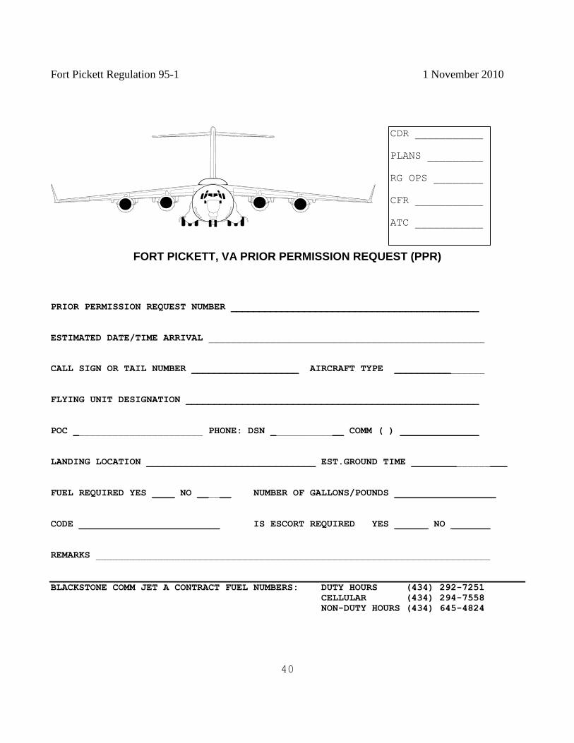
FORT PICKETT, VA PRIOR PERMISSION REQUEST (PPR)
PRIOR PERMISSION REQUEST NUMBER ____________________________________________
ESTIMATED DATE/TIME ARRIVAL _________________________________________________
CALL SIGN OR TAIL NUMBER ___________________ AIRCRAFT TYPE ________________
FLYING UNIT DESIGNATION ____________________________________________________
POC _______________________ PHONE: DSN _____________ COMM ( ) ______________
LANDING LOCATION ______________________________ EST.GROUND TIME _________________
FUEL REQUIRED YES ____ NO ______ NUMBER OF GALLONS/POUNDS __________________
CODE _________________________ IS ESCORT REQUIRED YES ______ NO _______
REMARKS ______________________________________________________________________
BLACKSTONE COMM JET A CONTRACT FUEL NUMBERS: DUTY HOURS (434) 292-7251
CELLULAR (434) 294-7558
NON-DUTY HOURS (434) 645-4824
CDR
_______________
CFR
_______________
RG OPS
____________
PLANS
_____________
BAAF
______________
CDR ___________
PLANS _________
RG OPS ________
CFR ___________
ATC ___________
Fort Pickett Regulation 95-1 1 November 2010
41
APPENDIX F
FORT PICKETT WIRE HAZARD MAP
Hazard maps are updated monthly and maintained on file in the Directorate of Plans, Training and
Security , Air Traffic and Airspace Managers office at Blackstone Army Airfield, Bldg. T-49. Copies are
available for issue.
Fort Pickett Regulation 95-1 1 November 2010
42
APPENDIX G
PRE-ACCIDENT PLAN
PRIMARY CRASH ALARM SYSTEM
1. If the tower is informed of, or a flight emergency is observed, they will activate the primary alarm
system by using the primary alarm phone.
2. If Range Operations is informed of a flight emergency, they will activate the primary alarm system by
using alternate notification system (phone or radio) and notify all stations listed in the primary alarm
system in order listed. If flight operations are NOT open, Range Operations will activate the secondary
crash alarm by phone in the order that they are listed.
3. INFORMATION NEEDED:
a. LOCATION
b. FIRE YES/NO
c. INJURIES
(1) NUMBER
(2) TYPE
d. TYPE AIRCRAFT
e. NAME OF PERSON WHO CALLED
FIRE DEPARTMENT WILL:
1. Respond immediately to the alarm with primary objectives of preserving life, property and mitigation
of potential environmental impact.
2. Conduct rescue and fire suppression as necessary.
3. Supervise crash area until the fire is under control, if applicable, or until area is safe for entry by
authorized personnel. The Incident Command System (ICS) will be used at all times.
4. Request additional firefighting or hazardous material supplies, equipment or personnel when
necessary because of location or the nature of the incident exceeds the finite capabilities of the
department.
5. Maintain trained and equipped crash rescue crew on alert during all flying operations.
6. Maintain trained hazardous material personnel with sufficient initial attack supplies and equipment to
contain or mitigate potential environmental damage.
Fort Pickett Regulation 95-1 1 November 2010
43
TROOP MEDICAL CLINIC (When operational):
1. Dispatch medical personnel to the crash scene via ambulance or helicopter, whichever permits earliest
arrival and evacuation of injured.
2. Periodically train all medical corpsmen who may be assigned crash or rescue duties.
3. Inform ambulance crews of best routes to reach each general area shown on grid map sections.
4. Request additional ambulance and medical assistance when necessary because of crash location or
nature.
5. Supervise removal and transportation of injured and provide emergency treatment.
6. Determine off airfield medical and ambulance facilities proximate to each grid map area and post
telephone numbers on the grid map.
7. Alert hospital emergency room of crash to expedite alerting medical personnel and readying of
medical facilities and equipment.
8. Notify flight surgeon of the unit or the Fort Eustis flight surgeon.
HELICOPTER AMBULANCE CREW WILL:
1. Maintain helicopter ambulance for immediate departure to locate crash.
2. Rescue personnel from crash and evacuate casualties to the designated medical facility.
3. Radio preliminary report of crash scene to tower or controlling agency to aid ground rescue operation.
4. Provide transportation for medical personnel, crash crews, and medical supplies as directed by the
flight surgeon.
FLIGHT OPERATIONS WILL:
1. If informed of a crash, activate the primary crash system and notify all parties in the primary system.
2. Activate the secondary alarm systems by informing all parties in this system and specifying an
assembly point at BAAF operations.
3. Control, direct, coordinate and dispatch personnel, aircraft, equipment, and convoys to locate or to
service the crash plane.
Fort Pickett Regulation 95-1 1 November 2010
44
4. Establish and control an adequate crash PASS SYSTEM, and engineer tape.
5. Monitor requests from the crash area for special or additional assistance or equipment.
6. Serve as the control center for general direction of post-accident activities.
AIR TRAFFIC CONTROL TOWER (If operational)
1. Keep a current grid map conspicuously posted and ensure all tower personnel are familiar with the
map.
2. Activate the primary alarm intercom and report when a crash or flight emergency is observed from the
tower or reported by radio.
3. Radio crash location data to firefighting and rescue crews.
4. Alert all traffic to the emergency and grant traffic priority to rescue and search aircraft.
5. Close field to traffic if necessary, including contacting the Dominion Low Sector controller or the
sector supervisor at Washington Air Route Traffic Control Center. Additionally a Notice to Airmen
(NOTAM) will be issued through Flight Service Station.
6. Contact the 15th
Operational Weather Squadron, Scott Air Force Base, Illinois for summary of current
observed and forecast conditions and preservation of radar coverage data at the time of the incident. Be
prepared to re-transmit downwind chemical messages to the Incident Commander. For specific criteria
that will be provided to the 15th
OWS, see annex 1 to this appendix.
VIRGINIA STATE POLICE/ FORT PICKETT POLICE DEPARTMENT WILL:
1. Dispatch to assembly point police officers and/or security guards as needed to provide adequate
security and order at the crash scene and prevent pilferage of wreckage. Inform any responding Military
Police that cooperation with civil authorities should be in consonance with the limitations of the Posse
Comitatus Act (18 USC 1385), and that treatment of the crash scene should be in accordance with AR
360-5.
2. Train police officers on specific duties at aircraft accident scenes including restraint of spectators,
crash pass requirements, handling of wreckage, security of classified materials and safeguarding
government property and the Incident Command System (ICS).
3. Escort crash convoys or recovery equipment/vehicles to accident scene.
4. Ensure all police patrols know best routes to all general areas within grid map sections.
Fort Pickett Regulation 95-1 1 November 2010
45
5. Determine off post police departments most proximate to each grid map areas and post telephone
numbers (and radio control data) on the grid map.
6. Obtain and supervise nonmilitary guards (normally Range Operations personnel) when there are
insufficient police officers to guard the accident area.
7. Be prepared to enforce stand off distances as directed by the Incident Commander in the event there is
a hazardous material event that will impact life or property on the installation or the general population.
Coordinate for mutual aid support from other law enforcement agencies as mandated by the situation.
8. Provide radio communications with mutual aid patrol cars where necessary.
FORT PICKETT DIRECTOR OF PLANS, TRAINING AND SECURITY:
1. Alert Commander to accident details.
2. Review implementations to this plan to ensure all applicable agencies conduct weekly tests to ensure
adequacy of this plan for all phases and circumstances.
3. NOTIFY UNIT AVIATION SAFETY OFFICER: Who will:
a. Proceed to scene of an aircraft mishap.
b. Classify the mishap on Estimated Costs Of Damage (ECOD) from the maintenance officer and
injury cost and classification estimates from the medical activity.
c. Take charge of the accident site until arrival of the accident investigation board.
d. Keep aviation safety officer in next higher Headquarters informed.
e. Make certain a preliminary report has been sent and the message is correct.
f. Act as advisor to investigating authority as required.
AIRCRAFT MAINTENANCE OFFICER WILL:
1. Ensure availability of and dispatch to assembly point qualified personnel to assist accident
investigation board at accident site.
2. Provide maintenance history of wrecked aircraft.
Fort Pickett Regulation 95-1 1 November 2010
46
3. Assist in recovery and identification of wreckage and determination of operating condition of various
parts.
4. Assist board in "reconstruction" of airplane from wrecked parts.
PUBLIC AFFAIRS OFFICER:
1. Dispatch personnel to assembly point to proceed to scene to handle news release.
2. Maintain liaison with local news services to help minimize adverse public relations that may evolve
from an accident.
3. Assist investigators by identifying witnesses and by soliciting return of wreckage that may have been
removed without authorization.
RANGE OPERATIONS WILL:
1. Muster all available personnel to Range Operations headquarters and standby; provide security of
crash site if needed.
2. Train all Range Operations personnel on how to use alternate notification system for primary and
secondary crash alarm system.
3. Be prepared to call a check fire if needed.
DIVISION OF PUBLIC WORKS WILL:
1. Be prepared to detail a qualified draftsman to assembly point equipped to diagram wreckage pattern
and accident scene.
2. Provide upon request from Aircraft Accident Investigation Board the personnel and apparatus
necessary to clear land, move earth or perform other engineering functions relating to accident
investigation.
Fort Pickett Regulation 95-1 1 November 2010
47
ANNEX 1 TO APPENDIX G
1. It is paramount the 15th
OWS is notified or aircraft mishaps or severe weather events as soon as
possible.
A. Aircraft Mishaps
(1) Contact the OWS Floor Manager as soon as possible: commercial (618) 256-9699 OR
DSN 576-9699. The 15th
OWS will begin saving all available weather data for the area. Users need to
provide the following information:
(a) Location and time of mishap.
(b) Aircraft type, tail number and unit or assignment.
(c) Takeoff time and location.
(d) Destination and ETA.
(e) Name, rank, organization and phone number of individual reporting the mishap.
(f) If know, did the OWS provide a 175-1 weather briefing for this flight?
(2) Safety Investigation teams may request a copy of pertinent weather data in order to
conduct the investigation Please send any request in writing (email is acceptable) to the Mission
Support Liaison with the requestors name, rank, organization and telephone number
B Severe Weather Events (non-aircraft) if severe weather causes property damage, serious injury
and/or death on a DoD installation or exercise area with the 15th
OWS area of responsibility, contact the
OWS Floor Manager as soon as possible: commercial (618) 256-9699 or DSN 576-9699 with the
following information:
(1) Location, time and type of mishap.
(2) Name, rank, organizations and phone number of individual reporting the mishap.
Fort Pickett Regulation 95-1 1 November 2010
48
APPENDIX H
LOCAL AREA MAPS
Maps (1:50000 scale) are maintained in the Division of Plans, Training and Security, Bldg. 3001 and are
available for issue in limited quantities.
Fort Pickett Regulation 95-1 1 November 2010
49
APPENDIX I
CLOSE AIR SUPPORT OPERATIONS
TABLE OF CONTENTS
Chapter 1 - Range Responsibilities
General
Scheduling
Explosive Ordnance Disposal (EOD)
Weather
Existing Ranges and other Government Lands
Range Fires
Chapter 2 - Range Description and Capabilities
General
Airspace
Location/Geographic Features
Danger Areas and Impact Zones
Targets
Chapter 3 - Weapons Delivery Procedures
General
Entry/Holding and Exit Procedures
Restrictions
Communications
Weather Minimums
External Stores Jettison Area
Hung Ordnance/Flare Procedures
Unsafe Gun Procedures
Emergency Airfields
Aircraft Accident/Incident
Restricted Area Violations
Live Fire Exercises
Laser Operations Procedures
Chapter 4 - Electronic Combat Ranges
General
Chapter 5 - Range Safety Officer
General
Certification
Duties
Fort Pickett Regulation 95-1 1 November 2010
50
Chapter 6 - Air Combat Maneuvering Instrumentation
General
Attachments
Ft Pickett CAS Deliveries
Ft Pickett Range Map
Ft Pickett Range Target List
Commander's Certification Letter (Sample)
Fort Pickett Regulation 95-1 1 November 2010
51
CHAPTER 1
RANGE RESPONSIBILITY
1 GENERAL.
1.1.1. This chapter outlines responsibilities for scheduling and control of the Ft Pickett Range
Complex and restricted area R-6602. The Commander of Ft Pickett has delegated the responsibility for
operations and safety to the Division of Plans Training and Security (DPTS). However, this does not
relieve air liaison officers (ALO), enlisted terminal air controllers (ETAC), tactical air command and
control specialists (TACCS) and aircrews of their responsibility for exercising good judgment for the
safe and orderly conduct of flights within the Ft Pickett Range Complex.
1.2 SCHEDULING. Planning, Coordination and Scheduling Process for Restricted Area R-6602 and the
Pickett Military Operating Areas (MOA) 1, 2, and 3.
1.2.1. Submit close air support (CAS) requests 45 days prior to the planned operation through DPTS.
The DPTS is the only agency authorized to reserve the MOAs. Requests submitted less than 45 days
prior will be accepted on a case-by-case basis. Requests received less than 10 days prior to the first day
of training will not be scheduled. All requests must be submitted via email to Commander, ARNG
Maneuver Training Center Fort Pickett, ATTN: VAFP-T, Blackstone, VA 23824-9000. Training
request forms and submission email addresses are available at fortpickett.net
1.2.2. The unit scheduler, operations officer, or coordinating activity must schedule the special use
airspace and provide block times, call signs, number of aircraft, squadron designation, point of contact
and DSN phone number to the air traffic and airspace manager NLT 48 hours prior to the block times.
1.2.3. Range restrictions and type munitions will be coordinated with the Range Officer telephonically or
in person prior to the first day of training. A training coordination meeting will be held Monday through
Friday at 0830.
1.2.4. Possession of a Range Bulletin is mandatory for the Officer in Charge or Range Safety Officer.
Range Bulletins are published 48 hours prior to the training event (Thursday for Saturday and Sunday
training and Friday for Monday and Tuesday training).
1.3 EOD.
1.3.1. No pyrotechnics, flares, demolition or any other type munitions are released or fired at any time
without clearance from Range Operations.
1.3.2. If any ordnance or ordnance effects impact outside the impact area, operations will immediately
cease and Range Operations notified with the grid location and type of ordnance. EOD support will be
Fort Pickett Regulation 95-1 1 November 2010
52
requested through Range Operations. An investigation IAW Ft Pickett Regulation 350-2 will be
initiated by the first field grade officer in the unit's chain of command.
1.4 WEATHER.
1.4.1. Weather briefings can be obtained from:
Flight Service Station Toll Free 800-992-7433
15TH
Operational Weather Squadron (618) 256-9755/9702
1.4.2. Range Operations is responsible for transmitting to units in the field all weather watches/warnings
received. Range Operations will upon initial receipt of a weather watch/warning make a blanket
broadcast over the FM radio, frequency 34.1; the broadcast will include the watch/warning number,
valid time and pertinent information.
1.5 EXISTING RANGES AND OTHER GOVERNMENT LANDS. The Ft Pickett Range Complex
consists of restricted airspace R-6602 and Pickett MOAs 1, 2, and 3. The US Army owns the land
underlying R-6602, including all targets. The land beneath the MOAs is privately owned.
1.6 RANGE FIRES.
1.6.1. Units are responsible, within their capabilities, for extinguishing fires started either by their
personnel or as a result of their unit training activities. If extinguishing the fire is beyond the unit's
capability, the unit will immediately notify the Post Fire Station, ext. 911, and Range Operations. If a
telephone is not available, any means, to include the Range Operations radio net or mounted messenger
will be used to effect notification.
1.6.2. Range Operations must be notified of fires in the impact area. Report the location and extent of the
fire, but DO NOT ENTER the impact area for the purpose of fighting the fire.
Fort Pickett Regulation 95-1 1 November 2010
53
CHAPTER 2
RANGE DESCRIPTION AND CAPABILITIES
2.1 GENERAL. The Ft Pickett Range Complex consists of Restricted Area R-6602 A, B, C, surface up
to but not including 18,000 feet AGL and three MOAs known as Pickett 1,2, and 3. Scheduling and
control of the airspace is the responsibility of the Army National Guard Maneuver Training Center Fort
Pickett and is returned to Washington ARTCC when not in use by military aircraft.
2.2 AIRSPACE.
2.2.1. Vertical stratification of R-6602:
RESTRICTED AREA CHARTED UTILIZATION ALTITUDES
R-6602A May I -Sept 15 other times by NOTAM Surface up to but not including 4,000 ft
AGL
R-6602B By NOTAM 24 hours in advance 4,000 ft up to but not including 11,000 ft
AGL
R-6602C By NOTAM 24 hours in advance 11,000 ft up to but not including 18,000 ft
AGL
2.2.2. R-6602 horizontal boundaries are:
N36 57 54 W77 53 19 N37 01 05 W77 50 43
N37 05 37 W77 51 54 N37 05 37 W77 54 42
N370421 W77 55 58 N37 01 50 W77 55 58
N37 01 50 W77 58 40 N36 58 12 W77 57 42
2.2.3. The Ft Pickett MOAs described below are intermittent and can only be activated from sunrise to
sunset and only in conjunction with the activation of restricted area R-6602. MOA altitudes are:
Pickett 1 MOA 500 ft AGL to 6,000 ft AGL
Pickett 2 MOA 500 ft AGL to 10,000 ft AGL
Pickett 3 MOA 4,000 ft AGL to 10,000 ft AGL
2.2.4, Horizontal MOA boundaries:
MOA 1:
N37 05 37 W77 54 42 N37 05 37 W77 51 54 N37 01 05 W77 50 43 N37 10 00
W77 43 00 N37 12 00 W77 46 00 N37 07 50 W77 54 42
Fort Pickett Regulation 95-1 1 November 2010
54
MOA 2:
N36 57 54 W77 5319 N36 54 00 W77 56 00 N36 52 00 W78 13 00 N37 03 00
W78 05 00 N37 01 50 W77 58 40 N36 58 12 W77 57 42
MOA 3:
N37 01 50 W77 58 40 N37 03 00 W78 05 00 N37 07 50 W77 54 42 N37 05 37
W77 54 42 N37 04 21 W77 55 58 N37 01 50 W77 55 58
2.3 LOCATION/GEOGRAPHIC FEATURES.
2.3.1 - The Ft Pickett Range Complex lies for the most part within the Coastal Plains Region of Virginia.
The topography is generally gently to sharply rolling ridges and hills. The highest topographic relief
occurs in the northwest and southwest portion of the installation. Elevation ranges from about 190 to 450
feet above mean sea level.
2.4 DANGER AREAS AND IMPACT ZONES. Entry into the danger areas is prohibited without
clearance from Range Operations. The coordinates of the impact area are:
18S TG42000200 18G TS45640172
18S TG42000020 18G TR45629990
2.5 TARGETS.
2.5.1. Only hard targets are available for live CAS missions in the Impact Area. ALO/ETACs or
qualified personnel are responsible for selecting and identifying all targets for CAS missions (see
attachment 4).
2.5.2. The location of the most prominent targets can be changed by Range Operations. Targets do not
change often, but can be placed anywhere in the impact area. It is the responsibility of the ALO/ETAC
and the aircrew to ensure they have the correct coordinates and target before expending ordnance.
Fort Pickett Regulation 95-1 1 November 2010
55
CHAPTER 3
WEAPONS DELIVERY PROCEDURES
3.1 GENERAL.
3.1.1. Aircraft will remain VMC at all times while on the range or while maneuvering in R-6602
and the MOAs.
3.1.2. Day and night CAS missions are permitted within the Ft Pickett Range Complex, however
the MOAs can not be activated between sunset and sunrise.
3.1.3. Coordinated activities between rotary wing, fixed wing aviation, and ground units are
encouraged.
3.1.4. The ALO/ETAC is specifically responsible for controlling all air strikes.
3.1.5. The ALO/ETAC will report on station in the field control location a minimum of one hour
prior to the scheduled mission time, contact Range Operations, and open the range using Attachments.
Continuous radio communications must be maintained with Range Operations.
3.1.6. The ALO/ETAC will brief airspace restrictions to the aircraft at initial contact, before
clearance into R-6602.
3.1.7. Contact Points and Initial Points should be telephonically coordinated between the
ALO/ETAC and the flight lead prior to the mission.
3.1.8. Aircrews may use any approved delivery modes, tactics, or techniques for simulated
ordnance to be delivered.
3.1.9. The ALO/ETAC will call out ordnance impact points in relation to the target in order to
aid pilots in subsequent deliveries and provide damage assessment.
3.1.10. Upon completion of the CAS mission and when all aircraft have departed the restricted
area, the ALO/ETAC will close out with Range Operations providing type and number of munitions
fired or released from the aircraft..
3.2 ENTRY/HOLDING AND EXIT PROCEDURES.
3.2.1. Aircraft operating within the MOA shall be assigned and use the current local altimeter
setting.
3.2.2. Remarks section of the flight plan shall specify, "Pickett MOA" and delay time.
Fort Pickett Regulation 95-1 1 November 2010
56
3.2.3. Entry into, operation within, and exit from the Pickett MOAs shall be accomplished as the
result of an ATC clearance.
3.2.4. Pilots maneuvering in R-6602 will be responsible for remaining within the MOA.
3.2.5. Request for ATC clearance to enter or exit the MOA shall be made to Washington Center
on frequencies depicted in Attachment 2.
3.2.6. Aircraft intending to depart the Pickett MOAs on an IFR flight plan will file an IFR plan
prior to departing home base.
3.2.7. The MOAs shall be considered active at the time participating aircraft receive clearance
into said airspace, unless otherwise coordinated.
3.2.8. Aircraft will squawk code 4000 and monitor guard while operating within the MOAs
unless otherwise requested by ATC.
3.3 RESTRICTIONS.
3.3.1. Aircraft engaged in close air support live fire missions must be under direct control of an
ALO, ETAC, or qualified personnel that have communications with the aircraft and can clear them in
"HOT." Coordinated operations involving artillery', mortars, or helicopters and high performance
aircraft must have a single point of contact that is in radio contact with Range Operations and all
participating units.
3.3.2. Aircraft operating in the Ft Pickett airspace without positive control receive a block time
during which all indirect or tank firing points/ranges are placed on a mandatory check fire. Strafing
operations are not permitted under these circumstances.
3.3.3. Aircrew/s may use approved tactics or techniques not restricted by Attachment 2 during
ingress to or egress from the target in order to fit the scenario. However, all weapons will be delivered
from a dive of at least 10 degrees.
3.3.4. External/internal cannon, up to and including 30mm GAU-8, is authorized for ordnance
delivery. Under no circumstances will any depleted uranium or explosive rounds be fired at this
installation. All strafing passes will be completed above 2,000 ft AOL. High angle strafe will not be less
than -30 degrees. Strafe run-ins must over fly Observation Point (OP) 3, on a heading between 350 and
360 degrees magnetic.

Fort Pickett Regulation 95-1 1 November 2010
57
3.3.5. High explosive ordnance is prohibited, but there are no restrictions on the size of training
bombs (BDU-33, MK-106, other inert) dropped into the impact area. The tactical scenario will dictate
bombing procedures, dive angles, and run in headings. It should be noted that available special use
airspace to the east of the complex is very limited and may not allow the use of east to west
ingress/egress routes.
3.3.6. Minimum release altitudes will be specified in the applicable, aircraft technical order for
the type of ordnance to be delivered or simulated to ensure adequate time for fusing and
blast/fragmentation clearance. In no case will aircraft descend below:
The minimums established in AFI 11 -214
AJFPD 11-2 series Aircraft Rules and Procedures
Directives of the FAC/ALO/ETAC in the target area or local directives, whichever is higher.
3.3.7. Mark 40 and Mark 66 rocket motors may be used as the propulsion system for the
following warheads: M-156 White Phosphorous, M-61 and WTU-I target practice. Use ofM-151 and
Mark I high explosive warheads will be handled on a case-by-case basis.
3,3,8. Maverick missiles cannot be fired at this installation.
3.3.9. Chaff and flares are authorized over the impact area only and require prior coordination.
Flares will be dropped at an altitude ensuring they will burn out before impacting the ground.
3.3.10. Operations involving fixed and rotary wing aircraft in joint training must maintain a
minimum altitude separation of 300 ft.
3.3.11. High performance aircraft are not allowed to operate in the Ft Pickett area between 0900-
1200 on Sunday and 0001-2400 Easter Sunday.
3.3.12. Minimum altitude over troops will be 300 ft.
3.4 COMMUNICATIONS.
a. The on-scene senior ALO/ETAC will ensure communications are maintained with Range
Operations. Communications failure will result in termination of all live fire operations.
b. Rapid communications must be available between the controlling FAC/ALO/ETAC, the
supported Army unit (Air Mission Commander during JAAT) and the Army agencies controlling the
impact area and supporting files. If two-way communication between the FAC/ALO/ETAC, the
supported unit or the controlling Army agencies is lost, all ordnance delivery activities will cease until
communications are restored.
Fort Pickett Regulation 95-1 1 November 2010
58
c. Aircraft will hold high and dry until communications are reestablished or their block time has
ended.
3.5 WEATHER MINIMUMS.
a. Weather minimums for joint training operations will be 2,500 ft ceiling, and 5 miles visibility
in the target and holding areas unless otherwise specified in applicable AFPD 11-2 series regulations.
b. For Special Operations Forces, minimum ceiling must be at least 500 ft above pattern/pop
apex altitude for delivery procedure employed or 1,500 ft, whichever is greater. Minimum visibility is 3
miles.
c. Deliveries will not be permitted when weather prevents range/target identification or when
surface winds exceed 40 knots.
3.6 EXTERNAL STORES JETTISON AREA.
a. Emergency external stores jettison will be as required.
b. The primary external stores jettison area is the Fort Pickett impact area.
c. For a controlled stores jettison, the following procedure will be used:
(1) Notify Range Operations prior to release in order to ensure area is clear.
(2) Jettison on a level pass at 1,700-ft MSL during day operations, 2,700 ft MSL
minimum during night operations.
(3) After release advise Ft Pickett Range Operations of number, type ordnance, and
location of impact.
3.7 HUNG ORDNANCE/FLARE PROCEDURES. Safe up all switches and advise Ft Pickett Range
Operations of your intentions.
3.8 UNSAFE GUN PROCEDURES.
a. The ALO/ETAC will notify Range Operations of the situation.
b. Aircrews will adhere to the procedures established by their parent command's (USAF, USN,
USMC) regulations.
c. Upon departure from the ranges avoid populated areas to the maximum extent possible.
Fort Pickett Regulation 95-1 1 November 2010
59
d. Land at the nearest suitable field (military if possible).
3.9 EMERGENCY AIRFIELDS. The following is a list of airfields in close proximity to R-6602 that
may be used in case of an emergency:
Blackstone AAF NW corner of R-6602 5332 x 150 ft runway
Petersburg Municipal N37 11.03; W77 30.44 5001 x 100 ft runway
Richmond International N37 30.31; W77 19.18 9003 x 150 ft runway
3.10 AIRCRAFT ACCIDENT/INCIDENT.
3.10.1. If an aircraft accident occurs on the range, the ALO/ETAC will notify Range Operations. Range
Operations will activate crash alarm procedures. Range Operations will also notify Washington Center
and the aircraft's squadron and render any assistance possible.
3.10.2. The ALO/ETAC should use proper radio procedure to prevent unauthorized personnel from
obtaining information. Use whatever means available to cordon off and secure the area. Direct all news
media requests to the Public Affairs Office.
3.11 RESTRICTED AREA VIOLATIONS. In the event of a violation of R-6602 by unauthorized
aircraft, Washington Center will notify aircraft directly utilizing ATC frequency or on 243.000 UHF.
3.12 LIVE FIRE EXERCISES.
3.12.1 Live fire is defined as any air activity that includes the dropping, firing, and/or expending of
objects or projectiles from an aircraft in conjunction with personnel on the ground. This includes normal
live CAS operations.
3.12.2. Troop and target identification is a critical aspect of the live fire program. Therefore,
ALO/ETACs will ensure the following minimum operational procedures are adhered to:
The ALO/ETAC will ensure a unique terrain feature or a conspicuous marking devise marks the target
(i.e., laser, white phosphorous marking rocket, artillery round, etc),
After each flight member has acknowledged target identification and direction of attack prior to their
initial pass on the target, the ALO/ETAC will clear the aircraft/flight for an initial dry pass to be used for
spacing and for reconfirmation of the target.
Specific control measures (phase lines, restricted fire areas, etc) will be identified by the Army
commander, beyond which no ground troops can maneuver without approval of the coordinating agency.
Fort Pickett Regulation 95-1 1 November 2010
60
If attack of multiple targets is planned, multiple control phase lines will be required. The senior
ALO/ETAC planning the exercise will ensure that the control phase lines comply with the safe
separation criteria of this supplement.
The senior ALO/ETAC will ensure the ground force commander is in contact and will advise the
controlling ALO/ETAC if troops intend to or have crossed the phase lines.
The controlling ALO/ETAC will be positioned to ensure that the correct target is being attacked and
watch for unplanned troop movements in advance of control phase lines.
While providing direct control (has positive radio communications with each aircraft and visual
contact with each aircraft and the target), the ALO/ETAC will be responsible for final clearance of each
fighter on every pass, and will also execute primary abort authority.
Under circumstances requiring indirect control (unable to see fighters and target) a safety observer will
be used.
The safety observer will also be required if terrain, weather, or other factors restrict the ALO/ETAC's
ability to observe and control the exercise.
The safety observer is defined as an ALO/ETAC who is in a position to observe the target and
attacking aircraft The safety observer maintains full abort authority and responsibility for any attack
which appears to be directed at the wrong target or could endanger troops or vehicles. The use of a safety
observer is intended to enhance safe operations; not to restrict properly executed CAS/JAAT operational
procedures.
The ALO/ETAC's role in JAAT is to coordinate the attack with the Air Mission Commander (AMC),
pass updated battlefield information to the fighters, and provide either direct or indirect control as the
situation dictates. The ALO/ETAC retains abort authority.
The AMC has overall coordination responsibility for the JAAT operation, and can authorize the
fighters to attack, but does not dictate attack methods or control the flight. The AMC also has abort
authority.
The ALO/ETAC will obtain confirmation that each in the flight has positively identified the target.
Each pilot will call "Fighter call sign - in HOT/DRY," "FAC in sight/not in sight" (if FAC is
controlling), and must receive clearance on each pass. If the ALO/ETAC does not respond the aircraft
will automatically abort that pass.
Providing separation for CAS mission aircraft. Minimum spacing between aircraft on live ordnance
passes will be in accordance with the appropriate technical order.
For those events/conditions not covered) 35 seconds from bomb impact to roll in will be used as a
minimum safety factor.
Fort Pickett Regulation 95-1 1 November 2010
61
3.13 LASER OPERATIONS PROCEDURES.
3.13.1. When LASER range finders/designators are used a LASER Range Safety Officer (LRRSO) must
be identified to Range Operations. The Range Safety Officer (RSO) may also be the LRRSO.
3.13.2. ALO/ETACs will provide aircrews with an attack heading or laser to target line. The attack
heading must allow aircrews to acquire the reflected laser energy.
3.13.3. Due to the possibility of false target indications, attack headings should avoid the target to laser
designator safety zone unless the tactical situation dictates otherwise. The safety zone is a 20-degree fan
whose apex is at the target and extends 10 degrees either side of the target to laser designator line.
3.13.4. The optimal attack zone is a 120 degree fan whose apex is at the target and extends to 60 degrees
either side of 'the target to laser designator line, leaving an ideal attack zone of 60 degrees either side
excluding the safety zone.
3.13.5. Proper safety procedures will be followed at all times. Do not point a laser at any person or
aircraft.
3.13.6, The following terminology will be used to enhance safe operations during lasing:
Switches Cold: Laser switch Standby or Off.
Switches Hot: Laser switch Arm or On.
Ten Seconds: Prepare to start laser designator in 10 seconds.
Laser On: Designate the target with laser energy now.
Spot: Aircraft has acquired laser energy.
Shift: Shift laser energy from the offset position next to the target onto the target.
Terminate: Cease laser designation.
3.13.7. Laser firing will not be permitted when standing water or reflective material is observed within
30 meters of the target area.
3.13-8. Laser operations will cease when any unsafe condition exists.
3.13.9. Any laser malfunction or accidental firing will be reported immediately to Range Operations.

Fort Pickett Regulation 95-1 1 November 2010
62
CHAPTER 4
ELECTRONIC COMBAT RANGES
4.1 GENERAL. Ft Pickett Range Complex is a class B range, and has no electronic ranges; therefore this
chapter is not applicable.
Fort Pickett Regulation 95-1 1 November 2010
63
CHAPTER 5
OFFICER IN CHARGE/RANGE SAFETY OFFICER
5.1 GENERAL. The Range Safety Officer (RSO) and the Officer In Charge (QIC) is charged with the
safe accomplishment of CAS missions flown on the Ft Pickett Range Complex. Each ALO/ETAC must
strictly enforce established range flying procedures and aircraft weapons deliveries.
5.2 CERTIFICATION.
5.2.1. Prior to conducting training on the Ft Pickett Range Complex, a commander certified OTC/RSO
must be present and listed with Range Operations.
5.2.2. OIC/RSO will be a certified mission-ready air liaison officer (ALO) or enlisted terminal attack
controller (ETAC).
5.2.3. The first field grade commander will provide a letter to Range Operations (see Attachment 5 for
format) of personnel who are certified to perform duties as OIC or RSO.
5.2.4. All OIC/RSOs are required to receive a range safety briefing every twelve months. Conducted by
the Range Operations personnel. Range Operations will maintain a list of personnel who have received
the briefing.
5.3 DUTIES. The OIC/RSO's primary duty is to supervise control of aircraft on the Ft Pickett Range
Complex and adjacent MOAs.
5.3.1. It is essential that the OIC/RSO have a thorough knowledge of range procedures, duties, and
aircraft delivery parameters before assuming duties.
5.3.2. The OIC/RSO is specifically responsible for:
Opening and closing the range for training and reporting the types and numbers of munitions fired or
released from the aircraft.
Providing separation for CAS mission aircraft.
Ensuring the CAS mission aircraft remain within the scheduled restrictions and MOA.
Operating the range IAW procedures outlined in this supplement, ACCR 55-26, Ft Pickett Regulation
350-2, and all other published instructions.
Reporting all duds by type and location to Ft Pickett Range Operations.
In the event of any ordnance reported or suspected to have landed outside of a designated impact area
the OIC/RSO will immediately:
Have aircraft safe all switches and proceed to the MOA and hold.
Report the incident to Range Operations.
Fort Pickett Regulation 95-1 1 November 2010
64
CHAPTER 6
AIR COMBAT MANEUVERING INSTRUMENTATION
6.1 GENERAL. Air combat is not authorized in the Ft Pickett Range Complex; therefore this chapter is
not applicable.
Fort Pickett Regulation 95-1 1 November 2010
65
ATTACHMENT 1
Ft. Pickett CAS Deliveries
1 Ground Controlled Events.
1.1. Table 1 lists authorized events and attack headings for each target. In addition, run in headings will
not be directed toward or over fly ground personnel. These restrictions apply to aircraft under the direct
control of a ground FAC with eyes on both the target and aircraft. Aircraft1are not to release ordnance
until clearance has been given by the ground controller. If no clearance is given (loss of
communication), aircraft will "continue DRY" and return to the IP. If no ground controller is present,
strafing is not authorized.
1,1.2. Aircraft strafing (20 mm and 30 mm) are restricted to high angle strafe over flying OP 3 with a
heading of 350 to 360 degrees magnetic.
1.1.3. The only authorized weapons are BDU-33/Mk-76 or 20/30 mm unless noted otherwise.
Fort Pickett Regulation 95-1 1 November 2010
66
ATTACHMENT 1
TARGETS LISTED BELOW ARE STRAFE/BDU TARGETS
AIRCRAFT EVENTS TARGETS RUN IN HEADINGS (MAG)
A-10 LAB 10, 22 Any
1, 2, 4, 5, 9, 21-25 280-100
VLD, DB, LALD, 1, 2, 4, 5, 9, 10, 21-25 ANY
LAHD, HADB
Low Angle Strafe 1, 2, 4, 5, 9, 10, 11, 13 See 1.1.2 above
High Angle Strafe 18, 19, 20, 21, 23-25
F-16 LAB 1, 2, 4, 5, 9, 10, 11, 13 280-100
18, 19, 20, 21, 23-25
F-15/F-16 HADB 17, 22 ANY
1, 2, 17, 20, 23 260-110
LALD 1, 2, 4, 5, 9, 10, 17, 18 270-040
19, 20-25
Low Angle Strafe 1, 2, 4, 5, 9, 10, 11, 13 See1.1.2. Above
High Angle Strafe 18, 19, 20, 21, 23-25
Low Alt Level 1, 2, 4, 5, 9, 10 270-300
F-18 Low Angle DB 1, 10, 19, 22 ANY
DB 1, 2, 4, 5, 9, 10, 11, 13 280-100
20, 21, 23-25
Low Angle Strafe 1, 2, 4, 5, 9, 10, 11, 13 See 1.1.2 above
High Angle Strafe 18, 19, 20, 21,23-25
F-18/AV-8B LAB 1, 2, 4, 5, 9, 10, 11, 13 280-100
18, 19, 20, 21, 23-25
F-18/BDU48 LowAngle DB 1, 2, 4, 5, 9, 10, 11, 13 280-100
18, 19, 20, 21, 23-25
Fort Pickett Regulation 95-1 1 November 2010
67
TGT# TARGET GRID LOCATION ELEV.
TGT# 1 2 APCs N to S 18S TG 4436291 262
TGT# 2 3 JEEPs 18S TG 4432288 262
TGT#3 5 JEEPs N to S 18S TG 4419241 260
TGT#4 TANK HULK 18S TG 4440283 295
TGT#5 CLUSTER OF HULKS N OF 5 JEEPS 18S TG 4437281 296
TGT#6 FLATTENED TANK OF SANDY AREA 18S TG 4429247 296
TGT#7 3 HULKS MIDDLE OF IMPACT AREA 18S TG 4433243 260
TGT#8 BEAT UP TANKS 18S TG 4437240 260
TGT#9 RECTANGLE HULK 18S TG 4456274 295
TGT#10 TANKS ON THE RIDGE 18S TG 4462304 262
TGT#11 HULK IN SAND 18S TG 4450704 262
TGT#12 TANK IN TREES 18S TG 4447245 262
TGT#13 1 JUNK TANK ON RIDGELINE 18S TG 4469254 229
TGT#14 1 HULK 18S TG 4459241 262
TGT#15 HULKS OF THE RIDGE 18S TG 4472252 295
TGT#16 ARTY PIECE 18S TG 4544327 262
TGT#17 2 TANK HULKS 18S TG 4462207 262
TGT#18 SINGLE TANK IN TREE LINE 18S TG 4503217 262
TGT#19 M60 A3 TANK 18S TG 44391181 262
TGT#20 M60 A3 TANK 18S TG 4401973 262
TGT#21 M60 A3 TANK 18S TG 44401003 262
TGT#22 M60 A3 TANK 18S TG 43961183 262
TGT#23 M60 A3 TANK 18S TG 4394292 262
TGT#24 6X30 METAL TUBES 18S TG 4386999 262
TGT#25 M60 A3 TANK 18S TG 43811006 262
Fort Pickett Regulation 95-1 1 November 2010
68
TARGETS LISTED BELOW ARE IN THE MOA AND ARE DRY TARGETS ONLY
TGT# TARGET GRID LOCATION ELEV.
TGT#19 REAL BRIDGE/DAM 18S TG 36489961 213
TGT#20 MOCK CITY 18S TG 3977425 262
TGT#21 RR/SMALL WHITE BLDG 18S TG 52191622 328
TGT#22 HWY BRIDGE OVER RR TRACKS 18S TG 51811647 393
TGT#23 OLD WHITE PLANTATION HOUSE 18S TG 49021429 295
TGT#24 4 GRAIN SILOs 18S TG 45931299 290
TGT#25 250 SLIVER TWR LOOKS LIKE SA-10 18S TG 45261378 280
TGT#26 HWY BRIDGE OF RR TRACKS 18S TG 44221488 300
TGT#27 3 GRAIN SILOS 18S TG 44421399 252
TGT#28 OLD WHITE HOUSE ON LAKE 18S TG 4582464 213
TGT#29 RED AND WHITE OP TOWER 18S TG 4697219 256
TGT#34 WHITE BLDG & DAM S END OF LAKE 18S TG 42911289 295
DIRT COMBAT ASSAULT STRIP AREA
TGT# TARGET GRID LOCATION ELEVATION
TGT#30 SW END OF RUNWAY 18S TG 4367999 328
TGT#31 NE END OF RUNWAY 18S TG 44221064 328
TGT#32 2 TANKS AND AAA GUN NW END 18S TG 44361064 329
TGT#33 PARALLEL TAXIWAY N SIDE OF DIRT 18S TG 43821034 329
STRIP
2. Operations without a Ground Controller The only authorized events without a ground controller are
level deliveries of BDU-33/Mk-76 on targets 1, 2, 4, 5, 9, and 10. Run in headings will be 290 to 300
degrees magnetic and will not be directed toward or over fly ground personnel.
Fort Pickett Regulation 95-1 1 November 2010
69
ATTACHMENT 4
Date
OFFICE SYMBOL
MEMORANDUM FOR Commander, ARNG MTC Fort Pickett, ATTN: VAFP-T,
Blackstone, VA 23824-9000
SUBJECT: Certification of Officer in Charge/Safety Officer (OIC/SO)
1. The following personnel assigned or attached to this unit are certified to perform duties as OIC/SO of
training facilities at Ft Pickett:
NAME RANK LAST 4 OF SSN OIC SO
DAVIDSON, Donald L. 04 9971 X X
JOHNSON, Hairy P. 03 1111 X X
HENRY, David J. E6 1299 X
2. The personnel named above meet the requirements outlined in AR 385-63 and Fort Pickett
Regulation 350-2. They have also completed a written examination that evaluates their knowledge of
these regulations.
3. All officers understand that they must have received the range safety briefing within the last six
months for this certification to be valid.
Signature Block
S-A-M-P-L-E
Fort Pickett Regulation 95-1 1 November 2010
70
APPENDIX J
Airborne Operations
.
a There are two Fort Pickett Drop Zones (DZ) listed in the Assault Zone Availability Report
(AZAR). All are approved for airborne operations by Headquarters, Air Mobility Command. The
following is a summary of the drop zones and the capabilities of each:
(1) Blackstone DZ - Static Line, High Altitude, Low Opening (HALO); High Altitude, High
Opening (HAHO); Container Delivery System (CDS); Heavy equipment.
(2) Dove DZ - Static line, HALO, HAHO, CDS, Heavy Equipment
b. Blackstone and Dove drop zones in listed in the Parachute Jumping Areas section of the
Airport Facility Directory (AFD) as having a permanent Notice To Airmen (NOTAM) from the surface to
12,500 feet MSL with a one mile radius of operation. Coordination with the installation AT&A is
encouraged, especially if HAHO standoff distances or altitudes are required beyond those specified in the
AFD.
c. All users will comply with the restrictions and instructions contained in the NOTAM or Drop
Zone survey. Additional information and Drop Zone surveys are available from the Air Traffic and
Airspace Manager, (434) 292-2193.

Fort Pickett Regulation 95-1 1 November 2010
71
APPENDIX K
OPERATION OF UNMANNED AERIAL VEHICLES/SYSTEMS
Unmanned aerial vehicles and/or systems may be utilized within the confines of the restricted airspace.
Vehicle specific vehicles may be launched from Blackstone Army Airfield only if a current Certificate of
Authorization has been issued by the Federal Aviation Administration. All UAV/UAS operations will
be conducted strictly IAW with Fort Pickett 95-23, UNMANNED AERIAL VEHICLE FLIGHT
REGULATIONS, dated 1 November 2010.
Fort Pickett Regulation 95-1 1 November 2010
72
BY ORDER OF THE GOVERNOR:
OFFICIAL: DANIEL E. LONG, JR.
MAJOR GENERAL, VaARNG
The Adjutant General
WILLIAM L. KORSEN
COL, AR
COMMANDING
DISTRIBUTION:
A
The proponent office for this regulation is the Division of Plans, Training and Security,
Fort Pickett. Users are invited to send comments and suggested changes to ARNG-
MTC, ATTN: NGVA-MTC-OTB.