Embed Size (px)
Citation preview
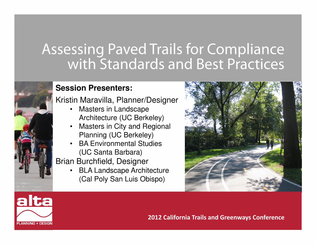
Assessing Paved Trails for Compliance with Standards and Best Practices
2012 California Trails and Greenways Conference
Session Presenters:
Kristin Maravilla, Planner/Designer• Masters in Landscape
Architecture (UC Berkeley)
• Masters in City and Regional
Planning (UC Berkeley)
• BA Environmental Studies
(UC Santa Barbara)
Brian Burchfield, Designer• BLA Landscape Architecture
(Cal Poly San Luis Obispo)
Presentation Outline
1. Introduction
2. Overview of Current Guidelines
3. Grey Areas
4. Applying the Guidelines
5. References
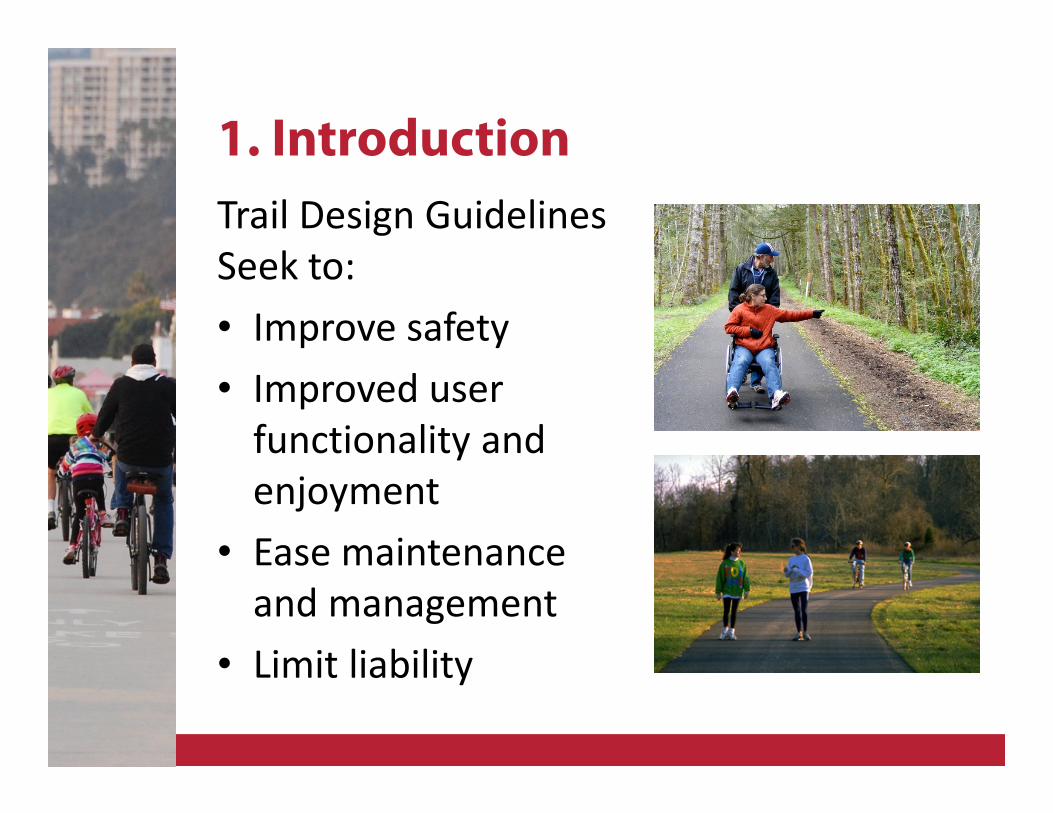
1. Introduction
Trail Design Guidelines
Seek to:
• Improve safety
• Improved user
functionality and
enjoyment
• Ease maintenance
and management
• Limit liability
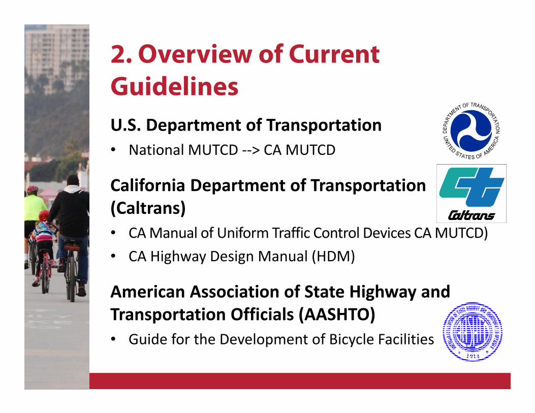
2. Overview of Current
Guidelines
U.S. Department of Transportation
• National MUTCD --> CA MUTCD
California Department of Transportation
(Caltrans)
• CA Manual of Uniform Traffic Control Devices CA MUTCD)
• CA Highway Design Manual (HDM)
American Association of State Highway and
Transportation Officials (AASHTO)
• Guide for the Development of Bicycle Facilities
2. Overview of Current
Guidelines
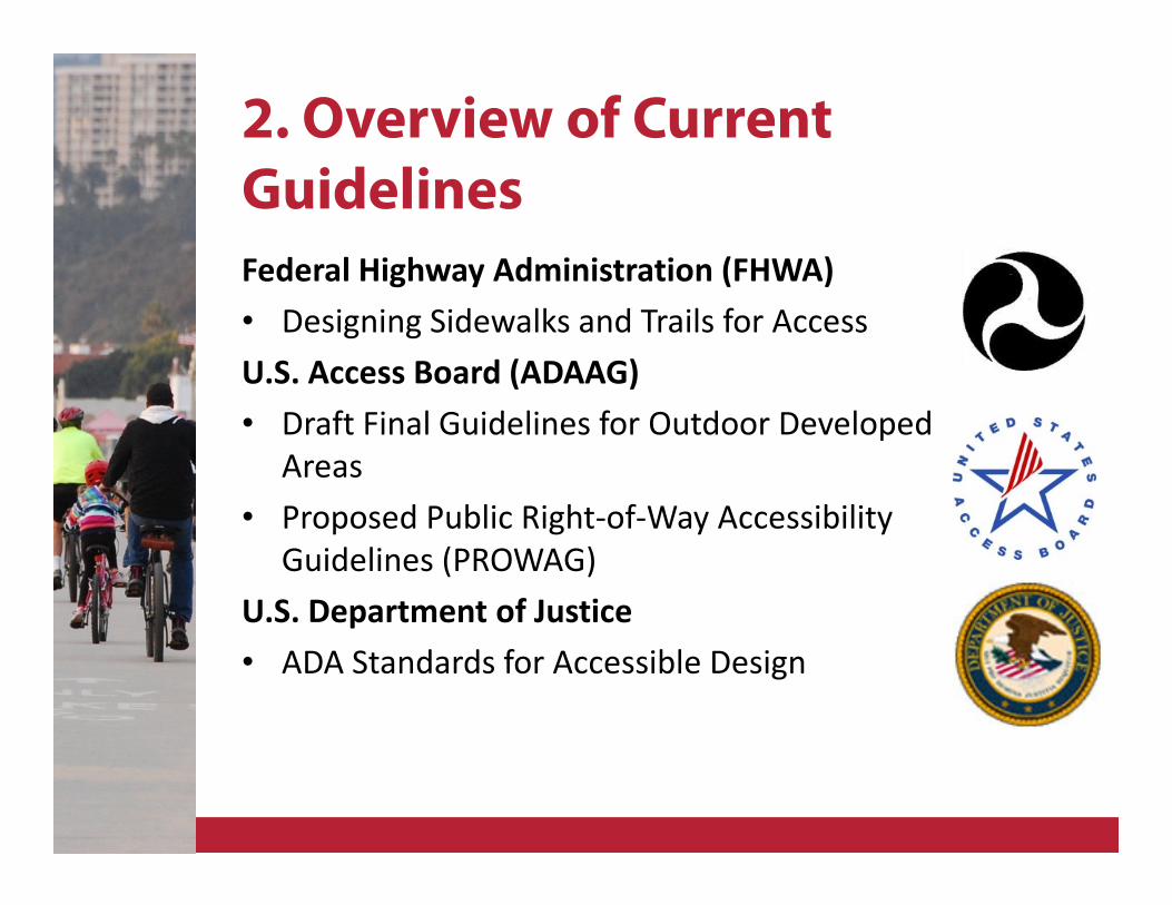
Federal Highway Administration (FHWA)
• Designing Sidewalks and Trails for Access
U.S. Access Board (ADAAG)
• Draft Final Guidelines for Outdoor Developed
Areas
• Proposed Public Right-of-Way Accessibility
Guidelines (PROWAG)
U.S. Department of Justice
• ADA Standards for Accessible Design
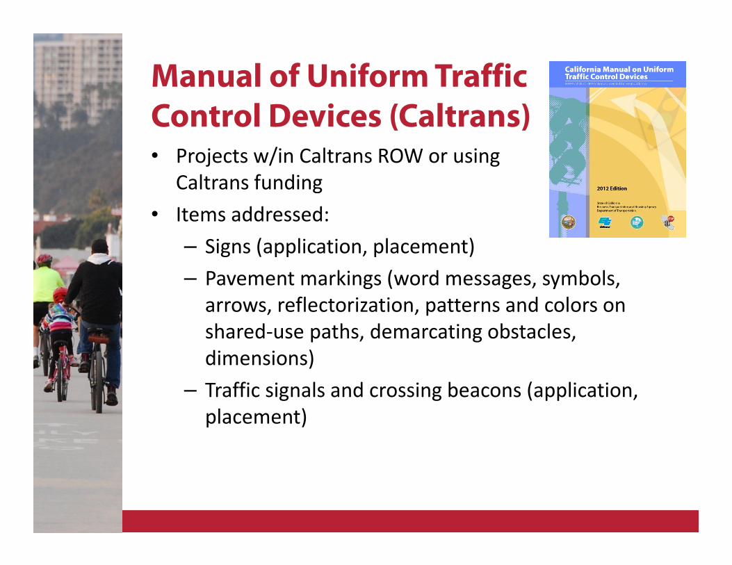
Manual of Uniform Traffic
Control Devices (Caltrans)• Projects w/in Caltrans ROW or using
Caltrans funding
• Items addressed:
– Signs (application, placement)
– Pavement markings (word messages, symbols,
arrows, reflectorization, patterns and colors on
shared-use paths, demarcating obstacles,
dimensions)
– Traffic signals and crossing beacons (application,
placement)
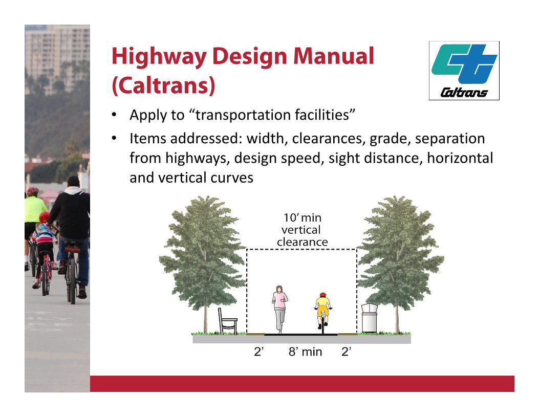
Highway Design Manual
(Caltrans)• Apply to “transportation facilities”
• Items addressed: width, clearances, grade, separation
from highways, design speed, sight distance, horizontal
and vertical curves
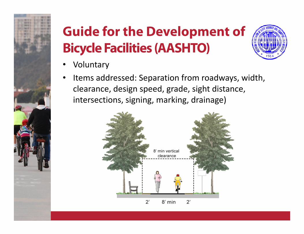
Guide for the Development of
Bicycle Facilities (AASHTO)• Voluntary
• Items addressed: Separation from roadways, width,
clearance, design speed, grade, sight distance,
intersections, signing, marking, drainage)
Designing Sidewalks and
Trails for Access (FHWA, 1999)• Accessibility guidelines and practices, and construction
and maintenance techniques have evolved since this
report.
• More current information is available in other reports
and guidance.
• Section: 5. Trail Design for Access
Draft Final Accessibility
Guidelines for Outdoor
Developed Areas (2009)
• Federal land management agencies and non-federal
entities that construct or alter facilities on Federal
lands on behalf of the Federal government
• Provisions for trails address surface; clear tread
width; passing spaces; obstacles; openings; slopes;
resting intervals; protruding objects; and gates and
barriers
• Clear tread width: 36” min
• Passing space: 5’ x 5’ every 1000’
• Tread Obstacles: 2” max. protrusion
• Openings: < ½”
Slope: Trails vs. Shared-use
Paths in ADAAG Guidelines
Trails
• Outdoor recreation trails must reflect environmental
considerations of terrain, maintenance, erosion, and
surface as well as constructability and use.
• Slopes up to 12% are permitted, but steep slopes are
limited in length.
Shared-use Paths [still In development]
• Multi-use routes that depart from roadway
alignments should be constructed to be accessible
(5% currently proposed)
• Full ADAAG compliance helps projects remain eligible
for state/federal transportation funds
ADA Standards for Accessible
Design (2010)
• State and local government facilities,
public accommodations, and
commercial facilities to be readily
accessible to and usable by individuals
with disabilities
• Items Addressed: slope, cross slope,
clearances, clear width
• As of March 15, 2012, compliance
with the 2010 Standards became
required for new construction and
alterations.
Proposed Public Right-of-
Way Accessibility
Guidelines (PROWAG)
• Pedestrian facilities constructed or altered in the
public right-of-way by state and local government
• Where pedestrian access routes are contained within
a street or highway right-of-way, the grade of the
pedestrian access route is permitted to equal the
general grade established for the adjacent street or
highway
Conditional Exceptions
• “maximum extent feasible”
• Terrain
• Compliance would fundamentally alter the function
or purpose of the facility or setting
• Compliance is precluded by the:
� Endangered Species Act;
� National Environmental Policy Act;
� National Historic Preservation Act;
� Wilderness Act; or
� Other Federal, State, or local laws.
• Where full compliance is not feasible, document it
and leave an obvious paper trail
3. Grey Areas
What don’t the guidelines fully address?
• Separation of trail users
• Traffic control/safety
• Wayfinding for trails
• Enforcement
• Access control (bollards)
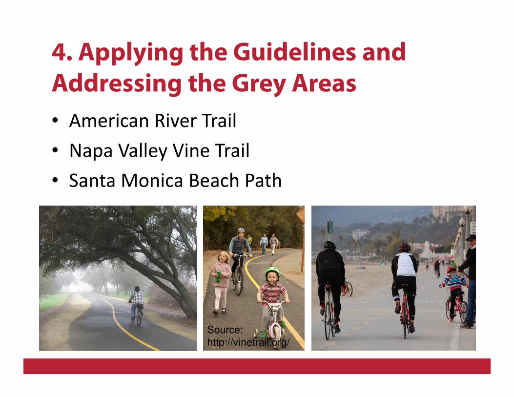
4. Applying the Guidelines and
Addressing the Grey Areas
• American River Trail
• Napa Valley Vine Trail
• Santa Monica Beach Path
Source:
http://vinetrail.org/
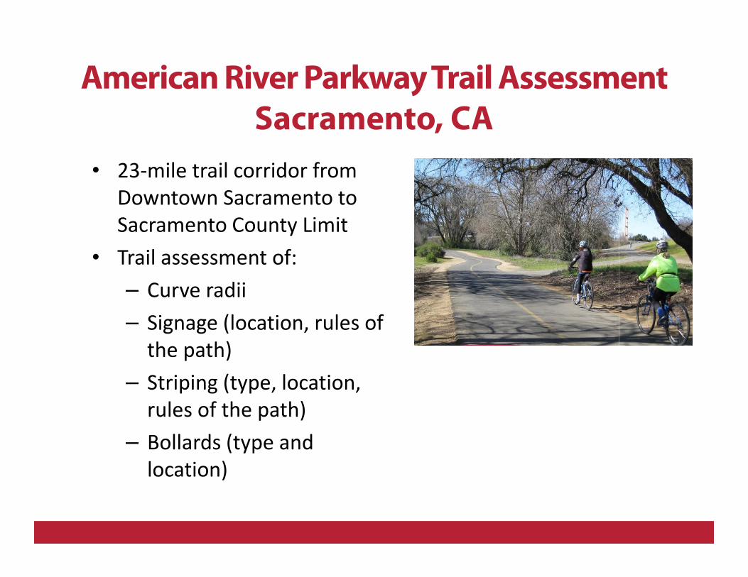
American River Parkway Trail Assessment
Sacramento, CA
• 23-mile trail corridor from
Downtown Sacramento to
Sacramento County Limit
• Trail assessment of:
– Curve radii
– Signage (location, rules of
the path)
– Striping (type, location,
rules of the path)
– Bollards (type and
location)
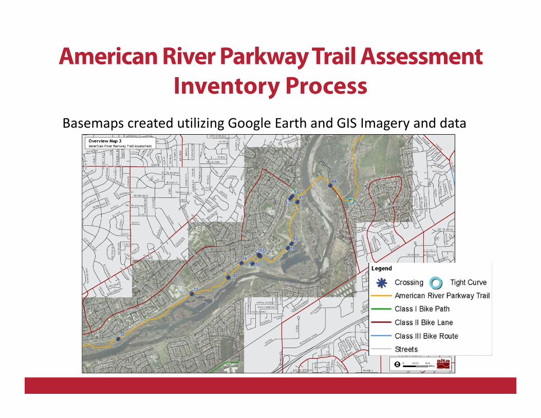
Basemaps created utilizing Google Earth and GIS Imagery and data
American River Parkway Trail Assessment
Inventory Process
American River Parkway Trail Assessment
Inventory Process
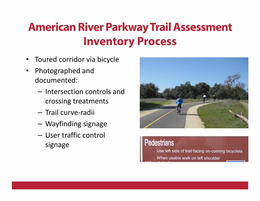
• Toured corridor via bicycle
• Photographed and
documented:
– Intersection controls and
crossing treatments
– Trail curve-radii
– Wayfinding signage
– User traffic control
signage
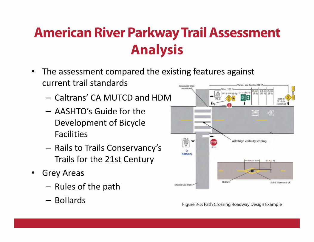
• The assessment compared the existing features against
current trail standards
– Caltrans’ CA MUTCD and HDM
– AASHTO’s Guide for the
Development of Bicycle
Facilities
– Rails to Trails Conservancy’s
Trails for the 21st Century
• Grey Areas
– Rules of the path
– Bollards
American River Parkway Trail Assessment
Analysis
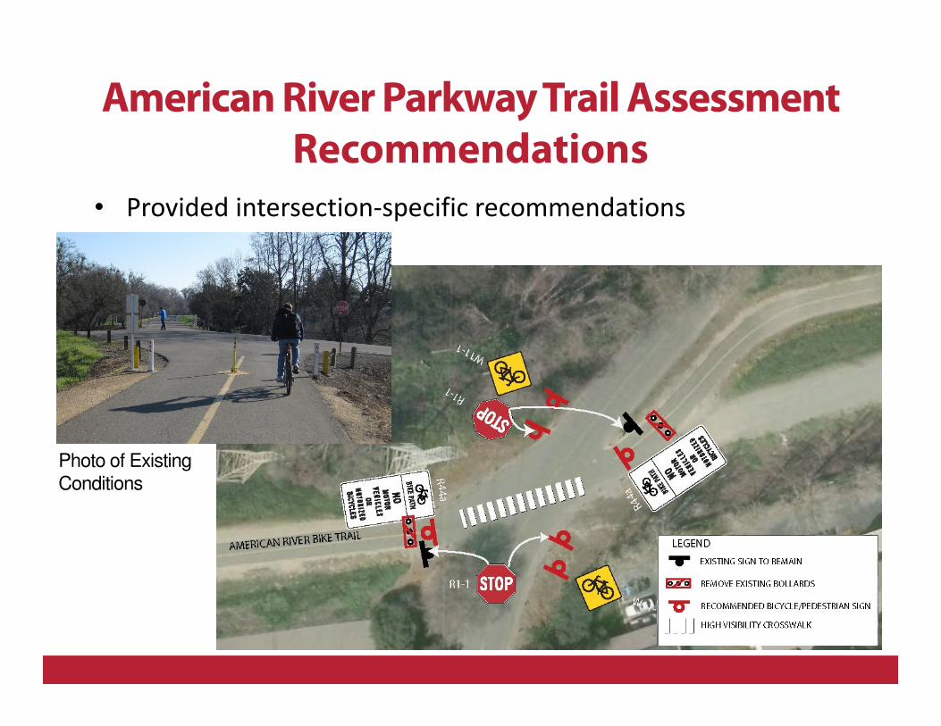
Photo of Existing
Conditions
American River Parkway Trail Assessment
Recommendations
• Provided intersection-specific recommendations
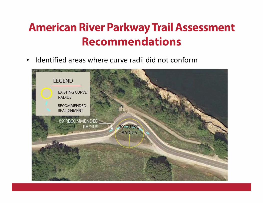
• Identified areas where curve radii did not conform
American River Parkway Trail Assessment
Recommendations
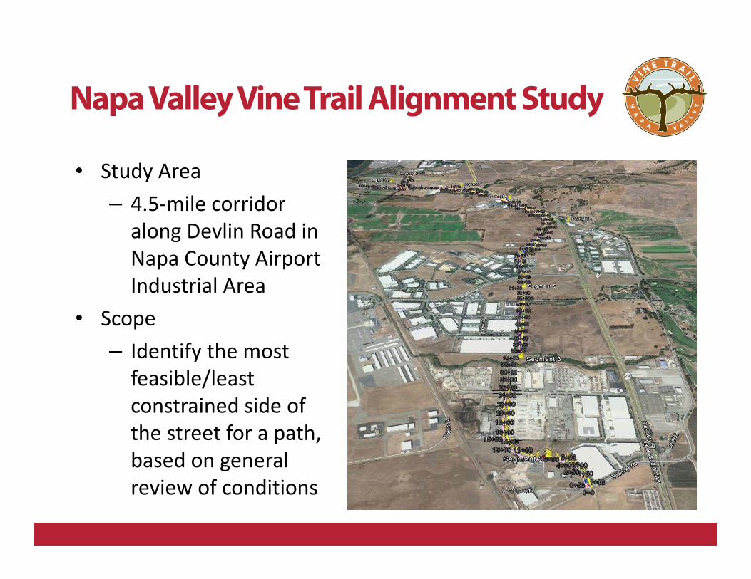
Napa Valley Vine Trail Alignment Study
• Study Area
– 4.5-mile corridor
along Devlin Road in
Napa County Airport
Industrial Area
• Scope
– Identify the most
feasible/least
constrained side of
the street for a path,
based on general
review of conditions
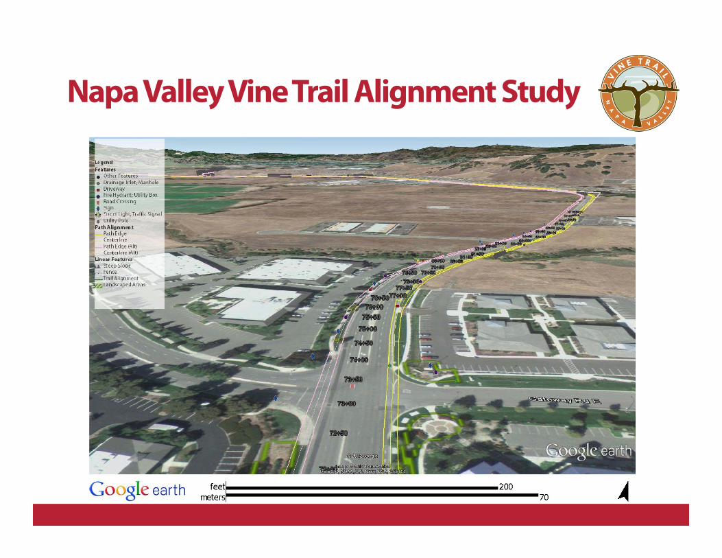
Napa Valley Vine Trail Alignment Study
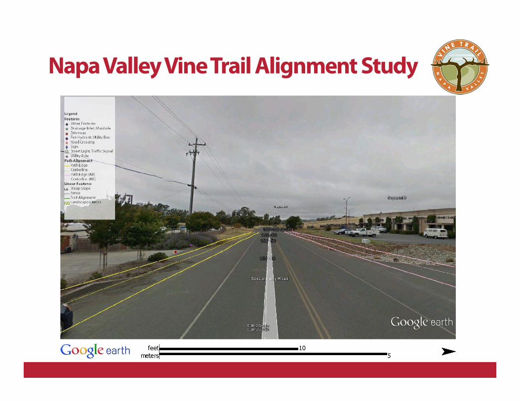
Napa Valley Vine Trail Alignment Study
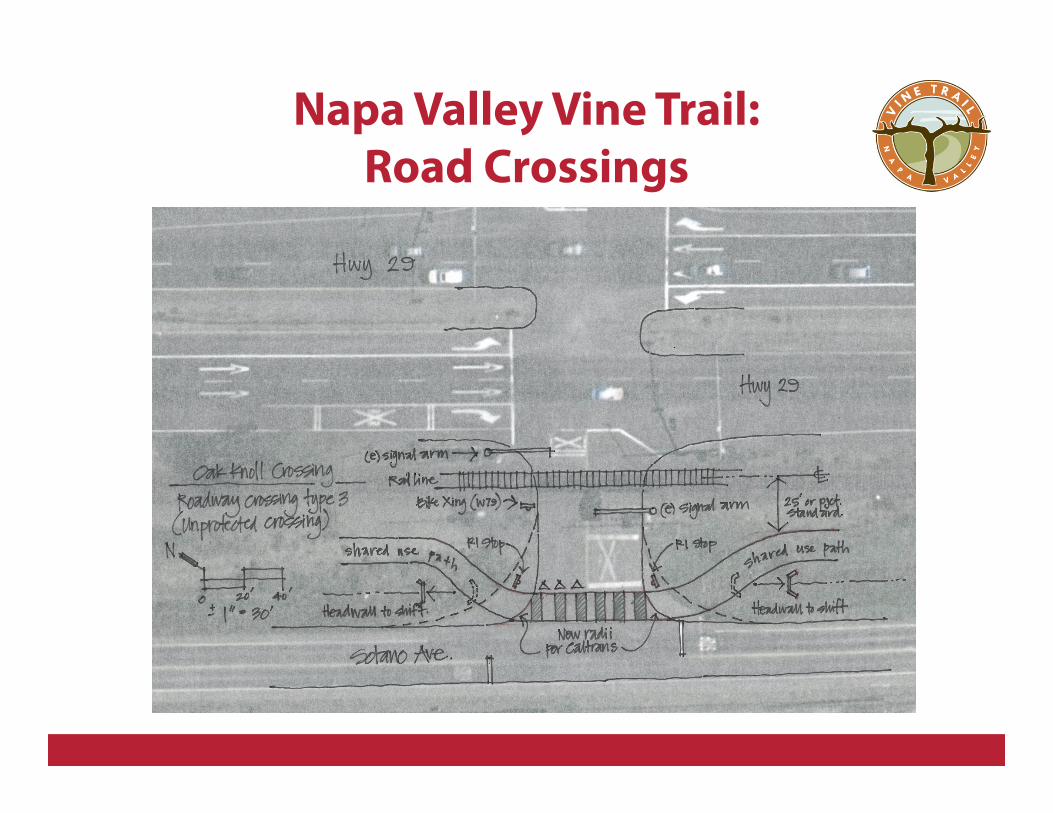
Napa Valley Vine Trail:
Road Crossings
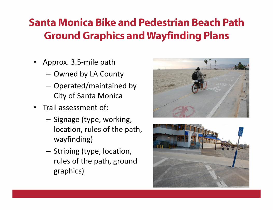
Santa Monica Bike and Pedestrian Beach Path
Ground Graphics and WayfindingPlans
• Approx. 3.5-mile path
– Owned by LA County
– Operated/maintained by
City of Santa Monica
• Trail assessment of:
– Signage (type, working,
location, rules of the path,
wayfinding)
– Striping (type, location,
rules of the path, ground
graphics)
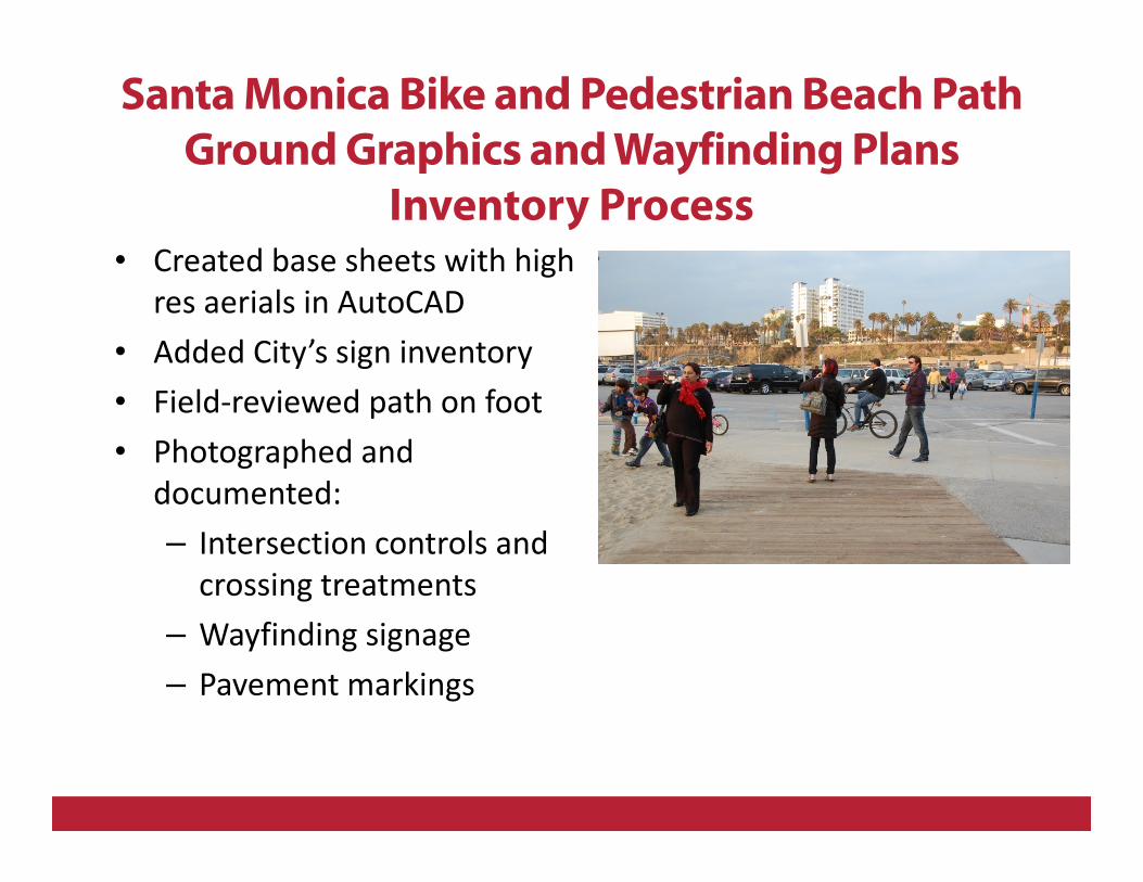
Santa Monica Bike and Pedestrian Beach Path
Ground Graphics and WayfindingPlans
Inventory Process• Created base sheets with high
res aerials in AutoCAD
• Added City’s sign inventory
• Field-reviewed path on foot
• Photographed and
documented:
– Intersection controls and
crossing treatments
– Wayfinding signage
– Pavement markings
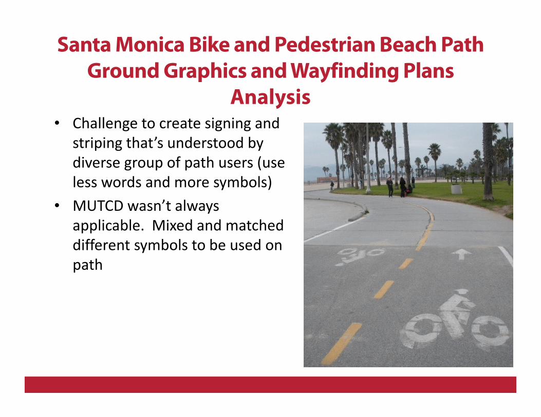
• Challenge to create signing and
striping that’s understood by
diverse group of path users (use
less words and more symbols)
• MUTCD wasn’t always
applicable. Mixed and matched
different symbols to be used on
path
Santa Monica Bike and Pedestrian Beach Path
Ground Graphics and WayfindingPlans
Analysis
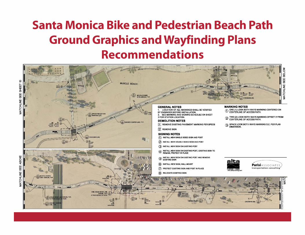
Santa Monica Bike and Pedestrian Beach Path
Ground Graphics and WayfindingPlans
Recommendations
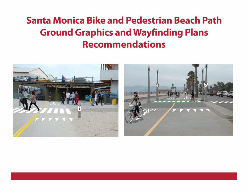
Santa Monica Bike and Pedestrian Beach Path
Ground Graphics and WayfindingPlans
Recommendations
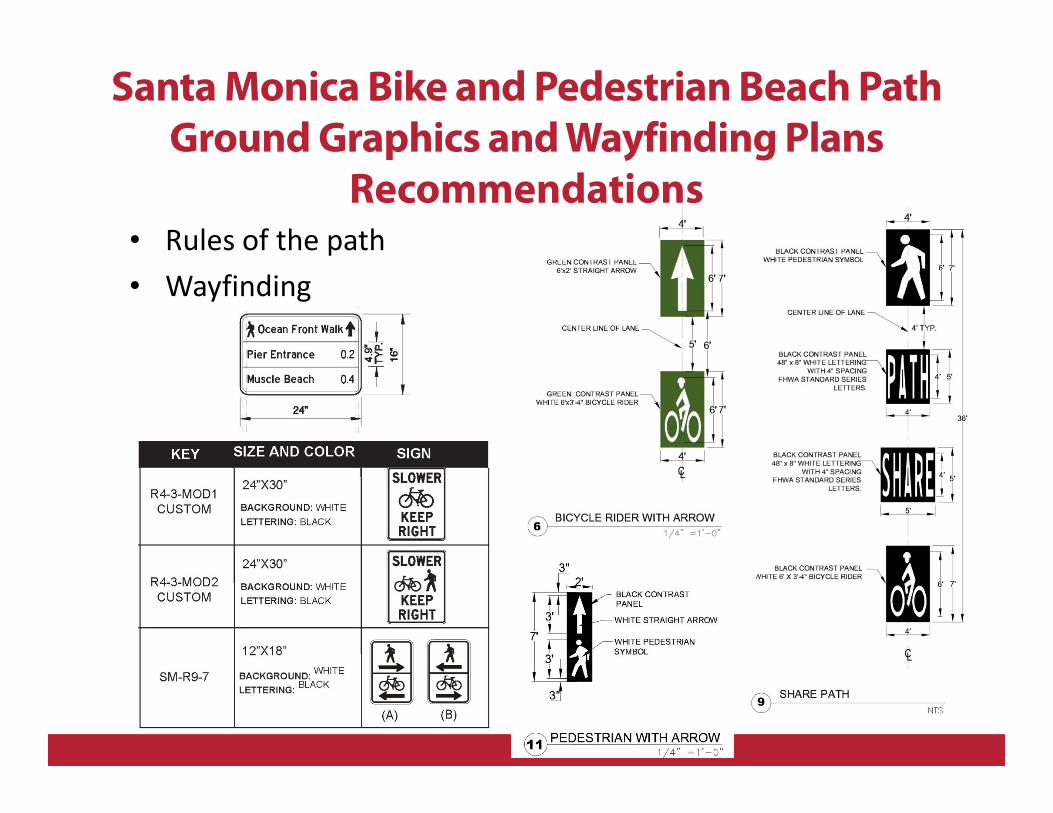
• Rules of the path
• Wayfinding
Santa Monica Bike and Pedestrian Beach Path
Ground Graphics and WayfindingPlans
Recommendations
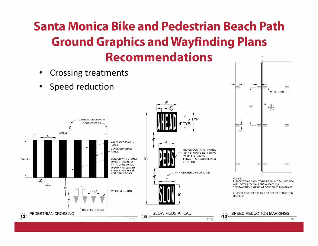
• Crossing treatments
• Speed reduction
Santa Monica Bike and Pedestrian Beach Path
Ground Graphics and WayfindingPlans
Recommendations
5. References
ADA Draft Final Accessibility Guidelines for Outdoor
Developed Areas (including trails, trailheads, and viewing
areas). Effective 3/15/12: http://www.access-
board.gov/outdoor/draft-final.htm
ADA Shared-Use Path Guidelines [In Development]:
http://www.access-board.gov/sup.htm
ADA Public Rights-of-Way Guidelines: http://www.access-
board.gov/prowac/index.htm
Draft Final Accessibility Guidelines for Outdoor Developed
Areas:
http://www.access-board.gov/outdoor/draft-final.htm
ADA Standards for Accessible Design (2010):
http://www.ada.gov/2010ADAstandards_index.htm
5. References
Proposed Public Right-of-Way Accessibility Guidelines
(PROWAG):
http://www.access-board.gov/prowac/nprm.htm
AASHTO Guide for the Development of Bicycle Facilities:
https://bookstore.transportation.org/item_details.aspx?ID
=104 (for purchase)
California Highway Design Manual:
http://www.dot.ca.gov/hq/oppd/hdm/hdmtoc.htm
California Manual of Uniform Traffic Control Devices:
http://www.dot.ca.gov/hq/traffops/signtech/mutcdsupp/
FHWA Designing Sidewalks and Trails for Access:
http://www.fhwa.dot.gov/environment/sidewalks/

5. Additional Resources
• American Trails http://www.americantrails.org/
• Bondurant, J., Thompson, L., et al. (2009). Trail
Planning for California Communities.
• Flink, C.A., Searns, R.M., Olka, K. (2001). Trails for the
Twenty-First Century: Planning, Design, and
Management Manual for Multi-use Trails.
• Flink, C.A., Searns, R.M. (1993). Greenways: A Guide
to Planning, Design, and Development.
• Rails-to-Trails Conservancy
http://www.railstotrails.org/index.html
Questions?
Contact Info
Alta Planning + Design
Kristin Maravilla, Planner/Designer
Brian Burchfield, Designer
510-540-5008
2560 9th Street, Suite 212
Berkeley, CA 94710
www.altaplanning.com