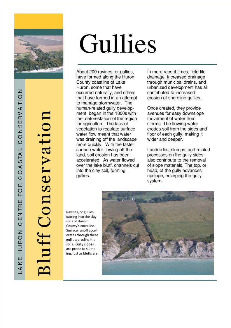
About 200 ravines, or gullies, have formed along the Huron County coastline of Lake Huron, some that have occurred naturally, and others that have formed in an attempt to manage stormwater. The human-related gully develop- ment began in the 1800s with the deforestation of the region for agriculture. The lack of vegetation to regulate surface water flow meant that water was draining off the landscape more quickly. With the faster surface water flowing off the land, soil erosion has been accelerated. As water flowed over the lake bluff, channels cut into the clay soil, forming gullies. In more recent times, field tile drainage, increased drainage through municipal drains, and urbanized development has all contributed to increased erosion of shoreline gullies. Once created, they provide avenues for easy downslope movement of water from storms. The flowing water erodes soil from the sides and floor of each gully, making it wider and deeper. Landslides, slumps, and related processes on the gully sides also contribute to the removal of slope materials. The top, or head, of the gully advances upslope, enlarging the gully system. GulliesB l u f f C o n s e r v a t i o n L A K E H U R O N C E N T R E F O R C O A S T A L C O N S E R V A T I O N Ravines, orgullies, cuttingintotheclaysoilsofHuronCounty’scoastline. Surfacerunoffaccel‐ eratesthroughthesegullies, erodingthesoils. Gullyslopesarepronetoslump‐ ing,justasbluffsare.