Embed Size (px)
Citation preview
Borrego Springs Alluvial Fan Active and Inactive Area Mapping,
County of San Diego, California
Julianne J. MillerSteve N. Bacon
Richard H. French
Outline
• Where is Borrego Springs, California?• History of flood events at Borrego Springs• Mapping of active vs. inactive alluvial fan areas
• Geomorphic mapping approach• Hydraulic characteristics • Integration of geomorphic- and hydraulic engineering-principles
• Comparison with flood hazard delineation map (FEMA FIRM)
YOU ARE HERE(Rancho Mirage)
Borrego Springs
Los Angeles
San Diego
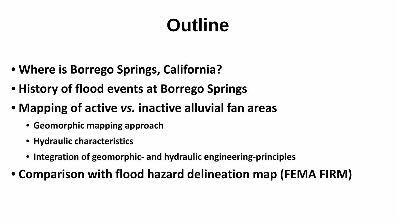
Where is Borrego Springs, California?
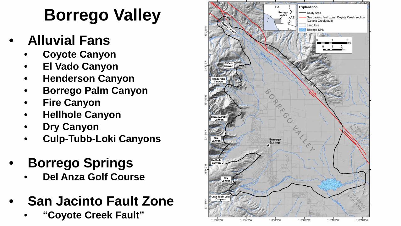
Borrego Valley• Alluvial Fans
• Coyote Canyon• El Vado Canyon• Henderson Canyon• Borrego Palm Canyon• Fire Canyon• Hellhole Canyon• Dry Canyon• Culp-Tubb-Loki Canyons
• Borrego Springs• Del Anza Golf Course
• San Jacinto Fault Zone• “Coyote Creek Fault”
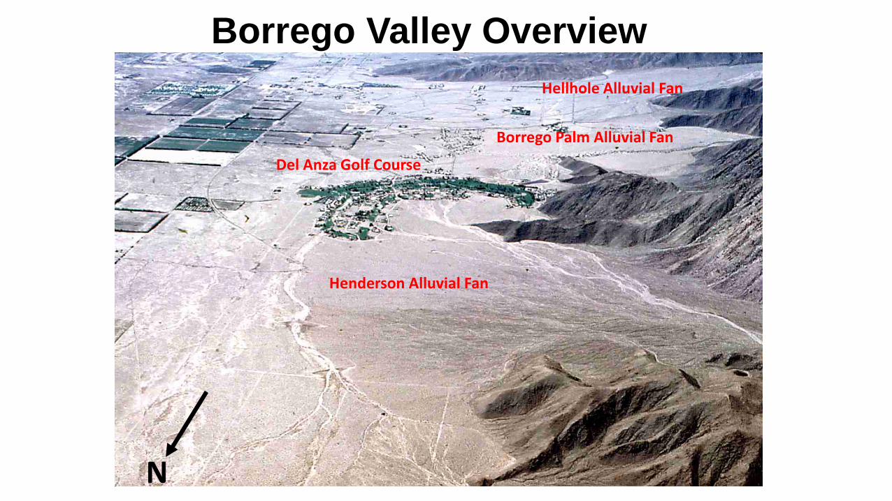
Borrego Valley Overview
Del Anza Golf Course
Henderson Alluvial Fan
Borrego Palm Alluvial Fan
Hellhole Alluvial Fan
N
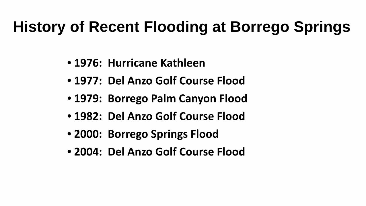
History of Recent Flooding at Borrego Springs
• 1976: Hurricane Kathleen• 1977: Del Anzo Golf Course Flood• 1979: Borrego Palm Canyon Flood• 1982: Del Anzo Golf Course Flood• 2000: Borrego Springs Flood• 2004: Del Anzo Golf Course Flood
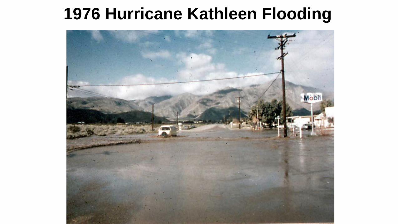
1976 Hurricane Kathleen Flooding
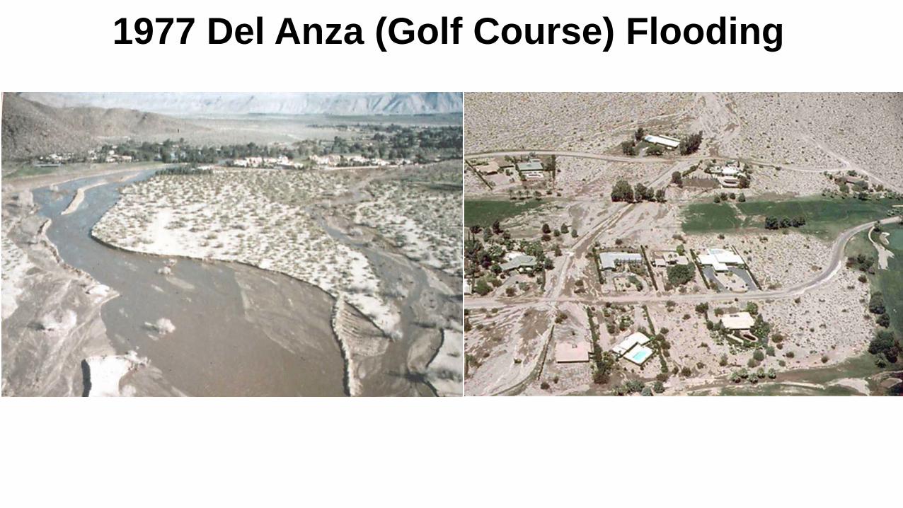
1977 Del Anza (Golf Course) Flooding
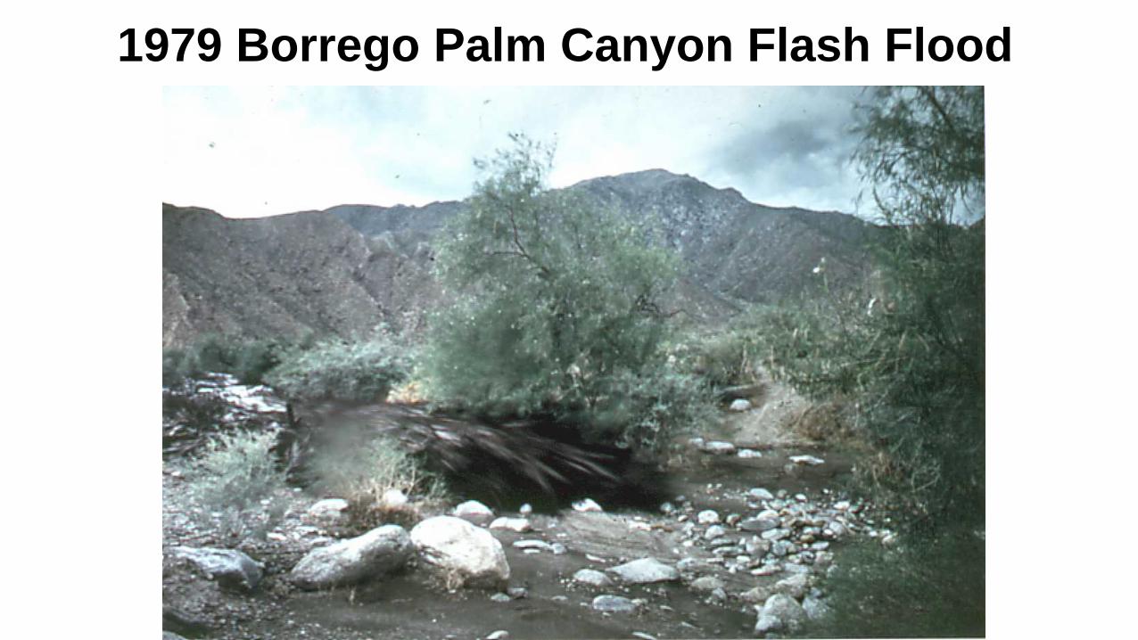
1979 Borrego Palm Canyon Flash Flood
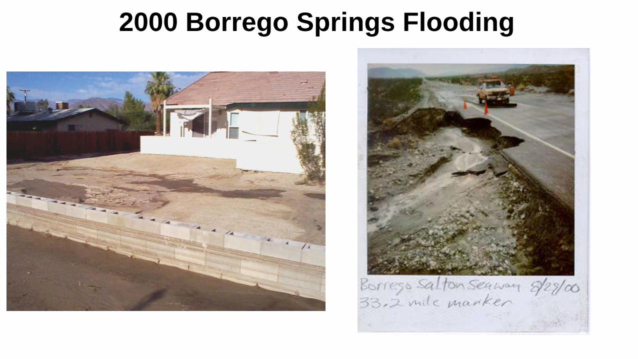
2000 Borrego Springs Flooding
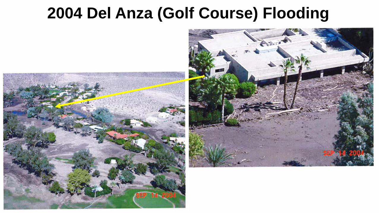
2004 Del Anza (Golf Course) Flooding
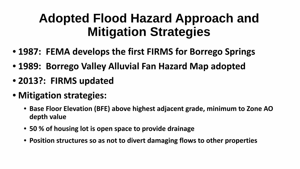
Adopted Flood Hazard Approach and Mitigation Strategies
• 1987: FEMA develops the first FIRMS for Borrego Springs• 1989: Borrego Valley Alluvial Fan Hazard Map adopted• 2013?: FIRMS updated• Mitigation strategies:
• Base Floor Elevation (BFE) above highest adjacent grade, minimum to Zone AO depth value
• 50 % of housing lot is open space to provide drainage• Position structures so as not to divert damaging flows to other properties
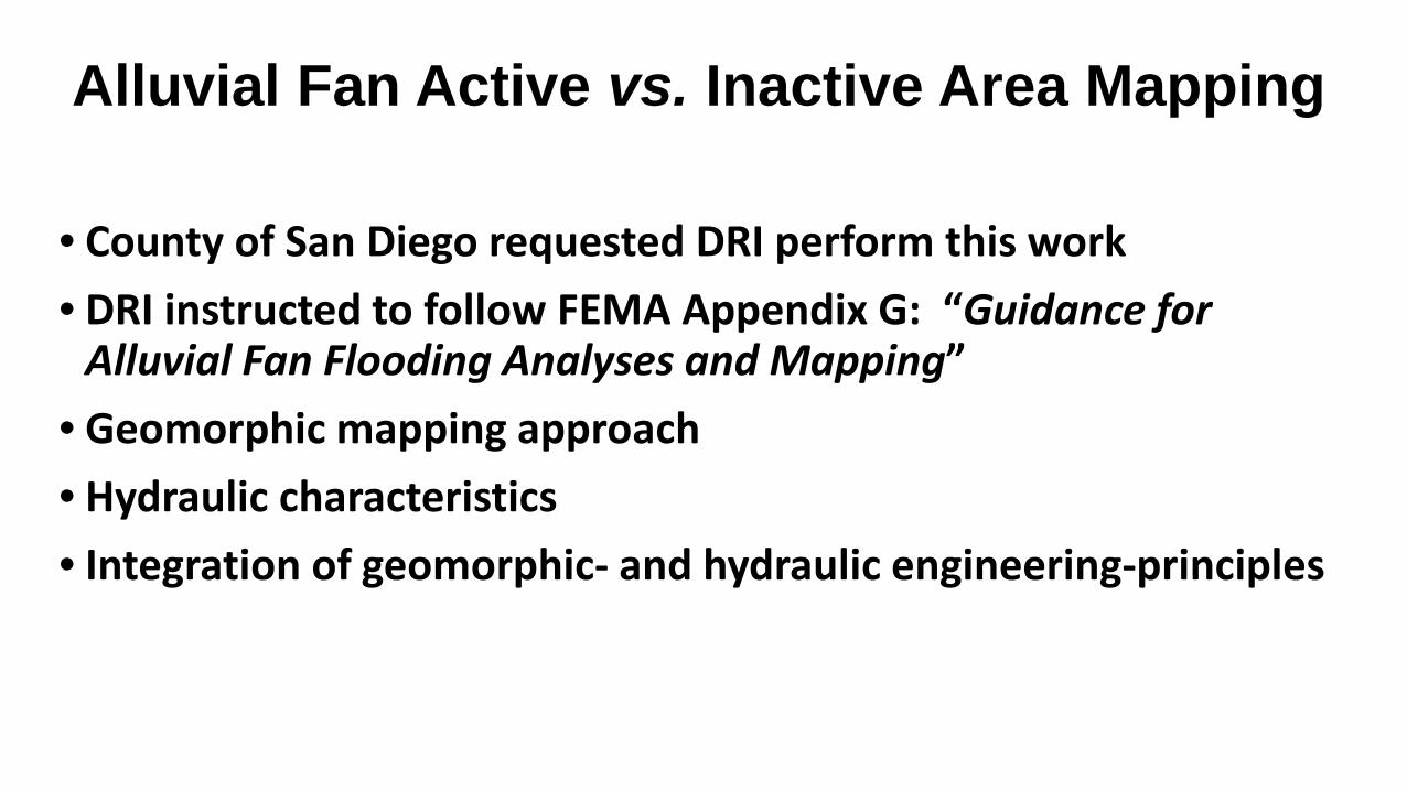
Alluvial Fan Active vs. Inactive Area Mapping
• County of San Diego requested DRI perform this work• DRI instructed to follow FEMA Appendix G: “Guidance for
Alluvial Fan Flooding Analyses and Mapping”• Geomorphic mapping approach• Hydraulic characteristics • Integration of geomorphic- and hydraulic engineering-principles
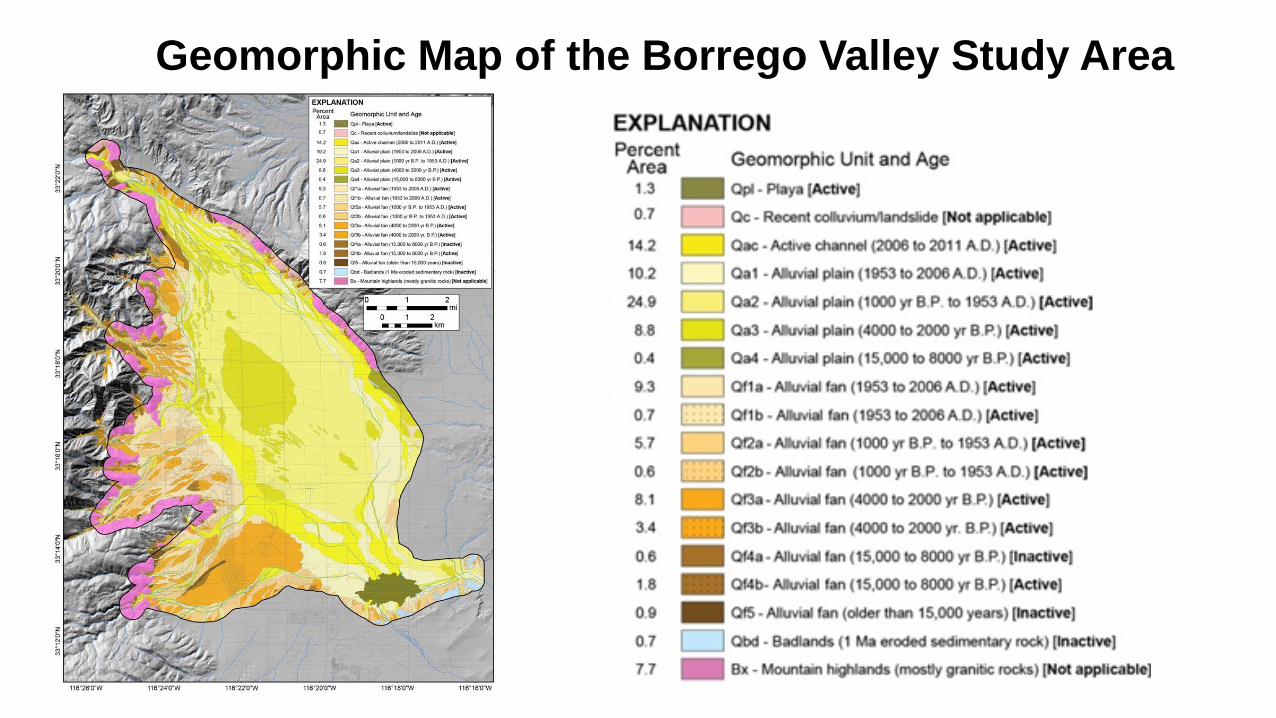
Geomorphic Map of the Borrego Valley Study Area
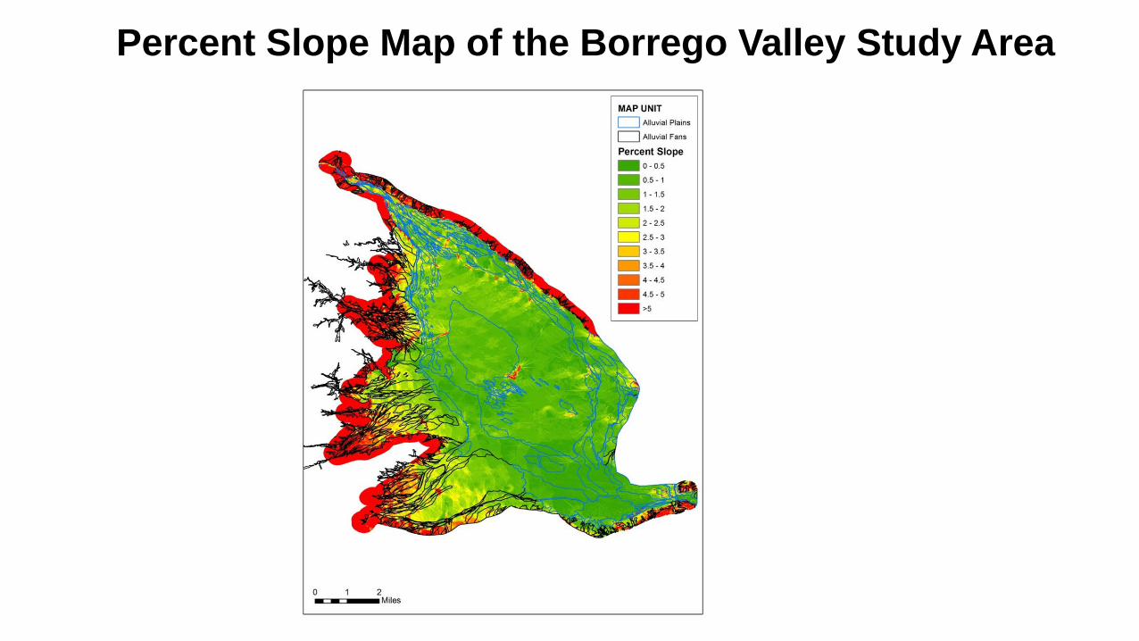
Percent Slope Map of the Borrego Valley Study Area
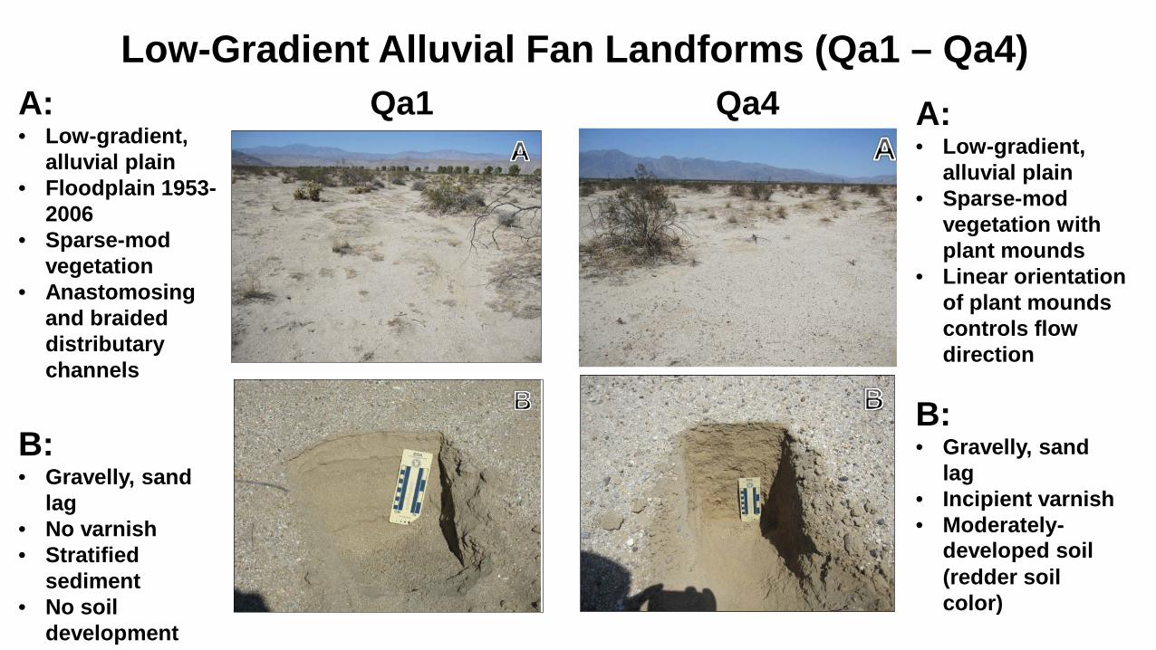
Low-Gradient Alluvial Fan Landforms (Qa1 – Qa4)
A:• Low-gradient,
alluvial plain• Floodplain 1953-
2006• Sparse-mod
vegetation• Anastomosing
and braided distributary channels
B:• Gravelly, sand
lag• No varnish• Stratified
sediment• No soil
development
Qa1 Qa4 A:• Low-gradient,
alluvial plain• Sparse-mod
vegetation with plant mounds
• Linear orientation of plant mounds controls flow direction
B:• Gravelly, sand
lag• Incipient varnish• Moderately-
developed soil(redder soil color)
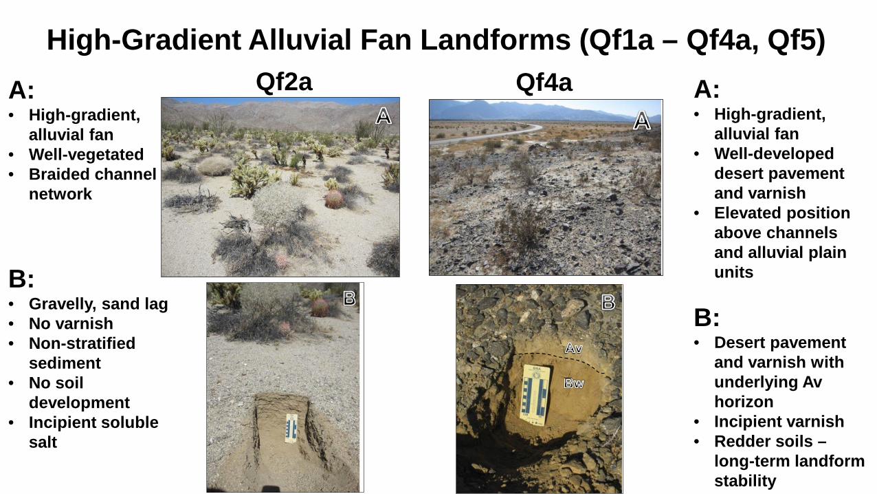
High-Gradient Alluvial Fan Landforms (Qf1a – Qf4a, Qf5)A:• High-gradient,
alluvial fan• Well-vegetated • Braided channel
network
B:• Gravelly, sand lag• No varnish• Non-stratified
sediment• No soil
development• Incipient soluble
salt
Qf2a Qf4a A:• High-gradient,
alluvial fan• Well-developed
desert pavement and varnish
• Elevated position above channels and alluvial plain units
B:• Desert pavement
and varnish with underlying Av horizon
• Incipient varnish• Redder soils –
long-term landform stability

High-Gradient Alluvial Fan Landforms (Debris Flow: Qf1b – Qf4b)
A:• High-gradient,
alluvial fan• Debris flow
deposits of boulders and blocks
• Boulder levees • Braided
channel network
B:• Imbrication of
boulders• Woody debris
relict of 2005 flood
• Incipient varnish
Qf1b Qf3bA:• High-gradient,
alluvial fan• Debris flow
deposits of boulders and blocks
• Incipient varnish
B:• Lobes with
boulder levees• Bar-and-swale• Braided channel
network• Incipient varnish
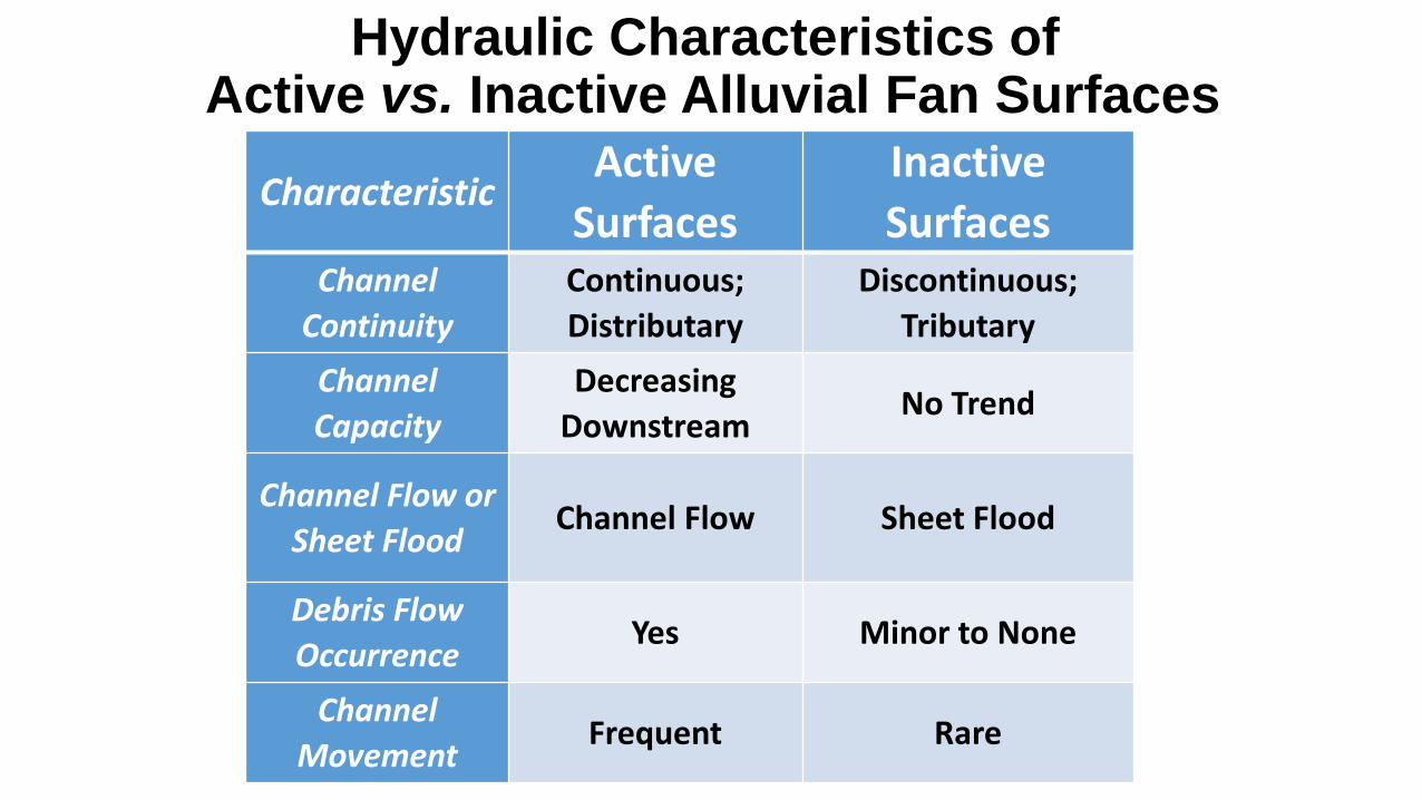
CharacteristicActive
SurfacesInactive Surfaces
Channel Continuity
Continuous; Distributary
Discontinuous; Tributary
Channel Capacity
Decreasing Downstream
No Trend
Channel Flow or Sheet Flood
Channel Flow Sheet Flood
Debris Flow Occurrence
Yes Minor to None
Channel Movement
Frequent Rare
Hydraulic Characteristics of Active vs. Inactive Alluvial Fan Surfaces
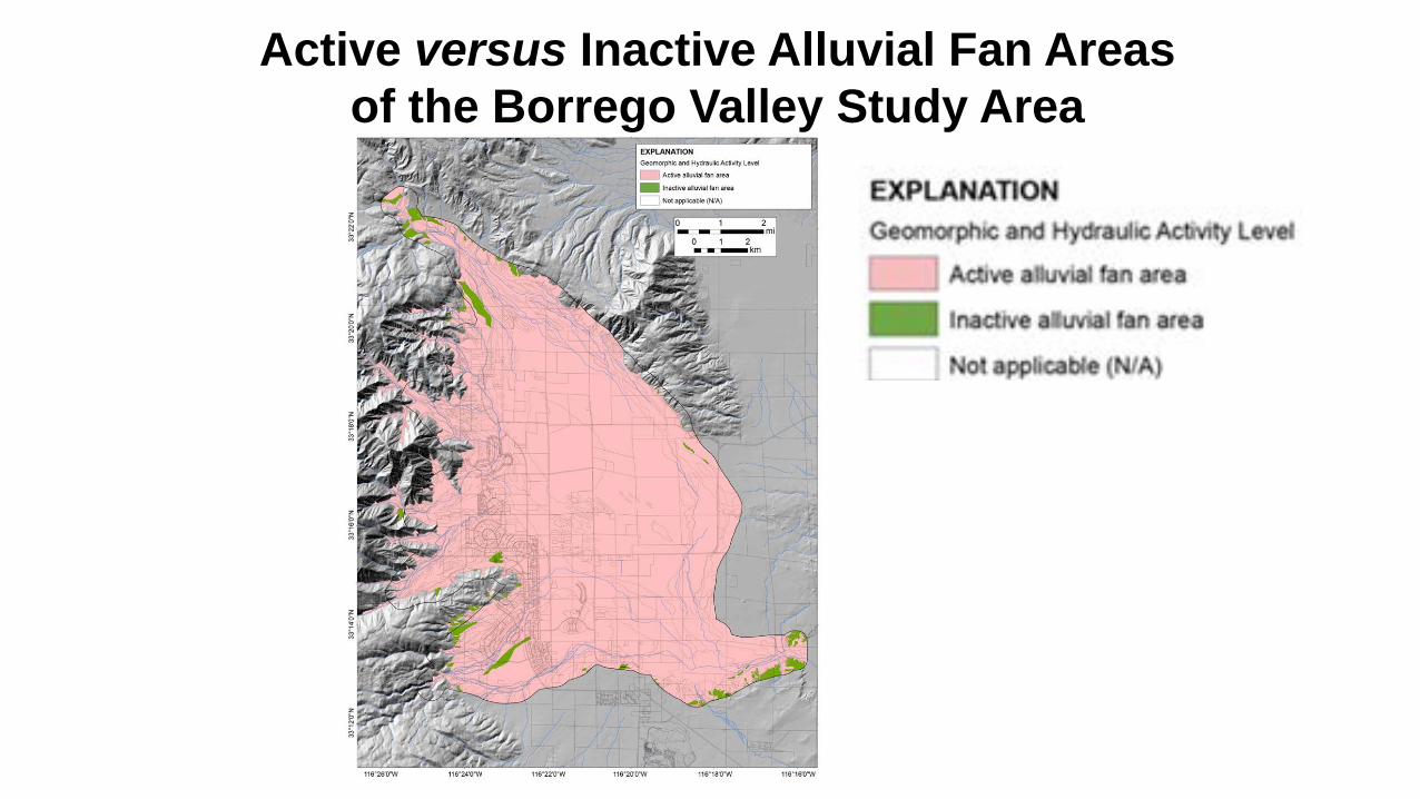
Active versus Inactive Alluvial Fan Areas of the Borrego Valley Study Area
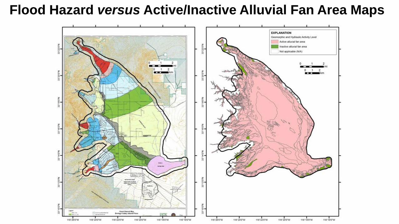
Flood Hazard versus Active/Inactive Alluvial Fan Area Maps
Summary• 90 % of the 61 mi2 of the Borrego Springs Study Area contain
geomorphically and hydraulically active alluvial fan landforms
• Results generally confirm existing flood hazard delineation map produced by Boyle Engineering (1989), which FEMA currently uses as a basis to assign flood insurance risk zones in Borrego Valley
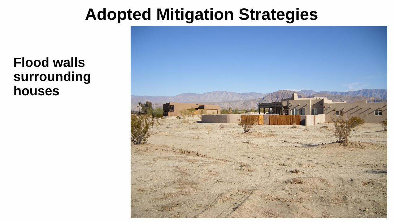
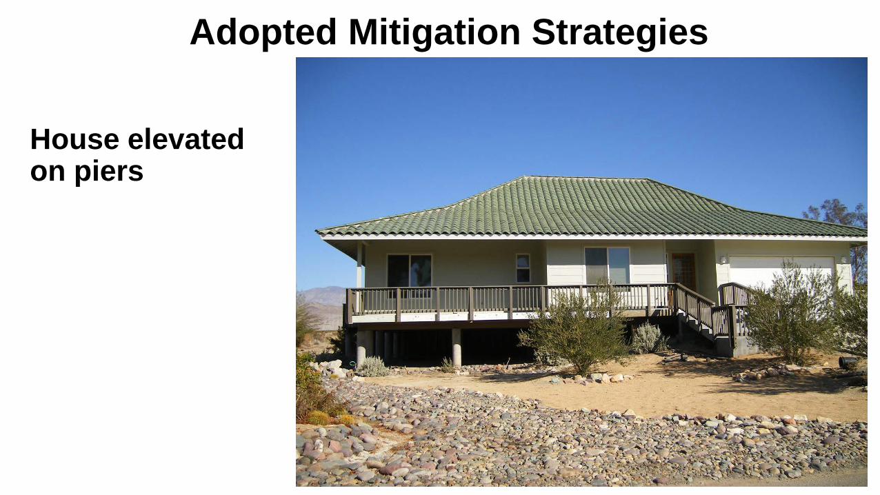
Adopted Mitigation Strategies
• Mitigation strategies:• Base Floor Elevation (BFE) above highest adjacent grade, minimum to Zone AO
depth value• 50 % of housing lot is open space to provide drainage
• Position structures so as not to divert damaging flows to other properties
• Flood walls surrounding some structures
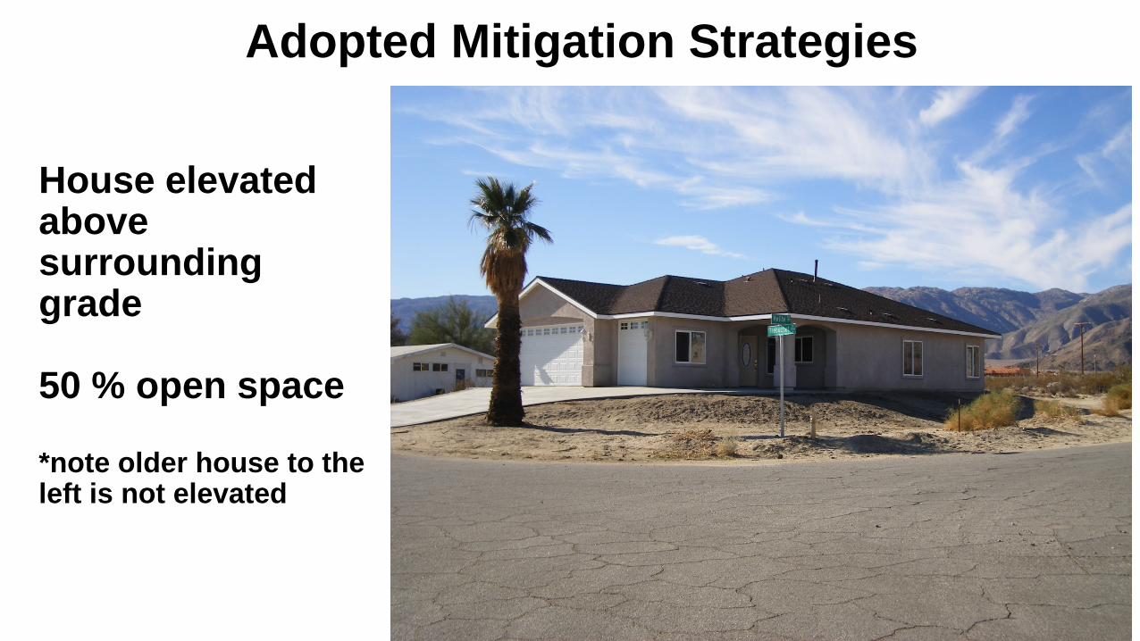
House elevated above surrounding grade
50 % open space
*note older house to the left is not elevated
Adopted Mitigation Strategies
Adopted Mitigation Strategies
Flood walls surrounding houses
Adopted Mitigation Strategies
House elevated on piers
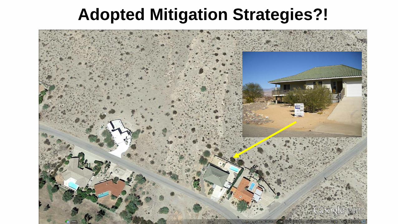
Adopted Mitigation Strategies?!