Embed Size (px)
Citation preview
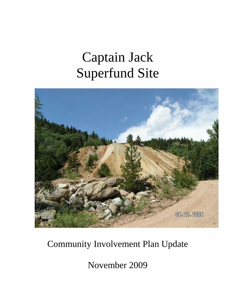
Captain Jack Superfund Site
Community Involvement Plan Update
November 2009
2
1.0 Overview This document updates the July 2004 Community Involvement Plan (CIP) for the Captain Jack Superfund Site. The CIP update identifies areas of current interest and potential concerns of the local community and other stakeholders in on-going environmental remediation activities at the Captain Jack site. The purpose of the Plan is to ensure stakeholders are appropriately informed and involved in the Superfund process at the site. In order to gauge current stakeholder awareness and interest for this CIP update, Colorado Department of Public Health and Environment (CDPHE) and U.S. Environmental Protection Agency (EPA) community involvement coordinators interviewed 10 stakeholders impacted by the Captain Jack site. Those interviewed included representatives from:
• Elected Officials o Mayor of Ward
• Residents o 1 Rowena o 2 Ward
• Community Advisory Groups o 1 Left Hand Creek Technical Advisory Group Coalition (LCTC) o 1 LCTC Technical Advisor o 1 Left Hand Watershed Oversight Group (LWOG)
• Local Agencies o 1 Left Hand Water District o 1 Boulder County Health Department
Major highlights from interviews include:
• Interest in site activities remains strong, especially among the two community advisory groups reviewing documents and providing local input to site activities
• Those interviewed are familiar with the site and environmental cleanup activities and decisions to date
• Interviewees are satisfied with the chosen remedy, but are concerned about water quality in the creek and how that will be monitored
• Due to a depressed economy in the area, local residents with construction experience would like to be employed in the cleanup construction
• Those involved with the watershed are concerned that potential transient residents using water downstream from the site could be adversely impacted by the site and by remedy construction activities
• Some interviewees are concerned about aquatic life and would like to see baseline fish studies performed
• Many stakeholders are interested in preserving historical aspects of the site
3
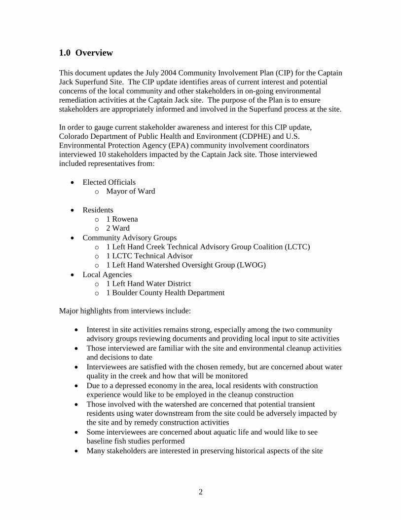
• Most interviewees voiced concern about additional truck traffic during remedy implementation, pointing out the poor condition of access roads and popularity of biking activities in Left Hand Canyon
• Some stakeholders expressed confusion over which community group represents the community; both review documents and provide local input to site activities
o Left Hand Creek Technical Advisory Group Coalition (LCTC) o Left Hand Watershed Oversight Group (LWOG)
• Interviewees explained that internet access is limited in the area, and that communication with transient residents can be a challenge
• Given the independent nature of residents in the area, agencies voiced concern about how best to gain access to some private properties for performing pre-design, remedial design, remedial action, and monitoring activities
Based on the information gathered through interviews, CDPHE and EPA developed goals for addressing primary concerns and preferences of community members to improve information exchange. In addition, goals are established that continue to provide opportunities for stakeholder input throughout remedy design and implementation phases. Specific goals detailed in this plan include:
• Work with local stakeholder groups to identify most effective communication approaches for reaching impacted stakeholders
• Provide regular information updates on site activities • Work with historic preservation agencies in remedy design • Work with residents to identify area road conditions and impacts of heavy truck
routes • Work with local residents and stakeholder groups to identify downstream water
users and use, and

4
• Work with local residents and stakeholder groups to gain site access for remedial activities
2.0 Site Information Site Location
The Captain Jack Superfund site is located at the headwaters of the Left Hand Creek Watershed in a narrow valley about 1.5 miles south of Ward in Boulder County, Colorado.
Site History
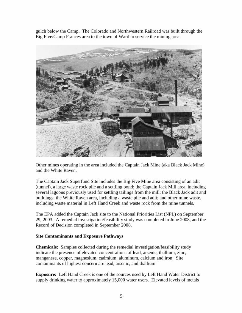
Mining for gold and silver began in this region in 1861 and continued intermittently until 1992. Camp Frances, near Ward, was started in the early 1890s. It was here that the Big Five Consolidated Company was organized from five existing mines, including the Adit Mining Company, Ni-Wot Mining Company, Columbia Mines Company, Timberline Mines Company, and Dew Drop Mining Company. Ore from the Big Five and Columbia vein systems was transported through the Adit tunnel (aka Big Five). Processing was carried out in the Dew Drop Mill or the larger Big Five Mill - located on the side of the
5
gulch below the Camp. The Colorado and Northwestern Railroad was built through the Big Five/Camp Frances area to the town of Ward to service the mining area.
Other mines operating in the area included the Captain Jack Mine (aka Black Jack Mine) and the White Raven.
The Captain Jack Superfund Site includes the Big Five Mine area consisting of an adit (tunnel), a large waste rock pile and a settling pond; the Captain Jack Mill area, including several lagoons previously used for settling tailings from the mill; the Black Jack adit and buildings; the White Raven area, including a waste pile and adit; and other mine waste, including waste material in Left Hand Creek and waste rock from the mine tunnels.
The EPA added the Captain Jack site to the National Priorities List (NPL) on September 29, 2003. A remedial investigation/feasibility study was completed in June 2008, and the Record of Decision completed in September 2008.
Site Contaminants and Exposure Pathways
Chemicals: Samples collected during the remedial investigation/feasibility study indicate the presence of elevated concentrations of lead, arsenic, thallium, zinc, manganese, copper, magnesium, cadmium, aluminum, calcium and iron. Site contaminants of highest concern are lead, arsenic, and thallium.
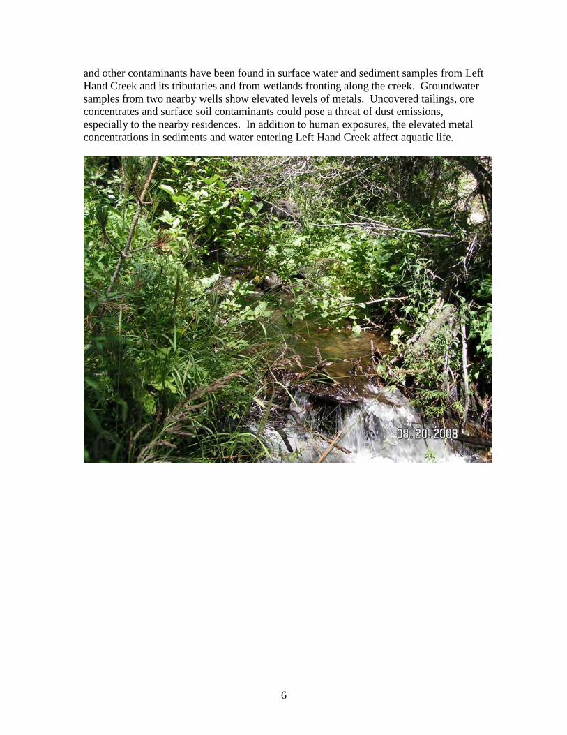
Exposure: Left Hand Creek is one of the sources used by Left Hand Water District to supply drinking water to approximately 15,000 water users. Elevated levels of metals
6
and other contaminants have been found in surface water and sediment samples from Left Hand Creek and its tributaries and from wetlands fronting along the creek. Groundwater samples from two nearby wells show elevated levels of metals. Uncovered tailings, ore concentrates and surface soil contaminants could pose a threat of dust emissions, especially to the nearby residences. In addition to human exposures, the elevated metal concentrations in sediments and water entering Left Hand Creek affect aquatic life.
7
3.0 Community Involvement History
Left Hand Creek was a dead waterway during the 1930s, virtually unable to support aquatic life. By the end of World War II, the creek was beginning to recover. In the 1960s, Boulder County Public Health began documenting water quality complaints in the Left Hand Watershed from citizens concerned with the use of the creek as a mill stream and source of irrigation and domestic water. In March 2000, Boulder County Health held informational meetings in Ward and Jamestown to discuss problems of heavy metals in the mountain streams.
Subsequently, Boulder County Public Health, EPA, CDPHE, and the Left Hand Watershed Task Force (precursor to the Left Hand Watershed Oversight Group) worked together to engage citizens in the impacted communities. Outreach efforts included educating people in impacted areas about the extent and history of contamination, and kepimg the community involved and informed of the possibilities for cleanup efforts. Town meetings were held in Ward and Jamestown in February 2001. Site visits were arranged and a press tour of the Left Hand Watershed was conducted on April 25, 2001.
The Task Force, comprised of citizens from the impacted communities, studied the entire watershed and recommended Superfund listing of only the Captain Jack area to the Boulder County Board of Health. The Board recommended listing to the Governor’s office, and the site was listed on EPA’s National Priorities List on September 29, 2003.
Community History with Agencies: In March 2002, the Task Force and the Community Advisory Group for the Environment (CAGE) recorded their experiences, both positive and negative, in dealing with CDPHE and EPA during agency consideration of the Captain Jack Mill and other watershed sites for listing on the NPL. These observations will prove useful in on-going efforts to work with the community.
On the positive side, the groups found that the agencies responded to local concerns, agreeing to postpone recommendations regarding Superfund listing until the Task Force concluded its deliberations. They worked with the community to prioritize availability for face-to-face meetings, telephone conversations, and email communications, and communicated in a generally straightforward manner. The agencies tried to accurately answer citizen questions and respond to requests for documentation.
On the negative side, some residents felt the agencies were vague and imprecise in their communications with the community. They felt that EPA and CDPHE sometimes conveyed contradictory messages, and caused confusion about the immediate health risks associated with the site. Public perception was that there was an immediate health risk, while agencies said there was no evidence of an immediate risk. Some residents believed that the agencies were “foot-dragging” on some issues, and weren’t always working constructively with the community. Some felt the agencies withheld information and appeared to make decisions about cleanup without adequate stakeholder input.
8
Community Profile
The community near the Captain Jack Superfund Site is comprised of four “sub-communities,” each with a distinct personality and differences in values, concerns, and attitudes.
California Gulch Road
This community consists of a few full-time residents and an unknown number of transient summer residents located along one of three branches of California Gulch Road. This community will be most impacted by remediation activities that will generate dust, noise, and traffic. Portions of the road can be driven in a two-wheel drive vehicle; the northernmost part of the main branch and the two west branches usually require four-wheel drive vehicles, especially during the winter months. There are two single-family dwellings along the road; several tenants live in permanent to semi-permanent dwellings; and a few individuals reside in buses, vans, or temporary structures.
Two gulches, known locally as “Bloomerville Gulch” and “Puzzler Gulch,” branch from California Gulch Road. One residence located on the first short stretch of road into Bloomerville Gulch is owned by a couple who visit and bring children and grandchildren several times a year during the summer months. Approximately 12 year-round residents and at least one or two seasonal residents live in Puzzler Gulch.
Ward
Ward is a small mountain community with “home-rule” government which allows the town to set up its own system of governing and establish local ordinances. Historically, residents have been hesitant to develop any relationship with outside government agencies. As of July 2009, the population of Ward was 169, roughly half male and half female. There were 45 children under the age of 18 and one adult 65 or older. Ninety-nine percent of the population was Caucasian and English was the predominant language. Thirty-nine percent of the population had a Bachelor’s degree or higher. Median household income was $33,750. Housing consisted of single-family homes.
The Captain Jack Superfund Site is located 1.5 miles south of the Ward. Local residents are very familiar with the site. To date, Ward has been relatively unimpacted by site activities. The town’s water supply is upgradient of the site and the town is located one valley away. The impact of remediation will be primarily from construction and traffic, and possibly any stigma attached to being near a Superfund site.
Rowena/Jamestown
This community is located within the Left Hand Watershed in unincorporated Boulder County. Rowena and Jamestown residents use Jamestown addresses. Residents are highly interested in the Superfund process. Rowena includes all residences below Ward
9
on Left Hand Canyon Drive. Many homes, including all homes along the Left Hand Creek corridor, have private drinking water wells.
The town of Jamestown is served by a municipal surface water treatment and distribution system that derives its water from James Creek. As of July 2009, the population of Jamestown was 205, roughly half male and half female. There were 27 children under the age of 18, and 12 adults 65 or older. Ninety-nine percent of the population was Caucasian and English was the predominant language. Seventy-two percent of the population had a Bachelor’s degree or higher. Median household income was $67,500 and the community’s residential housing consisted of single-family homes. Much of the Rowena/Jamestown population works and plays in Boulder.
Boulder
Boulder is the eighth largest city in Colorado, with a dynamic economy supported by computer, aerospace, scientific, and research firms. The University of Colorado includes a 143-acre research park and has 29,000 students. Left Hand Creek flows into Boulder Reservoir which is used by residents for recreation and water storage.
As of July 2009, the population of Boulder was more than 100,000, roughly half male and half female. Twelve percent of the population was under the age of 18, and eight percent were 65 or older. Eighty-eight percent of the population was Caucasian and English was the predominant language. Eight percent were Hispanic, four percent Asian, and one percent African American. Sixty-seven percent of the population had a Bachelor’s degree or higher. Median household income was $44,748. Boulder has more than 30 art galleries, four local museums, 32 movie and state theaters, and many festivals.
Community Types
The 2009 interviews indicate that stakeholders in these four sub-communities fall into three types of communities, based on how they organize and get information. Communication and involvement efforts during remedial design and implementation will take this into consideration.
Immediate Vicinity Communities
The immediate vicinity community includes residents of Ward and California Gulch Road, as well as property owners upgradient of the adit tunnel portal and above the Peak-to-Peak Highway. Historically, residents of Ward and the surrounding communities have been hesitant to develop any relationship with outside government entities. Many residences have difficult-to-find mailboxes; internet service is only beginning to become available in the area. Primary communication approaches for this community are word-of-mouth, town billboards, and bulk mailings. Key concerns of stakeholders in this area include:
10
• Construction nuisance: Interviewees said they are concerned about noise and dust from additional truck traffic during construction.
• Trucks driving on poorly paved roads: Remedy implementation may include a significant amount of truck traffic carrying equipment and soil to the site. Many roads are narrow and contain significant potholes; Left Hand Canyon Drive is a popular bicycle route.
• Jobs for local construction workers: Cleanup construction will include a significant amount of dirt moving. Ward residents have construction experience and some own backhoes. In the depressed economy, these construction workers are looking for employment. Some of these residents worked in the Captain Jack mine and may have knowledge of the area’s workings.
• Historic preservation: Residents from Ward and beyond expressed concerns about preserving physical aspects of the site, including the Cornish wall and boarding house; agencies and concerned local stakeholders have also discussed preservation of the Camp Frances site, located above the Big Five adit.
• Increased governmental presence: Local residents are not welcoming to outside governmental entities.
Watershed Stakeholders
Watershed stakeholders include off-site downstream users and stakeholders from outside the Left Hand Watershed valleys. These stakeholders are comprised of the Left Hand Water District, environmental advocacy groups, and interested area residents. While these stakeholders don’t necessarily live in Ward, they live in the area and are often willing to help relay information from governmental agencies to the Immediate Vicinity Communities identified above. Members of this community work together, participating in many environmental groups. They are more connected to the internet and are most accessible by email. Email and address lists are the main communication tools for reaching these stakeholders. Key concerns for these stakeholders include:
• Human health: A transient population lives on and around the Captain Jack site, making it difficult to track who is using contaminated water from Left Hand Creek and for what purposes, causing concern for exposure to site contaminants.
• Aquatic life restoration: Watershed stakeholders expressed concern that the Remedial Investigation/Feasibility Study and Record of Decision do not set numerical or performance standards for aquatic life, and agencies have not performed baseline fish studies.
• Truck access during construction: See explanation of this concern above.
Community Advisory Groups
Two community advisory groups have formed to review documents and provide local input on site activities. Some interviewees voiced confusion about which represents the community.

11
Left Hand Creek Technical Advisory Group Coalition (LCTC): EPA funds this group as a technical assistance liaison for the community regarding the Captain Jack Superfund Site. The EPA grant is limited to activities related to the Superfund site.
Left Hand Watershed Oversight Group (LWOG): This group’s interest is in the entire watershed. They have a larger presence within the watershed, but do not have the technical expertise available to the LCTC.
12
4.0 Community Involvement Program
The overall goal of this community involvement effort is to promote continued communication and coordination among impacted local stakeholders, CDPHE, and EPA. The following specific goals are based on results of the 2009 community interviews.
Goal 1: Work with local stakeholder groups to identify most effective communication approaches for reaching impacted stakeholders Activity 1A: CDPHE and EPA staff will meet with representatives of LCTC and LWOG to further refine best approaches for reaching diverse members of the community. Activity 1B: CDPHE will work with LCTC, LWOG, and other stakeholders to update the CIP mailing list to include email addresses for those who indicate a preference for email communication. Activity 1C: Agencies will use bulk mailings from Ward and Jamestown post offices to reach residents below Ward and in Left Hand Canyon; post information on bulletin boards in the Ward post office and the general store; publish display ads in the Boulder Daily Camera and Denver Post; work with local contacts to provide information word-of-mouth; and conduct site tours and cleanup overviews when requested. Meetings will be scheduled as needed or required. Goal 2: Provide regular information updates on site activities Activity 2A: CDPHE and EPA will solicit local interests and concerns to be included in quarterly information updates on design and construction activities. Activity 2B: Information updates will include status of design and construction activities, schedules of planned work, and a Frequently Asked Questions (FAQ) section. Activity 2C: CDPHE and EPA will work with local stakeholders to develop a protocol for communicating with residents and other stakeholders in the event of any unforeseen events during design and construction. Goal 3: Work with historic preservation agencies in remedy design Activity 3A: CDPHE and EPA will continue a positive working relationship with the Boulder County historic preservation district, and solicit input during remedial design. Activity 3B: CDPHE and EPA will include results of historic preservation discussions in the quarterly information update. Goal 4: Work with residents and County officials to identify area road conditions and impacts of heavy truck routes
13
Activity 4A: CDPHE and EPA staff will attend relevant community meetings to discuss area road conditions and usage to be considered during remedial design. Activity 4B: CDPHE and EPA will coordinate with Boulder County on road usage during remedial design and construction. Goal 5: Work with local residents and stakeholder groups to identify downstream water users and use, and to gain site access for remedial activities Activity 5A: CDPHE and EPA will work with LCTC and LWOG to visit site and immediate downstream residents to determine if Left Hand Creek is used as a drinking water source, and provide information regarding potential health impacts of such use. Activity 5B: CDPHE and EPA will work with LCTC and LWOG to solicit from property owners site access agreements required to collect additional information for remedial design and implementation.
14
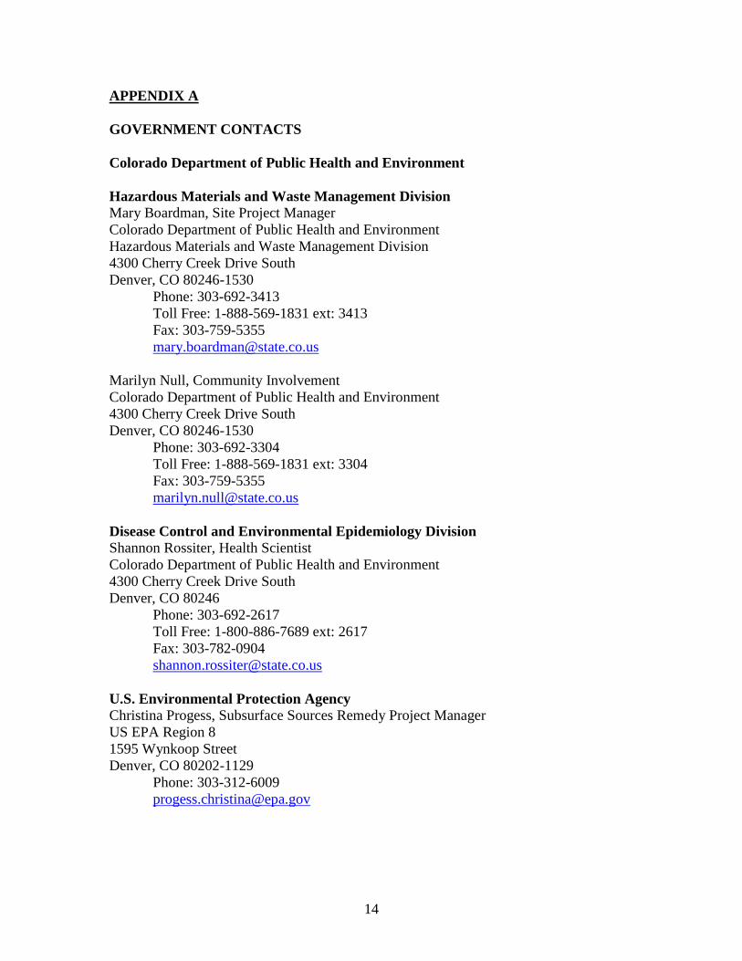
APPENDIX A GOVERNMENT CONTACTS Colorado Department of Public Health and Environment Hazardous Materials and Waste Management Division Mary Boardman, Site Project Manager Colorado Department of Public Health and Environment Hazardous Materials and Waste Management Division 4300 Cherry Creek Drive South Denver, CO 80246-1530
Phone: 303-692-3413 Toll Free: 1-888-569-1831 ext: 3413 Fax: 303-759-5355 [email protected]
Marilyn Null, Community Involvement Colorado Department of Public Health and Environment 4300 Cherry Creek Drive South Denver, CO 80246-1530
Phone: 303-692-3304 Toll Free: 1-888-569-1831 ext: 3304 Fax: 303-759-5355 [email protected]
Disease Control and Environmental Epidemiology Division Shannon Rossiter, Health Scientist Colorado Department of Public Health and Environment 4300 Cherry Creek Drive South Denver, CO 80246
Phone: 303-692-2617 Toll Free: 1-800-886-7689 ext: 2617 Fax: 303-782-0904 [email protected]
U.S. Environmental Protection Agency Christina Progess, Subsurface Sources Remedy Project Manager US EPA Region 8 1595 Wynkoop Street Denver, CO 80202-1129
Phone: 303-312-6009 [email protected]
15
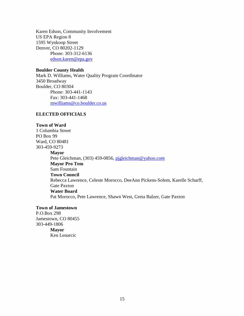
Karen Edson, Community Involvement US EPA Region 8 1595 Wynkoop Street Denver, CO 80202-1129
Phone: 303-312-6136 [email protected]
Boulder County Health Mark D. Williams, Water Quality Program Coordinator 3450 Broadway Boulder, CO 80304
Phone: 303-441-1143 Fax: 303-441-1468 [email protected]
ELECTED OFFICIALS Town of Ward 1 Columbia Street PO Box 99 Ward, CO 80481 303-459-9273
Mayor Pete Gleichman, (303) 459-0856, [email protected] Mayor Pro Tem Sam Fountain Town Council Rebecca Lawrence, Celeste Morocco, DeeAnn Pickens-Solem, Karelle Scharff, Gate Paxton Water Board Pat Morocco, Pete Lawrence, Shawn West, Greta Balzer, Gate Paxton
Town of Jamestown P.O.Box 298 Jamestown, CO 80455 303-449-1806
Mayor Ken Lenarcic
16
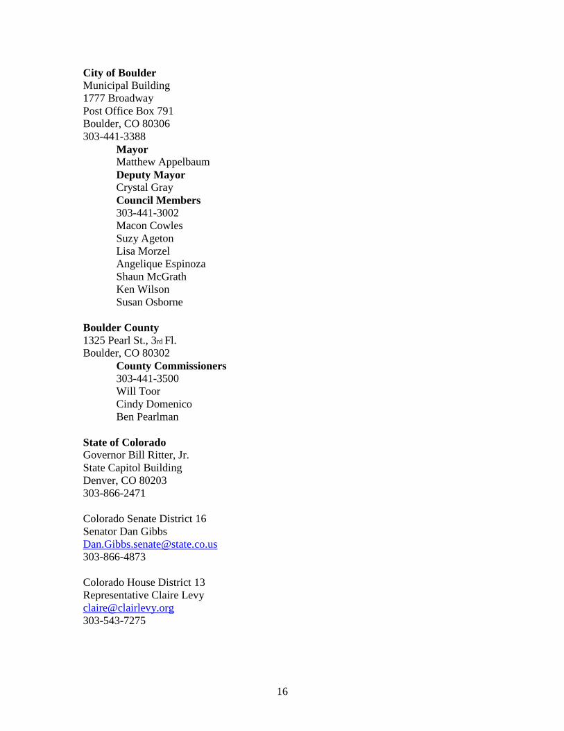
City of Boulder Municipal Building 1777 Broadway Post Office Box 791 Boulder, CO 80306 303-441-3388
Mayor Matthew Appelbaum Deputy Mayor Crystal Gray Council Members 303-441-3002 Macon Cowles Suzy Ageton Lisa Morzel Angelique Espinoza Shaun McGrath Ken Wilson Susan Osborne
Boulder County 1325 Pearl St., 3rd Fl. Boulder, CO 80302
County Commissioners 303-441-3500 Will Toor Cindy Domenico Ben Pearlman
State of Colorado Governor Bill Ritter, Jr. State Capitol Building Denver, CO 80203 303-866-2471 Colorado Senate District 16 Senator Dan Gibbs [email protected] 303-866-4873 Colorado House District 13 Representative Claire Levy [email protected] 303-543-7275
17
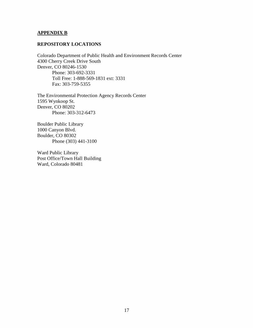
APPENDIX B REPOSITORY LOCATIONS Colorado Department of Public Health and Environment Records Center 4300 Cherry Creek Drive South Denver, CO 80246-1530
Phone: 303-692-3331 Toll Free: 1-888-569-1831 ext: 3331 Fax: 303-759-5355
The Environmental Protection Agency Records Center 1595 Wynkoop St. Denver, CO 80202
Phone: 303-312-6473
Boulder Public Library 1000 Canyon Blvd. Boulder, CO 80302
Phone (303) 441-3100
Ward Public Library Post Office/Town Hall Building Ward, Colorado 80481
18
APPENDIX C INTERESTED CITIZEN GROUPS Lefthand Creek TAG Coalition (LCTC) Elizabeth Russell, Coordinator [email protected] Left Hand Water Oversight Group (LWOG) Geneva Mixon, Coordinator [email protected] P.O. Box 1074 Niwot, CO 80544 720-562-6183 James Creek Watershed Initiative Colleen Williams, Executive Director Post Office Box 110 Jamestown, CO 80455 Student Environmental Action Coalition UMC 345 at CU Boulder Campus Box 207 Boulder, CO 80309 (303) 492-5449 Clean Water Action 899 Logan, Suite 101 Denver, CO 80203 Phone: 303-839-9866 Coloradoans for Clean Air 1985 Grape Street Denver, CO 80220 Phone: 303-388-4858 Colorado Environmental Coalition 1536 Wynkoop, Suite 5-C Denver, CO 80202 Phone: 303-534-7066 Colorado Mountain Club 710 10th Street Golden, CO 80401 Phone: 303-279-3080
19
Colorado Open Lands 274 Union Blvd Lakewood, CO 80228 Phone: 303-988-2373 Colorado Public Interest Research Group 1530 Blake Street Denver, CO 80202 Phone: 303-573-7474 Greenpeace 702 “H” Street, Northwest Washington, DC 20001 Phone: 800-326-0959 National Audubon Society 3109 28th Street Boulder, CO 80201 Phone: 303-415-0130 National Wildlife Federation 2260 Baseline Road, Suite 100 Boulder, CO 80302 Phone: 303-786-8001 The Nature Conservancy 1881 9th Street, Suite 200 Boulder, CO 80302 Phone: 303-444-2950 Rocky Mountain Institute 1739 Snowmass Creed Road Snowmass, CO 81654 Phone: 970-927-3851 Sierra Club, Rocky Mountain Chapter 1410 Grant Street Denver, CO 80203 Phone 303-861-8819 Thome Ecological Institute 5398 Manhattan Circle, Suite 120 Boulder, CO 80303 303-499-3647

20
APPENDIX D MEDIA CONTACTS Boulder Daily Camera 1048 Pearl Street Boulder, CO 80302 Phone: 303-442-1202 Fax: 303-449-9358 www.dailycamera.com Nederland Mountain-Ear 74 Hwy 72 Nederland, CO 80466 Phone: 303-258-7075 Fax: 303-258-3547 www.themountainear.com Daily Times-Call 350 Terry Street Longmont, CO 80501 Phone: 303-776-2244 Fax: 303-776-0837 www.longmontfyi.com Boulder Colorado Daily 5505 Central Avenue Boulder, CO 80301 Phone: 303-443-6272 Fax: 303-443-9357 www.coloradodaily.com Denver Post 101 West Colfax Avenue Denver, CO 80202 Phone: (303) 954-1434 (advertising) www.denverpost.com Erie Review 215 Cheesman, Suite J Erie, CO 80516 Phone: 303-666-6576 Fax: 303-666-6602

21
Lafayette News 1285 Centaur Village Drive Lafayette, CO 80026 Phone: 303-665-6515 Fax: 303-666-6602 www.coloradohometownnews.com Louisville Times 1285 Centaur Village Drive Lafayette, CO 80026 Phone: 303-666-8617 Fax: 303-666-6602 www.coloradohometownnews.com The Old Lyons Recorder 412 High Street Lyons, CO 80540 Phone: 303-823-6625 Fax: 303-823-6633
22
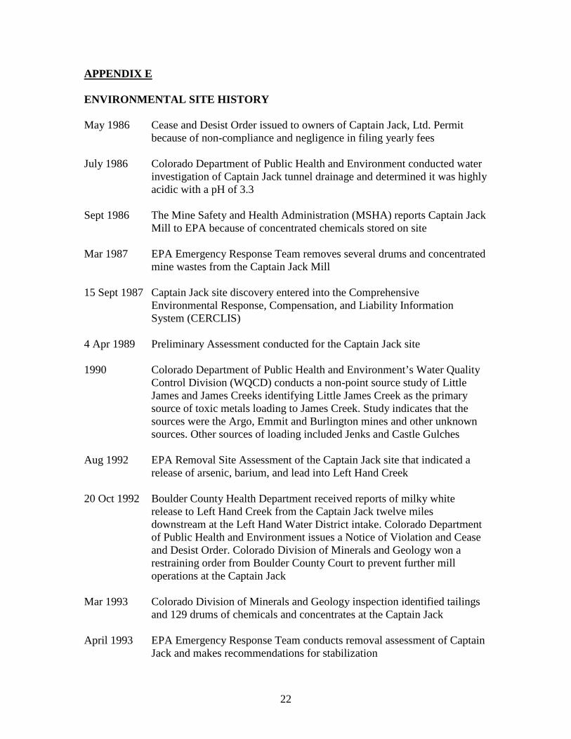
APPENDIX E ENVIRONMENTAL SITE HISTORY May 1986 Cease and Desist Order issued to owners of Captain Jack, Ltd. Permit
because of non-compliance and negligence in filing yearly fees July 1986 Colorado Department of Public Health and Environment conducted water
investigation of Captain Jack tunnel drainage and determined it was highly acidic with a pH of 3.3
Sept 1986 The Mine Safety and Health Administration (MSHA) reports Captain Jack
Mill to EPA because of concentrated chemicals stored on site Mar 1987 EPA Emergency Response Team removes several drums and concentrated
mine wastes from the Captain Jack Mill 15 Sept 1987 Captain Jack site discovery entered into the Comprehensive
Environmental Response, Compensation, and Liability Information System (CERCLIS)
4 Apr 1989 Preliminary Assessment conducted for the Captain Jack site 1990 Colorado Department of Public Health and Environment’s Water Quality
Control Division (WQCD) conducts a non-point source study of Little James and James Creeks identifying Little James Creek as the primary source of toxic metals loading to James Creek. Study indicates that the sources were the Argo, Emmit and Burlington mines and other unknown sources. Other sources of loading included Jenks and Castle Gulches
Aug 1992 EPA Removal Site Assessment of the Captain Jack site that indicated a
release of arsenic, barium, and lead into Left Hand Creek 20 Oct 1992 Boulder County Health Department received reports of milky white
release to Left Hand Creek from the Captain Jack twelve miles downstream at the Left Hand Water District intake. Colorado Department of Public Health and Environment issues a Notice of Violation and Cease and Desist Order. Colorado Division of Minerals and Geology won a restraining order from Boulder County Court to prevent further mill operations at the Captain Jack
Mar 1993 Colorado Division of Minerals and Geology inspection identified tailings
and 129 drums of chemicals and concentrates at the Captain Jack April 1993 EPA Emergency Response Team conducts removal assessment of Captain
Jack and makes recommendations for stabilization
23
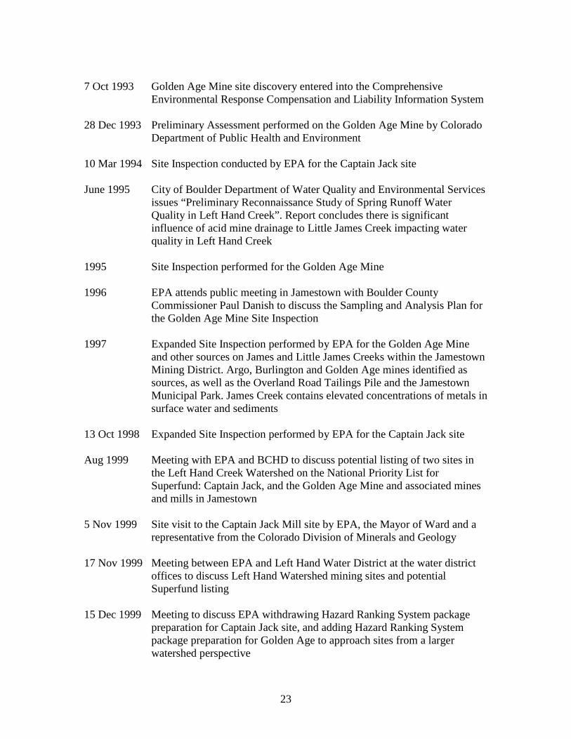
7 Oct 1993 Golden Age Mine site discovery entered into the Comprehensive
Environmental Response Compensation and Liability Information System 28 Dec 1993 Preliminary Assessment performed on the Golden Age Mine by Colorado
Department of Public Health and Environment 10 Mar 1994 Site Inspection conducted by EPA for the Captain Jack site June 1995 City of Boulder Department of Water Quality and Environmental Services
issues “Preliminary Reconnaissance Study of Spring Runoff Water Quality in Left Hand Creek”. Report concludes there is significant influence of acid mine drainage to Little James Creek impacting water quality in Left Hand Creek
1995 Site Inspection performed for the Golden Age Mine 1996 EPA attends public meeting in Jamestown with Boulder County
Commissioner Paul Danish to discuss the Sampling and Analysis Plan for the Golden Age Mine Site Inspection
1997 Expanded Site Inspection performed by EPA for the Golden Age Mine
and other sources on James and Little James Creeks within the Jamestown Mining District. Argo, Burlington and Golden Age mines identified as sources, as well as the Overland Road Tailings Pile and the Jamestown Municipal Park. James Creek contains elevated concentrations of metals in surface water and sediments
13 Oct 1998 Expanded Site Inspection performed by EPA for the Captain Jack site Aug 1999 Meeting with EPA and BCHD to discuss potential listing of two sites in
the Left Hand Creek Watershed on the National Priority List for Superfund: Captain Jack, and the Golden Age Mine and associated mines and mills in Jamestown
5 Nov 1999 Site visit to the Captain Jack Mill site by EPA, the Mayor of Ward and a
representative from the Colorado Division of Minerals and Geology 17 Nov 1999 Meeting between EPA and Left Hand Water District at the water district
offices to discuss Left Hand Watershed mining sites and potential Superfund listing
15 Dec 1999 Meeting to discuss EPA withdrawing Hazard Ranking System package
preparation for Captain Jack site, and adding Hazard Ranking System package preparation for Golden Age to approach sites from a larger watershed perspective
24
16 Dec 1999 Meeting with Boulder County Health Department, EPA, and the Water
Quality Control Division’s S. Platte River Watershed Coordinator to discuss cleanup, community involvement, Superfund issues, and the Total Maximum Daily Load process
20 Jan 2000 Meeting with Boulder County Health Department, EPA, and Colorado
Department of Public Health and Environment to discuss Superfund National Priority Listing and potential enforcement issues
29 Mar 2000 Press release issued from Boulder County Health Department to inform
people about the mining impacts and possible cleanup at the Captain Jack and Golden Age sites, and to announce department participation in upcoming town meetings for Ward and Jamestown to discuss the issues
Mar 2000 Letter sent from Boulder County Health Department to Colorado
Department of Public Health and Environment requesting $74,000 funding for community involvement assistance in the Left Hand Creek Watershed
Mar/Apr 2000 EPA sampled sediments in Left Hand and James Creeks and found
elevated levels of metals in sediments as far downstream as the Left Hand Water District’s water supply intake
3 Apr 2000 Representative from Boulder County Health Department attends a Ward
town meeting to discuss mining-related contamination at the Captain Jack Mill and Big Five adit, EPA and Colorado Department of Public Health and Environment studies, clean-up options, and coordination with the community
10 Apr 2000 Representative from Boulder County Health Department attends a
Jamestown Town Meeting to discuss mining-related contamination in the vicinity of Jamestown at the Golden Age and Burlington Mines, EPA and Colorado Department of Public Health and Environment studies, clean-up options, and coordination with the community
Aug 2000 EPA issues a fact sheet on the Captain Jack and Golden Age Mining sites
in the Left Hand Creek watershed that provides information on studies, contamination, and potential Superfund cleanup
29 Sept 2003 EPA adds Captain Jack to the National Priorities List. Subsequently, EPA
and the Colorado Department of Public Health and Environment enter into a Cooperative Agreement that places the site under state-lead management
2004 EPA conducts an emergency removal of miscellaneous hazardous wastes
discovered during the initial phase of Remedial Investigation
25
2005 Left Hand Watershed Oversight Group identifies the draining Big Five adit tunnel as the only “high-priority” site along Left Hand Creek
2007 EPA performs an Emergency Removal to rehabilitate the partially-
collapsed Big Five adit and remove the impounded mine water 2008 Remedial Investigation and Risk Assessment are completed, as well as the
Proposed Plan 2 July 2008 Public meeting at the Town of Ward, Municipal Dojo Room to provide the
community an opportunity to comment on the proposed plan 29 Sept 2008 EPA and the Colorado Department of Public Health and Environment sign
the Record of Decision, which determines the site remedy 2009 CDPHE and EPA conduct interviews to gather information for
Community Involvement Plan update
26
APPENDIX F REFERENCES Cobb, Harrison S. 1988. “Prospecting Our Past: Gold, Silver and Tungsten Mill of Boulder County.” URS Operating Services, Inc. 1998. “Analytical Results Report, Captain Jack Mill Site, Ward, Colorado.” Colorado Department of Public Health and Environment. 2003. “Recent History of EPA and Colorado Department of Public Health and Environment Involvement in the Left Hand Creek Watershed.” Colorado Department of Public Health and Environment. September 29, 2008. “Captain Jack Superfund Site Record of Decision.” Left Hand Watershed Task Force. March 11, 2002. “Left Hand Watershed Task Force Final Report to the Boulder County Board of Health.” National Association of County and City Health Officials & Agency for Toxic Substances and Disease Registry. June 2001. “NACCHO Environmental Health Community Needs Assessment Report, Captain Jack Mill & Burlington Mine Sites, Boulder County, Colorado.” US Census Bureau. Census 2000 Summary File Geographic Location: Ward town, Colorado. US Census Bureau. Census 2000 Summary File Geographic Location: Jamestown, Colorado. US Census Bureau. Census 2000 Summary File Geographic Location: Boulder, Colorado. Boulder Chamber of Commerce. 2003. Boulder Life.