Embed Size (px)
Citation preview
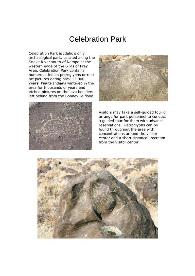
Celebration Park
Celebration Park is Idaho’s only archaelogical park. Located along the Snake River south of Nampa at the western edge of the Birds of Prey Area, Celebration Park contains numerous Indian petroglyphs or rock art pictures dating back 12,000 years. Paiute Indians wintered in the area for thousands of years and etched pictures on the lava boulders left behind from the Bonneville flood.
Visitors may take a self-guided tour or arrange for park personnel to conduct a guided tour for them with advance reservations. Petroglyphs can be found throughout the area with concentrations around the visitor center and a short distance upstream from the visitor center.
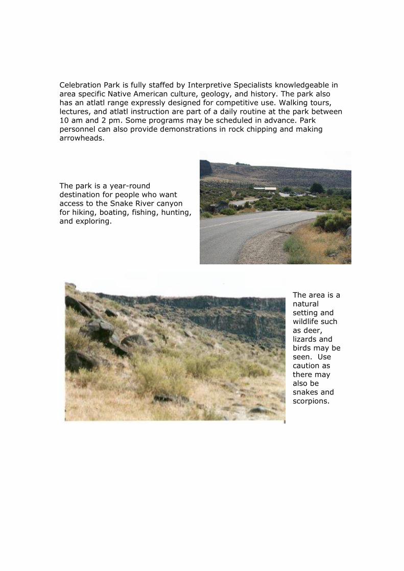
Celebration Park is fully staffed by Interpretive Specialists knowledgeable in area specific Native American culture, geology, and history. The park also has an atlatl range expressly designed for competitive use. Walking tours, lectures, and atlatl instruction are part of a daily routine at the park between 10 am and 2 pm. Some programs may be scheduled in advance. Park personnel can also provide demonstrations in rock chipping and making arrowheads.
The park is a year-round destination for people who want access to the Snake River canyon for hiking, boating, fishing, hunting, and exploring.
The area is a natural setting and wildlife such as deer, lizards and birds may be seen. Use caution as there may also be snakes and scorpions.

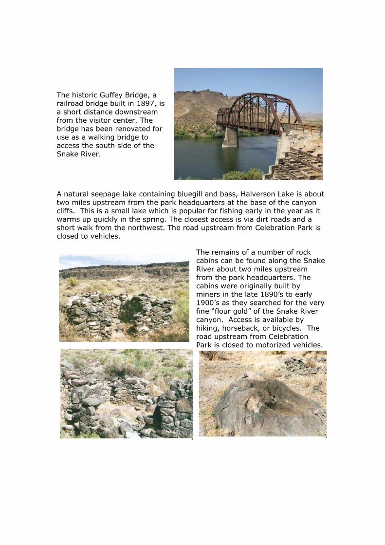
The historic Guffey Bridge, a railroad bridge built in 1897, is a short distance downstream from the visitor center. The bridge has been renovated for use as a walking bridge to access the south side of the Snake River.
A natural seepage lake containing bluegill and bass, Halverson Lake is about two miles upstream from the park headquarters at the base of the canyon cliffs. This is a small lake which is popular for fishing early in the year as it warms up quickly in the spring. The closest access is via dirt roads and a short walk from the northwest. The road upstream from Celebration Park is closed to vehicles.
The remains of a number of rock cabins can be found along the Snake River about two miles upstream from the park headquarters. The cabins were originally built by miners in the late 1890’s to early 1900’s as they searched for the very fine “flour gold” of the Snake River canyon. Access is available by hiking, horseback, or bicycles. The road upstream from Celebration Park is closed to motorized vehicles.
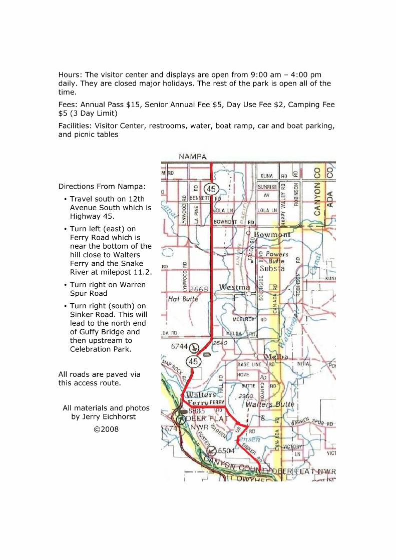
Hours: The visitor center and displays are open from 9:00 am – 4:00 pm daily. They are closed major holidays. The rest of the park is open all of the time.
Fees: Annual Pass $15, Senior Annual Fee $5, Day Use Fee $2, Camping Fee $5 (3 Day Limit)
Facilities: Visitor Center, restrooms, water, boat ramp, car and boat parking, and picnic tables
Directions From Nampa:
• Travel south on 12th Avenue South which is Highway 45.
• Turn left (east) on Ferry Road which is near the bottom of the hill close to Walters Ferry and the Snake River at milepost 11.2.
• Turn right on Warren Spur Road
• Turn right (south) on Sinker Road. This will lead to the north end of Guffy Bridge and then upstream to Celebration Park.
All roads are paved via this access route.
All materials and photos by Jerry Eichhorst
©2008