Embed Size (px)
Citation preview
1
Climbing Trikora and Mandala After climbing Carstensz Pyramid and 3 surrounding peaks (Sumantri, Ngga Pulu, East Carstensz) in February, Anthony Nightingale, Dan Zokaites and Steven Drive Liwe, this time accompanied by Nanang Sunarko traveled back to Papua in October to climb the mountains of Trikora and Mandala. They are sometimes reckoned to be the second and third highest mountains in Papua (and thus in “Australasia”) after Carstensz Pyramid (4894 meters) but our calculations indicate Sumantri (4874 meters) and Ngga Pulu (4836 meters) are higher. We calculated Mandala at 4747 meters and Trikora at 4734 meters. But both, though seldom visited, are fascinating climbs. Dan, Steven and Anthony met up at Jayapura, on the north coast in the eastern part of Indonesian Papua.
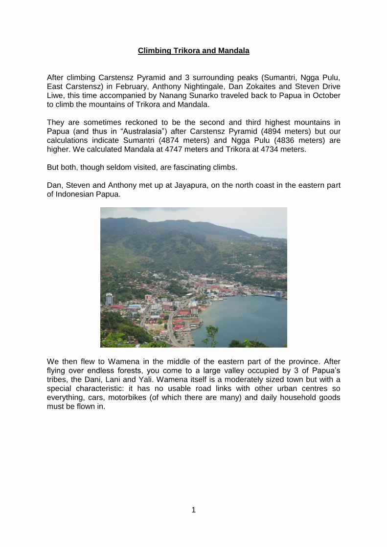
We then flew to Wamena in the middle of the eastern part of the province. After flying over endless forests, you come to a large valley occupied by 3 of Papua’s tribes, the Dani, Lani and Yali. Wamena itself is a moderately sized town but with a special characteristic: it has no usable road links with other urban centres so everything, cars, motorbikes (of which there are many) and daily household goods must be flown in.
2
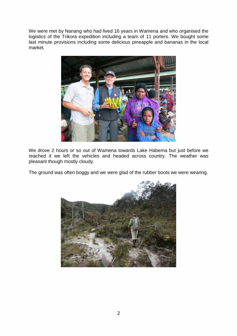
We were met by Nanang who had lived 16 years in Wamena and who organised the logistics of the Trikora expedition including a team of 11 porters. We bought some last minute provisions including some delicious pineapple and bananas in the local market.
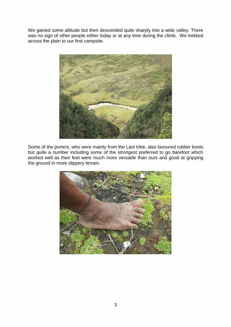
We drove 2 hours or so out of Wamena towards Lake Habema but just before we reached it we left the vehicles and headed across country. The weather was pleasant though mostly cloudy. The ground was often boggy and we were glad of the rubber boots we were wearing.
3
We gained some altitude but then descended quite sharply into a wide valley. There was no sign of other people either today or at any time during the climb. We trekked across the plain to our first campsite.
Some of the porters, who were mainly from the Lani tribe, also favoured rubber boots but quite a number including some of the strongest preferred to go barefoot which worked well as their feet were much more versatile than ours and good at gripping the ground in more slippery terrain.
4
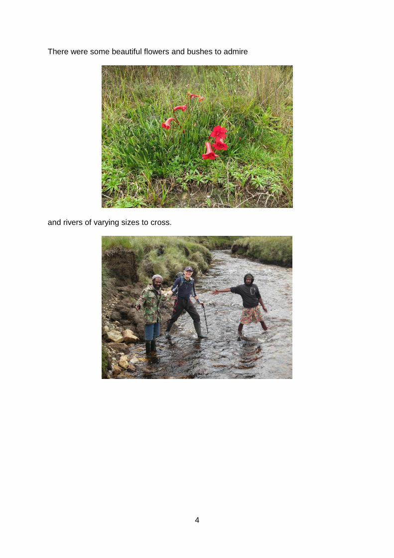
There were some beautiful flowers and bushes to admire
and rivers of varying sizes to cross.
5
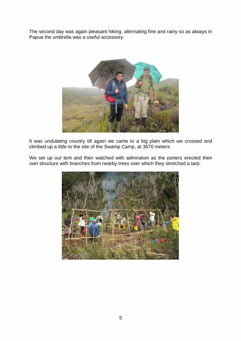
The second day was again pleasant hiking, alternating fine and rainy so as always in Papua the umbrella was a useful accessory.
It was undulating country till again we came to a big plain which we crossed and climbed up a little to the site of the Swamp Camp, at 3670 meters. We set up our tent and then watched with admiration as the porters erected their own structure with branches from nearby trees over which they stretched a tarp.
6
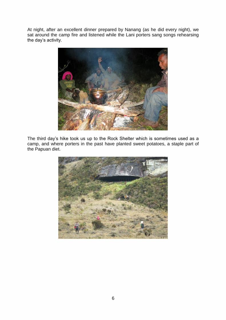
At night, after an excellent dinner prepared by Nanang (as he did every night), we sat around the camp fire and listened while the Lani porters sang songs rehearsing the day’s activity.
The third day’s hike took us up to the Rock Shelter which is sometimes used as a camp, and where porters in the past have planted sweet potatoes, a staple part of the Papuan diet.
7
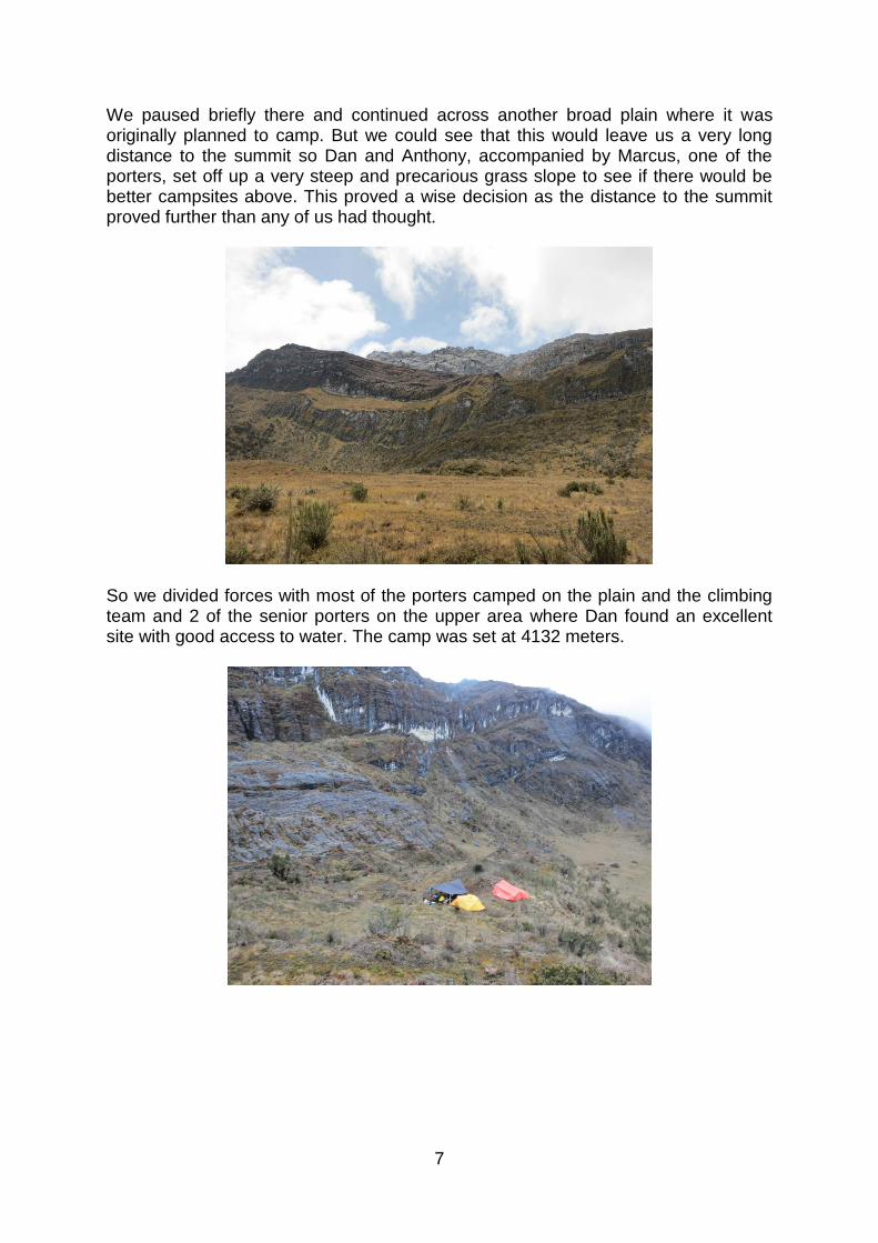
We paused briefly there and continued across another broad plain where it was originally planned to camp. But we could see that this would leave us a very long distance to the summit so Dan and Anthony, accompanied by Marcus, one of the porters, set off up a very steep and precarious grass slope to see if there would be better campsites above. This proved a wise decision as the distance to the summit proved further than any of us had thought.
So we divided forces with most of the porters camped on the plain and the climbing team and 2 of the senior porters on the upper area where Dan found an excellent site with good access to water. The camp was set at 4132 meters.
8
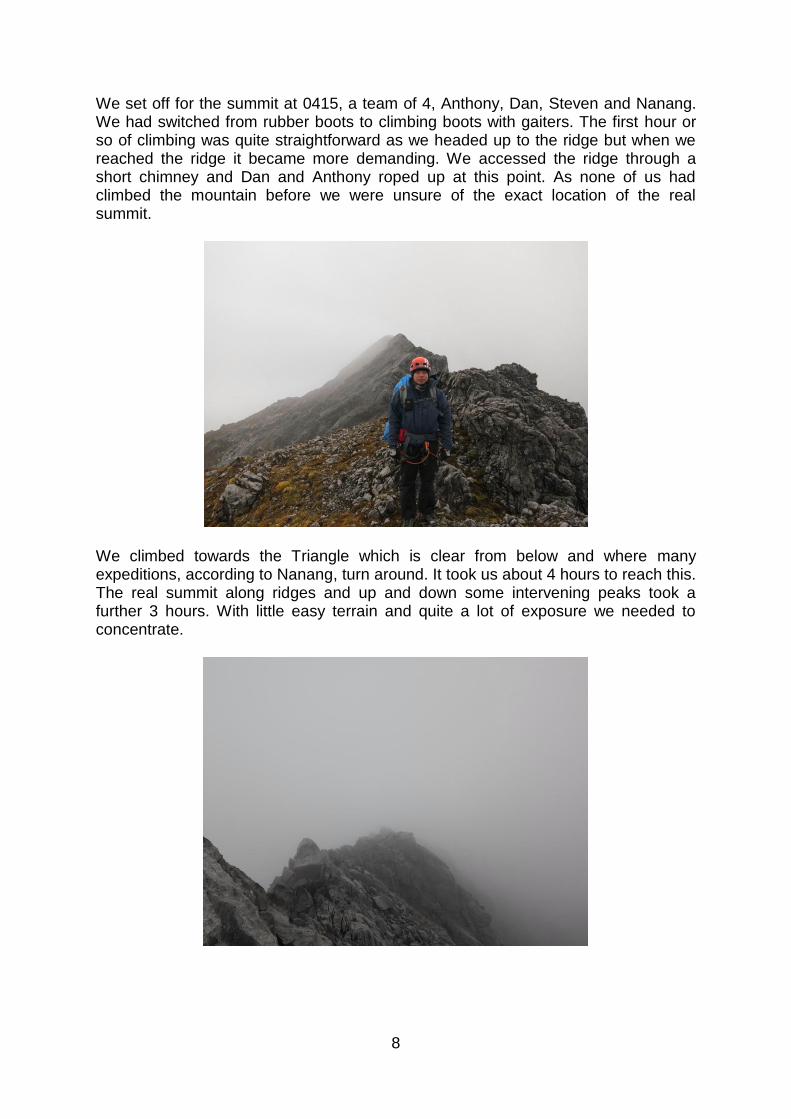
We set off for the summit at 0415, a team of 4, Anthony, Dan, Steven and Nanang. We had switched from rubber boots to climbing boots with gaiters. The first hour or so of climbing was quite straightforward as we headed up to the ridge but when we reached the ridge it became more demanding. We accessed the ridge through a short chimney and Dan and Anthony roped up at this point. As none of us had climbed the mountain before we were unsure of the exact location of the real summit.
We climbed towards the Triangle which is clear from below and where many expeditions, according to Nanang, turn around. It took us about 4 hours to reach this. The real summit along ridges and up and down some intervening peaks took a further 3 hours. With little easy terrain and quite a lot of exposure we needed to concentrate.
9
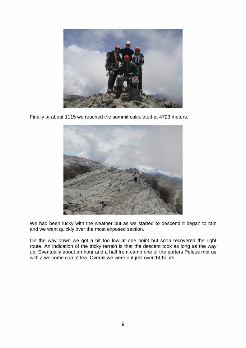
Finally at about 1115 we reached the summit calculated at 4723 meters.
We had been lucky with the weather but as we started to descend it began to rain and we went quickly over the most exposed section. On the way down we got a bit too low at one point but soon recovered the right route. An indication of the tricky terrain is that the descent took as long as the way up. Eventually about an hour and a half from camp one of the porters Peleus met us with a welcome cup of tea. Overall we were out just over 14 hours.
10
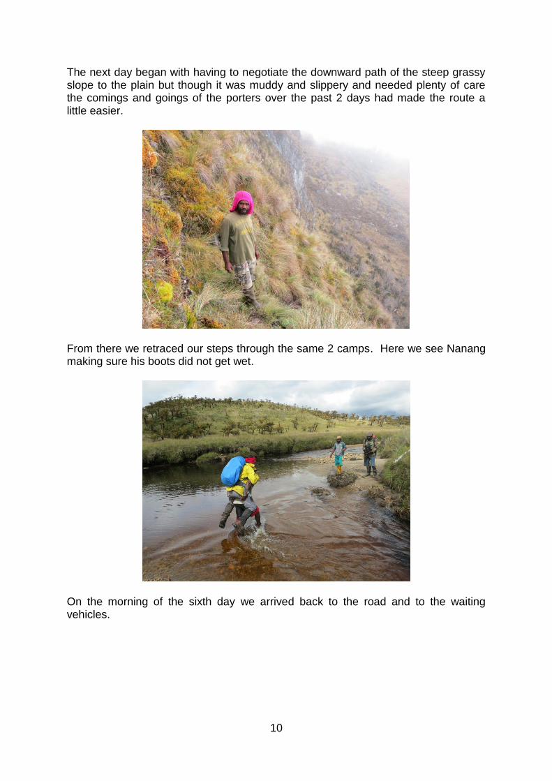
The next day began with having to negotiate the downward path of the steep grassy slope to the plain but though it was muddy and slippery and needed plenty of care the comings and goings of the porters over the past 2 days had made the route a little easier.
From there we retraced our steps through the same 2 camps. Here we see Nanang making sure his boots did not get wet.
On the morning of the sixth day we arrived back to the road and to the waiting vehicles.
11
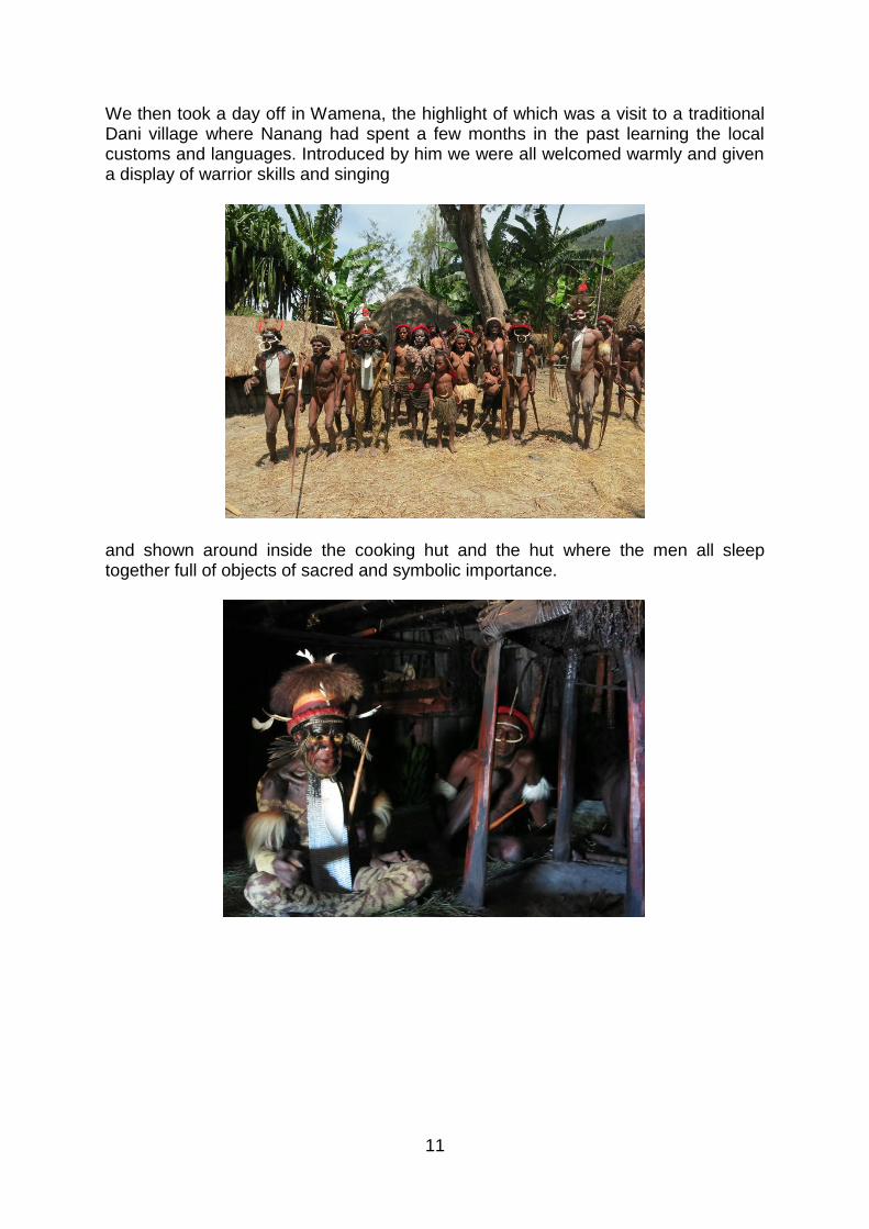
We then took a day off in Wamena, the highlight of which was a visit to a traditional Dani village where Nanang had spent a few months in the past learning the local customs and languages. Introduced by him we were all welcomed warmly and given a display of warrior skills and singing
and shown around inside the cooking hut and the hut where the men all sleep together full of objects of sacred and symbolic importance.
12
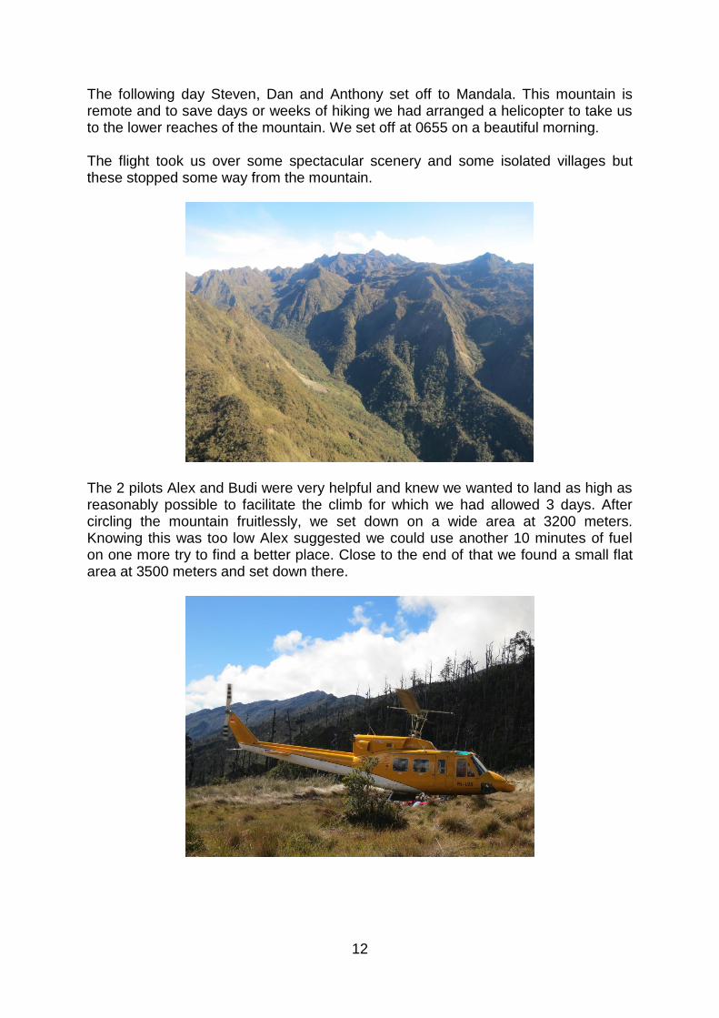
The following day Steven, Dan and Anthony set off to Mandala. This mountain is remote and to save days or weeks of hiking we had arranged a helicopter to take us to the lower reaches of the mountain. We set off at 0655 on a beautiful morning. The flight took us over some spectacular scenery and some isolated villages but these stopped some way from the mountain.
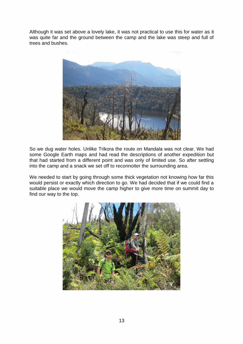
The 2 pilots Alex and Budi were very helpful and knew we wanted to land as high as reasonably possible to facilitate the climb for which we had allowed 3 days. After circling the mountain fruitlessly, we set down on a wide area at 3200 meters. Knowing this was too low Alex suggested we could use another 10 minutes of fuel on one more try to find a better place. Close to the end of that we found a small flat area at 3500 meters and set down there.
13
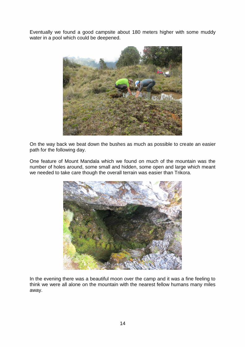
Although it was set above a lovely lake, it was not practical to use this for water as it was quite far and the ground between the camp and the lake was steep and full of trees and bushes.
So we dug water holes. Unlike Trikora the route on Mandala was not clear. We had some Google Earth maps and had read the descriptions of another expedition but that had started from a different point and was only of limited use. So after settling into the camp and a snack we set off to reconnoiter the surrounding area. We needed to start by going through some thick vegetation not knowing how far this would persist or exactly which direction to go. We had decided that if we could find a suitable place we would move the camp higher to give more time on summit day to find our way to the top.
14
Eventually we found a good campsite about 180 meters higher with some muddy water in a pool which could be deepened.
On the way back we beat down the bushes as much as possible to create an easier path for the following day. One feature of Mount Mandala which we found on much of the mountain was the number of holes around, some small and hidden, some open and large which meant we needed to take care though the overall terrain was easier than Trikora.
In the evening there was a beautiful moon over the camp and it was a fine feeling to think we were all alone on the mountain with the nearest fellow humans many miles away.
15
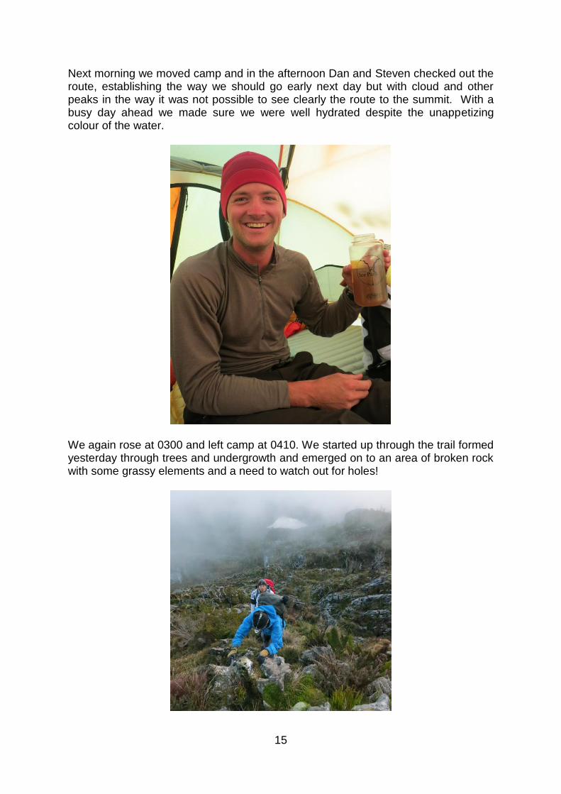
Next morning we moved camp and in the afternoon Dan and Steven checked out the route, establishing the way we should go early next day but with cloud and other peaks in the way it was not possible to see clearly the route to the summit. With a busy day ahead we made sure we were well hydrated despite the unappetizing colour of the water.
We again rose at 0300 and left camp at 0410. We started up through the trail formed yesterday through trees and undergrowth and emerged on to an area of broken rock with some grassy elements and a need to watch out for holes!
16
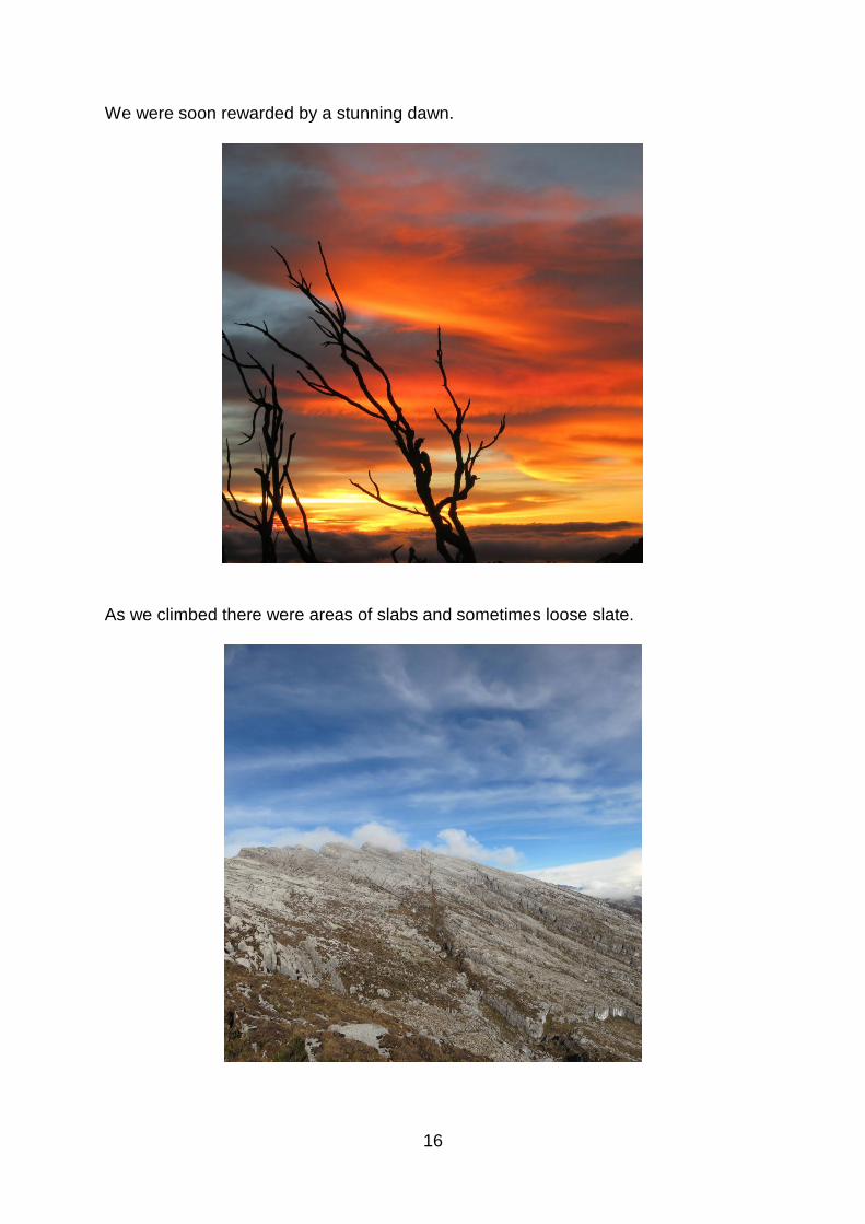
We were soon rewarded by a stunning dawn.
As we climbed there were areas of slabs and sometimes loose slate.
17
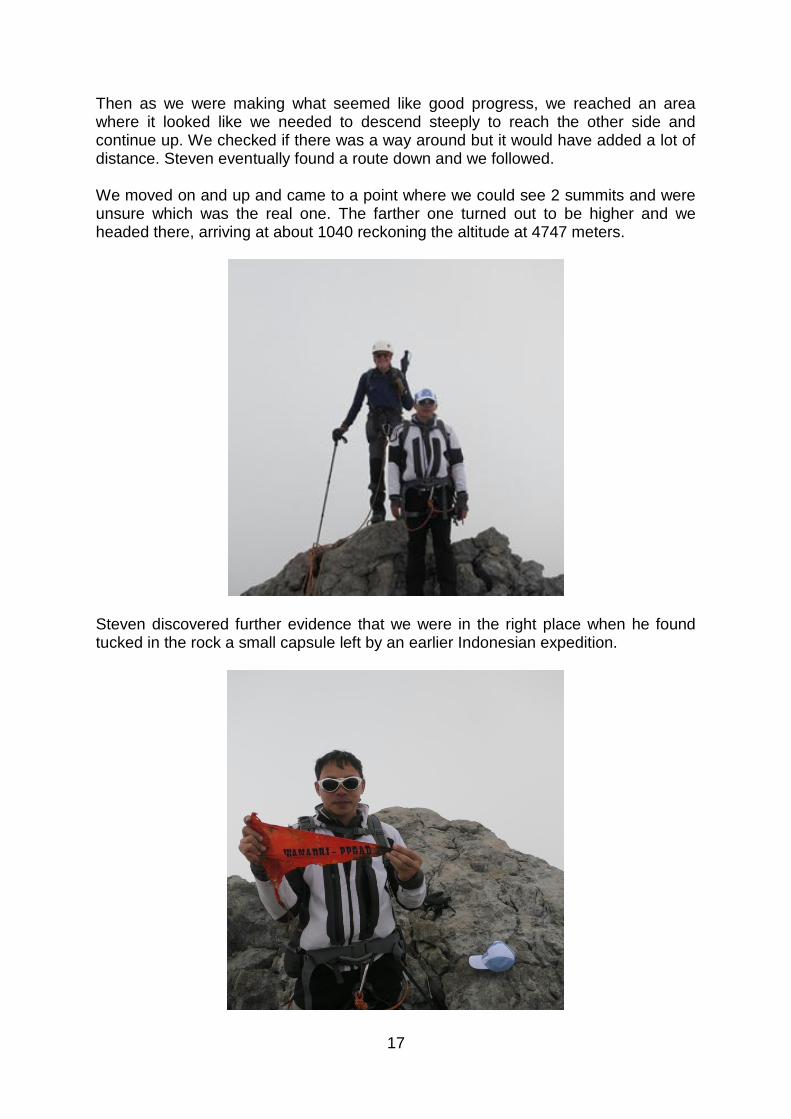
Then as we were making what seemed like good progress, we reached an area where it looked like we needed to descend steeply to reach the other side and continue up. We checked if there was a way around but it would have added a lot of distance. Steven eventually found a route down and we followed. We moved on and up and came to a point where we could see 2 summits and were unsure which was the real one. The farther one turned out to be higher and we headed there, arriving at about 1040 reckoning the altitude at 4747 meters.
Steven discovered further evidence that we were in the right place when he found tucked in the rock a small capsule left by an earlier Indonesian expedition.
18
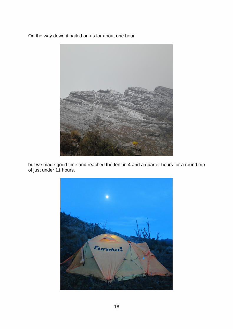
On the way down it hailed on us for about one hour
but we made good time and reached the tent in 4 and a quarter hours for a round trip of just under 11 hours.
19
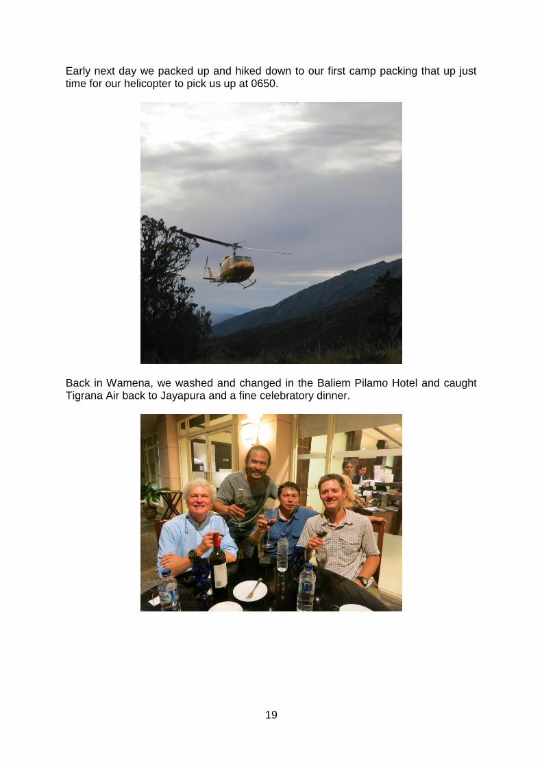
Early next day we packed up and hiked down to our first camp packing that up just time for our helicopter to pick us up at 0650.
Back in Wamena, we washed and changed in the Baliem Pilamo Hotel and caught Tigrana Air back to Jayapura and a fine celebratory dinner.
![[p. 1] Journal kept by Jan Carstensz on his voyage to New ......[p. 1] Journal kept by Jan Carstensz on his voyage to New Guinea, including a copy of the Act of Conveyance, Submission](https://img.pdfslide.net/doc/110x75/61499a8512c9616cbc68de4e/p-1-journal-kept-by-jan-carstensz-on-his-voyage-to-new-p-1-journal.jpg)