Embed Size (px)
Citation preview
2017 Coastal GeoTools Conference
Coastal Enhancements to the National Hydrography Dataset (NHD)
Susan Phelps, CFM, GISP
Thurs, Feb. 9th 2017
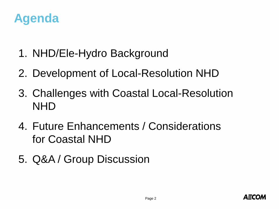
Agenda
1. NHD/Ele-Hydro Background
2. Development of Local-Resolution NHD
3. Challenges with Coastal Local-Resolution NHD
4. Future Enhancements / Considerations for Coastal NHD
5. Q&A / Group Discussion
Page 2
Background on National Hydrography Dataset (NHD) and Ele-Hydro
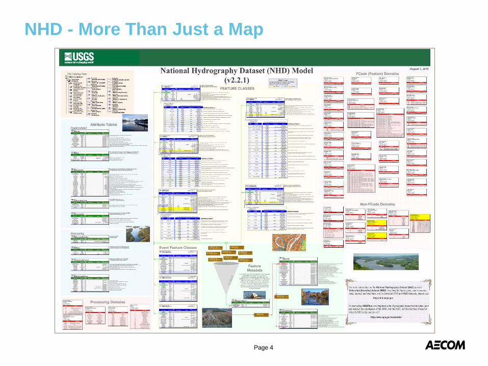
NHD - More Than Just a Map
Page 4
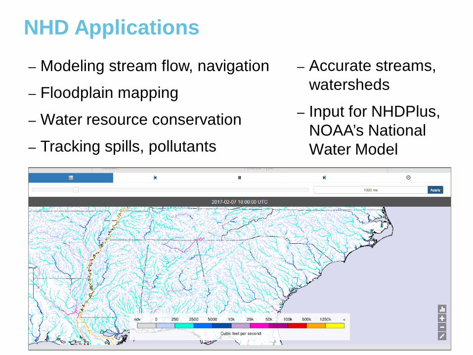
NHD Applications
Page 5
– Modeling stream flow, navigation – Floodplain mapping– Water resource conservation– Tracking spills, pollutants
– Accurate streams, watersheds
– Input for NHDPlus, NOAA’s National Water Model
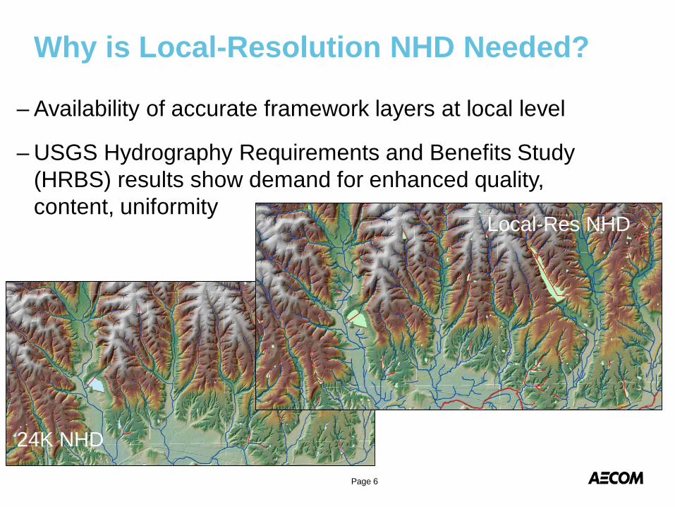
Why is Local-Resolution NHD Needed?
Page 6
– Availability of accurate framework layers at local level
– USGS Hydrography Requirements and Benefits Study (HRBS) results show demand for enhanced quality, content, uniformity
24K NHD
Local-Res NHD
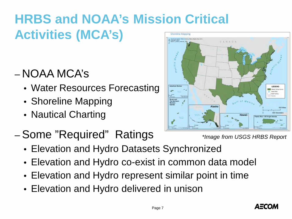
– NOAA MCA’s• Water Resources Forecasting• Shoreline Mapping• Nautical Charting
– Some ”Required” Ratings• Elevation and Hydro Datasets Synchronized• Elevation and Hydro co-exist in common data model• Elevation and Hydro represent similar point in time• Elevation and Hydro delivered in unison
HRBS and NOAA’s Mission Critical Activities (MCA’s)
Page 7
*Image from USGS HRBS Report
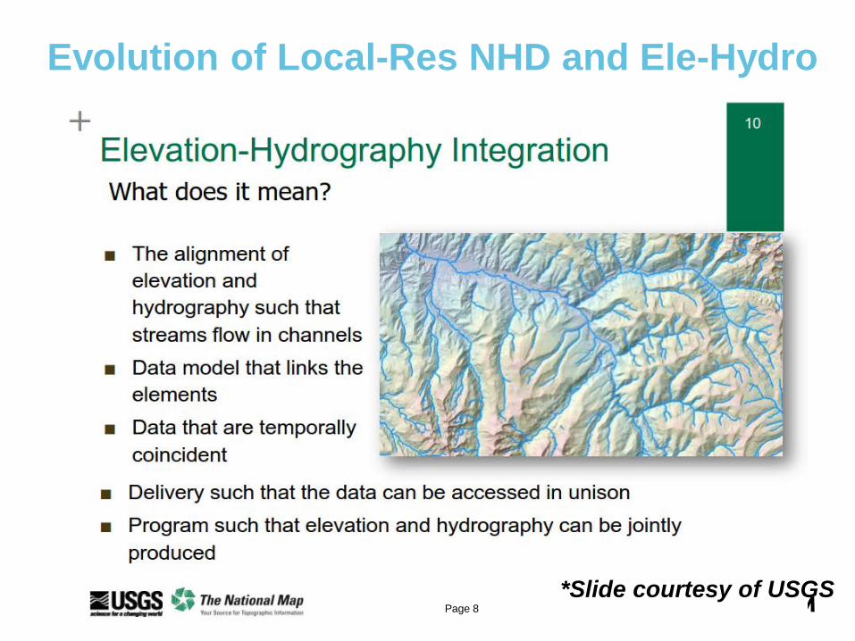
Evolution of Local-Res NHD and Ele-Hydro
Page 8*Slide courtesy of USGS
Development of Local-Resolution NHD
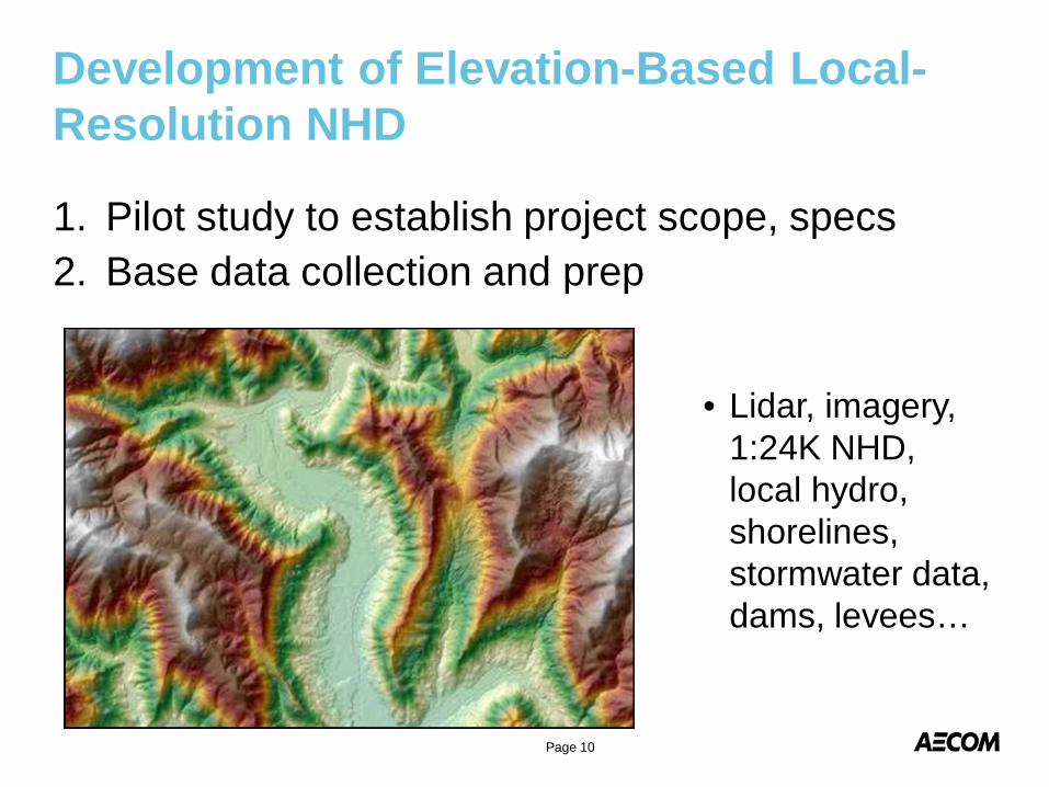
Development of Elevation-Based Local-Resolution NHD
1. Pilot study to establish project scope, specs2. Base data collection and prep
Page 10
• Lidar, imagery, 1:24K NHD, local hydro, shorelines, stormwater data, dams, levees…
Development of Elevation-Based Local-Resolution NHD
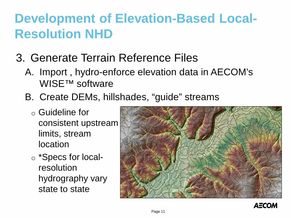
3. Generate Terrain Reference FilesA. Import , hydro-enforce elevation data in AECOM’s
WISE™ software B. Create DEMs, hillshades, “guide” streams
Page 11
o Guideline for consistent upstream limits, stream location
o *Specs for local-resolution hydrography vary state to state
Development of Elevation-Based Local-Resolution NHD
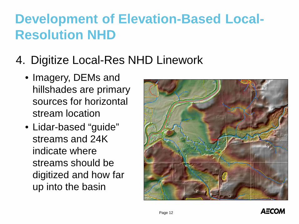
• Imagery, DEMs and hillshades are primary sources for horizontal stream location
• Lidar-based “guide” streams and 24K indicate where streams should be digitized and how far up into the basin
4. Digitize Local-Res NHD Linework
Page 12
Development of Elevation-Based Local-Resolution NHD4. Digitize Local-Res NHD Linework (cont’d)
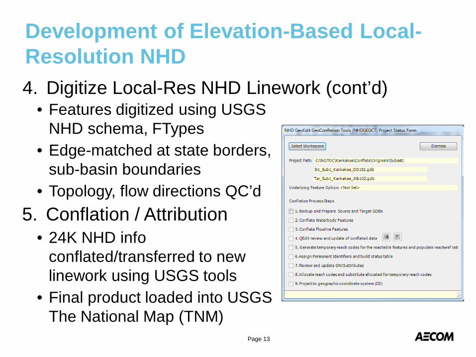
• Features digitized using USGS NHD schema, FTypes
• Edge-matched at state borders, sub-basin boundaries
• Topology, flow directions QC’d5. Conflation / Attribution
• 24K NHD info conflated/transferred to new linework using USGS tools
• Final product loaded into USGS The National Map (TNM)
Page 13
Challenges with Coastal Local-Resolution NHD
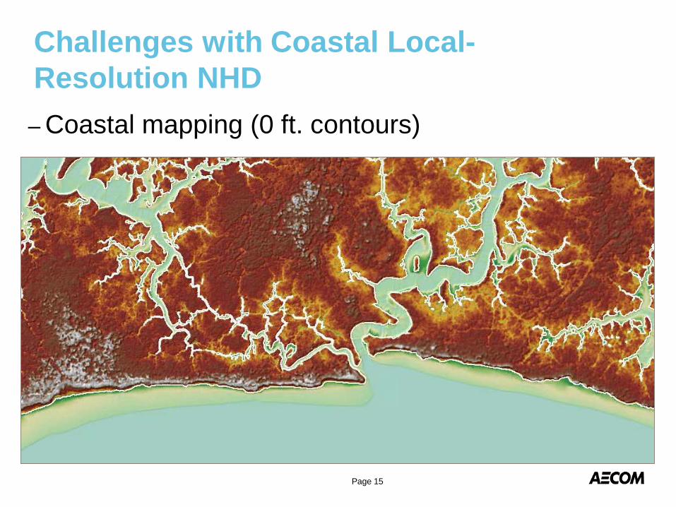
– Coastal mapping (0 ft. contours)
Challenges with Coastal Local-Resolution NHD
Page 15
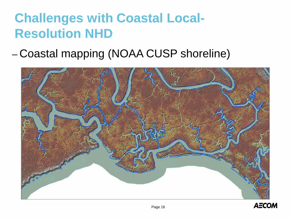
– Coastal mapping (NOAA CUSP shoreline)
Challenges with Coastal Local-Resolution NHD
Page 16
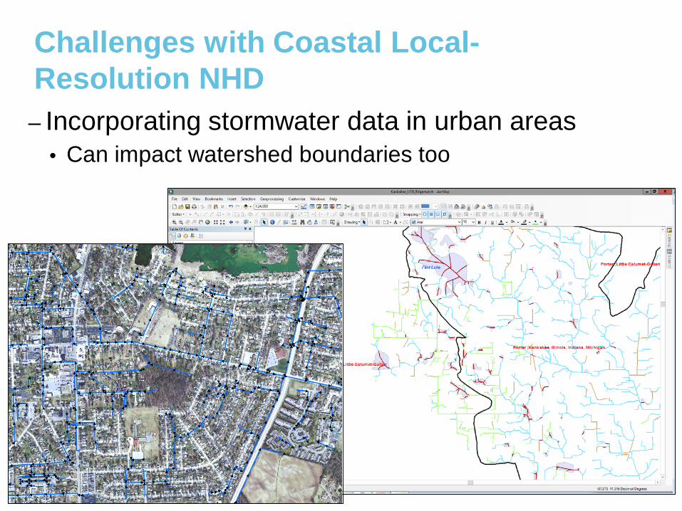
– Incorporating stormwater data in urban areas• Can impact watershed boundaries too
Challenges with Coastal Local-Resolution NHD
Agricultural areas
Page 17
Future Enhancements / Considerations for Coastal Local-Resolution NHD
1. Identify interested stakeholders
2. Identify/develop coastal mapping standardso Relevance to USGS Hydro Requirements and
Benefits Study (HRBS)
o Mission-critical activities, outputs
3. Plan NHD, WBD projects with lidar collection
4. Improve auto-feature extraction, processing techniques for coastal areas
Page 19
Considerations for Future Coastal NHD and Ele-Hydro Efforts