Embed Size (px)
Citation preview
COLLABORATIVE RESEARCH IN THE PANTHER CREEK WATERSHED:
WILLAMETTE RIVER BASIN, OREGON
George McFadden
Oregon State Office
Bureau of Land Management
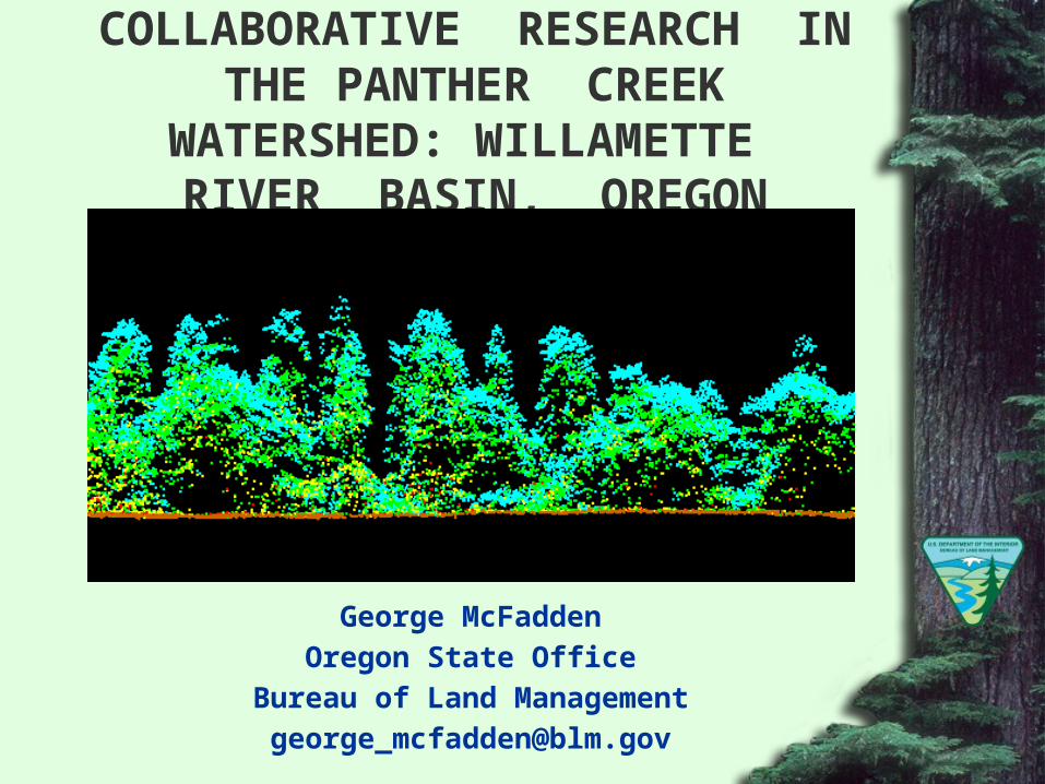
PANTHER CREEK WATERSHED
Ball Bearing Mountain 2265 ft.
Carlton City Reservoir 575 ft.

COLLABORATIVE RESEARCH PARTNERS
• Bureau of Land Management *• Environmental Protection Agency *• Natural Resource Conservation Service *• Weyerhaeuser Company *• U.S. Forest Service, PNW Research Station *• Oregon Department of Geology and Mineral
Industries *• City of Carlton• McMinnville Water and Light

COLLABORATIVE RESEARCH PARTNERS
• Forest Capitol Partners• Oregon State University *• Portland State University• Seattle Biometrics *• Watershed Sciences *• Hampton Affiliates• Yamhill Basin Council
* Core Research Organizations
PANTHER CREEK RESEARCH OBJECTIVES
• Develop LiDAR stand level inventory methods• Conduct a systematic soil sample• Develop methods to predict distribution of soil
carbon• Characterize Panther Creek slope stability• Characterize Panther Creek soil chemistry• Assess effects of forest / land use management
on carbon storage
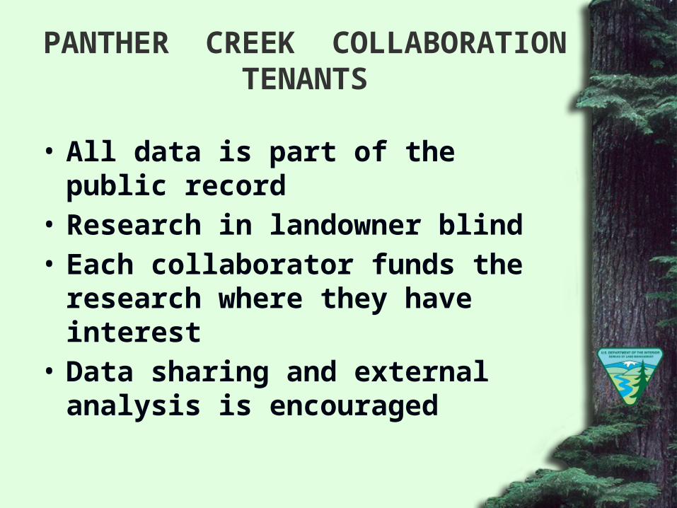
PANTHER CREEK COLLABORATION TENANTS
• All data is part of the public record• Research in landowner blind• Each collaborator funds the research where
they have interest• Data sharing and external analysis is
encouraged
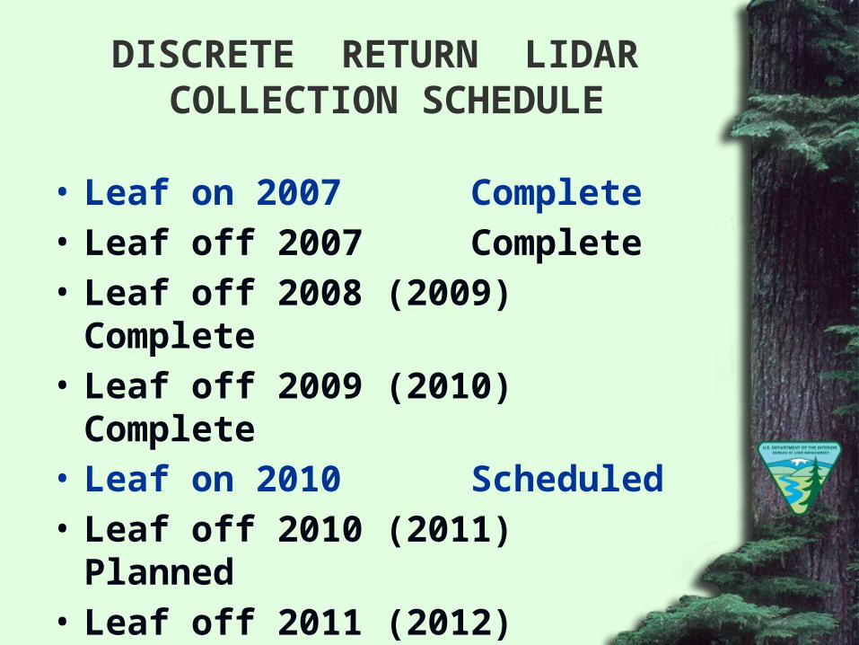
DISCRETE RETURN LIDAR COLLECTION SCHEDULE
• Leaf on 2007 Complete• Leaf off 2007 Complete• Leaf off 2008 (2009) Complete• Leaf off 2009 (2010) Complete• Leaf on 2010 Scheduled• Leaf off 2010 (2011) Planned• Leaf off 2011 (2012) Planned
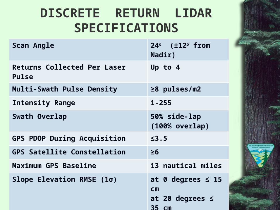
DISCRETE RETURN LIDAR SPECIFICATIONS
Scan Angle 24o (±12o from Nadir)
Returns Collected Per Laser Pulse Up to 4
Multi-Swath Pulse Density ≥8 pulses/m2
Intensity Range 1-255
Swath Overlap 50% side-lap (100% overlap)
GPS PDOP During Acquisition ≤3.5
GPS Satellite Constellation ≥6
Maximum GPS Baseline 13 nautical miles
Slope Elevation RMSE (1σ) at 0 degrees ≤ 15 cmat 20 degrees ≤ 35 cmat 50 degrees ≤ 100 cm
Horizontal Accuracy (1σ), bare earth, slope <20 o 30 cm
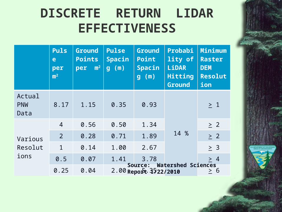
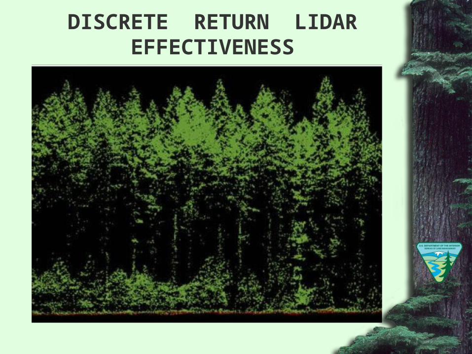
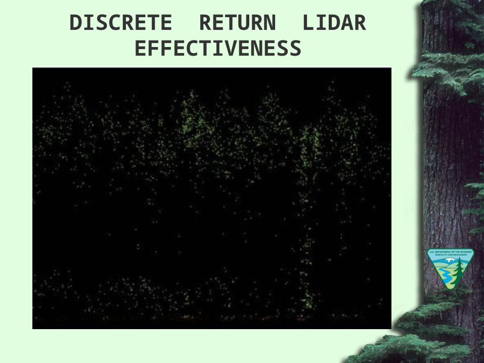
DISCRETE RETURN LIDAR EFFECTIVENESS
Pulse per m2
Ground Points per m2
Pulse Spacing (m)
Ground Point Spacing (m)
Probability of LiDAR Hitting Ground
Minimum Raster DEM Resolution
Actual PNW Data 8.17 1.15 0.35 0.93
14 %
> 1
Various Resolutions
4 0.56 0.50 1.34 > 2
2 0.28 0.71 1.89 > 2
1 0.14 1.00 2.67 > 3
0.5 0.07 1.41 3.78 > 4
0.25 0.04 2.00 5.35 > 6
Source: Watershed Sciences Report 1/22/2010
DISCRETE RETURN LIDAR EFFECTIVENESS
DISCRETE RETURN LIDAR EFFECTIVENESS
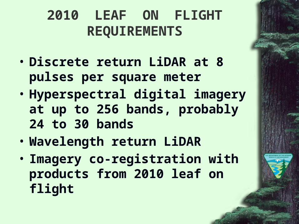
2010 LEAF ON FLIGHT REQUIREMENTS
• Discrete return LiDAR at 8 pulses per square meter
• Hyperspectral digital imagery at up to 256 bands, probably 24 to 30 bands
• Wavelength return LiDAR• Imagery co-registration with products from
2010 leaf on flight
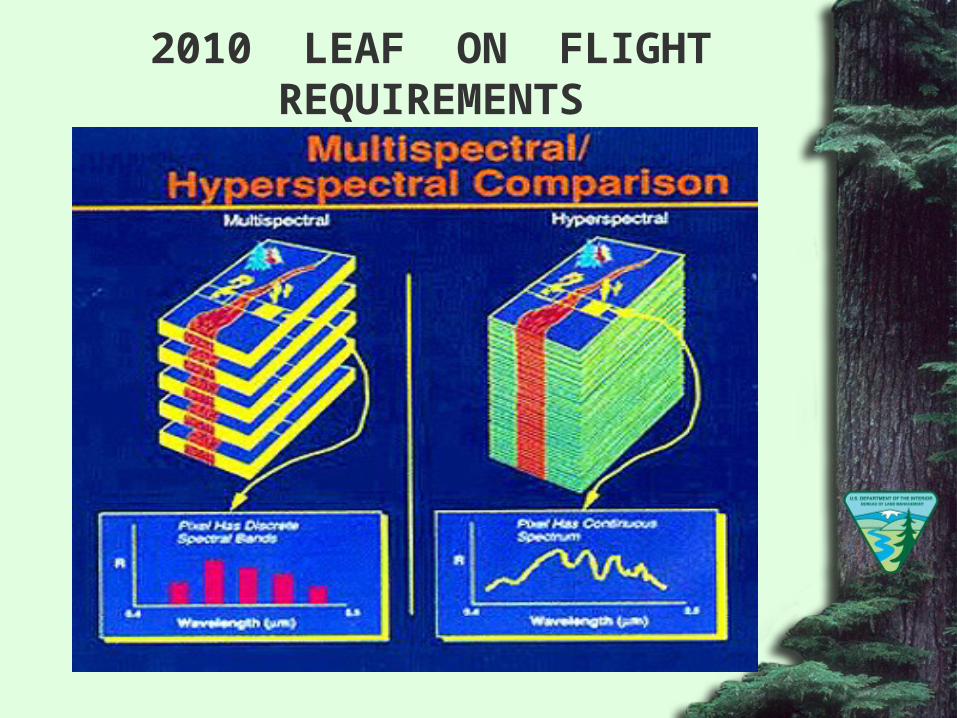
2010 LEAF ON FLIGHT REQUIREMENTS
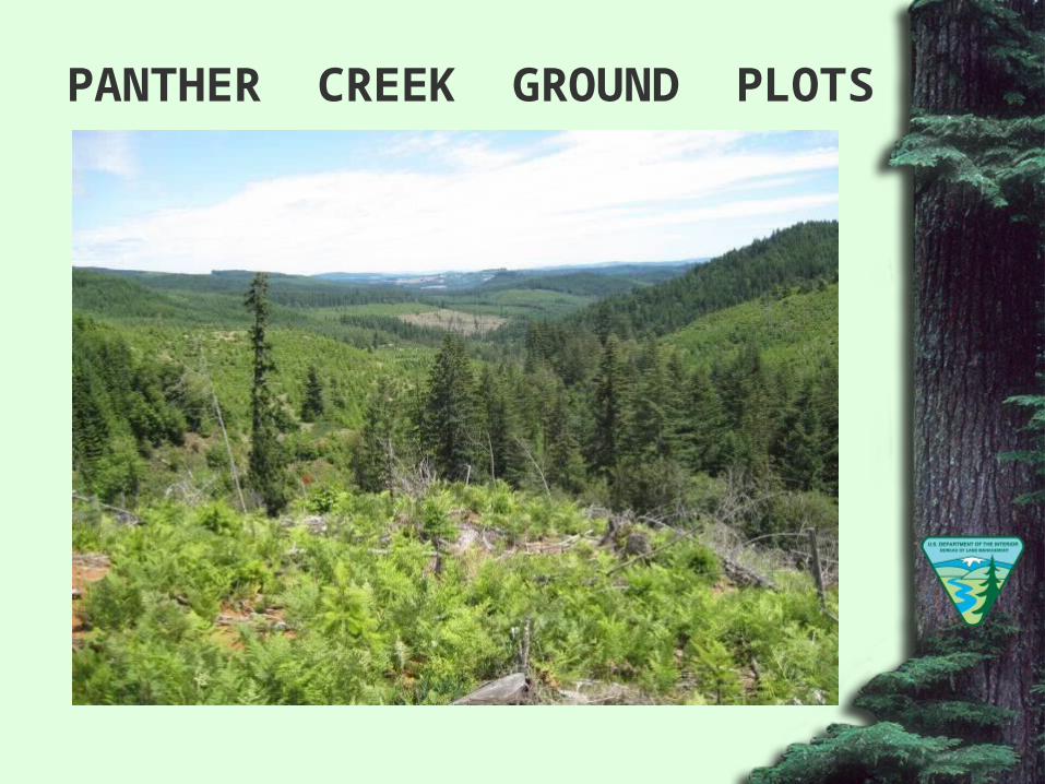
PANTHER CREEK GROUND PLOTS
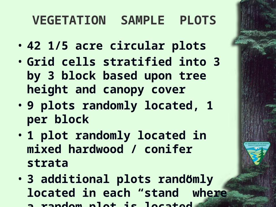
VEGETATION SAMPLE PLOTS
• 42 1/5 acre circular plots• Grid cells stratified into 3 by 3 block based
upon tree height and canopy cover• 9 plots randomly located, 1 per block• 1 plot randomly located in mixed hardwood /
conifer strata• 3 additional plots randomly located in each
“stand” where a random plot is located• 2 additional plots randomly located in
riparian stands
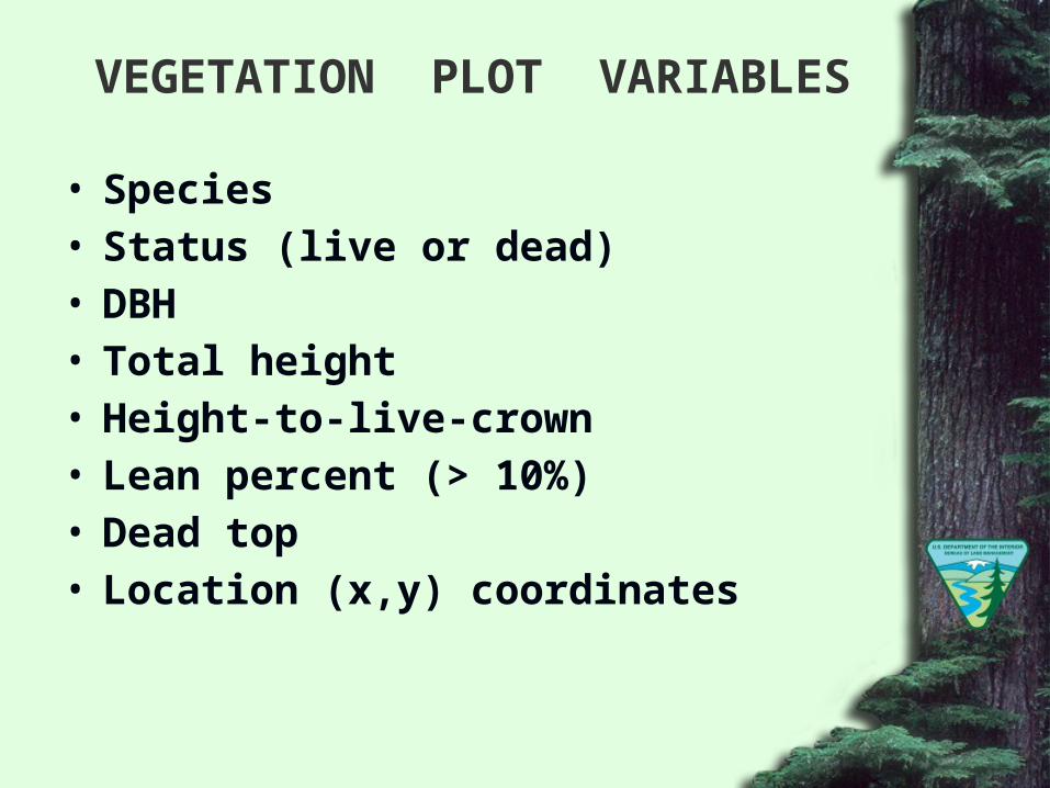
VEGETATION PLOT VARIABLES
• Species• Status (live or dead)• DBH• Total height• Height-to-live-crown• Lean percent (> 10%)• Dead top• Location (x,y) coordinates
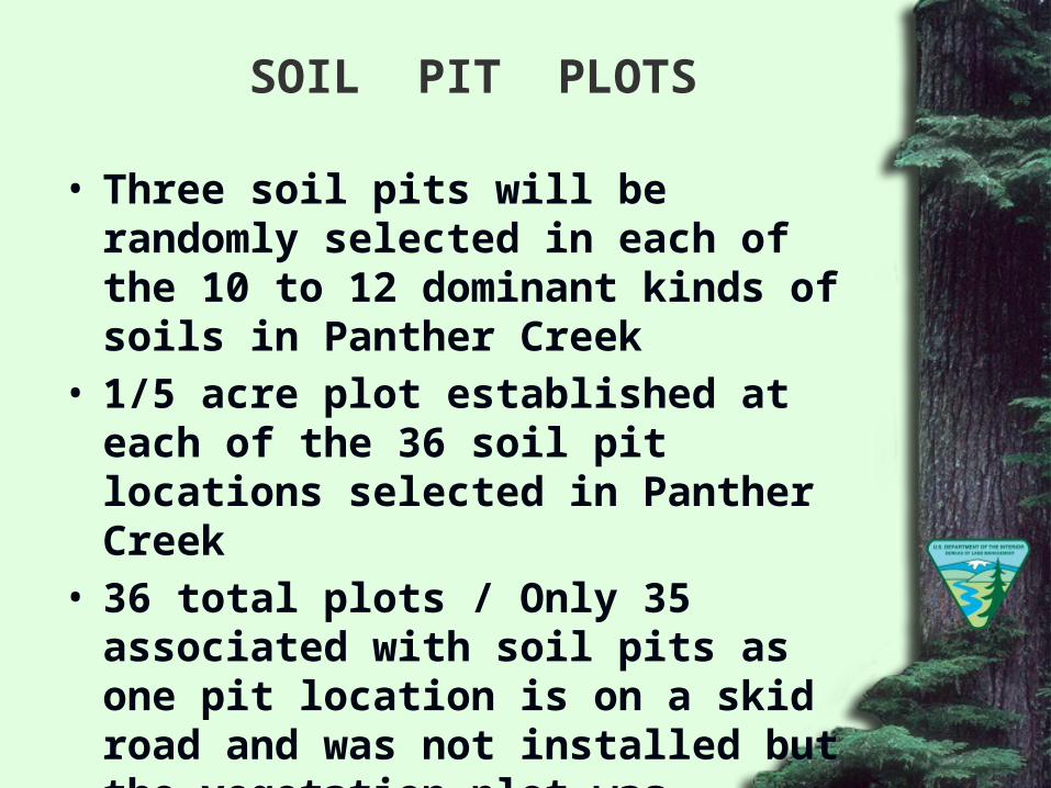
SOIL PIT PLOTS
• Three soil pits will be randomly selected in each of the 10 to 12 dominant kinds of soils in Panther Creek
• 1/5 acre plot established at each of the 36 soil pit locations selected in Panther Creek
• 36 total plots / Only 35 associated with soil pits as one pit location is on a skid road and was not installed but the vegetation plot was installed
• Measurements the same as vegetation plots
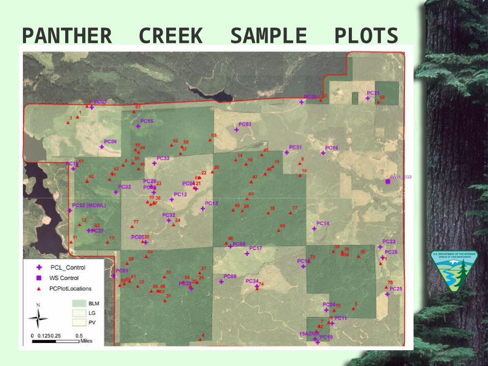
PANTHER CREEK SAMPLE PLOTS
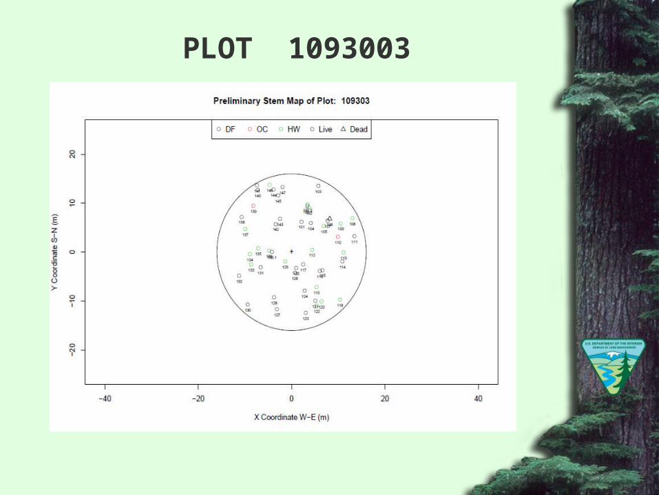
PLOT 1093003
PLOT 1093003
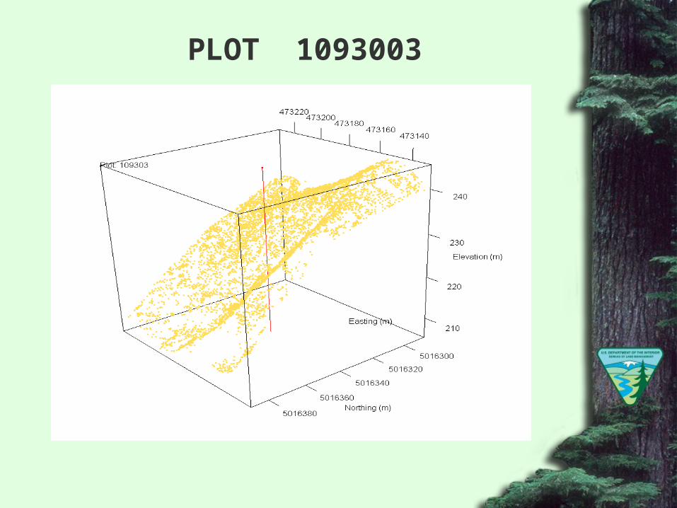
PLOT 1093003
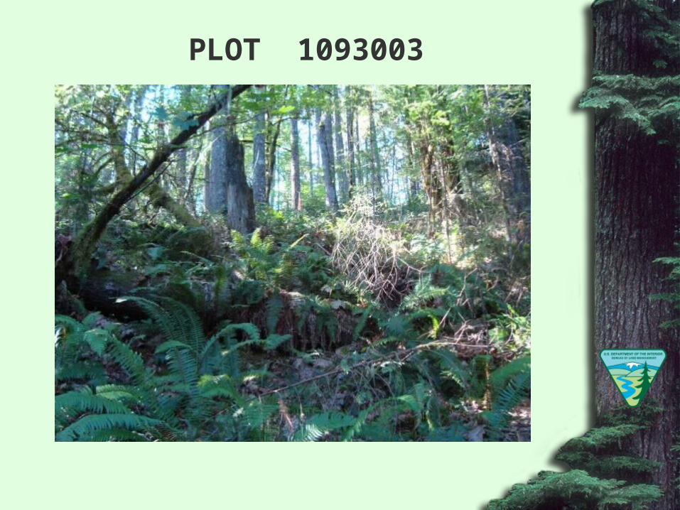
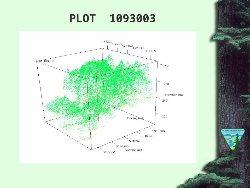
PLOT 1093003
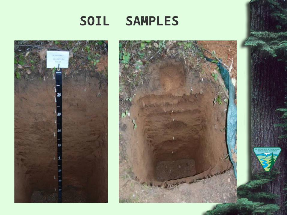
SOIL SAMPLES
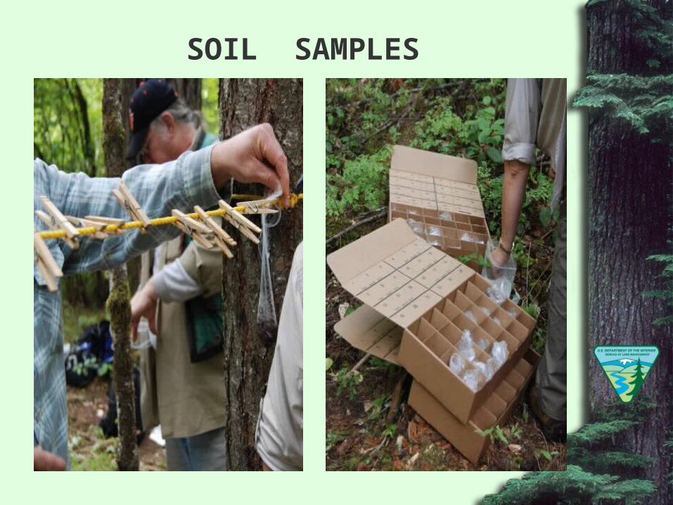
SOIL SAMPLES
SOIL VARIABLES SAMPLED
• Acid oxalate extractable Fe, Al & Si• Active soil carbon (AC)• Aggregate stability• Bulk density• Calcium carbonate equivalent• Cation exchange capacity (CEC)• Clay mineralogy via x-ray diffraction• Dithionite-citrate extractable Fe, Al & Si• Effervescence in 1N HCl
• Extractable acidity (BaCl2-TEA)
SOIL VARIABLES SAMPLED (CONT)
• Exchangeable cations (Na, K, Ca, Mg)
• KCl extractable NH4+ & NO3
-
• Micromorphology – thin section• Mineral content• New Zealand phosphorus retention• Optical analysis – glass count• Particulate organic matter (POM)• p-Nitrophenol, β-Glucosidase• pH in NaF
• pH in water & CaCl2
SOIL VARIABLES SAMPLED (CONT)
• Particle size analysis (sand, silt and clay)• Total N, C & S• Water retention (0.06 Bar)• Water retention (0.1 Bar)• Water retention (0.33 Bar)• Water retention (1 Bar)• Water retention (2 Bar)• Water retention (5 Bar)• Water retention (15 Bar)
WEATHER INSTRUMENTS
• RAWS Station Installed Spring 2010
• Soil Pits (36) Installed Spring 2010• Air Temperature• Relative Humidity• Soil Moisture• Soil Temperature
LANDSLIDE ANALYSIS
LANDSLIDE ANALYSIS
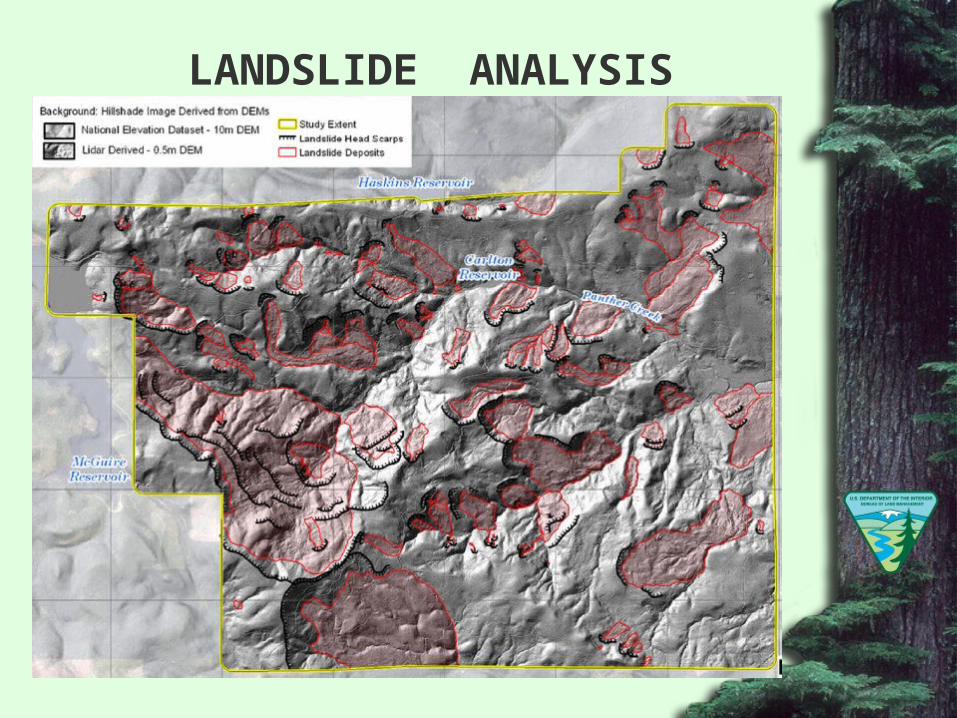
Landslide inventory mapping is greatly improved using high resolution (~8pts/m2) LiDAR data collected during leaf-on and/or leaf-off conditions
In Panther Creek identified landslides went from 7 to 93
Great care is needed when using differential LiDAR DEMs to map, quantify, and interpret elevation change caused by landslides
In Panther Creek 90 % of high confidence sites were active landslides but only 10 % of low confidence sites were active landslides
Source: Burns, W.J., Coe, J.A., Kaya Sener, K, Ma, L., 2009. Analysis of Elevation Changes Detected from Multi-Temporal LiDAR Surveys in Forested Landslide Terrain in Western Oregon. Geological Society of America Abstracts with Programs, Vol. 41, No. 7, p. 379
DATA SHARING METHODOLOGY
Seattle Biometrics maintains a password protected website where core researchers upload raw data sets for storage and archiving
Oregon State University is developing a public website with project descriptions, sample designs, list of publications and a selected sample of raw data
Bureau of Land Management will distribute the archived raw data upon request and submission of a portable hard drive for data transfer