Embed Size (px)
DESCRIPTION
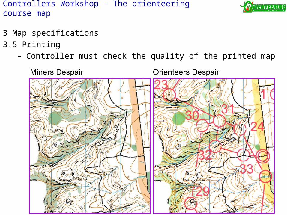
Controllers Workshop - The orienteering course map. 3 Map specifications 3.5 Printing Controller must check the quality of the printed map. Controllers Workshop - The orienteering course map. 3 Map specifications 3.5 Printing Guidelines for WRE’s - PowerPoint PPT Presentation
Citation preview
3 Map specifications
3.5 Printing– Controller must check the quality of the printed map
Controllers Workshop - The orienteering course map
3 Map specifications
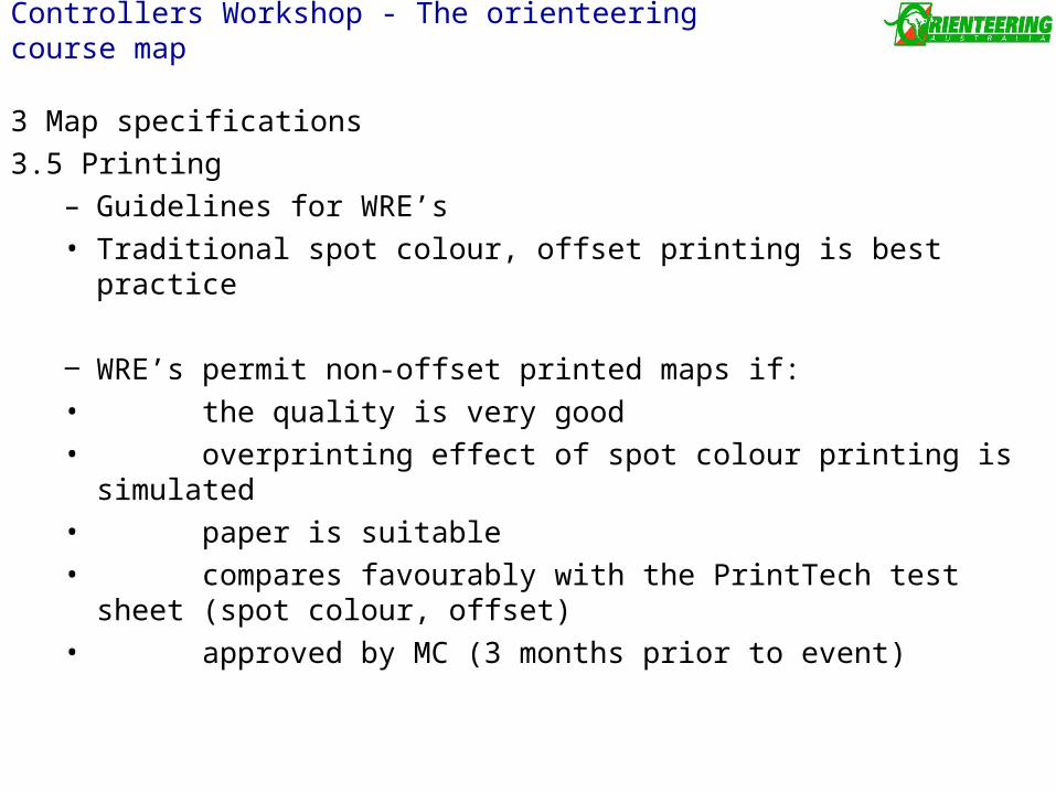
3.5 Printing– Guidelines for WRE’s• Traditional spot colour, offset printing is best practice
‒ WRE’s permit non-offset printed maps if:• the quality is very good• overprinting effect of spot colour printing is simulated• paper is suitable• compares favourably with the PrintTech test sheet (spot colour,
offset)• approved by MC (3 months prior to event)
Controllers Workshop - The orienteering course map
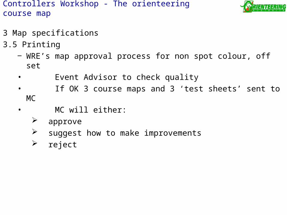
3 Map specifications
3.5 Printing‒ WRE’s map approval process for non spot colour, off set• Event Advisor to check quality• If OK 3 course maps and 3 ‘test sheets’ sent to MC • MC will either:
approve suggest how to make improvements reject
Controllers Workshop - The orienteering course map
3 Map specifications
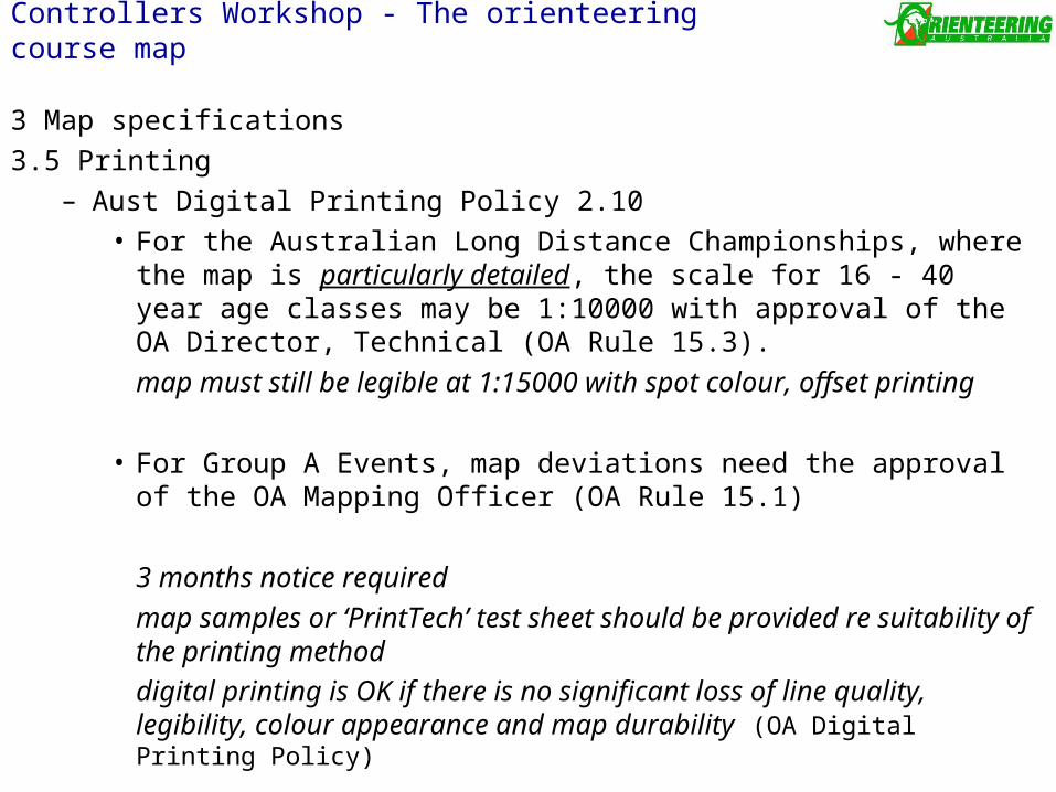
3.5 Printing– Aust Digital Printing Policy 2.10
• For the Australian Long Distance Championships, where the map is particularly detailed, the scale for 16 - 40 year age classes may be 1:10000 with approval of the OA Director, Technical (OA Rule 15.3).
map must still be legible at 1:15000 with spot colour, offset printing
• For Group A Events, map deviations need the approval of the OA Mapping Officer (OA Rule 15.1)
3 months notice required
map samples or ‘PrintTech’ test sheet should be provided re suitability of the printing method
digital printing is OK if there is no significant loss of line quality, legibility, colour appearance and map durability (OA Digital Printing Policy)
Controllers Workshop - The orienteering course map
3 Map specifications3.5 Printing
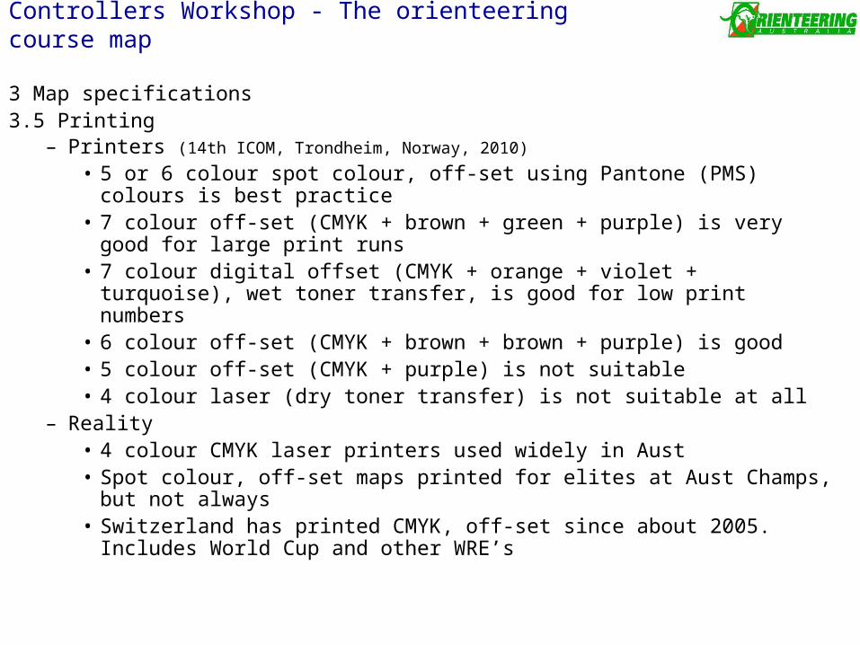
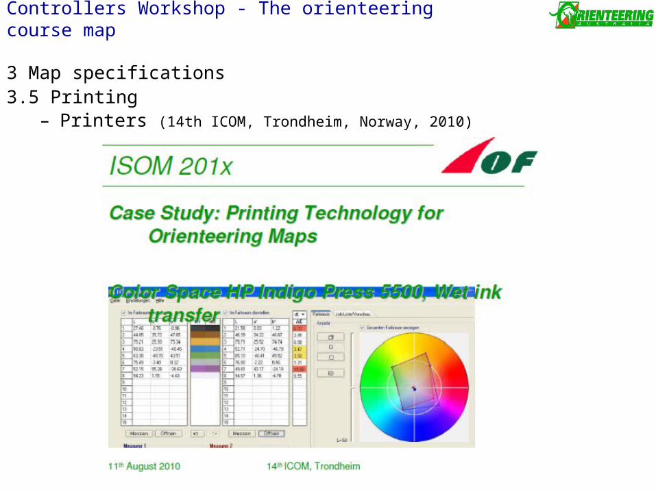
– Printers (14th ICOM, Trondheim, Norway, 2010)
• 5 or 6 colour spot colour, off-set using Pantone (PMS) colours is best practice
• 7 colour off-set (CMYK + brown + green + purple) is very good for large print runs
• 7 colour digital offset (CMYK + orange + violet + turquoise), wet toner transfer, is good for low print numbers
• 6 colour off-set (CMYK + brown + brown + purple) is good • 5 colour off-set (CMYK + purple) is not suitable• 4 colour laser (dry toner transfer) is not suitable at all
– Reality• 4 colour CMYK laser printers used widely in Aust • Spot colour, off-set maps printed for elites at Aust Champs, but not
always• Switzerland has printed CMYK, off-set since about 2005. Includes World
Cup and other WRE’s
Controllers Workshop - The orienteering course map
3 Map specifications3.5 Printing
– Printers (14th ICOM, Trondheim, Norway, 2010)
Controllers Workshop - The orienteering course map
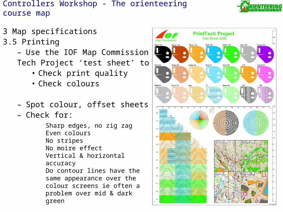
3 Map specifications3.5 Printing
– Use the IOF Map Commission Print Tech Project ‘test sheet’ to:
• Check print quality• Check colours
– Spot colour, offset sheets available– Check for:
Sharp edges, no zig zagEven coloursNo stripesNo moire effectVertical & horizontal accuracyDo contour lines have the same appearance over the colour screens ie often a problem over mid & dark green
Controllers Workshop - The orienteering course map
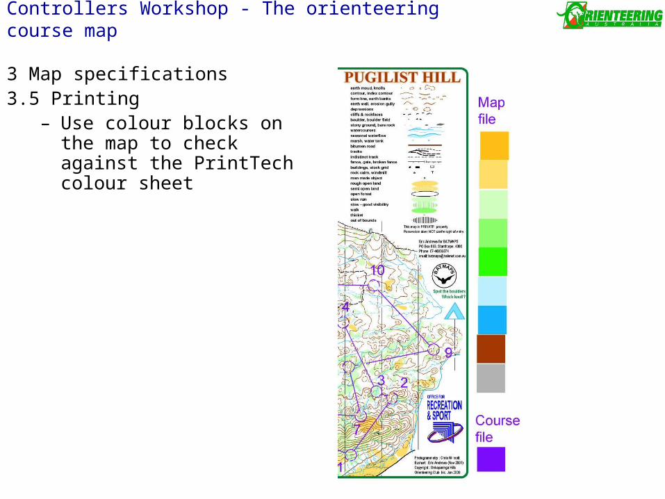
3 Map specifications3.5 Printing
– Use colour blocks on the map to check against the PrintTech colour sheet
Controllers Workshop - The orienteering course map
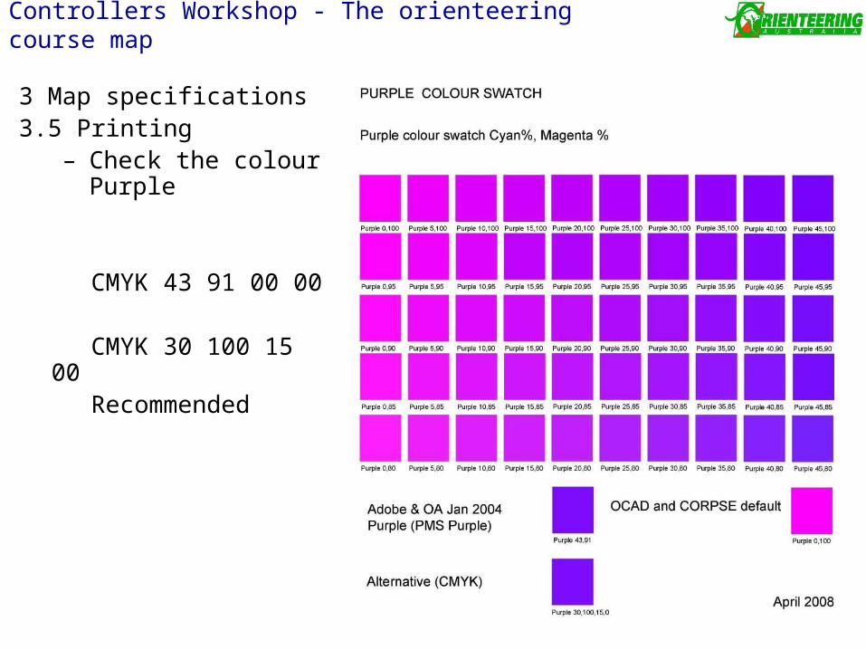
3 Map specifications3.5 Printing
– Check the colour Purple
CMYK 43 91 00 00
CMYK 30 100 15 00 Recommended
Controllers Workshop - The orienteering course map
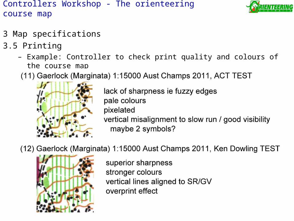
3 Map specifications
3.5 Printing– Example: Controller to check print quality and colours of the course map
Controllers Workshop - The orienteering course map
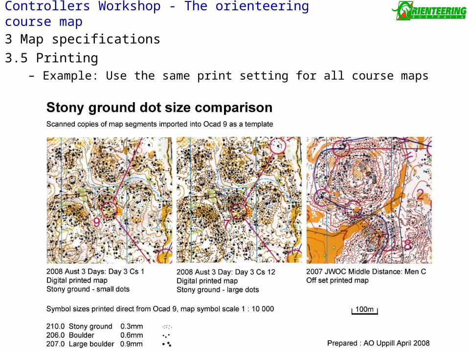
3 Map specifications
3.5 Printing– Example: Use the same print setting for all course maps
Controllers Workshop - The orienteering course map
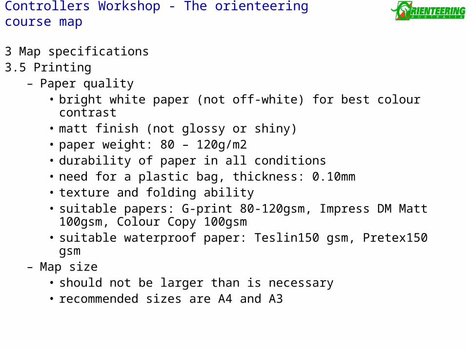
3 Map specifications3.5 Printing
– Paper quality• bright white paper (not off-white) for best colour contrast• matt finish (not glossy or shiny)• paper weight: 80 – 120g/m2• durability of paper in all conditions• need for a plastic bag, thickness: 0.10mm• texture and folding ability• suitable papers: G-print 80-120gsm, Impress DM Matt 100gsm,
Colour Copy 100gsm• suitable waterproof paper: Teslin150 gsm, Pretex150 gsm
– Map size• should not be larger than is necessary• recommended sizes are A4 and A3
Controllers Workshop - The orienteering course map
4 Explanation of symbols
4.1 Land Form
4.2 Rocks & Boulders
4.3 Water & Marsh
4.4 Vegetation
- Controller to check Runnability ie running speed through the forest
• open forest 80-100% white
• slow running 60-80% light green
• difficult to run 20-60% mid green
• very difficult to run 0-20% dark green
nb Sprint maps have 4 Greens (very dark green / not to be crossed)
4.5 Man-made features
- Special man-made features to be defined in the map legend
ie Special man-made feature – car wreck
Controllers Workshop - The orienteering course map
4 Explanation of symbols
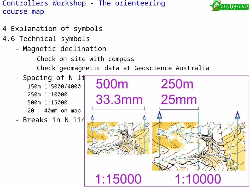
4.6 Technical symbols– Magnetic declination
Check on site with compass
Check geomagnetic data at Geoscience Australia
– Spacing of N lines150m 1:5000/4000
250m 1:10000
500m 1:15000
20 - 40mm on map
– Breaks in N lines
Controllers Workshop - The orienteering course map
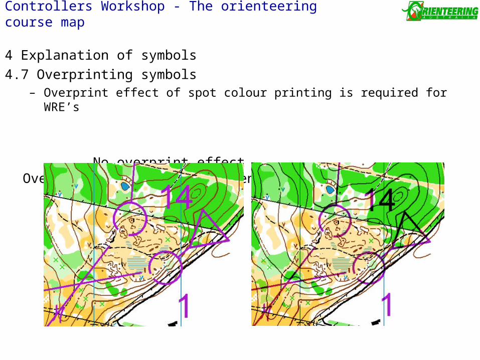
4 Explanation of symbols
4.7 Overprinting symbols– Overprint effect of spot colour printing is required for WRE’s
No overprint effect Overprint effect & transparency
Controllers Workshop - The orienteering course map
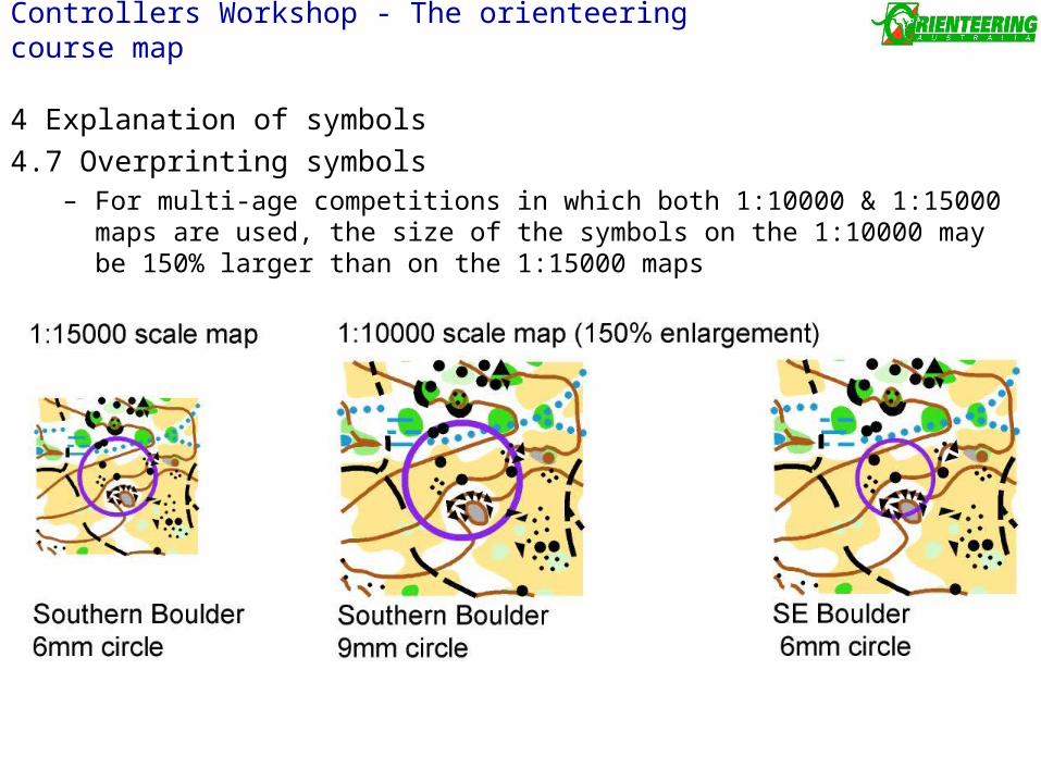
4 Explanation of symbols
4.7 Overprinting symbols– For multi-age competitions in which both 1:10000 & 1:15000 maps are used, the
size of the symbols on the 1:10000 may be 150% larger than on the 1:15000 maps
Controllers Workshop - The orienteering course map
5 Field Checking
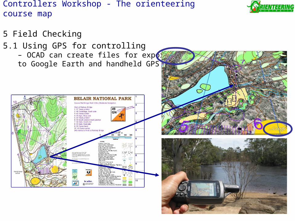
5.1 Using GPS for controlling– OCAD can create files for exporting to Google Earth and handheld GPS
Controllers Workshop - The orienteering course map
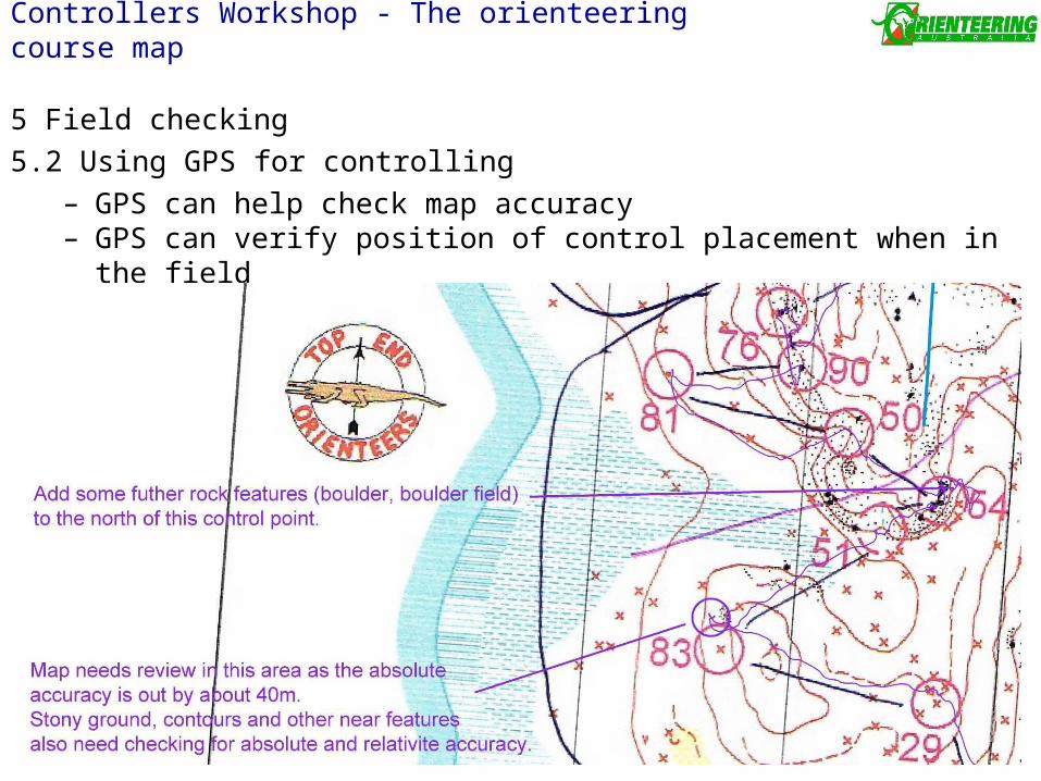
5 Field checking
5.2 Using GPS for controlling– GPS can help check map accuracy– GPS can verify position of control placement when in the field
Controllers Workshop - The orienteering course map
6 Check list for controlling the map making process (as per IOF)
6.1 Visits to the terrain & meetings– 1st visit: before any mappingsuitability of the terrain, any deviations required (seek approval as necessary)
getting to know the personnel, timelines, suitability of base maps
– 2nd visit: after some mappingcheck sample maps of all terrain typescheck level of generalisation, map legibility, runnability, etc
– 3rd visit: mapping complete but subject to correctionscheck for corrections, quality of mappingmap layout & design, credits, logos, special symbols defined
6.2 Controlling during competitionno mistakes at map printingno mistakes in control descriptionswhere will the maps be kept (before and at the event), spares, set of maps for search & rescue, etc
Controllers Workshop - The orienteering course map
7 Map deviations7.1 Some recent Australian map deviations
– Using two symbol sizes for Termite mounds– Using ISOM fence symbols with Sprint maps (Sprint only permits 2)– Sprint scale of 1:3000– 1:10000 scale maps with 1:15000 scale symbol size– Vegetation areas under size – Cliff lengths too short– Special man made feature not defined– Using non standard symbol
7.2 Approved map deviations
– ISOM symbol 209 Boulder cluster approved for Sprint map as no equivalent symbol for ISSOM (2011 Sprint prologue, WA)
Controllers Workshop - The orienteering course map
8 Other considerations
• Controller and Course setter should use the same software– Map: OCAD– Course: OCAD, Condes, Corpse, Purple Pen– Have a system to track updates, corrections & map changes
• Ensure sufficient space between the map edge and controls or likely route choices
• Avoid covering part or all of the legend with the control description
• The sides of the map should be parallel to the magnetic north lines
• Map credits
Controllers Workshop - The orienteering course map
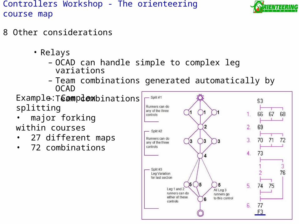
8 Other considerations
• Relays– OCAD can handle simple to complex leg variations– Team combinations generated automatically by OCAD – Team combinations exported to OS
Controllers Workshop - The orienteering course map
Example: Complex splitting• major forking within courses• 27 different maps• 72 combinations
Controllers Workshop - The orienteering course map
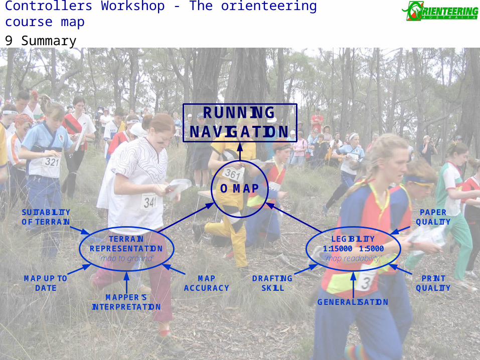
9 Summary
O MAP
TERRAIN REPRESENTATION
‘map to ground’
LEGIBILITY1:15000 1:5000‘map readability’
SUITABILITY OF TERRAIN
MAP UP TO DATE
MAPPER’S INTERPRETATION
MAP ACCURACY
DRAFTING SKILL
GENERALISATION
PRINT QUALITY
PAPER QUALITY
RUNNING NAVIGATION
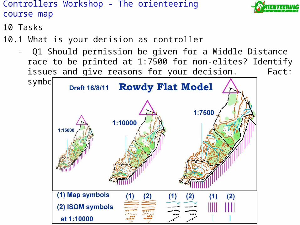
10 Tasks
10.1 What is your decision as controller– Q1 Should permission be given for a Middle Distance race to be
printed at 1:7500 for non-elites? Identify issues and give reasons for your decision. Fact: symbols are undersize by 4-13% to ISOM2000
Controllers Workshop - The orienteering course map
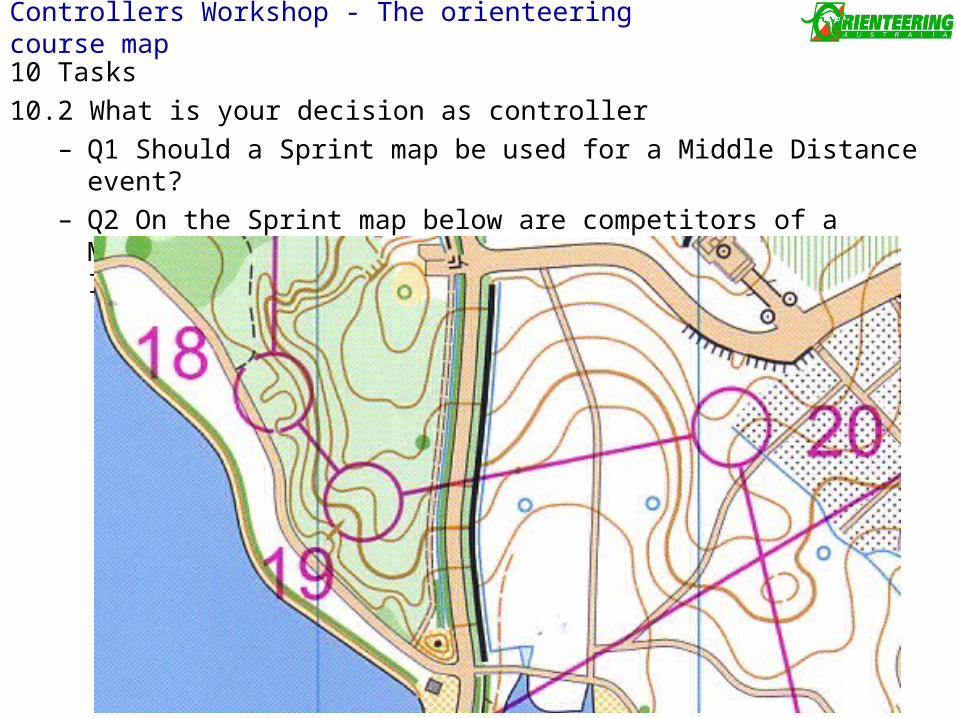
10 Tasks
10.2 What is your decision as controller– Q1 Should a Sprint map be used for a Middle Distance event?– Q2 On the Sprint map below are competitors of a Middle Distance event
permitted to cross the Impassable wall between leg 19 to 20?
Controllers Workshop - The orienteering course map