Embed Size (px)
Citation preview
CRYOSPHERE NEPAL
BIKRAM SHRESTHA ZOOWA Sr. Hydrologist Department of Hydrology
and Meteorology
NEPAL
2016
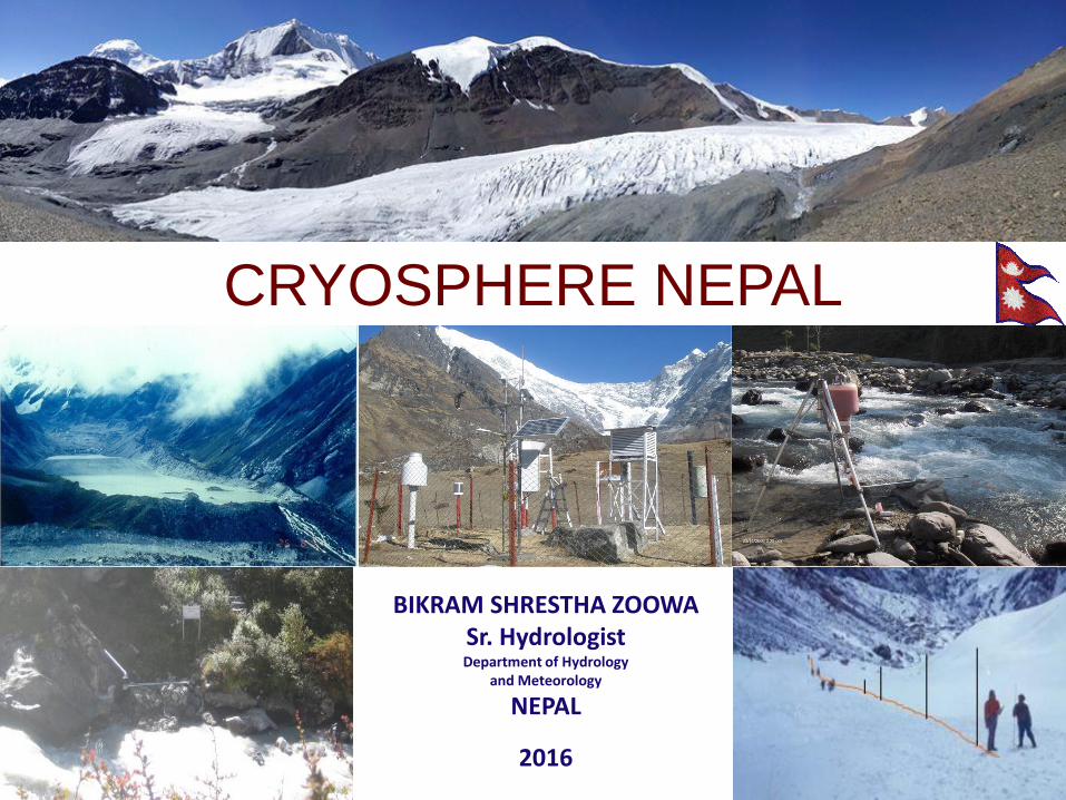
Ministry of Science, Technology and Environment
DEPARTMENT OF HYDROLOGY AND METEOROLOGY
ORGANISATIONAL STRUCTURE
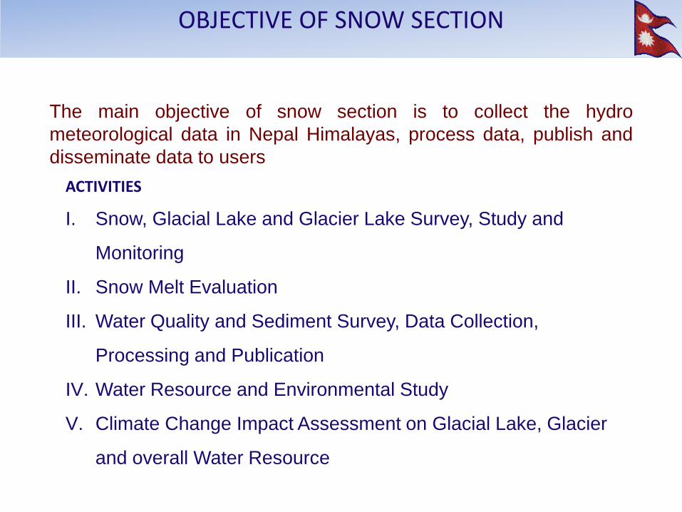
ACTIVITIES
I. Snow, Glacial Lake and Glacier Lake Survey, Study and
Monitoring
II. Snow Melt Evaluation
III. Water Quality and Sediment Survey, Data Collection,
Processing and Publication
IV. Water Resource and Environmental Study
V. Climate Change Impact Assessment on Glacial Lake, Glacier
and overall Water Resource
The main objective of snow section is to collect the hydro
meteorological data in Nepal Himalayas, process data, publish and
disseminate data to users
OBJECTIVE OF SNOW SECTION
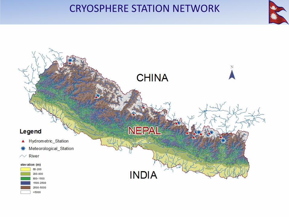
CRYOSPHERE STATION NETWORK

REGULAR OBSERVATIONS A. HDROLOGICAL PARAMETER
• Water Level • Discharge • Sediment • Water Quality
OTHER OBSERVATIONS
• Glacier Mass Balance • Bathymetric Survey of Glacial Lakes • Inventory of Glacial Lakes and
Glaciers
B. METEOROLOGICAL PARAMETER • Rainfall • Temperature • Humidity • Solar Radiation • Wind • Snow Depth
including other staton network
AWS station at Rika Samba and Glacier Expedition October 2015: Source: Sunny Maharjan, DHM
CRYOSPHERE STUDY
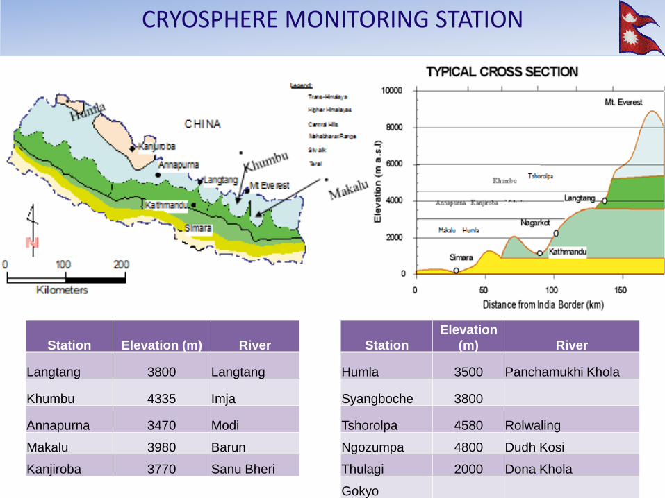
Makalu Humla
Station Elevation (m) River Station
Elevation
(m) River
Langtang 3800 Langtang Humla 3500 Panchamukhi Khola
Khumbu 4335 Imja Syangboche 3800
Annapurna 3470 Modi Tshorolpa 4580 Rolwaling
Makalu 3980 Barun Ngozumpa 4800 Dudh Kosi
Kanjiroba 3770 Sanu Bheri Thulagi 2000 Dona Khola
Gokyo
CRYOSPHERE MONITORING STATION
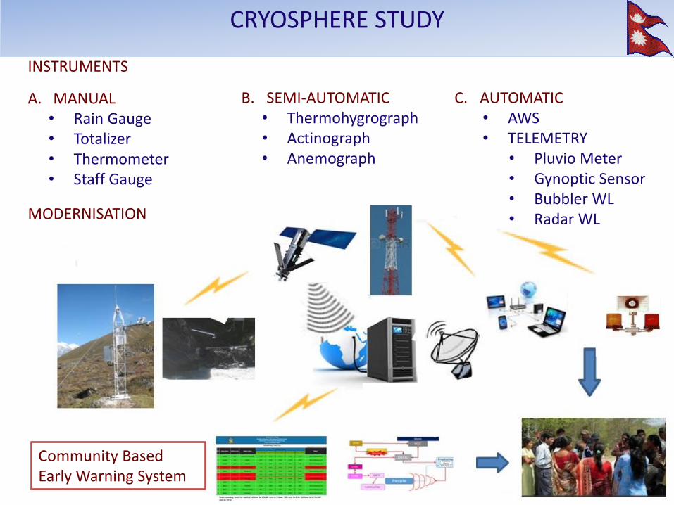
INSTRUMENTS
A. MANUAL • Rain Gauge • Totalizer • Thermometer • Staff Gauge
B. SEMI-AUTOMATIC • Thermohygrograph • Actinograph • Anemograph
C. AUTOMATIC • AWS • TELEMETRY
• Pluvio Meter • Gynoptic Sensor • Bubbler WL • Radar WL
MODERNISATION
Community Based Early Warning System
CRYOSPHERE STUDY
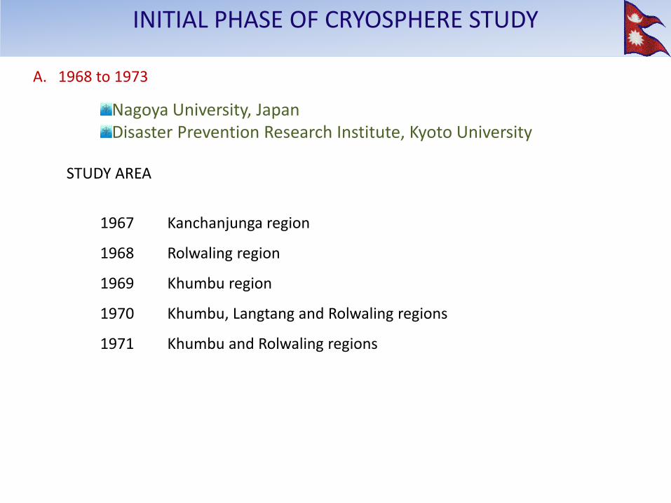
A. 1968 to 1973
Nagoya University, Japan Disaster Prevention Research Institute, Kyoto University
ACTIVITIES
1. Collection of photographs of glaciers taken by members of mountaineering
parties and other travelers in Nepal.
2. Collection of data on the topography and climate in the glacier area in Nepal.
3. Request to mountaineering parties and other travelers to collect data on glaciers in areas of Nepal where the data obtained on regular scientific expedition are poor.
4. Observations of glaciers by taking oblique photographs from the air in the remote area where few mountaineering parties and travelers have visited.
INITIAL PHASE OF CRYOSPHERE STUDY
A. 1968 to 1973
Nagoya University, Japan Disaster Prevention Research Institute, Kyoto University
STUDY AREA
1967 Kanchanjunga region
1968 Rolwaling region
1969 Khumbu region
1970 Khumbu, Langtang and Rolwaling regions
1971 Khumbu and Rolwaling regions
INITIAL PHASE OF CRYOSPHERE STUDY
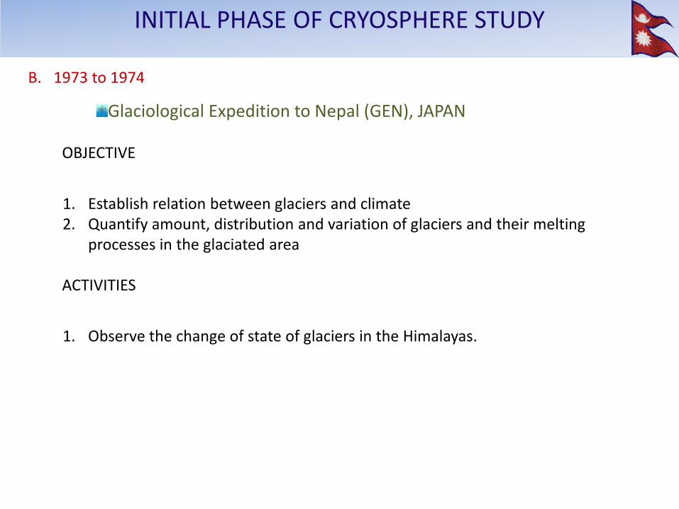
B. 1973 to 1974
Glaciological Expedition to Nepal (GEN), JAPAN OBJECTIVE
1. Establish relation between glaciers and climate 2. Quantify amount, distribution and variation of glaciers and their melting
processes in the glaciated area ACTIVITIES
1. Observe the change of state of glaciers in the Himalayas.
INITIAL PHASE OF CRYOSPHERE STUDY
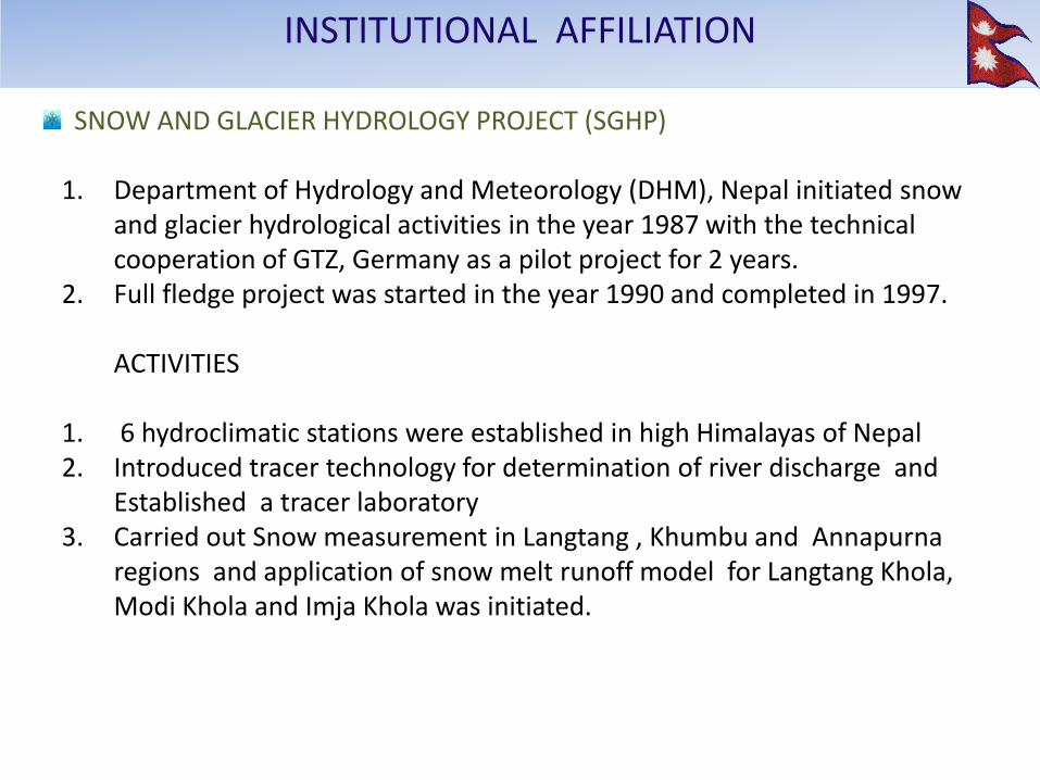
SNOW AND GLACIER HYDROLOGY PROJECT (SGHP) 1. Department of Hydrology and Meteorology (DHM), Nepal initiated snow
and glacier hydrological activities in the year 1987 with the technical cooperation of GTZ, Germany as a pilot project for 2 years.
2. Full fledge project was started in the year 1990 and completed in 1997.
ACTIVITIES 1. 6 hydroclimatic stations were established in high Himalayas of Nepal 2. Introduced tracer technology for determination of river discharge and
Established a tracer laboratory 3. Carried out Snow measurement in Langtang , Khumbu and Annapurna
regions and application of snow melt runoff model for Langtang Khola, Modi Khola and Imja Khola was initiated.
INSTITUTIONAL AFFILIATION
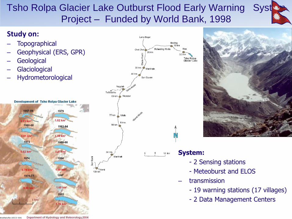
Study on: – Topographical
– Geophysical (ERS, GPR)
– Geological
– Glaciological
– Hydrometorological
System:
- 2 Sensing stations
- Meteoburst and ELOS
– transmission
- 19 warning stations (17 villages)
- 2 Data Management Centers
Tsho Rolpa Glacier Lake Outburst Flood Early Warning System Project – Funded by World Bank, 1998
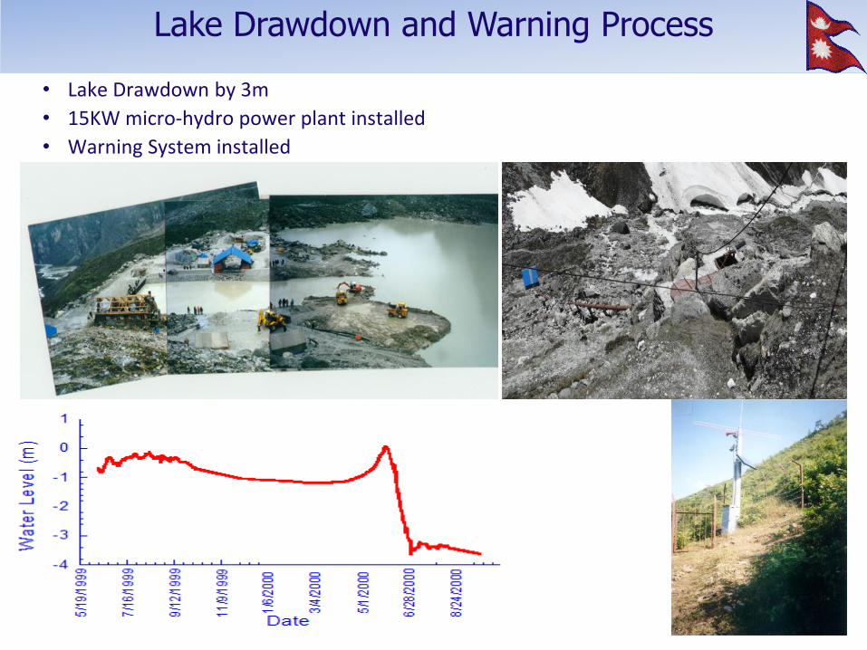
• Lake Drawdown by 3m
• 15KW micro-hydro power plant installed
• Warning System installed
Lake Drawdown and Warning Process
1. International Symposium on Snow and Glacier Hydrology was
organized in Kathmandu (Nov. 1992)
2. Investigation of Thulagi Glacier Lake in 1996 and 2000 – funded by German Government – Multidisciplinary (glaciology, topography, hydrology, geophysics, etc)
– Multi-institutional (DHM, BGR, DMG, NEA, TU, SILT)
– Installed automatic water level recorder at the outlet of Thulagi lake
3. Studies and surveys on Imja Glacier Lake (i) Topographical survey of Imja Glacier Lake (1999,2001)
(ii) Bathymetric Survey of Imja Glacier Lake (1999)
(iii) Hydrological study of Imja Glacier Lake(1999)
(iv) Climatological studies in the vicinity of the Imja Glacier lake (1999)
(v) Study of the monitoring the growth rate of Imja Glacier Lake
(vi) GPR survey of end moraine of Imja Glacier Lake(2000)
OTHER MAJOR ACTIVITIES
Glaciological Expedition to Nepal (GEN), JAPAN-(2005 to 2010)
OBJECTIVE
1. To select a glacier to be monitored for a) mass balance b) energy balance and c) hydrology.
2. Monitoring a glacier on a long term has mainly three goals in the Himalayas a. To study the evolution of glaciers and the climate change in remote and
high- altitude places of the Nepal Himalayas, b. To study the water resources available from glaciers and their future
changes c. to assess the glacial hazards linked to present glacier shrinkage.
3. To make an inventory of potential dangerous proglacial lakes (GLOFs – Glacial Lakes Outburst Floods) in the Hinku-Hunku region.
4. To define strategies to conduct glaciological research jointly in Nepal.
CRYOSPHERE STUDY COLLABORATIVE APPROACH
Glaciological Expedition to Nepal (GEN), JAPAN-(2005 to 2010)
STUDY AREA
Trambau Glacier, Rolwaling region (2010) OBJECTIVE
1. Survey of surface height by differential GPS 2. Obtaining shallow ice core (~20m) to understand recent climate
ACTIVITIES
1. Topographical survey with carrier-phase differential GPS system 2. Drilling shallow ice core (~20m)
CRYOSPHERE STUDY COLLABORATIVE APPROACH
Glaciological Expedition to Nepal (GEN), JAPAN-(2005 to 2010)
STUDY AREA
Rika Samba Glacier (Hidden Valley, 2009) OBJECTIVE
1. Survey of glacier and peripheral topography height by differential GPS 2. Obtaining flow velocity and ice thickness of the glacier to understand
glacier dynamics ACTIVITIES
1. Topographical survey with carrier-phase differential GPS system 2. Surface flow velocity measurement by carrier-phase differential GPS
system 3. Measurement of ice thickness by GPR radar
CRYOSPHERE STUDY COLLABORATIVE APPROACH
Ev-K2-CNR : Joint High Altitude Scientific and Technological Research Project, Italy
STUDY AREA
Khumbu valley (Mt. Everest Region)
OBJECTIVE
1. Research based on in-situ observations at high altitude in the Khumbu region of Nepal Himalayas and environmental modeling in the areas related to meteorology, hydrology, air quality and climate .
2. Studying climate change impacts by facilitating scientific collaboration and data exchange.
ACTIVITIES
1. Management of the Pyramid International Laboratory-Observatory (hereafter referred to as Pyramid) located above the settlement of Lobuche, Nepal, at 5,050 m. a.s.l.
2. Technical scientific equipment used in field data collection at the Pyramid and in the Khumbu valley, including Automatic Weather Stations (AWSs) and atmospheric pollution monitoring equipment
CRYOSPHERE STUDY COLLABORATIVE APPROACH

Ev-K2-CNR : Joint High Altitude Scientific and Technological Research Project, Italy
CRYOSPHERE STUDY COLLABORATIVE APPROACH
AWS Pyramid (September 2000) Latitude: 27° 57' 33" N
Longitude: 86° 48' 46" E
Elevation: 5.050 m a.s.l
AWS Changri Nup (February 2010) Latitude: 27° 58' 54.5" N
Longitude: 86° 45' 53.8" E
Elevation: 5,700 m a.s.l Hydrological Station at Pheriche (July 2012 ) Latitude: 27° 52' N
Longitude: 86° 49' E
Elevation: 4229 m a.s.l
Pyramid Station
Khumbu Valley
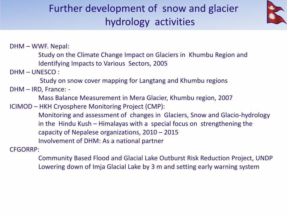
DHM – WWF. Nepal: Study on the Climate Change Impact on Glaciers in Khumbu Region and Identifying Impacts to Various Sectors, 2005 DHM – UNESCO : Study on snow cover mapping for Langtang and Khumbu regions DHM – IRD, France: - Mass Balance Measurement in Mera Glacier, Khumbu region, 2007 ICIMOD – HKH Cryosphere Monitoring Project (CMP): Monitoring and assessment of changes in Glaciers, Snow and Glacio-hydrology in the Hindu Kush – Himalayas with a special focus on strengthening the capacity of Nepalese organizations, 2010 – 2015 Involvement of DHM: As a national partner CFGORRP: Community Based Flood and Glacial Lake Outburst Risk Reduction Project, UNDP Lowering down of Imja Glacial Lake by 3 m and setting early warning system
Further development of snow and glacier hydrology activities
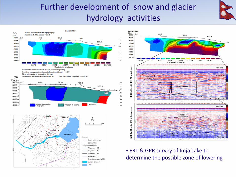
Further development of snow and glacier hydrology activities
• ERT & GPR survey of Imja Lake to determine the possible zone of lowering
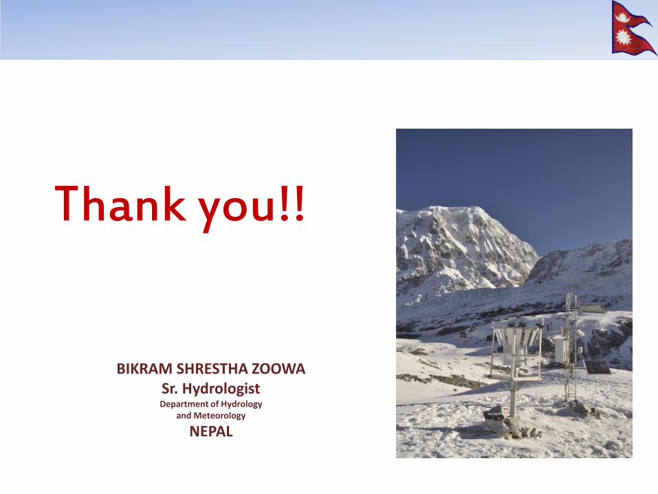
Thank you!!
BIKRAM SHRESTHA ZOOWA Sr. Hydrologist Department of Hydrology
and Meteorology
NEPAL