Embed Size (px)
Citation preview
Danube and Rhine Rivers:Threats of navigation to wetlands – what we have lost
Jürg Bloesch ex-Eawag, IAD President (1998-2004), Editor Danube News
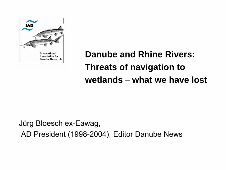
Yellow: RhineRed: Danube
After F.Mallard, in Bloesch (2002)
The illness of rivers: Uniformity
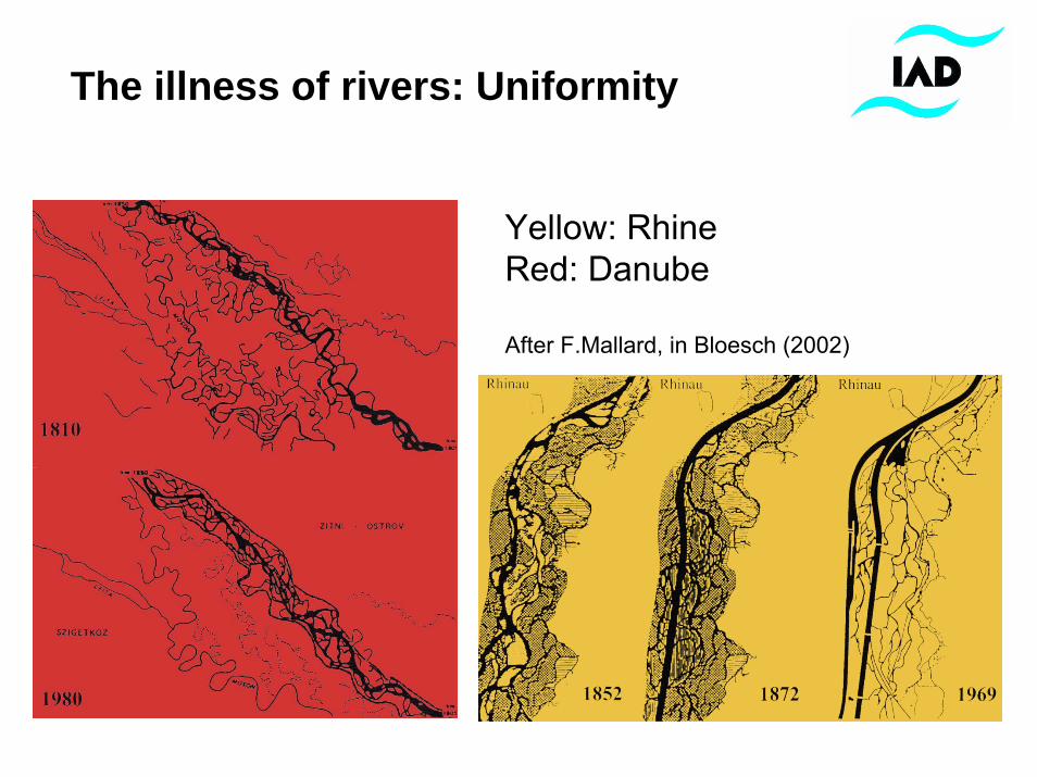
Channelized Danube River near Vienna vs. natural braidings of 1859 After Humpesch (1994)
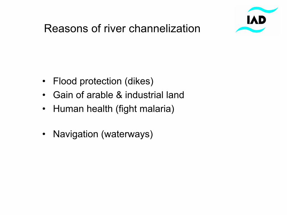
Reasons of river channelization
• Flood protection (dikes)• Gain of arable & industrial land• Human health (fight malaria)
• Navigation (waterways)
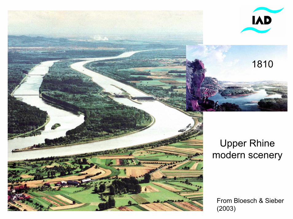
Upper Rhine modern scenery
From Bloesch & Sieber (2003)
1810
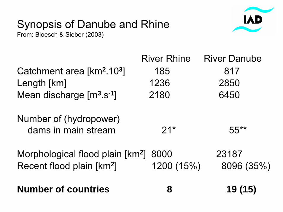
Synopsis of Danube and RhineFrom: Bloesch & Sieber (2003)
River Rhine River DanubeCatchment area [km2.103] 185 817Length [km] 1236 2850Mean discharge [m3.s-1] 2180 6450
Number of (hydropower)dams in main stream 21* 55**
Morphological flood plain [km2] 8000 23187Recent flood plain [km2] 1200 (15%) 8096 (35%)
Number of countries 8 19 (15)
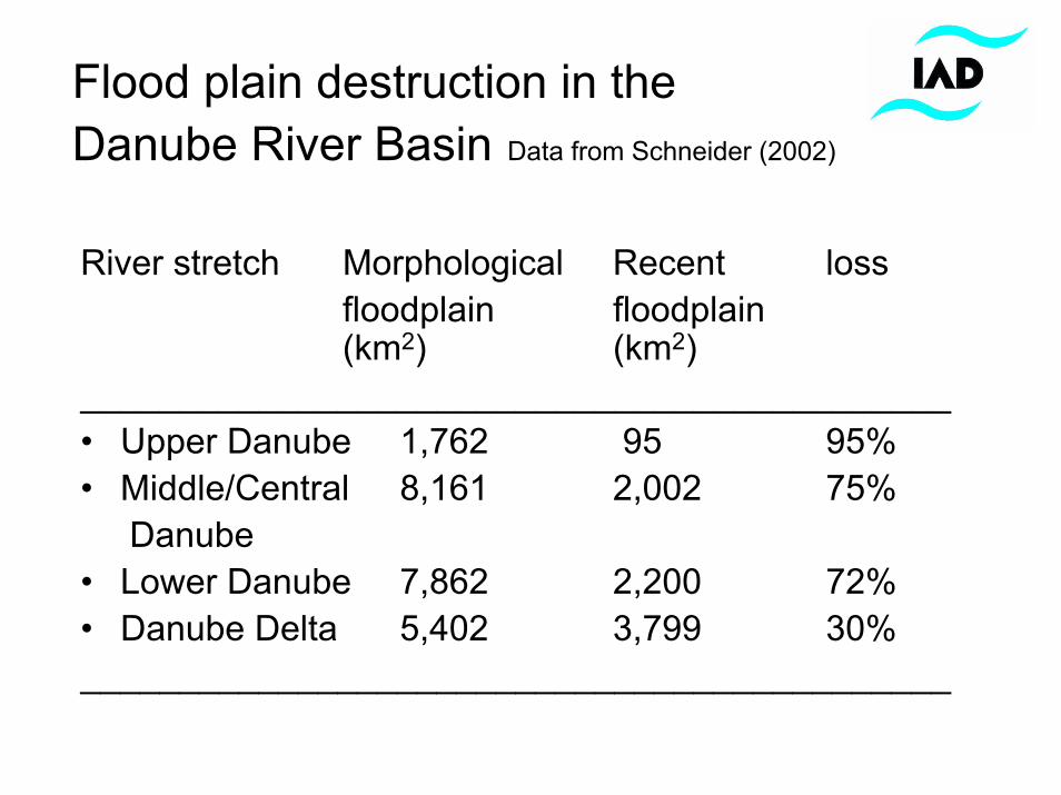
Flood plain destruction in the Danube River Basin Data from Schneider (2002)
River stretch Morphological Recent lossfloodplain floodplain(km2) (km2)
____________________________________________• Upper Danube 1,762 95 95%• Middle/Central 8,161 2,002 75%
Danube• Lower Danube 7,862 2,200 72%• Danube Delta 5,402 3,799 30%____________________________________________
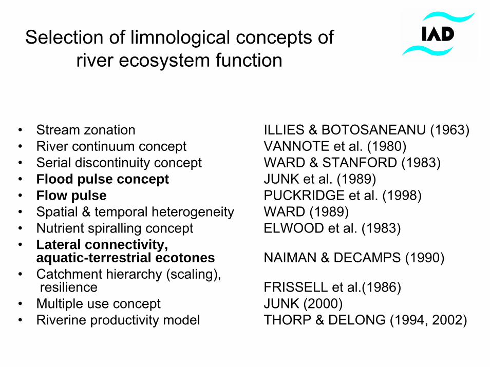
Selection of limnological concepts of river ecosystem function
• Stream zonation ILLIES & BOTOSANEANU (1963)• River continuum concept VANNOTE et al. (1980)• Serial discontinuity concept WARD & STANFORD (1983)• Flood pulse concept JUNK et al. (1989) • Flow pulse PUCKRIDGE et al. (1998)• Spatial & temporal heterogeneity WARD (1989)• Nutrient spiralling concept ELWOOD et al. (1983) • Lateral connectivity,
aquatic-terrestrial ecotones NAIMAN & DECAMPS (1990)• Catchment hierarchy (scaling),
resilience FRISSELL et al.(1986)• Multiple use concept JUNK (2000)• Riverine productivity model THORP & DELONG (1994, 2002)
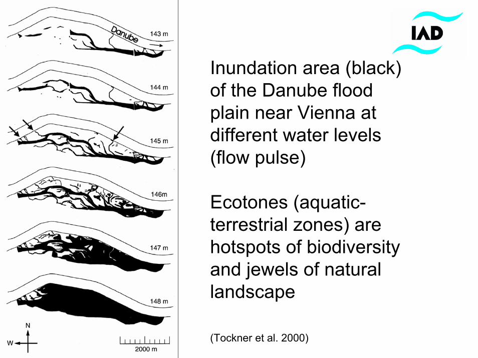
Inundation area (black) of the Danube flood plain near Vienna at different water levels (flow pulse)
Ecotones (aquatic-terrestrial zones) are hotspots of biodiversity and jewels of natural landscape
(Tockner et al. 2000)
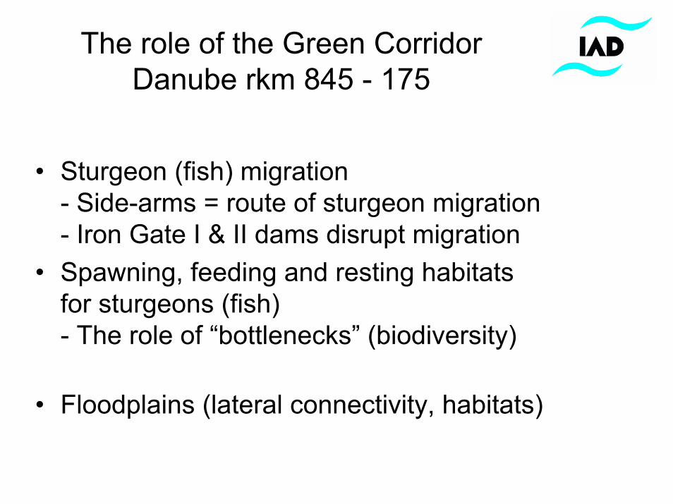
The role of the Green CorridorDanube rkm 845 - 175
• Sturgeon (fish) migration- Side-arms = route of sturgeon migration - Iron Gate I & II dams disrupt migration
• Spawning, feeding and resting habitatsfor sturgeons (fish)- The role of “bottlenecks” (biodiversity)
• Floodplains (lateral connectivity, habitats)
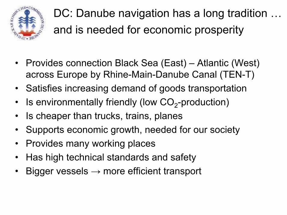
DC: Danube navigation has a long tradition …and is needed for economic prosperity
• Provides connection Black Sea (East) – Atlantic (West) across Europe by Rhine-Main-Danube Canal (TEN-T)
• Satisfies increasing demand of goods transportation• Is environmentally friendly (low CO2-production) • Is cheaper than trucks, trains, planes• Supports economic growth, needed for our society• Provides many working places• Has high technical standards and safety• Bigger vessels → more efficient transport
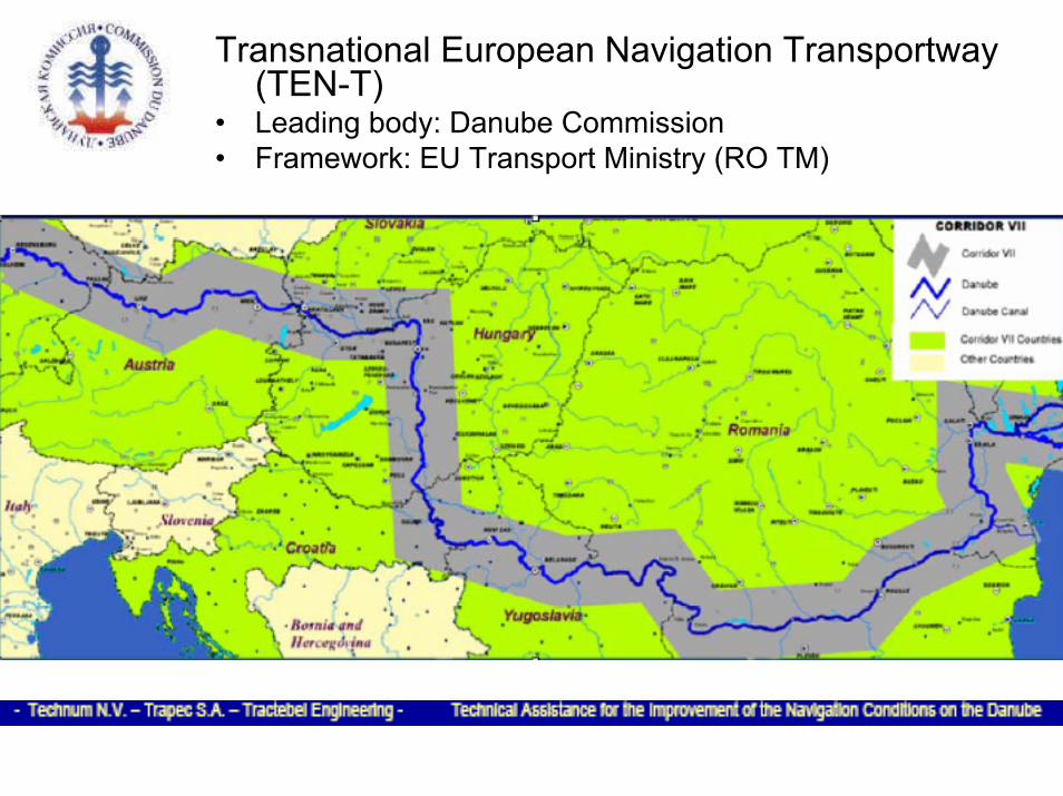
Transnational European Navigation Transportway(TEN-T)
• Leading body: Danube Commission • Framework: EU Transport Ministry (RO TM)
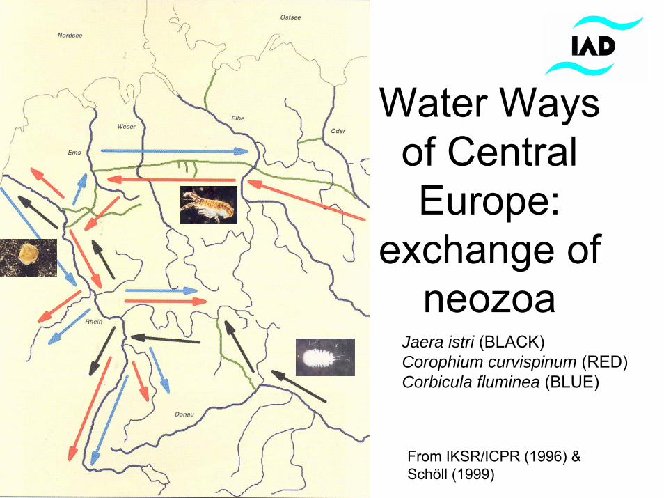
Water Ways of Central Europe:
exchange of neozoa
From IKSR/ICPR (1996) & Schöll (1999)
Jaera istri (BLACK)Corophium curvispinum (RED)Corbicula fluminea (BLUE)
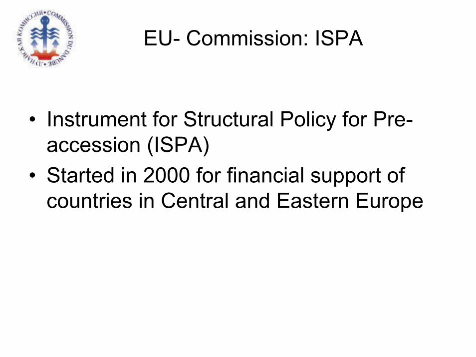
EU- Commission: ISPA
• Instrument for Structural Policy for Pre-accession (ISPA)
• Started in 2000 for financial support of countries in Central and Eastern Europe
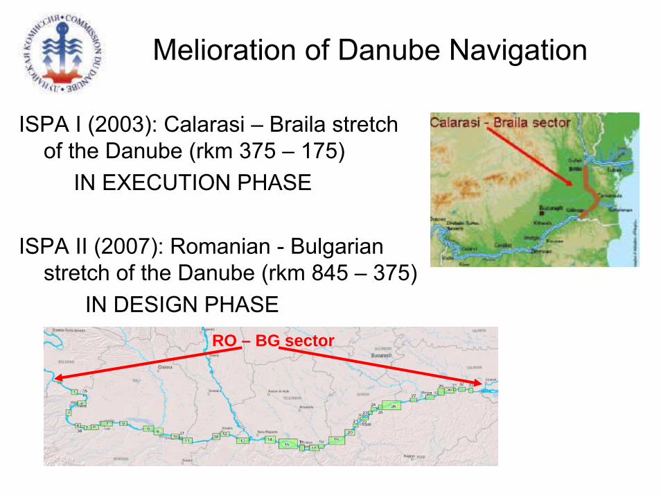
ISPA I (2003): Calarasi – Braila stretch of the Danube (rkm 375 – 175)
IN EXECUTION PHASE
ISPA II (2007): Romanian - Bulgarian stretch of the Danube (rkm 845 – 375)
IN DESIGN PHASE
Melioration of Danube Navigation
RO – BG sector
DC: ISPA I measure 2002 RO 16 PA 011
• Based on Danube Convention• Objectives: promote sustainable mobility, improve navigation
conditions, with high economic return• Avoid degradation and „aging“ state of riverbed• Steering Committee (6): Ministry of Transport, Construction & Tourism• 3 Technical Consultants• Feasibility study, EIA & public consultation (ensuring fish/sturgeon
migration, restocking & monitoring of impact)• Project Stages: geotechnical surveys – topographical and
bathymetrical surveys – mathematical modelling (2D: hydrodynamics flow, sediment transport) - design
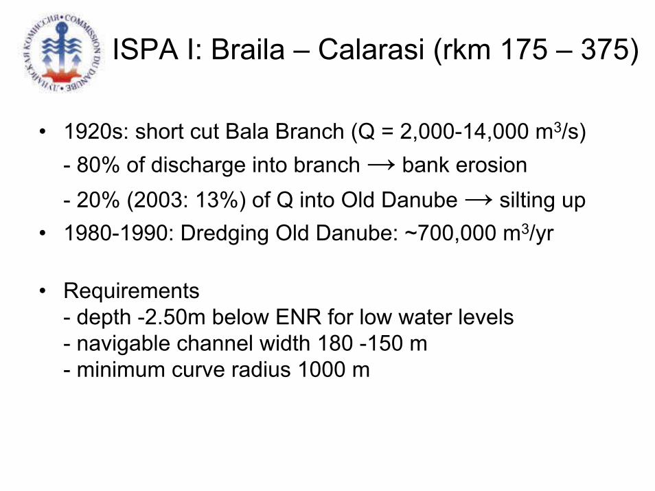
ISPA I: Braila – Calarasi (rkm 175 – 375)
• 1920s: short cut Bala Branch (Q = 2,000-14,000 m3/s)- 80% of discharge into branch → bank erosion- 20% (2003: 13%) of Q into Old Danube → silting up
• 1980-1990: Dredging Old Danube: ~700,000 m3/yr
• Requirements- depth -2.50m below ENR for low water levels- navigable channel width 180 -150 m- minimum curve radius 1000 m
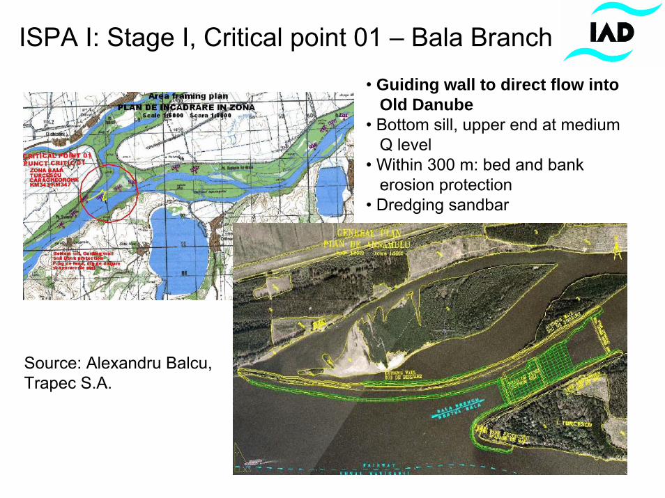
ISPA I: Stage I, Critical point 01 – Bala Branch
Source: Alexandru Balcu,Trapec S.A.
• Guiding wall to direct flow intoOld Danube
• Bottom sill, upper end at mediumQ level
• Within 300 m: bed and bankerosion protection
• Dredging sandbar
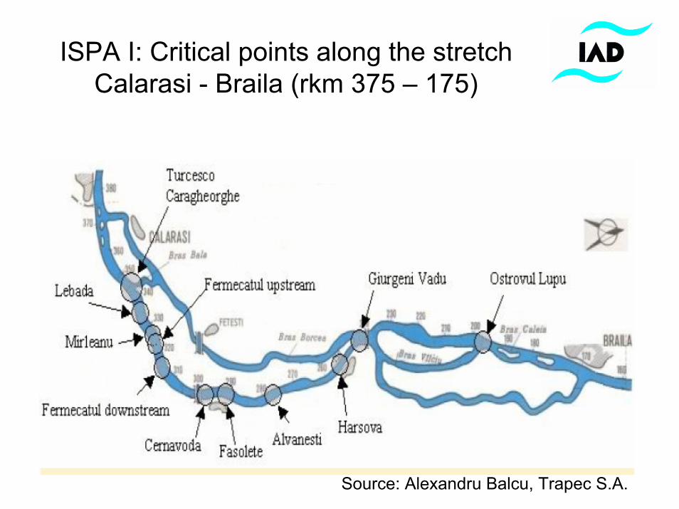
ISPA I: Critical points along the stretch Calarasi - Braila (rkm 375 – 175)
Source: Alexandru Balcu, Trapec S.A.
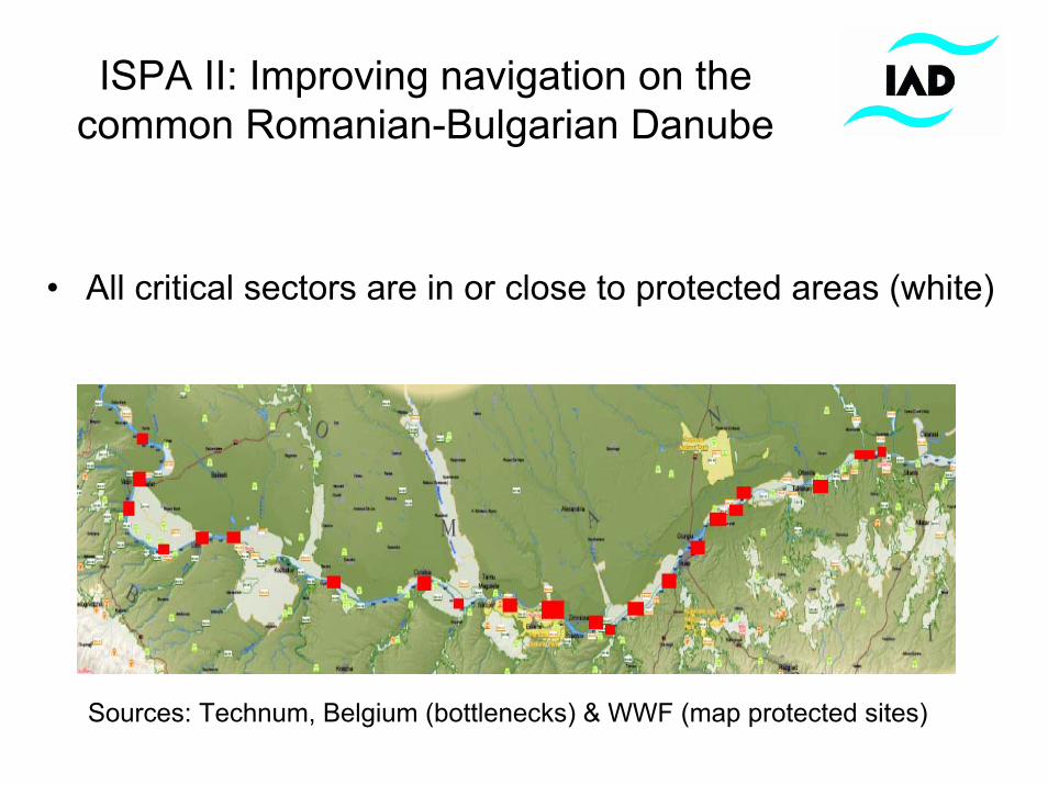
ISPA II: Improving navigation on the common Romanian-Bulgarian Danube
• All critical sectors are in or close to protected areas (white)
Sources: Technum, Belgium (bottlenecks) & WWF (map protected sites)
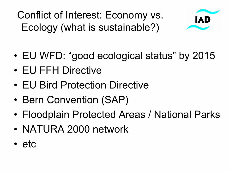
Conflict of Interest: Economy vs. Ecology (what is sustainable?)
• EU WFD: “good ecological status” by 2015 • EU FFH Directive• EU Bird Protection Directive• Bern Convention (SAP)• Floodplain Protected Areas / National Parks• NATURA 2000 network• etc
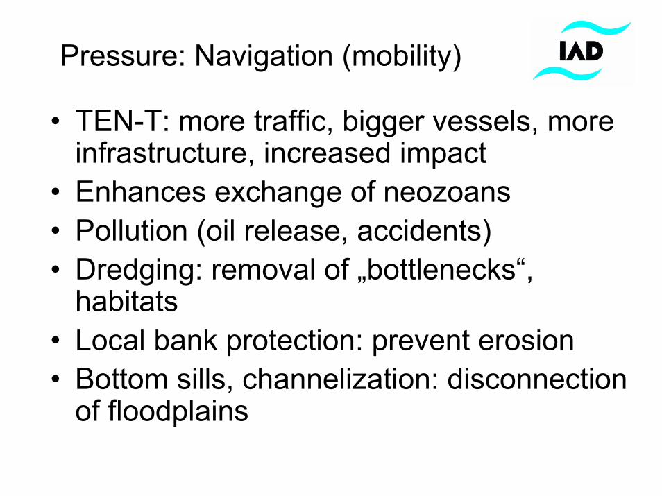
Pressure: Navigation (mobility)
• TEN-T: more traffic, bigger vessels, more infrastructure, increased impact
• Enhances exchange of neozoans• Pollution (oil release, accidents)• Dredging: removal of „bottlenecks“,
habitats• Local bank protection: prevent erosion• Bottom sills, channelization: disconnection
of floodplains
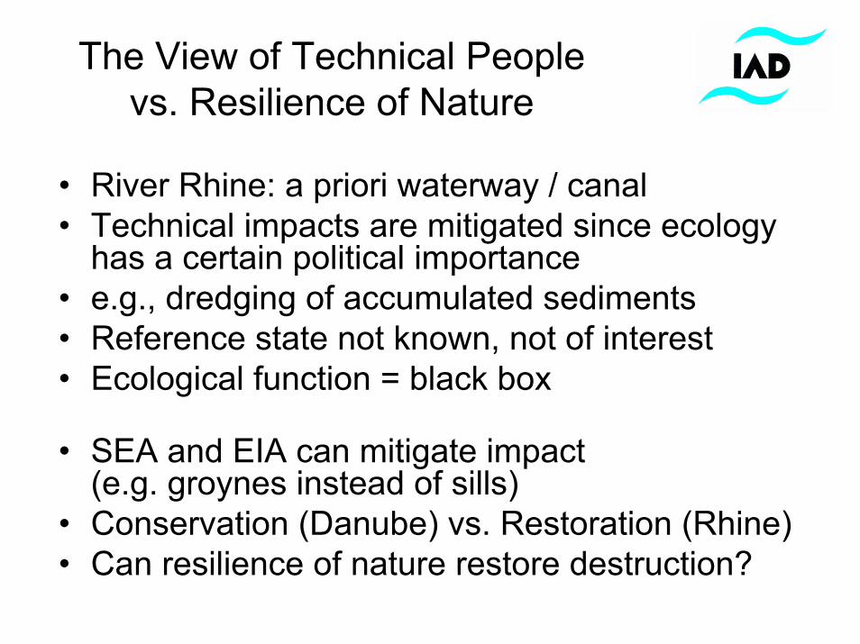
The View of Technical Peoplevs. Resilience of Nature
• River Rhine: a priori waterway / canal • Technical impacts are mitigated since ecology
has a certain political importance• e.g., dredging of accumulated sediments• Reference state not known, not of interest• Ecological function = black box
• SEA and EIA can mitigate impact (e.g. groynes instead of sills)
• Conservation (Danube) vs. Restoration (Rhine)• Can resilience of nature restore destruction?
Reality based on experience
• “Salami” tactics – what is the reference? • Economy (DC, EU TM) stronger than
ecology (ICPDR, IAD, WWF)• Political lobbying matters• NGOs have limited power• etc
Project ideas based on ISPA 2
• Wetland inventories & habitat requirements • Hydrological modeling: flow dynamics vs.
groundwater table (floodplain forests)• Hydromorphological inventories & mapping
(CEN standards)• Effect of flood/flow pulse on biodiversity • Ecosystem services: economic value of
wetlands• etc