Embed Size (px)
Citation preview
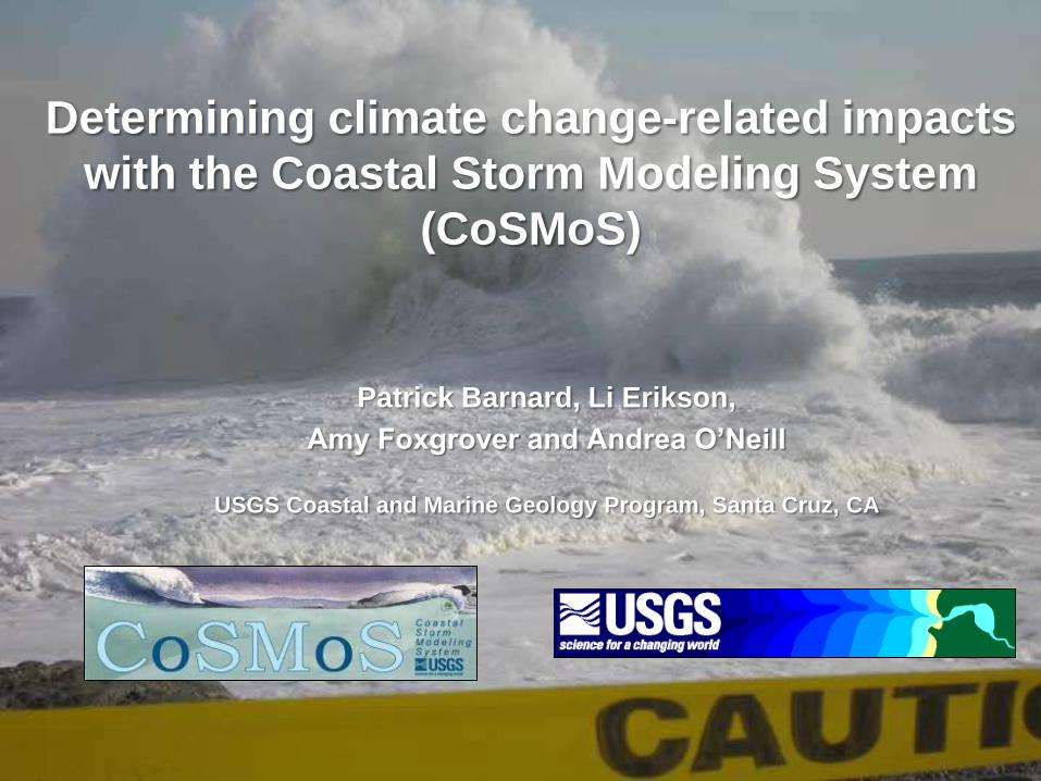
Determining climate change-related impacts
with the Coastal Storm Modeling System
(CoSMoS)
Patrick Barnard, Li Erikson,
Amy Foxgrover and Andrea O’Neill
USGS Coastal and Marine Geology Program, Santa Cruz, CA
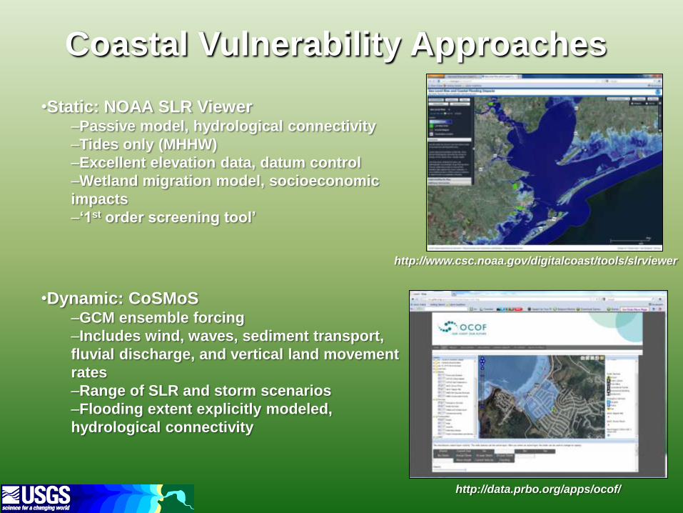
Coastal Vulnerability Approaches
•Static: NOAA SLR Viewer –Passive model, hydrological connectivity
–Tides only (MHHW)
–Excellent elevation data, datum control
–Wetland migration model, socioeconomic
impacts
–‘1st order screening tool’
•Dynamic: CoSMoS –GCM ensemble forcing
–Includes wind, waves, sediment transport,
fluvial discharge, and vertical land movement
rates
–Range of SLR and storm scenarios
–Flooding extent explicitly modeled,
hydrological connectivity
http://www.csc.noaa.gov/digitalcoast/tools/slrviewer
http://data.prbo.org/apps/ocof/
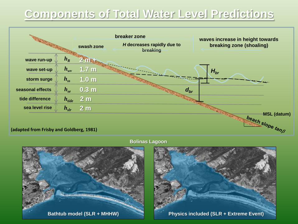
Components of Total Water Level Predictions
MSL (datum)
hslr
Hbr
dbr
waves increase in height towards
breaking zone (shoaling)
breaker zone
H decreases rapidly due to
breaking swash zone
hR
hwv
hss
hse
htide
sea level rise
tide difference
seasonal effects
storm surge
wave set-up
wave run-up
(adapted from Frisby and Goldberg, 1981)
Bolinas Lagoon
Bathtub model (SLR + MHHW) Physics included (SLR + Extreme Event)
2 m
2 m
0.3 m
1.0 m
1.7 m
2 m +
State-of-Science Modeling System
• Acquire the most accurate topographic/bathymetric
information
• Include all the physics: waves, tides, surge
• Use the latest sea level rise and storm scenarios
from climate models developed for IPCC 2013
(CMIP5)
• Relevant products
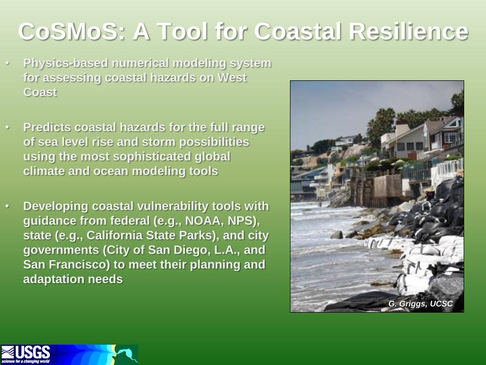
CoSMoS: A Tool for Coastal Resilience • Physics-based numerical modeling system
for assessing coastal hazards on West
Coast
• Predicts coastal hazards for the full range
of sea level rise and storm possibilities
using the most sophisticated global
climate and ocean modeling tools
• Developing coastal vulnerability tools with
guidance from federal (e.g., NOAA, NPS),
state (e.g., California State Parks), and city
governments (City of San Diego, L.A., and
San Francisco) to meet their planning and
adaptation needs
G. Griggs, UCSC
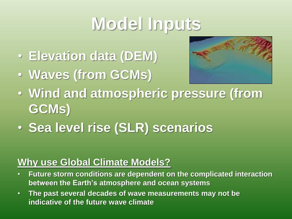
Model Inputs
• Elevation data (DEM)
• Waves (from GCMs)
• Wind and atmospheric pressure (from
GCMs)
• Sea level rise (SLR) scenarios
Why use Global Climate Models? • Future storm conditions are dependent on the complicated interaction
between the Earth’s atmosphere and ocean systems
• The past several decades of wave measurements may not be
indicative of the future wave climate
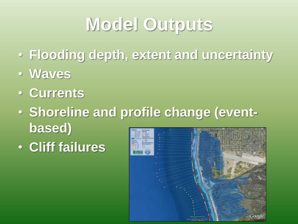
Model Outputs
• Flooding depth, extent and uncertainty
• Waves
• Currents
• Shoreline and profile change (event-
based)
• Cliff failures
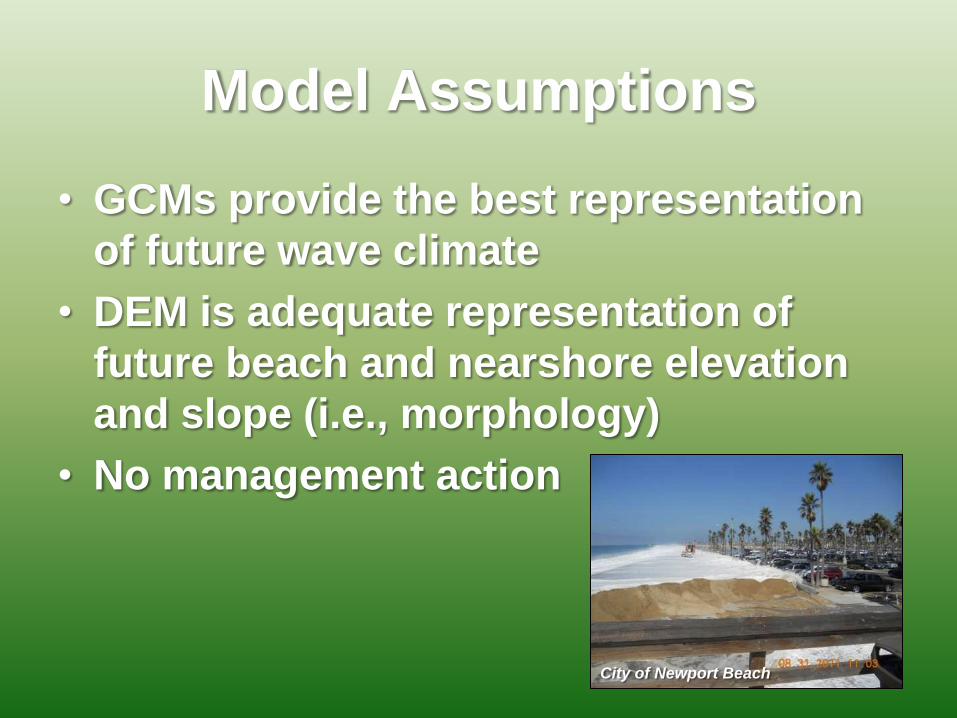
Model Assumptions
• GCMs provide the best representation
of future wave climate
• DEM is adequate representation of
future beach and nearshore elevation
and slope (i.e., morphology)
• No management action
City of Newport Beach
Model Applications
• Climate impacts assessments
• Coastal impacts for range of possible
current AND future conditions (SLR
and storms), ideal for Infrastructure
and ecosystem vulnerability
• Web-based coastal planning user-
interface
Model Uncertainties
• DEM: model processes and local-scale
results limited to resolution and
accuracy
• Modeling total water levels
• Projected forcing (i.e., storm
conditions)
• Joint occurrence of SLR, storm and
spring tide
Model Constraints
(e.g., advantages/disadvantages)
• Ideal for planning for full range of
potential current AND future coastal
impacts
• Publicly available data and access to
support
• Active scientific development
• Does not predict future beach
morphology changes (but we are
actively working on this)
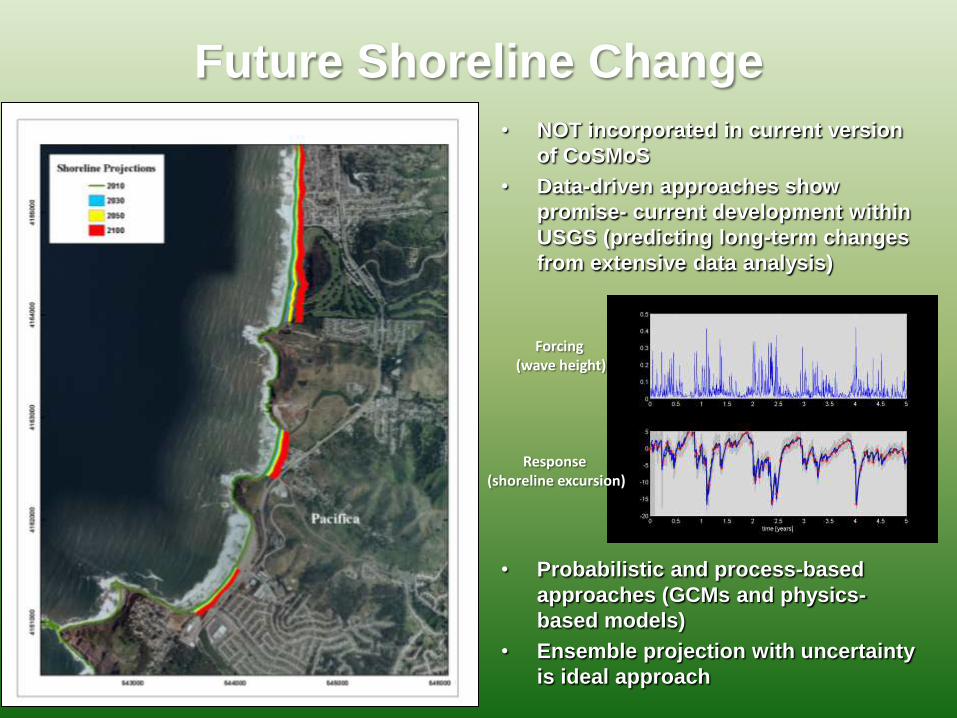
Future Shoreline Change
• NOT incorporated in current version
of CoSMoS
• Data-driven approaches show
promise- current development within
USGS (predicting long-term changes
from extensive data analysis)
• Probabilistic and process-based
approaches (GCMs and physics-
based models)
• Ensemble projection with uncertainty
is ideal approach
Forcing (wave height)
Response (shoreline excursion)
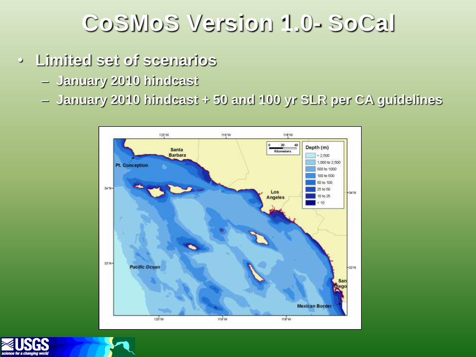
CoSMoS Version 1.0- SoCal
• Limited set of scenarios
– January 2010 hindcast
– January 2010 hindcast + 50 and 100 yr SLR per CA guidelines
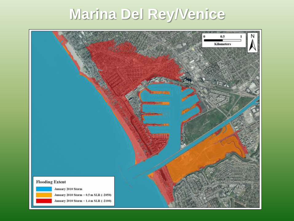
Marina Del Rey/Venice
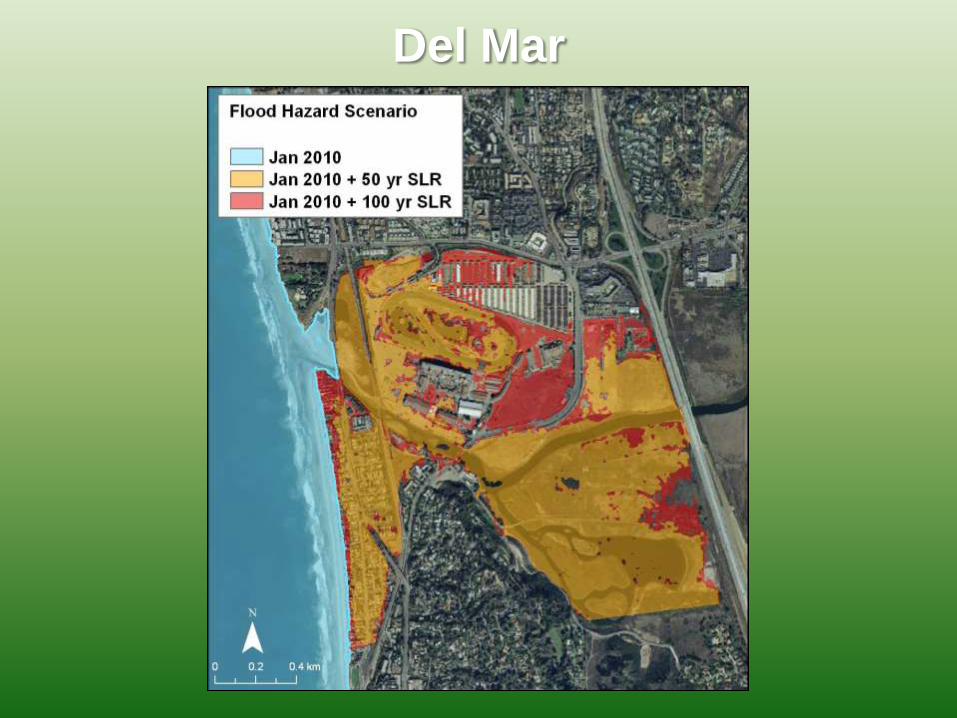
Del Mar
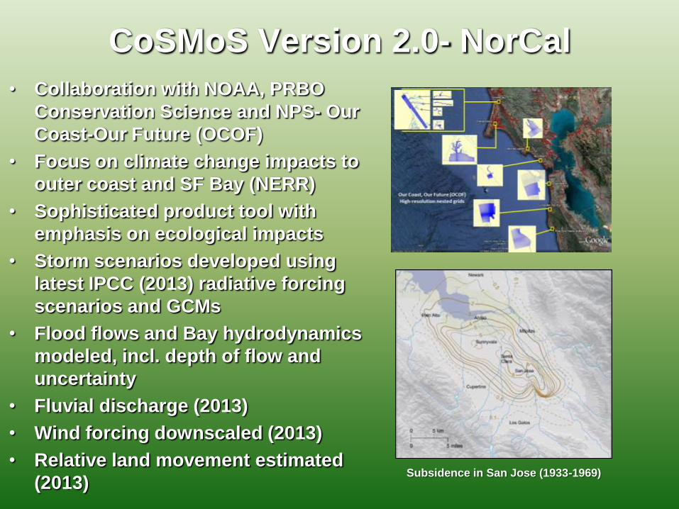
CoSMoS Version 2.0- NorCal
• Collaboration with NOAA, PRBO
Conservation Science and NPS- Our
Coast-Our Future (OCOF)
• Focus on climate change impacts to
outer coast and SF Bay (NERR)
• Sophisticated product tool with
emphasis on ecological impacts
• Storm scenarios developed using
latest IPCC (2013) radiative forcing
scenarios and GCMs
• Flood flows and Bay hydrodynamics
modeled, incl. depth of flow and
uncertainty
• Fluvial discharge (2013)
• Wind forcing downscaled (2013)
• Relative land movement estimated
(2013)
Subsidence in San Jose (1933-1969)
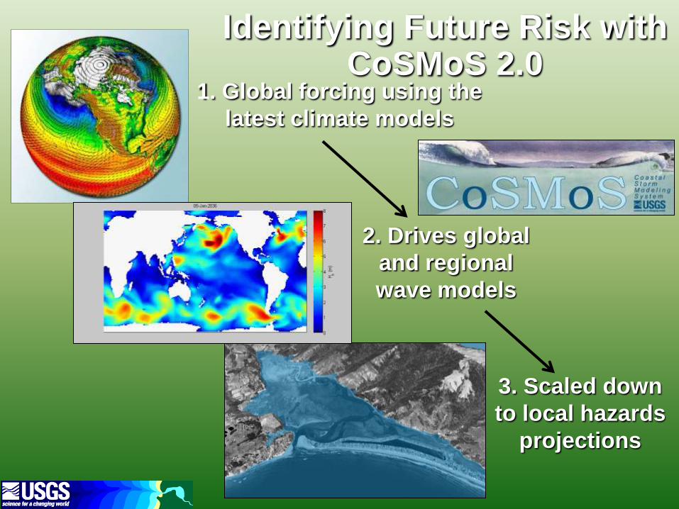
Identifying Future Risk with CoSMoS 2.0
1. Global forcing using the
latest climate models
3. Scaled down
to local hazards
projections
2. Drives global
and regional
wave models
Scenario Summary
• January 2010 storm hindcast- testing and validation
• Global wave modeling: 2 emissions scenarios, 4
Global Climate Models
• Storm event and wave conditions = daily, annual, and
10, 20 and 100-year return interval events
• SLR scenarios = 0 to 2 m in 25 cm increments, and 5
m extreme scenario
• Total of 50 future scenarios of SLR and wave
conditions
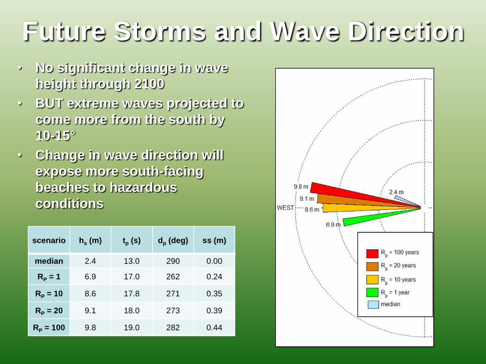
Future Storms and Wave Direction
scenario hs (m) tp (s) dp (deg) ss (m)
median 2.4 13.0 290 0.00
RP = 1 6.9 17.0 262 0.24
RP = 10 8.6 17.8 271 0.35
RP = 20 9.1 18.0 273 0.39
RP = 100 9.8 19.0 282 0.44
• No significant change in wave
height through 2100
• BUT extreme waves projected to
come more from the south by
10-15°
• Change in wave direction will
expose more south-facing
beaches to hazardous
conditions
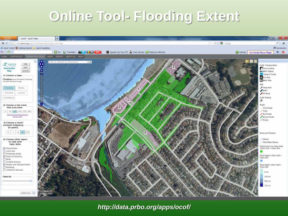
Online Tool- Flooding Extent
http://data.prbo.org/apps/ocof/
http://data.prbo.org/apps/ocof/
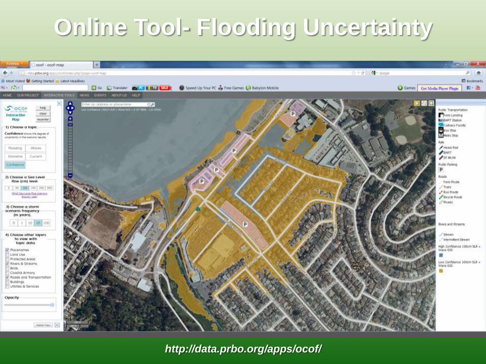
Online Tool- Flooding Uncertainty
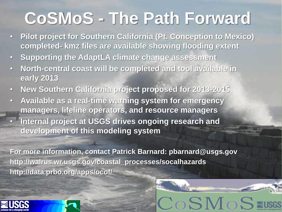
CoSMoS - The Path Forward • Pilot project for Southern California (Pt. Conception to Mexico)
completed- kmz files are available showing flooding extent
• Supporting the AdaptLA climate change assessment
• North-central coast will be completed and tool available in
early 2013
• New Southern California project proposed for 2013-2015
• Available as a real-time warning system for emergency
managers, lifeline operators, and resource managers
• Internal project at USGS drives ongoing research and
development of this modeling system
For more information, contact Patrick Barnard: [email protected]
http://walrus.wr.usgs.gov/coastal_processes/socalhazards
http://data.prbo.org/apps/ocof/