Embed Size (px)
Citation preview
DETERMINING LAND DEVELOPMENT EFFECT ON
SURFACE RUNOFF USING GIS
Objectives
To assess the changes in water flow due to development
Validate USGS Data and Hydrology Analysis Tools
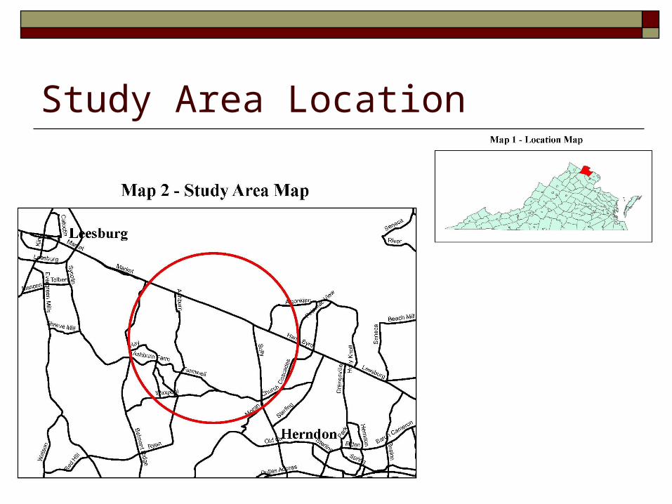
Study Area Location
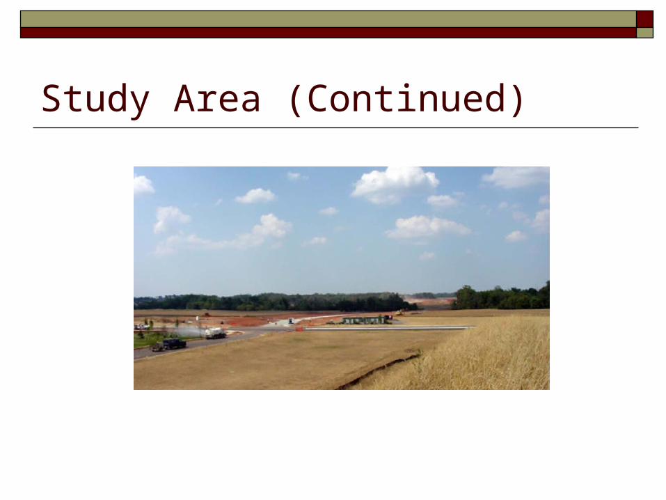
Study Area (Continued)
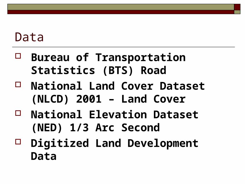
Data
Bureau of Transportation Statistics (BTS) Road
National Land Cover Dataset (NLCD) 2001 – Land Cover
National Elevation Dataset (NED) 1/3 Arc Second
Digitized Land Development Data
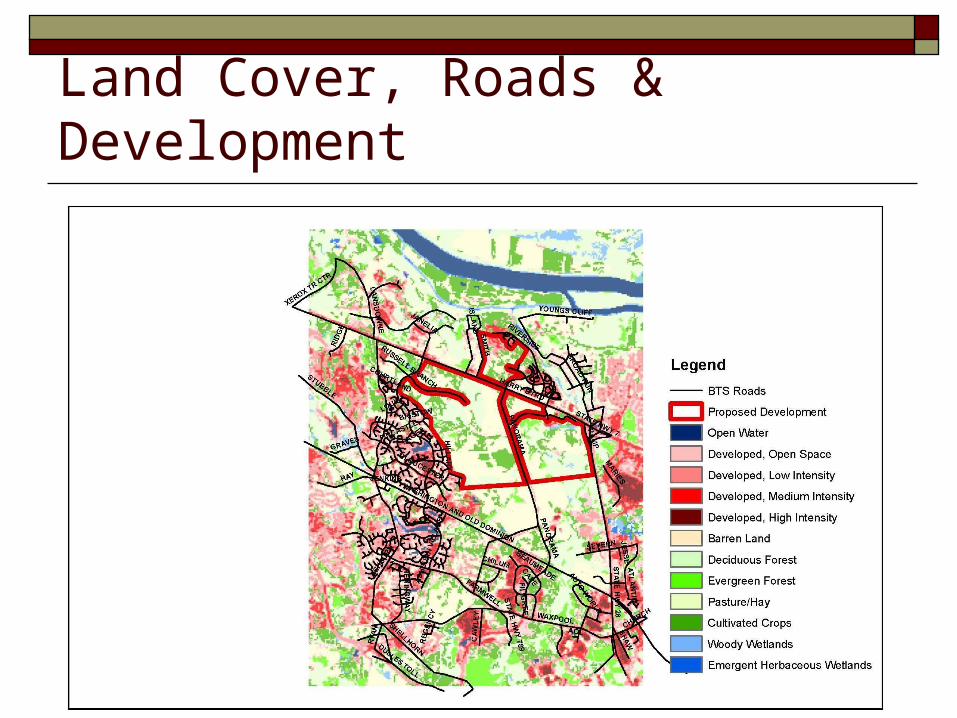
Land Cover, Roads & Development
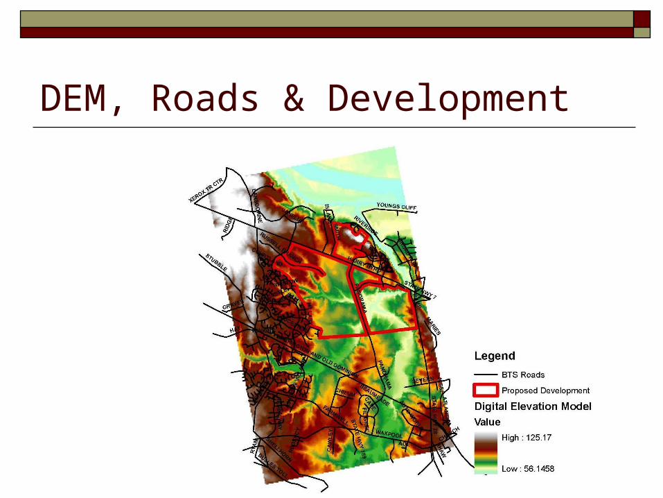
DEM, Roads & Development
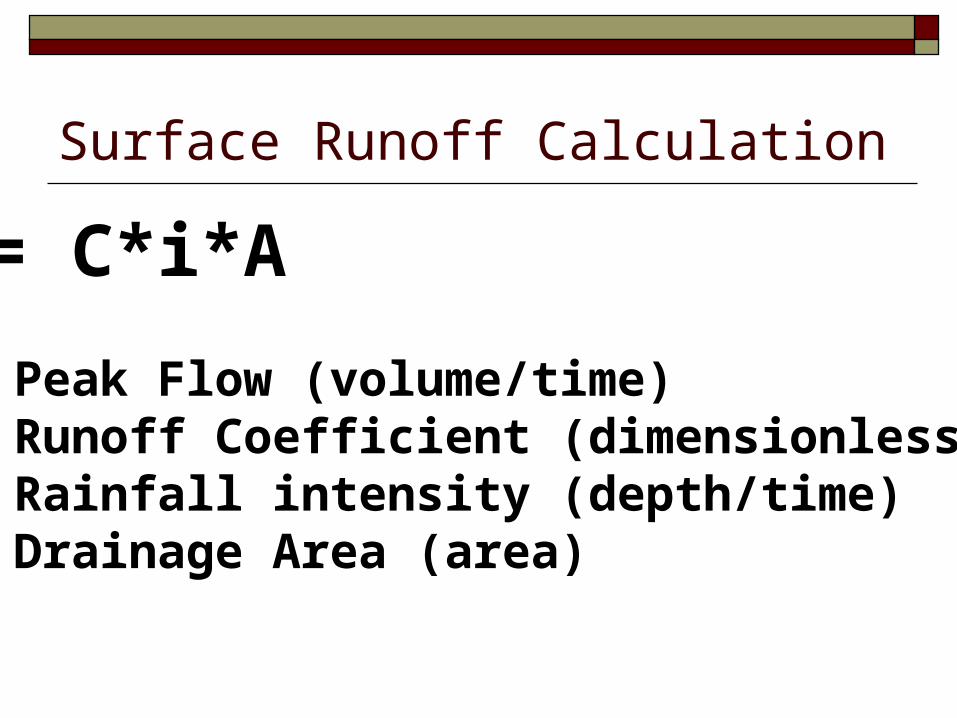
Surface Runoff Calculation
Q = C*i*A
Q = Peak Flow (volume/time)C = Runoff Coefficient (dimensionless) i = Rainfall intensity (depth/time)A = Drainage Area (area)
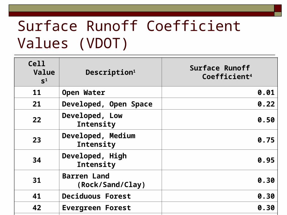
Surface Runoff Coefficient Values (VDOT)Cell Values1 Description1 Surface Runoff Coefficient4
11 Open Water 0.01
21 Developed, Open Space 0.22
22 Developed, Low Intensity 0.50
23 Developed, Medium Intensity 0.75
34 Developed, High Intensity 0.95
31 Barren Land (Rock/Sand/Clay) 0.30
41 Deciduous Forest 0.30
42 Evergreen Forest 0.30
81 Pasture/Hay 0.70
82 Cultivated Crops 0.70
90 Woody Wetlands 0.05
95Emergent Herbaceous
Wetlands0.05
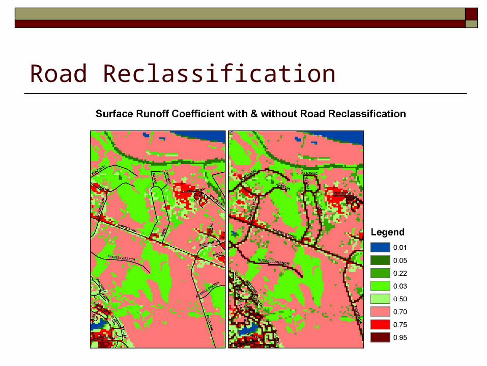
Road Reclassification
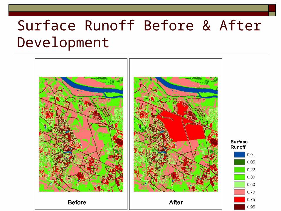
Surface Runoff Before & After Development
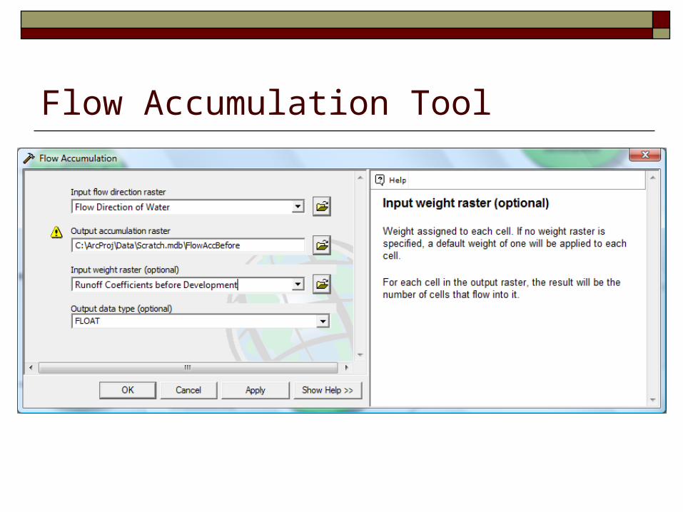
Flow Accumulation Tool
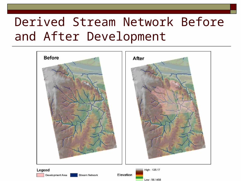
Derived Stream Network Before and After Development
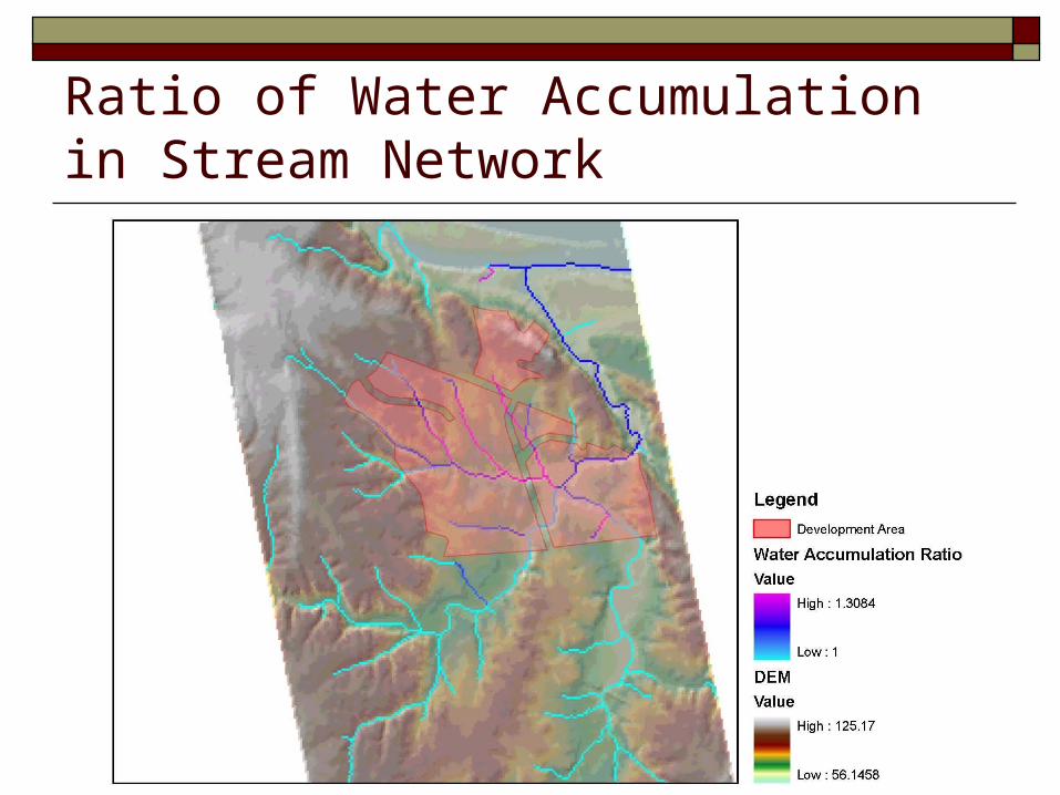
Ratio of Water Accumulation in Stream Network
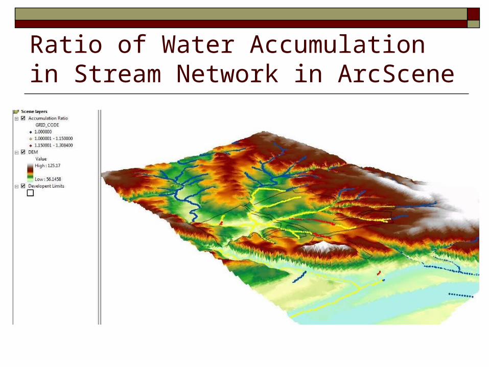
Ratio of Water Accumulation in Stream Network in ArcScene
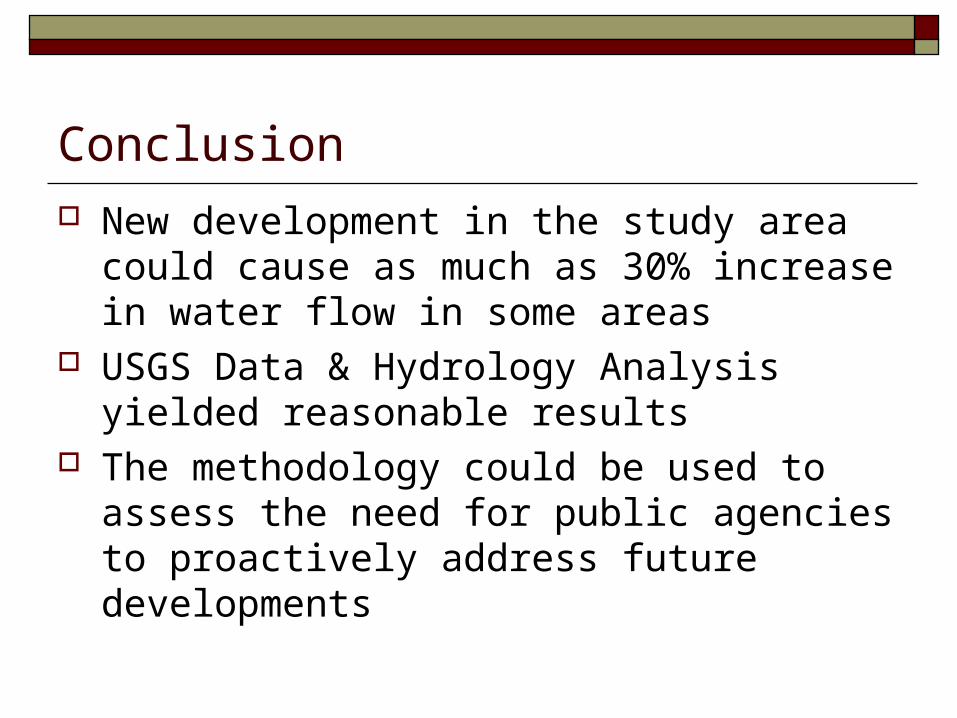
Conclusion
New development in the study area could cause as much as 30% increase in water flow in some areas
USGS Data & Hydrology Analysis yielded reasonable results
The methodology could be used to assess the need for public agencies to proactively address future developments
Study Limitations &Future Study Suggestions
Proposed Grade (elevation) of New Development assumed unchanged
More recent Land Cover Data Proposed Development is assumed as a single
Land Cover Category Effects of existing/proposed pour points are
ignored
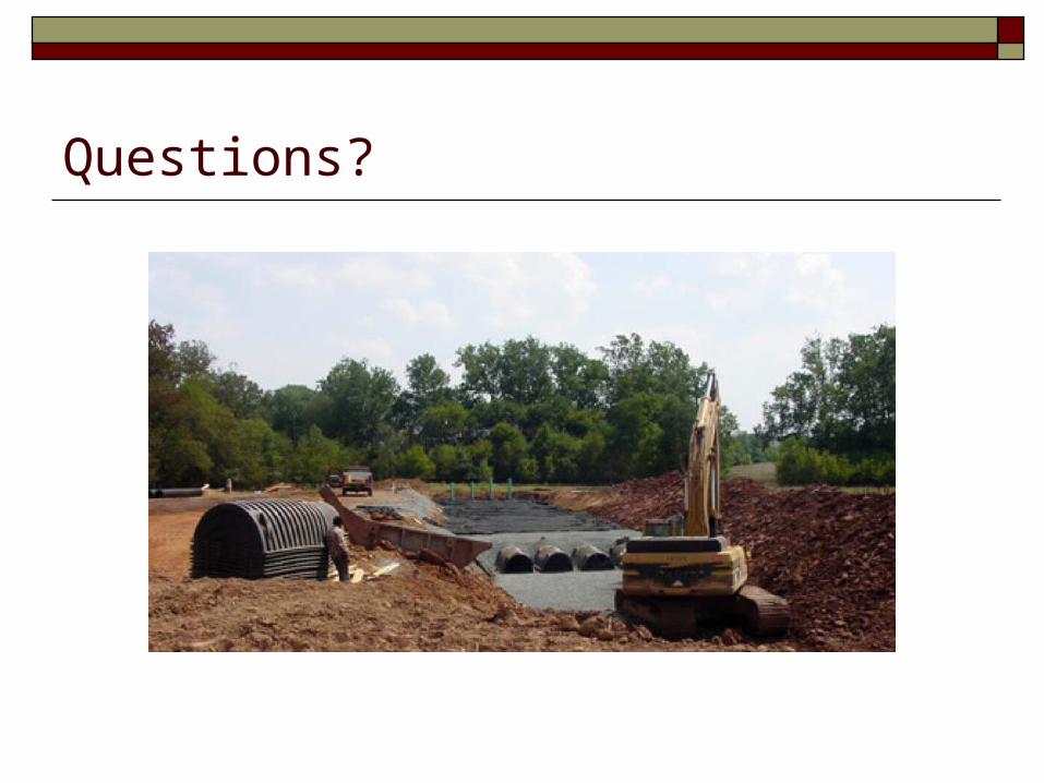
Questions?