Embed Size (px)
Citation preview

Draft PANS-AIM
Contents CHAPTER 1 - GENERAL ..................................................................................................................... 6
1.1 Historical background ............................................................................................................... 6
1.2 Scope and purpose .................................................................................................................... 6
1.3 Status ............................................................................................................................................. 7
1.4 Implementation ............................................................................................................................ 7
1.5 Publication of differences ............................................................................................................ 7
1.6 Promulgation of information ........................................................................................................ 8
1.7 Contents of the document .......................................................................................................... 8
1.9 Common reference systems for air navigation.......................................................................... 15
1.9.1 Horizontal reference system ............................................................................................... 15
1.9.2 Vertical reference system ................................................................................................... 16
1.9.3 Temporal reference system ............................................................................................... 17
CHAPTER 2. RESPONSIBILITIES AND FUNCTIONS ................................................................. 18
CHAPTER 3. AERONAUTICAL INFORMATION MANAGEMENT ........................................... 19
3.1 Information management requirements ................................................................................... 19
3.1.1 Collection ............................................................................................................................. 19
3.1.2 Processing ............................................................................................................................ 19
3.1.3. Quality control .................................................................................................................... 20
3.2 Data integrity and data protection ............................................................................................ 20
3.3 Quality management system .................................................................................................... 20
3.4 Safety management ..................................................................................................................... 20
3.4.2 Safety management activities ............................................................................................... 20
3.5 Relationship between safety management and quality management .......................................... 21
Chapter 4 - Scope of Aeronautical Data and Aeronautical Information ............................................... 22
4.1 Data Catalogue ............................................................................................................................ 22
4.2 Additional information ................................................................................................................ 22
4.3 Metadata Requirements ............................................................................................................. 27
CHAPTER 5 - AERONAUTICAL INFORMATION PRODUCTS AND SERVICES ....................... 28
5.1 General ....................................................................................................................................... 28
5.2 Aeronautical information in a standardized presentation ............................................................ 28
5.2.1 Aeronautical Information Publication (AIP) ........................................................................ 28
5.2.2 Aeronautical Information Circulars ..................................................................................... 30
5.2.3 Printed products ................................................................................................................... 32
5.2.4 Electronic AIP (eAIP) ......................................................................................................... 33
5.2.5 NOTAM ............................................................................................................................... 33
5.3 Digital Data ................................................................................................................................. 34
5.3.1 General provisions ............................................................................................................... 35
5.3.2 Metadata ............................................................................................................................... 35
5.3.3 Data sets ............................................................................................................................... 35
5.4.3 NOTAM distribution........................................................................................................... 38
5.5 Pre-flight information services.................................................................................................... 38
Chapter 6 - Aeronautical information updates ...................................................................................... 40
6.1 Aeronautical Information Regulation and Control (AIRAC) ..................................................... 40
6.2 Aeronautical Information Product updates ................................................................................. 40
6.2.2 Specifications for AIP updates ............................................................................................. 40
6.2.2 Specifications for AIP Supplements .................................................................................... 40
6.2.3 Specifications for NOTAM .................................................................................................. 40
6.2.4 Specifications for digital data updates ................................................................................. 41
APPENDIX 1. CONTENTS OF THE AERONAUTICAL INFORMATION PUBLICATION (AIP)
42
PART 1 — GENERAL (GEN) ......................................................................................................... 42
GEN 0.1 Preface ........................................................................................................................... 42
GEN 0.2 Record of AIP Amendments ............................................................................................ 42
GEN 0.3 Record of AIP Supplements ............................................................................................ 42
GEN 0.4 Checklist of AIP pages .................................................................................................... 42
GEN 0.5 List of hand amendments to the AIP ............................................................................. 43
GEN 0.6 Table of contents to Part 1 ............................................................................................ 43
GEN 1. NATIONAL REGULATIONS AND REQUIREMENTS ................................................ 43
GEN 1.1 Designated authorities..................................................................................................... 43
GEN 1.2 Entry, transit and departure of aircraft .............................................................................. 43
GEN 1.3 Entry, transit and departure of passengers and crew ............................................. 43
GEN 1.4 Entry, transit and departure of cargo ............................................................................. 43
GEN 1.5 Aircraft instruments, equipment and flight documents .................................................... 43
GEN 1.6 Summary of national regulations and international agreements/conventions ............... 44
GEN 1.7 Differences from ICAO Standards, Recommended Practices and Procedures ................ 44
GEN 2. TABLES AND CODES..................................................................................................... 44
GEN 2.1 Measuring system, aircraft markings, holidays ............................................................... 44
GEN 2.1.1 Units of measurement ........................................................................................... 44
GEN 2.1.2 Temporal reference system ................................................................................... 44
GEN 2.1.3 Horizontal reference system .................................................................................. 44
GEN 2.1.4 Vertical reference system ...................................................................................... 44
GEN 2.1.5 Aircraft nationality and registration marks ........................................................... 45
GEN 2.1.6 Public holidays ...................................................................................................... 45
GEN 2.2 Abbreviations used in AIS publications ......................................................................... 45
GEN 2.3 Chart symbols ................................................................................................................. 45
GEN 2.4 Location indicators ........................................................................................................ 45
GEN 2.5 List of radio navigation aids .......................................................................................... 45
GEN 2.6 Conversion of units of measurement ............................................................................... 45
GEN 2.7 Sunrise/sunset .................................................................................................................. 45
GEN 3. SERVICES ........................................................................................................................ 46
GEN 3.1 Aeronautical information services ................................................................................... 46
GEN 3.1.1 Responsible service ............................................................................................... 46
GEN 3.1.2 Area of responsibility ............................................................................................ 46
GEN 3.1.3 Aeronautical publications...................................................................................... 46
GEN 3.1.4 AIRAC system ...................................................................................................... 46
GEN 3.1.5 Pre-flight information service at aerodromes/heliports ......................................... 46
GEN 3.1.6 Electronic terrain and obstacle data ...................................................................... 47
GEN 3.2 Aeronautical charts ......................................................................................................... 47
GEN 3.2.1 Responsible service(s) ........................................................................................... 47
GEN 3.2.2 Maintenance of charts ............................................................................................... 47
GEN 3.2.3 Purchase arrangements .......................................................................................... 47
GEN 3.2.4 Aeronautical chart series available ........................................................................ 47
GEN 3.2.5 List of aeronautical charts available ...................................................................... 47
GEN 3.2.6 Index to the World Aeronautical Chart (WAC) — ICAO 1:1 000 000 ................ 48
GEN 3.2.7 Topographical charts ............................................................................................. 48
GEN 3.2.8 Corrections to charts not contained in the AIP ..................................................... 48
GEN 3.3 Air traffic services .......................................................................................................... 48
GEN 3.3.1 Responsible service ............................................................................................... 48
GEN 3.3.2 Area of responsibility ............................................................................................ 48
GEN 3.3.3 Types of services ................................................................................................... 48
GEN 3.3.4 Coordination between the operator and ATS ........................................................ 48
GEN 3.3.5 Minimum flight altitude ............................................................................................ 49
GEN 3.3.6 ATS units address list ........................................................................................... 49
GEN 3.4 Communication services .................................................................................................. 49
GEN 3.4.1 Responsible service ............................................................................................... 49
GEN 3.4.2 Area of responsibility ............................................................................................ 49
GEN 3.4.3 Types of service .................................................................................................... 49
GEN 3.4.4 Requirements and conditions ................................................................................ 49
GEN 3.4.5 Miscellaneous ........................................................................................................... 49
GEN 3.5 Meteorological services .................................................................................................. 49
GEN 3.5.1 Responsible service ............................................................................................... 50
GEN 3.5.2 Area of responsibility ............................................................................................ 50
GEN 3.5.6 Aircraft reports ...................................................................................................... 50
GEN 3.5.9 Other automated meteorological services ............................................................. 51
GEN 3.6 Search and rescue......................................................................................................... 52
GEN 3.6.5 Conditions of availability ...................................................................................... 52
GEN 4. CHARGES FOR AERODROMES/HELIPORTS AND AIR NAVIGATION
SERVICES .................................................................................................................................... 52
PART 2 — EN-ROUTE (ENR) .................................................................................................... 53
ENR 0.6 Table of contents to Part 2 ..................................................................................... 53
ENR 1. GENERAL RULES AND PROCEDURES ................................................................... 53
ENR 1.4 ATS airspace classification and description .................................................................... 54
ENR 1.5 Holding, approach and departure procedures ................................................................... 54
Appendix 2 – SNOWTAM Format ....................................................................................................... 77
Appendix 3 – ASHTAM Format .......................................................................................................... 78
Appendix 4 – NOTAM Format ............................................................................................................. 79
APPENDIX 5. AERONAUTICAL DATA PUBLICATION RESOLUTION ..................................... 80
ForewordINTRODUCTION
The Air Navigation Commission, at the eleventh meeting of its 177th Session on 20 March 2008,
agreed to the establishment of a study group in order to assist the Secretariat with the development of:
a global strategy/roadmap for the transition from Aeronautical Information Services (AIS) to
Aeronautical Information Management (AIM);
Standards and Recommended Practices (SARPs) and guidance material related to the provision of
a standard aeronautical information conceptual model and standard aeronautical information
exchange model to enable the global exchange of data in digital format; and
other SARPs, guidance material and training material necessary to support AIM implementation.
Comment [1]: Similar to Annex 15
Comment [2]: Couldn't this material be included in what is now PANS Ch 1/historical background? Or vice versa, i.e., move section 1.1- 1.9 into the Introduction?
Comment [3]: Maybe the other way around - move the historical background here? In the current Annex 15, chapter 1 already contains SARPS. The Foreword section contains historical background and other explanatory material.
Comment [4]: That was my second suggestion and it's fine with me
Previously there were two ICAO documents where AIS and AIM can be addressed in terms of
standards, practices, and procedures; Annex 15 and the Aeronautical Information Services Manual,
Doc 8126.
While many of the specifications in Doc 8126 were too detailed to be incorporated into Annex 15, it
has been observed that the promulgation in a guidance document may not be conducive to reaching a
higher level of harmonization.
ICAO AIS-AIM Study Group
Following an assessment of the two ICAO documents, it was proposed by the study group that
specifications published as Procedures for Air Navigation Services (PANS) would provide a means
for increased harmonisation within the domain of AIS/AIM as well as provide a vehicle for the
emerging technical requirements of AIM.
Since PANS primarily consist of material related to the standardization of how something is to be
done, material such as product specifications, standard procedures, and protocols are ideal material for
promulgation as PANS.
With the foregoing in mind it was considered that the PANS-AIM would be assembled from:
Appendix 1 of Annex 15 concerning the formatting of an AIP;
Appendices 2, 3, 5, and 6 of Annex 15 and material from Doc 8126 concerning NOTAM,
SNOWTAM, and ASHTAM; and
material from Doc 8126 concerning AIC and AIRAC where it is desirable to elevate the material to a
status beyond guidance.
The study group also determined that a PANS-AIM would provide a vehicle for expanded and/or new
specifications for terrain and obstacle data and data exchange where it was found desirable to have a
level of standardisation but the material was too detailed or not appropriate for inclusion in Annex 15
as a SARP.
Comment [5]: I thought we agreed to not use the term "promulgation" any longer.
Comment [6]: This section implies that the PANS AIM is exclusively made up of old Annex and Guidance material. There is no indication of new or revised material. I would suggest deleting this section
Comment [7]: Agree
Comment [8]: I am not sure we want to say so...
Comment [9]: Could we re-write to 'a vehicle for expanded and or new digital data requirements and exchange'?
Comment [10]: Once the PANS-AIM is published and the Study Group concluded, the paragraph on the Study Group activity should probably be deleted at the 2nd edition of the PANS-AIM.
Comment [11]: Personally I think it should get ou as from the 1st version.
CHAPTER 1 - GENERAL
1.1 Historical background
1.1 The Procedures for Air Navigation Services — Aeronautical Information Management
(PANS-AIM) are the result of the transition from the product based Aeronautical Information
Services (AIS) to the data centric Aeronautical Information Management (AIM).
1.2 The first requirements in the field of Aeronautical Information were developed by the Air
Navigation Committee as a result of recommendations of Regional Air Navigation Meetings, and
were published by authority of the Council as Procedures for International Notices to Airmen PANS-
NOTAM, PICAO Doc 2713) in January 1947.
1.3 In 1949, the Special NOTAM Meeting reviewed and proposed amendments to these
procedures which were later issued as "Procedures for Air Navigation Services-Aeronautical
Information Services (PANS-AIS) and which became applicable on 1 August 1951.
1.4 In 1952, the PANS-AIS were reviewed by the First Session of the Aeronautical Information
Services Division which recommended their adoption as Standards and Recommended Practices.
Following consideration by all Contracting States, these recommendations were reviewed by the Air
Navigation Commission and the first set of Standards and Recommended Practices was adopted by
the Council on 15 May 1953 as Annex 15 to the Convention. [PANS-AIS got discontinued per xxx /
superseded by Annex 15 ?]
1.5 Annex 15 has progressively evolved to serve the air navigation information needs. The events
preceding the Eleventh Air Navigation Conference (AN-Conf/11) held in Montréal in September
2003 which endorsed the global air traffic management (ATM) operational concept re-defined the
scope and functionality of AIS.
1.6 Aeronautical Information Service (AIS) was envisaged as one of the most valuable and
important enabling services in (ATM) operational concept. The ATM concept, developed to be
visionary in scope and not constrained by the level of technology available at the time, is based on a
collaborative decision-making environment, the timely availability of high-quality and reliable
electronic aeronautical, meteorological, airspace and flow management information would be
necessary.
1.7 To satisfy new requirements arising from the Global ATM Operational Concept, aeronautical
information services has to transition to a broader concept of aeronautical information management
(AIM), with a different method of information provision and management given its data-centric
nature as opposed to the product-centric nature of AIS.
1.8 With Aeronautical Information Management (AIM) the concept of a Data Catalogue is
introduced which details data elements in terms of field names, field types and field definitions.
Further, this approach allows the data collection activity to be decoupled from the definition of the
end-products. The end-user applications, which make use of the information transferred in the form of
data sets, do not rely exclusively on the structure and format of the messages but are free to transform
the data and combine it with other data to construct the final view appropriate for the end-user.
1.9 This edition titled Procedures for Air Navigation Services — Aeronautical Information
Management (PANS-AIM) contains detailed requirements for the collection, specification and
provision of aeronautical data and aeronautical information.
1.2 Scope and purpose
2.1 Procedures for Air Navigation Services — Aeronautical Information Management (PANS-AIM)
Comment [12]: 1.1 to 1.7 -> action for ICAO Secretariat to review and align with other PANS documents.
Comment [13]: @Michael H - is this correct?
Comment [14]: Yes, it's extracted from the foreword to Annex 15.
Comment [15]: I don't think we want the data 'transformed', which means that users could change the data. I think we want it 'used or used in combination', but not altered.
Comment [16]: Good point - recommend replace the word 'Transform' with 'Manage'
Comment [17]: Agreed. 'Manage' is a much better word.
Comment [18]: Agree with "manage".
are complementary to the Standards and Recommended Practices contained in Annex 15 —
Aeronautical Information Services and in Annex 4-Aeronautical Charts. They are supplemented when
necessary by regional procedures contained in the Regional Supplementary Procedures (Doc 7030).
Note 1.— Although the provisions and procedures are mainly directed to AIM Authorities at state or
regional level, Data Originators, data providers, accredited providers of AIM Information & data
and consumers of AIM Information & data should be familiar with the procedures contained in the
following chapters of the document:
Chapters 4……………………………
Note 2. — One of the objectives of AIM is to ensure integrity of aeronautical data is maintained
through the data process from survey/origination to distribution to the next intended user. The
provisions and procedures in this document do not relieve the end users of aeronautical data and
aeronautical information of their responsibility to ensure accuracy and integrity of aeronautical data
and information received for end use meet their requirements
1.3 Status
3.1 The Procedures for Air Navigation Services (PANS) do not have the same status as the
Standards and Recommended Practices. While the latter are adopted by Council in pursuance of
Article 37 of the Convention on International Civil Aviation, subject to the full procedure of Article
90, the PANS are approved by the Council and recommended to Contracting States for worldwide
application
3.2 While the PANS may contain material which may eventually become Standards or
Recommended Practices (SARPs) when it has reached the maturity and stability necessary for
adoption as such, they may also comprise material prepared as an amplification of the basic principles
in the corresponding SARPs, and designed particularly to assist the user in the application of those
SARPs. (PANS-ATM)
1.4 Implementation
The implementation of procedures is the responsibility of Contracting States; they are applied in
actual operations only after, and in so far as, States have enforced them. However, with a view to
facilitating their processing towards implementation by States, they have been prepared in language
which will permit direct use by the ATM community. (PANS-ATM)
1.5 Publication of differences
5.1 The PANS do not carry the status afforded to Standards adopted by the Council as Annexes
to the Convention and, therefore, do not come within the obligation imposed by Article 38 of the
Convention to notify differences in the event of non-implementation. (PANS-ATM-Status)
5.2 However, attention of States is drawn to the provision of Annex 15 related to the publication
in their Aeronautical Information Publication of lists of significant differences between their
procedures and the related ICAO procedures. (PANS-ATM)
Comment [19]: ??? (what is it). To me it is directed to STATES
Comment [20]: Agreed - I recall an agreement of the group to replace the term 'AIM authority'. I suggest change to 'AIM provider' or 'AIM organisation'
Comment [21]: I guess unless really specific to AIS-AIM Providers, we should keep all the Annex 15 provisions directed to States. It is then up to them to determine the best arrangements to do so
Comment [22]: Good point Steph,I Agree
Comment [23]: Since Annex 15 is entitled "AIS", I would stay consistent and say "AIS providers" which is the "what" is being provided. How they do it, by "AIM" or some other form of "IM", is up to the States. keep in mind, this is only a Note.
Comment [24]: State
Comment [25]: ??? (is it defined)
Comment [26]: Not to my knowledge - recommend remove 'accredited providers'
Comment [27]: Agreed
Comment [28]: We know we about to define data originators and data ...
Comment [29]: and say "Data originators and data providers...."
Comment [30]: ??? (what is the difference with user)
Comment [31]: None - Keep it simple and replace 'consumers' with users'
Comment [32]: Agreed
Comment [33]: Agree with "users". The term remains consistent with the ...
Comment [34]: Recommend deleting 'in the following chapters of the ...
Comment [35]: Agree
Comment [36]: On second thought, I'm not sure that this note is needed at ...
Comment [37]: Recommend replace 'procedures contained in the following ...
Comment [38]: Just "herein" will work. Again, this is just a note.
Comment [39]: Agreed
Comment [40]: Recommend deleting 'received for end use meet their ...
Comment [41]: I would keep "received", then end the sentence.
Comment [42]: Agreed
Comment [43]: seconded!
Comment [44]: Well then, according to this passage, if a PANS is ...
Comment [45]: Could reword end of sentence to read ' ...approved by the ...
Comment [46]: agree
Comment [47]: I would NOT change this sentence which is identical as the ...
Comment [48]: OK - one for Michael
Comment [49]: Agree, we'll leave it up to ICAO.
1.6 Promulgation of information
Information relating to the establishment and withdrawal of and changes to facilities, services and
procedures affecting aircraft operations provided according to the Procedures specified in this
document should be notified and take effect in accordance with Annex 15. .(PANS-ATM)
1.7 Contents of the document
Table A. Amendments to the PANS-AIM
…
1.8 Definitions
When the following terms are used in the present document they have the following meanings:
Aerodrome. A defined area on land or water (including any buildings, installations and equipment)
intended to be used either wholly or in part for the arrival, departure and surface movement of
aircraft.
Aerodrome mapping data (AMD). Data collected for the purpose of compiling aerodrome mapping
information.
Note.— Aerodrome mapping data are collected for purposes that include the improvement of
the user’s situational awareness, surface navigation operations, training, charting and planning.
Aerodrome mapping database (AMDB). A collection of aerodrome mapping data organized and
arranged as a structured data set.
Aeronautical data. A representation of aeronautical facts, concepts or instructions in a formalized
manner suitable for communication, interpretation or processing.
Aeronautical information. Information resulting from the assembly, analysis and formatting of
aeronautical data.
Aeronautical Information Circular (AIC). A notice containing information that does not qualify
for the origination of a NOTAM or for inclusion in the AIP, but which relates to flight safety,
air navigation, technical, administrative or legislative matters.
Aeronautical information management (AIM). The dynamic, integrated management of
aeronautical information through the provision and exchange of quality-assured digital
aeronautical data in collaboration with all parties.
Aeronautical Information Product. Aeronautical data and aeronautical information provided either
as digital data sets or as a standardized presentation in paper or electronic media. Aeronautical
Information Products include:
— Aeronautical Information Publication (AIP), including Amendments and Supplements
— Aeronautical Information Circulars (AIC)
Comment [50]: We keep or change this word?
Comment [51]: We could change to read 'Publication' however this might imply the use of Paper. Alternatives are announcement, provision, proclamation, declaration?
Comment [52]: Agree with Publication, we'll see what the secretariat says.
Comment [53]: I'm OK with the original since this para was copied verbatim from the PANS ATM, para 6 of the Foreword. 'Promulgate' may be a little archaic but it means more than publish; it means 'to make known'. Would 'dissemination' be better? Or perhaps 'Notification of changes'.
Comment [54]: Remove all definitions of the terms that are not used in the PANS-AIM document. Eventually, add missing definitions.
Comment [55]: Agreed, I would also consider removing definitions that should be described in other more apprpriate (principle) annexes. For example, as a user I would not look for the definition of a Heliport in Annex 15 or PAMS-AIM Doc
— Aeronautical charts
— NOTAM
— Digital data sets
Note.— Aeronautical Information Products are intended primarily to satisfy international
requirements for the exchange of aeronautical information.
Aeronautical Information Publication (AIP). A publication issued by or with the authority of a
State and containing aeronautical information of a lasting character essential to air navigation.
Aeronautical information service (AIS). A service established within the defined area of coverage
responsible for the provision of aeronautical data and aeronautical information necessary for the
safety, regularity and efficiency of air navigation.
AIP Amendment. Permanent changes to the information contained in the AIP.
AIP Supplement. Temporary changes to the information contained in the AIP which are provided by
means of special pages.
AIRAC. An acronym (aeronautical information regulation and control) signifying a system aimed at
advance notification, based on common effective dates, of circumstances that necessitate
significant changes in operating practices.
Air defence identification zone (ADIZ). Special designated airspace of defined dimensions within
which aircraft are required to comply with special identification and/or reporting procedures
additional to those related to the provision of air traffic services (ATS).
Air traffic management (ATM). The dynamic, integrated management of air traffic and airspace
(including air traffic services, airspace management and air traffic flow management) — safely,
economically and efficiently — through the provision of facilities and seamless services in
collaboration with all parties and involving airborne and ground-based functions.
Application. Manipulation and processing of data in support of user requirements (ISO 19104*1).
Area navigation (RNAV). A method of navigation which permits aircraft operation on any desired
flight path within the coverage of ground- or space-based navigation aids or within the limits of
the capability of self-contained aids, or a combination of these.
Note.— Area navigation includes performance-based navigation as well as other operations
that do not meet the definition of performance-based navigation.
ASHTAM. A special series NOTAM notifying by means of a specific format change in activity of a
volcano, a volcanic eruption and/or volcanic ash cloud that is of significance to aircraft
operations.
Assemble. A process of merging data from multiple sources into a database and establishing a
baseline for subsequent processing.
Note.— The assemble phase includes checking the data and ensuring that detected errors
and omissions are rectified.
ATS surveillance service. Term used to indicate a service provided directly by means of an ATS
surveillance system.
ATS surveillance system. A generic term meaning variously, ADS-B, PSR, SSR or any comparable
ground-based system that enables the identification of aircraft.
Note.— A comparable ground-based system is one that has been demonstrated, by comparative
1 * All ISO Standards are listed at the end of this chapter.
assessment or other methodology, to have a level of safety and performance equal to or better than
monopulse SSR.
Automatic dependent surveillance — broadcast (ADS-B). A means by which aircraft, aerodrome
vehicles and other objects can automatically transmit and/or receive data such as identification,
position and additional data, as appropriate, in a broadcast mode via a data link.
Automatic dependent surveillance — contract (ADS-C). A means by which the terms of an ADS-C
agreement will be exchanged between the ground system and the aircraft, via a data link,
specifying under what conditions ADS-C reports would be initiated, and what data would be
contained in the reports.
Note.— The abbreviated term “ADS contract” is commonly used to refer to ADS event contract,
ADS demand contract, ADS periodic contract or an emergency mode.
Automatic terminal information service (ATIS). The automatic provision of current, routine
information to arriving and departing aircraft throughout 24 hours or a specified portion thereof:
Data link-automatic terminal information service (D-ATIS). The provision of ATIS via data link.
Voice-automatic terminal information service (Voice-ATIS). The provision of ATIS by
means of continuous and repetitive voice broadcasts.
Bare Earth. Surface of the Earth including bodies of water and permanent ice and snow, and
excluding vegetation and man- made objects.
Calendar. Discrete temporal reference system that provides the basis for defining temporal position
to a resolution of one day
(ISO 19108*).
Canopy. Bare Earth supplemented by vegetation height.
Confidence level. The probability that the true value of a parameter is within a certain interval
around the estimate of its value.
Note.— The interval is usually referred to as the accuracy of the estimate.
Controller-pilot data link communications (CPDLC). A means of communication between
controller and pilot, using data link for ATC communications.
Culture. All man-made features constructed on the surface of the Earth, such as cities, railways and
canals.
Cyclic redundancy check (CRC). A mathematical algorithm applied to the digital expression of
data that provides a level of assurance against loss or alteration of data.
Danger area. An airspace of defined dimensions within which activities dangerous to the flight of
aircraft may exist at specified times.
Data accuracy. A degree of conformance between the estimated or measured value and the true
value.
Note.— For measured positional data the accuracy is normally expressed in terms of a distance from
a stated position within which there is a defined confidence of the true position falling.
Data completeness. The degree of confidence that all of the data needed to support the intended use
is provided.
Data format. A structure of data elements, records and files arranged to meet standards,
specifications or data quality requirements
Data integrity (assurance level). A degree of assurance that an aeronautical data and its value has
not been lost or altered since the data origination or authorized amendment.
Data product. Data set or data set series that conforms to a data product specification (ISO 19131*).
Data product specification. Detailed description of a data set or data set series together with
additional information that will enable it to be created, supplied to and used by another party
(ISO 19131*).
Note.— A data product specification provides a description of the universe of discourse and a
specification for mapping the universe of discourse to a data set. It may be used for production,
sales, end-use or other purpose.
Data quality. A degree or level of confidence that the data provided meet the requirements of the
data user in terms of accuracy, resolution, integrity (or equivalent assurance level), traceability,
timeliness, completeness and format.
Data resolution. A number of units or digits to which a measured or calculated value is expressed
and used.
Data timeliness. The degree of confidence that the data is applicable to the period of its intended use
Data traceability: the degree that a system or a data product can provide a record of the changes
made to that product and thereby enable an audit trail to be followed from the end-user to the data
originator
Data set. Identifiable collection of data (ISO 19101*).
Data set series. Collection of data sets sharing the same product specification (ISO 19115*).
Datum. Any quantity or set of quantities that may serve as a reference or basis for the calculation of
other quantities
(ISO 19104*).
Digital Elevation Model (DEM). The representation of terrain surface by continuous elevation
values at all intersections of a defined grid, referenced to common datum.
Note.— Digital Terrain Model (DTM) is sometimes referred to as DEM.
Direct transit arrangements. Special arrangements approved by the public authorities concerned by
which traffic which is pausing briefly in its passage through the Contracting State may remain
under their direct control.
Ellipsoid height (Geodetic height). The height related to the reference ellipsoid, measured along the
ellipsoidal outer normal through the point in question.
Feature. Abstraction of real world phenomena (ISO 19101*).
Feature attribute. Characteristic of a feature (ISO 19101*).
Note.— A feature attribute has a name, a data type and a value domain associated with it.
Feature operation. Operation that every instance of a feature type may perform (ISO 19110*).
Note.— An operation upon the feature type dam is to raise the dam. The result of this operation
is to raise the level of water in the reservoir.
Feature relationship. Relationship that links instances of one feature type with instances of the
same or a different feature type (ISO 19101*).
Feature type. Class of real world phenomena with common properties (ISO 19110*).
Note.— In a feature catalogue, the basic level of classification is the feature type.
Geodesic distance. The shortest distance between any two points on a mathematically defined
ellipsoidal surface.
Geodetic datum. A minimum set of parameters required to define location and orientation of the
local reference system with respect to the global reference system/frame.
Geoid. The equipotential surface in the gravity field of the Earth which coincides with the
undisturbed mean sea level (MSL)
extended continuously through the continents.
Note.— The geoid is irregular in shape because of local gravitational disturbances (wind tides,
salinity, current, etc.)and the direction of gravity is perpendicular to the geoid at every point.
Geoid undulation. The distance of the geoid above (positive) or below (negative) the mathematical
reference ellipsoid.
Note.— In respect to the World Geodetic System — 1984 (WGS-84) defined ellipsoid, the
difference between the WGS-84 ellipsoidal height and orthometric height represents WGS-84 geoid
undulation.
Gregorian calendar. Calendar in general use; first introduced in 1582 to define a year that more
closely approximates the tropical year than the Julian calendar (ISO 19108*).
Note.— In the Gregorian calendar, common years have 365 days and leap years 366 days
divided into twelve sequential months.
Height. The vertical distance of a level, point or an object considered as a point, measured from a
specific datum.
Heliport. An aerodrome or a defined area on a structure intended to be used wholly or in part for the
arrival, departure and surface movement of helicopters.
Human Factors principles. Principles which apply to aeronautical design, certification, training,
operations and maintenance and which seek safe interface between the human and other system
components by proper consideration to human performance.
Integrity classification (aeronautical data). Classification based upon the potential risk resulting
from the use of corrupted data. Aeronautical data are classified as:
a) routine data: there is a very low probability when using corrupted routine data that the
continued safe flight and landing of an aircraft would be severely at risk with the potential
for catastrophe;
b) essential data: there is a low probability when using corrupted essential data that the
continued safe flight and landing of an aircraft would be severely at risk with the potential
for catastrophe; and
c) critical data: there is a high probability when using corrupted critical data that the
continued safe flight and landing of an aircraft would be severely at risk with the potential
for catastrophe.
International airport. Any airport designated by the Contracting State in whose territory it is situated
as an airport of entry and departure for international air traffic, where the formalities incident to
customs, immigration, public health, animal and plant quarantine and similar procedures are carried
out.
International NOTAM office (NOF). An office designated by a State for the exchange of NOTAM
internationally.
Logon address. A specified code used for data link logon to an ATS unit.
Manoeuvring area. That part of an aerodrome to be used for the take-off, landing and taxiing of
aircraft, excluding aprons.
Metadata. Data about data (ISO 19115*).
Note.— A structured description of the content, quality, condition or other characteristics of
data.
Minimum en-route altitude (MEA). The altitude for an en-route segment that provides adequate
reception of relevant navigation facilities and ATS communications, complies with the airspace
structure and provides the required obstacle clearance.
Minimum obstacle clearance altitude (MOCA). The minimum altitude for a defined segment of
flight that provides the required obstacle clearance.
Movement area. That part of an aerodrome to be used for the take-off, landing and taxiing of
aircraft, consisting of the manoeuvring area and the apron
Navigation specification. A set of aircraft and flight crew requirements needed to support
performance-based navigation operations within a defined airspace. There are two kinds of
navigation specifications:
Required navigation performance (RNP) specification. A navigation specification based on area
navigation that includes the requirement for performance monitoring and alerting,
designated by the prefix RNP, e.g. RNP 4, RNP APCH.
Area navigation (RNAV) specification. A navigation specification based on area navigation that
does not include the requirement for performance monitoring and alerting, designated by
the prefix RNAV, e.g. RNAV 5, RNAV 1.
Note 1.— The Performance-based Navigation (PBN) Manual (Doc 9613), Volume II, contains
detailed guidance on navigation specifications.
Note 2.— The term RNP, previously defined as “a statement of the navigation performance
necessary for operation within a defined airspace”, has been removed from this Annex as the
concept of RNP has been overtaken by the concept of PBN. The term RNP in this Annex is now
solely used in the context of navigation specifications that require performance monitoring and
alerting, e.g. RNP 4 refers to the aircraft and operating requirements, including a 4 NM lateral
performance with on-board performance monitoring and alerting that are detailed in Doc 9613.
Next intended user. The entity that receives the aeronautical information from the Aeronautical
Information Service.
NOTAM. A notice distributed by means of telecommunication containing information
concerning the establishment, condition or change in any aeronautical facility, service,
procedure or hazard, the timely knowledge of which is essential to personnel concerned with
flight operations.
Obstacle. All fixed (whether temporary or permanent) and mobile objects, or parts thereof, that:
a) are located on an area intended for the surface
movement of aircraft; or
b) extend above a defined surface intended to protect aircraft in flight; or
c) stand outside those defined surfaces and that have been assessed as being a hazard to air
navigation.
Obstacle/terrain data collection surface. A defined surface intended for the purpose of collecting
obstacle/terrain data.
Orthometric height. Height of a point related to the geoid, generally presented as an MSL elevation.
Performance-based navigation (PBN). Area navigation based on performance requirements for
aircraft operating along an
ATS route, on an instrument approach procedure or in a designated airspace.
Note.— Performance requirements are expressed in navigation specifications (RNAV
specification, RNP specification) in terms of accuracy, integrity, continuity, availability and
functionality needed for the proposed operation in the context of a particular airspace concept.
Portrayal. Presentation of information to humans (ISO 19117*).
Position (geographical). Set of coordinates (latitude and longitude) referenced to the mathematical
reference ellipsoid which define the position of a point on the surface of the Earth.
Post spacing. Angular or linear distance between two adjacent elevation points.
Precision. The smallest difference that can be reliably distinguished by a measurement process.
Note.— In reference to geodetic surveys, precision is a degree of refinement in performance of
an operation or a degree of perfection in the instruments and methods used when taking
measurements.
Pre-flight information bulletin (PIB). A presentation of current NOTAM information of
operational significance, prepared prior to flight.
Prohibited area. An airspace of defined dimensions, above the land areas or territorial waters of a
State, within which the flight of aircraft is prohibited.
Quality. Degree to which a set of inherent characteristics fulfils requirements (ISO 9000*).
Note 1.— The term “quality” can be used with adjectives such as poor, good or excellent.
Note 2.— “Inherent”, as opposed to “assigned”, means existing in something, especially as a
permanent characteristic.
Quality assurance. Part of quality management focused on providing confidence that quality
requirements will be fulfilled
(ISO 9000*).
Quality control. Part of quality management focused on fulfilling quality requirements (ISO 9000*)
Quality management. Coordinated activities to direct and control an organization with regard to
quality (ISO 9000*).
Radio navigation service. A service providing guidance information or position data for the
efficient and safe operation of aircraft supported by one or more radio navigation aids.
Requirement. Need or expectation that is stated, generally implied or obligatory (ISO 9000*).
Note 1.— “Generally implied” means that it is custom or common practice for the
organization, its customers and other interested parties, that the need or expectation under
consideration is implied.
Note 2.— A qualifier can be used to denote a specific type of requirement, e.g. product
requirement, quality management requirement, customer requirement.
Note 3.— A specified requirement is one which is stated, for
example, in a document. Note 4.— Requirements can be
generated by different interested parties.
Restricted area. An airspace of defined dimensions, above the land areas or territorial waters of a
State, within which the flight of aircraft is restricted in accordance with certain specified conditions.
Route stage. A route or portion of a route flown without an intermediate landing.
SNOWTAM. A special series NOTAM notifying the presence or removal of hazardous conditions
due to snow, ice, slush or standing water associated with snow, slush and ice on the movement
area, by means of a specific format.
Station declination. An alignment variation between the zero degree radial of a VOR and true
north, determined at the time the VOR station is calibrated.
Terrain. The surface of the Earth containing naturally occurring features such as mountains, hills,
ridges, valleys, bodies of water, permanent ice and snow, and excluding obstacles.
Note.— In practical terms, depending on the method of data collection used, terrain represents
the continuous surface that exists at the bare Earth, the top of the canopy or something in-between,
also known as “first reflective surface”.
Traceability. Ability to trace the history, application or location of that which is under consideration
(ISO 9000*).
Note.— When considering product, traceability can relate to:
— the origin of materials and parts;
— the processing history; and
— the distribution and location of the product after delivery.
Validation. Confirmation, through the provision of objective evidence, that the requirements for a
specific intended use or application have been fulfilled (ISO 9000*).
Verification. Confirmation, through the provision of objective evidence, that specified requirements
have been fulfilled
(ISO 9000*).
Note 1.— The term “verified” is used to designate the
corresponding status. Note 2.— Confirmation can
comprise activities such as:
— performing alternative calculations;
— comparing a new design specification with a similar proven design specification;
— undertaking tests and demonstrations; and
— reviewing documents prior to issue.
VOLMET. Meteorological information for aircraft in flight.
Data link-VOLMET (D-VOLMET). Provision of current aerodrome routine meteorological
reports (METAR) and aerodrome special meteorological reports (SPECI), aerodrome
forecasts (TAF), SIGMET, special air-reports not covered by a SIGMET and, where
available, AIRMET via data link.
VOLMET broadcast. Provision, as appropriate, of current METAR, SPECI, TAF and SIGMET
by means of continuous and repetitive voice broadcasts.
1.9 Common reference systems for air navigation
1.9.1 Horizontal reference system
1.9.1.1 The horizontal (geodetic) reference system for international air navigation is the World
Geodetic System — 1984 (WGS-84).
1.9.1.2 Recommendation.— In precise geodetic applications and some air navigation
applications, temporal changes in the tectonic plate motion and tidal effects on the Earth’s crust
should be modelled and estimated. To reflect the temporal effect, an epoch should be included with
any set of absolute station coordinates.
Note 1.— The epoch of the WGS-84 (G873) reference frame is 1997.0 while the epoch of the
latest updated WGS-84 (G1150) reference frame, which includes plate motion model, is 2001.0. (G
indicates that the coordinates were obtained through Global Positioning System (GPS) techniques,
and the number following G indicates the GPS week when these coordinates were implemented in
the United States of America’s National Geospatial-Intelligence Agency’s (NGA’s) precise
ephemeris estimation process.)
Note 2.— The set of geodetic coordinates of globally distributed permanent GPS tracking
stations for the most recent realization of the WGS-84 reference frame (WGS-84 (G1150)) is
provided in Doc 9674. For each permanent GPS tracking station, the accuracy of an individually
estimated position in WGS-84 (G1150) has been in the order of 1 cm (1s).
Note 3.— Another precise worldwide terrestrial coordinate system is the International Earth
Rotation Service (IERS) Terrestrial Reference System (ITRS), and the realization of ITRS is the
IERS Terrestrial Reference Frame (ITRF). Guidance material regarding the ITRS is provided in
Appendix C of Doc 9674. The most current realization of the WGS-84 (G1150) is referenced to the
ITRF 2000 epoch. The WGS-84 (G1150) is consistent with the ITRF 2000 and in practical
realization the difference between these two systems is in the one to two centimetre range
worldwide, meaning WGS-84 (G1150) and ITRF 2000 are essentially identical.
1.9.1.3 Geographical coordinates which have been transformed into WGS-84 coordinates but
whose accuracy of original field work does not meet the requirements in Annex 11, Chapter 2, and
Annex 14, Volumes I and II, Chapter 2, shall be identified by an asterisk.
1.9.2 Vertical reference system
1.9.2.1 The vertical reference system for international air navigation is the Mean Sea Level
(MSL) datum, which gives the relationship of gravity-related height (elevation) to a surface known
as the geoid.
1.9.2.2 The global gravity model used by international air navigation is the Earth Gravitational
Model — 1996 (EGM-96), containing long wavelength gravity field data to degree and order 360.
1.9.2.3 At those geographical positions where the accuracy of EGM-96 does not meet the
accuracy requirements for elevation and geoid undulation specified in Annex 14, Volumes I and II,
on the basis of EGM-96 data, regional, national or local geoid models containing high resolution
(short wavelength) gravity field data shall be developed and used. When a geoid model other than
the EGM-96 model is used, a description of the model used, including the parameters required for
height transformation between the model and EGM-96, shall be provided in the Aeronautical
Information Publication (AIP).
Note.— Specifications governing determination and reporting (accuracy of field work and data
integrity) of elevation and geoid undulation at specific positions at aerodromes/heliports are given
in Annex 14, Volumes I and II, Chapter 2, and Table A5-2 and Table 2 of Appendices 5 and 1,
respectively.
1.9.2.4 The order of publication resolution of elevation and geoid undulation shall be that
specified in Appendix 1 and Table A7-2 of Appendix 7 while the order of chart resolution of
elevation and geoid undulation shall be that specified in Annex 4, Appendix 6, Table 2.
Comment [56]: Zurich -> this will be the general approach for solving all similar problems of "orphan" text - take relevant text from the Annex and re-phrase it: - restructure the sentence with the subject matter first - use "is" instead of shall.
Comment [57]: check references
1.9.3 Temporal reference system
1.9.3.1 The t9emporal reference system for international civil aviation is the Gregorian calendar
and Coordinated Universal Time (UTC).
Note 1.— A value in the time domain is a temporal position measured relative to a temporal
reference system.
Note 2.— Coordinated Universal Time (UTC) is a time scale maintained by the Bureau
International de l’Heure (BIH)
and the IERS and forms the basis of a coordinated dissemination of standard frequencies and time
signals.
Note 3.— See Attachment D of Annex 5 for guidance material relating to UTC.
Note 4.— ISO Standard 8601 specifies the use of the Gregorian calendar and 24-hour local or
UTC for information interchange while ISO Standard 19108 prescribes the Gregorian calendar and
UTC as the primary temporal reference system for use with geographic information.
1.9.3.2 When a different temporal reference system is used for some applications, the
feature catalogue, or the metadata associated with an application schema or a data set, as
appropriate, shall include either a description of that system or a citation for a document that
describes that temporal reference system.
Note.— ISO Standard 19108, Annex D, describes some aspects of calendars that may have to be
considered in such a description.

CHAPTER 2. RESPONSIBILITIES AND FUNCTIONS
Comment [58]: After decision in Montreal to move back in the Annex the two recommendations that were initially proposed for the PANS-AIM, there is no text content for Chapter 2 anymore. To be removed and following chapters to be renumbered (when the PANS-AIM draft is finalised).
CHAPTER 3. AERONAUTICAL INFORMATION
MANAGEMENT
3.1 Information management requirements
Management of aeronautical data and aeronautical information shall be carried out to include the
following handling processes:
- collection
- processing
- quality control
- provision
3.1.1 Collection
3.1.1.1 The identification of the data originator (or of the relevant intermediate entity responsible for
delivering data to AIS) shall be carried out taking into account the scope of aeronautical data and
aeronautical information to be collected.
3.1.1.2 A record of data originators should be maintained.
Note. — Metadata requirements in Chapter 4 indicate which information has to be recorded for each
originator
3.1.1.3 Each data element to be collected should be mapped to an identified data originator, in
accordance with the formal arrangements established between data originators and AIS.
3.1.2 Processing
3.1.2.1 Collected data shall be verified and validated for compliance with completeness, format,
timeliness, traceability and data quality requirements.
Note 1. — Appendix A1of PANS-AIM contains aeronautical data attributes, metadata, and accuracy
requirements.
Note 2. — Guidance material on the aeronautical data quality requirements (accuracy,
resolution, integrity), traceability and protection requirements may be found in the World
Geodetic System — 1984 (WGS-84) Manual (Doc 9674).
Note 3. — Supporting data quality material in respect of data accuracy, publication
resolution, and integrity of aeronautical data, together with guidance material in respect to the
rounding convention for aeronautical data, is contained in RTCA Document DO-201A and European
Organization for Civil Aviation Equipment (EUROCAE) Document ED-77 — Standards for
Aeronautical Information (or equivalent).
Note 4. — Guidance material on the management of aeronautical data quality is included in
the Manual on the Quality Management System for Aeronautical Information Services (Doc 9839).
Note 5. — Verification activities may include:
a) Comparison processes in which data and information are compared with an
independant source;
b) Feedback processes in which data and information are compared between their
input and output state;
c) Processing through multiple independent and different systems, comparing the
output of each; this includes performing alternative calculations.
d) Processes in which data and information are compared to the originator’s
request;
Note 6. — Validation activities may include:
a) Application processes in which data and information are tested;
b) Processes in which data and information are compared between two different
outputs, and;
Comment [59]: Split this chapter: - Aero Info Management could become chapter 2 (which is anyhow empty) - Chapter 3 could retain only "Quality and Safety Management" provisions
Comment [60]: Zurich - wait for the discussion on Flimsy 3 from the SG meeting 10 before splitting this chapter.
Comment [61]: While there is supporting text for collection Processing Quality later in the document, there is no supporting text for provision
Comment [62]: Replace with 'documented'
Comment [63]: agreed.
Comment [64]: Replace 'specify'
Comment [65]: Replace 'is'
Comment [66]: agreed
Comment [67]: Check ref
c) Processes in which data and information are compared to an expected range,
value or other business rules.
3.1.2.2 Automation systems implemented for processing aeronautical data and aeronautical
information should ensure traceability of the performed actions.
3.1.3. Quality control
3.1.3.1 Quality checks should be implemented to ensure compliance with product specifications
contained in Chapter 5 of PANS-AIM.
3.1.3.2 When the same data is duplicated in different AI products, coherency checks should be
undertaken.
3.2 Data integrity and data protection
3.2.1 The data protection mechanism for digital data sets shall offer, at the minimum, an equivalent
level of protection as a 32-bit cyclic redundancy check (CRC).
Note 1. - Guidance on the use of a 32-bit CRC algorithm to implement a protection of aeronautical
digital data sets is contained in the Aeronautical Information Services Manual (Doc 8126).
Note 2.— Guidance material in respect of the processing of aeronautical data and aeronautical
information is contained in RTCA Document DO-200A and European Organization for Civil
Aviation Equipment (EUROCAE) Document ED-76 — Standards for Processing Aeronautical Data.
Note 3.— Error-producing faults in the entire process may be mitigated by additional data quality
assurance techniques as may be required. These could include application tests for critical data (for
example, by flight check); the use of security, logic, semantic, comparison, and redundancy checks;
digital error detection; and the qualification of human resources and process tools such as hardware
and software.
Note 4.— ISO 27001 is the international standard describing best practice for an Information
Security Management System .
3.3 Quality management system
Note 1. — Quality management may be provided by a single quality management system or a series of
quality management systems.
Note 2. — Formal arrangements concerning data quality between originator and distributor and
between distributor and next intended user may be used to manage the aeronautical information data
chain.
Note 3. — International Organization for Standardization (ISO) 9000 series of quality assurance
standards provide a basic framework for the development of a quality assurance programme. An ISO
9000 certificate issued by an accredited certification body is considered an acceptable means of
compliance.
Note 4. — Guidance material concerning training methodology to ensure the competency of
personnel is contained in the Aeronautical Information Management Training Development Manual
(Doc 9919).
In the framework of the quality management system, a user feedback system shall be defined and
implemented.
3.4 Safety management
3.4.1 Recommendation. Monitoring and measurement processes and procedures should be
established in order to provide verification that safety performance complies with the
established safety policy and objectives.
3.4.2 Safety management activities
Comment [68]: Should this Section be moved down to section 3.3 QMS
Comment [69]: but this is just one quality management activity. We've deleted all the earlier material on QM activities (policy, planning, assurance, and improvement). The QM section now just has a note. So for consistency I think we should either delete this activity or add back all of the QM activities in section 3.3
Comment [70]: This section currently only contains notes?
Comment [71]: This section only contains notes?
Comment [72]: This section only contains notes?
3.4.2.1 Recommendation. Assessment and mitigation of hazards and safety risks relating to
AIM changes should include:
a) identifying potential and actual hazards as well as associated safety risks related
to AIM processes, procedures, resources and systems changes;
b) assessing and classifying the safety risks for acceptability;
c) identifying and implementing mitigations to reduce safety risks to an acceptable
level; and
d) evaluating the mitigation measures to determine effectiveness in reducing the
associated safety risk.
3.4.2.2 Recommendation.Voluntary confidential reporting procedures should be implemented
where appropriate.
Note 1.— A non-punitive environment is fundamental to voluntary reporting.
Note 2.— Each State is encouraged to facilitate and promote the voluntary reporting of events
that could affect aviation safety by adjusting their applicable laws, regulations and policies.
3.4.2.3 Recommendation. : As a minimum, the following safety documents should be
developed and maintained:
a) The safety policy and objectives of the organization;
b) Responsibilities, authorities and accountabilities for safety related activities;
and
c) Records of identified safety risks, safety assessments performed and mitigations
implemented.
3.5 Relationship between safety management and quality management
Note 1.— The objective of quality management is to satisfy the needs of the users of a product
or a service, whether they are expressed or implied. Safety is one of the requirement relating to
aeronautical information management and aeronautical information services and products.
Note 2.— Hence, safety management is that part of quality management that deals with the
satisfaction of the users’ requirement for safety.
Note 3.— Safety management activities can be embedded into a safety management system or
exist as standalone activities. A safety management system can exist on its own or be part of a
broader quality management system which will then deal with all the aspects of quality,
including safety.
Chapter 4 - Scope of Aeronautical Data and Aeronautical Information
4.1 Data Catalogue
4.1.1 The Data Catalogue included in PANS-AIM Appendix AA presents the scope of aeronautical
data that can be provided through aeronautical information products by Aeronautical Information
Services.
4.2.2 The Data Catalogue covers the following data domains, as identified in Annex 15, chapter 4:
a) Aerodromes;.
b) Airspace;
c) ATS routes;
d) Instrument flight procedures;
e) Radio navigation aids/systems;
f) Obstacles; and
g) Geographic information.
The Data Catalogue is organised as follows...
4.2.3 The Data Catalogue is the source of the accuracy and integrity requirements for determination
and reporting of aeronautical data to AIS included in Annex 15 Chapter 4. It is also the source of the
resolution and integrity requirements for publication and charting of products including aeronautical
data included in Annex 15 Chapter 5.
Note 1. — Specifications governing the determination and reporting (accuracy of field collection
work and data integrity) for each data type including other metadata requirements are provided in
Appendix A3
Note 2. — Three types of positional data are identified: surveyed points (runway thresholds,
navigation aid positions, etc.), calculated points (mathematical calculations from the known surveyed
points of points in space/fixes) and declared points (e.g. flight information region boundary points).
4.2 Additional information
4.2.1 Additional aeronautical information, mostly of textual or graphical nature, is included in the data
scope, as necessary for the production of the aeronautical information products by Aeronautical
Information Services.
4.2.2 This additional information belongs to the following data domains, as identified in Annex 15,
chapter 4:
a) National and local regulations, rules and procedures; and
b) Aviation reference information.
4.2.3 The following information shall be considered as included in the national and local regulations,
rules and procedures domain:
1) Aerodrome related information:
a) Contact information and a description of the State’s designated authority responsible
for aerodromes and heliports.
b) Regulations, and procedures, if any concerning civil use of military air bases.
c) The general conditions under which the low visibility procedures applicable to Cat
II/III operations at aerodromes, if any, are applied.
d) The details of aerodrome operating minima applied by the State.
e) Runway friction measuring devices and runway friction level minima.
f) Rules governing the establishment of rescue and firefighting services at aerodromes
and heliports together with an indication of rescue and firefighting categories
established by the State.
Comment [73]: Feel this whole chapter is disorganised. recommend complete review particularly in respect to the section ordering
Comment [74]: explain the structure and contents of the DC: - all columns will be included in an Appendix of the PANS-AIM, with the exception of the Reference table that will be kept for internal use. This could be used on long term for traceability
g) A description of general snow plan considerations for aerodromes/heliports available
for public use at which snow conditions are normally liable to occur.
h) A description of the criteria applied by the State in grouping aerodromes/heliports
shall be provided for the production/distribution/provision of information purposes
(e.g. international/national; primary/secondary; major/other; civil/military; etc.).
i) A description of regulations applicable to the traffic at use of the aerodrome including
the acceptability of training flights, non-radio and micro light aircraft and similar, and
to ground manoeuvring and parking.
2) Charges
a) Information on the type of charges (Aerodrome/air navigation service charges, etc.)
including methods of payment and exemptions/reductions where applicable.
3) Flight Procedures At Aerodrome/ Heliport.
a) The conditions and flight procedures (including radar and/or ADS-B procedures)
established on the basis of airspace organization at the aerodrome/ Heliport.
4) Low Visibility Procedures
a) Runway(s) and associated equipment authorized for use under low visibility
procedures;
b) Defined meteorological conditions under which initiation, use and termination of low
visibility procedures would be made;
c) Description of ground marking/lighting for use under low visibility procedures.
5) Description of air navigation services (Aeronautical information services, Aeronautical charts,
Air traffic services, Communication services, Meteorological services, Search and rescue)
a) service/unit name;
b) Postal address;
c) Telephone number;
d) Telefax number;
e) E-mail address;
f) AFS address;
g) Website address, if available;
h) ICAO documents on which the service is based and a reference to the AIP location
where differences, if any, are listed; and
i) Service hours of operation.
j) Area of responsibility
k) Types of services
6) Information about Elements of the Integrated Aeronautical Information Package managed by
the aeronautical information services including how they may be obtained.
7) Information on how electronic terrain and obstacle data may be obtained.
8) The AIRAC system provided including present and near future AIRAC dates.
9) Pre-flight information service available at aerodromes/heliports
a) Elements of the Integrated Aeronautical Information Packages held;
b) Maps and charts held; and
c) General area of coverage of such data.
10) Aeronautical charts availability to include
a) Title of series;
b) scale of series;
c) Name and/or number of each chart or each sheet in a series;
d) Maintenance (chart revision and amendment);
e) Purchase arrangement;
f) Information on availability of topographical charts
g) Corrections to aeronautical charts not contained in the AIP
11) Types of air traffic services provided
a) Conditions under which coordination between the operator and air traffic services is
effected
b) Criteria used to determine minimum flight altitudes.
c) ATS units and their contact information
12) The meteorological observations and reports provided for international air navigation
a) Name of the station and the ICAO location indicator;"
b) Type and frequency of observation including an indication of automatic observing
equipment;
c) Types of meteorological reports (e.g. METAR) and availability of a trend forecast;
d) specific type of observation system and number of observation sites used to observe
and report surface wind, visibility, runway visual range, cloud base, temperature and,
where applicable, wind shear (e.g. anemometer at intersection of runways,
transmissometer next to touchdown zone, etc.);
e) Hours of operation; and
f) Indication of aeronautical climatological information available.
g) Minimum amount of advance notice required by the meteorological authority from
operators in respect of briefing, consultation and flight documentation and other
meteorological information they require or change.
h) Requirements of the meteorological authority for the making and transmission of
aircraft reports
13) VOLMET and/or D-VOLMET service, including:
a) Name of transmitting station;
b) Call sign or identification and abbreviation for the radio communication emission;
c) Frequency or frequencies used for broadcast;
d) Broadcasting period;
e) Hours of service;
f) List of aerodromes/heliports for which reports and/or forecasts are included; and
g) Reports, forecasts and SIGMET information included.
14) Meteorological watch provided within flight information regions or control areas for which
air traffic services are provided, including a list of the meteorological watch offices with:
a) Name of the meteorological watch office, ICAO location indicator;
b) Hours of service;
c) Flight information region(s) or control area(s) served;
d) SIGMET validity periods;
e) Specific procedures applied to SIGMET information (e.g. for volcanic ash and
tropical cyclones);
f) Procedures applied to AIRMET information (in accordance with relevant regional air
navigation agreements);
g) The air traffic services unit(s) provided with SIGMET and AIRMET
15) Other available automated services for the provision of meteorological information.
16) SAR agreements in force, including provisions for facilitating entry and departure of other
States’aircraft for search, rescue, salvage, repair or salvage in connection with lost or
damaged aircraft,either with airborne notification only or after flight plan notification.
17) General conditions under which the service and facilities are available for international use,
including an indication of whether a facility available for search and rescue is specialized in
SAR techniques and functions, or is specially used for other purposes but adapted for SAR
purposes by training and equipment, or is only occasionally available and has no particular
training or preparation for SAR work.
18) Procedures and signals employed by rescue aircraft and also the signals to be used by
survivors.
19) The addresses of designated authorities concerned with the facilitation of international air
navigation (civil aviation, meteorology, customs, immigration, health, en-route and
aerodrome/heliport charges, agricultural quarantine and aircraft accident investigation) (from
Annex 15 Appendix 1)
a) Designated authority;
b) Name of the authority;
c) Postal address;
d) Telephone number;
e) Telefax number;
f) E-mail address;
g) Aeronautical fixed service (AFS) address; and
h) Website address, if available.
20) Regulations and other requirements concerning entry, transit and departure of aircraft on
international flights including;
a) Regulations applicable to all types of operations
b) Scheduled flight
c) Non-scheduled flights
d) Private flights
e) Public health measures applied to aircraft
21) Regulations and other requirements concerning entry, transit and departure passengers and
crew to include:
a) Customs requirements
b) Immigration requirements
c) Public health requirements
22) Regulations and other requirements concerning entry, transit and departure of cargo to
include:
a) Customs requirements concerning cargo and other articles
b) Agricultural quarantine requirements
23) Aircraft instruments, equipment and flight documents, including:
a) Instruments, equipment (including aircraft communication and navigation equipment)
and flight documents to be carried on aircraft.
b) Emergency locator transmitter (ELT), signalling devices and lifesaving equipment
24) National regulations and agreements/conventions ratified by the State affecting air navigation.
25) Differences between national regulations and practices of the State and related ICAO
provisions , including:
a) Provision concerned (Annex number, title, edition number and paragraph)
b) The complete text of the difference.
4.2.4 The following information shall be considered as included in the aviation reference information
domain:
1) Horizontal reference system
a) Name/designation of the reference system;
b) Identification of the projection;
c) Identification of the ellipsoid used;
d) Identification of the datum used;
e) Area of application;
2) Vertical reference system
a) Name/designation of the reference system;
b) Description of the geoid model used including the parameters required for height
transformation between the model used and EGM-96;
3) Temporal reference system
a) Calendar and time system employed
4) Information on the time of sunrise and sunset and criteria/ formulae used for determination of
the times given to include:
a) Station name;
b) ICAO location indicator;
c) Geographical coordinates in degrees and minutes;
d) date(s) for which times are given;
e) Time for the beginning of morning civil twilight;
f) Time for sunrise;
g) Time for sunset; and
h) Time for the end of evening civil twilight
i) Public holidays with indication of services being affected
5) Conversion/conversion formulae used by the state between:
a) Nautical miles and kilometres and vice versa;
b) Feet and metres and vice versa;
c) Decimal minutes of arc and seconds of arc and vice versa; and
d) Other conversions as appropriate.
4.3 Metadata Requirements 4.3.1 The metadata to be collected shall include, as a minimum:
1) the name of the organizations or entities performing any action of originating, transmitting or
manipulating the data;
2) the action performed; and
3) the date and time the action was performed.
Note 1. — ISO standard 19115 specifies requirements for Geographic information — metadata
CHAPTER 5 - AERONAUTICAL INFORMATION
PRODUCTS AND SERVICES
5.1 General
5.1.1 Geographical coordinates whose accuracy does not meet the requirements in Table XX,
shall be identified.
Note. — The identification may be made either with an annotation or by explicitly providing
the actual accuracy value.
5.1.2 Recommendation.— In aeronautical information products that are distributed on paper,
the identification should be done with an asterisk following the coordinate value concerned.
5.2 Aeronautical information in a standardized presentation
5.2.1 Aeronautical Information Publication (AIP)
5.2.1.1 Contents
5.2.1.1.1 The AIP shall contain concise, current information relating to, and arranged under, the subject
headings listed in, Appendix 1. This facilitates both the locating of information under a specific heading and the
storage/retrieval of the information using automated processing.
5.2.1.1.2 If no facilities or services are provided or no information is available for publication in respect of one
of the categories of information specified in, Appendix X, an indication should be given as to which of these
circumstances applies (e.g. “NIL” or “Not AVBL”).
5.2.1.1.3 The following sections of the AIP may contain an unambiguous reference to a data set where
the data is available instead of containing the actual data.
ENR 4.1
ENR 4.3
etc.
The reference to a data set shall include as a minimum:
- the identification of the data set
- the name and contact details of the organisation that provides the data set
- a direct link to a Web resource, if available
5.2.1.2 General Specification
5.2.1.2.1 The format and arrangement of an AIP should be, as much as possible, in accordance with
that of the Specimen AIP, which is provided in Aeronautical Information Services Manual (Doc
8126)
5.2.1.2.2 The issuing State and publishing authority shall be clearly indicated on the cover.
5.2.1.2.3 When two or more States publish an AIP jointly, this shall also be clearly indicated both on
the cover and in the table of contents.
5.2.1.2.4 Each Aeronautical Information Publication shall be self-contained and shall include a table
of contents.
5.2.1.2.5 Each AIP shall be dated.
5.2.1.2.5.1 The date, consisting of the day, month (by name) and year, shall be the publication date or
the effective date (AIRAC) of the information.
5.2.1.2.6 Charts, maps or diagrams shall be used, when appropriate, to complement or as a substitute
for the tabulations or text of Aeronautical Information Publications.
Note.— Where appropriate, charts produced in conformity with Annex 4 — Aeronautical
Charts, may be used to fulfil this requirement. Guidance material as to the specifications of index
maps and diagrams included in Aeronautical Information Publications is contained in the
Comment [75]: Include in this chapter a reference to the publication resolution requirements (from the current Annex, to be moved as a table in PANS). They will not exist in the data catalogue
Comment [76]: Zurich - decision: include the publication resolution requirements in the data catalogue. Also need to scan the Annex 15 Appendix 1 for all "hidden" resolution requirements, such as "elevation of the transmitting antenna of DME to the nearest 30 m (100 ft); " These also need to be included (if missing) into the Data Catalogue.
Comment [77]: Replace with 'placement'
Comment [78]: Replace: As an alternative to its publication in the document.
Comment [79]: the criteria to decide could be: look in the data catalogue for all the elements that have integrity requirements. Identify whey they are located in the AIP. List those sub-sections here.
Comment [80]: very early draft text. To be further developed in a Study Note for the April 2015 meeting in Montreal by Peter R with support from Roland B
Comment [81]: coversheet
Comment [82]: coversheet
Comment [83]: replace: AIP
Comment [84]: Statement To generic – are we talking about every page and the folders?
Aeronautical Information Services Manual (Doc 8126).
5.2.1.2.7 If publication in more than one language is undertaken, a bilingual or multilingual edition
may assist in the interpretation of questionable text to have the possibility of comparing two
languages.
5.2.1.2.8 When listing locations, the city or town should be given in capital letters followed, where the
facility is an aerodrome/heliport or is located at an aerodrome/heliport, by an oblique stroke and the
name of the aerodrome/heliport in smaller capital letters or lower case type. Unless otherwise
indicated, the list should be in alphabetical order.
5.2.1.2.9 The spelling of place names shall conform with local usage, transliterated where necessary
into the ISO Basic-Latin alphabet.
5.2.1.2.10 In the indication of the geographical coordinates of a location:
— the latitude should be given first;
— symbols for degrees, minutes or seconds should be omitted;
— two digits should always be used in expressing values of less than 10 degrees of latitude; and
— three digits should always be used in expressing values of less than 100 degrees of longitude.
5.2.1.2.11 Hours of operation of various facilities and services should be given in terms of
coordinated universal time (UTC) or by use of one of the following abbreviations:
HJ — Sunrise to sunset
HN — Sunset to sunrise
HO — Service available to meet operational requirements
HS — Service available during hours of scheduled operations
HX — No specific working hours
H24 — Continuous day and night service
5.2.1.2.12 When describing periods of activity, availability or operation, specify the applicable days
and times.
5.2.1.2.13 The units of measurement selected for use in the AIP, e.g. dimensions on aerodromes,
distances, elevations or altitudes, should be consistently followed and should adhere to Annex 5.
5.2.1.2.14 An Aeronautical Information Publication shall be organised in three parts (GEN, ENR and
AD), sections and sub-sections, except when the AIP, or a volume of the AIP, is designed to facilitate
operational use in flight, the precise format and arrangement may be left to the discretion of the State
provided that an adequate table of contents is included.
5.2.1.2.15 Index maps and diagrams included in the AIP should comply with the following
specifications:
a) Base map: The base map should be an outline map of the area adapted from existing material with
general details. Graticules, topography and other details should be as simple as possible Political
subdivisions should be shown and identified. It should be produced in one colour.
b) Sheet size and scale: The overall dimensions should be 210 mm × 297 mm. If a larger map is
required, it should be folded to conform to this size. A uniform scale should be used for all charts
produced as a series and other charts where practicable.
c) Title and marginal notes: The title should be shown on the top border and should be as short and
simple as possible.
d) Colours: The number of colours used should be kept to a minimum. If more than one colour is
used, the colours should offer adequate contrast.
e) Symbols: Symbols should conform, where practicable, to the ICAO Chart symbols shown in Annex
4, Appendix 2. The basic, general purpose symbols for AIP index maps are a filled circle and an
empty circle . Except when the symbols used are self explanatory, a legend should be provided. For
details for which no ICAO symbol has been provided, any appropriate symbol may be chosen
provided it does not conflict with an ICAO symbol.
5.2.1.3 Specifications for AIP Amendments
5.2.1.3.1 The AIP shall be amended or re-issued at such regular intervals as necessary to ensure the
information contained in the AIP is complete and up to date. In this respect, it shall be noted that any
Comment [85]: Replace with Where
Comment [86]: Replace with 'defined'
Comment [87]: remove 'contained in the AIP'
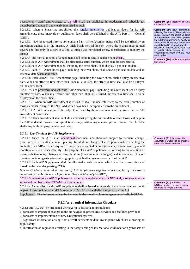
operationally significant changes to an AIP shall be published in predetermined schedule (as
described in Chapter 6) and clearly identified as such.
5.2.1.3.2 When a State has established the regular interval or publication dates for its AIP
Amendments, these intervals or publication dates shall be published in the AIP, Part 1 — General
(GEN).
5.2.1.3.3 New or revised information contained in AIP replacement pages shall be identified by an
annotation against it in the margin. A thick black vertical line or, where the change incorporated
covers one line only or a part of a line, a thick black horizontal arrow, is sufficient to identify the
change.
5.2.1.3.4 The normal method of amendment shall be by means of replacement sheets.
5.2.1.3.5 Each AIP Amendment shall be allocated a serial number, which shall be consecutive.
5.2.1.3.6 Each AIP Amendment page, including the cover sheet, shall display a publication date.
5.2.1.3.7 Each AIP Amendment page, including the cover sheet, shall show a publication date and an
effective date when applicable.
5.2.1.3.8 Each AIRAC AIP Amendment page, including the cover sheet, shall display an effective
date. When an effective time other than 0000 UTC is used, the effective time shall also be displayed
on the cover sheet.
5.2.1.3.9 Each predetermined schedule AIP Amendment page, including the cover sheet, shall display
an effective date. When an effective time other than 0000 UTC is used, the effective time shall also be
displayed on the cover sheet.
5.2.1.3.10 When an AIP Amendment is issued, it shall include references to the serial number of
those elements, if any, of the NOTAM which have been incorporated into the amendment.
5.2.1.3.11 A brief indication of the subjects affected by the amendment shall be given on the AIP
Amendment cover sheet.
5.2.1.3.12 Each amendment shall include a checklist giving the current date of each loose-leaf page in
the AIP, and shall provide a recapitulation of any outstanding manuscript corrections. The checklist
shall carry both the page number and date.
5.2.1.4 Specifications for AIP Supplements
5.2.1.4.1 Since the AIP is an operational document and therefore subject to frequent change,
provisions exist for its continual updating. In addition, changes of a temporary nature affecting the
contents of an AIP are often required to cater for unexpected circumstances or, in some cases, planned
modifications to a service/facility. The purpose of an AIP Supplement is to bring to the attention of
users both temporary changes of long duration (three months or longer) and information of short
duration containing extensive text or graphics which affect one or more parts of the AIP.
5.2.1.4.2 Each AIP Supplement shall be allocated a serial number which shall be consecutive and
based on the calendar year(e.g. 2/13).
Note.— Guidance material on the use of AIP Supplements together with examples of such use is
contained in the Aeronautical Information Services Manual (Doc 8126).
5.2.1.4.3 Whenever an AIP Supplement is issued as a replacement of a NOTAM, a reference to the
series and number of the NOTAM shall be included.
5.2.1.4.4 A checklist of valid AIP Supplements shall be issued at intervals of not more than one month
as part of the checklist of NOTAM required at 5.1.4.2 and with distribution as for the AIP
Supplements. This information is to be included in the monthly plain-lanugage list of valid NOTAM.
5.2.2 Aeronautical Information Circulars
5.2.2.1 An AIC shall be originated whenever it is desirable to promulgate:
1) forecasts of important changes in the air navigation procedures, services and facilities provided;
2) forecasts of implementation of new navigational systems;
3) significant information arising from aircraft accident/incident investigation which has a bearing on
flight safety;
4) information on regulations relating to the safeguarding of international civil aviation against acts of
Comment [88]: insert 'the information contained in the'
Comment [89]: [8126] contains the following Statement: "The established regular intervals or publication dates for AIP Amendments should not prevent the AIS from publishing an additional amendment. However, this should be strictly limited to cases of urgent necessity." This should be taken out from 8126, it is unclear and it encourage deviations from the regular amdt cycles.
Comment [90]: replace with 'loose leaf pages'
Comment [91]: Question this assumption: what does ‘operational’ mean – is there a definition?
Comment [92]: Problem: The NOTAM has been replaced and is therefore no longer effective?
unlawful interference;
5) advice on medical matters of special interest to pilots;
6) warnings to pilots concerning the avoidance of physical hazards;
7) effect of certain weather phenomena on aircraft operations;
8) information on new hazards affecting aircraft handling techniques;
9) regulations relating to the carriage of restricted articles by air;
10) reference to the requirements of, and publication of changes in, national legislation;
11) aircrew licensing arrangements;
12) training of aviation personnel;
13) application of, or exemption from, requirements in national legislation;
14) advice on the use and maintenance of specific types of equipment;
15) actual or planned availability of new or revised editions of aeronautical charts;
16) carriage of communication equipment;
17) explanatory information relating to noise abatement;
18) selected airworthiness directives;
19) changes in NOTAM series or distribution, new editions of AIP or major changes in their contents,
coverage or format;
20) advance information on the snow plan (see 7.1.1.2);
21) other information of a similar nature.
Note.— The publication of an AIC does not remove the obligations set forth in Chapters 4 and 5.
Note.— An AIC shall not be used for information that qualifies for inclusion in AIP or NOTAM.
5.2.2.2 The snow plan published under AD 1.2.2 of the AIP shall be supplemented by seasonal
information, to be issued well in advance of the beginning of each winter — not less than one month
before the normal onset of winter conditions and shall contain information such as that listed below:
a) a list of aerodromes/heliports where snow clearance is expected to be performed during the coming
winter:
*21) in accordance with the runway and taxiway systems; or
*2) planned snow clearing, deviating from the runway system (length, width and number of
runways, affected taxiways and aprons or portions thereof);
*b) information concerning any centre designated to coordinate information on the current state of
progress of clearance and on the current state of runways, taxiways and aprons;
c) a division of the aerodromes/heliports into SNOWTAM distribution lists in order to avoid
excessive NOTAM distribution;
*d) an indication, as necessary, of minor changes to the standing snow plan;
*e) a descriptive list of clearance equipment;
*f) a listing of what will be considered as the minimum critical snow bank to be reported at each
aerodrome/heliport at which reporting will commence.
5.2.2.3 The originating State shall select the AIC that are to be given international distribution.
5.2.2.4 States shall give AIC selected for international distribution the same distribution as for the
AIP.
5.2.2.5 Distribution of AIC on a national basis is left to the discretion of the originating State
concerned.
5.1.2.6 Each AIC shall be allocated a serial number which shall be consecutive and based on the
calendar year.
5.2.2.7 Since AIC information is often effective for long periods and requires little amendment, it will
usually be found that AIC can, if necessary, remain outstanding for several years without
inconvenience. A review and re-issue on a yearly basis is however advisable.
5.2.2.8 Further, if AIC are issued in more than one series, each series shall be identified by a letter (A
2/02, B 4/02, etc.).
5.2.2.9 When AIC are distributed in more than one series, each series shall be separately identified by
2 * This information, or any part of it, may be included in the AIP, if so desired.
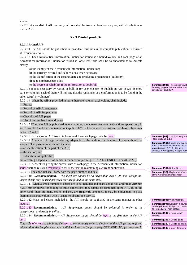
a letter.
5.2.2.10 A checklist of AIC currently in force shall be issued at least once a year, with distribution as
for the AIC.
5.2.3 Printed products
5.2.3.1 Printed AIP
5.2.3.1.1 The AIP should be published in loose-leaf form unless the complete publication is reissued
at frequent intervals.
5.2.3.1.2 Each Aeronautical Information Publication issued as a bound volume and each page of an
Aeronautical Information Publication issued in loose-leaf form shall be so annotated as to indicate
clearly:
a) the identity of the Aeronautical Information Publication;
b) the territory covered and subdivisions when necessary;
c) the identification of the issuing State and producing organization (authority);
d) page numbers/chart titles;
e) the degree of reliability if the information is doubtful.
5.2.3.1.3 If it is necessary by reason of bulk or for convenience, to publish an AIP in two or more
parts or volumes, each of them will indicate that the remainder of the information is to be found in the
other part(s) or volume(s).
5.2.3.1.4 When the AIP is provided in more than one volume, each volume shall include:
— Preface
— Record of AIP Amendments
— Record of AIP Supplements
— Checklist of AIP pages
— List of current hand amendments
5.2.3.1.5 When the AIP is published as one volume, the above-mentioned subsections appear only in
Part 1 — GEN and the annotation “not applicable” shall be entered against each of these subsections
in Parts 2 and 3.
5.2.3.1.6 In the case of AIP issued in loose-leaf form, each page must be dated.
5.2.3.1.7 A system of page numbering adaptable to the addition or deletion of sheets should be
adopted. The page number should include:
— an identification of the part of the AIP;
— the section; and
— subsection, as applicable;
thus creating a separate set of numbers for each subject (e.g. GEN 2.1-3, ENR 4.1-1 or AD 2.2-3).
5.2.3.1.8 A checklist giving the current date of each page in the Aeronautical Information Publication
series shall be reissued frequently to assist the user in maintaining a current publication.
5.2.3.1.9 The checklist shall carry both the page number and date.
5.2.3.1.10 Recommendation.— The sheet size should be no larger than 210 × 297 mm, except that
larger sheets may be used provided they are folded to the same size.
5.2.3.1.11 When a small number of charts are to be included and chart size is not larger than 210 mm
× 297 mm or allows for folding to these dimensions, they should be contained in the AIP. If, on the
other hand, there are many charts and they are frequently amended, it may be convenient to place
them in a separate volume with a separate subscription service.
5.2.3.1.12 Maps and charts included in the AIP should be paginated in the same manner as other
material.
5.2.3.1.13 Recommendation.— AIP Supplement pages should be coloured in order to be
conspicuous, preferably in yellow.
5.2.3.1.14 Recommendation.— AIP Supplement pages should be kept as the first item in the AIP
parts.
Note – As alternate to eliminate the need to continuously refer to the front of the AIP for the required
information, the Supplements may be divided into specific parts (e.g. GEN, ENR, AD) for insertion in
Comment [93]: This is unachievable for every page of the AIP. What is the definition of doubtful?
Comment [94]: This is already stated - See section 5.2.1.3
Comment [95]: I would say that this is the complement of information that was missing in 5.2.1.3. It is here because it only applies to paper AIP
Comment [96]: Delete Series
Comment [97]: Replace with ‘as part of the AIP amendment service'
Comment [98]: What material?
Comment [99]: Establish a new sub-heading (Printed SUP) to be consistent as Printed AIC- next section.
Comment [100]: Replace with 'retained'
Comment [101]: Delete 'parts'
Comment [102]: Delete 'as alternate'
Comment [103]: Insert 'for users'
each AIP part, as necessary.
5.2.3.1.15 Each AIP Supplement page shall show a publication date. Each predetermined schedule
AIP Supplement page shall show a publication date and an effective date.
5.2.3.1.16 AIP Supplement pages shall be kept in the AIP as long as all or some of their contents
remain valid.
5.2.3.2 Printed AIC
5.2.3.2.1 Recommendation.— Differentiation and identification of AIC topics according to subjects
using colour coding should be practised where the numbers of AIC in force are sufficient to make
identification in this form necessary.
5.2.3.2.2 Recommendation.— It is recommended that AIC be colour coded by subject where there
are sufficient circulars in force to warrant such identification, e.g.:
a) white — administrative;
b) yellow — ATC;
c) pink — safety;
d) mauve — danger area map; and
e) green — maps/charts.
5.2.4 Electronic AIP (eAIP)
5.2.4.1 Recommendation.— The AIP, AIP Amendment, AIP Supplement and AIC should also be
published in a format that allows for displaying on a computer screen and printing on paper.
Note 1.— This composite electronic document is named “Electronic AIP” (eAIP) and may be based
on a format that allows for digital data exchange.
Note 2.— Guidance material for the production and provision of the eAIP is contained in Doc8126.
5.2.4.2 When provided, the information content of the eAIP and the structure of chapters, sections and
sub-sections shall follow the content and structure of the paper AIP. The eAIP shall include files that
allow for printing a paper AIP.
5.2.4.3 Recommendation.— When provided, the eAIP should be available on a physical distribution
medium (CD, DVD, etc.) and/or online on the Internet.
Note.— Guidance material on the use of the Internet is contained in Guidelines on the Use of the
Public Internet for Aeronautical Applications (Doc 9855).
5.2.5 NOTAM
5.2.5.1 General specifications
5.2.5.1.1 Except as otherwise provided in 5.1.2.2.3 and 5.1.2.4, each NOTAM shall contain the
information in the order shown in the NOTAM Format in PANS-AIM.
5.2.5.1.2 Text of NOTAM shall be composed of the significations/uniform abbreviated phraseology
assigned to the ICAO NOTAM Code complemented by ICAO abbreviations, indicators, identifiers,
designators, call signs, frequencies, figures and plain language.
Note.— Detailed guidance material covering NOTAM, SNOWTAM, ASHTAM and PIB
production is contained in Doc 8126.
5.2.5.1.3 When NOTAM is selected for international distribution, English text shall be included for
those parts expressed in plain language. All NOTAM shall be published in English language.
Note.— The ICAO NOTAM Code together with significations/uniform abbreviated
phraseology, and ICAO Abbreviations are those contained in the PANS-ABC (Doc 8400).
5.2.5.1..4 If necessary for domestic users, NOTAM may additionally be published in national
language.
5.2.5.1.5 Information concerning snow, slush, ice and standing water on aerodrome/heliport
pavements, when reported by means of a SNOWTAM, shall contain the information in the order
shown in the SNOWTAM Format in PANS-AIM.
5.2.5.1.6 Information concerning an operationally significant change in volcanic activity, a volcanic
eruption and/or volcanic ash cloud shall, when reported by means of an ASHTAM, contain the
Comment [104]: This paragraph needs to be promoted up in the section
Comment [105]: include Chapter?
Comment [106]: As proposed in SN 9/4, following discussions in the Eurocontrol AI-OPS group.
Comment [107]: As proposed in SN9/4.
Comment [108]: include chapter?
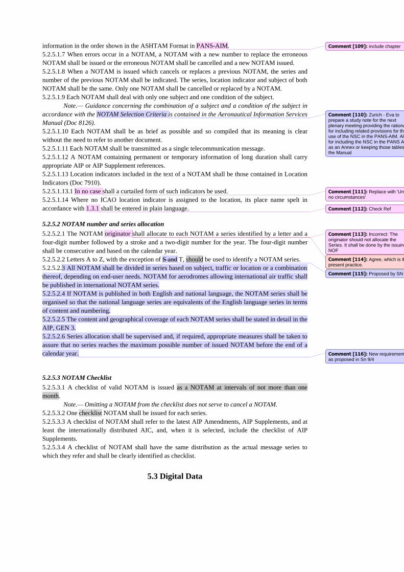
information in the order shown in the ASHTAM Format in PANS-AIM.
5.2.5.1.7 When errors occur in a NOTAM, a NOTAM with a new number to replace the erroneous
NOTAM shall be issued or the erroneous NOTAM shall be cancelled and a new NOTAM issued.
5.2.5.1.8 When a NOTAM is issued which cancels or replaces a previous NOTAM, the series and
number of the previous NOTAM shall be indicated. The series, location indicator and subject of both
NOTAM shall be the same. Only one NOTAM shall be cancelled or replaced by a NOTAM.
5.2.5.1.9 Each NOTAM shall deal with only one subject and one condition of the subject.
Note.— Guidance concerning the combination of a subject and a condition of the subject in
accordance with the NOTAM Selection Criteria is contained in the Aeronautical Information Services
Manual (Doc 8126).
5.2.5.1.10 Each NOTAM shall be as brief as possible and so compiled that its meaning is clear
without the need to refer to another document.
5.2.5.1.11 Each NOTAM shall be transmitted as a single telecommunication message.
5.2.5.1.12 A NOTAM containing permanent or temporary information of long duration shall carry
appropriate AIP or AIP Supplement references.
5.2.5.1.13 Location indicators included in the text of a NOTAM shall be those contained in Location
Indicators (Doc 7910).
5.2.5.1.13.1 In no case shall a curtailed form of such indicators be used.
5.2.5.1.14 Where no ICAO location indicator is assigned to the location, its place name spelt in
accordance with 1.3.1 shall be entered in plain language.
5.2.5.2 NOTAM number and series allocation
5.2.5.2.1 The NOTAM originator shall allocate to each NOTAM a series identified by a letter and a
four-digit number followed by a stroke and a two-digit number for the year. The four-digit number
shall be consecutive and based on the calendar year.
5.2.5.2.2 Letters A to Z, with the exception of S and T, should be used to identify a NOTAM series.
5.2.5.2.3 All NOTAM shall be divided in series based on subject, traffic or location or a combination
thereof, depending on end-user needs. NOTAM for aerodromes allowing international air traffic shall
be published in international NOTAM series.
5.2.5.2.4 If NOTAM is published in both English and national language, the NOTAM series shall be
organised so that the national language series are equivalents of the English language series in terms
of content and numbering.
5.2.5.2.5 The content and geographical coverage of each NOTAM series shall be stated in detail in the
AIP, GEN 3.
5.2.5.2.6 Series allocation shall be supervised and, if required, appropriate measures shall be taken to
assure that no series reaches the maximum possible number of issued NOTAM before the end of a
calendar year.
5.2.5.3 NOTAM Checklist
5.2.5.3.1 A checklist of valid NOTAM is issued as a NOTAM at intervals of not more than one
month.
Note.— Omitting a NOTAM from the checklist does not serve to cancel a NOTAM.
5.2.5.3.2 One checklist NOTAM shall be issued for each series.
5.2.5.3.3 A checklist of NOTAM shall refer to the latest AIP Amendments, AIP Supplements, and at
least the internationally distributed AIC, and, when it is selected, include the checklist of AIP
Supplements.
5.2.5.3.4 A checklist of NOTAM shall have the same distribution as the actual message series to
which they refer and shall be clearly identified as checklist.
5.3 Digital Data
Comment [109]: include chapter
Comment [110]: Zurich - Eva to prepare a study note for the next plenary meeting providing the rationale for including related provisions for the use of the NSC in the PANS-AIM. Also for including the NSC in the PANS AIM as an Annex or keeping those tables in the Manual
Comment [111]: Replace with 'Under no circumstances'
Comment [112]: Check Ref
Comment [113]: Incorrect: The originator should not allocate the Series. It shall be done by the issuing NOF
Comment [114]: Agree, which is the present practice.
Comment [115]: Proposed by SN 9/4
Comment [116]: New requirements, as proposed in Sn 9/4
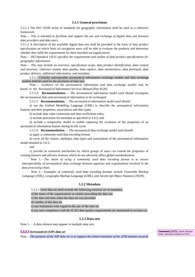
5.3.1 General provisions
5.3.1.1 The ISO 19100 series of standards for geographic information shall be used as a reference
framework.
Note.— This is intended to facilitate and support the use and exchange of digital data sets between
data providers and data users.
5.3.1.2 A description of the available digital data sets shall be provided in the form of data product
specification on which basis air navigation users will be able to evaluate the products and determine
whether they fulfil the requirements for their intended use (application).
Note.— ISO Standard 19131 specifies the requirements and outline of data product specifications for
geographic information.
Note.— This may include an overview, specification scope, data product identification, data content
and structure, reference system, data quality, data capture, data maintenance, data portrayal, data
product delivery, additional information, and metadata.
5.3.1.3 Globally interoperable aeronautical information exchange models and data exchange
models shall be used for the provision of data sets.
Note.— Guidance on the aeronautical information and data exchange models may be
found in the Aeronautical Information Services Manual (Doc 8126).
5.3.1.4 Recommendation.— The aeronautical information model used should encompass
the aeronautical data and aeronautical information to be exchanged.
5.3.1.5 Recommendation.— The aeronautical information model used should:
a) use the Unified Modelling Language (UML) to describe the aeronautical information
features and their properties, associations and data types;
b) include data value constraints and data verification rules;
c) include provisions for metadata as specified in 3.4.2; and
d) include a temporality model to enable capturing the evolution of the properties of an
aeronautical information feature during its life cycle.
5.3.1.6 Recommendation.— The aeronautical data exchange model used should:
a) apply a commonly used data encoding format;
b) cover all the classes, attributes, data types and associations of the aeronautical information
model detailed in 3.6.5;
and
c) provide an extension mechanism by which groups of users can extend the properties of
existing features and add new features which do not adversely affect global standardization.
Note 1.—The intent of using a commonly used data encoding format is to ensure
interoperability of aeronautical data exchange between agencies and organizations involved in the
data processing chain.
Note 2.—Examples of commonly used data encoding formats include Extensible Markup
Language (XML), Geography Markup Language (GML), and JavaScript Object Notation (JSON).
5.3.2 Metadata
5.3.2.1 Each data set shall include the following minimal set of metadata:
a) the name of the organizations or entities providing the data set;
c) the date and time when the data set was provided
d) validity of the data set
e) any limitations with regard to the use of the data set
f) any non-compliance with the ICAO data quality requirements (as mentioned in section xx)
5.3.3 Data sets
Note 1.— A data element may appear in multiple data sets.
5.3.2.1 Aeronautical (AIP) data set
Note. - The purpose of the AIP data set is to support the initial transition of the ATM domain towards
Comment [117]: Check Section order, previous section is 5.3.3.
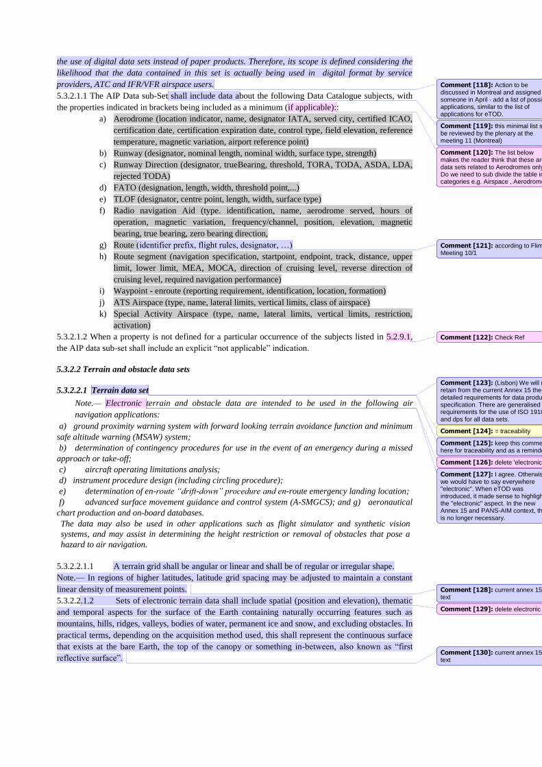
the use of digital data sets instead of paper products. Therefore, its scope is defined considering the
likelihood that the data contained in this set is actually being used in digital format by service
providers, ATC and IFR/VFR airspace users.
5.3.2.1.1 The AIP Data sub-Set shall include data about the following Data Catalogue subjects, with
the properties indicated in brackets being included as a minimum (if applicable)::
a) Aerodrome (location indicator, name, designator IATA, served city, certified ICAO,
certification date, certification expiration date, control type, field elevation, reference
temperature, magnetic variation, airport reference point)
b) Runway (designator, nominal length, nominal width, surface type, strength)
c) Runway Direction (designator, trueBearing, threshold, TORA, TODA, ASDA, LDA,
rejected TODA)
d) FATO (designation, length, width, threshold point,...)
e) TLOF (designator, centre point, length, width, surface type)
f) Radio navigation Aid (type. identification, name, aerodrome served, hours of
operation, magnetic variation, frequency/channel, position, elevation, magnetic
bearing, true bearing, zero bearing direction,
g) Route (identifier prefix, flight rules, designator, …)
h) Route segment (navigation specification, startpoint, endpoint, track, distance, upper
limit, lower limit, MEA, MOCA, direction of cruising level, reverse direction of
cruising level, required navigation performance)
i) Waypoint - enroute (reporting requirement, identification, location, formation)
j) ATS Airspace (type, name, lateral limits, vertical limits, class of airspace)
k) Special Activity Airspace (type, name, lateral limits, vertical limits, restriction,
activation)
5.3.2.1.2 When a property is not defined for a particular occurrence of the subjects listed in 5.2.9.1,
the AIP data sub-set shall include an explicit “not applicable” indication.
5.3.2.2 Terrain and obstacle data sets
5.3.2.2.1 Terrain data set
Note.— Electronic terrain and obstacle data are intended to be used in the following air
navigation applications:
a) ground proximity warning system with forward looking terrain avoidance function and minimum
safe altitude warning (MSAW) system;
b) determination of contingency procedures for use in the event of an emergency during a missed
approach or take-off;
c) aircraft operating limitations analysis;
d) instrument procedure design (including circling procedure);
e) determination of en-route “drift-down” procedure and en-route emergency landing location;
f) advanced surface movement guidance and control system (A-SMGCS); and g) aeronautical
chart production and on-board databases.
The data may also be used in other applications such as flight simulator and synthetic vision
systems, and may assist in determining the height restriction or removal of obstacles that pose a
hazard to air navigation.
5.3.2.2.1.1 A terrain grid shall be angular or linear and shall be of regular or irregular shape.
Note.— In regions of higher latitudes, latitude grid spacing may be adjusted to maintain a constant
linear density of measurement points.
5.3.2.2.1.2 Sets of electronic terrain data shall include spatial (position and elevation), thematic
and temporal aspects for the surface of the Earth containing naturally occurring features such as
mountains, hills, ridges, valleys, bodies of water, permanent ice and snow, and excluding obstacles. In
practical terms, depending on the acquisition method used, this shall represent the continuous surface
that exists at the bare Earth, the top of the canopy or something in-between, also known as “first
reflective surface”.
Comment [118]: Action to be discussed in Montreal and assigned to someone in April - add a list of possible applications, similar to the list of applications for eTOD.
Comment [119]: this minimal list shall be reviewed by the plenary at the meeting 11 (Montreal)
Comment [120]: The list below makes the reader think that these are data sets related to Aerodromes only, Do we need to sub divide the table into categories e.g. Airspace , Aerodrome?
Comment [121]: according to Flimsy Meeting 10/1
Comment [122]: Check Ref
Comment [123]: (Lisbon) We will not retain from the current Annex 15 the detailed requirements for data products specification. There are generalised requirements for the use of ISO 19100 and dps for all data sets.
Comment [124]: = traceability
Comment [125]: keep this comment here for traceability and as a reminder
Comment [126]: delete 'electronic'
Comment [127]: I agree. Otherwise we would have to say everywhere "electronic". When eTOD was introduced, it made sense to highlight the "electronic" aspect. In the new Annex 15 and PANS-AIM context, this is no longer necessary.
Comment [128]: current annex 15 text
Comment [129]: delete electronic
Comment [130]: current annex 15 text
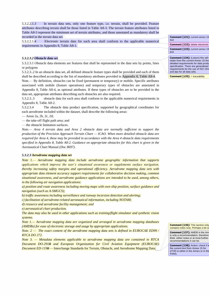
5.3.2.2.1.3 In terrain data sets, only one feature type, i.e. terrain, shall be provided. Feature
attributes describing terrain shall be those listed in Table A8-3. The terrain feature attributes listed in
Table A8-3 represent the minimum set of terrain attributes, and those annotated as mandatory shall be
recorded in the terrain data set.
5.3.2.2.1.4 Electronic terrain data for each area shall conform to the applicable numerical
requirements in Appendix 8, Table A8-1.
5.3.2.3.2 Obstacle data set
5.3.2.3.1 Obstacle data elements are features that shall be represented in the data sets by points, lines
or polygons
5.3.2.3..2 In an obstacle data set, all defined obstacle feature types shall be provided and each of them
shall be described according to the list of mandatory attributes provided in Appendix 8, Table A8-4.
Note.— By definition, obstacles can be fixed (permanent or temporary) or mobile. Specific attributes
associated with mobile (feature operations) and temporary types of obstacles are annotated in
Appendix 8, Table A8-4, as optional attributes. If these types of obstacles are to be provided in the
data set, appropriate attributes describing such obstacles are also required.
5.3.2.3..3 obstacle data for each area shall conform to the applicable numerical requirements in
Appendix 8, Table A8-2.
5.3.2.3.4 The obstacle data product specification, supported by geographical coordinates for
each aerodrome included within the dataset, shall describe the following areas:
— Areas 2a, 2b, 2c, 2d;
— the take-off flight path area; and
— the obstacle limitation surfaces.
Note.— Area 4 terrain data and Area 2 obstacle data are normally sufficient to support the
production of the Precision Approach Terrain Chart — ICAO. When more detailed obstacle data are
required for Area 4, these may be provided in accordance with the Area 4 obstacle data requirements
specified in Appendix 8, Table A8-2. Guidance on appropriate obstacles for this chart is given in the
Aeronautical Chart Manual (Doc 8697).
5.3.2.3 Aerodrome mapping data set
Note 1.— Aerodrome mapping data include aerodrome geographic information that supports
applications which improve the user’s situational awareness or supplements surface navigation,
thereby increasing safety margins and operational efficiency. Aerodrome mapping data sets with
appropriate data element accuracy support requirements for collaborative decision making, common
situational awareness, and aerodrome guidance applications are intended to be used, among others,
in the following air navigation applications:
a) position and route awareness including moving maps with own ship position, surface guidance and
navigation (such as A-SMGCS);
b) traffic awareness including surveillance and runway incursion detection and alerting;
c) facilitation of aerodrome-related aeronautical information, including NOTAM;
d) resource and aerodrome facility management; and
e) aeronautical chart production.
The data may also be used in other applications such as training/flight simulator and synthetic vision
systems.
Note 1.— Aerodrome mapping data are organized and arranged in aerodrome mapping databases
(AMDBs) for ease of electronic storage and usage by appropriate applications.
Note. 2 — The exact content of the aerodrome mapping data sets is defined in EUROCAE ED99 /
RTCA DO 272.
Note 3. — Metadata elements applicable to aerodrome mapping data are contained in RTCA
Document DO-291B and European Organization for Civil Aviation Equipment (EUROCAE)
Document ED-119B — Interchange Standards for Terrain, Obstacle, and Aerodrome Mapping Data.
Comment [131]: current annex 15 text
Comment [132]: delete electronic
Comment [133]: current annex 15 text
Comment [134]: (Lisbon) We will not retain from the current Annex 15 the detailed requirements for data products specification. There are generalised requirements for the use of ISO 19100 and dps for all data sets.
Comment [135]: = traceability
Comment [136]: This section only contains notes now. Perhaps a bit odd
Comment [137]: AMDB in the Annex is only a recommendation, therefore I think. either notes or at most further recommendations it can be.
Comment [138]: Action: check if all the current text from Annex 15 for eTOD is either in the Annex or in the PANS.
5.3.2.4 Instrument flight procedure design data set
Note. - The purpose of the Instrument flight procedure design data set is to...
5.2.13.1The Instrument flight procedure design data set shall include data about the following data
Data Catalogue subjects, with the properties indicated in brackets being included as a minimum (if
applicable):
a) Waypoint - terminal (reporting requirement, identification, location, formation)
b)
5.4.1 Distribution to the next intended user will differ in the delivery method applied which may
either be:
c) Physical distribution. The means by which aeronautical data and aeronautical
information distribution is achieved through the delivery of a physical package, such
as postal services; or
d) Direct electronic distribution. The means by which aeronautical data and
aeronautical information distribution is achieved automatically through the use of a
direct electronic connection between the AIS and the next intended user.
5.4.2 Different delivery methods and data media may require different procedures to ensure the
required data quality.
5.4.3 NOTAM distribution
5.3.1 An aeronautical information service shall arrange, as necessary, to satisfy operational
requirements for the issuance and receipt of NOTAM distributed by telecommunication.
5.3.2 International exchange of NOTAM shall take place only as mutually agreed between the
international NOTAM offices and/or multinational NOTAM Processing Units concerned.
Note.— Arrangements may be made for direct exchange of SNOWTAM (see Appendix X) between
aerodromes/heliports.
5.3.3 The international exchange of ASHTAM (see 5.1.4.1.5), and NOTAM where States continue to
use NOTAM for distribution of information on volcanic activity, shall include volcanic ash advisory
centres and the centres designated by regional air navigation agreement for the operation of AFS
satellite distribution systems (satellite distribution system for information relating to air navigation
(SADIS) and international satellite communications system (ISCS)), and shall take account of the
requirements of long-range operations.
5.3.4 These exchanges of NOTAM between international NOTAM offices and/or multinational
NOTAM Processing Units shall, as far as practicable, cover the needs of operations personnel
including flight crew members be limited to the requirements of the receiving States concerned by
means of separate series providing for at least international and domestic flights.
5.3.5 A predetermined distribution system for NOTAM transmitted on the AFS in accordance with
Appendix X shall be used whenever possible, subject to the requirements of 5.3.3.
Note.— Further guidance on digital dataset distribution can be found in the Document - ICAO SWIM
Concept - Doc xxxx
5.5 Pre-flight information services
5.5.1 Geographic coverage for pre-flight information services should be determined and
periodically reviewed. In general the coverage zone should be limited to the FIR within which the
aerodrome/heliport is located, the FIR(s) adjacent thereto, and all air route or portion of route flown
without an intermediate landing, originating at the aerodrome/heliport and extending beyond the
FIR(s) mentioned.
5.5.2 Pre-flight information may be provided as a verbal briefing or a self-briefing.
5.5.3 A Trigger NOTAM shall be included in the pre-flight information bulletin for its entire validity
Comment [139]: Replace with 'according to the method applied:'
Comment [140]: Replace with 'safeguard' or 'maintain'
Comment [141]: 'Maintain' will be more appropriate.
Comment [142]: Decision Montreal - to remain in the PANS, chapter 2.
Comment [143]: duplicates Annex 15. Maybe apply the same method as in other sections of the PANS - use "is" when requirements are copied, so that there are no orphan statements in the PANS
Comment [144]: Replace with 'The exchange'
Comment [145]: Proposed by SN 9/4
Comment [146]: Proposed by SN 9/4
Comment [147]: Question this Note– The title is ‘distribution’ does it cover Digital NOTAM or NOTAM distribution
Comment [148]: Move this para to later in the chapter – possibly the end.
Comment [149]: This is an opening statement move up to 5.5.1
Comment [150]: Move this para later down section
period if less than fourteen days or for at least fourteen days if its validity is fourteen days or longer.
5.5.4 Although Miscellaneous NOTAM is regarded not subject for a briefing but available on request,
all NOTAM shall be provided for briefing by default and that content reduction should be at user’s
discretion.
5.5.5 Automated pre-flight information systems shall be used to make aeronautical data and
aeronautical information available to operations personnel including flight crew members for self-
briefing, flight planning and flight information service purposes. The aeronautical data and
aeronautical information made available shall comply with the provisions of Annex 15.
5.5.6 Self-briefing facilities of an automated pre-flight information system shall provide access to
operations personnel, including flight crew members and other aeronautical personnel concerned, for
consultation as necessary with the aeronautical information service by telephone or other suitable
telecommunications means. The human/machine interface of such facilities shall ensure easy access in
a guided manner to all relevant information/data.
5.5.7 Automated pre-flight information systems for the supply of aeronautical data and aeronautical
information for self-briefing, flight planning and flight information service shall:
a) provide for continuous and timely updating of the system database and monitoring of the validity
and quality of the aeronautical data stored;
b) permit access to the system by operations personnel including flight crew members, aeronautical
personnel concerned and other aeronautical users through suitable telecommunications means;
c) ensure provision, in paper copy form, of the aeronautical data and aeronautical information
accessed, as required;
d) use access and interrogation procedures based on abbreviated plain language and ICAO location
indicators, as appropriate, or based on a menu-driven user interface or other appropriate mechanism as
agreed between the civil aviation authority and operator concerned; and
e) provide for rapid response to a user request for information.
Note.— ICAO abbreviations and codes and location indicators are given respectively in the
Procedures for Air Navigation Services — ICAO Abbreviations and Codes (PANS-ABC, Doc 8400)
and Location Indicators (Doc 7910).
5.5.8 Recommendation.—Automated pre-flight information systems providing a harmonized,
common point of access by operations personnel, including flight crew members and other
aeronautical personnel concerned, to aeronautical information in accordance with Annex 15 and
meteorological information in accordance with Annex 3 — Meteorological Service for International
Air Navigation, should be established by an agreement between the civil aviation authority or the
agency to which the authority to provide service has been delegated in accordance with 2.1.1 c) and
the relevant meteorological authority.
5.5.9 Where automated pre-flight information systems are used to provide the harmonized,
common point of access by operations personnel, including flight crew members and other
aeronautical personnel concerned, to aeronautical data, aeronautical information and meteorological
information, the civil aviation authority or the agency to which the authority to provide service has
been delegated in accordance with 2.1.1 c) shall remain responsible for the quality and timeliness of
the aeronautical data and aeronautical information provided by means of such a system.
Note.— The meteorological authority concerned remains responsible for the quality of the
meteorological information provided by means of such a system in accordance with Annex 3.
Comment [151]: This is an opening statement should be the second para after 5.5.2
Chapter 6 - Aeronautical information updates
6.1 Aeronautical Information Regulation and Control (AIRAC)
6.1.2 When information has not been submitted by the AIRAC date, a NIL notification shall be
originated and distributed by NOTAM or other suitable means, not later than one cycle before the
AIRAC effective date concerned.
6.1.3 Information provided under the AIRAC system and published in paper copy or made available
on physical media form shall be distributed by the AIS unit at least 42 days in advance of the effective
date.
6.2 Aeronautical Information Product updates
6.2.1 The same update cycle shall be applied to the AIP, the AIP data set and the Instrument Flight
Procedures data set in order to ensure the coherence of the data items that appear in multiple
aeronautical information products.
6.2.2 Specifications for AIP updates
6.2.1.1 The AIP Amendment regular interval shall be specified in the AIP, Part 1 — General (GEN).
Note.— Guidance material on the establishment of intervals between publication dates of AIP
Amendments is contained in the Aeronautical Information Services Manual (Doc 8126).
6.2.1.2 When an AIP Amendment will not be published at the established regular interval or
publication date, a NIL notification shall be originated and distributed by the NOTAM checklist.
6.2.1.3 Recourse to hand amendments or annotations shall be kept to the minimum.
6.2.1.4 When the AIP is provided in more than one volume, each volume should include separate
amendment services.
6.2.2 Specifications for AIP Supplements
6.2.2.1 When an error occurs in an AIP Supplement or when the period of validity of an AIP
Supplement is changed, a new AIP Supplement shall be published as a replacement.
Note 1.— The requirements for NOTAM apply when time constraints do not allow sufficient time for
the distribution of an AIP Supplement.
Note 2.— Guidance material on the use of AIP Supplements together with examples of such use is
contained in the Aeronautical Information Services Manual (Doc 8126).
6.2.3 Specifications for NOTAM
6.2.3.4 Recommendation. - NOTAM should be published with sufficient lead time for the affected
parties to take any required action, except in the case of unserviceability, volcanic activity, release of
radioactive material, toxic chemicals and other events that cannot be foreseen.
6.2.3.5 NOTAM notifying unserviceability of aids to air navigation, facilities or communication
services shall give an estimate of the period of unserviceability or the time at which restoration of
service is expected.
6.2.3.6 Recommendation. At least seven days’ advance notice should be given of the activation of
established danger, restricted or prohibited areas and of activities requiring temporary airspace
restrictions other than for emergency operations.
6.2.3.7 Recommendation.- Notice of any subsequent cancellation of the activities or any reduction of
the hours of activity or the dimensions of the airspace should be given as soon as possible.
Note.— Whenever possible, at least 24 hours’ advance notice is desirable, to permit timely completion
of the notification process and to facilitate airspace utilization planning.
6.2.3.8 Within three months from the issuing of a Permanent NOTAM, the information contained in
the NOTAM shall be included in the Aeronautical Information Products affected.
Comment [152]: This relates to AIP amdts only - we a NIL Notification is not used for AIRAC Supplements
Comment [153]: Move para to 6.1.1
Comment [154]: delete form
Comment [155]: Delete unit
Comment [156]: partial duplication with 6.1.2
Comment [157]: Duplicated number - see above
Comment [158]: Swap this sentence round ‘or an error occurs
6.3.3.8 Within three months from the issuing of a temporary NOTAM of long duration, the
information contained in the NOTAM shall be included in an AIP Supplement.
6.2.3.9 When a NOTAM with estimated end of validity unexpectedly exceeds the three-month period,
a replacement NOTAM shall be issued, unless the condition is expected to last for a further period of
more than three months; in this case an AIP Supplement shall be issued.
6.2.3.10 A “Trigger” NOTAM shall give a brief description of the content, the effective date and time,
and the reference number of the amendment , datasets or supplement.
6.2.3.11 A “Trigger” NOTAM shall come into force on the same effective date and time as the
amendment or supplement.
6.2.3.12 In the case of an AIP Amendment, a “Trigger” NOTAM shall remain valid for a period of
fourteen days.
6.2.3.13 In the case of an AIP Supplement that is valid for less than fourteen days, the “Trigger”
NOTAM shall remain valid for the complete validity period of the AIP Supplement.
6.2.3.14 In the case of an AIP Supplement that is valid for fourteen days or more, the “Trigger”
NOTAM shall remain valid for at least fourteen days.
Note.— Guidance material for the origination of NOTAM announcing the existence of AIRAC AIP
Amendments or AIP Supplements (“Trigger NOTAM”) is contained in the Aeronautical Information
Services Manual (Doc 8126).
6.2.4 Specifications for digital data updates
6.2.1 The update interval for the Aeronautical (AIP) data set and Instrument Flight Procedures data
sets shall be specified in data product specification.
6.2.2 Data sets that have been made available in advance (according to the AIRAC cycle) shall be
updated with the non-AIRAC changes that occurred in between the publication and the effective date.
Comment [159]: (for traceability) Following the comment made by Stephane before SG/10: to avoid that certaing long duration NOTAM remain valid for years.
Comment [160]: insert AIP
Comment [161]: As agreed following SN 10/2, Montreal 2014
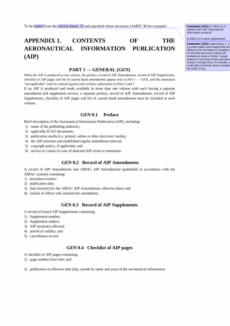
To be copied from the current Annex 15 and amended where necessary (AMDT 38 for example)
APPENDIX 1. CONTENTS OF THE
AERONAUTICAL INFORMATION PUBLICATION
(AIP)
PART 1 — GENERAL (GEN) When the AIP is produced as one volume, the preface, record of AIP Amendments, record of AIP Supplements,
checklist of AIP pages and list of current hand amendments appear only in Part 1 — GEN, and the annotation
“not applicable” must be entered against each of these subsections in Parts 2 and 3.
If an AIP is produced and made available in more than one volume with each having a separate
amendment and supplement service, a separate preface, record of AIP Amendments, record of AIP
Supplements, checklist of AIP pages and list of current hand amendments must be included in each
volume.
GEN 0.1 Preface
Brief description of the Aeronautical Information Publication (AIP), including:
1) name of the publishing authority;
2) applicable ICAO documents;
3) publication media (i.e. printed, online or other electronic media);
4) the AIP structure and established regular amendment interval;
5) copyright policy, if applicable; and
6) service to contact in case of detected AIP errors or omissions.
GEN 0.2 Record of AIP Amendments
A record of AIP Amendments and AIRAC AIP Amendments (published in accordance with the
AIRAC system) containing:
1) amendment number;
2) publication date;
3) date inserted (for the AIRAC AIP Amendments, effective date); and
4) initials of officer who inserted the amendment.
GEN 0.3 Record of AIP Supplements
A record of issued AIP Supplements containing:
1) Supplement number;
2) Supplement subject;
3) AIP section(s) affected;
4) period of validity; and
5) cancellation record.
GEN 0.4 Checklist of AIP pages
A checklist of AIP pages containing:
1) page number/chart title; and
2) publication or effective date (day, month by name and year) of the aeronautical information.
Comment [162]: In GEN 3.1.3 replace IAIP with "aeronautical information products"
In GEN 3.1.5 same replacement
Comment [163]: Appendices 1, 2, 3, 4 contain tables and images that are difficult to be formatted in GooglDocs. As the final document editing will probably be done in Word, I would propose to just keep these apendices empty in Google Docs. Eventually, we could add comments about changes to be made, if any.
GEN 0.5 List of hand amendments to the AIP
A list of current hand amendments to the AIP containing:
1) AIP page(s) affected;
2) amendment text; and
3) AIP Amendment number by which a hand amendment was introduced.
GEN 0.6 Table of contents to Part 1
A list of sections and subsections contained in Part 1 — General (GEN).
Note.— Subsections may be listed alphabetically.
GEN 1. NATIONAL REGULATIONS AND REQUIREMENTS
GEN 1.1 Designated authorities
The addresses of designated authorities concerned with the facilitation of international air navigation
(civil aviation, meteorology, customs, immigration, health, en-route and aerodrome/heliport charges,
agricultural quarantine and aircraft accident investigation) containing, for each authority:
1) designated authority;
2) name of the authority;
3) postal address;
4) telephone number;
5) telefax number;
6) e-mail address;
7) aeronautical fixed service (AFS) address; and
8) website address, if available.
GEN 1.2 Entry, transit and departure of aircraft Regulations and requirements for advance notification and applications for permission concerning
entry, transit and departure of aircraft on international flights.
GEN 1.3 Entry, transit and departure of passengers and crew
Regulations (including customs, immigration and quarantine, and requirements for advance
notification and applications for permission) concerning entry, transit and departure of non-immigrant
passengers and crew.
GEN 1.4 Entry, transit and departure of cargo
Regulations (including customs, and requirements for advance notification and applications for
permission) concerning entry, transit and departure of cargo.
Note.— Provisions for facilitating entry and departure for search, rescue, salvage,
investigation, repair or salvage in connection with lost or damaged aircraft are detailed in section
GEN 3.6, Search and rescue.
GEN 1.5 Aircraft instruments, equipment and flight documents
Brief description of aircraft instruments, equipment and flight documents, including:
1) instruments, equipment (including aircraft communication, navigation and surveillance
equipment) and flight documents to be carried on aircraft, including any special requirement in
addition to the provisions specified in Annex 6, Part I, Chapters 6 and 7; and
2) emergency locator transmitter (ELT), signalling devices and life-saving equipment as presented in
Annex 6, Part I, 6.6 and Part II, 2.4.5, where so determined by regional air navigation meetings, for
flights over designated land areas.
GEN 1.6 Summary of national regulations and international
agreements/conventions
A list of titles and references and, where applicable, summaries of national regulations affecting air
navigation, together with a list of international agreements/conventions ratified by State.
GEN 1.7 Differences from ICAO Standards, Recommended Practices and
Procedures
A list of significant differences between national regulations and practices of the State and related
ICAO provisions, including:
1) provision affected (Annex and edition number, paragraph); and
2) difference in full text.
All significant differences must be listed under this subsection. All Annexes must be listed in
numerical order even if there is no difference to an Annex, in which case a NIL notification must be
provided. National differences or the degree of non- application of the regional supplementary
procedures (SUPPs) must be notified immediately following the Annex to which the supplementary
procedure relates.
GEN 2. TABLES AND CODES
GEN 2.1 Measuring system, aircraft markings, holidays
GEN 2.1.1 Units of measurement
Description of units of measurement used including table of units of measurement.
GEN 2.1.2 Temporal reference system
Description of the temporal reference system (calendar and time system) employed, together with an
indication of whether or not daylight saving hours are employed and how the temporal reference
system is presented throughout the AIP.
GEN 2.1.3 Horizontal reference system
Brief description of the horizontal (geodetic) reference system used, including:
1) name/designation of the reference system;
2) identification and parameters of the projection;
3) identification of the ellipsoid used;
4) identification of the datum used;
5) area(s) of application; and
6) an explanation, if applicable, of the asterisk used to identify those coordinates that do not meet
Annex 11 and 14 accuracy requirements.
GEN 2.1.4 Vertical reference system
Brief description of the vertical reference system used, including:
1) name/designation of the reference system;
2) description of the geoid model used including the parameters required for height transformation
between the model used and EGM-96; and
3) an explanation, if applicable, of the asterisk used to identify those elevations/geoid undulations
Comment [164]: In line with new CH5 replace 'asterisk' with 'annotation'
Comment [165]: In line with new CH5 replace 'asterisk' with 'annotation'
that do not meet Annex 14 accuracy requirements.
GEN 2.1.5 Aircraft nationality and registration marks
Indication of aircraft nationality and registration marks adopted by the State.
GEN 2.1.6 Public holidays
A list of public holidays with indication of services being affected.
GEN 2.2 Abbreviations used in AIS publications
A list of alphabetically arranged abbreviations and their respective significations used by the State in
its AIP and in the distribution of aeronautical data and aeronautical information with appropriate
annotation for those national abbreviations that are different from those contained in the Procedures
for Air Navigation Services — ICAO Abbreviations and Codes (PANS-ABC, Doc 8400).
Note.— A list of alphabetically arranged definitions/glossary of terms may also be added.
GEN 2.3 Chart symbols
A list of chart symbols arranged according to the chart series where symbols are applied.
GEN 2.4 Location indicators
A list of alphabetically arranged location indicators assigned to the locations of aeronautical fixed
stations to be used for encoding and decoding purposes. An annotation to locations not connected to
the aeronautical fixed service (AFS) must be provided.
GEN 2.5 List of radio navigation aids
A list of radio navigation aids arranged alphabetically, containing:
1) identifier;
2) name of the station;
3) type of facility/aid; and
4) indication whether aid serves en-route (E), aerodrome (A) or dual (AE) purposes.
GEN 2.6 Conversion of units of measurement
Tables for conversion or, alternatively, conversion formulae between:
1) nautical miles and kilometres and vice versa;
2) feet and metres and vice versa;
3) decimal minutes of arc and seconds of arc and vice versa; and
4) other conversions as appropriate.
GEN 2.7 Sunrise/sunset
Information on the time of sunrise and sunset including a brief description of criteria used for
determination of the times given and either a simple formulae or table from which times may be
calculated for any location within its territory/area of responsibility, or an alphabetical list of locations
for which the times are given in a table with a reference to the related page in the table and the
sunrise/sunset tables for the selected stations/locations, including:
1) station name;
2) ICAO location indicator;
3) geographical coordinates in degrees and minutes;
4) date(s) for which times are given;
5) time for the beginning of morning civil twilight;
6) time for sunrise;
7) time for sunset; and
8) time for the end of evening civil twilight.
GEN 3. SERVICES
GEN 3.1 Aeronautical information services
GEN 3.1.1 Responsible service
Description of the Aeronautical Information Service (AIS) provided and its major components,
including:
1) service/unit name;
2) postal address;
3) telephone number;
4) telefax number;
5) e-mail address;
6) AFS address;
7) website address, if available;
8) a statement concerning the ICAO documents on which the service is based and a reference to the
AIP location where differences, if any, are listed; and
9) an indication if service is not H24.
GEN 3.1.2 Area of responsibility
The area of responsibility for the aeronautical information service.
GEN 3.1.3 Aeronautical publications
Description of the elements of the Integrated Aeronautical Information Package, including:
1) AIP and related amendment service;
2) AIP Supplements;
3) AIC;
4) NOTAM and pre-flight information bulletins (PIB);
5) checklists and lists of valid NOTAM; and
6) how they may be obtained.
When an AIC is used to promulgate publication prices, that must be indicated in this section of the
AIP.
GEN 3.1.4 AIRAC system
Brief description of the AIRAC system provided including a table of present and near future AIRAC
dates.
GEN 3.1.5 Pre-flight information service at aerodromes/heliports
A list of aerodromes/heliports at which pre-flight information is routinely available, including an
indication of relevant:
1) elements of the Integrated Aeronautical Information Packages held;
2) maps and charts held; and
3) general area of coverage of such data.
Comment [166]: Should we xchange here also into AI Products?
Comment [167]: Agreed - all references to IAIP should be replaced
GEN 3.1.6 Electronic terrain and obstacle data
Details of how electronic terrain and obstacle data may be obtained, containing:
1) name of the individual, service or organization responsible;
2) street address and e-mail address of the individual, service or organization responsible;
3) telefax number of the individual, service or organization responsible;
4) contact telephone number of the individual, service or organization responsible;
5) hours of service (time period including time zone when contact can be made);
6) online information that can be used to contact the individual, service or organization; and
7) supplemental information, if necessary, on how and when to contact the individual, service or
organization.
GEN 3.2 Aeronautical charts
GEN 3.2.1 Responsible service(s)
Description of service(s) responsible for the production of aeronautical charts, including:
1) service name;
2) postal address;
3) telephone number;
4) telefax number;
5) e-mail address;
6) AFS address;
7) website address, if available;
8) a statement concerning the ICAO documents on which the service is based and a reference to the
AIP location where differences, if any, are listed; and
9) an indication if service is not H24.
GEN 3.2.2 Maintenance of charts
Brief description of how aeronautical charts are revised and amended.
GEN 3.2.3 Purchase arrangements
Details of how charts may be obtained, containing:
1) service/sales agency(ies);
2) postal address;
3) telephone number;
4) telefax number;
5) e-mail address;
6) AFS address; and
7) website address, if available.
GEN 3.2.4 Aeronautical chart series available
A list of aeronautical chart series available followed by a general description of each series and an
indication of the intended use.
GEN 3.2.5 List of aeronautical charts available
A list of aeronautical charts available, including:
1) title of series;
2) scale of series;
3) name and/or number of each chart or each sheet in a series;
4) price per sheet; and
5) date of latest revision.
GEN 3.2.6 Index to the World Aeronautical Chart (WAC) — ICAO 1:1 000
000
An index chart showing coverage and sheet layout for the WAC 1:1 000 000 produced by a State. If
Aeronautical Chart — ICAO 1:500 000 is produced instead of WAC 1:1 000 000, index charts must
be used to indicate coverage and sheet layout for the Aeronautical Chart — ICAO 1:500 000.
GEN 3.2.7 Topographical charts
Details of how topographical charts may be obtained, containing:
1) name of service/agency(ies);
2) postal address;
3) telephone number;
4) telefax number;
5) e-mail address;
6) AFS address; and
7) website address, if available.
GEN 3.2.8 Corrections to charts not contained in the AIP
A list of corrections to aeronautical charts not contained in the AIP, or an indication where such
information can be obtained.
GEN 3.3 Air traffic services
GEN 3.3.1 Responsible service
Description of the air traffic service and its major components, including:
1) service name;
2) postal address;
3) telephone number;
4) telefax number;
5) e-mail address;
6) AFS address;
7) website address, if available;
8) a statement concerning the ICAO documents on which the service is based and a reference to the
AIP location where differences, if any, are listed; and
9) an indication if service is not H24.
GEN 3.3.2 Area of responsibility
Brief description of area of responsibility for which air traffic services are provided.
GEN 3.3.3 Types of services
Brief description of main types of air traffic services provided.
GEN 3.3.4 Coordination between the operator and ATS
General conditions under which coordination between the operator and air traffic services is effected.
GEN 3.3.5 Minimum flight altitude
The criteria used to determine minimum flight altitudes.
GEN 3.3.6 ATS units address list
A list of ATS units and their addresses arranged alphabetically, containing:
1) unit name;
2) postal address;
3) telephone number;
4) telefax number;
5) e-mail address;
6) AFS address; and
7) website address, if available.
GEN 3.4 Communication services
GEN 3.4.1 Responsible service
Description of the service responsible for the provision of telecommunication and navigation
facilities, including:
1) service name;
2) postal address;
3) telephone number;
4) telefax number;
5) e-mail address;
6) AFS address;
7) website address, if available;
8) a statement concerning the ICAO documents on which the service is based and a reference to the
AIP location where differences, if any, are listed; and
9) an indication if service is not H24.
GEN 3.4.2 Area of responsibility
Brief description of area of responsibility for which telecommunication service is provided.
GEN 3.4.3 Types of service
Brief description of the main types of service and facilities provided, including:
1) radio navigation services;
2) voice and/or data link services;
3) broadcasting service;
4) language(s) used; and
5) an indication of where detailed information can be obtained.
GEN 3.4.4 Requirements and conditions
Brief description concerning the requirements and conditions under which the communication service
is available.
GEN 3.4.5 Miscellaneous
Any additional information (e.g. selected radio broadcasting stations, telecommunications diagram).
GEN 3.5 Meteorological services
GEN 3.5.1 Responsible service
Brief description of the meteorological service responsible for the provision of meteorological
information, including:
1) service name;
2) postal address;
3) telephone number;
4) telefax number;
5) e-mail address;
6) AFS address;
7) website address, if available;
8) a statement concerning the ICAO documents on which the service is based and a reference to the
AIP location where differences, if any, are listed; and
9) an indication if service is not H24.
GEN 3.5.2 Area of responsibility
Brief description of area and/or air routes for which meteorological service is provided.
GEN 3.5.3 Meteorological observations and reports
Detailed description of the meteorological observations and reports provided for international
air navigation, including:
1) name of the station and the ICAO location indicator;
2) type and frequency of observation including an indication of automatic observing equipment;
3) types of meteorological reports (e.g. METAR) and availability of a trend forecast;
4) specific type of observation system and number of observation sites used to observe and report
surface wind, visibility, runway visual range, cloud base, temperature and, where applicable, wind
shear (e.g. anemometer at intersection of runways, transmissometer next to touchdown zone, etc.);
5) hours of operation; and
6) indication of aeronautical climatological information available.
GEN 3.5.4 Types of services
Brief description of the main types of service provided, including details of briefing, consultation,
display of meteorological information, flight documentation available for operators and flight crew
members, and of the methods and means used for supplying the meteorological information.
GEN 3.5.5 Notification required from operators
Minimum amount of advance notice required by the meteorological authority from operators
in respect of briefing, consultation and flight documentation and other meteorological information
they require or change.
GEN 3.5.6 Aircraft reports
As necessary, requirements of the meteorological authority for the making and transmission of aircraft
reports.
GEN 3.5.7 VOLMET service
Description of VOLMET and/or D-VOLMET service, including:
1) name of transmitting station;
2) call sign or identification and abbreviation for the radio communication emission;
3) frequency or frequencies used for broadcast;
4) broadcasting period;
5) hours of service;
6) list of aerodromes/heliports for which reports and/or forecasts are included; and
7) reports, forecasts and SIGMET information included and remarks.
GEN 3.5.8 SIGMET and AIRMET service
Description of the meteorological watch provided within flight information regions or control areas
for which air traffic services are provided, including a list of the meteorological watch offices with:
1) name of the meteorological watch office, ICAO location indicator;
2) hours of service;
3) flight information region(s) or control area(s) served;
4) SIGMET validity periods;
5) specific procedures applied to SIGMET information (e.g. for volcanic ash and tropical cyclones);
6) procedures applied to AIRMET information (in accordance with relevant regional air navigation
agreements);
7) the air traffic services unit(s) provided with SIGMET and AIRMET information; and
8) additional information (e.g. concerning any limitation of service, etc.).
GEN 3.5.9 Other automated meteorological services
Description of available automated services for the provision of meteorological information (e.g.
automated pre-flight information service accessible by telephone and/or computer modem) including:
1) service name;
2) information available;
3) areas, routes and aerodromes covered; and
4) telephone and telefax number(s), e-mail address, and, if available, website address.
GEN 3.6 Search and rescue
GEN 3.6.1 Responsible service(s)
Brief description of service(s) responsible for the provision of search and rescue (SAR), including:
1) service/unit name;
2) postal address;
3) telephone number;
4) telefax number;
5) e-mail address;
6) AFS address;
7) website address, if available; and
8) a statement concerning the ICAO documents on which the service is based and a reference to the
AIP location where differences, if any, are listed.
GEN 3.6.2 Area of responsibility
Brief description of area of responsibility within which search and rescue services are provided.
Note.— A chart may be included to supplement the description of the area.
GEN 3.6.3 Types of service
Brief description and geographical portrayal, where appropriate, of the type of service and facilities
provided including indications where SAR aerial coverage is dependent upon significant deployment
of aircraft.
GEN 3.6.4 SAR agreements
Brief description of SAR agreements in force, including provisions for facilitating entry and departure
of other States’ aircraft for search, rescue, salvage, repair or salvage in connection with lost or
damaged aircraft, either with airborne notification only or after flight plan notification.
GEN 3.6.5 Conditions of availability
Brief description of provisions for search and rescue, including the general conditions under which the
service and facilities are available for international use, including an indication of whether a facility
available for search and rescue is specialized in SAR techniques and functions, or is specially used for
other purposes but adapted for SAR purposes by training and equipment, or is only occasionally
available and has no particular training or preparation for SAR work.
GEN 3.6.6 Procedures and signals used
Brief description of the procedures and signals employed by rescue aircraft and a table showing the
signals to be used by survivors.
GEN 4. CHARGES FOR AERODROMES/HELIPORTS AND AIR
NAVIGATION SERVICES
Reference may be made to where details of actual charges may be found, if not itemized in this
chapter.
GEN 4.1 Aerodrome/heliport charges
Brief description of type of charges which may be applicable at aerodromes/heliports available for
international use, including:
1) landing of aircraft;
2) parking, hangarage and long-term storage of aircraft;
3) passenger service;
4) security;
5) noise-related items;
6) other (customs, health, immigration, etc.);
7) exemptions/reductions; and
8) methods of payment.
GEN 4.2 Air navigation services charges
Brief description of charges which may be applicable to air navigation services provided for
international use, including:
1) approach control;
2) route air navigation services;
3) cost basis for air navigation services and exemptions/reductions; and
4) methods of payment.
PART 2 — EN-ROUTE (ENR)
If an AIP is produced and made available in more than one volume with each having a separate
amendment and supplement service, a separate preface, record of AIP Amendments, record of AIP
Supplements, checklist of AIP pages and list of current hand amendments must be included in each
volume. In the case of an AIP being published as one volume, the annotation “not applicable” must
be entered against each of the above subsections.
ENR 0.6 Table of contents to Part 2
A list of sections and subsections contained in Part 2 — En-route.
Note.— Subsections may be listed alphabetically.
ENR 1. GENERAL RULES AND PROCEDURES
ENR 1.1 General rules The requirement is for publication of the general rules as applied within the State.
ENR 1.2 Visual flight rules
The requirement is for publication of the visual flight rules as applied within the State.
ENR 1.3 Instrument flight rules
The requirement is for publication of the instrument flight rules as applied within the State.
ENR 1.4 ATS airspace classification and description
ENR 1.4.1 ATS airspace classification
The description of ATS airspace classes in the form of the ATS airspace classification table in Annex
11, Appendix 4, appropriately annotated to indicate those airspace classes not used by the State.
ENR 1.4.2 ATS airspace description
Other ATS airspace descriptions as applicable, including general textual descriptions.
ENR 1.5 Holding, approach and departure procedures
ENR 1.5.1 General
The requirement is for a statement concerning the criteria on which holding, approach and
departure procedures are established. If different from ICAO provisions, the requirement is for
presentation of criteria used in a tabular form.
ENR 1.5.2 Arriving flights
The requirement is to present procedures (conventional or area navigation or both) for arriving flights
which are common to flights into or within the same type of airspace. If different procedures apply
within a terminal airspace, a note to this effect must be given together with a reference to where the
specific procedures can be found.
ENR 1.5.3 Departing flights
The requirement is to present procedures (conventional or area navigation or both) for departing
flights which are common to flights departing from any aerodrome/heliport.
ENR 1.5.4 Other relevant information and procedures
Brief description of additional information, e.g. entry procedures, final approach alignment, holding
procedures and patterns.
ENR 1.6 ATS surveillance services and procedures
ENR 1.6.1 Primary radar
Description of primary radar services and procedures, including:
1) supplementary services;
2) the application of radar control service;
3) radar and air-ground communication failure procedures;
4) voice and CPDLC position reporting requirements; and
5) graphic portrayal of area of radar coverage.
ENR 1.6.2 Secondary surveillance radar (SSR)
Description of secondary surveillance radar (SSR) operating procedures, including:
1) emergency procedures;
2) air-ground communication failure and unlawful interference procedures;
3) the system of SSR code assignment;
4) voice and CPDLC position reporting requirements; and
5) graphic portrayal of area of SSR coverage.
Note.— The SSR description is of particular importance in areas or routes where the possibility of
interception exists.
ENR 1.6.3 Automatic dependent surveillance — broadcast (ADS-B)
Description of automatic dependent surveillance — broadcast (ADS-B) operating procedures,
including:
1) emergency procedures;
2) air-ground communication failure and unlawful interference procedures;
3) aircraft identification requirements;
4) voice and CPDLC position reporting requirements; and
5) graphic portrayal of area of ADS-B coverage.
Note.— The ADS-B description is of particular importance in areas or routes where the possibility of
interception exists.
ENR 1.6.4 Other relevant information and procedures
Brief description of additional information and procedures, e.g. radar failure procedures and
transponder failure procedures.
ENR 1.7 Altimeter setting procedures
The requirement is for a statement of altimeter setting procedures in use, containing:
1) brief introduction with a statement concerning the ICAO documents on which the procedures are
based together with differences to ICAO provisions, if any;
2) basic altimeter setting procedures;
3) description of altimeter setting region(s);
4) procedures applicable to operators (including pilots); and
5) table of cruising levels.
ENR 1.8 Regional supplementary procedures
The requirement is for presentation of regional supplementary procedures (SUPPs) affecting the entire
area of responsibility.
ENR 1.9 Air traffic flow management and airspace management
Brief description of air traffic flow management (ATFM) system and airspace management,
including:
1) ATFM structure, service area, service provided, location of unit(s) and hours of operation;
2) types of flow messages and descriptions of the formats; and
3) procedures applicable for departing flights, containing:
a)service responsible for provision of information on applied ATFM measures;
b) flight plan requirements; and
c) slot allocations.
4) information on overall responsibility regarding airspace management within FIR(s), details of
civil/military airspace allocation and management coordination, structure of manageable airspace
(allocation and changes to allocation) and general operating procedures.
ENR 1.10 Flight planning
The requirement is to indicate any restriction, limitation or advisory information related to the flight
planning stage which may assist the user in the presentation of the intended flight operation,
including:
1) procedures for the submission of a flight plan;
2) repetitive flight plan system; and
3) changes to the submitted flight plan.
ENR 1.11 Addressing of flight plan messages
The requirement is for an indication, in tabular form, of the addresses allocated to flight plans,
showing:
1) category of flight (IFR, VFR or both);
2) route (into or via FIR and/or TMA); and
3) message address.
ENR 1.12 Interception of civil aircraft
The requirement is for a complete statement of interception procedures and visual signals to be used
with a clear indication of whether ICAO provisions are applied and, if not, that differences exist.
Note.— A list of significant differences between national regulations and practices of the State and
related ICAO provisions is found in Gen 1.7.
ENR 1.13 Unlawful interference
The requirement is for presentation of appropriate procedures to be applied in case of unlawful
interference.
ENR 1.14 Air traffic incidents
Description of air traffic incidents reporting system, including:
1) definition of air traffic incidents;
2) use of the “Air Traffic Incident Reporting Form”;
3) reporting procedures (including in-flight procedures); and
4) purpose of reporting and handling of the form.
Note.— A copy of the “Air Traffic Incident Report Form” (PANS ATM, Doc 4444, Appendix 4)
may be included for reference.
ENR 2. AIR TRAFFIC SERVICES AIRSPACE
ENR 2.1 FIR, UIR, TMA AND CTA
Detailed description of flight information regions (FIR), upper flight information regions (UIR), and
control areas (CTA) (including specific CTA such as TMA), including: 1) name, geographical coordinates in degrees and minutes of the FIR/UIR lateral limits and in
degrees, minutes and seconds of the CTA lateral limits, vertical limits and class of airspace; 2) identification of unit providing the service;
3) call sign of aeronautical station serving the unit and language(s) used, specifying the area and
conditions, when and where to be used, if applicable; 4) frequencies supplemented by indications for specific purposes; and
5) remarks.
Control zones around military air bases not otherwise described in the AIP must be included in this subsection. Where the requirements of Annex 2 concerning flight plans, two-way communications and position reporting apply to all flights in order to eliminate or reduce the need for interceptions and/or where the possibility of interception exists and the maintenance of guard on the VHF emergency channel 121.5 MHz is required, a statement to this effect must be included for the relevant area(s) or portion(s) thereof.
A description of designated areas over which the carriage of an emergency locator transmitter (ELT)
is required and where aircraft shall continuously guard the VHF emergency frequency 121.5 MHz,
except for those periods when aircraft are carrying out communications on other VHF channels or
when airborne equipment limitations or cockpit duties do not permit simultaneous guarding of two
channels.
Note.— Other types of airspace around civil aerodromes/heliports such as control zones and
aerodrome traffic zones are described in the relevant aerodrome or heliport section.
ENR 2.2 Other regulated airspace
Where established, a detailed description of other types of regulated airspace and airspace
classification.
ENR 3. ATS ROUTES
Note 1.— Bearings, tracks and radials are normally magnetic. In areas of high latitude, where
it is determined by the appropriate authority that reference to Magnetic North is impractical,
another suitable reference, i.e. True North or Grid North, may be used.
Note 2.— Changeover points established at the midpoint between two radio navigation aids, or
at the intersection of the two radials in the case of a route which changes direction between the
navigation aids, need not be shown for each route segment if a general statement regarding their
existence is made.
ENR 3.1 Lower ATS routes
Detailed description of lower ATS routes, including:
1) route designator, designation of the navigation specification(s) applicable to a specified
segment(s), names, coded designators or name-codes and the geographical coordinates in degrees,
minutes and seconds of all significant points defining the route including “compulsory” or “on-
request” reporting points;
2) tracks or VOR radials to the nearest degree, geodesic distance to the nearest tenth of a kilometre
or tenth of a nautical mile between each successive designated significant point and, in the case of
VOR radials, changeover points;
3) upper and lower limits or minimum en-route altitudes, to the nearest higher 50 m or 100 ft, and
airspace classification;
4) lateral limits and minimum obstacle clearance altitudes;
5) direction of cruising levels;
6) the navigation accuracy requirement for each PBN (RNAV or RNP) route segment; and
7) remarks, including an indication of the controlling unit, its operating channel and, if applicable,
its logon address, and any navigation specification(s) limitations.
Note.— In relation to Annex 11, Appendix 1, and for flight planning purposes, the defined
navigation specification is not considered to be an integral part of the route designator.
ENR 3.2 Upper ATS routes
Detailed description of upper ATS routes, including:
1) route designator, designation of the navigation specification(s) applicable to a specified
segment(s), names, coded designators or name-codes and the geographical coordinates in degrees,
minutes and seconds of all significant points defining the route including “compulsory” or “on-
request” reporting points;
2) tracks or VOR radials to the nearest degree, geodesic distance to the nearest tenth of a kilometre
or tenth of a nautical mile between each successive designated significant point and, in the case of
VOR radials, changeover points;
3) upper and lower limits and airspace classification;
4) lateral limits;
5) direction of cruising levels;
6) the navigation accuracy requirement for each PBN (RNAV or RNP) route segment; and
7) remarks, including an indication of the controlling unit, its operating channel and, if applicable,
its logon address, and any navigation specification(s) limitations.
Note.— In relation to Annex 11, Appendix 1, and for flight planning purposes, defined
navigation specification is not considered to be an integral part of the route designator.
ENR 3.3 Area navigation routes
Detailed description of area navigation (RNAV) routes, including:
1) route designator, designation of the navigation specification(s) applicable to a specified
segment(s), names, coded designators or name-codes and the geographical coordinates in degrees,
minutes and seconds of all significant points defining the route including “compulsory” or “on-
request” reporting points;
2) in respect of waypoints defining an area navigation route, additionally as applicable:
a) station identification of the reference VOR/DME;
b) bearing to the nearest degree and the distance to the nearest tenth of a kilometre or tenth of a
nautical mile from the reference VOR/DME, if the waypoint is not collocated with it; and
c) elevation of the transmitting antenna of DME to the nearest 30 m (100 ft);
3) geodesic distance to the nearest tenth of a kilometre or tenth of a nautical mile between defined
end-points and distance between each successive designated significant point;
4) upper and lower limits and airspace classification;
5) direction of cruising levels;
6) the navigation accuracy requirement for each PBN (RNAV or RNP) route segment; and
7) remarks, including an indication of the controlling unit, its operating channel and, if applicable,
its logon address, and any navigation specification(s) limitations.
Note.— In relation to Annex 11, Appendix 1, and for flight planning purposes, defined
navigation specification is not considered to be an integral part of the route designator.
ENR 3.4 Helicopter routes
Detailed description of helicopter routes, including:
1) route designator, designation of the navigation specification(s) applicable to a specified
segment(s), names, coded designators or name-codes and the geographical coordinates in degrees,
minutes and seconds of all significant points defining the route including “compulsory” or “on-
request” reporting points;
2) tracks or VOR radials to the nearest degree, geodesic distance to the nearest tenth of a kilometre
or tenth of a nautical mile between each successive designated significant point and, in the case of
VOR radials, changeover points;
3) upper and lower limits and airspace classification;
4) minimum flight altitudes to the nearest higher 50 m or 100 ft;
5) the navigation accuracy requirement for each PBN (RNAV or RNP) route segment; and
6) remarks, including an indication of the controlling unit and its operating frequency, and any
navigation specification(s) limitations.
Note.— In relation to Annex 11, Appendix 1, and for flight planning purposes, defined
navigation specification is not considered to be an integral part of the route designator.
ENR 3.5 Other routes
The requirement is to describe other specifically designated routes which are compulsory within
specified area(s).
Note.— Arrival, transit and departure routes which are specified in connection with procedures
for traffic to and from aerodromes/heliports need not be described since they are described in the
relevant section of Part 3 — Aerodromes.
ENR 3.6 En-route holding
The requirement is for a detailed description of en-route holding procedures, containing:
1) holding identification (if any) and holding fix (navigation aid) or waypoint with geographical
Comment [168]: Changed - See Amdt 38, inclusion of "magnetic bearing to the nearest degree"
coordinates in degrees, minutes and seconds;
2) inbound track;
3) direction of the procedure turn;
4) maximum indicated airspeed;
5) minimum and maximum holding level;
6) time/distance outbound; and
7) indication of the controlling unit and its operating frequency.
Note.— Obstacle clearance criteria related to holding procedures are contained in
Procedures for Air Navigation Services — Aircraft Operations (PANS-OPS, Doc 8168), Volumes I
and II.
ENR 4. RADIO NAVIGATION AIDS/SYSTEMS
ENR 4.1 Radio navigation aids — en-route
A list of stations providing radio navigation services established for en-route purposes and arranged
alphabetically by name of the station, including:
1) name of the station and magnetic variation to the nearest degree and for VOR, station declination
to the nearest degree used for technical line-up of the aid;
2) identification;
3) frequency/channel for each element;
4) hours of operation;
5) geographical coordinates in degrees, minutes and seconds of the position of the transmitting
antenna;
6) elevation of the transmitting antenna of DME to the nearest 30 m (100 ft); and
7) remarks.
If the operating authority of the facility is other than the designated governmental agency, the name
of the operating authority must be indicated in the remarks column. Facility coverage must be
indicated in the remarks column.
ENR 4.2 Special navigation systems
Description of stations associated with special navigation systems (DECCA, LORAN, etc.), including:
1) name of station or chain;
2) type of service available (master signal, slave signal, colour);
3) frequency (channel number, basic pulse rate, recurrence rate, as applicable);

4) hours of operation;
5) geographical coordinates in degrees, minutes and seconds of the position of the transmitting
station; and
6) remarks.
If the operating authority of the facility is other than the designated governmental agency, the name
of the operating authority must be indicated in the remarks column. Facility coverage must be
indicated in the remarks column.
ENR 4.3 Global navigation satellite system (GNSS)
A list and description of elements of the global navigation satellite system (GNSS) providing
the navigation service established for en-route purposes and arranged alphabetically by name of the
element, including:
1) the name of the GNSS element (GPS, GLONASS, EGNOS, MSAS, WAAS, etc.);
2) frequency(ies), as appropriate;
3) geographical coordinates in degrees, minutes and seconds of the nominal service area and
coverage area; and
4) remarks.
If the operating authority of the facility is other than the designated governmental agency, the name
of the operating authority must be indicated in the remarks column.
ENR 4.4 Name-code designators for significant points
An alphabetically arranged list of name-code designators (five-letter pronounceable “name-code”)
established for significant points at positions not marked by the site of radio navigation aids,
including:
1) name-code designator;
2) geographical coordinates in degrees, minutes and seconds of the position;
3) reference to ATS or other routes where the point is located; and
4) remarks, including supplementary definition of positions where required.
ENR 4.5 Aeronautical ground lights — en-route
A list of aeronautical ground lights and other light beacons designating geographical positions which
are selected by the State as being significant, including:
1) name of the city or town or other identification of the beacon;
2) type of beacon and intensity of the light in thousands of candelas;
3) characteristics of the signal;
4) operational hours; and
5) remarks.
ENR 5. NAVIGATION WARNINGS
ENR 5.1 Prohibited, restricted and danger areas
Description, supplemented by graphic portrayal where appropriate, of prohibited, restricted and
danger areas together with information regarding their establishment and activation, including:
1) identification, name and geographical coordinates of the lateral limits in degrees, minutes and
seconds if inside and in degrees and minutes if outside control area/control zone boundaries;
2) upper and lower limits; and
3) remarks, including time of activity.
Type of restriction or nature of hazard and risk of interception in the event of penetration must be
indicated in the remarks column.
ENR 5.2 Military exercise and training areas and air defence identification zone (ADIZ)
Description, supplemented by graphic portrayal where appropriate, of established military
training areas and military exercises taking place at regular intervals, and established air defence
identification zone (ADIZ), including: 1) geographical coordinates of the lateral limits in degrees, minutes and seconds if inside and in
degrees and minutes if outside control area/control zone boundaries; 2) upper and lower limits and system and means of activation announcements together with
information pertinent to civil flights and applicable ADIZ procedures; and 3) remarks, including time of activity and risk of interception in the event of penetration of ADIZ.
ENR 5.3 Other activities of a dangerous nature and other potential hazards
ENR 5.3.1 Other activities of a dangerous nature
Description, supplemented by charts where appropriate, of activities that constitute a specific or
obvious danger to aircraft operation and could affect flights including:
1) geographical coordinates in degrees and minutes of centre of area and range of influence;
2) vertical limits;
3) advisory measures;
4) authority responsible for the provision of information; and
5) remarks, including time of activity.
ENR 5.3.2 Other potential hazards
Description, supplemented by charts where appropriate, of other potential hazards that could affect
flights (e.g. active volcanoes, nuclear power stations, etc.) including: 1) geographical coordinates in degrees and minutes of location of potential hazard;
2) vertical limits;
3) advisory measures;
4) authority responsible for the provision of information; and
5) remarks.
ENR 5.4 Air navigation obstacles
The list of obstacles affecting air navigation in Area 1 (the entire State territory), including:
1) obstacle identification or designation;
2) type of obstacle;
3) obstacle position, represented by geographical coordinates in degrees, minutes and seconds;
4) obstacle elevation and height to the nearest metre or foot;
5) type and colour of obstacle lighting (if any); and
6) if appropriate, an indication that the list of obstacles is available in electronic form, and a
reference to GEN 3.1.6.
Note 1.— An obstacle whose height above the ground is 100 m and higher is considered an
obstacle for Area 1.
Note 2.— Specifications governing the determination and reporting (accuracy of field work and
data integrity) of positions (latitude and longitude) and elevations/heights for obstacles in Area 1 are
given in Annex 11, Appendix 5, Tables 1 and 2, respectively.
ENR 5.5 Aerial sporting and recreational activities
Brief description, supplemented by graphic portrayal where appropriate, of intensive aerial sporting
and recreational activities together with conditions under which they are carried out, including:
1) designation and geographical coordinates of the lateral limits in degrees, minutes and seconds if
inside and in degrees and minutes if outside control area/control zone boundaries;
2) vertical limits;
3) operator/user telephone number; and
4) remarks, including time of activity.
Note.— This paragraph may be subdivided into different sections for each different category of
activity, giving the indicated details in each case.
ENR 5.6 Bird migration and areas with sensitive fauna
Description, supplemented by charts where practicable, of movements of birds associated with
migration, including migration routes and permanent resting areas and areas with sensitive fauna.
ENR 6. EN-ROUTE CHARTS
The requirement is for the En-route Chart — ICAO and index charts to be included in this section.
PART 3 — AERODROMES (AD)
If an AIP is produced and made available in more than one volume with each having a separate
amendment and supplement service, a separate preface, record of AIP Amendments, record of AIP
Supplements, checklist of AIP pages and list of current hand amendments must be included in each
volume. In the case of an AIP being published as one volume, the annotation “not applicable” must
be entered against each of the above subsections.
AD 0.6 Table of contents to Part 3
A list of sections and subsections contained in Part 3 — Aerodromes (AD).
Note.— Subsections may be listed alphabetically.
AD 1. AERODROMES/HELIPORTS — INTRODUCTION
AD 1.1 Aerodrome/heliport availability and conditions of use
AD 1.1.1 General conditions
Brief description of the State’s designated authority responsible for aerodromes and heliports,
including:
1) the general conditions under which aerodromes/heliports and associated facilities are available
for use; and
2) a statement concerning the ICAO documents on which the services are based and a reference to
the AIP location where differences, if any, are listed.
AD 1.1.2 Use of military air bases
Regulations and procedures, if any, concerning civil use of military air bases.
AD 1.1.3 Low visibility procedures (LVP)
The general conditions under which the low visibility procedures applicable to Cat II/III operations at
aerodromes, if any, are applied.
AD 1.1.4 Aerodrome operating minima
Details of aerodrome operating minima applied by the State.
AD 1.1.5 Other information
If applicable, other information of a similar nature.
AD 1.2 Rescue and firefighting services and snow plan
AD 1.2.1 Rescue and firefighting services
Brief description of rules governing the establishment of rescue and firefighting services at
aerodromes and heliports available for public use together with an indication of rescue and
firefighting categories established by a State.
AD 1.2.2 Snow plan
Brief description of general snow plan considerations for aerodromes/heliports available for public
use at which snow conditions are normally liable to occur, including:
1) organization of the winter service;
2) surveillance of movement areas;
3) measuring methods and measurements taken;
4) actions taken to maintain the usability of movement areas;
5) system and means of reporting;
6) the cases of runway closure; and
7) distribution of information about snow conditions.
Note.— Where different snow plan considerations apply at aerodromes/heliports, this
subparagraph may be subdivided accordingly.
AD 1.3 Index to aerodromes and heliports
A list, supplemented by graphic portrayal, of aerodromes and heliports within a State, including:
1) aerodrome/heliport name and ICAO location indicator;
2) type of traffic permitted to use the aerodrome/heliport (international/national, IFR/VFR,
scheduled/non-scheduled, general aviation, military and other); and
3) reference to AIP, Part 3 subsection in which aerodrome/heliport details are presented.
AD 1.4 Grouping of aerodromes/heliports
Brief description of the criteria applied by the State in grouping aerodromes/heliports for
production/distribution/provision of information purposes (e.g. international/national;
primary/secondary; major/other; civil/military; etc.).
AD 1.5 Status of certification of aerodromes
A list of aerodromes in the State, indicating the status of certification, including:
1) aerodrome name and ICAO location indicator;
2) date and, if applicable, validity of certification; and
3) remarks, if any.
AD 2. AERODROMES
Note.— **** is to be replaced by the
relevant ICAO location indicator.
**** AD 2.1 Aerodrome location indicator and name
The requirement is for the ICAO location indicator allocated to the aerodrome and the name of
aerodrome. An ICAO location indicator must be an integral part of the referencing system applicable
to all subsections in section AD 2.
**** AD 2.2 Aerodrome geographical and administrative data
The requirement is for aerodrome geographical and administrative data including:
1) aerodrome reference point (geographical coordinates in degrees, minutes and seconds) and its site;
2) direction and distance of aerodrome reference point from centre of the city or town which the
aerodrome serves;
3) aerodrome elevation to the nearest metre or foot, and reference temperature;
4) where appropriate, geoid undulation at the aerodrome elevation position to the nearest metre or
foot;
5) magnetic variation to the nearest degree, date of information and annual change;
6) name of aerodrome operator, address, telephone and telefax numbers, e-mail address, AFS address
and, if available, website address;
7) types of traffic permitted to use the aerodrome (IFR/VFR); and
8) remarks.
**** AD 2.3 Operational hours
Detailed description of the hours of operation of services at the aerodrome, including:
1) aerodrome operator;
2) customs and immigration;
3) health and sanitation;
Comment [169]: Ref temperatures? (Plural) Roys earlier input high/low?
AIS briefing office;
5) ATS reporting office (ARO);
6) MET briefing office;
7) air traffic service;
8) fuelling;
9) handling;
10) security;
11) de-icing; and
12) remarks.
**** AD 2.4 Handling services and facilities
Detailed description of the handling services and facilities available at the aerodrome, including:
1) cargo-handling facilities;
2) fuel and oil types;
3) fuelling facilities and capacity;
4) de-icing facilities;
5) hangar space for visiting aircraft;
6) repair facilities for visiting aircraft; and
7) remarks.
**** AD 2.5 Passenger facilities
Passenger facilities available at the aerodrome, provided as a brief description or a reference to other
information sources such as a website including:
1) hotel(s) at or in the vicinity of aerodrome;
2) restaurant(s) at or in the vicinity of aerodrome;
3) transportation possibilities;
4) medical facilities;
5) bank and post office at or in the vicinity of aerodrome;
6) tourist office; and
7) remarks.
**** AD 2.6 Rescue and firefighting services
Detailed description of the rescue and firefighting services and equipment available at the aerodrome,
including:
1) aerodrome category for fire fighting;
2) rescue equipment;
3) capability for removal of disabled aircraft; and
4) remarks.
**** AD 2.7 Seasonal availability — clearing
Detailed description of the equipment and operational priorities established for the clearance of
aerodrome movement areas, including:
1) type(s) of clearing equipment;
2) clearance priorities; and
3) remarks.
**** AD 2.8 Aprons, taxiways and check locations/positions data
Details related to the physical characteristics of aprons, taxiways and locations/positions of designated
checkpoints, including:
1) designation, surface and strength of aprons;
2) designation, width, surface and strength of taxiways;
3) location and elevation to the nearest metre or foot of altimeter checkpoints;
4) location of VOR checkpoints;
5) position of INS checkpoints in degrees, minutes, seconds and hundredths of seconds; and
6) remarks.
If check locations/positions are presented on an aerodrome chart, a note to that effect must be
provided under this subsection.
**** AD 2.9 Surface movement guidance and control system and markings
Brief description of the surface movement guidance and control system and runway and taxiway
markings, including:
1) use of aircraft stand identification signs, taxiway guide lines and visual docking/parking guidance
system at aircraft stands;
2) runway and taxiway markings and lights;
3) stop bars (if any); and
4) remarks.
**** AD 2.10 Aerodrome obstacles
Detailed description of obstacles, including:
1) obstacles in Area 2:
a) obstacle identification or designation;
b) type of obstacle;
c) obstacle position, represented by geographical coordinates in degrees, minutes, seconds and tenths
of seconds;
d) obstacle elevation and height to the nearest metre or foot;
e) obstacle marking, and type and colour of obstacle lighting (if any);
f) if appropriate, an indication that the list of obstacles is available in electronic form, and a reference
to GEN 3.1.6; and
g) NIL indication, if appropriate.
Note 1.— Chapter 10, 10.1.1, provides a description of Area 2 while Appendix 8, Figure A8-
2, contains graphical illustrations of obstacle data collection surfaces and criteria used to identify
obstacles in Area 2.
Note 2.— Specifications governing the determination and reporting (accuracy of field work
and data integrity) of positions (latitude and longitude) and elevations for obstacles in Area 2 are
given in Annex 11, Appendix 5, Tables 1 and 2, and in Annex 14, Volume I, Appendix 5, Tables A5-1
and A5-2, respectively.
2) the absence of an Area 2 data set for the aerodrome is to be clearly stated and obstacle data are to
be provided for:
a) obstacles that penetrate the obstacle limitation surfaces;
b) obstacles that penetrate the take-off flight path area obstacle identification surface; and
c) other obstacles assessed as being hazardous to air navigation.
3) indication that information on obstacles in Area 3 is not provided, or if provided:
a) obstacle identification or designation;
b) type of obstacle;
c) obstacle position, represented by geographical coordinates in degrees, minutes, seconds and tenths
of seconds;
d) obstacle elevation and height to the nearest tenth of a metre or tenth of a foot;
e) obstacle marking, and type and colour of obstacle lighting (if any);
f) if appropriate, an indication that the list of obstacles is available in electronic form, and a reference
to GEN 3.1.6; and
g) NIL indication, if appropriate.
Note 1.— Chapter 10, 10.1.1, provides a description of Area 3 while Appendix 8, Figure A8-
3, contains graphical illustrations of obstacle data collection surfaces and criteria used to identify
obstacles in Area 3.
Note 2.— Specifications governing the determination and reporting (accuracy of field work
and data integrity) of positions (latitude and longitude) and elevations for obstacles in Area 3 are
given in Annex 14, Volume I, Appendix 5, Tables A5-1 and A5-2, respectively.
**** AD 2.11 Meteorological information provided
Detailed description of meteorological information provided at the aerodrome and an indication of
which meteorological office is responsible for the service enumerated, including:
1) name of the associated meteorological office;
2) hours of service and, where applicable, the designation of the responsible meteorological office
outside these hours;
Comment [170]: guidelines - one word
Comment [171]: conflicts with AD 2.14 and AD 2.15. Remove reference to lighting to avoid duplication and promote consistency. See further comments below.
Comment [172]: Stop Bars are Lgts - conflicts with AD 2.14/AD 2.15 Recommend move text to AD 2.14 or AD 2.15 (LGT) ? Inconsistency in the way States publish Stop Bars, with several States using 2.9, 2.14. 215. or inserting sentence 'refer to AD Chart'
3) office responsible for preparation of TAFs and periods of validity and interval of issuance of the
forecasts;
4) availability of the trend forecasts for the aerodrome, and interval of issuance;
5) information on how briefing and/or consultation is provided;
6) types of flight documentation supplied and language(s) used in flight documentation;
7) charts and other information displayed or available for briefing or consultation;
8) supplementary equipment available for providing information on meteorological conditions, e.g.
weather radar and receiver for satellite images;
9) the air traffic services unit(s) provided with meteorological information; and
10) additional information (e.g. concerning any limitation of service, etc.).
**** AD 2.12 Runway physical characteristics
Detailed description of runway physical characteristics, for each runway, including:
1) designations;
2) true bearings to one-hundredth of a degree;
3) dimensions of runways to the nearest metre or foot;
4) strength of pavement (PCN and associated data) and surface of each runway and associated
stopways;
5) geographical coordinates in degrees, minutes, seconds and hundredths of seconds for each
threshold and runway end and, where appropriate, geoid undulation of:
— thresholds of a non-precision approach runway to the nearest metre or foot; and
— thresholds of a precision approach runway to the nearest tenth of a metre or tenth of a foot;
6) elevations of:
— thresholds of a non-precision approach runway to the nearest metre or foot; and
— thresholds and the highest elevation of the touchdown zone of a precision approach runway to the
nearest tenth of a metre or tenth of a foot;
7) slope of each runway and associated stopways;
8) dimensions of stopway (if any) to the nearest metre or foot;
9) dimensions of clearway (if any) to the nearest metre or foot;
10) dimensions of strips;
11) the existence of an obstacle-free zone; and
12) remarks.
**** AD 2.13 Declared distances
Detailed description of declared distances to the nearest metre or foot for each direction of each
runway, including:
1) runway designator;
2) take-off run available;
3) take-off distance available, and if applicable, alternative reduced declared distances;
4) accelerate-stop distance available;
5) landing distance available; and
6) remarks, including runway entry or start point where alternative reduced declared distances have
been declared.
If a runway direction cannot be used for take-off or landing, or both, because it is operationally
forbidden, then this must be declared and the words “not usable” or the abbreviation “NU” entered
(Annex 14, Volume I, Attachment A, Section 3).
**** AD 2.14 Approach and runway lighting
Detailed description of approach and runway lighting, including:
1) runway designator;
2) type, length and intensity of approach lighting system;
3) runway threshold lights, colour and wing bars;
4) type of visual approach slope indicator system;
5) length of runway touchdown zone lights;
6) length, spacing, colour and intensity of runway centre line lights;
7) length, spacing, colour and intensity of runway edge lights;
8) colour of runway end lights and wing bars;
9) length and colour of stopway lights; and
10) remarks.
**** AD 2.15 Other lighting, secondary power supply
Description of other lighting and secondary power supply, including:
1) location, characteristics and hours of operation of aerodrome beacon/identification beacon (if any);
2) location and lighting (if any) of anemometer/landing direction indicator;
3) taxiway edge and taxiway centre line lights;
4) secondary power supply including switch-over time; and
5) remarks.
**** AD 2.16 Helicopter landing area
Detailed description of helicopter landing area provided at the aerodrome, including:
1) geographical coordinates in degrees, minutes, seconds and hundredths of seconds and, where
appropriate, geoid undulation of the geometric centre of touchdown and lift-off (TLOF) or of each
threshold of final approach and take-off (FATO) area:
— for non-precision approaches, to the nearest metre or foot; and
— for precision approaches, to the nearest tenth of a metre or tenth of a foot;
2) TLOF and/or FATO area elevation:
— for non-precision approaches, to the nearest metre or foot; and
— for precision approaches, to the nearest tenth of a metre or tenth of a foot;
3) TLOF and FATO area dimensions to the nearest metre or foot, surface type, bearing strength and
marking;
4) true bearings to one-hundredth of a degree of FATO;
5) declared distances available, to the nearest metre or foot;
6) approach and FATO lighting; and
7) remarks.
**** AD 2.17 Air traffic services airspace
Detailed description of air traffic services (ATS) airspace organized at the aerodrome, including:
1) airspace designation and geographical coordinates in degrees, minutes and seconds of the lateral
limits;
2) vertical limits;
3) airspace classification;
4) call sign and language(s) of the ATS unit providing service;
5) transition altitude;
6) hours of applicability; and
7) remarks.
**** AD 2.18 Air traffic services communication facilities
Detailed description of air traffic services communication facilities established at the aerodrome,
including:
1) service designation;
2) call sign;
3) channel(s);
4) logon address, as appropriate;
5) hours of operation; and
6) remarks.
**** AD 2.19 Radio navigation and landing aids
Detailed description of radio navigation and landing aids associated with the instrument approach and
the terminal area
procedures at the aerodrome, including:
1) type of aids, magnetic variation to the nearest degree, as appropriate, and type of supported
operation for ILS/MLS, basic GNSS, SBAS, and GBAS and for VOR/ILS/MLS also station
declination to the nearest degree used for technical line-up
2) identification, if required;
Comment [173]: Related to previous comment AD 2.9. replace text with 'taxiway edge and centreline lights and stop bars (if any);'
3) frequency(ies), channel number(s), service provider, and reference path identifier(s) (RPI), as
appropriate;
4) hours of operation, as appropriate;
5) geographical coordinates in degrees, minutes, seconds and tenths of seconds of the position of the
transmitting antenna, as appropriate;
6) elevation of the transmitting antenna of DME to the nearest 30 m (100 ft) and of DME/P to the
nearest 3 m (10 ft), elevation of GBAS reference point to the nearest metre or foot, and the ellipsoid
height of the point to the nearest metre or foot. For SBAS, the ellipsoid height of the landing threshold
point (LTP) or the fictitious threshold point (FTP) to the nearest metre or foot;
7) service volume radius from the GBAS reference point to the nearest kilometre or nautical mile; and
8) remarks.
When the same aid is used for both en-route and aerodrome purposes, a description must also be
given in section ENR 4. If the ground-based augmentation system (GBAS) serves more than one
aerodrome, description of the aid must be provided under each aerodrome. If the operating authority
of the facility is other than the designated governmental agency, the name of the operating authority
must be indicated in the remarks column. Facility coverage must be indicated in the remarks column.
**** AD 2.20 Local aerodrome regulations
Detailed description of regulations applicable to the use of the aerodrome including the acceptability
of training flights, non radio and microlight aircraft and similar, and to ground manoeuvring and
parking but excluding flight procedures.
**** AD 2.21 Noise abatement procedures
Detailed description of noise abatement procedures established at the aerodrome.
**** AD 2.22 Flight procedures
Detailed description of the conditions and flight procedures, including radar and/or ADS-B
procedures, established on the basis of airspace organization at the aerodrome. When established,
detailed description of the low visibility procedures at the aerodrome, including:
1) runway(s) and associated equipment authorized for use under low visibility procedures;
2) defined meteorological conditions under which initiation, use and termination of low visibility
procedures would be made;
3) description of ground marking/lighting for use under low visibility procedures; and
4) remarks.
**** AD 2.23 Additional information
Additional information at the aerodrome, such as an indication of bird concentrations at the
aerodrome, together with an indication of significant daily movement between resting and feeding
areas, to the extent practicable.
**** AD 2.24 Charts related to an aerodrome
The requirement is for charts related to an aerodrome to be included in the following order:
1) Aerodrome/Heliport Chart — ICAO;
2) Aircraft Parking/Docking Chart — ICAO;
3) Aerodrome Ground Movement Chart — ICAO;
4) Aerodrome Obstacle Chart — ICAO Type A (for each runway);
5) Aerodrome Terrain and Obstacle Chart — ICAO (Electronic);
6) Precision Approach Terrain Chart — ICAO (precision approach Cat II and III runways);
7) Area Chart — ICAO (departure and transit routes);
8) Standard Departure Chart — Instrument — ICAO;
9) Area Chart — ICAO (arrival and transit routes);
10) Standard Arrival Chart — Instrument — ICAO;
11) ATC Surveillance Minimum Altitude Chart — ICAO;
12) Instrument Approach Chart — ICAO (for each runway and procedure type);
13) Visual Approach Chart — ICAO; and
14) bird concentrations in the vicinity of the aerodrome.
If some of the charts are not produced, a statement to this effect must be given in section GEN 3.2,
Aeronautical charts.
Note.— A page pocket may be used in the AIP to include the Aerodrome Terrain and Obstacle
Chart — ICAO (Electronic) on appropriate electronic media.
AD 3. HELIPORTS
When a helicopter landing area is provided at the aerodrome, associated data must be listed only
under **** AD 2.16.
Note.— **** is to be replaced by the relevant ICAO location indicator.
**** AD 3.1 Heliport location indicator and name
The requirement is for the ICAO location indicator assigned to the heliport and the name of
heliport.An ICAO location indicator must be an integral part of the referencing system applicable to
all subsections in section AD 3.
**** AD 3.2 Heliport geographical and administrative data
The requirement is for heliport geographical and administrative data, including:
1) heliport reference point (geographical coordinates in degrees, minutes and seconds) and its site;
2) direction and distance of heliport reference point from centre of the city or town which the heliport
serves;
3) heliport elevation to the nearest metre or foot, and reference temperature;
4) where appropriate, geoid undulation at the heliport elevation position to the nearest metre or foot;
5) magnetic variation to the nearest degree, date of information and annual change;
6) name of heliport operator, address, telephone and telefax numbers, e-mail address, AFS address
and, if available, website address;
7) types of traffic permitted to use the heliport (IFR/VFR); and
8) remarks.
**** AD 3.3 Operational hours
Detailed description of the hours of operation of services at the heliport, including:
1) heliport operator;
2) customs and immigration;
3) health and sanitation;
4) AIS briefing office;
5) ATS reporting office (ARO);
6) MET briefing office;
7) air traffic service;
8) fuelling;
9) handling;
10) security;
11) de-icing; and
12) remarks.
**** AD 3.4 Handling services and facilities
Detailed description of the handling services and facilities available at the heliport, including:
1) cargo-handling facilities;
2) fuel and oil types;
3) fuelling facilities and capacity;
4) de-icing facilities;
5) hangar space for visiting helicopter;
6) repair facilities for visiting helicopter; and
7) remarks.
**** AD 3.5 Passenger facilities
Passenger facilities available at the heliport, provided as a brief description or as a reference to other
information sources such as a website, including:
1) hotel(s) at or in the vicinity of the heliport;
2) restaurant(s) at or in the vicinity of the heliport;
3) transportation possibilities;
4) medical facilities;
5) bank and post office at or in the vicinity of the heliport;

6) tourist office; and
7) remarks.
**** AD 3.6 Rescue and firefighting services
Detailed description of the rescue and firefighting services and equipment available at the heliport,
including:
1) heliport category for fire fighting;
2) rescue equipment;
3) capability for removal of disabled helicopter; and
4) remarks.
**** AD 3.7 Seasonal availability — clearing
Detailed description of the equipment and operational priorities established for the clearance of
heliport movement areas, including:
1) type(s) of clearing equipment;
2) clearance priorities; and
3) remarks.
**** AD 3.8 Aprons, taxiways and check locations/positions data
Details related to the physical characteristics of aprons, taxiways and locations/positions of designated
checkpoints, including:
1) designation, surface and strength of aprons, helicopter stands;
2) designation, width, and surface type of helicopter ground taxiways;
3) width and designation of helicopter air taxiway and air transit route;
4) location and elevation to the nearest metre or foot of altimeter checkpoints;
5) location of VOR checkpoints;
6) position of INS checkpoints in degrees, minutes, seconds and hundredths of seconds; and
7) remarks.
If check locations/positions are presented on a heliport chart, a note to that effect must be provided
under this subsection.
**** AD 3.9 Markings and markers
Brief description of final approach and take-off area and taxiway markings and markers, including:
1) final approach and take-off markings;
2) taxiway markings, air taxiway markers and air transit route markers; and
3) remarks.
**** AD 3.10 Heliport obstacles
Detailed description of obstacles, including:
1) obstacle identification or designation;
2) type of obstacle;
3) obstacle position, represented by geographical coordinates in degrees, minutes, seconds and tenths
of seconds;
4) obstacle elevation and height to the nearest metre or foot;
5) obstacle marking, and type and colour of obstacle lighting (if any);
6) if appropriate, an indication that the list of obstacles is available in electronic form, and a reference
to GEN 3.1.6; and
7) NIL indication, if appropriate.
**** AD 3.11 Meteorological information provided
Detailed description of meteorological information provided at the heliport and an indication of which
meteorological office
is responsible for the service enumerated, including:
1) name of the associated meteorological office;
2) hours of service and, where applicable, the designation of the responsible meteorological office
outside these hours;
3) office responsible for preparation of TAFs, and periods of validity of the forecasts;
4) availability of the trend forecasts for the heliport, and interval of issuance;
5) information on how briefing and/or consultation is provided;
6) type of flight documentation supplied and language(s) used in flight documentation;
7) charts and other information displayed or available for briefing or consultation;
8) supplementary equipment available for providing information on meteorological conditions, e.g.
weather radar and receiver for satellite images;
9) the air traffic services unit(s) provided with meteorological information; and
10) additional information (e.g. concerning any limitation of service, etc.).
**** AD 3.12 Heliport data
Detailed description of heliport dimensions and related information, including:
1) heliport type — surface-level, elevated or helideck;
2) touchdown and lift-off (TLOF) area dimensions to the nearest metre or foot;
3) true bearings to one-hundredth of a degree of final approach and take-off (FATO) area;
4) dimensions to the nearest metre or foot of FATO, and surface type;
5) surface and bearing strength in tonnes (1 000 kg) of TLOF;
6) geographical coordinates in degrees, minutes, seconds and hundredths of seconds and, where
appropriate, geoid
undulation of the geometric centre of TLOF or of each threshold of FATO:
— for non-precision approaches, to the nearest metre or foot; and
— for precision approaches, to the nearest tenth of a metre or tenth of a foot;
7) TLOF and/or FATO slope and elevation:
— for non-precision approaches, to the nearest metre or foot; and
— for precision approaches, to the nearest tenth of a metre or tenth of a foot;
8) dimensions of safety area;
9) dimensions, to the nearest metre or foot, of helicopter clearway;
10) the existence of an obstacle-free sector; and
11) remarks.
**** AD 3.13 Declared distances
Detailed description of declared distances to the nearest metre or foot, where relevant for a heliport,
including:
1) take-off distance available, and if applicable, alternative reduced declared distances;
2) rejected take-off distance available;
3) landing distance available; and
4) remarks, including entry or start point where alternative reduced declared distances have been
declared.
**** AD 3.14 Approach and FATO lighting
Detailed description of approach and FATO lighting, including:
1) type, length and intensity of approach lighting system;
2) type of visual approach slope indicator system;
3) characteristics and location of FATO area lights;
4) characteristics and location of aiming point lights;
5) characteristics and location of TLOF lighting system; and
6) remarks.
**** AD 3.15 Other lighting, secondary power supply
Description of other lighting and secondary power supply, including:
1) location, characteristics and hours of operation of heliport beacon;
2) location and lighting of wind direction indicator (WDI);
3) taxiway edge and taxiway centre line lights;
4) secondary power supply including switch-over time; and
5) remarks.
**** AD 3.16 Air traffic services airspace
Detailed description of air traffic services (ATS) airspace organized at the heliport, including:
1) airspace designation and geographical coordinates in degrees, minutes and seconds of the lateral
limits;
2) vertical limits;
3) airspace classification;
4) call sign and language(s) of ATS unit providing service;
5) transition altitude;
6) hours of applicability; and
7) remarks.
**** AD 3.17 Air traffic services communication facilities
Detailed description of air traffic services communication facilities established at the heliport,
including:
1) service designation;
2) call sign;
3) frequency(ies);
4) hours of operation; and
5) remarks.
**** AD 3.18 Radio navigation and landing aids
Detailed description of radio navigation and landing aids associated with the instrument approach and
the terminal area
procedures at the heliport, including:
1) type of aids, magnetic variation (for VOR, station declination used for technical line-up of the aid)
to the nearest degree, and type of operation for ILS, MLS, basic GNSS, SBAS and GBAS;
2) identification, if required;
3) frequency(ies), as appropriate;
4) hours of operation, as appropriate;
5) geographical coordinates in degrees, minutes, seconds and tenths of seconds of the position of the
transmitting antenna, as appropriate;
6) elevation of the transmitting antenna of DME to the nearest 30 m (100 ft) and of DME/P to the
nearest 3 m (10 ft); and 7) remarks.
When the same aid is used for both en-route and heliport purposes, a description must also be given in
section ENR 4. If the ground-based augmentation system (GBAS) serves more than one heliport,
description of the aid must be provided under each heliport. If the operating authority of the facility is
other than the designated governmental agency, the name of the operating authority must be indicated
in the remarks column. Facility coverage must be indicated in the remarks column.
**** AD 3.19 Local heliport regulations
Detailed description of regulations applicable to the use of the heliport, including the acceptability of
training flights, non radio and microlight aircraft and similar, and to ground manoeuvring and parking
but excluding flight procedures.
**** AD 3.20 Noise abatement procedures
Detailed description of noise abatement procedures established at the heliport.
**** AD 3.21 Flight procedures
Detailed description of the conditions and flight procedures, including radar and/or ADS-B
procedures, established on the basis of airspace organization established at the heliport. When
established, detailed description of the low visibility procedures at the heliport, including:
1) touchdown and lift-off (TLOF) area(s) and associated equipment authorized for use under low
visibility procedures;
2) defined meteorological conditions under which initiation, use and termination of low visibility
procedures would be made;
3) description of ground marking/lighting for use under low visibility procedures; and
4) remarks.
**** AD 3.22 Additional information
Additional information about the heliport, such as an indication of bird concentrations at the heliport
together with an indication of significant daily movement between resting and feeding areas, to the
extent practicable.
**** AD 3.23 Charts related to a heliport
The requirement is for charts related to a heliport to be included in the following order:

1) Aerodrome/Heliport Chart — ICAO;
2) Area Chart — ICAO (departure and transit routes);
3) Standard Departure Chart — Instrument — ICAO;
4) Area Chart — ICAO (arrival and transit routes);
5) Standard Arrival Chart — Instrument — ICAO;
6) ATC Surveillance Minimum Altitude Chart — ICAO;
7) Instrument Approach Chart — ICAO (for each procedure type);
8) Visual Approach Chart — ICAO; and
9) bird concentrations in the vicinity of heliport.
If some of the charts are not produced, a statement to this effect must be given in section GEN 3.2,
Aeronautical charts.
Appendix 2 – SNOWTAM Format
To be copied from the current Annex 15 - Appendix 2
Also to consider the following:
- comment
- further comments here...
Comment [PE174]: Awaiting State Letter FTF
Comment [175]: Appendices 1, 2, 3, 4 contain tables and images that are difficult to be formatted in GooglDocs. As the final document editing will probably be done in Word, I would propose to just keep these apendices empty in Google Docs. Eventually, we could add comments about changes to be made, if any.
Comment [176]: Abbas Niknejad: APP 2-4 SNOWTAM example: filling time is 0645 while the latest observation time is 0700; filling time should be after the latest observation time.
Appendix 3 – ASHTAM Format
To be copied from the current Annex 15 - Appendix 3
Comment [177]: Appendices 1, 2, 3, 4 contain tables and images that are difficult to be formatted in GooglDocs. As the final document editing will probably be done in Word, I would propose to just keep these apendices empty in Google Docs. Eventually, we could add comments about changes to be made, if any.

Appendix 4 – NOTAM Format
To be copied from the current Annex 15 - Appendix 6
-
Changes to be made, based on Study Notes:
“If the subject is not listed in the NOTAM Code (Doc 8400) or in the NOTAM Selection Criteria
(Doc 8126), insert “XX” as the second and third letters (e.g. QXXAK); If subject is “XX”, use “XX”
also for condition.”
Align the text and all examples on prescribed NOTAM format to exclude a ‘blank’ between the date-
time group and the word “EST”.
Comment [178]: Appendices 1, 2, 3, 4 contain tables and images that are difficult to be formatted in GooglDocs. As the final document editing will probably be done in Word, I would propose to just keep these apendices empty in Google Docs. Eventually, we could add comments about changes to be made, if any.
Comment [179]: Based on SN 10/2
Comment [180]: Based on SN 10/2
APPENDIX 5. AERONAUTICAL DATA PUBLICATION
RESOLUTION
Table A5-1. Latitude and longitude
Latitude and longitude Publication
resolution
Chart
resolution
Flight information region boundary point 1 min As plotted
P, R, D area boundary points (outside CTA/CTR boundaries) 1 min As plotted
P, R, D area boundary points (inside CTA/CTR boundaries) 1 sec As plotted
CTA/CTR boundary points 1 sec As plotted
En-route NAVAIDS, intersections and waypoints, and
holding, and STAR/SID points
1 sec 1 sec
Obstacles in Area 1 (the entire State territory) 1 sec As plotted
Aerodrome/heliport reference point 1 sec 1 sec
NAVAIDS located at the aerodrome/heliport 1/10 sec As plotted
Obstacles in Area 3 1/10 sec 1/10 sec
Obstacles in Area 2 (the part within the aerodrome boundary) 1/10 sec 1/10 sec
Final approach fixes/points and other essential fixes/points
comprising the instrument approach procedure
1/10 sec 1 sec
Runway threshold 1/100 sec 1 sec
Runway end (flight path alignment point) 1/100 sec 1 sec
Runway centre line points
Runway holding position 1/100 sec 1 sec
Taxiway centre line/parking guidance line points (Annex 14
Pt1)
1/100 sec 1/100 sec
Ground Taxiway centre line points, air taxiway and transit
route points (Annex 14 Pt2)
1/100 sec
Ground/Taxiway intersection marking line 1/100 sec 1 sec
Ground/Exit guidance line 1/100 sec 1 sec
Aircraft stand points/INS checkpoints 1/100 sec
Geometric centre of TLOF or FATO thresholds, heliports 1/100 sec 1 sec
Apron boundaries (polygon) 1/10 sec 1 sec
De-icing/anti-icing facility (polygon) 1/10 sec 1 sec
Aircraft/Helicopter stand points / INS checkpoints 1/100 sec
Table A5-2. Elevation/altitude/height
Elevation/altitude/height Publication
resolution
Chart
resolution
Aerodrome/heliport elevation 1 m or 1 ft 1 m or 1 ft
WGS-84 geoid undulation at aerodrome/heliport elevation
position
1 m or 1 ft 1 m or 1 ft
Runway or FATO threshold, non-precision approaches 1 m or 1 ft 1 m or 1 ft
WGS-84 geoid undulation at runway or FATO threshold,
TLOF geometric centre, non-precision approaches
1 m or 1 ft 1 m or 1 ft
Runway or FATO threshold, precision approaches 0.1 m or 0.1 ft 0.5 m or 1 ft
WGS-84 geoid undulation at runway or FATO threshold,
TLOF geometric centre, precision approaches
0.1 m or 0.1 ft 0.5 m or 1 ft
Threshold crossing height, (Reference datum height)
precision approaches
0.1 m or 0.1 ft 0.5 m or 1 ft
Obstacle clearance altitude/height As specified
in PANS-OPS
(Doc 8168)
Runway centre line points
Taxiway centre line/parking guidance line points (Annex 14
Pt1)
Ground Taxiway centre line points, air taxiway and transit
route points (Annex 14 Pt2)
Obstacles in Area 2 (the part within the aerodrome boundary) 1 m or 1 ft 1 m or 1 ft
Obstacles in Area 3 0.1 m or 0.1 ft 1 m or 1 ft
Obstacles in Area 1 (the entire State territory) 1 m or 1 ft 3 m (10 ft)
Terrain data Area 1 1m -
Terrain data Area 2 0.1 m -
Terrain data Area 3 0.1 m -
Terrain data Area 4 0.1 m -
Distance measuring equipment/precision (DME/P) 3 m (10 ft)
Distance measuring equipment (DME) elevation 30 m (100 ft) 30 m (100 ft)
Instrument approach procedures altitude As specified
in PANS-OPS
(Doc 8168)
upper and lower altitude limit at a significant point, 50 m or 100 ft 50 m or 100 ft
Table A5-3. Declination and magnetic variation
Declination and magnetic variation Publication
resolution
Chart
resolution
VHF NAVAID station declination used for technical
line-up
1 degree
NDB NAVAID magnetic variation 1 degree
Aerodrome/heliport magnetic variation 1 degree 1 degree
ILS localizer antenna magnetic variation 1 degree
MLS azimuth antenna magnetic variation 1 degree
Table A5-4. Bearing
Bearing Publication
resolution
Chart
resolution
Airway segments 1 degree 1 degree
Bearing used for the formation of an en-route and of
a terminal fix
1/10 degree 1/10 degree
Terminal arrival/departure route segments 1 degree 1 degree
Bearing used for the formation of an instrument
approach procedure fix
1/100 degree 1/10 degree
ILS localizer alignment (True) 1/100 degree 1 degree
MLS zero azimuth alignment (True) 1/100 degree 1 degree
Runway and FATO bearing (True) 1/100 degree 1 degree
true track between each successive significant point; 1/10 degree 1/10 degree
magnetic track between each successive significant
point
1 degree 1 degree
Table A5-5. Gradients and angles
Type of gradient/angle Publication
resolution
Chart
resolution
Non-precision final approach descent gradient 0.1 per cent
Final approach descent angle (Non-precision
approach or approach with vertical guidance)
0.1 degree
Precision approach glide path/elevation angle 0.1 degree
Table A5-6. Length/distance/dimension
Length/distance/dimension Publication
resolution
Chart
resolution
Airway segment length 1/10 km or 1/10 NM 1 km or 1 NM
Distance used for the formation of an en-route fix 1/10 km or 1/10 NM 2/10 km or 1/10 NM
Terminal arrival/departure route segment length 1/100 km or 1/100
NM
1 km or 1 NM
Distance used for the formation of a terminal and
instrument approach procedure fix
1/100 km or 1/100
NM
2/10 km or 1/10 NM
Runway and FATO length, TLOF dimensions 1 m or 1 ft 1 m
Runway width 1 m or 1 ft 1 m
Displaced threshold distance 1 m or 1 ft
Clearway length and width 1 m or 1 ft
Stopway length and width 1 m or 1 ft 1 m
Landing distance available 1 m or 1 ft 1 m
Take-off run available 1 m or 1 ft 1 m
Take-off distance available 1 m or 1 ft 1 m
Rejected Take off distance available
Accelerate-stop distance available 1 m or 1 ft 1 m
Runway shoulder width 1 m or 1 ft
Taxiway width 1 m or 1 ft
Taxiway shoulder width 1 m or 1 ft
ILS localizer antenna-runway end/FATO end,
distance
1 m or 1 ft As plotted
ILS glide slope antenna-threshold, distance along
centre line
1 m or 1 ft As plotted
ILS marker-threshold distance 1 m or 1 ft 2/10 km or 1/10 NM
ILS DME antenna-threshold, distance along centre
line
1 m or 1 ft As plotted
MLS azimuth antenna-runway end/FATO end,
distance
1 m or 1 ft As plotted
MLS elevation antenna-threshold, distance along
centre line
1 m or 1 ft As plotted
MLS DME/P antenna-threshold, distance along
centre line
1 m or 1 ft As plotted