Embed Size (px)
Citation preview
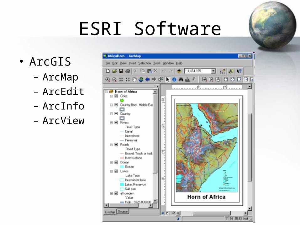
ESRI Software
• ArcGIS– ArcMap– ArcEdit– ArcInfo– ArcView
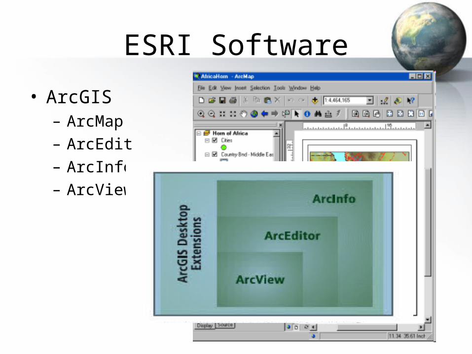
ESRI Software
• ArcGIS– ArcMap– ArcEdit– ArcInfo– ArcView
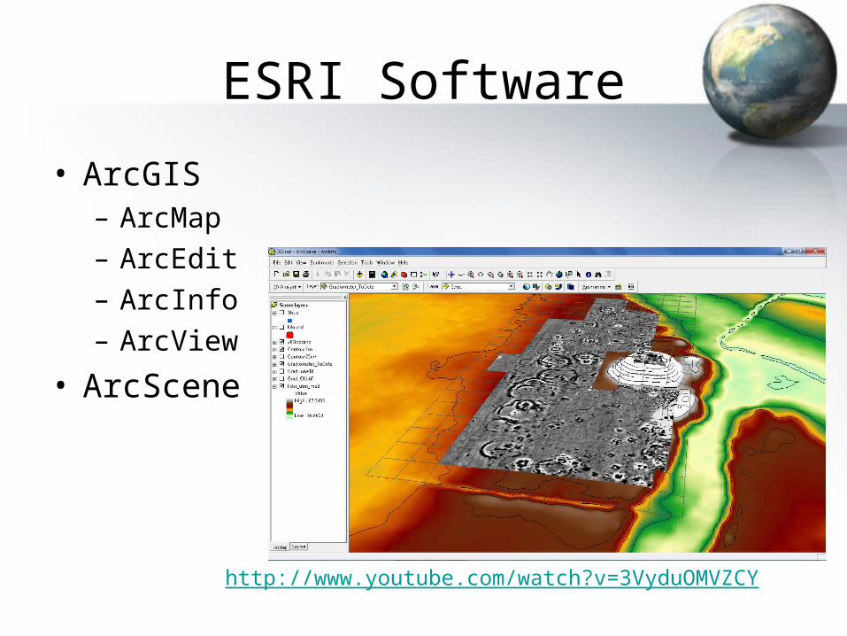
ESRI Software
• ArcGIS– ArcMap– ArcEdit– ArcInfo– ArcView
• ArcScene
http://www.youtube.com/watch?v=3VyduOMVZCY
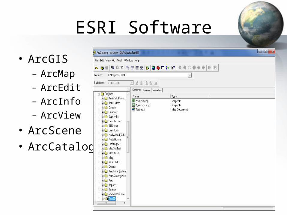
ESRI Software
• ArcGIS– ArcMap– ArcEdit– ArcInfo– ArcView
• ArcScene• ArcCatalog
ESRI Software
• ArcGIS– ArcMap– ArcEdit– ArcInfo– ArcView
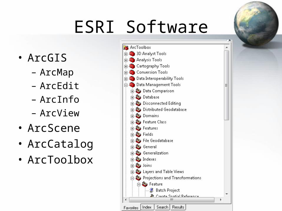
• ArcScene• ArcCatalog• ArcToolbox
ESRI Software
• ArcGIS– ArcMap– ArcEdit– ArcInfo– ArcView
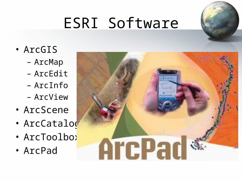
• ArcScene• ArcCatalog• ArcToolbox• ArcPad
Extensions
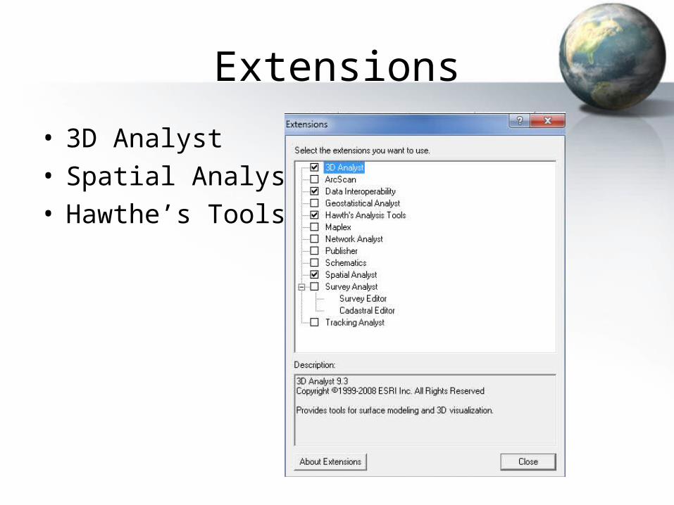
• 3D Analyst• Spatial Analyst• Hawthe’s Tools
GIS, Definition• GIS is a system of hardware and software used for storage,
retrieval, mapping, and analysis of geographic data, which is geographically referenced to a map projection in an earth coordinate system.
• GIS is a special-purpose digital database in which a common spatial coordinate system is the primary means of reference.
• GIS is a facility for preparing, presenting, and interpreting facts that pertain to the surface of the earth.
• GIS is an information system that is designed to work with data referenced by spatial or geographic coordinates.
• GIS is "an organized collection of computer hardware, software, geographic data, and personnel designed to efficiently capture, store, update, manipulate, analyze, and display all forms of geographically referenced information."
• A GIS is a database mixed with a map.
Types of Data
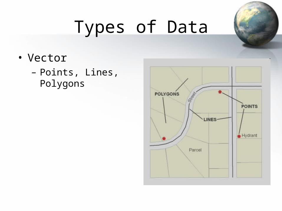
• Vector– Points, Lines, Polygons
Types of Data
• Vector– Points, Lines, Polygons
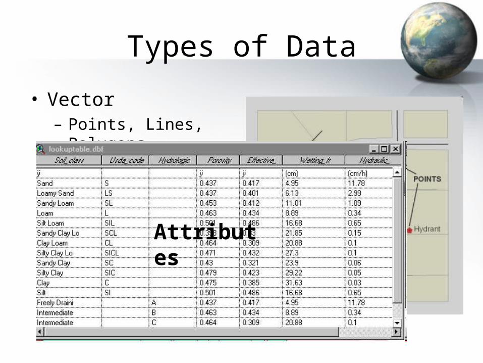
Attributes
Types of Data
• Vector– Points, Lines, Polygons
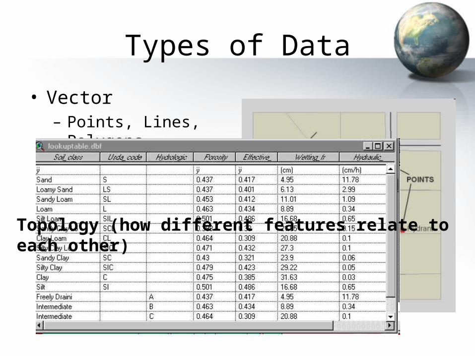
Topology (how different features relate to each other)
Types of Data
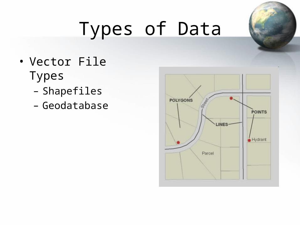
• Vector File Types– Shapefiles– Geodatabase
Types of Data
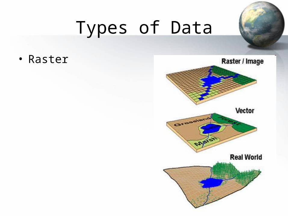
• Raster
Types of Data
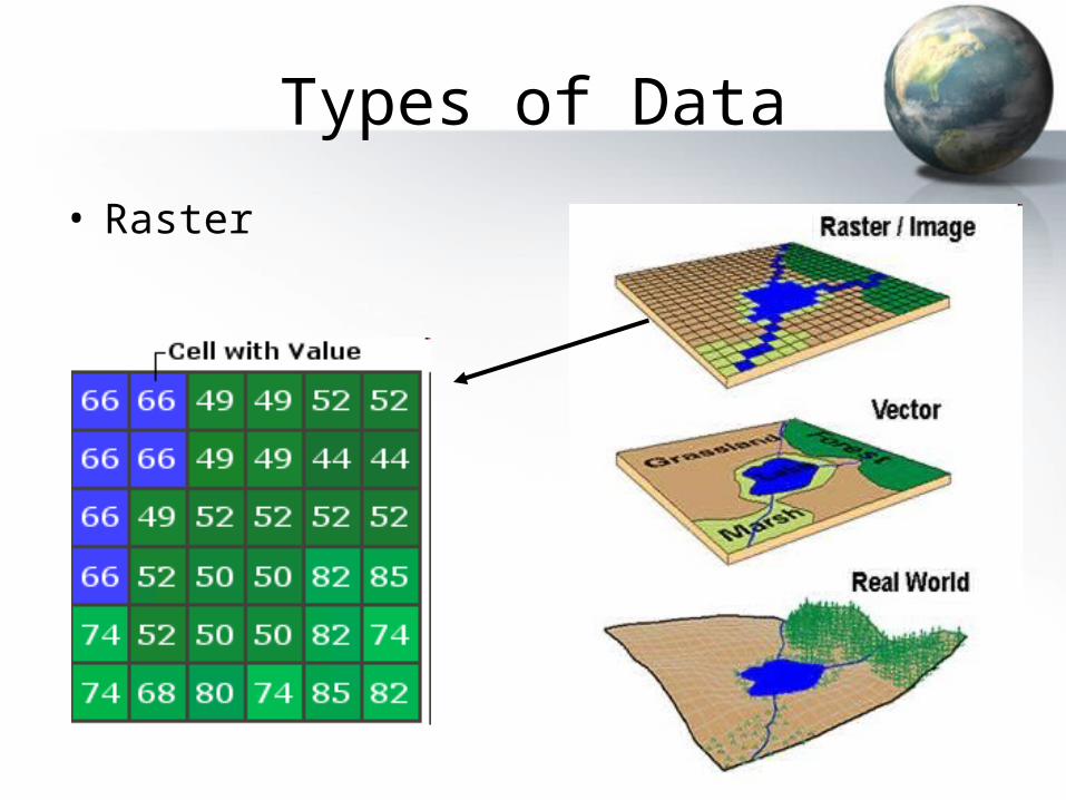
• Raster
Types of Data
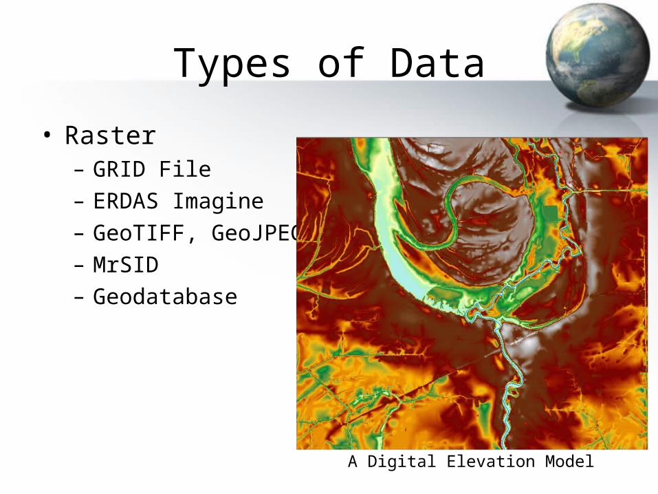
• Raster– GRID File– ERDAS Imagine– GeoTIFF, GeoJPEG– MrSID– Geodatabase
A Digital Elevation Model