Embed Size (px)
DESCRIPTION
Features of erosion. These slide-shows are all on the Prepwork folder if you wish to copy any notes from them; we will not be stopping in class for you to do this. FEATURES OF GLACIAL EROSION. - PowerPoint PPT Presentation
Citation preview
1
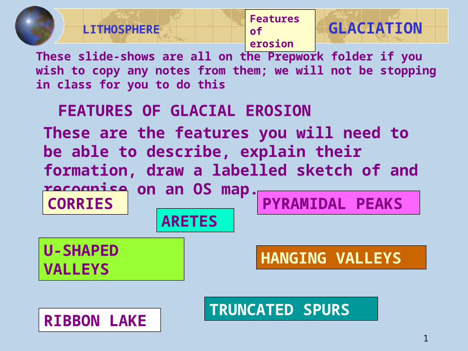
LITHOSPHERE
GLACIATION
FEATURES OF GLACIAL EROSIONThese are the features you will need to be able to describe, explain their formation, draw a labelled sketch of and recognise on an OS map.CORRIES ARETES
PYRAMIDAL PEAKS
U-SHAPED VALLEYS
RIBBON LAKE
TRUNCATED SPURS
HANGING VALLEYS
Features of erosion
These slide-shows are all on the Prepwork folder if you wish to copy any notes from them; we will not be stopping in class for you to do this
2
LITHOSPHERE
GLACIATION
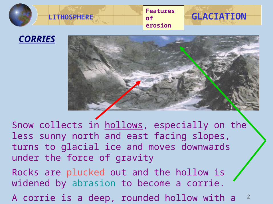
Snow collects in hollows, especially on the less sunny north and east facing slopes, turns to glacial ice and moves downwards under the force of gravity
Rocks are plucked out and the hollow is widened by abrasion to become a corrie.
A corrie is a deep, rounded hollow with a steep back wall.
CORRIES
Features of erosion
3
LITHOSPHERE
GLACIATIONFeatures of erosion
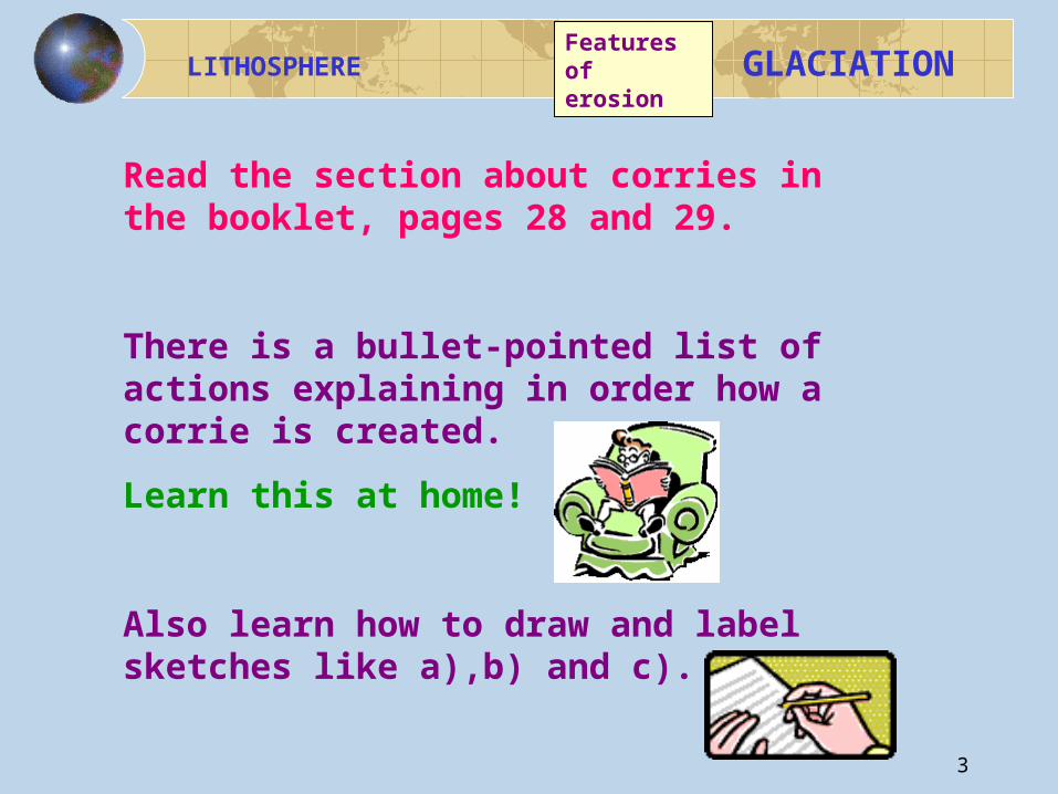
Read the section about corries in the booklet, pages 28 and 29.
There is a bullet-pointed list of actions explaining in order how a corrie is created.
Learn this at home!
Also learn how to draw and label sketches like a),b) and c).
4
LITHOSPHERE
GLACIATIONFeatures of erosion
NOTE;- the labels on the first two sketches are not just naming the features, like in sketch c).
They describe what is happening in the sketch, naming the processes.
This makes these labels -and the diagram- worth more marks than one where bits only are named!
MAXIMISE
YOUR
MARKS !
5
LITHOSPHERE
GLACIATIONFeatures of erosion
Answer these questions in the usual way;-
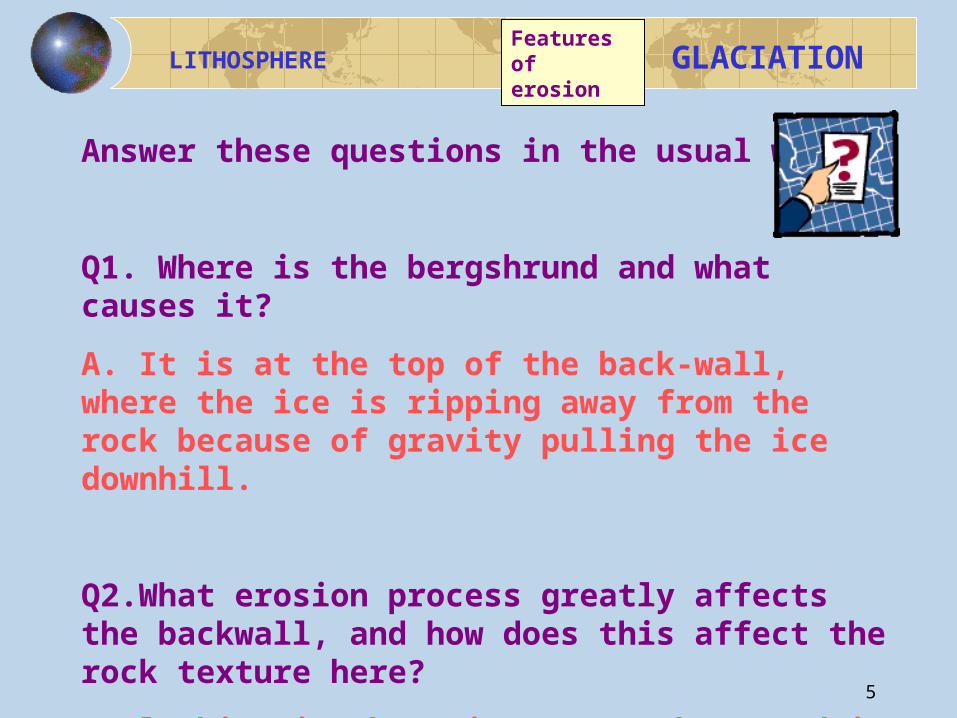
Q1. Where is the bergshrund and what causes it?
A. It is at the top of the back-wall, where the ice is ripping away from the rock because of gravity pulling the ice downhill.
Q2.What erosion process greatly affects the backwall, and how does this affect the rock texture here?
A.Plucking is the main process here and it leaves the rock jagged and rough.
6
LITHOSPHERE
GLACIATIONFeatures of erosion
Q3.The debris created by plucking is active elsewhere in the corrie- where and with what results?A.Abrasion uses the plucking products to smooth, deepen and enlarge the floor/ basin of the corrie.
Q4. Describe how corries, aretes and pyramidal peaks are all related features.A. To create an arete, there has to be more than one corrie eroding the land between them into an arete. The eroded corrie back-walls eat into the summit of the mountain creating a pyramidal peak, where several aretes come together.
7
LITHOSPHERE
GLACIATION
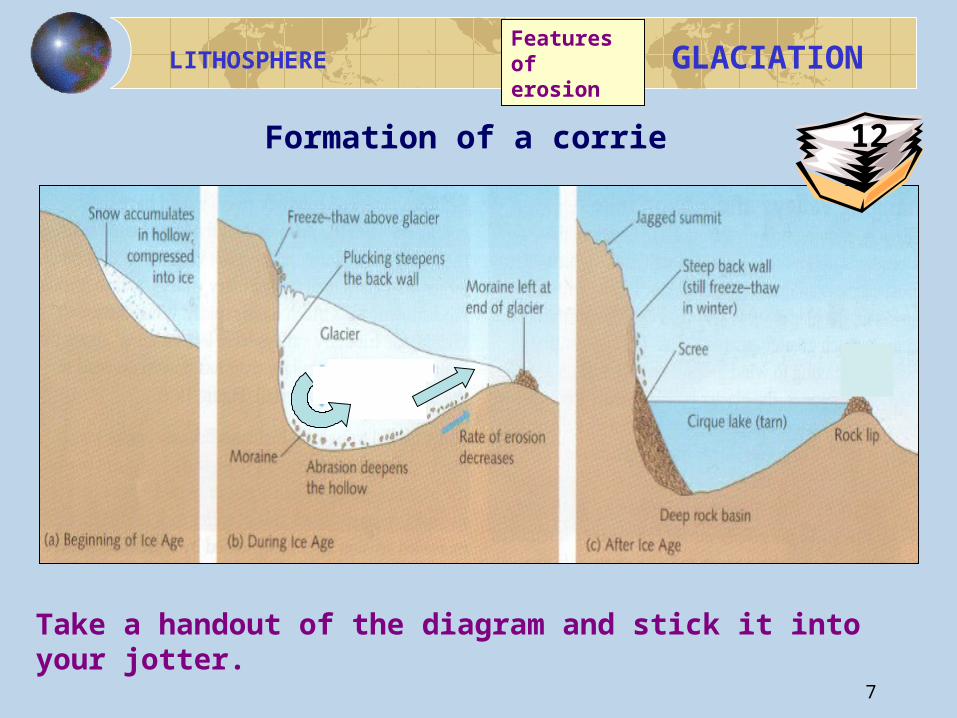
Formation of a corrie
Take a handout of the diagram and stick it into your jotter.
Features of erosion
12
8
LITHOSPHERE
GLACIATION
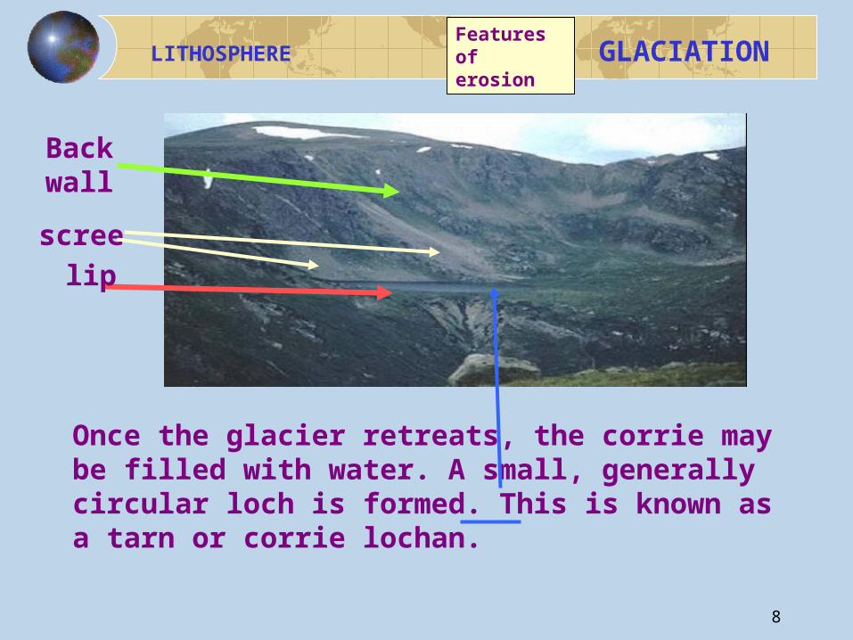
Once the glacier retreats, the corrie may be filled with water. A small, generally circular loch is formed. This is known as a tarn or corrie lochan.
lip
Back wall
scree
Features of erosion
9
LITHOSPHERE
GLACIATION
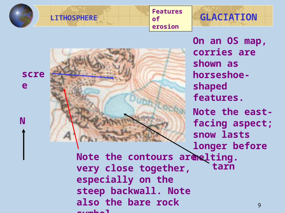
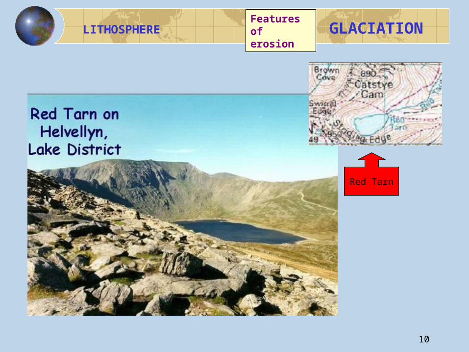
On an OS map, corries are shown as horseshoe-shaped features.
Note the east-facing aspect; snow lasts longer before melting.Note the contours are
very close together, especially on the steep backwall. Note also the bare rock symbol.
tarn
scree
N
Features of erosion
10
LITHOSPHERE
GLACIATION
Red Tarn
Features of erosion
11
LITHOSPHERE
GLACIATION
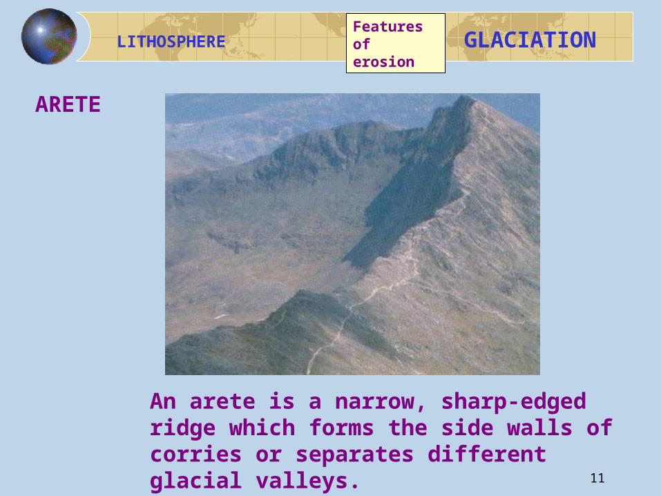
An arete is a narrow, sharp-edged ridge which forms the side walls of corries or separates different glacial valleys.
ARETE
Features of erosion
12
LITHOSPHERE
GLACIATION
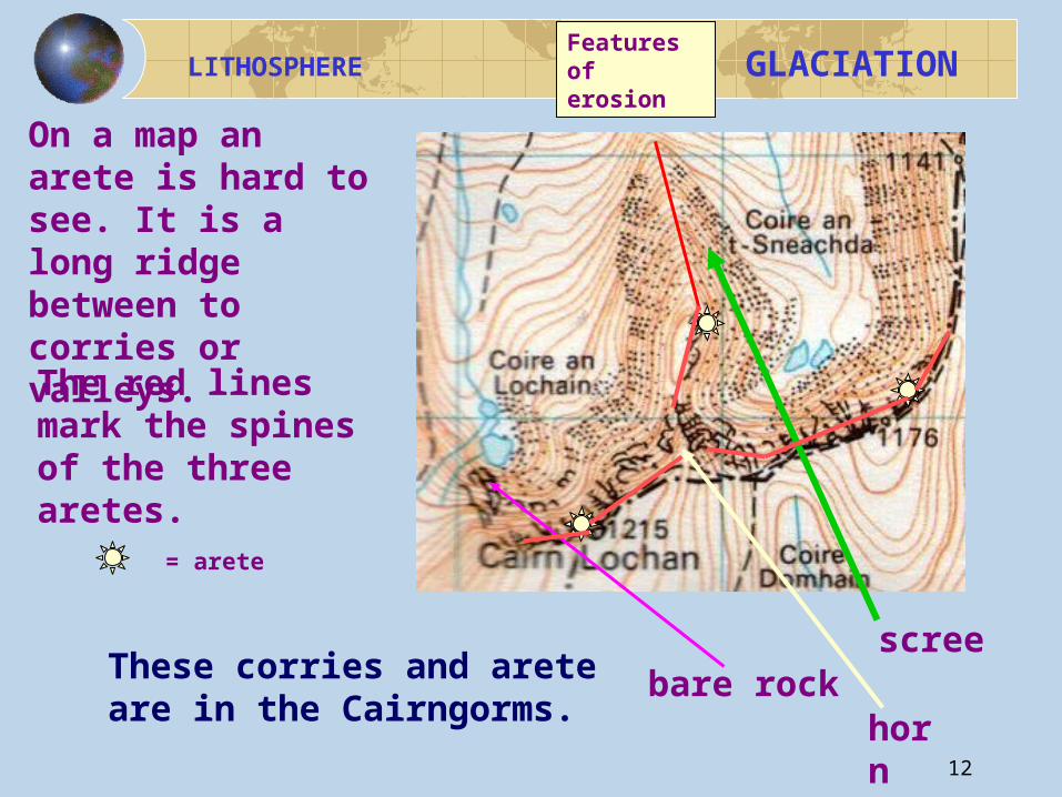
On a map an arete is hard to see. It is a long ridge between to corries or valleys.
The red lines mark the spines of the three aretes.
These corries and arete are in the Cairngorms.
screebare rock
horn
= arete
Features of erosion
13
LITHOSPHERE
GLACIATION
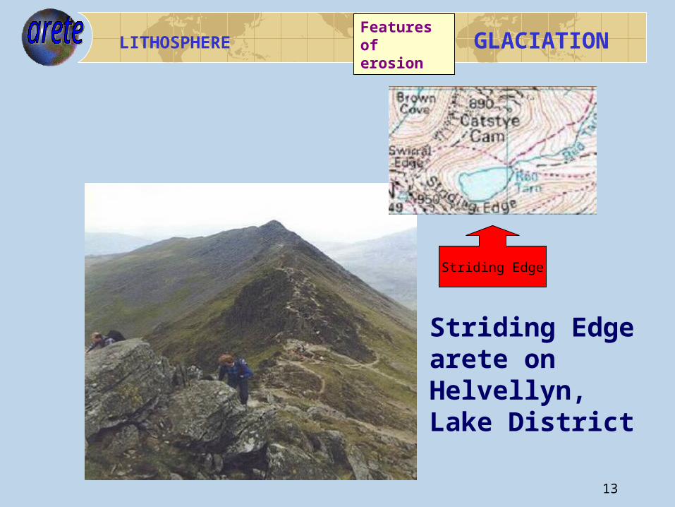
Striding Edge arete onHelvellyn,Lake District
Striding Edge
Features of erosion
14
LITHOSPHERE
GLACIATION
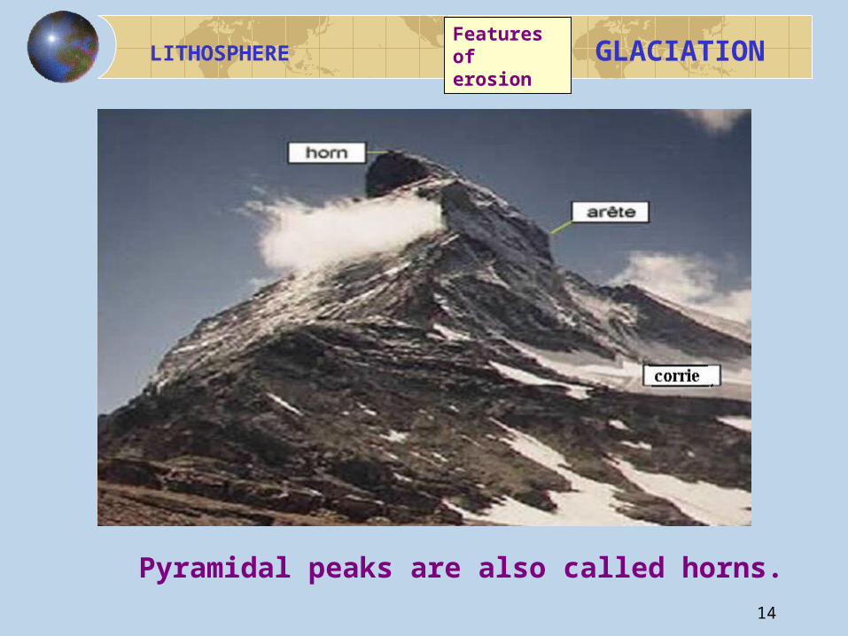
MATTERHORN
Pyramidal peaks are also called horns.
Features of erosion
15
LITHOSPHERE
GLACIATION
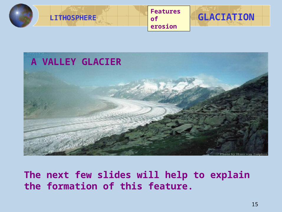
A VALLEY GLACIER
The next few slides will help to explain the formation of this feature.
Features of erosion
16
LITHOSPHERE
GLACIATION
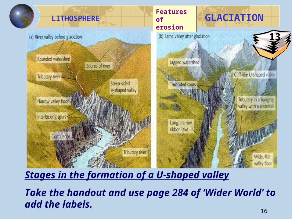
Stages in the formation of a U-shaped valley
Take the handout and use page 284 of ‘Wider World’ to add the labels.
Features of erosion
13
17
LITHOSPHERE
GLACIATION
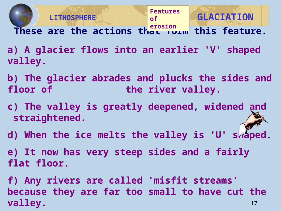
These are the actions that form this feature.
a) A glacier flows into an earlier 'V' shaped valley.
b) The glacier abrades and plucks the sides and floor of the river valley.
c) The valley is greatly deepened, widened and straightened.
d) When the ice melts the valley is 'U' shaped.
e) It now has very steep sides and a fairly flat floor.
f) Any rivers are called 'misfit streams’ because they are far too small to have cut the valley.
Features of erosion
18
LITHOSPHERE
GLACIATION
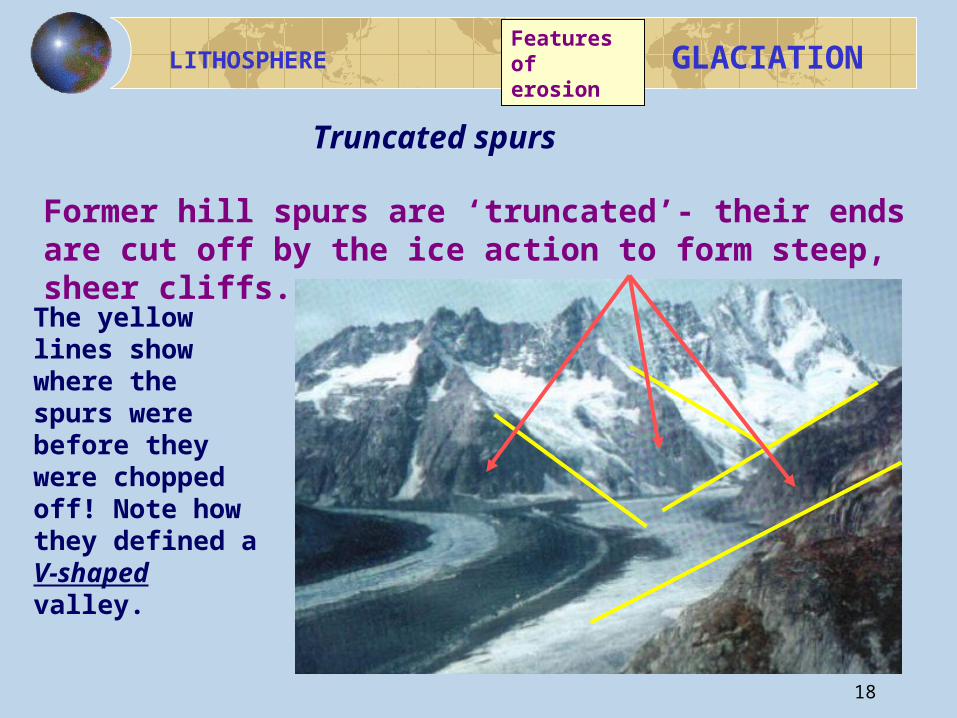
Former hill spurs are ‘truncated’- their ends are cut off by the ice action to form steep, sheer cliffs.
The yellow lines show where the spurs were before they were chopped off! Note how they defined a V-shaped valley.
Truncated spurs
Features of erosion
19
LITHOSPHERE
GLACIATION
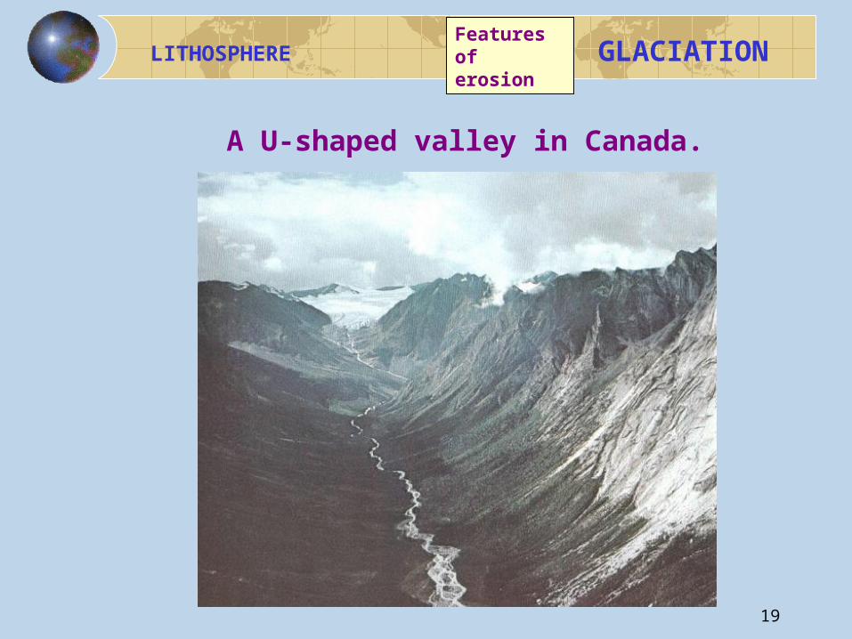
A U-shaped valley in Canada.
Features of erosion
20
LITHOSPHERE
GLACIATION
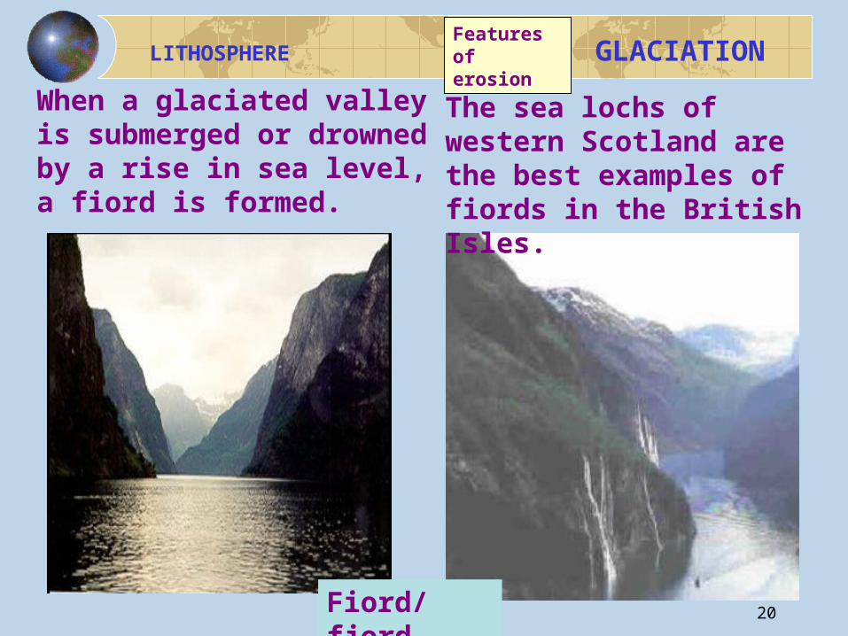
The sea lochs of western Scotland are the best examples of fiords in the British Isles.
When a glaciated valley is submerged or drowned by a rise in sea level, a fiord is formed.
Fiord/fjord
Features of erosion
21
LITHOSPHERE
GLACIATION
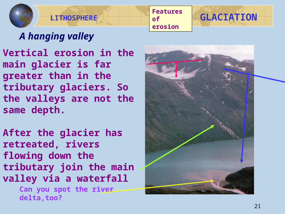
Vertical erosion in the main glacier is far greater than in the tributary glaciers. So the valleys are not the same depth.
After the glacier has retreated, rivers flowing down the tributary join the main valley via a waterfall
A hanging valley
Can you spot the river delta,too?
Features of erosion
22
LITHOSPHERE
GLACIATION
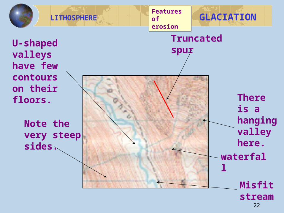
U-shaped valleys have few contours on their floors.
Note the very steep sides.
There is a hanging valley here.
Truncated spur
Misfit stream
waterfall
Features of erosion
23
LITHOSPHERE
GLACIATION
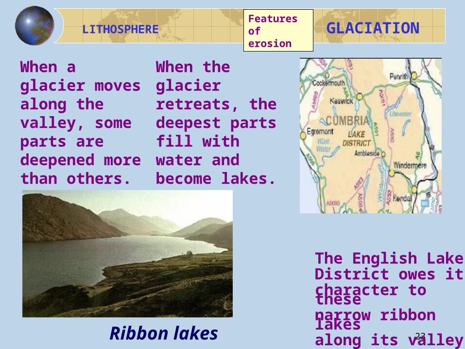
The English Lake District owes its character to these narrow ribbon lakes along its valley floors.
When the glacier retreats, the deepest parts fill with water and become lakes.
When a glacier moves along the valley, some parts are deepened more than others.
Ribbon lakes
Features of erosion
24
LITHOSPHERE
GLACIATION
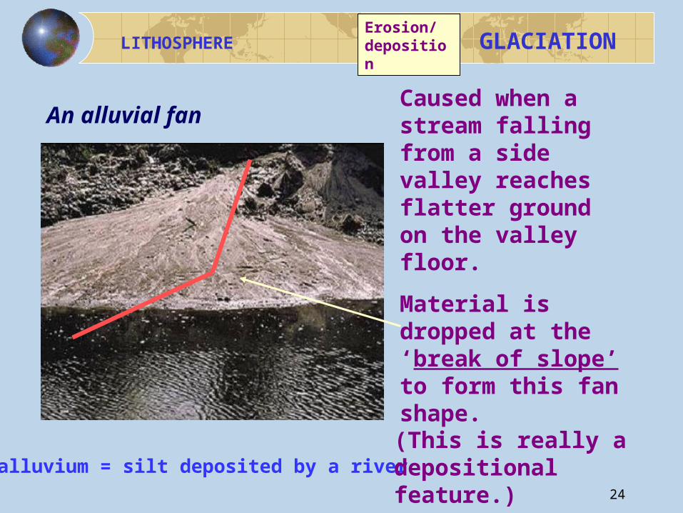
alluvium = silt deposited by a river
An alluvial fanCaused when a stream falling from a side valley reaches flatter ground on the valley floor.
Material is dropped at the ‘break of slope’ to form this fan shape.
(This is really a depositional feature.)
Erosion/ deposition
25
LITHOSPHERE
GLACIATION
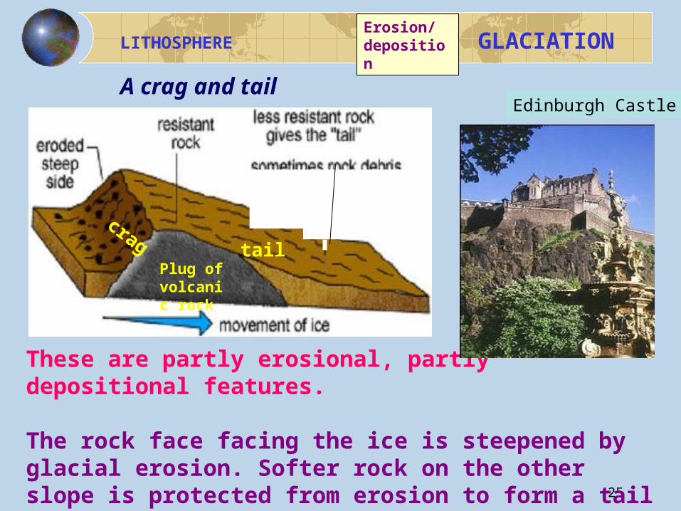
These are partly erosional, partly depositional features.
The rock face facing the ice is steepened by glacial erosion. Softer rock on the other slope is protected from erosion to form a tail of boulder clay.
Edinburgh CastleA crag and tail
Plug of volcanic rock
crag tail
Erosion/ deposition
26
LITHOSPHERE
GLACIATION
There is a mapping question sheet to try at this point.
You will need a copy of the questions and the map extract supplied.
A ruler may also be quite useful.
The extract is of the area you will need to know for the Rural Land Use section of the course.
Features of erosion
Now play the glacial erosion dominoes game!
14
27
LITHOSPHERE
GLACIATION
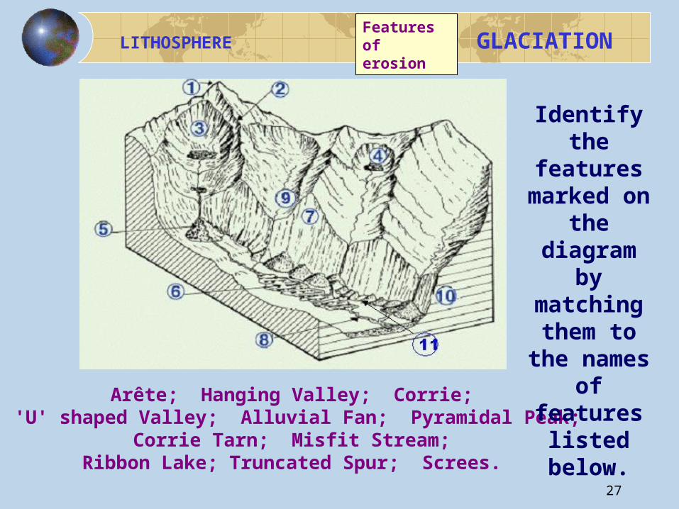
Arête; Hanging Valley; Corrie; 'U' shaped Valley; Alluvial Fan; Pyramidal Peak;
Corrie Tarn; Misfit Stream; Ribbon Lake; Truncated Spur; Screes.
Identify the
features marked on the
diagram by
matching them to
the names of features
listed below.
Features of erosion