Embed Size (px)
Citation preview
Flood Map Modernization
Mitigation Division, FEMA
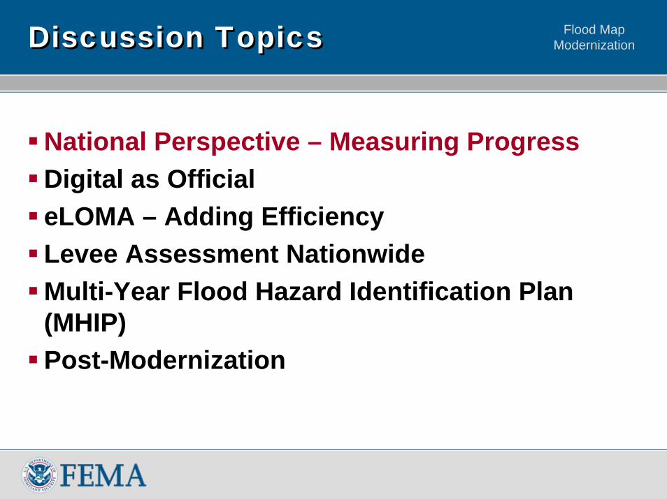
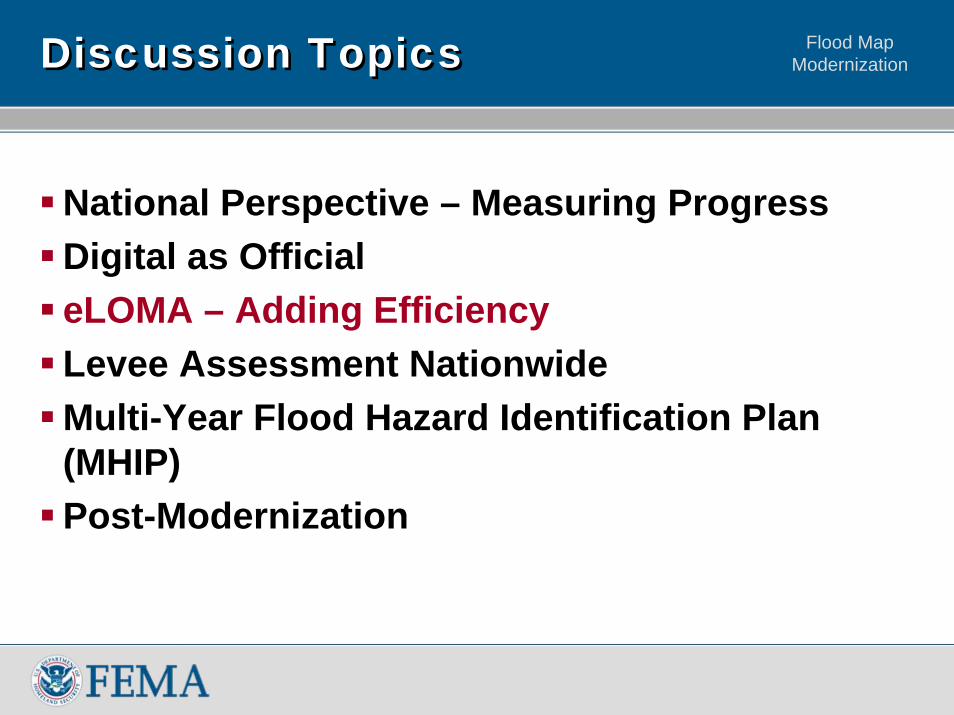
Flood Map ModernizationDiscussion TopicsDiscussion Topics
National Perspective – Measuring ProgressDigital as OfficialeLOMA – Adding EfficiencyLevee Assessment NationwideMulti-Year Flood Hazard Identification Plan (MHIP)Post-Modernization
Flood Map Modernization
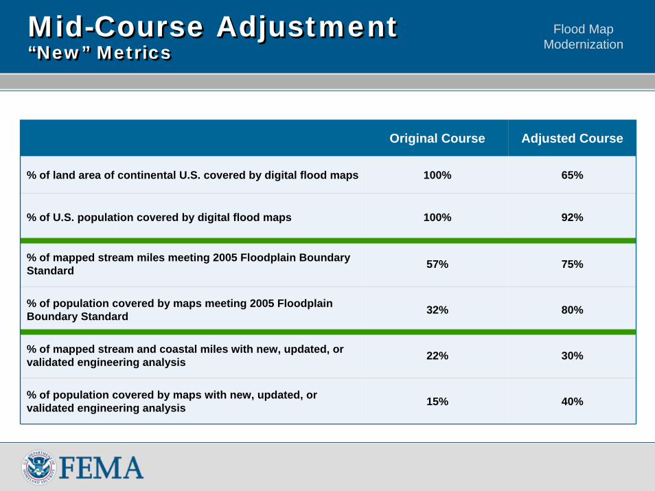
Mid-Course Adjustment“New” MetricsMid-Course Adjustment“New” Metrics
Original Course Adjusted Course
% of land area of continental U.S. covered by digital flood maps 100% 65%
% of U.S. population covered by digital flood maps 100% 92%
% of mapped stream miles meeting 2005 Floodplain Boundary Standard 57% 75%
% of population covered by maps meeting 2005 Floodplain Boundary Standard 32% 80%
% of mapped stream and coastal miles with new, updated, or validated engineering analysis 22% 30%
% of population covered by maps with new, updated, or validated engineering analysis 15% 40%
Flood Map Modernization
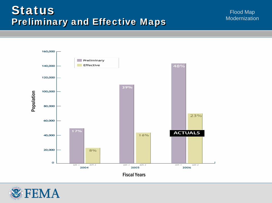
StatusPreliminary and Effective MapsStatusPreliminary and Effective Maps
Popu
latio
n in
Thou
sand
s
Fiscal Years
Popu
latio
n
Flood Map Modernization
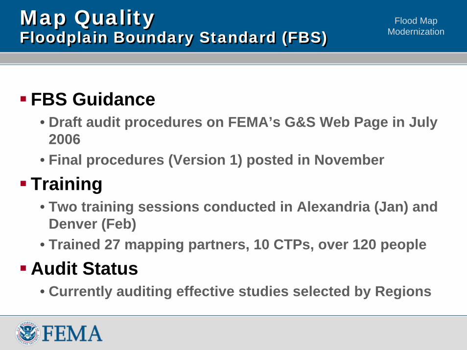
Map QualityFloodplain Boundary Standard (FBS)Map QualityFloodplain Boundary Standard (FBS)
FBS Guidance• Draft audit procedures on FEMA’s G&S Web Page in July
2006• Final procedures (Version 1) posted in November
Training• Two training sessions conducted in Alexandria (Jan) and
Denver (Feb)• Trained 27 mapping partners, 10 CTPs, over 120 people
Audit Status• Currently auditing effective studies selected by Regions
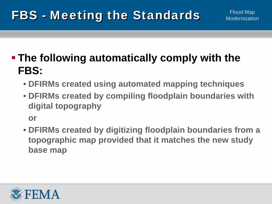
Flood Map ModernizationFBS - Meeting the StandardsFBS - Meeting the Standards
The following automatically comply with the FBS:
• DFIRMs created using automated mapping techniques• DFIRMs created by compiling floodplain boundaries with
digital topographyor
• DFIRMs created by digitizing floodplain boundaries from a topographic map provided that it matches the new study base map
Flood Map Modernization
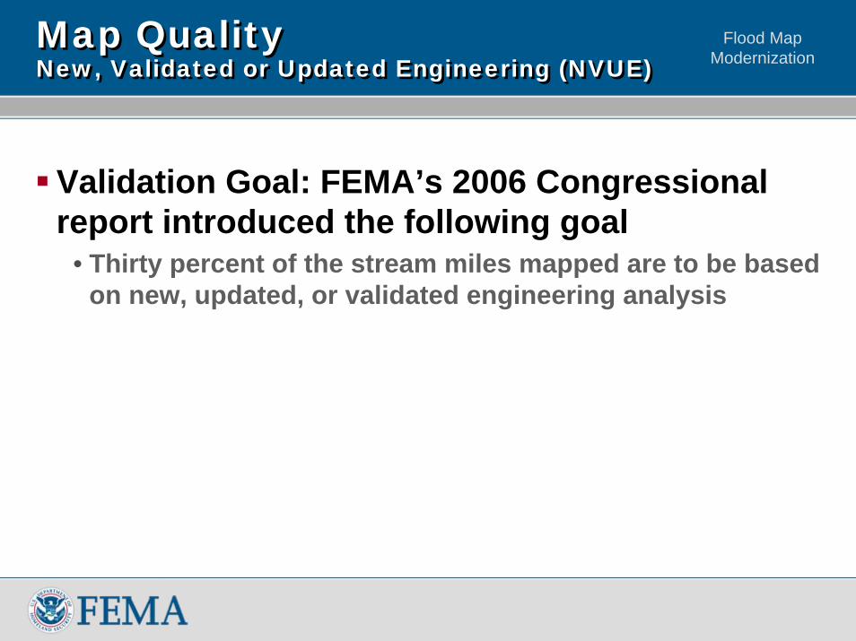
Validation Goal: FEMA’s 2006 Congressional report introduced the following goal
• Thirty percent of the stream miles mapped are to be based on new, updated, or validated engineering analysis
Map Quality New, Validated or Updated Engineering (NVUE)Map Quality New, Validated or Updated Engineering (NVUE)
Flood Map Modernization
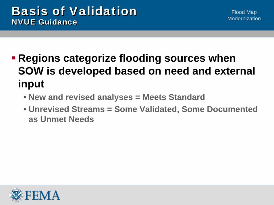
Basis of Validation NVUE GuidanceBasis of Validation NVUE Guidance
Regions categorize flooding sources when SOW is developed based on need and external input
• New and revised analyses = Meets Standard• Unrevised Streams = Some Validated, Some Documented
as Unmet Needs
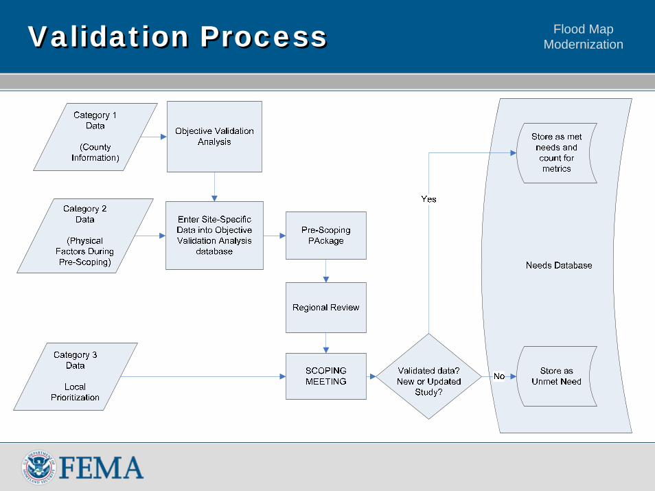
Flood Map ModernizationValidation ProcessValidation Process
Flood Map Modernization
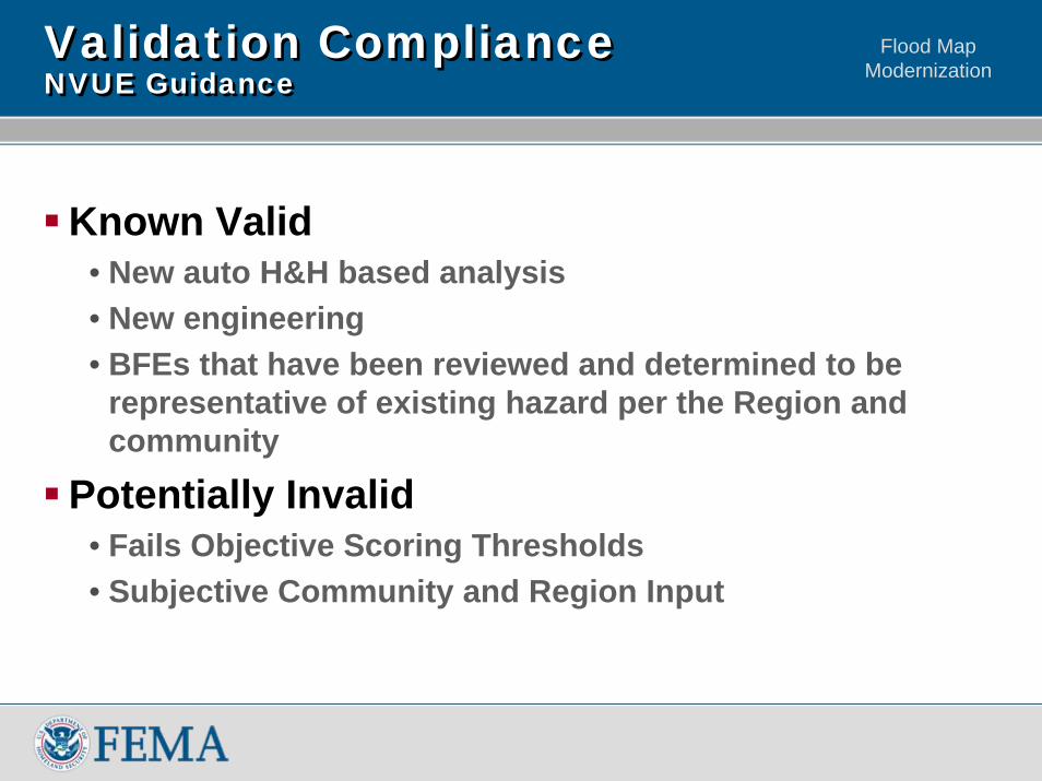
Validation ComplianceNVUE GuidanceValidation ComplianceNVUE Guidance
Known Valid• New auto H&H based analysis• New engineering• BFEs that have been reviewed and determined to be
representative of existing hazard per the Region and community
Potentially Invalid• Fails Objective Scoring Thresholds• Subjective Community and Region Input
Flood Map ModernizationDiscussion TopicsDiscussion Topics
National Perspective – Measuring ProgressDigital as OfficialeLOMA – Adding EfficiencyLevee Assessment NationwideMulti-Year Flood Hazard Identification Plan (MHIP)Post-Modernization
Flood Map Modernization
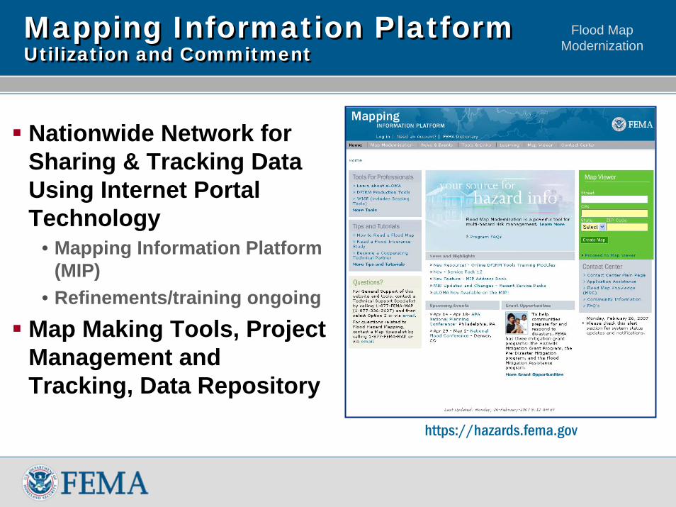
Mapping Information Platform Utilization and CommitmentMapping Information Platform Utilization and Commitment
Nationwide Network for Sharing & Tracking Data Using Internet Portal Technology
• Mapping Information Platform (MIP)
• Refinements/training ongoing
Map Making Tools, Project Management and Tracking, Data Repository
https://hazards.fema.gov
Flood Map Modernization
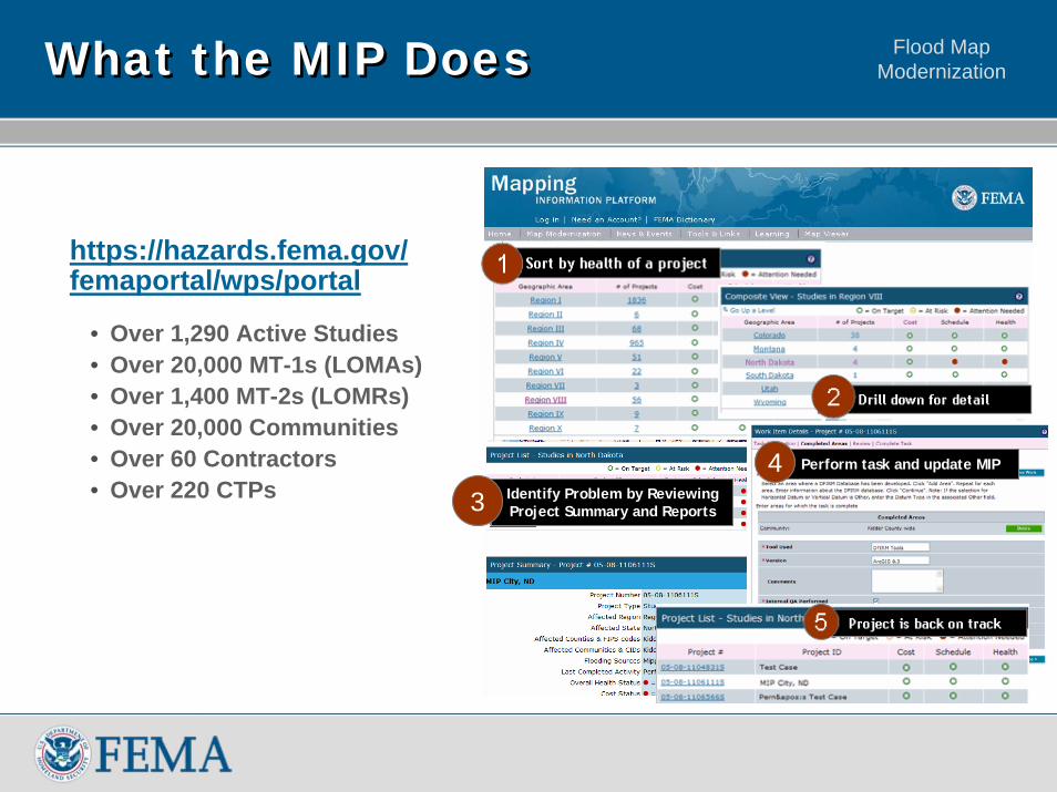
Identify Problem by Reviewing Project Summary and Reports3
Perform task and update MIP4
What the MIP DoesWhat the MIP Does
https://hazards.fema.gov/ femaportal/wps/portal
• Over 1,290 Active Studies• Over 20,000 MT-1s (LOMAs)• Over 1,400 MT-2s (LOMRs)• Over 20,000 Communities• Over 60 Contractors• Over 220 CTPs
Flood Map ModernizationDiscussion TopicsDiscussion Topics
National Perspective – Measuring ProgressDigital as OfficialeLOMA – Adding EfficiencyLevee Assessment NationwideMulti-Year Flood Hazard Identification Plan (MHIP)Post-Modernization
Flood Map ModernizationDigital VisionDigital Vision
Digital is official for National Flood Insurance Program usesUtilize digital toolsReduce paper product production and distribution
Flood Map Modernization
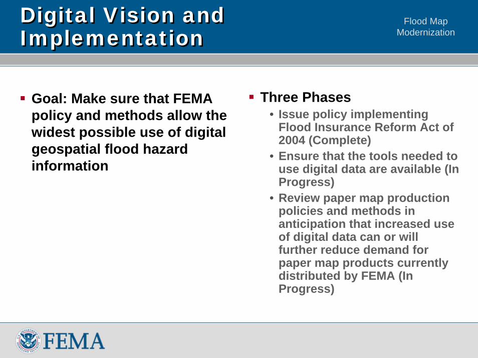
Digital Vision and ImplementationDigital Vision and Implementation
Goal: Make sure that FEMA policy and methods allow the widest possible use of digital geospatial flood hazard information
Three Phases• Issue policy implementing
Flood Insurance Reform Act of 2004 (Complete)
• Ensure that the tools needed to use digital data are available (In Progress)
• Review paper map production policies and methods in anticipation that increased use of digital data can or will further reduce demand for paper map products currently distributed by FEMA (In Progress)
Flood Map Modernization
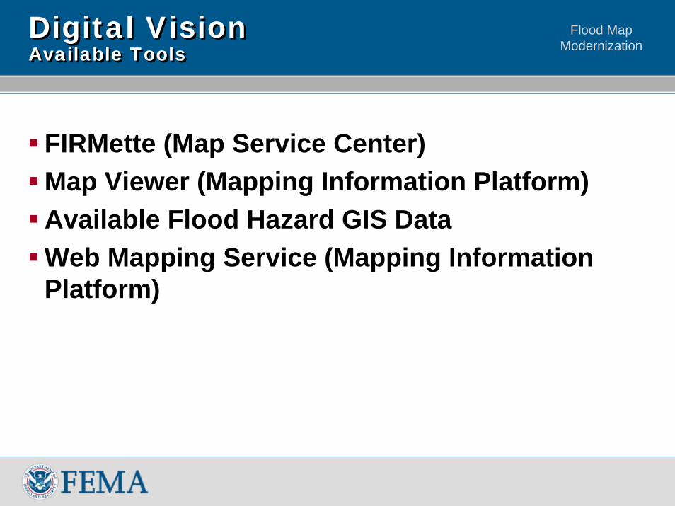
Digital VisionAvailable ToolsDigital VisionAvailable Tools
FIRMette (Map Service Center)Map Viewer (Mapping Information Platform)Available Flood Hazard GIS Data Web Mapping Service (Mapping Information Platform)
Flood Map ModernizationDiscussion TopicsDiscussion Topics
National Perspective – Measuring ProgressDigital as OfficialeLOMA – Adding EfficiencyLevee Assessment NationwideMulti-Year Flood Hazard Identification Plan (MHIP)Post-Modernization
Flood Map Modernization
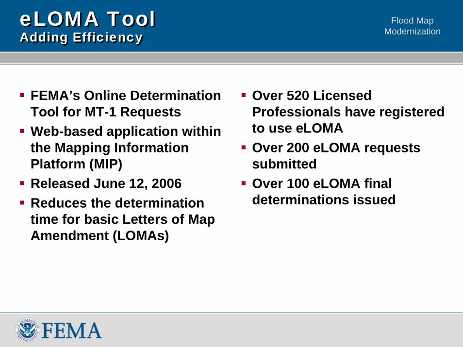
eLOMA ToolAdding EfficiencyeLOMA ToolAdding Efficiency
FEMA’s Online Determination Tool for MT-1 Requests Web-based application within the Mapping Information Platform (MIP) Released June 12, 2006Reduces the determination time for basic Letters of Map Amendment (LOMAs)
Over 520 Licensed Professionals have registered to use eLOMAOver 200 eLOMA requests submittedOver 100 eLOMA final determinations issued
Flood Map ModernizationDiscussion TopicsDiscussion Topics
National Perspective – Measuring ProgressDigital as Official eLOMA – Adding EfficiencyLevee Assessment NationwideMulti-Year Flood Hazard Identification Plan (MHIP)Post-Modernization
Flood Map Modernization
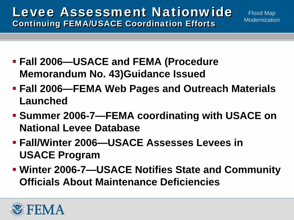
Levee Assessment NationwideContinuing FEMA/USACE Coordination EffortsLevee Assessment NationwideContinuing FEMA/USACE Coordination Efforts
Fall 2006—USACE and FEMA (Procedure Memorandum No. 43)Guidance IssuedFall 2006—FEMA Web Pages and Outreach Materials LaunchedSummer 2006-7—FEMA coordinating with USACE on National Levee Database Fall/Winter 2006—USACE Assesses Levees in USACE ProgramWinter 2006-7—USACE Notifies State and Community Officials About Maintenance Deficiencies
Flood Map Modernization
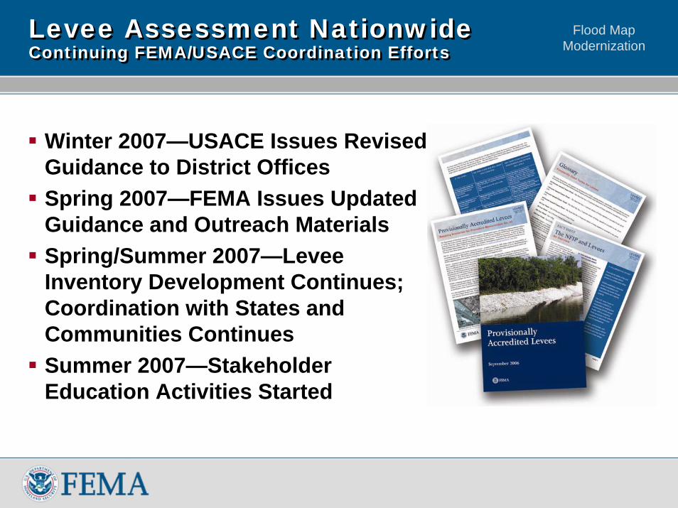
Levee Assessment NationwideContinuing FEMA/USACE Coordination EffortsLevee Assessment NationwideContinuing FEMA/USACE Coordination Efforts
Winter 2007—USACE Issues Revised Guidance to District OfficesSpring 2007—FEMA Issues Updated Guidance and Outreach MaterialsSpring/Summer 2007—Levee Inventory Development Continues; Coordination with States and Communities ContinuesSummer 2007—Stakeholder Education Activities Started
Flood Map ModernizationDiscussion TopicsDiscussion Topics
National Perspective – Measuring ProgressDigital as OfficialeLOMA – Adding EfficiencyLevee Assessment NationwideMulti-Year Flood Hazard Identification Plan (MHIP)Post-Modernization
Flood Map ModernizationMHIPMHIP
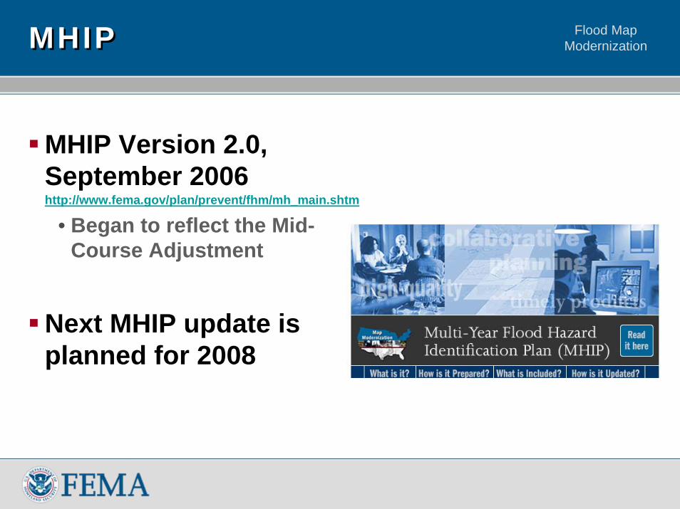
MHIP Version 2.0, September 2006http://www.fema.gov/plan/prevent/fhm/mh_main.shtm
• Began to reflect the Mid-Course Adjustment
Next MHIP update is planned for 2008
Flood Map ModernizationDiscussion TopicsDiscussion Topics
National Perspective – Measuring ProgressDigital as OfficialeLOMA – Adding EfficiencyLevee Assessment NationwideMulti-Year Flood Hazard Identification Plan (MHIP)Post-Modernization
Flood Map Modernization
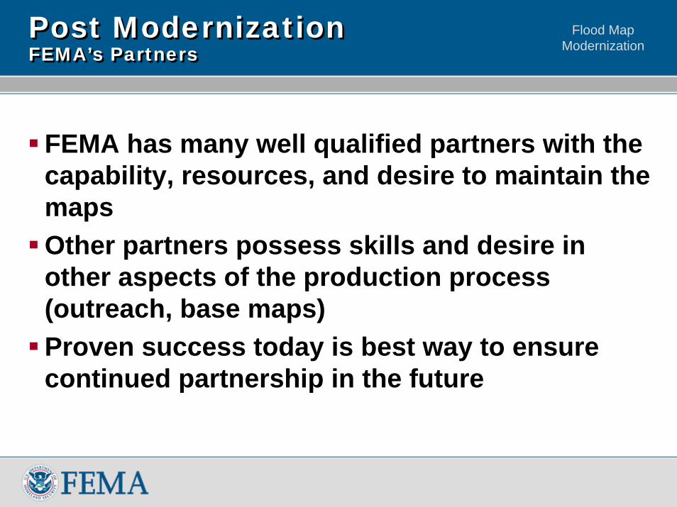
Post ModernizationFEMA’s PartnersPost ModernizationFEMA’s Partners
FEMA has many well qualified partners with the capability, resources, and desire to maintain the mapsOther partners possess skills and desire in other aspects of the production process (outreach, base maps)Proven success today is best way to ensure continued partnership in the future
Flood Map Modernization
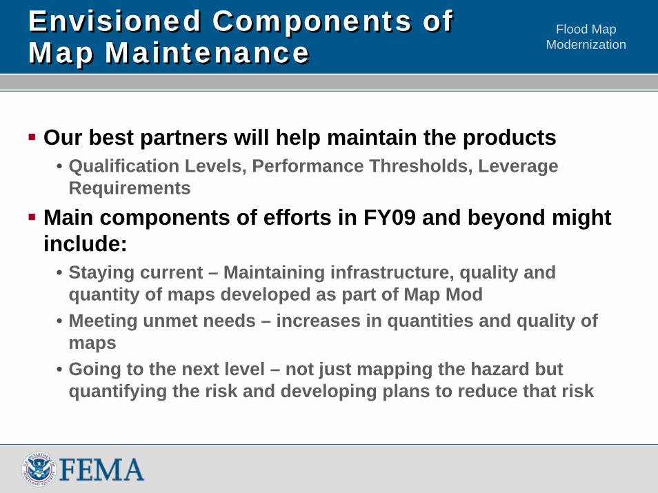
Envisioned Components of Map Maintenance Envisioned Components of Map Maintenance
Our best partners will help maintain the products• Qualification Levels, Performance Thresholds, Leverage
RequirementsMain components of efforts in FY09 and beyond might include:
• Staying current – Maintaining infrastructure, quality and quantity of maps developed as part of Map Mod
• Meeting unmet needs – increases in quantities and quality of maps
• Going to the next level – not just mapping the hazard but quantifying the risk and developing plans to reduce that risk
Flood Map Modernization
Geospatial Data Coordination
Flood Map Modernization
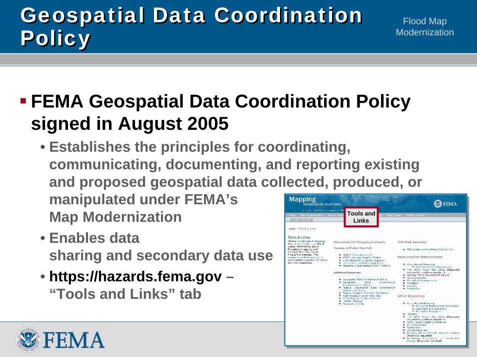
Geospatial Data Coordination PolicyGeospatial Data Coordination Policy
FEMA Geospatial Data Coordination Policy signed in August 2005
• Establishes the principles for coordinating, communicating, documenting, and reporting existing and proposed geospatial data collected, produced, or manipulated under FEMA’s Map Modernization
• Enables data sharing and secondary data use
• https://hazards.fema.gov –“Tools and Links” tab
Tools andLinks
Flood Map Modernization
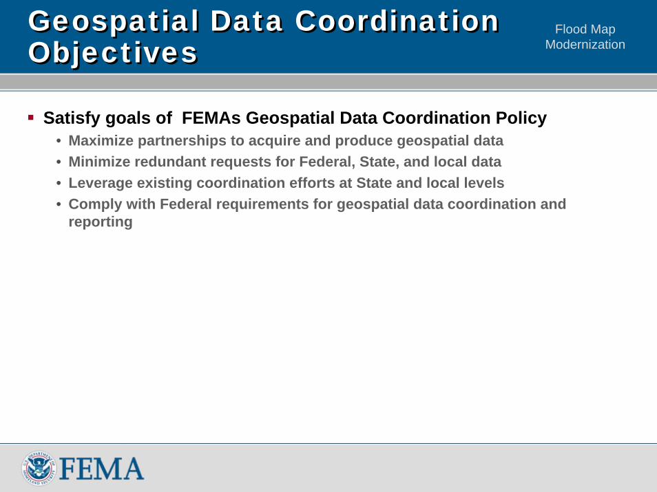
Geospatial Data Coordination ObjectivesGeospatial Data Coordination Objectives
Satisfy goals of FEMAs Geospatial Data Coordination Policy• Maximize partnerships to acquire and produce geospatial data• Minimize redundant requests for Federal, State, and local data• Leverage existing coordination efforts at State and local levels• Comply with Federal requirements for geospatial data coordination and
reporting
Flood Map Modernization
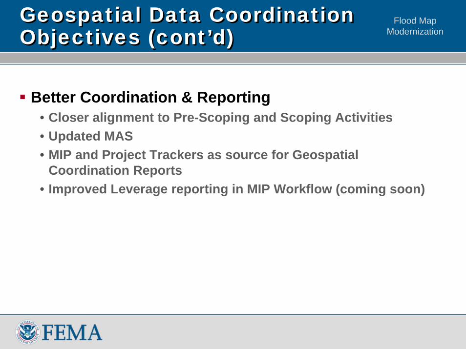
Geospatial Data Coordination Objectives (cont’d)Geospatial Data Coordination Objectives (cont’d)
Better Coordination & Reporting• Closer alignment to Pre-Scoping and Scoping Activities• Updated MAS• MIP and Project Trackers as source for Geospatial
Coordination Reports• Improved Leverage reporting in MIP Workflow (coming soon)
Flood Map Modernization
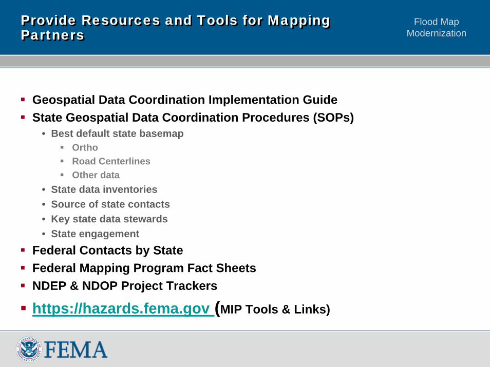
Provide Resources and Tools for Mapping PartnersProvide Resources and Tools for Mapping Partners
Geospatial Data Coordination Implementation GuideState Geospatial Data Coordination Procedures (SOPs)
• Best default state basemapOrthoRoad CenterlinesOther data
• State data inventories• Source of state contacts• Key state data stewards• State engagement
Federal Contacts by StateFederal Mapping Program Fact SheetsNDEP & NDOP Project Trackers
https://hazards.fema.gov (MIP Tools & Links)
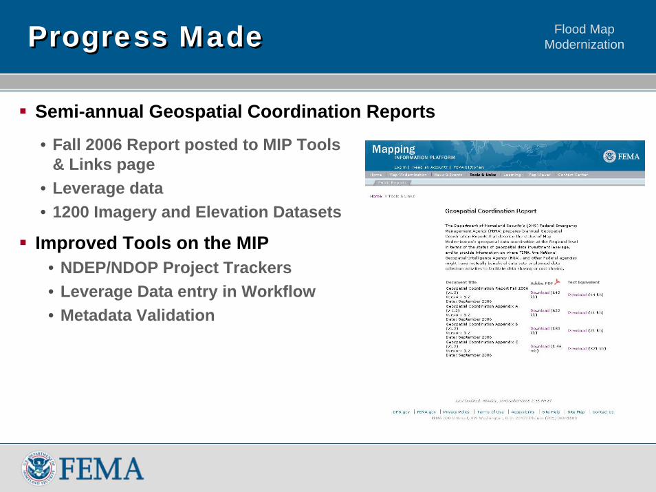
Flood Map ModernizationProgress MadeProgress Made
Semi-annual Geospatial Coordination Reports
• Fall 2006 Report posted to MIP Tools & Links page
• Leverage data• 1200 Imagery and Elevation Datasets
Improved Tools on the MIP• NDEP/NDOP Project Trackers• Leverage Data entry in Workflow• Metadata Validation
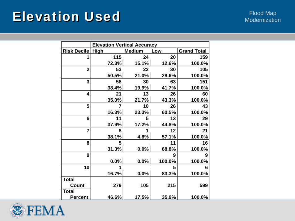
Flood Map ModernizationElevation UsedElevation Used
Elevation Vertical AccuracyRisk Decile High Medium Low Grand Total
1 115 24 20 15972.3% 15.1% 12.6% 100.0%
2 53 22 30 10550.5% 21.0% 28.6% 100.0%
3 58 30 63 15138.4% 19.9% 41.7% 100.0%
4 21 13 26 6035.0% 21.7% 43.3% 100.0%
5 7 10 26 4316.3% 23.3% 60.5% 100.0%
6 11 5 13 2937.9% 17.2% 44.8% 100.0%
7 8 1 12 2138.1% 4.8% 57.1% 100.0%
8 5 11 1631.3% 0.0% 68.8% 100.0%
9 9 90.0% 0.0% 100.0% 100.0%
10 1 5 616.7% 0.0% 83.3% 100.0%
Total Count 279 105 215 599
Total Percent 46.6% 17.5% 35.9% 100.0%
Flood Map Modernization
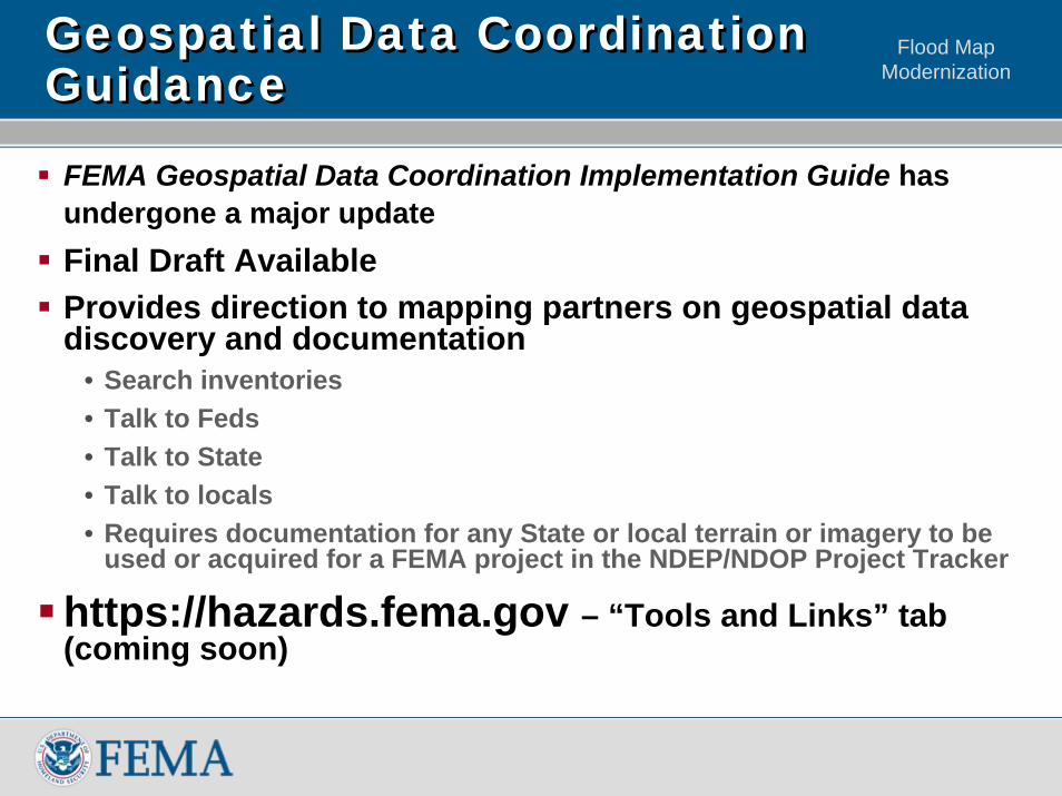
Geospatial Data Coordination GuidanceGeospatial Data Coordination Guidance
FEMA Geospatial Data Coordination Implementation Guide has undergone a major updateFinal Draft Available Provides direction to mapping partners on geospatial data discovery and documentation
• Search inventories• Talk to Feds• Talk to State• Talk to locals• Requires documentation for any State or local terrain or imagery to be
used or acquired for a FEMA project in the NDEP/NDOP Project Tracker
https://hazards.fema.gov – “Tools and Links” tab (coming soon)
Flood Map Modernization
Flood Map Modernization
![Flood Map Modernization Flood Map Modernization Mapping the Risk Editorial Board Meeting [date] V123005 [COMMUNITY NAME] FLOOD MAP MODERNIZATION](https://img.pdfslide.net/doc/110x75/56649ebb5503460f94bc3787/flood-map-modernization-flood-map-modernization-mapping-the-risk-editorial.jpg)