Embed Size (px)
Citation preview
Brownfields Success Story
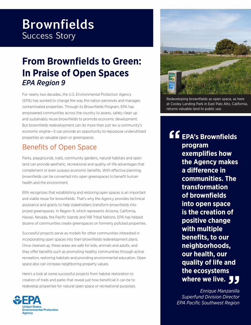
From Brownfields to Green:In Praise of Open SpacesEPA Region 9For nearly two decades, the U.S. Environmental Protection Agency
(EPA) has worked to change the way the nation perceives and manages
contaminated properties. Through its Brownfields Program, EPA has
empowered communities across the country to assess, safely clean up
and sustainably reuse brownfields to promote economic development.
But brownfields redevelopment can do more than just rev a community’s
economic engine—it can provide an opportunity to repurpose underutilized
properties as valuable open or greenspaces.
Benefits of Open SpaceParks, playgrounds, trails, community gardens, natural habitats and open
land can provide aesthetic, recreational and quality-of-life advantages that
complement or even surpass economic benefits. With effective planning,
brownfields can be converted into open greenspaces to benefit human
health and the environment.
EPA recognizes that establishing and restoring open spaces is an important
and viable reuse for brownfields. That’s why the Agency provides technical
assistance and grants to help stakeholders transform brownfields into
prized greenspaces. In Region 9, which represents Arizona, California,
Hawaii, Nevada, the Pacific Islands and 148 Tribal Nations, EPA has helped
dozens of communities create greenspaces on formerly polluted properties.
Successful projects serve as models for other communities interested in
incorporating open spaces into their brownfields redevelopment plans.
Once cleaned up, these areas are safe for kids, animals and adults, and
they offer benefits such as promoting healthy communities through active
recreation, restoring habitats and providing environmental education. Open
space also can increase neighboring property values.
Here’s a look at some successful projects from habitat restoration to
creation of trails and parks that reveal just how beneficial it can be to
redevelop properties for natural open space or recreational purposes.
Redeveloping brownfields as open space, as here at Cooley Landing Park in East Palo Alto, California, returns valuable land to public use.
EPA’s Brownfields program exemplifies how the Agency makes a difference in communities. The transformation of brownfields into open space is the creation of positive change with multiple benefits, to our neighborhoods, our health, our quality of life and the ecosystems where we live.
Enrique ManzanillaSuperfund Division Director
EPA Pacific Southwest Region
“
“
2
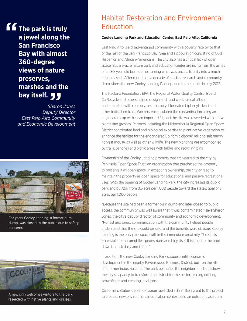
The park is truly a jewel along the San Francisco Bay with almost 360-degree views of nature preserves, marshes and the bay itself.
Sharon JonesDeputy Director
East Palo Alto Community and Economic Development
For years Cooley Landing, a former burn dump, was closed to the public due to safety concerns.
A new sign welcomes visitors to the park, reseeded with native plants and grasses.
“
“
Habitat Restoration and Environmental EducationCooley Landing Park and Education Center, East Palo Alto, California
East Palo Alto is a disadvantaged community with a poverty rate twice that
of the rest of the San Francisco Bay Area and a population consisting of 80%
Hispanics and African–Americans. The city also has a critical lack of open
space. But a 9-acre nature park and education center are rising from the ashes
of an 80-year-old burn dump, turning what was once a liability into a much-
needed asset. After more than a decade of studies, research and community
discussions, the new Cooley Landing Park opened to the public in July 2012.
The Packard Foundation, EPA, the Regional Water Quality Control Board,
CalRecycle and others helped design and fund work to seal off soil
contaminated with mercury, arsenic, polychlorinated biphenyls, lead and
other toxic chemicals. Workers encapsulated the contamination using an
engineered cap with clean imported fill, and the site was reseeded with native
plants and grasses. Partners including the Midpeninsula Regional Open Space
District contributed land and biological expertise to plant native vegetation to
enhance the habitat for the endangered California clapper rail and salt marsh
harvest mouse, as well as other wildlife. The new plantings are accompanied
by trails, benches and picnic areas with tables and recycling bins.
Ownership of the Cooley Landing property was transferred to the city by
Peninsula Open Space Trust, an organization that purchased the property
to preserve it as open space. In accepting ownership, the city agreed to
maintain the property as open space for educational and passive recreational
uses. With the opening of Cooley Landing Park, the city increased its public
parkland by 72%, from 0.5 acre per 1,000 people toward the state’s goal of 3
acres per 1,000 people.
“Because the site had been a former burn dump and later closed to public
access, the community was well aware that it was contaminated,” says Sharon
Jones, the city’s deputy director of community and economic development.
“Honest and direct communication with the community helped people
understand that the site could be safe, and the benefits were obvious. Cooley
Landing is the only park space within the immediate proximity. The site is
accessible for automobiles, pedestrians and bicyclists. It is open to the public
dawn to dusk daily and is free.”
In addition, the new Cooley Landing Park supports infill economic
development in the nearby Ravenswood Business District, built on the site
of a former industrial area. The park beautifies the neighborhood and shows
the city’s capacity to transform the district for the better, reusing existing
brownfields and creating local jobs.
California’s Statewide Park Program awarded a $5 million grant to the project
to create a new environmental education center, build an outdoor classroom,
3
construct outdoor interpretive displays and create a community gathering place with
bathrooms and other facilities. City officials expect to complete and open the education
center to the public in summer 2015.
“This project is so important because we’ll actually have a place right here in our
backyards where our kids can connect to nature,” says former East Palo Alto Mayor
Carlos Romero. “Ultimately, if we want to save our planet, they need to have that
connection.”
Snow Creek, Lake Tahoe, California
An old concrete plant near Lake Tahoe is going back to nature as part of a grassroots
effort to improve water quality and restore a roughly 3-acre parcel of land with
native habitat.
When Squaw Valley landed the 1960 Winter Olympics, the games spurred rapid
development on Lake Tahoe’s north shore. To support that growth, a concrete plant was
constructed about a mile north of the lake on a site with pine forests, wetland meadows
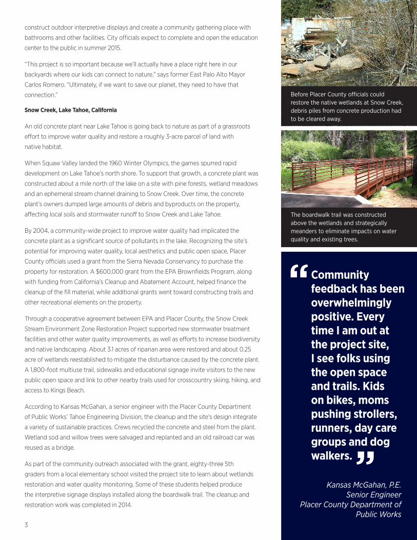
and an ephemeral stream channel draining to Snow Creek. Over time, the concrete
plant’s owners dumped large amounts of debris and byproducts on the property,
affecting local soils and stormwater runoff to Snow Creek and Lake Tahoe.
By 2004, a community-wide project to improve water quality had implicated the
concrete plant as a significant source of pollutants in the lake. Recognizing the site’s
potential for improving water quality, local aesthetics and public open space, Placer
County officials used a grant from the Sierra Nevada Conservancy to purchase the
property for restoration. A $600,000 grant from the EPA Brownfields Program, along
with funding from California’s Cleanup and Abatement Account, helped finance the
cleanup of the fill material, while additional grants went toward constructing trails and
other recreational elements on the property.
Through a cooperative agreement between EPA and Placer County, the Snow Creek
Stream Environment Zone Restoration Project supported new stormwater treatment
facilities and other water quality improvements, as well as efforts to increase biodiversity
and native landscaping. About 3.1 acres of riparian area were restored and about 0.25
acre of wetlands reestablished to mitigate the disturbance caused by the concrete plant.
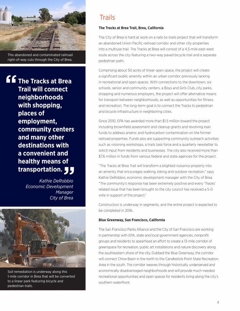
A 1,800-foot multiuse trail, sidewalks and educational signage invite visitors to the new
public open space and link to other nearby trails used for crosscountry skiing, hiking, and
access to Kings Beach.
According to Kansas McGahan, a senior engineer with the Placer County Department
of Public Works’ Tahoe Engineering Division, the cleanup and the site’s design integrate
a variety of sustainable practices. Crews recycled the concrete and steel from the plant.
Wetland sod and willow trees were salvaged and replanted and an old railroad car was
reused as a bridge.
As part of the community outreach associated with the grant, eighty-three 5th
graders from a local elementary school visited the project site to learn about wetlands
restoration and water quality monitoring. Some of these students helped produce
the interpretive signage displays installed along the boardwalk trail. The cleanup and
restoration work was completed in 2014.
Before Placer County officials could restore the native wetlands at Snow Creek, debris piles from concrete production had to be cleared away.
The boardwalk trail was constructed above the wetlands and strategically meanders to eliminate impacts on water quality and existing trees.
Community feedback has been overwhelmingly positive. Every time I am out at the project site, I see folks using the open space and trails. Kids on bikes, moms pushing strollers, runners, day care groups and dog walkers.
Kansas McGahan, P.E.Senior Engineer
Placer County Department of Public Works
“
“
4
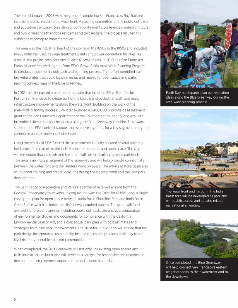
This abandoned and contaminated railroad right-of-way cuts through the City of Brea.
The Tracks at Brea Trail will connect neighborhoods with shopping, places of employment, community centers and many other destinations with a convenient and healthy means of transportation.
Kathie DeRobbioEconomic Development
Manager City of Brea
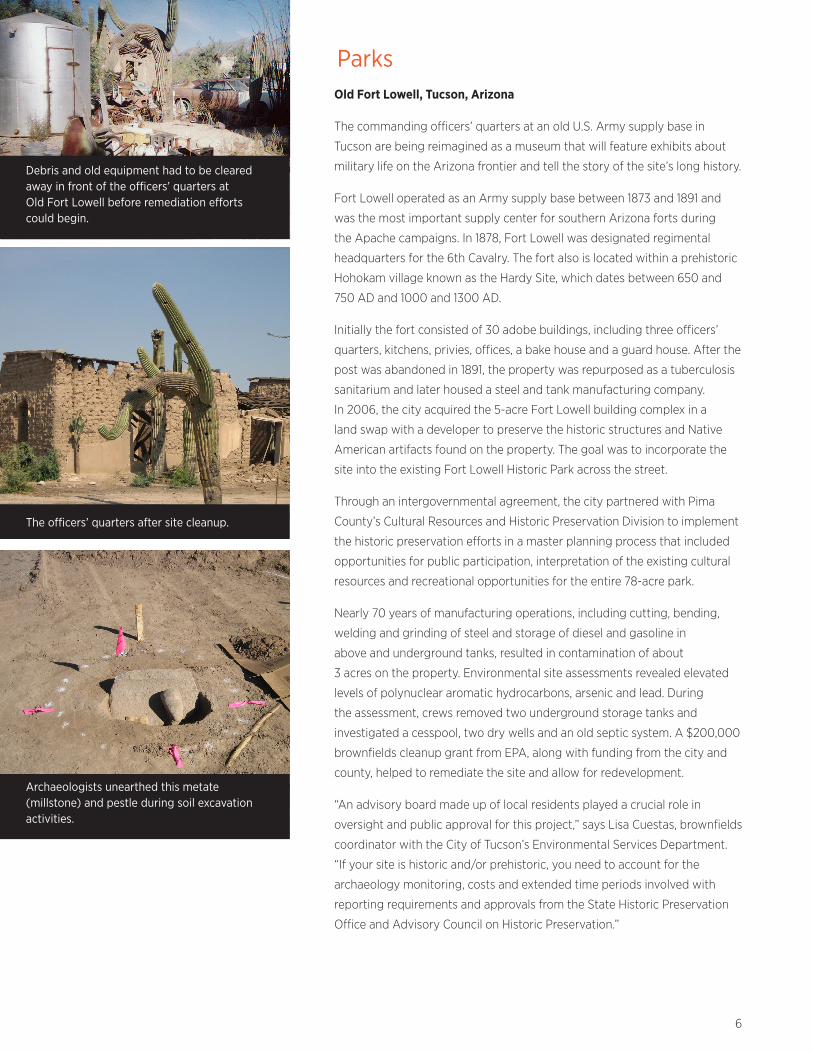
Soil remediation is underway along this 1-mile corridor in Brea that will be converted to a linear park featuring bicycle and pedestrian trails.
“
“
TrailsThe Tracks at Brea Trail, Brea, California
The City of Brea is hard at work on a rails-to-trails project that will transform
an abandoned Union Pacific railroad corridor and other city properties
into a multiuse trail. The Tracks at Brea will consist of a 4.5-mile east-west
route across the city featuring a two-way paved bicycle trail and a separate
pedestrian path.
Comprising about 50 acres of linear open space, the project will create
a significant public amenity within an urban corridor previously lacking
in recreational and open spaces. With connections to the downtown, six
schools, senior and community centers, a Boys and Girls Club, city parks,
shopping and numerous employers, the project will offer alternative means
for transport between neighborhoods, as well as opportunities for fitness
and recreation. The long-term goal is to connect the Tracks to pedestrian
and bicycle infrastructure in neighboring cities.
Since 2010, EPA has awarded more than $1.5 million toward the project,
including brownfield assessment and cleanup grants and revolving loan
funds to address arsenic and hydrocarbon contamination on the former
railroad properties. Funds also are supporting community outreach activities
such as visioning workshops, a trails task force and a quarterly newsletter to
solicit input from residents and businesses. The city also received more than
$7.6 million in funds from various federal and state agencies for the project.
“The Tracks at Brea Trail will transform a blighted nuisance property into
an amenity that encourages walking, biking and outdoor recreation,” says
Kathie DeRobbio, economic development manager with the City of Brea.
“The community’s response has been extremely positive and every ‘Tracks’
related issue that has been brought to the city council has received a 5-0
vote in support of the project.”
Construction is underway in segments, and the entire project is expected to
be completed in 2016.
Blue Greenway, San Francisco, California
The San Francisco Parks Alliance and the City of San Francisco are working
in partnership with EPA, state and local government agencies, nonprofit
groups and residents to spearhead an effort to create a 13-mile corridor of
greenspace for recreation, public art installations and nature discovery along
the southeastern shore of the city. Dubbed the Blue Greenway, the corridor
will connect China Basin in the north to the Candlestick Point State Recreation
Area in the south. The corridor weaves through historically underserved and
economically disadvantaged neighborhoods and will provide much-needed
recreational opportunities and open spaces for residents living along the city’s
southern waterfront.
5
The project began in 2003 with the goals of completing San Francisco’s Bay Trail and
increasing public access to the waterfront. A steering committee led the public outreach
and education campaign, consisting of community events, conferences, waterfront tours
and public meetings to engage residents and civic leaders. The process resulted in a
vision and roadmap to implementation.
This area was the industrial heart of the city from the 1850s to the 1950s and included
heavy industrial uses, sewage treatment plants and power generation facilities. As
a result, the project area contains at least 12 brownfields. In 2010, the San Francisco
Parks Alliance received a grant from EPA’s Brownfields Area-Wide Planning Program
to conduct a community outreach and planning process. That effort identified six
brownfield sites that could be cleaned up and reused for open space and parks,
helping connect gaps in the Blue Greenway.
In 2012, the city passed a park bond measure that included $16 million for the
Port of San Francisco to create part of the bicycle and pedestrian path and make
infrastructure improvements along the waterfront. Building on the work of the
area-wide planning process, EPA later awarded a $400,000 brownfields assessment
grant to the San Francisco Department of the Environment to identify and evaluate
brownfield sites in the southeast area along the Blue Greenway cooridor. This award
supplements EPA contract support and site investigations for a key segment along the
corridor in an area known as India Basin.
Using the results of EPA-funded site assessments, the city secured several privately
held brownfield parcels in the India Basin area for parks and open space. The city
will remediate those parcels and link them with other nearby shoreline parklands.
This area is an integral segment of the greenway and will help promote connectivity
between the waterfront and the Hunters Point Shipyard. The efforts at India Basin also
will support training and create local jobs during the cleanup work and trail and park
development.
The San Francisco Recreation and Parks Department received a grant from the
Coastal Conservancy to develop, in conjunction with the Trust for Public Land, a single
conceptual plan for open space between India Basin Shoreline Park and India Basin
Open Space, which includes the city’s newly acquired parcels. The grant will fund
oversight of project planning, including public outreach, site analysis, preparation
of environmental studies and documents for compliance with the California
Environmental Quality Act, and a conceptual park plan with cost estimates and
strategies for future park improvements. The Trust for Public Land will ensure that the
park design incorporates sustainability best practices and provides resiliency to sea
level rise for vulnerable adjacent communities.
When completed, the Blue Greenway will not only link existing open spaces and
trails infrastructure, but it also will serve as a catalyst for responsive and responsible
development, employment opportunities and economic vitality.
Earth Day participants plan out recreation ideas along the Blue Greenway during the area-wide planning process.
Once completed, the Blue Greenway will help connect San Francisco’s eastern neighborhoods to their waterfront and to the downtown.
The waterfront and harbor in the India Basin area will be developed as parkland with public access and aquatic-related recreational amenities.
6
Debris and old equipment had to be cleared away in front of the officers’ quarters at Old Fort Lowell before remediation efforts could begin.
The officers’ quarters after site cleanup.
Archaeologists unearthed this metate (millstone) and pestle during soil excavation activities.
ParksOld Fort Lowell, Tucson, Arizona
The commanding officers’ quarters at an old U.S. Army supply base in
Tucson are being reimagined as a museum that will feature exhibits about
military life on the Arizona frontier and tell the story of the site’s long history.
Fort Lowell operated as an Army supply base between 1873 and 1891 and
was the most important supply center for southern Arizona forts during
the Apache campaigns. In 1878, Fort Lowell was designated regimental
headquarters for the 6th Cavalry. The fort also is located within a prehistoric
Hohokam village known as the Hardy Site, which dates between 650 and
750 AD and 1000 and 1300 AD.
Initially the fort consisted of 30 adobe buildings, including three officers’
quarters, kitchens, privies, offices, a bake house and a guard house. After the
post was abandoned in 1891, the property was repurposed as a tuberculosis
sanitarium and later housed a steel and tank manufacturing company.
In 2006, the city acquired the 5-acre Fort Lowell building complex in a
land swap with a developer to preserve the historic structures and Native
American artifacts found on the property. The goal was to incorporate the
site into the existing Fort Lowell Historic Park across the street.
Through an intergovernmental agreement, the city partnered with Pima
County’s Cultural Resources and Historic Preservation Division to implement
the historic preservation efforts in a master planning process that included
opportunities for public participation, interpretation of the existing cultural
resources and recreational opportunities for the entire 78-acre park.
Nearly 70 years of manufacturing operations, including cutting, bending,
welding and grinding of steel and storage of diesel and gasoline in
above and underground tanks, resulted in contamination of about
3 acres on the property. Environmental site assessments revealed elevated
levels of polynuclear aromatic hydrocarbons, arsenic and lead. During
the assessment, crews removed two underground storage tanks and
investigated a cesspool, two dry wells and an old septic system. A $200,000
brownfields cleanup grant from EPA, along with funding from the city and
county, helped to remediate the site and allow for redevelopment.
“An advisory board made up of local residents played a crucial role in
oversight and public approval for this project,” says Lisa Cuestas, brownfields
coordinator with the City of Tucson’s Environmental Services Department.
“If your site is historic and/or prehistoric, you need to account for the
archaeology monitoring, costs and extended time periods involved with
reporting requirements and approvals from the State Historic Preservation
Office and Advisory Council on Historic Preservation.”
7
The restoration and preservation efforts in the officers’ quarters are underway. Future
funding through a bond election will support continued preservation and educational
activities, including integrating historic interpretation of the fort’s remains with other
resources on both sides of Craycroft Boulevard. New and improved sports fields, a
swimming pool, tennis courts, playground structures and hiking trails also are planned.
In addition, the city will install a HAWK pedestrian beacon to improve safety for
pedestrians crossing Craycroft Boulevard.
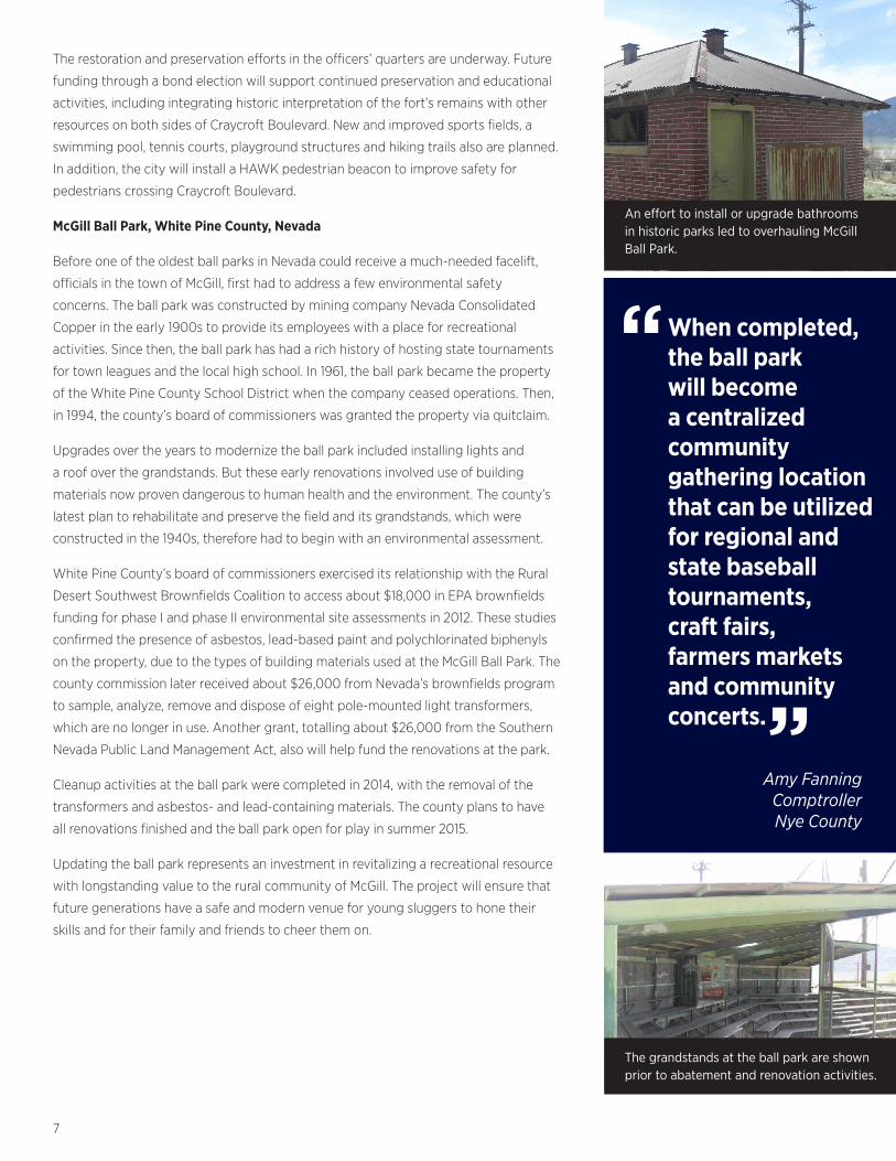
McGill Ball Park, White Pine County, Nevada
Before one of the oldest ball parks in Nevada could receive a much-needed facelift,
officials in the town of McGill, first had to address a few environmental safety
concerns. The ball park was constructed by mining company Nevada Consolidated
Copper in the early 1900s to provide its employees with a place for recreational
activities. Since then, the ball park has had a rich history of hosting state tournaments
for town leagues and the local high school. In 1961, the ball park became the property
of the White Pine County School District when the company ceased operations. Then,
in 1994, the county’s board of commissioners was granted the property via quitclaim.
Upgrades over the years to modernize the ball park included installing lights and
a roof over the grandstands. But these early renovations involved use of building
materials now proven dangerous to human health and the environment. The county’s
latest plan to rehabilitate and preserve the field and its grandstands, which were
constructed in the 1940s, therefore had to begin with an environmental assessment.
White Pine County’s board of commissioners exercised its relationship with the Rural
Desert Southwest Brownfields Coalition to access about $18,000 in EPA brownfields
funding for phase I and phase II environmental site assessments in 2012. These studies
confirmed the presence of asbestos, lead-based paint and polychlorinated biphenyls
on the property, due to the types of building materials used at the McGill Ball Park. The
county commission later received about $26,000 from Nevada’s brownfields program
to sample, analyze, remove and dispose of eight pole-mounted light transformers,
which are no longer in use. Another grant, totalling about $26,000 from the Southern
Nevada Public Land Management Act, also will help fund the renovations at the park.
Cleanup activities at the ball park were completed in 2014, with the removal of the
transformers and asbestos- and lead-containing materials. The county plans to have
all renovations finished and the ball park open for play in summer 2015.
Updating the ball park represents an investment in revitalizing a recreational resource
with longstanding value to the rural community of McGill. The project will ensure that
future generations have a safe and modern venue for young sluggers to hone their
skills and for their family and friends to cheer them on.
An effort to install or upgrade bathrooms in historic parks led to overhauling McGill Ball Park.
When completed, the ball park will become a centralized community gathering location that can be utilized for regional and state baseball tournaments, craft fairs, farmers markets and community concerts.
Amy Fanning ComptrollerNye County
““
The grandstands at the ball park are shown prior to abatement and renovation activities.
8
Keys to SuccessThese examples underscore a number of keys to success in advancing brownfield
assessment, remediation and redevelopment projects.
Partnerships. Coordination among local, state and Federal government agencies is
key. Development of broad partnerships across multiple stakeholder groups, including
property owners, EPA grant recipients, regulators, consultants, community groups,
nonprofit organizations and other interested parties, helps expedite work toward
common goals.
As evidenced at Cooley Landing Park in East Palo Alto, California, partners bring
complementary support and skill sets to the table, from funding and cleanup logistics to
native habitat restoration and long-term maintenance of the restored land. In general,
the more participants involved in the upfront planning, the smoother the project will go.
Community Engagement. Reaching out to the community generates local interest
and support for the project, and ultimately helps ensure that the redeveloped property
meets community needs and expectations. Community groups and residents can serve
as sources of valuable input in visioning and design charettes. Especially in economically
disadvantaged areas, community involvement provides an opportunity for all interested
residents and stakeholders to have a voice in their community’s future.
As demonstrated by the habitat restoration project at Snow Creek in
Lake Tahoe, California, involving schools and youth groups is a great way to
promote environmental education and inspire young people to play a role in
redevelopment activities.
Patience and persistence too are critical. “The process takes a while to make sure things
are done right the first time,” says Amy Fanning, comptroller with Nye County, Nevada.
“Keeping the community informed at each milestone—and celebrating
even small successes—helps maintain momentum and cooperation from your
community partners.”
Leveraging Resources. All the grantees reported that leveraging funding from a variety
of sources makes these types of projects possible—and affordable. A combination of
public and private sector funding can help finance assessment, remediation, purchase
and redevelopment activities. These funding sources could include property owners,
developers, investors, and nonprofit organizations, as well as local, state and federal
government programs that offer tax credits, tax abatements, tax increment financing,
grants, subsidies, bonds or loans.
Combining federal and state brownfields money with funds generated through bond
elections proved successful in the Old Fort Lowell and Blue Greenway projects. Both the
Snow Creek and Blue Greenway projects leveraged grants from nonprofits to advance
their efforts. Reach out to your state brownfields program or municipal economic
development agency for more information on financing brownfield redevelopment.
For more information: Visit the EPA Brownfields website at www.epa.gov/brownfields or contact Region 9 Brownfields Coordinator Noemi Emeric-Ford at (213) 244-1821 or [email protected].
EPA 560-F-14-214 January 2015
Potential Benefits of Brownfields Redevelopment as Open Space
Health
•
• •
Removal or reduction of exposure to contamination Increased access to open space Active recreational opportunities
Environmental
• • • •
•
Habitat and ecosystem restorationImproved land and water qualityReduced heat island effectsReduced greenhouse gas emissionsMore sustainable environment
Social
• • •
•
• • • •
Improved aestheticsCreation of public space Provision of trails, art and amenitiesEnvironmental education opportunitiesImproved neighborhoodsMore vibrant, livable communitiesEnhanced quality of lifeAddressing of environmental justice issues
Economic
• • • •
Job creationIncreased transportation optionsImproved property valuesSpurred economic development