Embed Size (px)
Citation preview
[1]
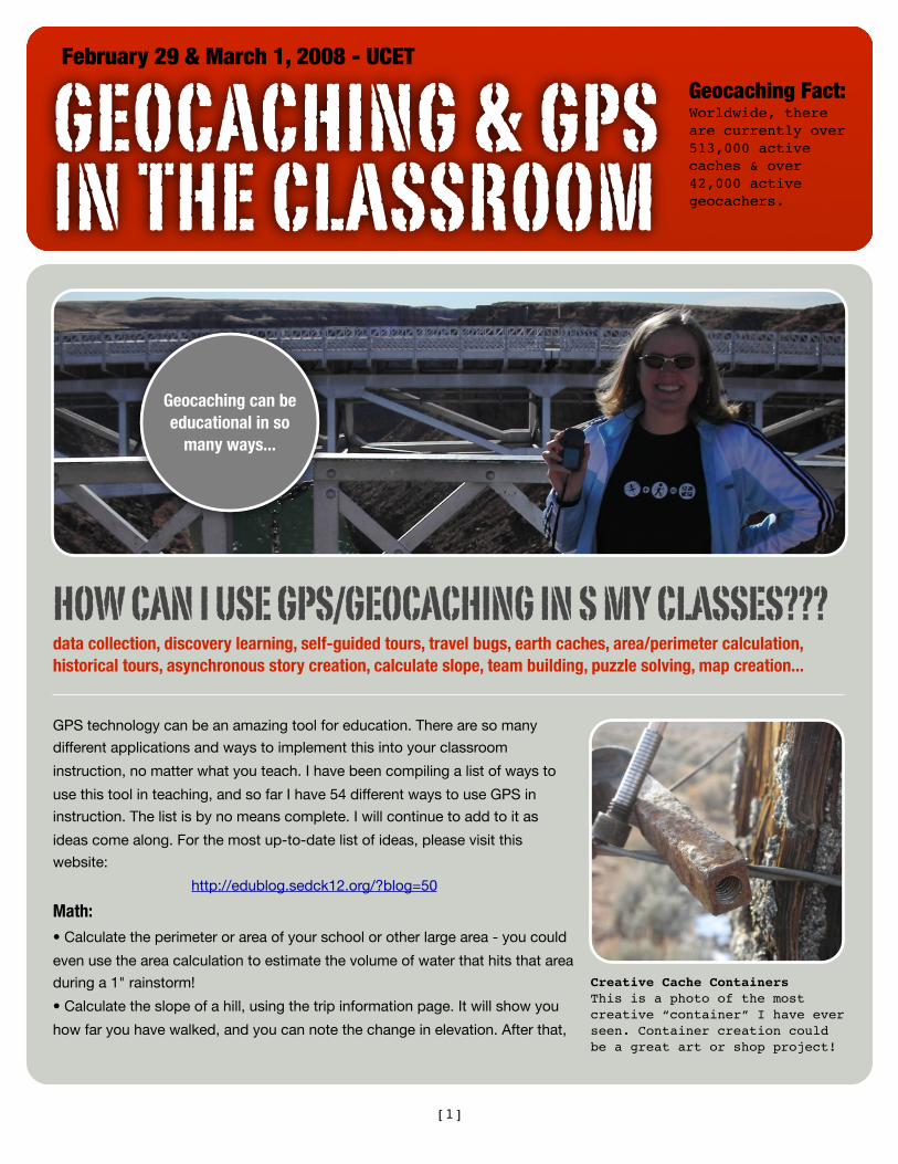
Creative Cache ContainersThis is a photo of the most creative “container” I have ever seen. Container creation could be a great art or shop project!
GEOCACHING & GPS IN THE CLASSROOM
February 29 & March 1, 2008 - UCETGeocaching Fact:Worldwide, there are currently over 513,000 active caches & over 42,000 active geocachers.
HOW CAN I USE GPS/GEOCACHING IN S MY CLASSES???data collection, discovery learning, self-guided tours, travel bugs, earth caches, area/perimeter calculation, historical tours, asynchronous story creation, calculate slope, team building, puzzle solving, map creation...
GPS technology can be an amazing tool for education. There are so many
different applications and ways to implement this into your classroom
instruction, no matter what you teach. I have been compiling a list of ways to
use this tool in teaching, and so far I have 54 different ways to use GPS in
instruction. The list is by no means complete. I will continue to add to it as
ideas come along. For the most up-to-date list of ideas, please visit this
website:
http://edublog.sedck12.org/?blog=50
Math:• Calculate the perimeter or area of your school or other large area - you could
even use the area calculation to estimate the volume of water that hits that area
during a 1" rainstorm!
• Calculate the slope of a hill, using the trip information page. It will show you
how far you have walked, and you can note the change in elevation. After that,
Geocaching can be educational in so
many ways...
[2]
let the power of the Pythagorean
Theorem guide you!
• Magic of Nine (GCGJPT) Geocache
(http://www.geocaching.com/seek/
cache_details.aspx?wp=GCGJPT).
Through some mathematical trick, the
procedure outlined in the cache
description will give correct
coordinates, even thgough the input
numbers could be different. Can
anyone explain to me how this one
works?
• Create a path, and at each turn, tell
your partner the angle to measure to
make the next turn. Could each
member of the team retrace the
correct path?
• Create a multi-cache, and require
students to do different math functions
or problems to come up with the
correct numbers for the next location.
• Have students walk and plot on the
map the endpoints of a given shape
(triangle, rhombus, parallelogram,
circle, etc.) and see their results. (My
addition - using Google Earth, plot the
coordinates and enter them into the
GPS units. Have students go from
point to point and see how the shape
that they walked compares to the
shape that they plotted.)
• Calculate the distance between 2
points, then calculate the legs using
Pythagoreans Theorem
• Calculate the height of an object
• Calculate or find the elevations of
different points and graph those
elevations.
• Area: Have students go outside and
step off an area, graph it, and find the
area. Use the GPS to walk the same
area to see how close you
were with the first estimate.
• (Elementary) Use the units to
practice or learn cardinal
directions of N, S, E, & W.
• Practice adding and
subtracting 3 digit numbers to
come up with GPS
coordinates to travel
from one cache or
location to another.
• Use a Sudoku
puzzle to give cache
coordinates - replace
the first needed digit in the
puzzle with an A, second number with
a B, and so on until the full
coordinates are given.
Social Studies/Geography:
•Get to know your Presidents. See
President's Day (GC10QA0)! (http://
www.geocaching.com/seek/
cache_details.aspx?wp=GC10QA0)
Use the presidential election order to
give the coordinates of a geocache in
a code.
• Develop an historical tour of your
town that takes people to different
monuments, statues, or markers of
historical events, and develop a
narrative for each location
• Come up with a "Travel Bug" on
Geocaching.com that will go from
place to place and end up in an
historical location that pertains to the
class, or give your travel bug a specific
route to follow, such as the Old
Spanish Trail or the route Lewis &
Clark took - whatever you are
studying!
• Send a travel bug along the route
that the pioneers took, or to go to the
locations of different Civil War battles.
• Hide flags for various countries and
have a group/pair of students each
find one and look on the Internet
(CultureGrams) for more information of
that country.
• Find elevation change & relief when
learning to use topographic maps.
• Take a GPS on field trips and either
use the Geocaching.com website or
have each class leave a cache for the
next class.
• Geocache Time Capsule: Create a
cache and leave some news items or
top issues of the class year and place
them in a cache near your school.
Leave similar items each year and over
time it can give some perspective on
past events.
• Use the GPS to show students that
there is more than one way to find
different locations or objects -
compare it with a compass, stars, or
other ways of navigating.
Science:• EarthCaching. There are many
caches that people have come up with
GEOCACHING & GPS IN THE CLASSROOM
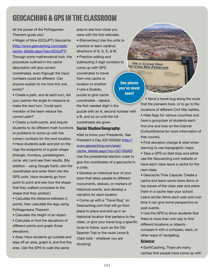
See places you’ve never
seen!
[3]
to point out or direct you to locations
that are geologically interesting. These
are called earthcaches. Plug in the
coordinates into a GPS and let your
students direct the class to places
where you could talk about rock types,
faults, or any other topic in Geology.
There are nearly 2,000 of these
locations already, and you could add
your own!
• Weather. "In our fifth grade caches,
we will have a log book, thermometer/
hygrometer, cloud chart, and
directions. We will ask people to log
the date and time, as well as a general
description of the weather conditions,
a comment on clouds overhead (if
any), and the temperature and
humidity." The cache finders will log
this information and collect the data
for you!
• Earth Science. "In the sixth grade
caches, which will be placed along
creeks/rivers, we will have water
testing strips. We will ask finders to log
the date, time, and results of a
quick water test at
the site."
• "Our students will help us collect
and graph the data. They will also be
involved in making and hiding the
cache containers. We're going to
request that people fill in the log book
and also take away a note sheet with
the same data to include in their online
log of their find. That way, we can
collect data from the cache pages in
real time without having to visit the
hide locations frequently."
• Make a botanical tour of your
campus or a park marking the
locations of different plants and
include a tour guide that gives each
plant its scientific name and
characteristics.
• Types of Rock Scavenger Hunt. Give
your students the locations of different
types of rocks. Their job is to
determine as a group what type or
kind of rock it is, give 3 reasons why
they think this, and bring back a
sample of the rock.
• Create a map or tour of different rock
formations with a description of each
layer visited.
• Create a map of different micro-
ecosystems around the campus.
• Locate & record coordinates of 3
major geologic features near your
home (i.e. faults, landslides, highly
eroded areas, geologic
formations, etc.).
• Create a virtual outdoor
classroom by marking the
locations of different habitats to
visit as examples.
• Use the units in the study of
moon phases - the Calendar on
the GPS units give the current phase
of the moon.
Language Arts:
• Hide different parts of a sequential
story in different caches around your
campus. Students will find each part
and as a group, decide the proper
sequence.
• Send your students to a coordinate
and have students write a description
of the object they find there or a
description of what they see there
facing a certain direction.
• Hide topics for essays & have
groups find a cache and do a group
project on that topic.
• Cut apart a story and have student
find the pieces and put them back
together using retention skills.
• Have several student writings at
each point, each with different
numbers. The student chooses the
story they like based on interest and
goes to the group by interest, then
continue on with like groups.
• Class reads story or book. Hide
props for the characters, setting,
problem/solution etc. and have the
students locate these props with the
GPS. Meet back together to do a
retelling or make up a new ending.
Other Content Areas & Electives:
• Art: Send your students on a Photo
Safari, where they mark the locations
and take digital photos of different
sculptures or monuments around your
town. They can report back with a
slide show and a map describing what
they saw, who created it, and why it is
significant.
• Physical Education: Have your
students map out a mile long course
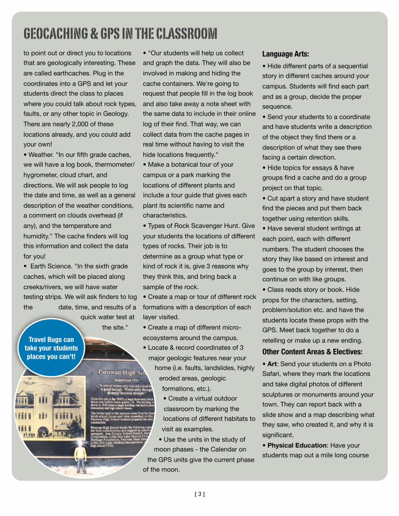
Travel Bugs can take your students places you can’t!
GEOCACHING & GPS IN THE CLASSROOM
[4]
around your school to follow for
walking or running.
• Home Ec./Family & Consumer
Science/Health:
• Create an historical homes tour
around your town.
• Give students a recipe and the
coordinates of the ingredients (i.e.
store, garden, restaurant, etc.) and
have them retrieve the ingredients,
come back to the school, and cook
the dish.
• Place ingredients & pieces of a
recipe in different locations. Each
group must find their goal in
order to complete the recipe
accurately & with all
ingredients.
• Go and find different foods
from each food group.
Counseling/TLC:
• Create a problem or activity to
promote a teamwork teaching
moment.
• Have students come up with
different careers that could use a GPS
and describe how they would use it.
• (Elementary) Use the GPS to
introduce students to the school by
using it to find classes (or find the
Gingerbread Man at Panguitch
Elementary).
• Computers: Create a new geocache
and list it on Geocaching.com. Create
a travel bug to make it more
interesting.
• Music: Go to different sites to find
music clues or rhythms and try to
duplicate them with rhythm sticks.
My favorite educational geocache:The name is "What If..." and asks the
question, what if the Sun were the size
of a community water tank? The
placer has scaled the Solar System
based on the size of the tank as the
size of the Sun. I have completed all of
the stages, and the scale is amazing.
Saturn, the last cache that you can
see the tank from is 8.5 miles away!
Pluto is the last cache in the series,
and it
would
be less than an inch
in diameter and 32 miles away. It is an
amazing way to help students visualize
the sheer dimensions and emptiness
of the solar system.
If you are in Cedar City, the work has
already been done for you, but there
are a multitude of ways to incorporate
this into your instruction in many
different classes. You could...
•...use this in Science to teach the
planets in the Solar System. At each
planet location, you could tell how
large the planet would be at this
distance from your "Sun" and then talk
about the orbit, diameter, mass, etc. of
each planet as you went. The Nine
Planets website has images and all of
the information that you will need! If
you need a little help with converting
the sizes of the planets and the
distances to scale, let me know and I
will pass along a file called Planetary
Conversions in Excel that will do the
work for you.
•...use this in Math to teach
conversions, ratios, fractions, etc. Find
a suitable "Sun" and measure its
dimensions. Then use this and the
information at Nine Planets to convert
each planet size and distance from the
sun to your scale. Feel free to use the
Excel file linked above for help.
•...use this in Geography to help
teach mapping skills. Find a
suitable "Sun" to figure out the
relative sizes and distances and
have your students locate and map
spots where each planet could be and
how big it would be at that distance.
•...extend this in Science by assigning
moons from the planets to your
students. Based on your scale, they
would have to calculate how big the
moon would be and how far away it
should be from it's planet. Extra credit
could be given for making a model of
their moon.
Of course, the real power of these
activities is not to just do the math or
project, but to actually go out and let
your students experience the scale
and the distances involved for
themselves. Be careful, the larger your
Sun is, the further you will have to
travel to Pluto!
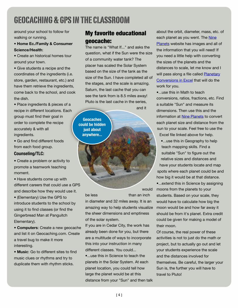
Geocaches could be hidden
just about anywhere...
GEOCACHING & GPS IN THE CLASSROOM