Embed Size (px)
Citation preview
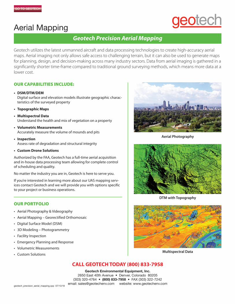
Geotech utilizes the latest unmanned aircraft and data processing technologies to create high-accuracy aerialmaps. Aerial imaging not only allows safe access to challenging terrain, but it can also be used to generate mapsfor planning, design, and decision-making across many industry sectors. Data from aerial imaging is gathered in asignificantly shorter time-frame compared to traditional ground surveying methods, which means more data at alower cost.
OUR CAPABILITIES INCLUDE:
• DSM/DTM/DEMDigital surface and elevation models illustrate geographic charac-teristics of the surveyed property
• Topographic Maps
• Multispectral DataUnderstand the health and mix of vegetation on a property
• Volumetric MeasurementsAccurately measure the volume of mounds and pits
• InspectionAssess rate of degradation and structural integrity
• Custom Drone Solutions
Authorized by the FAA, Geotech has a full-time aerial acquisitionand in-house data processing team allowing for complete control of scheduling and quality.
No matter the industry you are in, Geotech is here to serve you.
If you’re interested in learning more about our UAS mapping serv-ices contact Geotech and we will provide you with options specificto your project or business operations.
OUR PORTFOLIO
• Aerial Photography & Videography
• Aerial Mapping – Georectified Orthomosaic
• Digital Surface Model (DSM)
• 3D Modeling – Photogrammetry
• Facility Inspection
• Emergency Planning and Response
• Volumetric Measurements
• Custom Solutions
CALL GEOTECH TODAY (800) 833-7958Geotech Environmental Equipment, Inc.
2650 East 40th Avenue • Denver, Colorado 80205(303) 320-4764 • (800) 833-7958 • FAX (303) 322-7242
email: [email protected] website: www.geotechenv.comgeotech_precision_aerial_mapping.qxp 07/13/18
Geotech Precision Aerial Mapping
Aerial Mapping
Aerial Photography
DTM with Topography
Multispectral Data
Geotech Precision Aerial Mapping
Aerial Mapping
CALL GEOTECH TODAY (800) 833-7958Geotech Environmental Equipment, Inc.
2650 East 40th Avenue • Denver, Colorado 80205(303) 320-4764 • (800) 833-7958 • FAX (303) 322-7242
email: [email protected] website: www.geotechenv.com
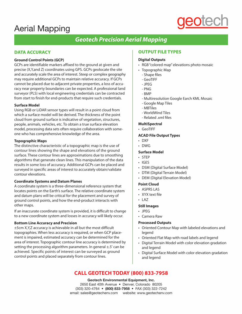
DATA ACCURACY
Ground Control Points (GCP)GCPs are identifiable markers affixed to the ground at given and precise (X,Y,and Z) coordinates using GPS. GCPs geolocate the siteand accurately scale the area of interest. Steep or complex geographymay require additional GCPs to maintain relative accuracy. If GCPscannot be placed due to adjacent private properties, a loss of accu-racy near property boundaries can be expected. A professional landsurveyor (PLS) with local engineering credentials can be contractedfrom start to finish for end-products that require such credentials.
Surface ModelUsing RGB or LiDAR sensor types will result in a point cloud fromwhich a surface model will be derived. The thickness of the pointcloud from ground surface is indicative of vegetation, structures,people, animals, vehicles, etc. To obtain a true surface elevationmodel, processing data sets often require collaboration with some-one who has comprehensive knowledge of the area.
Topographic MapsThe distinctive characteristic of a topographic map is the use ofcontour lines showing the shape and elevations of the groundsurface. These contour lines are approximations due to smoothingalgorithms that generate clean lines. This manipulation of the dataresults in some loss of accuracy. Additional GCPs can be placed andsurveyed in specific areas of interest to accurately obtain/validatecontour elevations.
Coordinate Systems and Datum PlanesA coordinate system is a three-dimensional reference system that locates points on the Earth’s surface. The relative coordinate systemand datum plans will be critical for the placement and survey ofground control points, and how the end-product interacts withother maps.
If an inaccurate coordinate system is provided, it is difficult to changeto a new coordinate system and losses in accuracy will likely occur.
Bottom Line Accuracy and Precision±5cm X,Y,Z accuracy is achievable in all but the most difficulttopographies. When less accuracy is required, or when GCP place-ment is impaired, estimated accuracy can be determined for thearea of interest. Topographic contour line accuracy is determined bysetting the processing algorithm parameters. In general ±.5' can beachieved. Specific points of interest can be surveyed as groundcontrol points and placed separately from contour lines.
OUTPUT FILE TYPES
Digital Outputs• RGB “colored map” elevations photo mosaic• Topographic Map
- Shape files- GeoTIFF- JPEG- PNG- BMP- Multiresolution Google Earch KML Mosaic- Google Map Tiles- MBTiles- WorldWind Tiles- Related .xml files
MultiSpectral• GeoTIFF
ACAD File Output Types• DXF• DWG
Surface Model• STEP• IGES• DSM (Digital Surface Model)• DTM (Digital Terrain Model)• DEM (Digital Elevation Model)
Point Cloud• ASPRS LAS• XYX text file• LAZ
Still Images• JPEG• Camera Raw
Processed Outputs• Oriented Contour Map with labeled elevations and
legend• Oriented Flat Map with road labels and legend• Digital Terrain Model with color elevation gradation
and legend• Digital Surface Model with color elevation gradation
and legend