Embed Size (px)
Citation preview
Getting to Know ArcGIS Image
Analyst
Essential workflows for getting started
with ArcGIS Image Analyst
Publication date: March 28, 2019
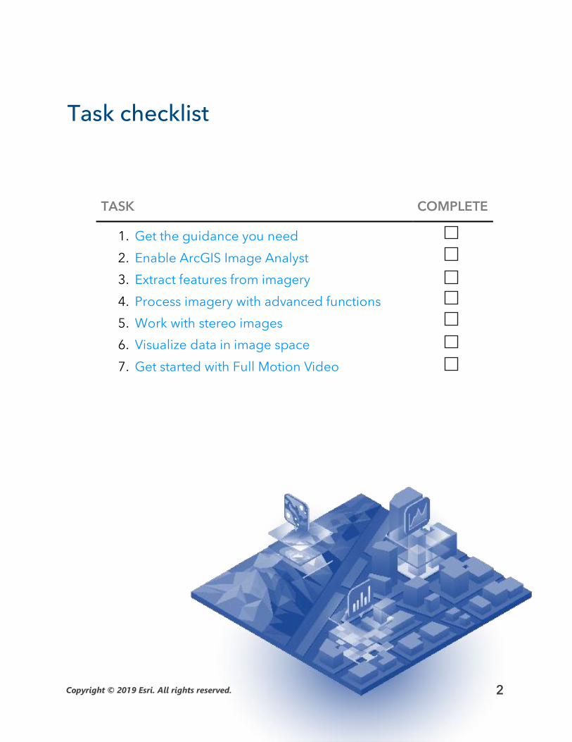
Task checklist
TASK COMPLETE
1. Get the guidance you need
2. Enable ArcGIS Image Analyst
3. Extract features from imagery
4. Process imagery with advanced functions
5. Work with stereo images
6. Visualize data in image space
7. Get started with Full Motion Video
Copyright © 2019 Esri. All rights reserved. 2
1. Get the guidance you need
The purpose of the Getting to Know ArcGIS Image Analyst guide is to give you hands-
on experience with the ArcGIS Image Analyst extension in ArcGIS Pro. You’ll get
started with stereo imagery, deep learning image classification, Full Motion Video,
and other advanced functionality.
We want you to be successful when you work through this guide, but there may be
another guide or resource that is better suited to your goals. Look at the list of roles
below to find out which resources are best for you.
If you’re an imagery analyst or GIS professional…
If you are an imagery analyst or a GIS professional looking to get more familiar with
advanced image processing capabilities, this is the guide for you.
Get started by moving on to the next section.
If you’re new to GIS or imagery…
If you are a new ArcGIS Pro user or simply new to image analysis, work through the
tutorials below before diving into the Getting to Know ArcGIS Image Analyst guide.
• Get started with ArcGIS Pro using this guided learn path.
• Learn how to use ArcGIS Pro to predict deforestation in Brazil.
• Get started with imagery by exploring the Esri Landsat app.
If you’re an administrator or manager…
If you are an administrator or a manager and you are looking for help accessing,
downloading, and licensing ArcGIS Pro and extensions like ArcGIS Image Analyst,
download the ArcGIS Pro Implementation Guide.
There you will learn how to obtain, install, and set up ArcGIS Pro for you and your
organization.
Copyright © 2019 Esri. All rights reserved. 3
2. Enable ArcGIS Image Analyst
ArcGIS Image Analyst is an extension for ArcGIS Pro that gives you access to enriched
visualization, geospatial analytics, and powerful image exploitation tools. It is
designed for analysts, scientists, and photogrammetrists who process, interpret,
analyze, and create information products from imagery and other remotely sensed
data.
Once you have purchased ArcGIS Image Analyst or requested a free trial, you can enable it in ArcGIS Pro. You’ll need an administrator of your organization to assign you the ArcGIS Image Analyst license. Once assigned, you’ll have immediate access to the tools and capabilities that come with ArcGIS Image Analyst. Learn how to view and authorize ArcGIS Pro extension licenses.
Before you jump into ArcGIS Image Analyst, watch a few short videos to help you
understand the fundamental capabilities of image analysis in ArcGIS Pro:
• Feature extraction: See the different classification tools that enable you to
extract quantifiable features from imagery. [5 minutes]
• Process raster data: Watch how quickly images and raster data can be
processed using raster functions. [5 minutes]
• Stereo viewing: See how to view imagery in stereo and extract 3D features. [2
minutes]
• Enriched visualization and measurement: Watch how to view imagery and
make measurements in image space. [4 minutes]
• Full Motion Video: See the new Full Motion Video functionality in action. [3
minutes]
Start the ArcGIS Image Analyst video playlist.
Copyright © 2019 Esri. All rights reserved. 4
3. Extract features from imagery
Extracting GIS data from an image can be done by digitizing features on top of a
georeferenced image, detecting objects using deep learning techniques, or
delineating features using image classification. Image classification refers to the task
of assigning classes—defined in a classification system or schema—to all the pixels in a
remotely sensed image. The output raster from image classification can be used to
create thematic maps, quantify resources, or detect change.
In the following guided learning path, you will learn the following:
• The basics of image segmentation, classification, and machine learning:
Watch a presentation from Esri experts on image classification techniques.
[1 hour]
• How to extract land cover types from imagery: Get hands-on experience
by extracting impervious surfaces from a remotely sensed image. [1.5
hours]
• The Image Classification Wizard: Walk through the guided wizard in
ArcGIS Pro to create a thematic map from imagery. [30 minutes]
• How to use spectral profiles to improve results: Find out how you can use
charts in ArcGIS Pro to improve your classification. [1 hour]
• How to integrate deep learning with ArcGIS Pro: Use a trained deep
learning model to extract palm tree location and health from an image. [1.5
hours]
Learn how to extract features from imagery in ArcGIS.
Copyright © 2019 Esri. All rights reserved. 5
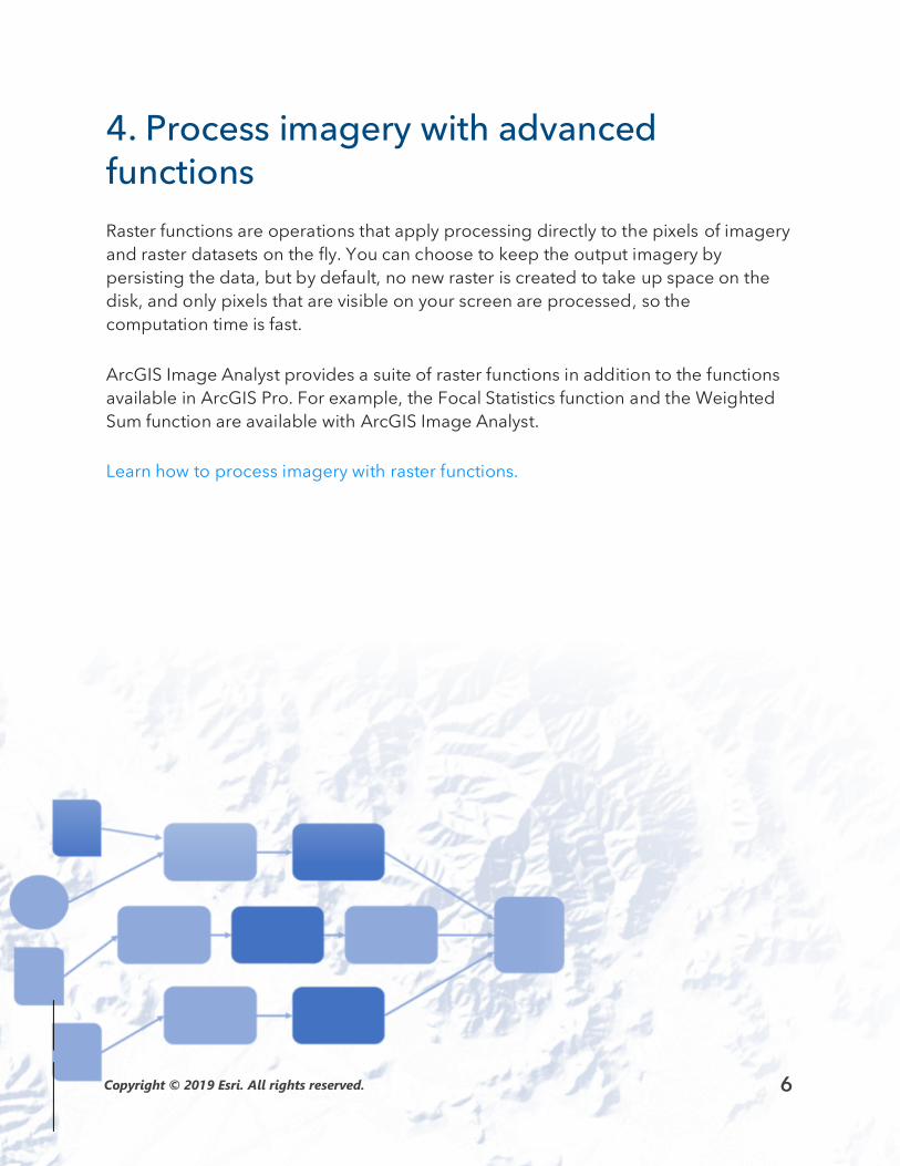
4. Process imagery with advanced functions
Raster functions are operations that apply processing directly to the pixels of imagery
and raster datasets on the fly. You can choose to keep the output imagery by
persisting the data, but by default, no new raster is created to take up space on the
disk, and only pixels that are visible on your screen are processed, so the
computation time is fast.
ArcGIS Image Analyst provides a suite of raster functions in addition to the functions
available in ArcGIS Pro. For example, the Focal Statistics function and the Weighted
Sum function are available with ArcGIS Image Analyst.
Learn how to process imagery with raster functions.
Copyright © 2019 Esri. All rights reserved. 6
5. Work with stereo images
Stereoscopy is the science of using overlapping images acquired from a remote
sensor at different look angles to produce 3D models that emulate true binocular
vision. With ArcGIS Image Analyst, you can visualize stereo pairs and create 3D
features in a stereo mapping environment.
To get an understanding of stereo mapping in ArcGIS Pro, read through the following
documentation, which describes the following:
• How to prepare satellite data for stereo mapping: Build a mosaic dataset
from overlapping imagery.
• How to prepare aerial data for stereo mapping: Build a mosaic dataset
from overlapping imagery.
• How to enable stereo viewing: See what is required and how to enable
stereo viewing in an ArcGIS Pro project.
• Create a stereo map: Visualize multiple stereo models in a stereo map and
use tools to navigate the map.
Next, learn how to collect and edit 3D features in stereo with this tutorial.
Copyright © 2019 Esri. All rights reserved. 7
6. Visualize data in image space
Oblique imagery can look distorted in projected map space,
making it hard to interpret. With ArcGIS Image Analyst, you can
display imagery from the perspective of the sensor. In image
space, buildings and features can be oriented vertically with no
distortion related to terrain, so they’re easier to interpret.
Features can be interactively measured, or they can be digitized,
edited, and saved in a map projection.
Watch the following video to get an introduction to working in
image space, and then get hands-on experience with the tutorial.
See a demonstration of image space in action.
Get hands-on experience working in image space.
Copyright © 2019 Esri. All rights reserved. 8
7. Get started with Full Motion Video
With Full Motion Video (FMV) in ArcGIS Image Analyst, you can work with aerial video
data right in your map. You can watch a drone-captured video in the video player
while seeing the path of the video frame update in your map. You can even capture
geospatial features using the video player or pause the video and export the contents
to a PowerPoint presentation with one click.
Use the following exercises to learn about Full Motion Video:
• Work with the video player: Take a tour of the tools and functionality of the
video player.
• Create features in your video: Digitize points of interest on your video and
save them for analysis.
• Use the video multiplexer tool: See how to use the multiplexer tool to
combine archived video with metadata to create FMV-compliant data.
• Multiplexer Tips and Tricks: What if your data isn’t formatted properly for
the multiplexer tool? Check out this blog post for handy tips.
Copyright © 2019 Esri. All rights reserved. 9
Additional resources
• ArcGIS Pro documentation is the best resource for learning how to use the
software in general and to perform specific tasks. It also includes technical
details and help for ArcGIS Image Analyst.
• The Learn ArcGIS Lesson Gallery includes a collection of lessons, articles,
story maps, and videos that help you learn about ArcGIS. Filter the results
for the Imagery and Remote Sensing capability to find resources specific to
image analysis.
• The GIS community, including Esri, shares thousands of ready-to-use
authoritative datasets in ArcGIS Living Atlas of the World. Browse for
imagery layers to use in your workflows.
• Join the conversation with the Esri Community on the Imagery and Remote
Sensing GeoNet forum. You can start discussions, ask questions, and share
your discoveries with other image analysis and remote-sensing specialists.
• The ArcGIS Blog gives you deeper insight into how ArcGIS helps you get
your image analysis workflows done.
• The ArcGIS Imagery Workflows site contains authoritative resources to help
you manage, analyze, and use your imagery effectively.
Copyright © 2019 Esri. All rights reserved. 10