Embed Size (px)
Citation preview
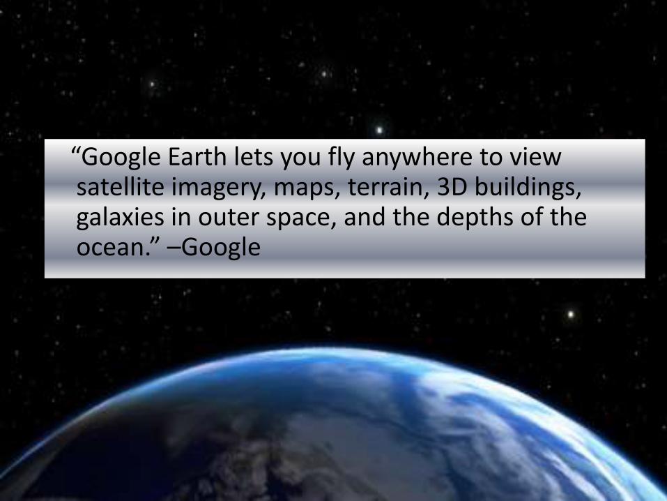
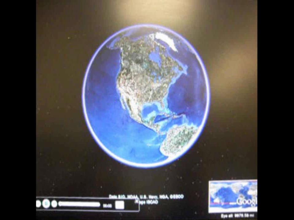
“Google Earth lets you fly anywhere to view satellite imagery, maps, terrain, 3D buildings, galaxies in outer space, and the depths of the ocean.” –Google
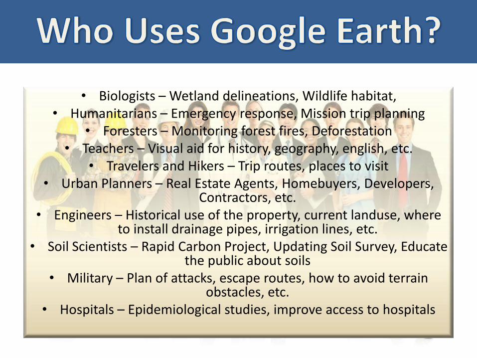
• Biologists – Wetland delineations, Wildlife habitat, • Humanitarians – Emergency response, Mission trip planning
• Foresters – Monitoring forest fires, Deforestation• Teachers – Visual aid for history, geography, english, etc.
• Travelers and Hikers – Trip routes, places to visit• Urban Planners – Real Estate Agents, Homebuyers, Developers,
Contractors, etc. • Engineers – Historical use of the property, current landuse, where
to install drainage pipes, irrigation lines, etc.• Soil Scientists – Rapid Carbon Project, Updating Soil Survey, Educate
the public about soils • Military – Plan of attacks, escape routes, how to avoid terrain
obstacles, etc.• Hospitals – Epidemiological studies, improve access to hospitals
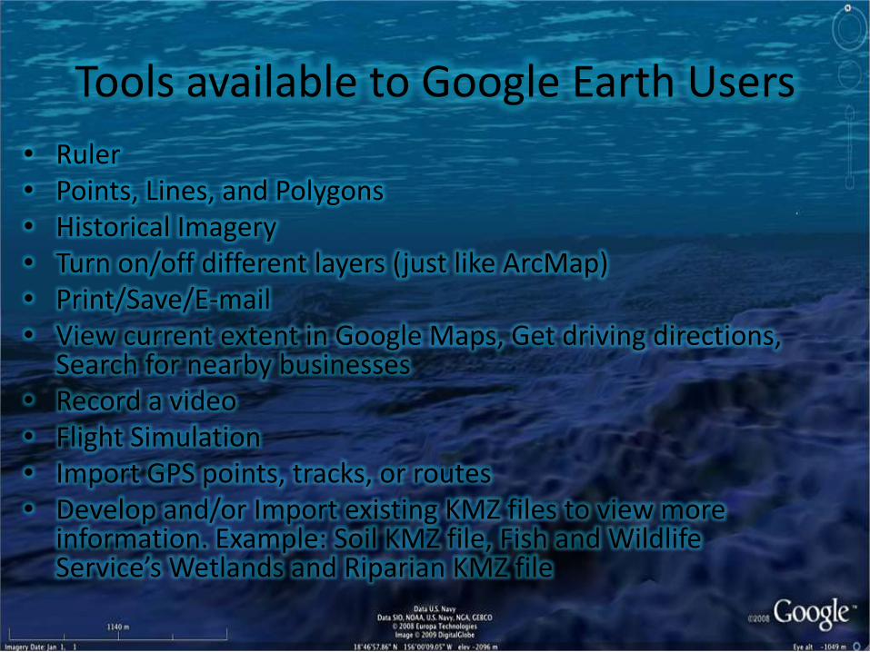
Tools available to Google Earth Users
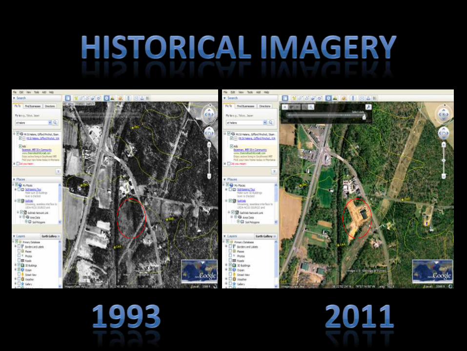
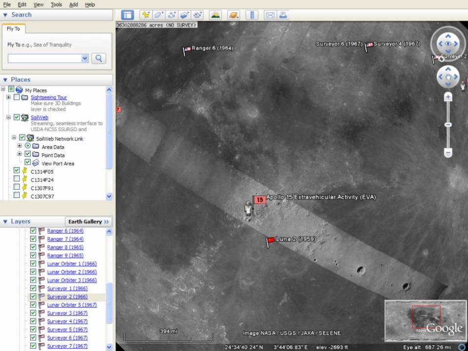
• Ruler• Points, Lines, and Polygons• Historical Imagery• Turn on/off different layers (just like ArcMap)• Print/Save/E-mail• View current extent in Google Maps, Get driving directions,
Search for nearby businesses• Record a video• Flight Simulation• Import GPS points, tracks, or routes• Develop and/or Import existing KMZ files to view more
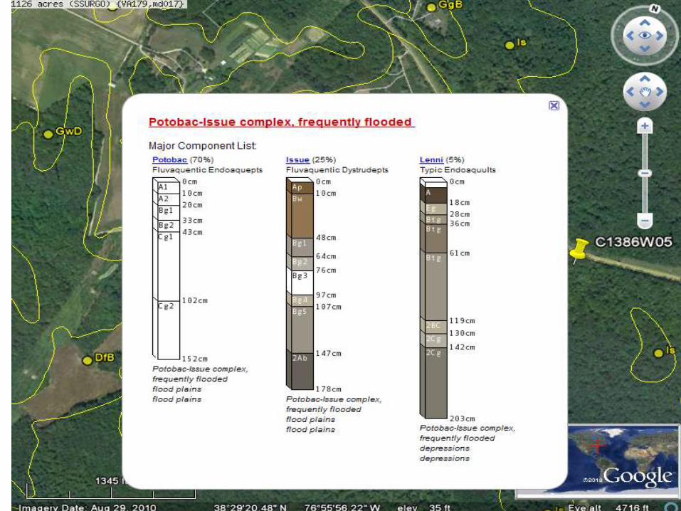
information. Example: Soil KMZ file, Fish and Wildlife Service’s Wetlands and Riparian KMZ file
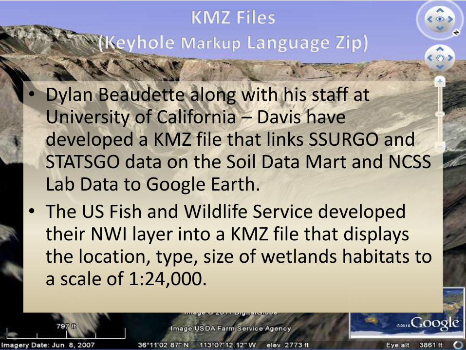
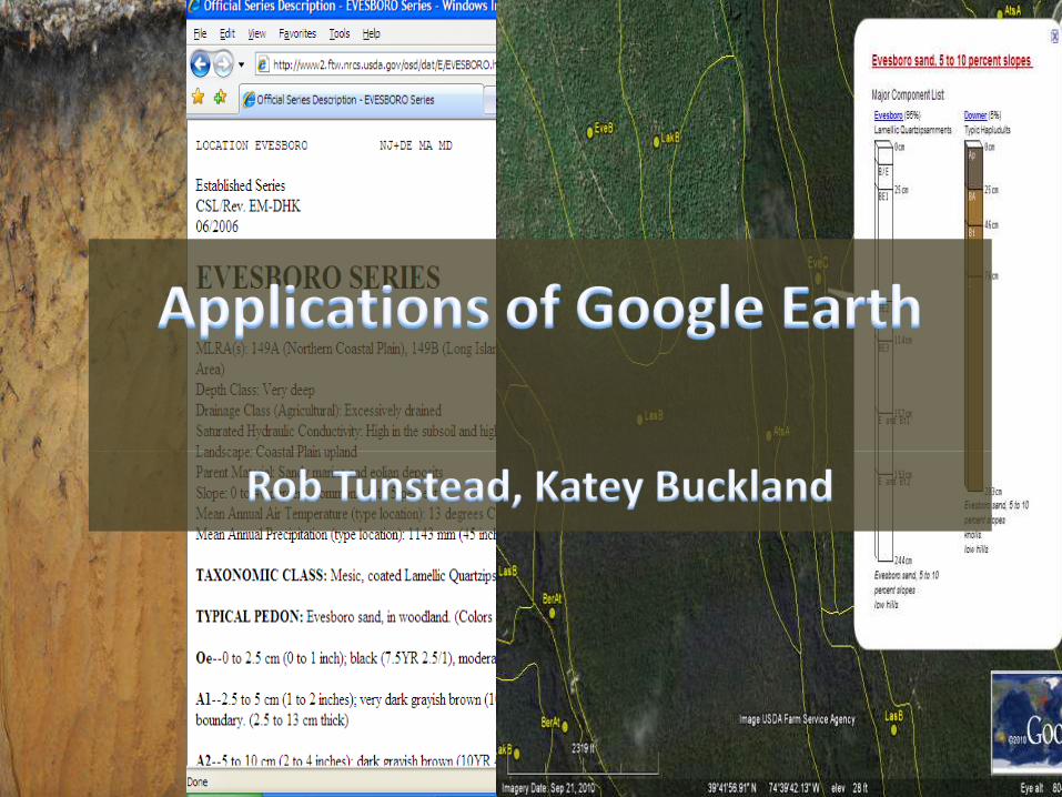
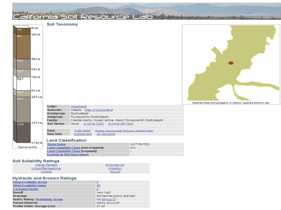
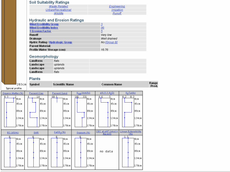
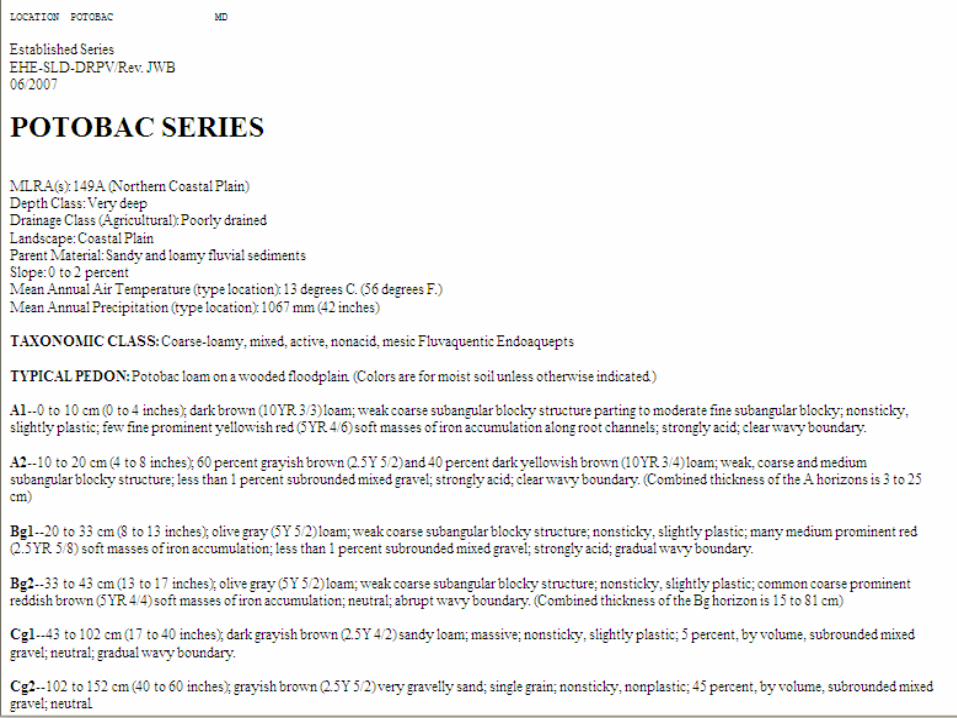
• Dylan Beaudette along with his staff at University of California – Davis have developed a KMZ file that links SSURGO and STATSGO data on the Soil Data Mart and NCSS Lab Data to Google Earth.
• The US Fish and Wildlife Service developed their NWI layer into a KMZ file that displays the location, type, size of wetlands habitats to a scale of 1:24,000.
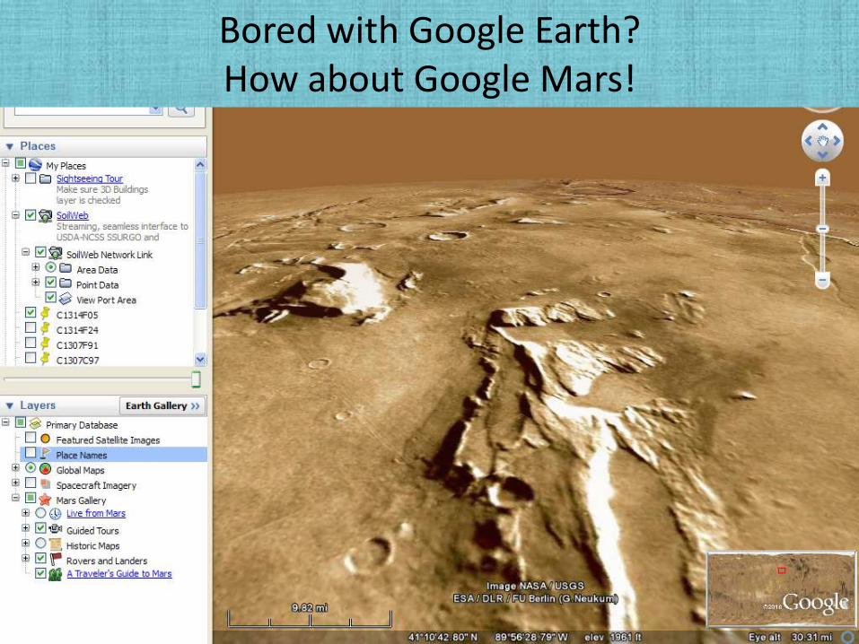
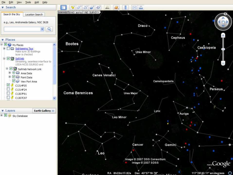
Bored with Google Earth?How about Google Mars!
Credits
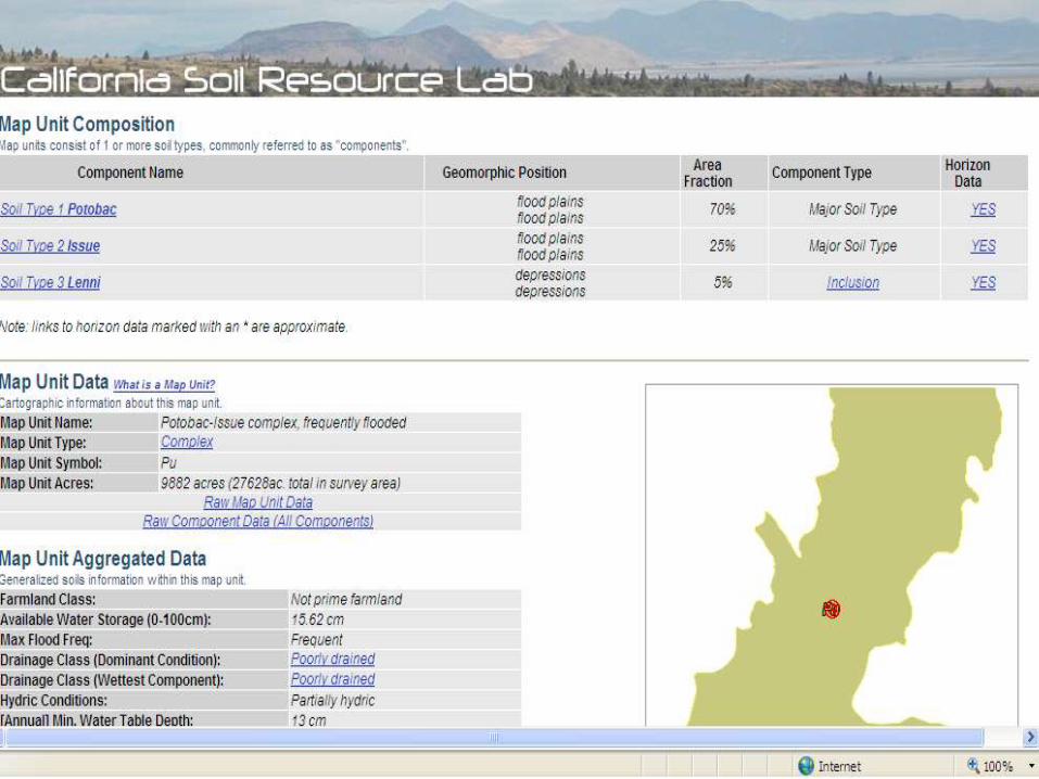
• http://casoilresource.lawr.ucdavis.edu/drupal/
• http://www.google.com/earth/download/ge/agree.html
• http://soildatamart.nrcs.usda.gov/
• http://www.fws.gov/wetlands/Data/GoogleEarth.html