Embed Size (px)
Citation preview
Feasibility Study and Environmental Analysis
Hank Aaron State Trail: Amendment to the Master Plan
August 2005
A report to the Natural Resources Board prepared by:
Planning Strategies 1133 E. Dayton Street Madison, WI 53703
(608)256-1213
TABLE OF CONTENTS
INTRODUCTION: THE FEASIBILITY STUDY AND ENVIRONMENTAL PROCESS .. 1
EXECUTIVE SUMMARY .......................................................................................................... 2
PROPOSAL ................................................................................................................................... 3 PROJECT DESCRIPTION ................................................................................................................. 3 PROPERTY DESIGNATION ............................................................................................................. 4 GOALS AND OBJECTIVES .............................................................................................................. 4
Goal Statement ........................................................................................................................ 4 Objectives (selected) ............................................................................................................... 4
MANAGEMENT ............................................................................................................................. 4
NEED ............................................................................................................................................. 5 RECREATIONAL NEEDS ................................................................................................................ 5 TRAIL NETWORK ......................................................................................................................... 6
CONTEXT ..................................................................................................................................... 7 PROPERTY PERSPECTIVE .............................................................................................................. 7
Corridor Route ........................................................................................................................ 7 Biological and Cultural Resources ......................................................................................... 8 Environmental Conditions ...................................................................................................... 8
REGIONAL PERSPECTIVE .............................................................................................................. 9 General Description................................................................................................................ 9 Socio-economics ................................................................................................................... 10 Regional Plans ...................................................................................................................... 11
ESTIMATED COSTS AND TIMELINE ................................................................................. 12 ACQUISITION.............................................................................................................................. 12 DEVELOPMENT........................................................................................................................... 12 OPERATION ................................................................................................................................ 13
ALTERNATIVES ....................................................................................................................... 13 NO ACTION ................................................................................................................................ 13 PREFERRED ALTERNATIVE ......................................................................................................... 13 COLLABORATION WITH MILWAUKEE COUNTY .......................................................................... 14
EVALUATION OF PROJECT SIGNIFICANCE ................................................................... 14 ENVIRONMENTAL EFFECTS AND THEIR SIGNIFICANCE ............................................................... 14 SIGNIFICANCE OF CUMULATIVE EFFECTS .................................................................................. 15 SIGNIFICANCE OF RISK ............................................................................................................... 15 SIGNIFICANCE OF PRECEDENT .................................................................................................... 15 SIGNIFICANCE OF CONTROVERSY .............................................................................................. 16
SUMMARY OF ISSUE IDENTIFICATION ACTIVITIES .................................................. 16
FEASIBILITY DETERMINATION ......................................................................................... 17
ENVIRONMENTAL ANALYSIS DECISION ........................................................................ 18
SELECTED BIBLIOGRAPHY ................................................................................................. 19
LIST OF APPENDIX ITEMS ................................................................................................... 20
Feasibility Study: Hank Aaron State Trail Extension Department of Natural Resources Page 1
INTRODUCTION: THE FEASIBILITY STUDY AND ENVIRONMENTAL PROCESS This document is a combined feasibility study and environmental analysis (EA) intended to include the required information for both types of studies, to avoid unnecessary duplication. Both the feasibility study and the EA function to provide the public and decision-makers with a factual, unbiased analysis of a proposal, and must identify reasonable alternatives in order to help make an informed decision. Results from this study will be included as an amendment to the Henry Aaron State Park Trail: Feasibility Study Master Plan and Environmental Assessment (1996). A feasibility study is used to determine whether it is practicable for the Department to establish, acquire, develop, and manage new property. The study takes into account the physical and biological environment and its capabilities, the views of the public and of landowners adjoining the property, and the availability of funding and staffing to accomplish the project’s purpose adequately. Furthermore, a feasibility study presents boundary alternatives, general land management strategies, and ensures integrated ecosystem management principles are considered. The feasibility study also must meet the requirements of the Wisconsin Environmental Policy Act (WEPA) and its implementing codes. Certain DNR actions require an Environmental Assessment (EA) or an Environmental Impact Statement (EIS). The Hank Aaron State Trail extension study requires an EA under NR 150 of Wisconsin’s Administrative Code. The EA process is used to evaluate the likely impacts of a proposed project, primarily on the natural environment. The EA also helps determine whether an activity’s impacts will be significant enough to warrant an EIS. On July 25, 2005, the Department held a public informational meeting at Solomon Juneau Business High School located near the project area. Approximately 65 people attended the open house. A summary of comments received at the meeting and throughout the following two-week public comment period are included in this document. For additional information, contact Melissa Cook, Southeast Region Trail Coordinator, at 2300 N. Dr. Martin Luther King Jr. Dr., Milwaukee, WI 53212, (414) 263-8559, [email protected].
Feasibility Study: Hank Aaron State Trail Extension Department of Natural Resources Page 2
EXECUTIVE SUMMARY This feasibility study considers the acquisition of a five-mile abandoned rail corridor in Milwaukee County to extend the Hank Aaron State Trail. The extension would connect to the Hank Aaron State Trail near Miller Park Stadium on the east with Milwaukee County’s Oak Leaf Trail near Underwood Creek Parkway on the west. Benefits of this proposed project include creating a direct east-west route across Milwaukee County, contributing to regional and statewide trail systems and providing an opportunity for users to commute and recreate safely. As an amendment to the Hank Aaron State Trail master plan (1996), the goals of the proposed project reflect those of the original trail. Extending the trail contributes to the goal of restoring, protecting and enhancing the natural, scenic, historical and cultural resources of the Menomonee River corridor while providing the public with recreational opportunities and access to the river. While Milwaukee County’s Oak Leaf Trail system provides approximately 99-miles of trail, it does not provide a direct east-west route across the county. Extending the Hank Aaron State Trail fills this need by creating a direct route through the highest density census tracts in the state and connecting them with numerous employment, commercial and recreational opportunities. Within Milwaukee County, the trail connects Lake Michigan and the Henry Maier Festival Park with downtown, Marquette University, Potawatomi Bingo, Miller Park Stadium, State Fair Park, the western suburbs and the Oak Leaf Trail near the Milwaukee/Waukesha county line. Beyond Milwaukee County, users can connect via other state and county trails and travel across the southern portion of the state to Madison and Governor Dodge State Park in Dodgeville or travel north on the Ice Age National Scenic Trail. Work on the existing portion of the trail reflects an extensive collaborative effort among public and private entities. The original master plan projected costs for the acquisition and development of the original trail between $9,164,625 and $9,575,875. Currently, all acquisitions for the original trail have been through donated easements at no cost to the state. Development costs for the original trail will be funded through three existing Congestion Mitigation and Air Quality Grants (CMAQ) totally $3,819,300. The DNR’s share is $763,860, with the remaining 80% from Federal funds. The DNR’s match funds come from an appropriation in the 99-01 FY budget. Therefore, due to community partnerships and successful grant funding, the DNR will spend about $1 million for the original trail, far less than the projected $9 million. The Department has gotten similar support from local officials on the proposed extension and anticipates continued collaboration. Funding for the acquisition of the extension will come from the Knowles-Nelson Stewardship Fund. The Department held a public meeting in July to gather public opinion about the project and explore the public’s desires and concerns about the proposal. Based on information in this document and public comments received, the Department believes the proposed extension to the Hank Aaron State Trail is feasible from the standpoint of legal authority, ecological soundness, public support and availability of funding. An environmental impact statement is not needed.
Feasibility Study: Hank Aaron State Trail Extension Department of Natural Resources Page 3
PROPOSAL Project Description This proposal describes the state acquisition of a five-mile line of abandoned railroad in Milwaukee County that extends from behind P&H Harnischfeger near State Highway 41 in Milwaukee to North 123rd Street and the Underwood Creek Parkway in Wauwatosa. Used by the Soo Line Railroad Company, d/b/a Canadian Pacific Railway Company (“Soo Line”) as a corridor since 1864, the last use of the rail line was in October 2001. The rail line is located within Sections 30, 31, 32, 33, 34, and 35, Township 7 North, Range 21 East, and passes through portions of Milwaukee, West Milwaukee, West Allis and Wauwatosa. Refer to “Hank Aaron State Trail and Proposed Extension” locator map in Appendix E. The Department proposes acquiring the abandoned rail line to extend the length of the Hank Aaron State Trail and create a direct east-west route across Milwaukee County. In October 1999, the White House Millennium Council in collaboration with the U.S. Department of Transportation and the Rails-to-Trails Conservancy designated the Hank Aaron State Trail as a Millennium Legacy Trail. Legacy Trails represent the essence and spirit of each of the 50 states. The Hank Aaron State Trail was selected as Wisconsin's representative because of its respectful celebration of the past, its connection to the community, and its far reaching vision for the future. Development of the Hank Aaron State Trail from Lake Michigan to Miller Park Stadium is underway and anticipated to be completed by spring 2006. When completed, the original trail will cover approximately five miles, connecting Lake Michigan shoreline parks and downtown Milwaukee with the western suburbs. Although public and private collaboration on this project has been successful, piecing together the original trail segment through a developed, urban landscape has been time consuming. With this proposal, the Department has an opportunity to nearly double the length of the trail within an established corridor. Land use within the project area is a mix of residential, commercial and industrial. Based on 2000 census data, there are an estimated 415,616 people living within a 15-minute bike ride (3-miles) of the Hank Aaron State Trail and proposed extension. No other trail in the state has as many potential users in such close proximity. The corridor also connects to large work sites such as downtown Milwaukee, Menomonee Valley business district, West Allis business district, and a light manufacturing park at 116th Street, and is located adjacent to high traffic generating destinations such as Miller Park Stadium, Henry Maier Festival Park, State Fair Park and the Lake Michigan shoreline. The proposed trail would provide an important linkage among many cultural, historic and natural sites, and numerous recreational venues in Milwaukee and Waukesha counties. If the extension is approved, the 12-mile Hank Aaron State Trail will provide a Wisconsin State Park presence in the most populous section of the state giving both commuters and recreational users a direct east-west route connecting communities with employment, commercial and recreational opportunities. It will also provide an important linkage within the statewide trail system giving users the opportunity to travel along several trails between the Lake Michigan shoreline, Milwaukee, Waukesha, Madison and Dodgeville.
Feasibility Study: Hank Aaron State Trail Extension Department of Natural Resources Page 4
Property Designation The property will be designated as an extension of the Hank Aaron State Trail, under the provisions of Wisconsin State Statute NR 23.175. The Hank Aaron State Trail is classified under NR 44 – Master Planning for Department Properties as a Recreation Management Area with a Type 4 Recreation Use Setting. The management objective of a Recreation Management Area is to provide and maintain land and water areas and facilities for outdoor public recreation or education. The management objective for a Type 4 Recreational Use Setting is to provide areas offering opportunities for intensive recreational use activities and experiences. Facilities, when present, may provide a relatively high level of user comfort, convenience and environmental education. Goals and Objectives As an extension of the existing trail, many of the goals and objectives for this project are similar to that described in the Henry Aaron State Park Trail: Feasibility Study Master Plan and Environmental Assessment (1996):
Goal Statement
To restore, protect and enhance the natural, scenic, historical and cultural resources of the Menomonee River corridor while providing the public with recreational opportunities and access to the river.
Objectives (selected) Provide close-to-home recreational opportunities such as hiking, biking and
nature study. Establish a multi-purpose trail linkage from the city of Milwaukee to local and
state trail systems, and to the Ice Age National Scenic Trail. Provide parkland and open space opportunities for under-served inner-city
neighborhoods. Provide equal access to a quality environment for all people.
Management The Department should take the lead in all aspects of this project, including the acquisition of land, development of facilities, and operations in partnership with public, private, and non-profit entities. The potential exists with this project to implement parts of the study recommendations in partnership with local units of government. In the state and nation there is an initiative for more public-private partnership projects. Previous work on the Hank Aaron State Trail illustrates the collaborative nature of the project with public and private participation. The Department anticipates similar collaboration in developing the west-end of the trail and will consider alternative implementation strategies and management partnerships. The proposed
Feasibility Study: Hank Aaron State Trail Extension Department of Natural Resources Page 5
extension has been strongly championed by city and county officials. A broad partnership effort for on-going operation of the trail will be formed between the state, county and city. The Department is communicating with the cities of Milwaukee, Wauwatosa, West Allis, Brookfield and the Village of Elm Grove to increase the number of connections that the trail will have to community trails, neighborhoods and businesses. Further, the Department is working closely with the Menomonee Valley Partners and business community to use the trail as a vehicle for bringing more employees into existing and developing businesses. NEED Recreational Needs The primary need for this project is recreation-based. The Department is considering acquisition of the abandoned rail corridor to extend the Hank Aaron State Trail and provide an important link to Milwaukee and Waukesha County’s trail systems, and to the statewide trail network. Extending the Hank Aaron State Trail offers a much-needed direct east-west corridor across Milwaukee County and through downtown connecting numerous recreational venues. The trail can be promoted as an economic and tourism asset to local communities by providing an appealing alternative transportation corridor for users to commute and recreate safely. The development of the entire Hank Aaron State Trail contributes to the restoration, protection and enhancement of the natural, scenic, historical and cultural resources of the Menomonee River corridor while providing recreational opportunities and access to the river. Secondarily, the preservation of this important environmental corridor aids in the restoration of fish and wildlife habitat and the rehabilitation of urban waterways, and provides valuable habitat for native plant and animal species. In the fall of 2004, the Soo Line Railroad Company filed a Petition for an Exemption with the United States Department of Transportation – Surface Transportation Board (STB) to discontinue and abandon all freight rail operations over an approximately five-mile line of railroad that extends between near State Highway 41 and near North 123rd Street in Milwaukee County. Since 1993, the Department has committed an extensive amount of effort piecing together the Hank Aaron State Trail route from Lake Michigan to Miller Park Stadium. Here is an opportunity to nearly double the trail length with an established corridor. By not pursuing this acquisition, the Department risks missing a great opportunity to acquire a key length of rail line, extend the Hank Aaron State Trail, and connect communities within a regional and statewide trail system. With the trail extension in place, the Hank Aaron State Trail would connect Lakeshore State Park and the Henry Maier Festival Park to downtown Milwaukee through the Historic Third Ward, and into the Menomonee Valley – the historic core of industry in the Milwaukee area. The trail also passes the Milwaukee Art Museum, Potawatomi Bingo, and Miller Park Stadium, home to the Milwaukee Brewers. The proposed trail extension continues west from Miller Park Stadium toward the historic Ward Theatre on the grounds of the National Soldiers Home, past State Fair
Feasibility Study: Hank Aaron State Trail Extension Department of Natural Resources Page 6
Park and the Pettit National Ice Center, to the Oak Leaf Trail near the Milwaukee/Waukesha county lines. Not only does this direct route connect some of Milwaukee’s most celebrated venues, it is also adjacent to a densely populated area. The trail’s location adjacent to the highest density census tracts in the state makes it an appealing transportation corridor within the regional trail system. The Department sees an opportunity to link residential neighborhoods to employment opportunities and recreational destinations and to make bicycle commuting a viable alternative. Reducing vehicle miles brings the added environmental benefits of reductions in traffic congestion and air quality contamination, which translates to added health benefits for sufferers of respiratory problems.1 Trail Network The development of the trail contributes to regional and statewide objectives, and is supported by the Southeastern Wisconsin Regional Planning Commission’s Regional Bicycle and Pedestrian Plan (2001) and the Wisconsin Department of Transportation’s Bicycle Transportation Plan 2020 (1998) (Refer to Regional Perspective, Regional Plans discussion). The Wisconsin State Trails Strategic Plan (1993) clarifies the Department’s role in and mission of providing trails, and discusses strategies for carrying out this mission. It describes a vision of a statewide network of interconnected trails into which smaller state, partnership, county, municipal and private trails feed. The plan further states that preserving corridors for future use is a very important consideration when converting a rail line to a recreational and alternative transportation corridor. Converted rail corridors in “rail-to-trail” projects are integral parts of the proposed statewide trail network. Wisconsin’s Department of Natural Resources is a national leader in the conversion of rail-to-trail projects with over 1,600 miles of trails developed on abandoned rail corridors. The Hank Aaron State Trail extension meets several key selection objectives identified in the State Trails Network Plan (amendment to Wisconsin State Trails Strategic Plan): Proximity to population centers that offer connections to a statewide trail network for
recreational trails. Existing historical sites, tourist attractions, state and county parks, and other significant
features. Links to existing federal, state, county, municipal trails. “Natural feature” corridors tied to rivers and other scenic landscape patterns including
major topographic features. 1 Actual trail user counts have been done along the Oak Leaf Trail. Based on infrared counts along a trail segment within a couple miles of the east-end of the Hank Aaron State Trail, there were 39,227 users passing one location between September 20-October 20, 2004. Surveys from additional nearby locations further supported these figures. Dividing these figures by 30 days in a month to determine an estimate of 1300 users/day, an average of 5 miles/trip, at 300 days/year, would translate to a mileage savings of 1,950,000 miles per year with air quality reductions potentially as high as : VOC–1.6 tons/yr; CO-17.6 tons/yr; Nox-2.0 tons/yr. (Source: CMAQ grant application, 5 April 2005).
Feasibility Study: Hank Aaron State Trail Extension Department of Natural Resources Page 7
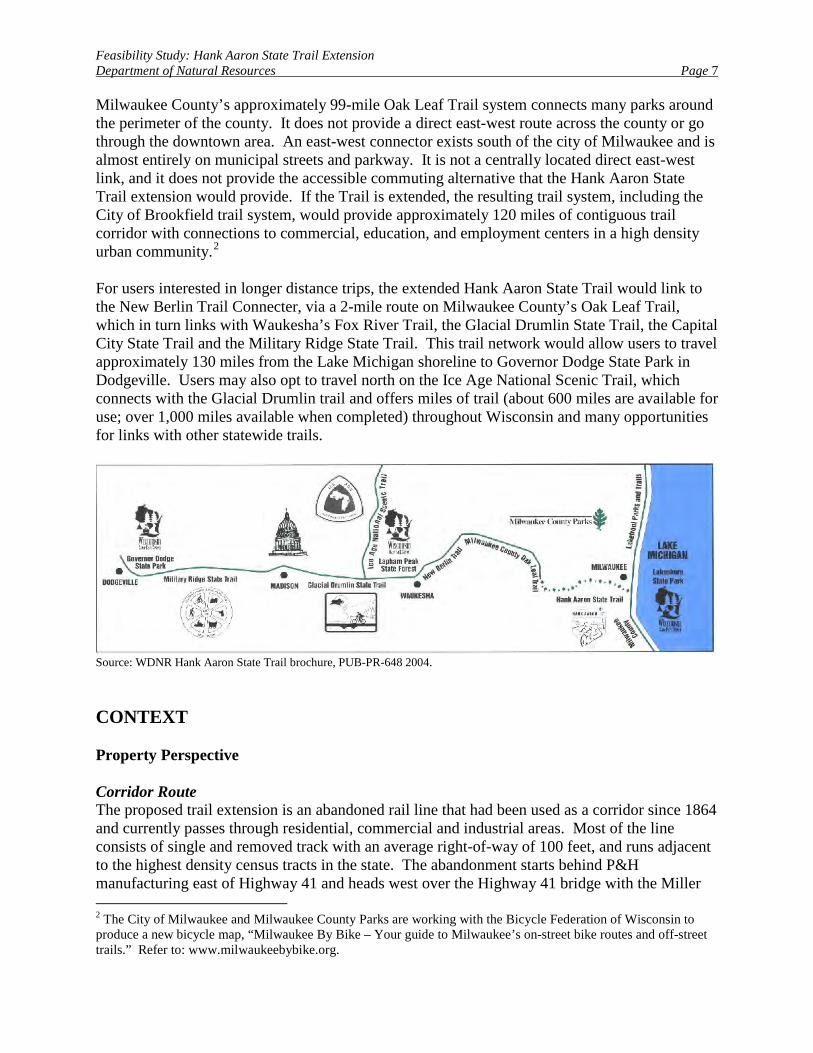
Milwaukee County’s approximately 99-mile Oak Leaf Trail system connects many parks around the perimeter of the county. It does not provide a direct east-west route across the county or go through the downtown area. An east-west connector exists south of the city of Milwaukee and is almost entirely on municipal streets and parkway. It is not a centrally located direct east-west link, and it does not provide the accessible commuting alternative that the Hank Aaron State Trail extension would provide. If the Trail is extended, the resulting trail system, including the City of Brookfield trail system, would provide approximately 120 miles of contiguous trail corridor with connections to commercial, education, and employment centers in a high density urban community.2 For users interested in longer distance trips, the extended Hank Aaron State Trail would link to the New Berlin Trail Connecter, via a 2-mile route on Milwaukee County’s Oak Leaf Trail, which in turn links with Waukesha’s Fox River Trail, the Glacial Drumlin State Trail, the Capital City State Trail and the Military Ridge State Trail. This trail network would allow users to travel approximately 130 miles from the Lake Michigan shoreline to Governor Dodge State Park in Dodgeville. Users may also opt to travel north on the Ice Age National Scenic Trail, which connects with the Glacial Drumlin trail and offers miles of trail (about 600 miles are available for use; over 1,000 miles available when completed) throughout Wisconsin and many opportunities for links with other statewide trails.
Source: WDNR Hank Aaron State Trail brochure, PUB-PR-648 2004. CONTEXT Property Perspective Corridor Route The proposed trail extension is an abandoned rail line that had been used as a corridor since 1864 and currently passes through residential, commercial and industrial areas. Most of the line consists of single and removed track with an average right-of-way of 100 feet, and runs adjacent to the highest density census tracts in the state. The abandonment starts behind P&H manufacturing east of Highway 41 and heads west over the Highway 41 bridge with the Miller 2 The City of Milwaukee and Milwaukee County Parks are working with the Bicycle Federation of Wisconsin to produce a new bicycle map, “Milwaukee By Bike – Your guide to Milwaukee’s on-street bike routes and off-street trails.” Refer to: www.milwaukeebybike.org.
Feasibility Study: Hank Aaron State Trail Extension Department of Natural Resources Page 8
Park Stadium to the north. The corridor crosses another bridge on a limestone base near the easternmost Veterans Administration service road and continues west toward the historic Ward Theatre on the grounds of the National Soldiers Home. Currently, the trail crosses at-grade across Hawley Road and continues under the 70th Street bridge. Shopping and restaurants are three blocks south in downtown West Allis and Milwaukee Area Technical College is two blocks south. The rail line goes through State Fair Park and behind the Pettit National Ice Center, with access at 76th and 84th streets. The corridor from 84th to 92nd streets includes the bridge at 84th, a mix of residential and light industry, vegetation of shrubs and trees, and the 92nd Street bridge. The corridor runs under I-894 to 100th Street near the Milwaukee County Zoo storage and greenhouse site, and continues under a railroad trestle built in 1910. The rail line travels under I-94 at 116th Street, crosses 121st Street at-grade, and ends near the Underwood Creek Parkway and Oak Leaf Trail intersection. Biological and Cultural Resources An environmental analysis conducted by attorneys representing the Soo Line reported no state or federal endangered or threatened species present in the rail corridor. Using the DNR Natural Heritage Inventory on-line database, a query of Town 7, Range 21 East in Milwaukee County returned one or more elements with a location too sensitive to map at a level more detailed than county. An Endangered Resources Planning and Protection Specialist conducted an environmental review. Although a number of state or federally listed species occur in the general area, the only endangered resource known to occur in the project area was Butler’s Gartersnake. One other endangered resource in the area is forked aster known from the Veteran’s Medical Administration facility. This species could occur along the corridor, but would not likely be affected by the proposed project if the work is kept within the existing right-of-way. There are several state special concern mesic forest communities within one mile of the corridor. Complete results of the Natural Heritage Inventory review are on file with the property manager.3 Refer to Appendix A, Table 1 for a listing of non-sensitive elements. While there are numerous areas of historical significance in the project area, there appear to be no known archaeological sites or historic structures within the railroad right-of-way (Dirst 2005). Refer to the property master plan (WDNR 1996) for a complete discussion of the area’s cultural and historic resources. Environmental Conditions In anticipation of filing a Petition for Exemption with the US DOT – Surface Transportation Board to discontinue and abandon all freight rail operations on this stretch of rail line, attorneys for the Soo Line Railroad Company prepared an Environmental Report. As discussed in this report (2004): 3 Natural Heritage Inventory Data is exempt from State of Wisconsin Open Records Law. The data is considered sensitive for several reasons and thus not appropriate for general public distribution.
Feasibility Study: Hank Aaron State Trail Extension Department of Natural Resources Page 9
“The Phase I Environmental Site Assessment identified five Recognized Environmental Conditions (RECs) on the Rail Line, including but not limited to, batteries and railroad ties, former track hoppers at a cement and concrete plant, a junkyard, unauthorized dumping of unlabelled empty drums and household trash, and also soil piles containing concrete and wood that are located west of Highway 100. Although the Phase I identified five RECs, the Rail Line is not listed as being currently or formerly on the following federal databases: the National Priorities List, CERCLIS, CORRACTS, ERNS, CERC-NFRAP, or a Proposed NPL or RCRIS List, nor is the Rail Line identified on any of the following State ASTM Standard databases: Indian UST, Leaking Underground Storage Tank (LUST), State Hazardous Waste sites (SHWS), State Solid Waste Facilities and Landfills (SWF/LF), or UST. Additionally, while the railway was reportedly used to haul freight, it was not known to have transported hazardous materials or petroleum products. Further, based on water well construction logs dating back to 1936, the Rail Line does not contain any water wells. While some neighboring sites have been listed on the abovementioned databases, none of these sites currently poses a threat to the Rail Line. Additionally, there are 23 active land lease records associated with the Rail Line. One inactive lease is associated with a wire crossing that was assigned to the Wisconsin Electric Power Company. Finally, there are no known current or historical operations that are known to cause, or could have caused changes to the environmental condition of the Rail Line.”
A further check on the Department’s Bureau for Remediation and Redevelopment Tracking System (BRRTS) website identified incidents of soil or groundwater contamination neighboring the project area. The rail line travels through portions of Milwaukee, West Milwaukee, West Allis and Wauwatosa. A remediation activity search of United States Postal Zip Code 53215 (in Milwaukee) yielded 46 open or conditionally closed activities. Of those 46 activities, none are within the immediate rail corridor. A search of zip code 53214 (in West Allis) found 80 open or conditionally closed activities of which 12 activities are within approximately 1000 feet of the rail corridor. In zip code 53226 (in Wauwatosa), a search found 28 open or conditionally closed activities with five of the activities in the neighboring area. Zip code 53295 (in West Milwaukee) had two activities neither of which is in the project area. While located in the neighboring project area, none of these identified sites appears to pose a threat to the immediate rail corridor or trail development. Regional Perspective General Description Milwaukee County is located in the Southern Lake Michigan Coastal ecological landscape. Landforms in this ecological landscape are characteristic of glacial lake influence, with ridge and swale topography, clay bluffs, and lake plain along Lake Michigan. Ground moraine is the
Feasibility Study: Hank Aaron State Trail Extension Department of Natural Resources Page 10
dominant landform further inland. Soils typically have a silt-loam surface overlying loamy and clayey tills. Sugar maple-basswood-beech forests with some oak dominated the historic vegetation in the northern part of this ecological landscape while oak forest, oak savanna and prairies dominated the southern part. Wet, wet-mesic, and lake plain prairies were common in this area. Black ash and relict cedar and tamarack swamps were found in this ecological landscape. Native Americans were the first people to populate the area. They called this place, Millioki, which means "gathering place by the waters." The Indians may have picked the name because they used the area for tribal gatherings or because they observed how three rivers, the Menomonee, the Kinnickinnic and the Milwaukee, met before flowing into the waters of Lake Mie-sit-gan (Michigan). In the earliest history of Milwaukee, Native Americans representing a variety of tribes grew wild rice and fished in the former swamps that now house the downtown Milwaukee area. Socio-economics The Southern Lake Michigan Coastal ecological landscape includes Milwaukee, Kenosha and Racine counties with a total land area of 539,824 acres. It has the lowest percent acreage in timberland (8%) of all the ecological landscapes; only 1% is in public land. Most of the area is dominated by dairy and cash grain agriculture and intense urban development. Among all the ecological landscapes, Southern Lake Michigan Coastal has the highest population density, but has lost the largest percentage of its population since 1970, especially in Milwaukee County. Yet, Milwaukee County is among the 100 largest counties in the United States. The population density in Milwaukee County (3,892 persons/mi2) is nearly 40 times higher than the statewide population density of 98.8 persons/mi2. Milwaukee is the 19th largest city in the United States with a population of 596,974 in the city and 1.5 million in the metropolitan area (based on Census 2000 data). The City borders the western shore of Lake Michigan and is just 90 miles north of Chicago. As described in the workforce profile (DWD 2004), Milwaukee County is the heart of the state’s economy demonstrated by the fact that almost one out of every five jobs in Wisconsin is in Milwaukee County. Civilian Labor Force Data for 2003 indicates that Milwaukee County had a labor force of 487,689 and an unemployment rate of 7.1% with the City of Milwaukee contributing a disproportionately abundant number of unemployed residents. Removing the City of Milwaukee from the county’s total labor force would result in a ‘balance of county’ unemployment rate of 3.8% in 2003. Urban areas like Milwaukee County tend to draw workers for the abundant and diverse job opportunities they offer. Based on 2000 census data, 82,500 Milwaukee County residents travel outside of the county for work, nearly 60,000 are commuting to neighboring Waukesha County. An estimated 118,800 workers travel into Milwaukee County with just over 60,000 commuting from Waukesha County. When traveling to work, 76 percent of Milwaukee County workers drove to work alone in 2003, 10 percent carpooled, 8 percent took public transportation, and 4
Feasibility Study: Hank Aaron State Trail Extension Department of Natural Resources Page 11
percent used other means. The remaining 3 percent worked at home. Among those who commuted to work, it took them on average 21 minutes to get to work. Data from the U.S. Census Bureau (2003) indicates that for the employed population 16 years and older, the leading industries in Milwaukee County were educational, health and social services (22%), and manufacturing (15%). Among the most common occupations were management, professional and related occupations, and sales and office occupations. Eighty-three percent of the people employed were private wage and salary workers; 12 percent were federal, state or local government workers, and 5 percent were self-employed. Regional Plans In 2001, the Department of Natural Resources Bureau of Parks and Recreation developed a State Trails Network Plan to identify the Department’s role and mission of providing all types of trails. It also describes a vision of a statewide network of interconnected rail trails into which smaller state, partnership, county, municipal, and private trails feed. The Wisconsin Department of Transportation (WisDOT) has been active in establishing bicycling as a viable, convenient and safe transportation choice in the 21st Century. WisDOT, recognizing the importance of the bicycle as a legitimate mode of transportation, especially in urban areas and communities, prepared Bicycling into the 21st Century via the Wisconsin Bicycle Transportation Plan (1998) to encourage bicycling and increase the number of bicyclist in Wisconsin. Benefits of bicycling include improving health, moving people and allowing them to park inexpensively, reducing congestion and air pollution, and providing a primary means of transportation (along with walking) for children and households with no car or driver. The plan notes bicycling is not only good for one’s health, but it is also environmentally friendly. When bicycle trips replace motor vehicle trips, air emissions can be reduced. These reductions can be considerable within urban areas where bicycle use is high. The WisDOT plan recommends policies and actions for both urban (including suburban and smaller communities) and rural (or intercity) areas. Implementing the urban/suburban element of the plan is critical to attaining the major goals of increasing bicycle usage and reducing the rate of bicycle crashes. Moreover, much of the urban strategy is tied to the implementation of completed metropolitan bicycle plans. All of the state’s 11 Metropolitan Planning Organizations (MPOs) have either produced a bicycle plan or prepared a bicycle element as part of their overall transportation plan. The Southeastern Wisconsin Regional Planning Commission (SEWRPC) – the MPO for the seven-county region that includes the urbanized areas of Milwaukee, Racine and Kenosha – not only prepared a bicycle plan for the three metropolitan areas, but also developed a region wide plan for the rest of its seven counties (2001).4 The regional bicycle and pedestrian plan for Southeastern Wisconsin considers projected need from 2010 to the year 2020. The year 2010 bicycle and pedestrian plan therefore sought to provide safe facilities for bicyclists and pedestrians as integral parts of the street and highway system, with consideration 4 SEWRPC includes the following counties: Kenosha, Milwaukee, Ozaukee, Racine, Walworth, Washington and Waukesha.
Feasibility Study: Hank Aaron State Trail Extension Department of Natural Resources Page 12
given to locating bicycle and pedestrian ways in off-street corridors where suitable alternatives to on-street locations exist. As noted, the plan was designed to provide connections between the Kenosha, Milwaukee, and Racine urbanized areas and between cities and villages with a population of 5,000 or more located outside the three urbanized areas, such cities and villages being termed “small urban areas”; and to provide bicycle access to major activity centers and transit stations located outside an urbanized or small urban area. The 2010 plan identifies 258 miles of existing bicycle ways within the seven-county region and proposes an additional 1,269 miles (total miles=1,527).5 The year 2020 plan envisions the development of a total of approximately 1,805 miles of recommended bicycle ways within the region (includes 317 miles of existing trail; 1,488 miles proposed). Milwaukee County’s park system offers over 140 parks and parkways totaling nearly 15,000 acres. Commuters and recreational users alike recognize Milwaukee County’s Oak Leaf Trail as a premier trail system. Approximately 99-miles in length, the Oak Leaf Trail is composed of 42 miles of off-road paths, 31 miles of parkway drives, and 26 miles of municipal streets as connecting routes. ESTIMATED COSTS AND TIMELINE Acquisition Funding for land acquisition is Knowles-Nelson Stewardship Fund. The Department estimates acquisition costs for the abandoned rail line to be in the range of $3-5 million. Actual acquisition costs will be determined pending the appraisal and negotiations. All land acquisition is on a willing-seller basis with costs spread out over many years as owners have interest in selling and funds are available.6 Refer to Appendix B to review a copy of the Memorandum of Agreement the Department has with City of Milwaukee regarding the acquisition, development, and operation of the original trail. Refer to Appendix C to review a copy of the Cooperative Trail Easement Agreement with the City of Milwaukee. Development Development costs are estimated to be approximately $1.6 million. This includes $710,800 for trail development and $443,600 for bridge development. The trail will have a stone base and asphalt paving. Additional trail costs include brushing and clearing, signage, modification and restoration to existing bridges, and fencing and guard rails. Bridge development costs include 5The term “bicycle way” was defined for regional planning purposes as a pathway or portion of a roadway that is specifically designated for exclusive or preferential bicycle travel. The term includes bicycle paths, bicycle lanes, and bicycle routes. 6 In Wisconsin, State law provides for payments from the DNR that fully replace or exceed the property taxes that would have been collected if the land were not acquired by the DNR. Therefore, the potential impact on property taxes from DNR ownership of land is negligible. In addition, each town, village or city gains the benefits of natural resource protection and outdoor recreation that public lands offer to all (WDNR Public Land and Property Taxes, PUB-LF-001 99 REV).
Feasibility Study: Hank Aaron State Trail Extension Department of Natural Resources Page 13
fill, retaining wall, and a 90’X12’ pre-fabricated steel bridge. Remaining costs include engineering and supervision, Metro Milwaukee and estimating cost factors, and a 10% contingency.7 The DNR has applied for a Congestion Mitigation and Air Quality grant (CMAQ) that would fund 80% of the projected development costs of the new acquisition. Preliminary feedback on the application has been very positive. Operation A trail manager and a half-time limited term employee currently manage the trail. Staff will be located at the future Lakeshore State Park. Park staff can assist in patrolling and maintenance. Mowing and other necessary maintenance service could be contracted out as necessary. Based on the Memorandum of Understanding between the Department and the City of Milwaukee, all on-street portions of the trail will be maintained by the City. Milwaukee County has also indicated that there is potential for partnering on some aspects of trail maintenance. Operational requirements will not exceed the $140,000 allotted amount identified initially in the 1999-2001 biennium. ALTERNATIVES No Action The Department could decide not to acquire the abandoned rail line. Currently there is a 3.3-mile east-west connector between Milwaukee County’s Doyne and Hoyt parks consisting of off-road path and parkway drive. From Hoyt Park, the Oak Leaf Trail is a 3.1-mile combination off-road path and parkway drive to the Underwood Creek Parkway intersection. This is not a desired route considering it is not centrally located and much of the trail is on the road, which is not a particularly good road for biking. The route is also difficult to navigate. Further, it does not provide a connection to such venues as the National Soldiers Home, State Fair Park or the Pettit National Ice Center. In comparison, the trip from Miller Park to Underwood Creek via this route is 7.4 miles versus the five-mile corridor of rail line from Miller Park Stadium to Underwood Creek. Preferred Alternative The preferred alternative is to purchase the abandoned rail line from behind P&H near Miller Park Stadium to Underwood Creek Parkway intersection near the Milwaukee/Waukesha county line. This creates a more direct, centrally-located route connecting the Hank Aaron State Trail to Milwaukee County’s Oak Leaf Trail. Extending the Hank Aaron State Trail provides easier access to the regional trail network and creates an accessible and attractive opportunity for 7 Estimates submitted by the Site Development Section of the Milwaukee County Department of Public Works, cross-referenced with the SER Engineering staff and Capital Development Cost Estimating Workbook.
Feasibility Study: Hank Aaron State Trail Extension Department of Natural Resources Page 14
commuting to work sites in downtown Milwaukee and the Menomonee Valley business district or to popular event destinations such as Miller Park Stadium, State Fair Park or the Henry Maier Festival Park. Users can also follow the Oak Leaf Trail south approximately 2.2 miles to the New Berlin Trail Connector, which leads to many miles of trails within the statewide network. Collaboration with Milwaukee County Another alternative is for the DNR to purchase the corridor and have the county manage it within their trail system. Milwaukee County has been a strong partner in trail development and chose to develop the segment of the Hank Aaron State Trail from Doyne to Hoyt park as the Oak Leaf Trail in an effort to connect their parks. The County has expressed an interest in partnering on selected maintenance aspects of the proposed trail extension. EVALUATION OF PROJECT SIGNIFICANCE Environmental Effects and Their Significance The Department does not anticipate negative environmental effects associated with the trail development of an abandoned rail corridor. The rail line had been used as a corridor since 1864; last use of the rail was in October 2001. It passes through residential, commercial, and industrial areas. No prime farmlands are affected. No historic or cultural resources are located within the immediate corridor nor are there any state or federal endangered or threatened species. The proposed site was evaluated according to the criteria of the Butler’s Gartersnake Conservation Strategy. Due to the size and quality of suitable Butler’s Gartersnake habitat, the site was classified as containing a portion of Tier 1 Site (Site of Minimal Conservation Value). As a result, the site is covered under the broad Incidental Take Authorization for Tier 1 Butler’s Gartersnake sites. Several state special concern mesic forest communities are within one mile of the corridor. Vegetated areas that are disturbed by the project activities should be re-seeded with DNR certified native prairie seed. Every effort should be made to ensure that invasive exotic species are not introduced. The project has the potential to enhance the quality of the environment by improving the environmental condition of the corridor, returning valuable habitat for native plant and animal species, and improving air quality. The proposed project promotes improved air quality because it will provide the opportunity for an increased number of people choosing to ride bikes or walk, for both commuting and recreational purposes, rather than use automobiles for their transportation needs. Given the densely populated areas adjacent to the Hank Aaron State Trail, there is considerable potential in Milwaukee County to reduce automobile use. Recent calculations for a similar stretch of trail on Milwaukee’s Oak Leaf Trail estimate 1,300 users/day. Using this value at 5 miles/trip and 300 days/year translates to a mileage savings of 1,950,000 miles/year with air quality reductions potentially as high as: VOC=1.6 tons/year,
Feasibility Study: Hank Aaron State Trail Extension Department of Natural Resources Page 15
CO=17.6 tons/year and Nox=2.0 tons/year.8 The Department anticipates the Hank Aaron State Trail would receive as great or greater use than this segment of the Oak Leaf Trail. Significance of Cumulative Effects Cumulative effects on the environment are expected to be insignificant. In general, abandoned rail corridors are not viewed as community assets. They tend to become overgrown and accumulate trash and other unwanted debris. On the other hand, when developed as a trail they tend to become safer given public accessibility and maintenance. As such, they tend to contribute to neighboring property values and can be promoted as an economic and tourism asset. The proposed project will enhance the corridor by restoring habitats and creating a direct east-west connector route for commuter and recreational users. The project has potential positive cumulative effects as an alternative transportation corridor. A reduction in automobile use creates less traffic congestion and energy consumption. This has long-term implications for improving quality of life by reducing harmful environmental effects caused by automobile use and encouraging a healthy lifestyle through exercise. Significance of Risk Purchasing the abandoned rail corridor does not pose a risk to the resources. Not purchasing the abandoned rail corridor poses a risk in terms of missed opportunity. Extending the Hank Aaron State Trail offers many opportunities for connecting communities with employment, commercial and recreational opportunities. The proposed rail corridor crosses five bridges. An inspection report from Department engineers documenting bridge costs and conditions is pending. A potential safety risk is the at-grade crossing at Hawley Road. At this intersection, the annual average daily traffic count is 22,800. A bridge for the trail currently exists at 70th Street, which has a traffic count of 19,000. Given the high volume of trail users that are anticipated to be using the trail for commuting purposes, the Department recommends a bridge be constructed across Hawley Road. A further check of the Department’s Bureau of Remediation and Redevelopment Tracking System (BRRTS) website identified incidents of soil or groundwater contamination neighboring the project area. While located in the neighboring project area, none of these identified sites appears to pose a threat to the immediate rail corridor or trail development. Significance of Precedent
8 Data from CMAQ Program Application for Funding, 5 April 2005.
Feasibility Study: Hank Aaron State Trail Extension Department of Natural Resources Page 16
Converting an abandoned rail line into a recreation trail is not precedent setting. Extending the Hank Aaron State Trail is consistent with the property master plan and with WisDOT’s Bicycle Transportation Plan (1998) and SEWRPC’s Regional Bicycle and Pedestrian Plan (2001). In addition, this project will contribute to the well-established Milwaukee and Waukesha County parkway and trail systems, the state of Wisconsin established trail systems, and the National Park Service’s Ice Age National Scenic Trail system. Significance of Controversy To date there is little controversy associated with the Hank Aaron State Trail. The existing trail segment is a successful example of collaboration among both public and private organizations with Milwaukee County and the City of Milwaukee playing key roles in trail development. The Department placed a considerable emphasis on gathering public input during the planning process. Additionally, the Department formed a 21-member Citizen’s Advisory Committee to provide direction and review of the feasibility study products. The Department anticipates similar collaboration for the extension. Milwaukee County has been integrally involved in the planning process; the City has been a strong partner in the trail’s development since the inception of the Hank Aaron State Trail. SUMMARY OF ISSUE IDENTIFICATION ACTIVITIES One purpose of a feasibility study is to gather public opinion about the need for the proposed project and explore the publics’ desires and concerns about the proposal. On July 25, 2005, the Department held a public information meeting at Solomon Juneau High School to solicit public comment on the proposed project. The Department partnered with City of Milwaukee Alderman Michael Murphy in hosting the meeting. His district runs along about 80% of the proposed extension. He sent out written notification of the meeting to 1400 of his constituents. The Department sent a press release to all major media in the area. Refer to Appendix D, Public Involvement Log. The Milwaukee Journal Sentinel did an article on the extension and meeting, which was published on the Saturday before the meeting. E-mails were also sent to and distributed to Milwaukee County, City of West Allis, Village of Wauwatosa, State Fair Park, Friends of Hank Aaron State Trail, Menomonee Valley Partners, and the Bicycle Federation of Wisconsin – Milwaukee Chapter. Approximately 65 individuals attended the meeting. Twenty-nine written comments and several phone messages were submitted to the Southeast Region office of the DNR. Of those comments received, all but one comment were very supportive of the corridor’s development as a multi-use trail. The comment that was the exception indicated an opinion that the rail line should stay active for shipping by rail. One additional letter was received by Secretary Hassett and also indicated a desire to see the corridor remain in rail use.
Feasibility Study: Hank Aaron State Trail Extension Department of Natural Resources Page 17
To date, the Hank Aaron State Trail and proposed extension has widespread support from both public and private sectors. The extension borders several jurisdictions and will function as the main spine for several trails and numerous linkages. The proposed extension has been strongly championed by city and county officials. The Department is communicating with the cities of Wauwatosa, West Allis, Brookfield and the Village of Elm Grove to increase the number of connections that the trail will have to community trails, neighborhoods and businesses. Further, the Department is working closely with the Menomonee Valley Partners and the business community who have given their full support for the trail efforts. They value the trail and extension as a vehicle for bringing more employees into existing and developing Valley businesses. Access from adjoining neighborhoods has always been a major component of the trail’s development and will continue to be an important component of the extension. The Department will continue past efforts to garner public input. FEASIBILITY DETERMINATION Based on the information and evaluation presented in this study and on public opinion, Department staff believes that the proposed extension of the Hank Aaron State Trail is feasible from the standpoint of legal authority, ecological soundness, public support and availability of funding.
Feasibility Study: Hank Aaron State Trail Extension Department of Natural Resources Page 18
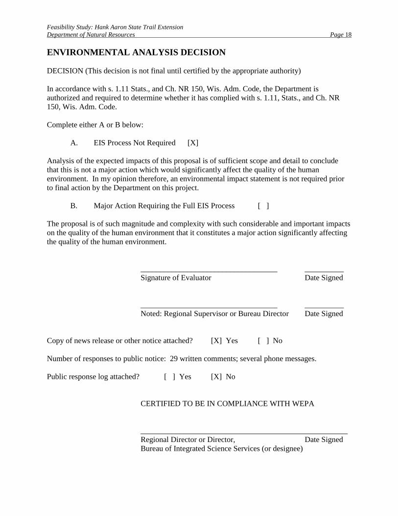
ENVIRONMENTAL ANALYSIS DECISION DECISION (This decision is not final until certified by the appropriate authority) In accordance with s. 1.11 Stats., and Ch. NR 150, Wis. Adm. Code, the Department is authorized and required to determine whether it has complied with s. 1.11, Stats., and Ch. NR 150, Wis. Adm. Code. Complete either A or B below:
A. EIS Process Not Required [X] Analysis of the expected impacts of this proposal is of sufficient scope and detail to conclude that this is not a major action which would significantly affect the quality of the human environment. In my opinion therefore, an environmental impact statement is not required prior to final action by the Department on this project. B. Major Action Requiring the Full EIS Process [ ] The proposal is of such magnitude and complexity with such considerable and important impacts on the quality of the human environment that it constitutes a major action significantly affecting the quality of the human environment. ___________________________________ __________ Signature of Evaluator Date Signed ___________________________________ __________ Noted: Regional Supervisor or Bureau Director Date Signed Copy of news release or other notice attached? [X] Yes [ ] No Number of responses to public notice: 29 written comments; several phone messages. Public response log attached? [ ] Yes [X] No CERTIFIED TO BE IN COMPLIANCE WITH WEPA _____________________________________________________ Regional Director or Director, Date Signed
Bureau of Integrated Science Services (or designee)
Feasibility Study: Hank Aaron State Trail Extension Department of Natural Resources Page 19
SELECTED BIBLIOGRAPHY Dirst, Victoria. 2005. Department of Natural Resources – Cultural Resources Coordinator.
Personal communication, 15 March. Greater Milwaukee Convention and Visitors Bureau. 2002-2005. “Visit Milwaukee”.
http://www.milwaukee.org. Leonard, Street and Deinard. 2004. “Environmental and Historic Reports: Soo Line Railroad
Company Abandonment of Trackage Located near West Allis, Milwaukee County, Wisconsin.” Docket No. AB-57 (SUB-NO. 55X).
Southeastern Wisconsin Regional Planning Commission. 2001. Amendment to the Regional
Bicycle and Pedestrian Facilities System Plan for Southeastern Wisconsin: 2020. Southeastern Wisconsin Regional Planning Commission. This document amends SEWRPC Planning Report No. 43, A Regional Bicycle and Pedestrian Facilities System Plan for Southeastern Wisconsin: 2010, December 1994.
Wisconsin Department of Natural Resources. 2004. “Ecological Landscapes of Wisconsin:
Southern Lake Michigan Coastal.” http://dnr.wi.gov/landscapes/so_lk_mi.htm. Wisconsin Department of Natural Resources. 1996. Henry Aaron State Park Trail: Feasibility
Study Master Plan and Environmental Assessment. Wisconsin Department of Transportation. 1998. Wisconsin Bicycle Transportation Plan 2020.
Wisconsin Department of Transportation, Division of Investment Management, Bureau of Planning.
Wisconsin Department of Workforce Development. 2004. Milwaukee County Workforce Profile.
State of Wisconsin Department of Workforce Development, Office of Economic Advisors. OEA-10633-P.
Feasibility Study: Hank Aaron State Trail Extension Department of Natural Resources Page 20
LIST OF APPENDIX ITEMS Appendix A: Table 1: Non-sensitive elements of T7N, R21E Appendix B: Copy of Memorandum of Agreement between the City of Milwaukee and the
State of Wisconsin Department of Natural Resources Appendix C: Copy of Cooperative Trail Easement Agreement with the City of Milwaukee Appendix D: Public Involvement Log Appendix E: Map
• Map 1: Hank Aaron State Trail and Proposed Extension

Feasibility Study: Hank Aaron State Trail Extension Appendix A Department of Natural Resources
Table 1: Non-sensitive Elements of T7N, R21E.
Group Name Scientific Name Common Name Last Observation Date
Bird HALIAEETUS LEUCOCEPHALUS BALD EAGLE 1995
Community NORTHERN DRY-MESIC FOREST
NORTHERN DRY-MESIC FOREST 1980
Community NORTHERN MESIC FOREST
NORTHERN MESIC FOREST 1982
Community LAKE--SHALLOW; SOFT; DRAINAGE
LAKE--SHALLOW; SOFT; DRAINAGE 1996
Community LAKE--SOFT BOG LAKE--SOFT BOG 1982 Community
NORTHERN WET FOREST NORTHERN WET FOREST 1982
Community SHRUB-CARR SHRUB-CARR 1982 Invertebrate
HESPERIA COMMA LAURENTIAN SKIPPER 1996
Invertebrate
HYDROBIUS MELAENUM
A WATER SCAVENGER BEETLE 1996
Invertebrate HYDROPORUS VITTATUS
A PREDACEOUS DIVING BEETLE 1996
Invertebrate LYCAENA DORCAS DORCAS COPPER 1996 Invertebrate OPHIOGOMPHUS
CAROLUS RIFFLE SNAKETAIL 1996 Plant CAREX PALLESCENS VAR.
NEOGAEA PALE SEDGE 1996 Plant CLEMATIS OCCIDENTALIS PURPLE CLEMATIS 1996 Plant DRYOPTERIS FRAGRANS
VAR. REMOTIUSCULA FRAGRANT FERN 1995 Plant LEUCOPHYSALIS
GRANDIFLORA LARGE-FLOWERED GROUND-CHERRY 1934
Plant MELICA SMITHII
SMITH MELIC GRASS 1993
Plant POLYSTICHUM BRAUNII
BRAUN'S HOLLY-FERN 1974
Plant STREPTOPUS AMPLEXIFOLIUS WHITE MANDARIN 1971
Plant VACCINIUM VITIS-IDAEA SSP. MINUS
MOUNTAIN CRANBERRY 1996
Plant CERATOPHYLLUM ECHINATUM
PRICKLY HORNWORT 1996
Bird ICTERUS SPURIUS ORCHARD ORIOLE 1999 Community SOUTHERN DRY-MESIC
FOREST SOUTHERN DRY-MESIC FOREST 1991
Community SOUTHERN MESIC FOREST
SOUTHERN MESIC FOREST 1993
Community FLOODPLAIN FOREST
FLOODPLAIN FOREST 1992
Feasibility Study: Hank Aaron State Trail Extension Appendix A Department of Natural Resources
Group Name Scientific Name Common Name Last Observation Date
Fish CLINOSTOMUS ELONGATUS REDSIDE DACE 1924
Fish ETHEOSTOMA MICROPERCA LEAST DARTER 1924
Herptile THAMNOPHIS BUTLERI
BUTLER'S GARTER SNAKE 1998
Invertebrate ARCHILESTES GRANDIS
GREAT SPREADWING 1984
Invertebrate CRANGONYX GRACILIS A SIDE-SWIMMER 1994 Invertebrate PROCAMBARUS GRACILIS PRAIRIE CRAYFISH 1910 Plant ASCLEPIAS
PURPURASCENS PURPLE MILKWEED 1912 Plant ASTER FURCATUS FORKED ASTER 2001 Plant ASTRAGALUS
NEGLECTUS COOPER'S MILKVETCH 1939
Plant CACALIA MUEHLENBERGII
GREAT INDIAN-PLANTAIN 1937
Plant ERIGENIA BULBOSA
HARBINGER-OF-SPRING 1897
Plant JEFFERSONIA DIPHYLLA TWINLEAF 1999 Plant LITHOSPERMUM
LATIFOLIUM AMERICAN GROMWELL 2001
Plant PTELEA TRIFOLIATA WAFER-ASH 1996 Plant
SCUTELLARIA OVATA HEART-LEAVED SKULLCAP 2001
Plant SOLIDAGO CAESIA
BLUESTEM GOLDENROD 1995
Plant TRILLIUM RECURVATUM
REFLEXED TRILLIUM 1846
Plant VIBURNUM PRUNIFOLIUM
SMOOTH BLACK-HAW 1999
Plant CONIOSELINUM CHINENSE HEMLOCK PARSLEY 1897
Plant CYPRIPEDIUM ARIETINUM
RAM'S-HEAD LADY'S-SLIPPER 1897
Plant CYPRIPEDIUM CANDIDUM
SMALL WHITE LADY'S-SLIPPER 1850
Plant LIATRIS SPICATA
MARSH BLAZING STAR 1875
Plant THALICTRUM REVOLUTUM
WAXLEAF MEADOWRUE 1933
Source: WDNR NHI On-line Database.

Feasibility Study: Hank Aaron State Trail Extension Appendix B Department of Natural Resources
Memorandum of Agreement between the City of Milwaukee and the State of Wisconsin Department of Natural Resources

Feasibility Study: Hank Aaron State Trail Extension Appendix B Department of Natural Resources
MEMOR!\NDLl'ti OF AGREEMENT BJ::TW:EEN THE CITY OF MILWAlfKEE A. 'liD
THE STATE OF \VlSCO~SIN DEP ARDfENT OF ~A TURAL RESO UR CES
I. Introduction
The pwposc of this MenlQrandum of Agreement, (MOA) is to set forth the agreements and understandings which ha"e been reached between the City of Milwaukee, (City) and the State of Wisconsin Depanmem of Narwal Resources (DNR) re~rding the acquisition, developme.n~ replacement and operation of approximately 6 miles of trail located in the City of Milwaukee, Milwaukee Com1ty between Lake Michigan and the Counry·s Doyne Park.
The D'I\R is interested in developing, replacing, maintaininlt. and operating a trail on the corridor for commuting and recreational trail pwposcs. The City of ~ilwaukee and the DI\'R agree to work tog~ther to achi.:ve their ruurual goals as set fonb below.
IJ. Description of the Property
The map attached to this MOA dated May 20, 2004 describes in general tile recreation corridor as it is anticipated to appear when completed. While the map shows an ofT-street trail along Erie Street, the intent is to provide bike lanes subject to the provisions of Section IV.2. The provisions of this agreement apply only to the links identified as the Hank Aaron State Trail and not to "Future Opportunity Areas'' or "Proposed Riverwal.k'' etc. An exact legal description of the property(ies) "~II be provided upon the execution of trail easements. In cases where the offstreet trail i' located within City right-of-way, a permissory resolution will be pru,·ided and a permit issued describing the location of the trail.
IlL Consideration
The D:>J R will take full responsibility for the management of the trail. It is understood that they may do this either with DNR staff or through contracts with other entities. They may also create agreements <~i th adjacent property owners, units of government, or private organi7_ations to provide a high level of quality and safety for all rrail users.
It is expected that adjacent property owners will pick up any debris on or along the rrail that is the result of an event sponsored or housed on th~t property.
In the exercise of its rights herein, including but not limite~ to the operation of the eased property as a recreational and commuting trail, the DNR and the City shall not discriminate against any member of the public on the basis of age, race, creed, color, handicap, sex, marital starus_ arrest or conviction records, ancestry, sexual orienution or member~hip lD the "'ational Guard. state defense force or any OIMr rt>serve component of the military forct>s of the Lnited States.
IV. Obligations of the City ofM ilwaukc~
I. The City of ~1ilwaukee agrees to prepare and pro~ide mutually acceptable non-exclusive trail eas~mems 10 the D!\"R for agreed upon off-street trail segments on city owned lands for the purpose of developing. operating, repall1Ilg, and maintaining the trail
2. For agreed upon on-street trail segments, the City will iriStall any pavement markings, install sigmrgc to be provided by the D"'R, and provide on going mamtenance of the
Feasibility Study: Hank Aaron State Trail Extension Appendix B Department of Natural Resources
facility. Any necessary geometric changes to accommodate the bicycle facilities shall be approved by the D:-<R and coordinated " ·ith the City or City sponsored work affecting the nail. If construction is occurring as pan of a development, the accommodation of the trail will be addressed as pan of that de, ·eJopment. The D)'..""R 'viii fund necessary geom~rric changes that can not be nccoinplished as pan a developmenr or other roadwork.
3. For tlJe segment between 6"' Street and ~iller Park where an ofl:srrect rrail 1vithin City right-of-way will be provided, the City will provide a permissoty resolution and issue pcm1its to the D:>IR a!lmving tl1e Dl\R to develop, maintain, repa1r and operate a recreation and cotrunuling rra il. The City retains the right to issue non-conflicting easements, leases or pennits to others for trail crossings, adjoining landowner needs and utilities, but shall nor enter into agreements that would matenally alter the trail or its uses.
4. The City agr~es to take responsibility for the management, engineering, construction, and contract adminisrration of the existing 44th Street segment Congestion Mitigation & Air Quality (C\fAQ) gram in possession of the City for the development of the rrail. The City will !ake responsibili ty for any cost O\"erruns associated with implementation of the 44•' Street segment grant.
5. l'or agreed upon off-~treet rra il segments on private property \\·i thin the 44"' Street segment, the City will prepare and a' quire surface trail easements with conveyance to the D:-<R. Any costs associated " ith acquisition or rt:location shall be funded by grant and local match funds or with prior consent, the D:--."R.
6. Th~ City agrees to take responsibility for the man~gemem. engineering, construction, and contract administrat ion of the existing grant to develop ~ separatedlparaJiel I 0' wide asphalt rratl adjacent to Canal Street between Miller Park and 6'' Street as pan of the reconstruction of Canal Street. Since ponions of tlus alignment differ from those indicated in the original grant agreement, the City will seek the consent for those changes from the Department of Transportation, the grant administrator. The DNR has agreed 10 the use of the t:mnt for dt>vclopment of this portion ofth.: uail, but will not be responsible for the local match to this ses.ment of the trail. Any reiTillining grant funds will be used tO develop ponions of the trail as identified i.n the original gram application (i.e. Airline Yards).
7. The City agrees to take responsibility for the righH •f-way acquisition and consrruction phases associated with the existing CongL-stion ~itigation & Air Quality grant project for the development of a ramp and stairway off of the Sixth Srreet Bridge and trail segment to anach to Pinsburgh Sn·eet. The City wil l implement the design provided by the DOA 's comractor for this segment, pnwided sufficient grant funds are 3\"ai lable.
8 The City agrees the rrail will meet D:'>I""R and AASJ!TO trail standards for the uses permitted to the extent practical. Any exceptions to these standards shall be permitted by mutual con.,ent. The D:-<R " 'ill have the opportunit y for review and input on all design and engineenng documems prior to the development of any segments implemented by the City.
9 The City agrees that any advertising or display materials relating to dte trail shall clearly identify the propeny as Hank Auron State Trai l and that it is under the management of the Dl\"R. ~o additional commercial advertising shall be allowed in the trail corridor, other than signs providing dll"eclional information about trail-rela1ed services.
10. "llle City \1~11 provide asststance with parrolling, Ia\\· enforcement., and fire service
I I. The City will provide the ll:'\R wuh a reasonable time frame for review atld input on all design & engineering documents affecting th~ Hank Aaron State Trail prior to the
Feasibility Study: Hank Aaron State Trail Extension Appendix B Department of Natural Resources
finalization of documents for the development of any segments developed by the City of Milw~ukee or an entity working with the City.
V Obligations of the Department of~aturB I :Resources
I. ll>e Dl'\R will designate the tra.il as a ·'State Trail"' under section "!R 51.7.3, Wis. Adm. Code. The trail will be included in any appropriate Jist of sta re trails.
2. The D:'I!R will participate in or conduct public meetings, which may be necessary for the establislunent and development, management, and improvements of the trail pmject.
3. The DKR will coordinate and prepare a master plan for the trail. Specific recreational uses are dttcrmined throu£h the master planning process.
4. The Dl\"R will provide the 20% match to the existing C.M.AQ b>rants t44th Street segment and the 61h Street Ramp segment) obtatned for the development of the trail (with the exccprion of the trail segment build in conjunction with the redeveloprr>ent and exten.~ion ofC3rul Street}.
5. Tbe D!\"R agrees to take responsibility for the dcSigJl engineering (including development of the rightof-way plat) associated with the extsting Congestion :Mitigation & Air Quality grant project for th~ development of a ramp and ~ta irvcay off of the Sixth Street Bridge and trail segment to anach to Pinsburgh Street.
6. The D:-IR will take respon~ibility for the Cln-going maintenance and oper~rion of all ponions designated as ! lank Aaron State Trail \\~th th~ exception of on-str~t ponioru., which will be the responsibility of the City.
7. The D~R will take responsibili ty for completion of segments wit bin the Stadium Dist.rict.
8. ·n1e o~·R will take responsibility for management and c!'tablisluncnt of landscaping and habitat improvement~ on segments within the Stadium Disnict and segment> along the :'\1enomonee River berwrcn 251b Street and t:mmber Lane. Future segments may be added to this responsibility. In the event adjoirung entities prefl'r a more intensely manicured landscape. rhose entities thiough agreement with the D:-'R, lllllY opt to nuinrain the corridor on their own.
9. The D~R agrees to ""rk with the City and other stakeholders to detennine the alignment and configuration of the rrail within the property known as the Airline Yards Fundtng for the development of this >egmem will be pursued.
I 0. The Dl'\R "ill take responsibility for enforcement of state starutes pertaining to tra il use, snow removal, sweeping the trail, rrasb pick up, and ot.her operational needs. In cases where tbe Hank Aaron State Trail funct ions as a public sidewalk (located within City right-of-way between tbe curb line and propc:rty line), the D~R shall take responsibility for snow removal in accord with Cit)• Ordinances.
II. The D!\R wi ll provide all trail signage, both directional a~d imerpreliR
12. The D!\R wil.l coordinate with and proYidc staff assistance for the Friends of the Hank Aaron State Trail.
13. The D~R will provide rhe Ciry with a reasonable rime frame for review and input on all destgn & engineering docum~nts affect ing the Hank Aaron State Trail prior to the finalization of documents for the development of any segments developed or implcmcnred by the DI'R.
VI. C'.eneral
Feasibility Study: Hank Aaron State Trail Extension Appendix B Department of Natural Resources
I. This Memorandum of Agreemenl is subject 10 all applicable laws and regula1ions.
2. This .'vlemorandum of Agreemem may be re--:iscd by murual written agrecmem oftbe Dl\'R and 1be City.
-'· An annual m<.'eting between 1he City and Dl\'R will lake place to review developmerll and acquisi1ion progress. op<>ratio!llll problems, and maintenanc~ standards needing artemion and to exchange ideas and infonnation for the good of the u~il project
4. The '\10A shall not be construed as crealing a public deb1 on the pan of the DNR in conrravemion of Article V!Il, Wisconsin Constitution and all payments or oblil!ations hereunder arc subject 10 the availability of future appropriations and grams.
5. The parties agree [hal the provtsions of Chapter 1'-'R 45.04(1 )(a), Wisconsin Adminismuive Code, remarn applicable to the Premises. Pursuant to :-m. 45, Wi~consin Administrative Code. rhe Department rerains ma.nagemo:nt. supervision, and conuol over the Premises for the purpose of enforcing Chapter 45, Wisconsin Administrative Code, when needed to protect rh~ Premises. Daily routine enfirrcement remain~ the responsibility of the City and Ire County.
r.>; WJ1:\1;ss WlfE'RcOF, the D"-"R and the City have caused this memorandum to be exeGuled in their respective names by their respective duly authorized representative;,.
ST:\ TE Of WJSCO~SN r_;z;;TME!:\T OF "-'AlU <AL RESOG~CES <:::: .. _ 5/.:zj c
Dy~~ - ~- - · ~ Scon Hassen, Secretary
CITY OF .'AIL WAUKEE
~L_fL__.~-- - ·-- -
c
Dared
Dared

Feasibility Study: Hank Aaron State Trail Extension Appendix C Department of Natural Resources
Cooperative Trail Easement Agreement with the City of Milwaukee
Feasibility Study: Hank Aaron State Trail Extension Appendix C Department of Natural Resources
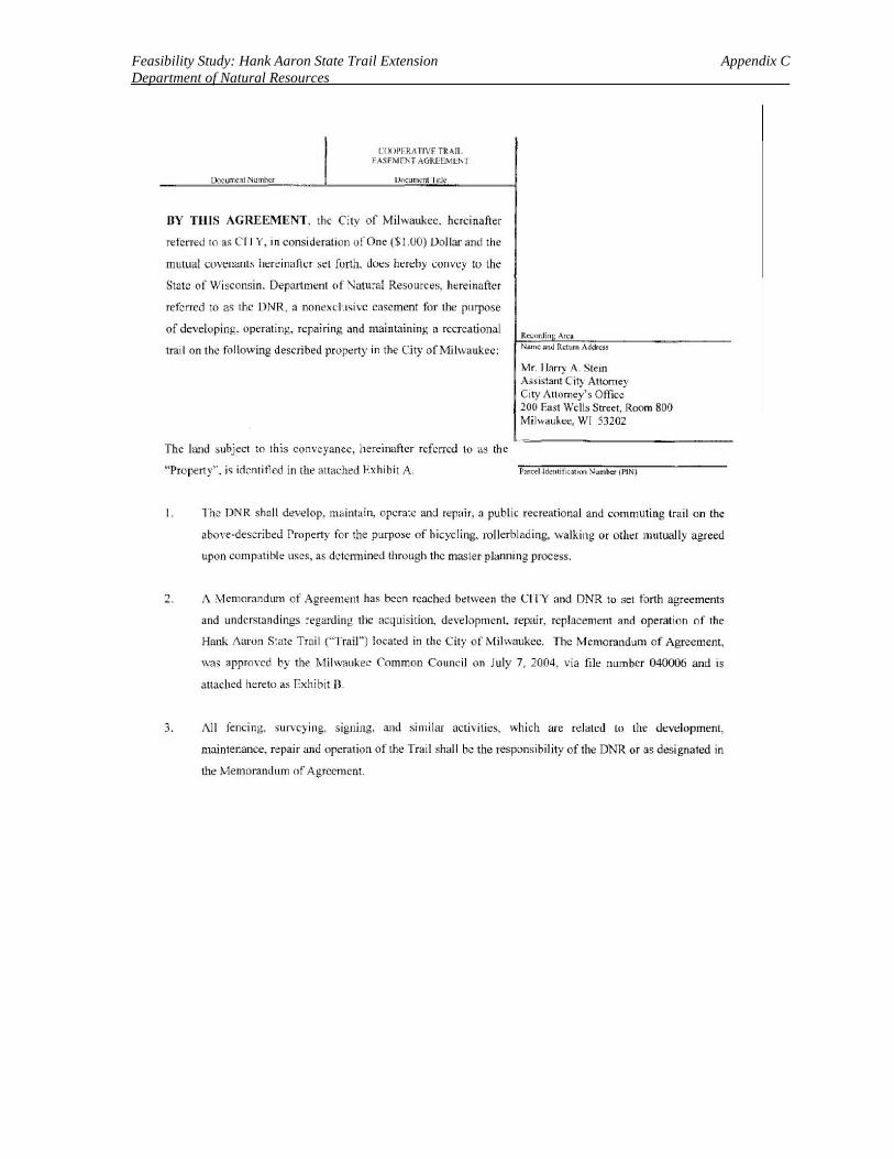
UOCIJnl(!ll NurniKr
C!X>PERill'IVF TR ~IL
f ASFMI'l'T AGR1:CM~N I
I::Mcumcsu Title
BY THIS AGREEMENT. the City of Milwaukee, hereinafter
referred to as CITY, in consideration of One($ t.OO) Dollar and the
mutual t:uvenant~ hereinafter set forth. dO<;:s hcrehy convey to the
Swtc of Wisconsin. Department o f Natural Resources. h~:reinaftcr
referred to as the DNR, a nonexclusive casement for the purpose
of developing. operating, repairing and maintaining a recreational
trail on the following described propt:rty in the City of Milwaukee:
The land subject to this conveyance, hereinafter referred to as the
"Propert y'', is identified in the attached Ex hibit A.
Rccordin An:a Name anc.l Return Address
Mr. I larry A. Stein Assi~1ant City Attorney City Attomey's Oflicll 200 East Wells Street, Room 800 Milwaukee, WI 53202
P:ifctl ld~ncitlcllhOO Number (l>tN)
I. The DNR shall develop. maintltin, operate and repair. a public recreational and commuting trail on the
aboYe-described Property for the purpose of bicycling. rollerblading. walking or other mutually agreed
upon compatible uses, as dctcnnined through the master planning process.
2. A Memorandum of Agreement has been reached bt:twccn the CITY and DNR to set forth agreements
and understandings regardin~ the acquisition, de\'elopmcnt, repai r, replacement and operation of the
Hank i\aron State Trail ("Trail") located in the C ity of Milwaukee. The Memorat\dum of Agreement,
was approved by the Milwaukee Common Council on July 7, 2004 , via file number 040006 and is
attached hereto as Exhibit B.
3. i\11 fencing, surveying, signing. and ~imilar activities, which are related to the development,
maintenance, repair and operation of the Tra il shall be the responsibility of the DNR or as designated in
the Memorandum of Agreement.
Feasibility Study: Hank Aaron State Trail Extension Appendix C Department of Natural Resources
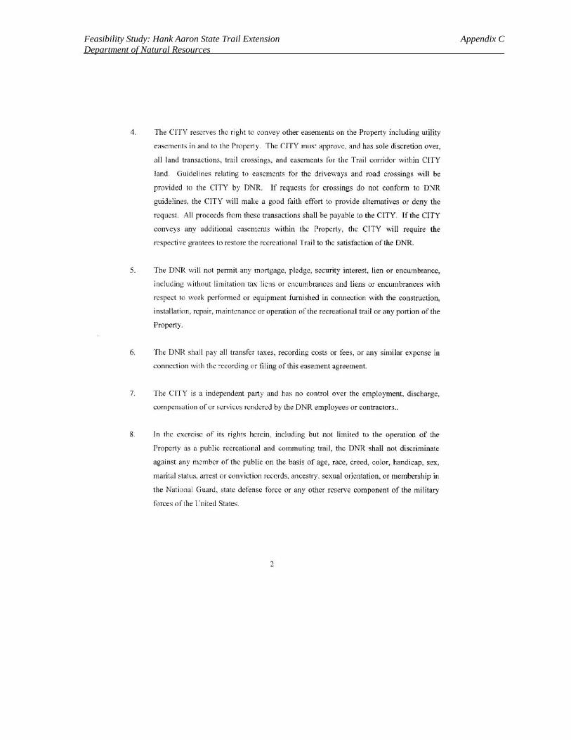
4. The CITY reserves the right to corwey other easements on the Property including utility
easements in and to the Propeny. The CITY must approve. and has sole discretion over,
all land transactions. trail crossings. and easements for the:: Trail corridor within CITY
land. Guidel ines relating 1\) easements for the driveways and road crossings will be
provided to the CITY by DNR. If requests for crossings do not eonfomt to DNR
guidelines, the CITY will make a good faith eflort to pmvide alternatives or deny the
request. All proceeds from these transactions shall be payable to the CITY. If the CITY
conveys any additional easements within the Property, the CITY will require the
respective grantees to restore the recreational Trai l to the satisfaction of the DNR.
5. Tht: DNR will not permit any mortgage, pledge, security interest, lien or encumbrance,
including 1\ithout li mitation tax liens or encumbrances and liens or encumbrances with
respect to work performed or equipment furnished in cormection with the construction,
installation, repair, maintenance or operation of the recreational trail or any ponion of the
Property.
6. The DNR shall pay all transfer taxes, recording costs or fees, or any similar expense in
connection with the recording or fi ling of this easement agreement.
7. The CITY is a independent party and has no control over the employment, discharge,
compensation of or services rendered by the DNR employees or contractors ..
8. In the exercise of its rights herein, including but not limited to the operation of the
Property as a public recreational and commuting trai l, the DNR shall not discriminate
against any member of the public on the basis of age, race, creed, color, handicap, sex,
marital slat us, arrest or convict ion records. ancestry, sexual orientation, or membership in
the Nat ional Guard. $late defense forc.c or any other reserve component of the military
forces of the I Jnited States.
2
Feasibility Study: Hank Aaron State Trail Extension Appendix C Department of Natural Resources
9. In connection with the pt:rformance of any work under the easement, the DNR agrees not
to discriminate against any employee or applicant for employment because of age,
handicap. physical condition, developmcnt.al disability as defined in s. 5 1.01 (5), Slats.,
race. religion, sex. color. sexual orientation or national origin regarding employment,
upgrading. demotion or transf~r, recruitment or recruitment advertising, Jay off or
termination. rates of pay or other forms of compensation, and selection for training,
including apprenticeship.
10. The DNR and the CITY agree that the provisions of Chapter NR 45. Wisconsin
Administrati ve Code, are appl icable to the Property. Pursuant to s. NR 45.01(1 ),
Wisconsin Administrative Code. the DNR maintains management, supervision, and
control over the property for the purpose of enforcing Chapter NR 45, Wisconsin
Administrative Code. when needed to protect the Property. The CITY will provide
customary patrolling, law enforcement. and fi re services.
1 I. Boundary disputes, trespass and other claims shall be the responsibility of the CITY.
Should any of the adjacent landowners challenge the City and/or the State of Wisconsin's
right to de\·elop this trail by way of court action in either State or Federal court, or by
other j udicial or administrative challenge, the State will fully defend its rights to develop,
in conjunction with the CITY. the trail which i~ the subject of this easement agreement.
12. The title to the Prnpcny shall automatically revert to and revest in the CITY withom
reentry upon the abandonment of the use of the same for recreational trail purposes or
upon non-use of the same for a period of rwo years.
I 3. This casement agreement shall be deemed in effect as of the date first written below and
for a period of ninety nine (99) years.
IN WITNESS WHEREOF. the ( ', r v c:. ;~ tf,t,.v day of __ .'jjj_ ... <.C....::::!..iJ;J.,.. . •.• , 20 -""~ •.!:_ .
3
executed this easement this ~
Feasibility Study: Hank Aaron State Trail Extension Appendix C Department of Natural Resources
CITY OF MILWAUKEE
13~~ / ::t.:..(/1: ~ r:&n~~ RONALD D. LEONHARDT, City Clerk
cfOUNTERSIGNED:
, ( SPECIAL DEPUTY
.-wY 1 The tc::rms or this easement agreement acc~pted this ~- day of -·-'-['_\;~, Yf--- -20()~ . I
STATE OF WISCONSI N, DF.I'ART MENT OF ~ATURAL RESO URCES
c-- J / l By: ... 2J c:-.-:mj ~--r:x:;p .. "\
SCOTI IIASSETT. Secretary
This docu01cnl was dralied by 1he Dcpan mcm ofNamrnl R.esources
4
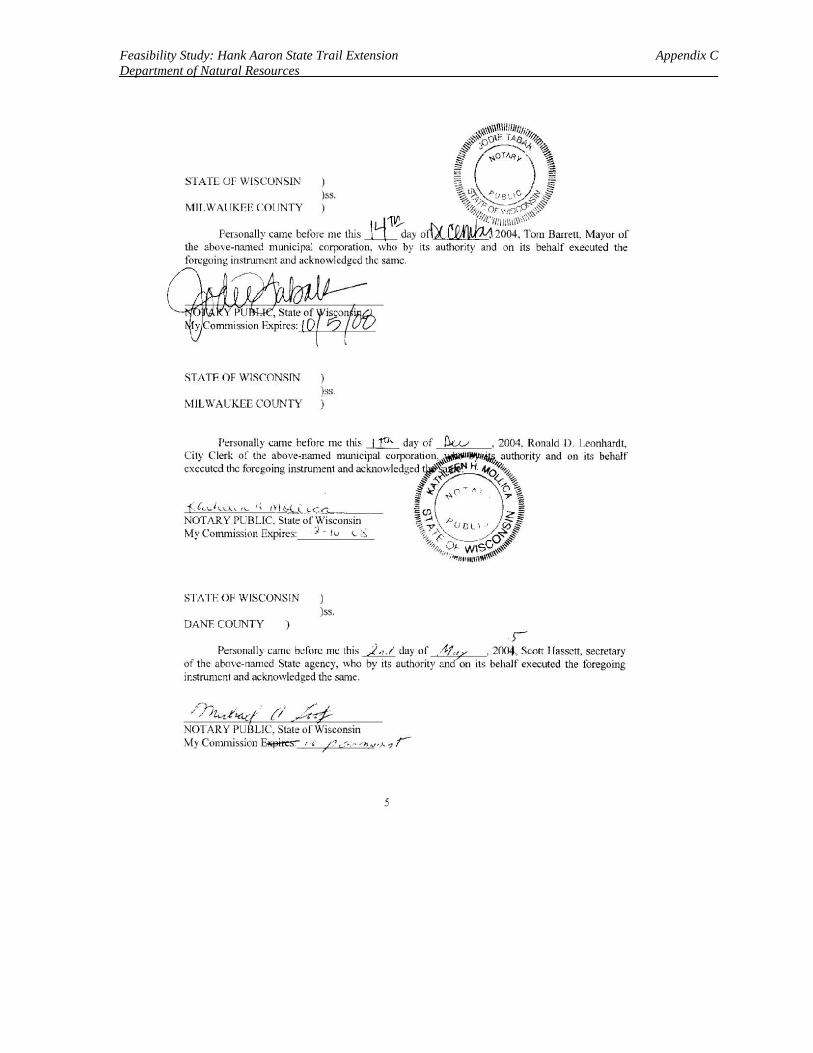
Feasibility Study: Hank Aaron State Trail Extension Appendix C Department of Natural Resources
. ),~\~\\ll~i!/1//Jitlli, ~~0orr=. fAe~ ~0 ~r--i~ i§ ~OTAJty \ ~
I ) I ) ~.o.\ ""··- c. j, t? ss. ~~~h~l..' /f:~~
I\IUL WAUKEE COUNTY ) 'f~;'}:'or-w-;,~
Sl ATE Of WISCONSIN
,u-re.. /{{1 .~. 1~t.:·,,lll!ll1\"'~.~ Personally came belo~ me this ___LL day o1bL11.1~ 2004. Torn Barrett. Mayor of
the above-named municipal corporation. who by it~ authority and on its behalf executed the fort:going instrument and acknowledged the same.
STATE OF WlSCONSIN ) )ss.
MILWAUKEE COUNTY )
-(C~,.J LL'.< ,..._ :; t i i~J....:. .l-CG._ ____ _ NOT/\R Y PUBLIC. State of Wisconsin My Commission Expires: ) - h-• t. 6
STATE OF WISCONSIN ) )ss.
DANF. COUNTY ) r
Personally came before me this~ day of A~,., , 2004, Sc.on I lassen, secretary of the above-named State agency, who by its authority an on tts behalf executed the foregomg instrument and acknowledged the same.
NOTARY PUBLIC. State of Wisconsin My Commission~ ',
5
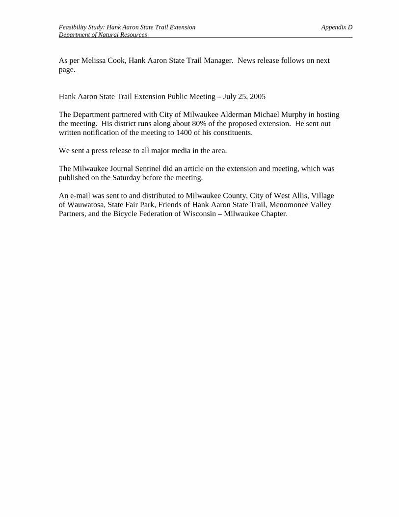
Feasibility Study: Hank Aaron State Trail Extension Appendix D Department of Natural Resources
As per Melissa Cook, Hank Aaron State Trail Manager. News release follows on next page. Hank Aaron State Trail Extension Public Meeting – July 25, 2005 The Department partnered with City of Milwaukee Alderman Michael Murphy in hosting the meeting. His district runs along about 80% of the proposed extension. He sent out written notification of the meeting to 1400 of his constituents. We sent a press release to all major media in the area. The Milwaukee Journal Sentinel did an article on the extension and meeting, which was published on the Saturday before the meeting. An e-mail was sent to and distributed to Milwaukee County, City of West Allis, Village of Wauwatosa, State Fair Park, Friends of Hank Aaron State Trail, Menomonee Valley Partners, and the Bicycle Federation of Wisconsin – Milwaukee Chapter.
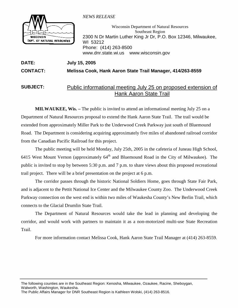
NEWS RELEASE
Wisconsin Department of Natural Resources Southeast Region
2300 N Dr Martin Luther King Jr Dr, P.O. Box 12346, Milwaukee, WI 53212 Phone: (414) 263-8500 www.dnr.state.wi.us www.wisconsin.gov
The following counties are in the Southeast Region: Kenosha, Milwaukee, Ozaukee, Racine, Sheboygan, Walworth, Washington, Waukesha. The Public Affairs Manager for DNR Southeast Region is Kathleen Wolski, (414) 263-8516.
DATE: July 15, 2005 CONTACT:
Melissa Cook, Hank Aaron State Trail Manager, 414/263-8559
SUBJECT: Public informational meeting July 25 on proposed extension of Hank Aaron State Trail
MILWAUKEE, Wis. – The public is invited to attend an informational meeting July 25 on a
Department of Natural Resources proposal to extend the Hank Aaron State Trail. The trail would be
extended from approximately Miller Park to the Underwood Creek Parkway just south of Bluemound
Road. The Department is considering acquiring approximately five miles of abandoned railroad corridor
from the Canadian Pacific Railroad for this project.
The public meeting will be held Monday, July 25th, 2005 in the cafeteria of Juneau High School,
6415 West Mount Vernon (approximately 64th and Bluemound Road in the City of Milwaukee). The
public is invited to stop by between 5:30 p.m. and 7 p.m. to share views about this proposed recreational
trail project. There will be a brief presentation on the project at 6 p.m.
The corridor passes through the historic National Soldiers Home, goes through State Fair Park,
and is adjacent to the Pettit National Ice Center and the Milwaukee County Zoo. The Underwood Creek
Parkway connection on the west end is within two miles of Waukesha County’s New Berlin Trail, which
connects to the Glacial Drumlin State Trail.
The Department of Natural Resources would take the lead in planning and developing the
corridor, and would work with partners to maintain it as a non-motorized multi-use State Recreation
Trail.
For more information contact Melissa Cook, Hank Aaron State Trail Manager at (414) 263-8559.

Feasibility Study: Hank Aaron State Trail Extension Appendix E Department of Natural Resources
Map 1: Hank Aaron State Trail and Proposed Extension

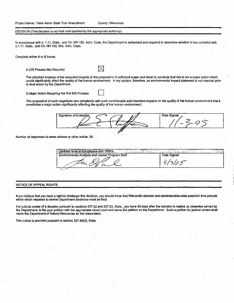
Project Name: Hank Aaron State Trail Amendment County: Milwaukee
DECISION (This decision is not final until certified by the appropriate authority)
In accordance with s. 1.11, Slats., and Ch. NR 150, Adm. Code, the Department is authorized and required to determine whether It has complied with s.1.11, Slats., and Ch. NR 150, Wis. Adm. Code.
Complete either A or B below:
A.EIS Process Not Required
The attached analysis of the expecteq impacts of this proposal is of sufficient scope and detail to conclude that this is not a major action which would significantly affect the quality of the human environment. In my opinion, therefore, an environmental impact statement is not required prior to final action by the Department.
B. Major Action Requiring the Full EIS Process D The proposal is of such magnitude and complexity with such considerable and important Impacts on the quality of the human environment that it constitutes a major action significantly affecting the quality of the human environment.
Number of responses to news release ~r other notice: 26
C!3rtified·toP,~incomplian{;e,with WEPA :<• .· / .• ,;· t .. . .. :··. ·.·• .. . .··.• .. : .. ;. Environmental Analysis and Liaison Pr<>gram Staff Date Signed
·····<~~~~ U/3/cJ5 .:: ... ·"
NOTICE OF APPEAL RIGHTS
If you believe that you have a right to challenge this decision, you should know that Wisconsin statutes aml a£1miRistratlw FYies establish time periOds within which requests to review Department decisions must be filed.
For judicial review of a decision pursuant to sections 227.52 and 227.53, Slats., you have 30 days after the decision is mailed, or otherwise served by the Department, to file your petition with the appropriate circuit court and serve the petition on the Department. Such a petition for judicial review shall name the Department of Natural Resources as the respondent.
This notice is provided pursuant to section 227.48(2), Stats.
NEWS RELEASE Wisconsin Department of Natural Resources Wisconsin Dept. of Natural Resources
2300 N Dr Martin Luther King Jr. Dr. Milwaukee WI 53212-3128 Phone: 414-263-8559 E-mail: [email protected]
FOR RELEASE: September 30, 2005 CONTACT: Melissa Cook, Parks and Recreation Specialist SUBJECT: Hank Aaron State Trail Master Plan Amendment
Milwaukee, Wis. -- The Department proposes acquiring five miles of abandoned rail line to extend the length
of the Hank Aaron State Trail and create a direct east-west route across Milwaukee County. The trail would
extend from behind P&H Harnischfeger near State Highway 41 in Milwaukee to North 123rd Street and the
Underwood Creek Parkway in Wauwatosa.
Currently, development of the initial section of the Hank Aaron State Trail from Lake Michigan to
Miller Park Stadium is underway. With this new proposal, the Department has an opportunity to nearly double
the length of the trail.
The Department has prepared a Feasibility Study and Environmental Assessment for this Master
Plan Amendment.
The proposed Department action is not anticipated to result in significant adverse environmental
effects. The Department has made a preliminary determination that an environmental impact statement
will not be required for this action.
Copies of the environmental assessment that led to the DNR's preliminary determination can be
obtained from Melissa Cook, Parks and Recreation Specialist, 414-263-8559,
Public comments, either written or oral, on the environmental assessment are welcome and must
be submitted to Melissa Cook no later than 4:30 p.m. October 18, 2005.
-30-