Embed Size (px)
Citation preview
High-altitude ceremonialsites in the Peruvian Andes:
GIS modeling
Adina Racoviteanu1,Todd Ackerman2, Mark Williams1 andWilliam Manley3
1 Department of Geography and INSTAAR, University of Colorado
2 INSTAAR and LTER Niwot Ridge3 Quaternary GIS Lab, INSTAAR
Carbon Climate and Society Initiative (NSF/IGERT) andLong-Term Ecological Research (LTER)
INTRODUCTION
Recent discoveries of high-altitude ceremonial sites and human sacrifices in the Andes brings about the question of why these ceremonial sites were located mountains peaks at altitudes often up to 23,000ft. High-altitude archeologists believe that rituals were meant to appease the “Apus”(Andean Mountain Gods), held responsible in Andean beliefs for rain, water sources and fertility of the fields. While the rituals themselves seem to be motivated by abrupt past climatic events or natural disasters such as earthquakes and volcanic eruptions, other hypotheses suggest that the location of these sites was linked with the expansion of the Inca Empire, or the canal system used for irrigation by the Incas. While these hypotheses can explain the location of a few ritual sites, there is currently little understanding of how and why the Incas chose these locations to perform their ceremonies at such high elevations. This paper attempts to fill in some of this gap in the understanding of Inca culture by using geo-visualization tools to infer spatial and temporal patterns of these archeological sites.
We argue that Inca rituals are linked with regional climatic fluctuations that had agricultural implications for the Inca Empire. Furthermore, we suggest that the rituals were mainly directed to those sacred sites (huacas) responsible for water supply: mountaintops, glaciers, and rivers. A climate reconstruction for the Inca period is proposed here to identify abrupt climate events during the 15th and 16th century A.D. Climate data from ice cores and pollen records from the Andes are analyzed for signals of droughts and volcanic eruptions. Precipitation reconstructions are performed using the Macro Physical Climate Model designed for archaeological dating. These records are compared against evidence from chronicles and local archives.
Next we evaluate different hypothesis about the spatial distribution of the high-altitude archaeological sites and sacred mountains uses GIS mapping and analysis. Sites are georeferenced on a GTOPO 30 arc-second DEM for high–elevation areas of Peru. We analyze the site locations with respect to drainage networks, glacier cover, and proximity to trans-mountain roads. Both elevation and aspect of the mountain terrain are used to determine general patterns of altitude and orientation of the archaeological sites with respect with the two the four directions (suyus) of the Inca Empire. An application for GIS modeling is developed using Modeling of Archaeological Potential of Ice Surface (MAPIS) approach for Mount Coropuna in Southern Peru. GIS layers are used to analyze the glacier cover and to derive potential archaeological sites to be tested in the field.
An aerial perspective has helped interpreting the archeological sites at Nazca and Macchu Picchu. Here we use the latest geo-visualization techniques to evaluate the ceques lines emerging from the Inca Capital- Cusco to sacred sites of importance for the Inca cosmology including mountaintops and rivers. A visualization of the sites in three dimensions is conducted using ESRI's ARCGIS package. Using the fly-tool of the 3DEM viewer and analyst, we are able to
gain a panoramic view on the location of the sites from different elevations.
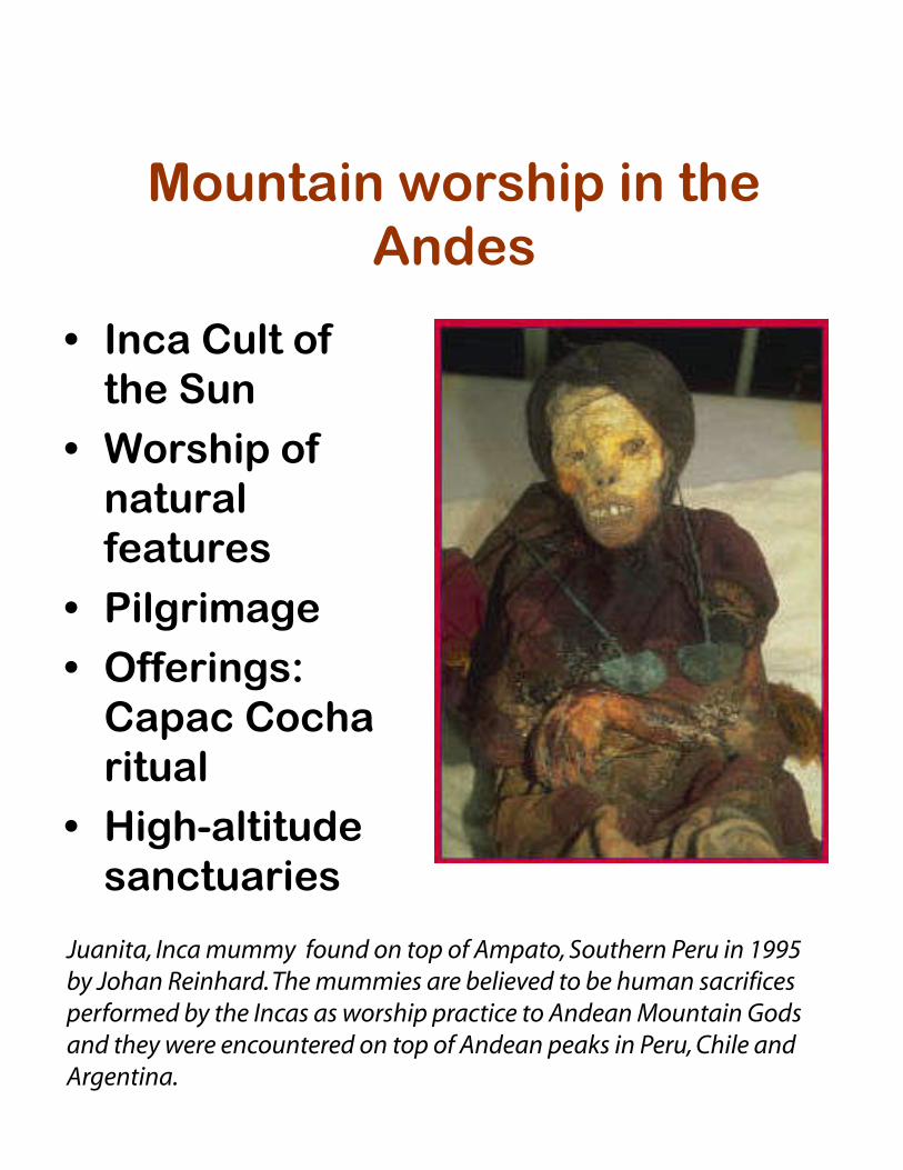
Mountain worship in theAndes
• Inca Cult ofthe Sun
• Worship ofnaturalfeatures
• Pilgrimage• Offerings:
Capac Cocharitual
• High-altitudesanctuaries
Juanita, Inca mummy found on top of Ampato, Southern Peru in 1995 by Johan Reinhard. The mummies are believed to be human sacrifices performed by the Incas as worship practice to Andean Mountain Gods and they were encountered on top of Andean peaks in Peru, Chile and Argentina.
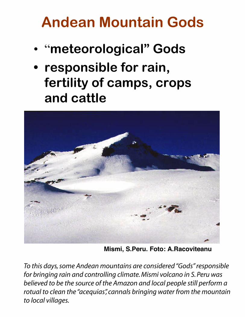
Andean Mountain Gods
• “meteorological” Gods
• responsible for rain,fertility of camps, cropsand cattle
Mismi, S.Peru. Foto: A.Racoviteanu
To this days, some Andean mountains are considered “Gods” responsible for bringing rain and controlling climate. Mismi volcano in S. Peru was believed to be the source of the Amazon and local people still perform a rotual to clean the “acequias”, cannals bringing water from the mountain to local villages.
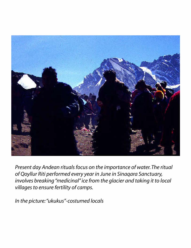
Present day Andean rituals focus on the importance of water. The ritual of Qoyllur Riti performed every year in June in Sinaqara Sanctuary, involves breaking “medicinal” ice from the glacier and taking it to local villages to ensure fertility of camps. In the picture: “ukukus”-costumed locals
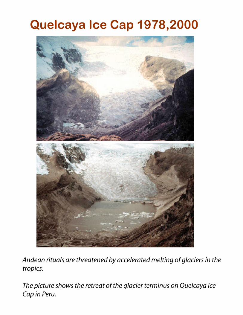
Quelcaya Ice Cap 1978,2000
Courtesy of L. Thompson
Andean rituals are threatened by accelerated melting of glaciers in the tropics.
The picture shows the retreat of the glacier terminus on Quelcaya Ice Cap in Peru.
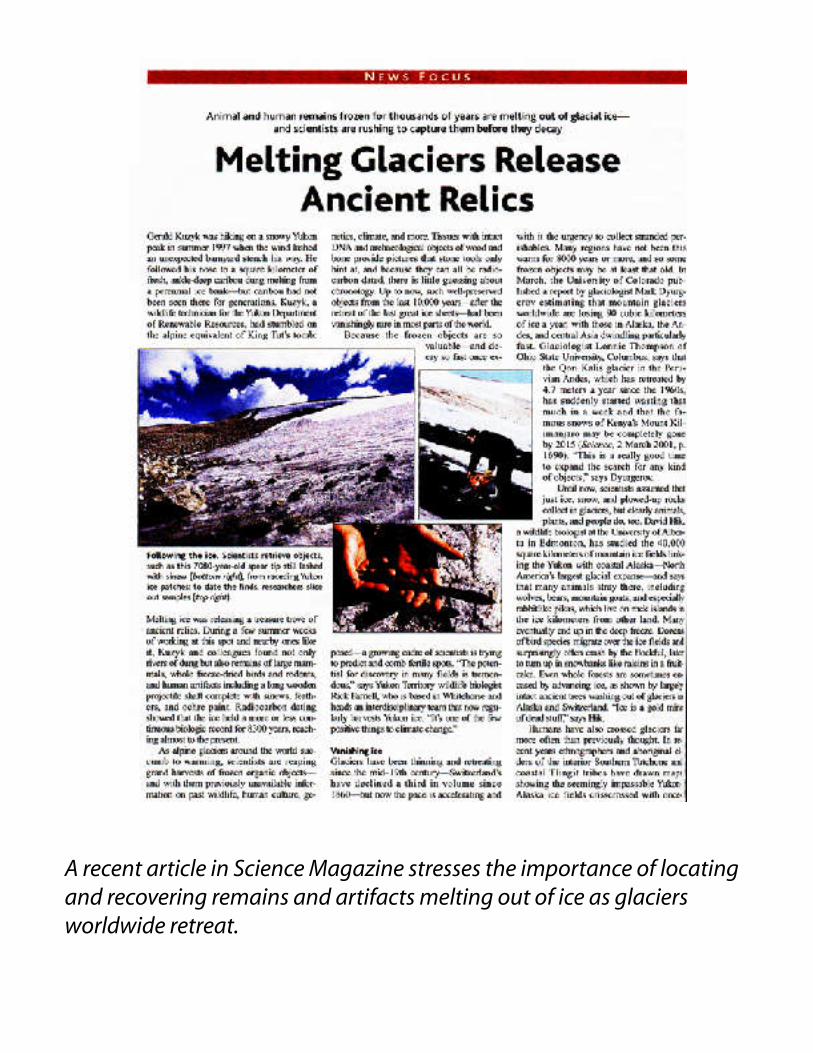
A recent article in Science Magazine stresses the importance of locating and recovering remains and artifacts melting out of ice as glaciers worldwide retreat.
Objectives• Using GIS to locate high-altitude
archeological ruins:An application using the ModelingArcheological Potential of Ice andSnow (MAPIS) for Mt.Coropuna,S.Peru
• Testing existing hypotheses on howand why high-altitudes ceremonialsites were chosen for Inca rituals;
• Spatial analysis:• proximity analysis: glaciers, Inca
roads, water canals;• direction• distribution within Inca Empire
• Terrain analysis;• Aerial perspective with 3D view
and fly-by tool.
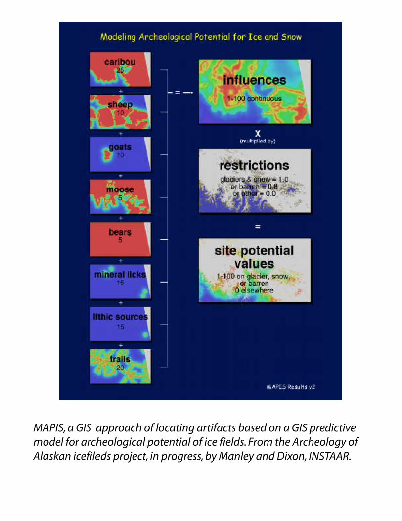
MAPIS, a GIS approach of locating artifacts based on a GIS predictive model for archeological potential of ice fields. From the Archeology of Alaskan icefileds project, in progress, by Manley and Dixon, INSTAAR.
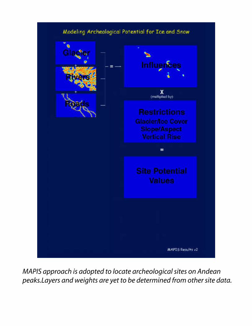
MAPIS approach is adopted to locate archeological sites on Andean peaks.Layers and weights are yet to be determined from other site data.
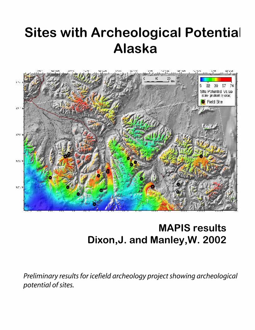
Sites with Archeological Potential,Alaska
MAPIS resultsDixon,J. and Manley,W. 2002
Preliminary results for icefield archeology project showing archeological potential of sites.
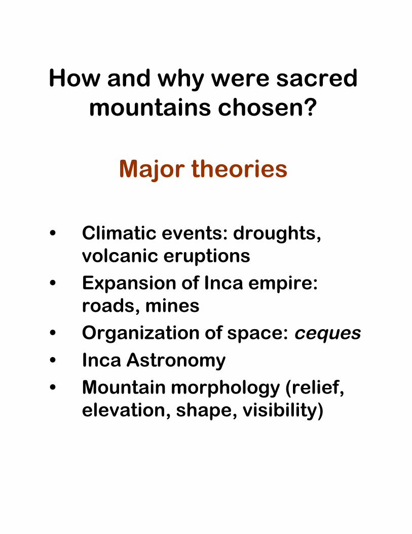
How and why were sacredmountains chosen?
Major theories
• Climatic events: droughts,volcanic eruptions
• Expansion of Inca empire:roads, mines
• Organization of space: ceques• Inca Astronomy• Mountain morphology (relief,
elevation, shape, visibility)
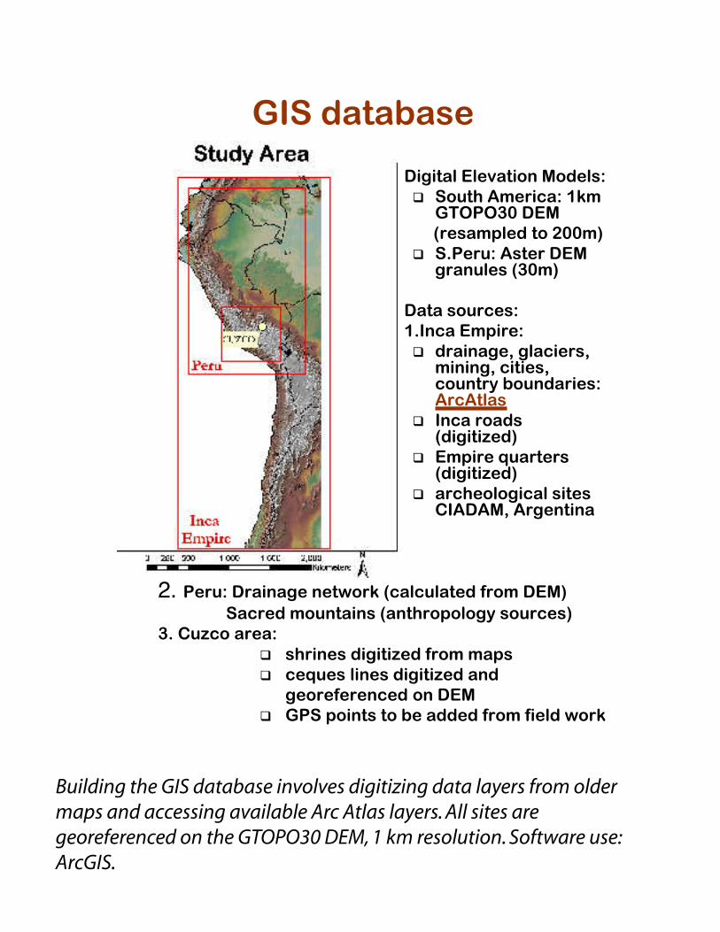
GIS database
• Digital Elevation Models:q South America: 1km
GTOPO30 DEM (resampled to 200m)q S.Peru: Aster DEM
granules (30m)
• Data sources:1.Inca Empire:q drainage, glaciers,
mining, cities,country boundaries:ArcAtlas
q Inca roads(digitized)
q Empire quarters(digitized)
q archeological sitesCIADAM, Argentina
2. Peru: Drainage network (calculated from DEM) Sacred mountains (anthropology sources)
3. Cuzco area:q shrines digitized from mapsq ceques lines digitized and
georeferenced on DEMq GPS points to be added from field work
Building the GIS database involves digitizing data layers from older maps and accessing available Arc Atlas layers. All sites are georeferenced on the GTOPO30 DEM, 1 km resolution. Software use: ArcGIS.
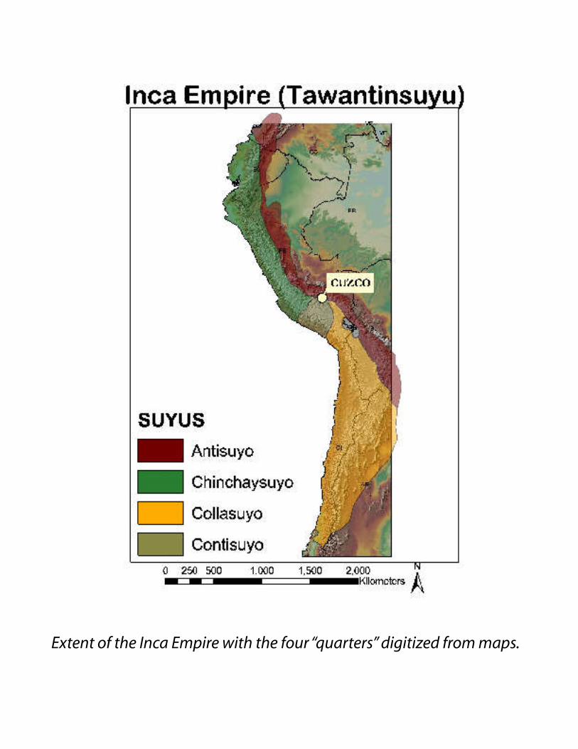
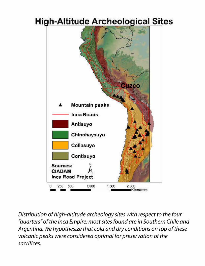
Extent of the Inca Empire with the four “quarters” digitized from maps.
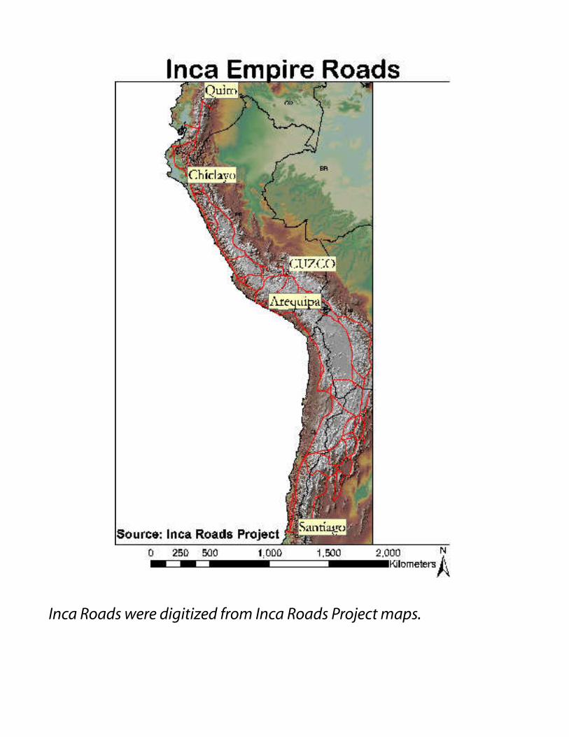
Inca Roads were digitized from Inca Roads Project maps.
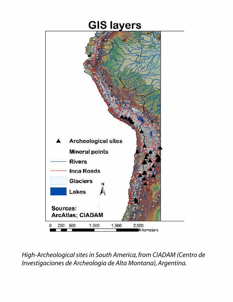
High-Archeological sites in South America, from CIADAM (Centro de Investigaciones de Archeologia de Alta Montana), Argentina.
Cuzco
Distribution of high-altitude archeology sites with respect to the four “quarters” of the Inca Empire: most sites found are in Southern Chile and Argentina. We hypothesize that cold and dry conditions on top of these volcanic peaks were considered optimal for preservation of the sacrifices.
Archeoclimatology inCentral Andes
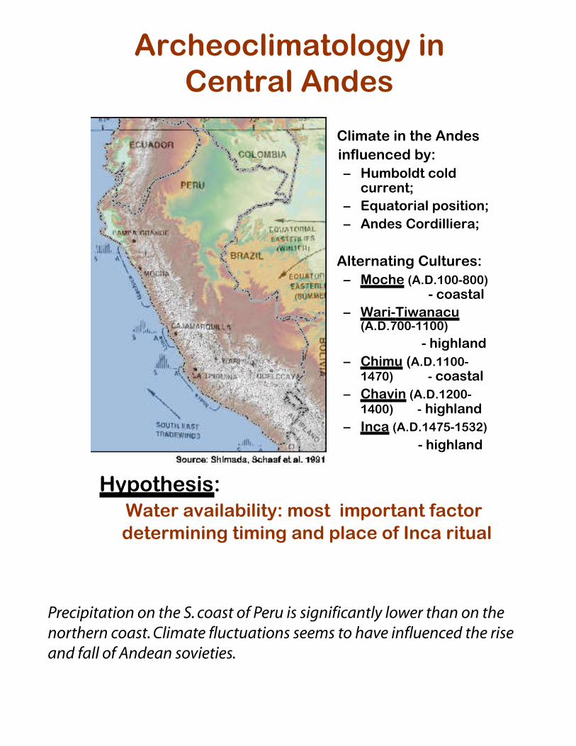
• Climate in the Andes influenced by:
– Humboldt coldcurrent;
– Equatorial position;– Andes Cordilliera;
• Alternating Cultures:– Moche (A.D.100-800)
- coastal– Wari-Tiwanacu
(A.D.700-1100)
- highland– Chimu (A.D.1100-
1470) - coastal– Chavin (A.D.1200-
1400) - highland– Inca (A.D.1475-1532)
- highland
•
Hypothesis: Water availability: most important factor determining timing and place of Inca rituals
Precipitation on the S. coast of Peru is significantly lower than on the northern coast. Climate fluctuations seems to have influenced the rise and fall of Andean sovieties.
Ice core climate evidence
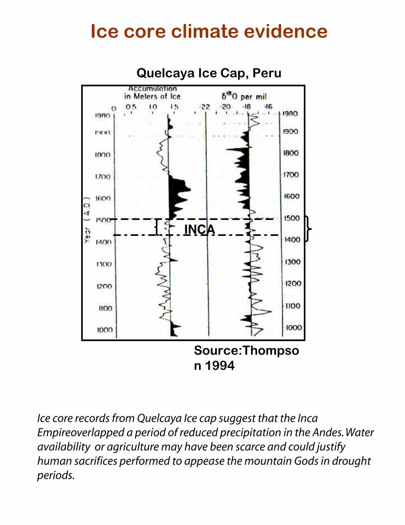
Quelcaya Ice Cap, Peru
Source:Thompson 1994
INCA
Ice core records from Quelcaya Ice cap suggest that the Inca Empireoverlapped a period of reduced precipitation in the Andes. Water availability or agriculture may have been scarce and could justify human sacrifices performed to appease the mountain Gods in drought periods.
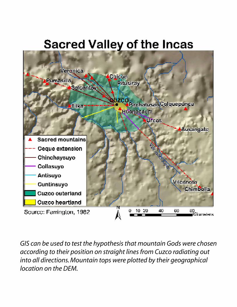
GIS can be used to test the hypothesis that mountain Gods were chosen according to their position on straight lines from Cuzco radiating out into all directions. Mountain tops were plotted by their geographical location on the DEM.
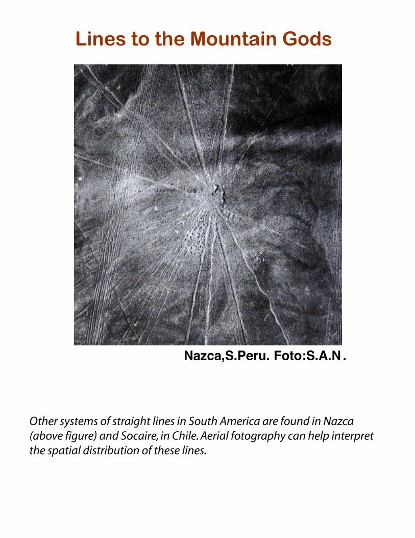
Lines to the Mountain Gods
Nazca,S.Peru. Foto:S.A.N .
Other systems of straight lines in South America are found in Nazca (above figure) and Socaire, in Chile. Aerial fotography can help interpret the spatial distribution of these lines.
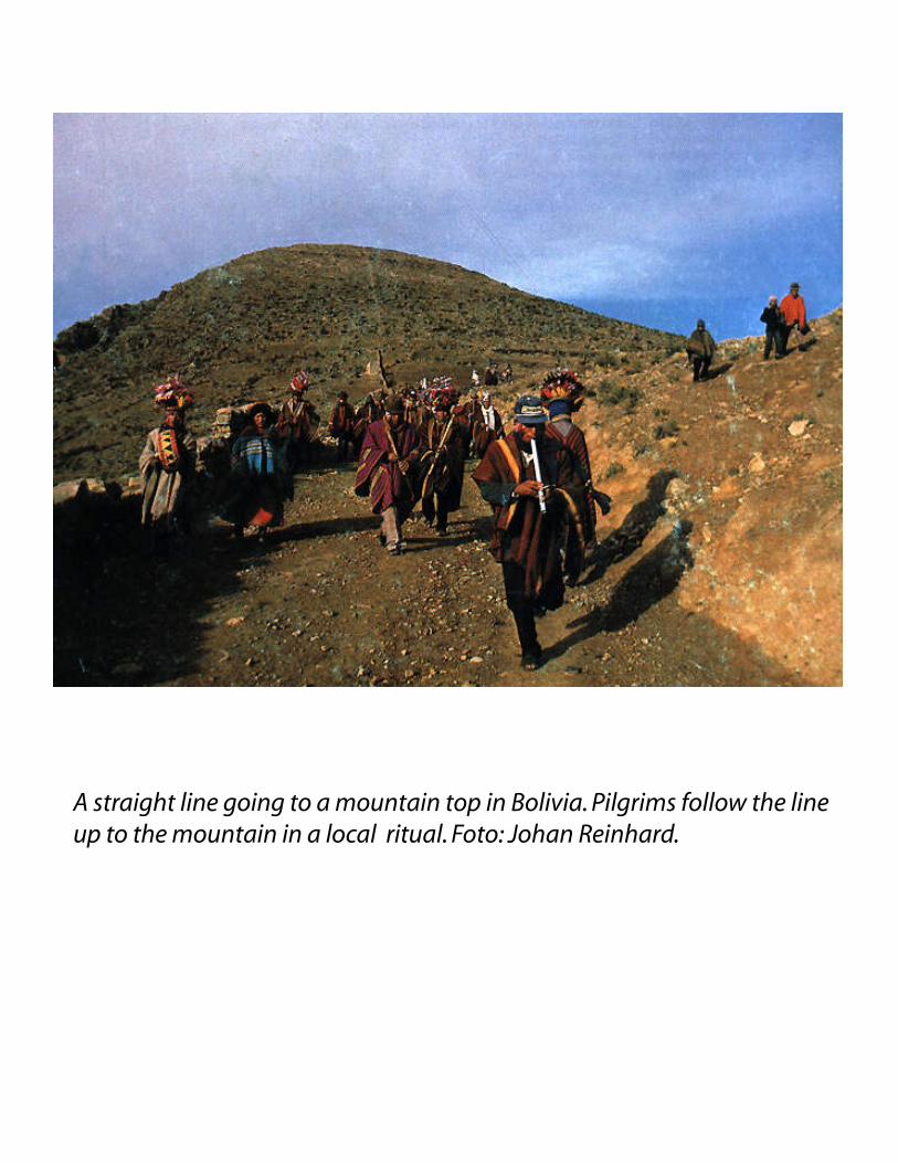
A straight line going to a mountain top in Bolivia. Pilgrims follow the line up to the mountain in a local ritual. Foto: Johan Reinhard.
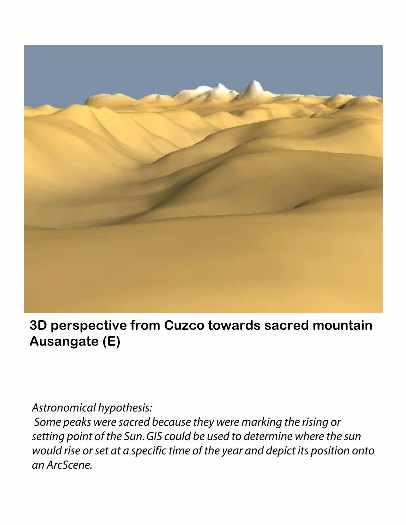
3D perspective from Cuzco towards sacred mountain Ausangate (E)
Astronomical hypothesis: Some peaks were sacred because they were marking the rising or setting point of the Sun. GIS could be used to determine where the sun would rise or set at a specific time of the year and depict its position onto an ArcScene.
Cuzco
Machu Pichu
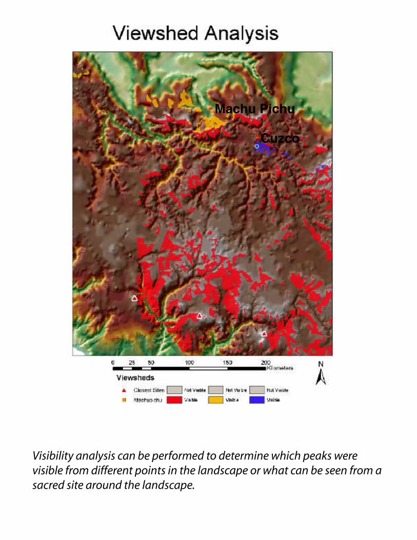
Visibility analysis can be performed to determine which peaks were visible from different points in the landscape or what can be seen from a sacred site around the landscape.
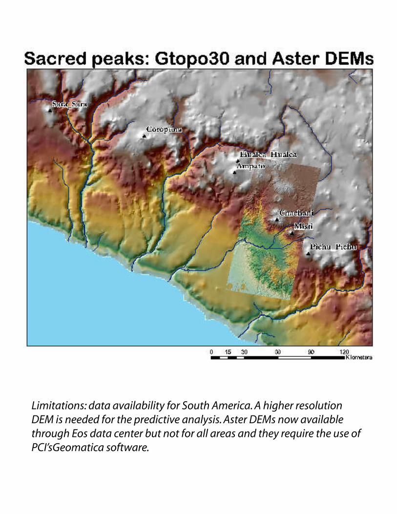
Limitations: data availability for South America. A higher resolution DEM is needed for the predictive analysis. Aster DEMs now available through Eos data center but not for all areas and they require the use of PCI’sGeomatica software.
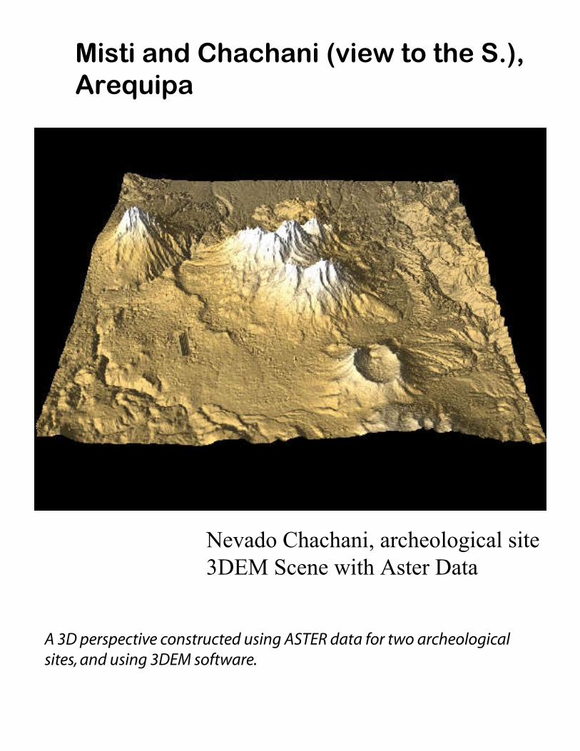
Misti and Chachani (view to the S.), Arequipa
Nevado Chachani, archeological site3DEM Scene with Aster Data
A 3D perspective constructed using ASTER data for two archeological sites, and using 3DEM software.
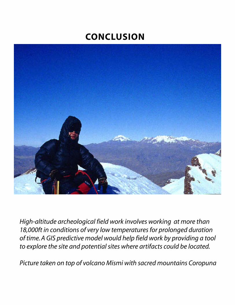
High-altitude archeological field work involves working at more than 18,000ft in conditions of very low temperatures for prolonged duration of time. A GIS predictive model would help field work by providing a tool to explore the site and potential sites where artifacts could be located.
Picture taken on top of volcano Mismi with sacred mountains Coropuna
CONCLUSION