Embed Size (px)
Citation preview
All Rights Reserved. Accounts and pictures may not be used or copied without prior written permission. © Jerry Eichhorst 2015
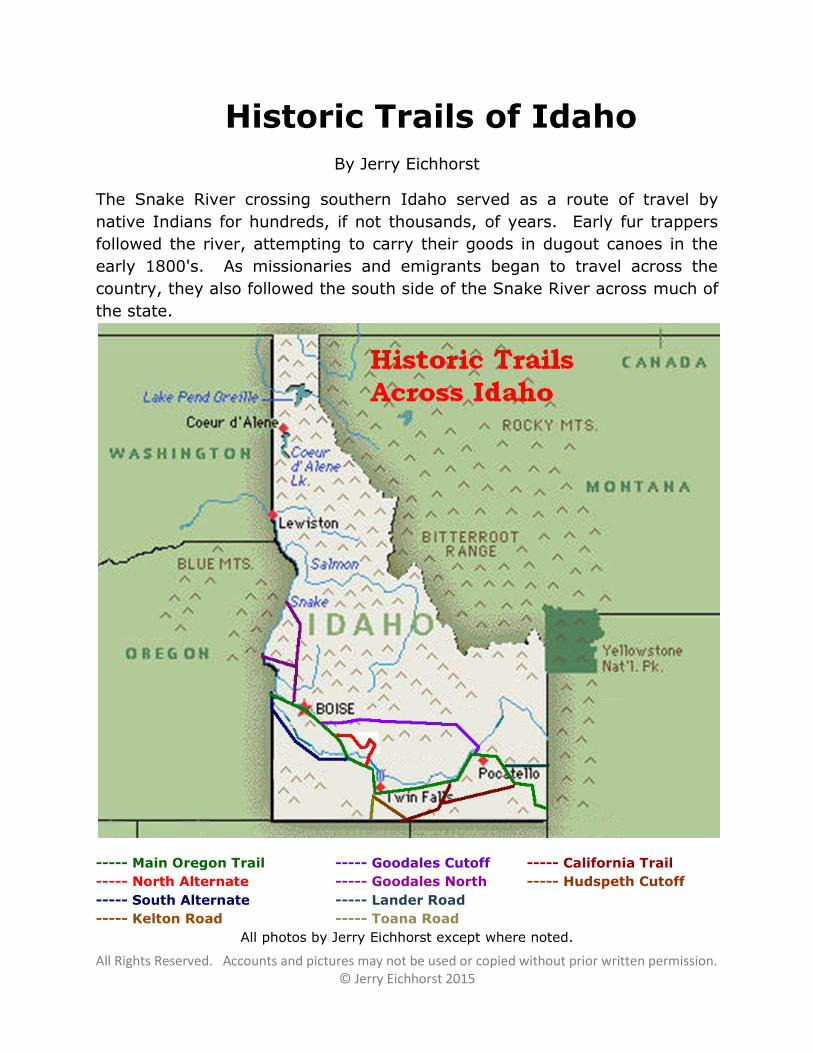
Historic Trails of Idaho
By Jerry Eichhorst
The Snake River crossing southern Idaho served as a route of travel by
native Indians for hundreds, if not thousands, of years. Early fur trappers
followed the river, attempting to carry their goods in dugout canoes in the
early 1800's. As missionaries and emigrants began to travel across the
country, they also followed the south side of the Snake River across much of
the state.
----- Main Oregon Trail ----- Goodales Cutoff ----- California Trail
----- North Alternate ----- Goodales North ----- Hudspeth Cutoff
----- South Alternate ----- Lander Road
----- Kelton Road ----- Toana Road
All photos by Jerry Eichhorst except where noted.
All Rights Reserved. Accounts and pictures may not be used or copied without prior written permission. © Jerry Eichhorst 2015
Main Oregon Trail
The Oregon Trail enters Idaho along the Bear River in the southeast corner
of the state. It travels hundreds of miles across the state and leaves near
Farewell Bend on the Snake River. Numerous alternative routes were
developed through the years.
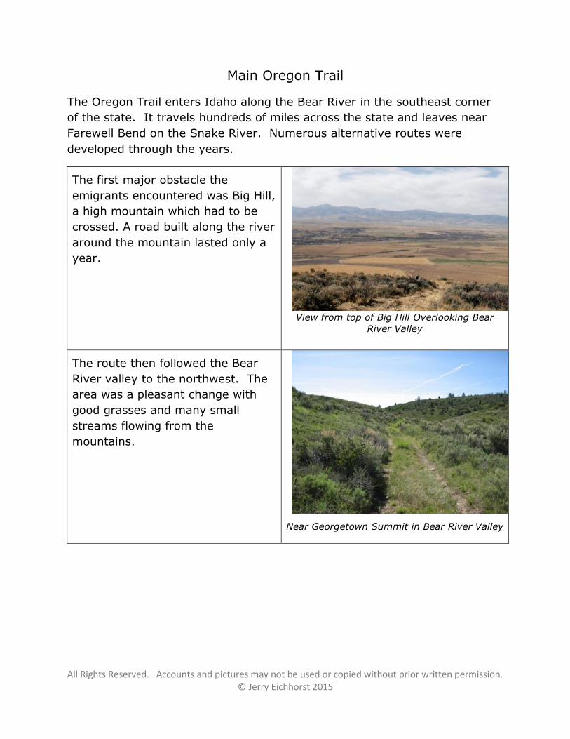
The first major obstacle the
emigrants encountered was Big Hill,
a high mountain which had to be
crossed. A road built along the river
around the mountain lasted only a
year.
View from top of Big Hill Overlooking Bear
River Valley
The route then followed the Bear
River valley to the northwest. The
area was a pleasant change with
good grasses and many small
streams flowing from the
mountains.
Near Georgetown Summit in Bear River Valley
All Rights Reserved. Accounts and pictures may not be used or copied without prior written permission. © Jerry Eichhorst 2015
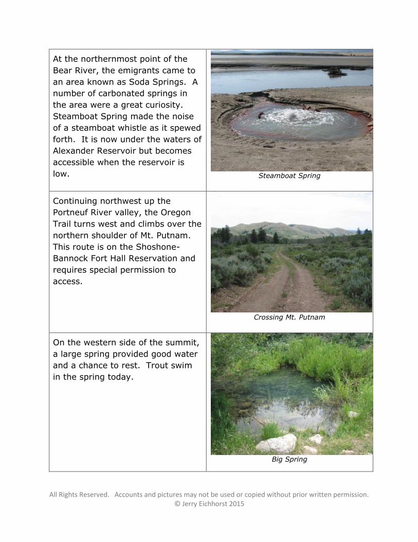
At the northernmost point of the
Bear River, the emigrants came to
an area known as Soda Springs. A
number of carbonated springs in
the area were a great curiosity.
Steamboat Spring made the noise
of a steamboat whistle as it spewed
forth. It is now under the waters of
Alexander Reservoir but becomes
accessible when the reservoir is
low. Steamboat Spring
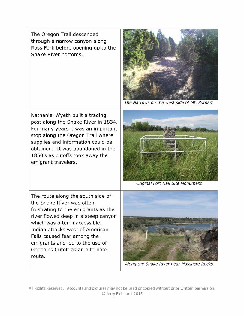
Continuing northwest up the
Portneuf River valley, the Oregon
Trail turns west and climbs over the
northern shoulder of Mt. Putnam.
This route is on the Shoshone-
Bannock Fort Hall Reservation and
requires special permission to
access.
Crossing Mt. Putnam
On the western side of the summit,
a large spring provided good water
and a chance to rest. Trout swim
in the spring today.
Big Spring
All Rights Reserved. Accounts and pictures may not be used or copied without prior written permission. © Jerry Eichhorst 2015
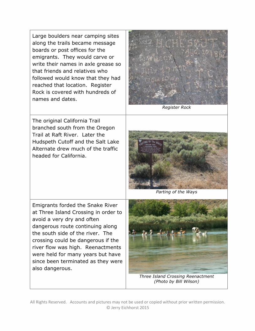
The Oregon Trail descended
through a narrow canyon along
Ross Fork before opening up to the
Snake River bottoms.
The Narrows on the west side of Mt. Putnam
Nathaniel Wyeth built a trading
post along the Snake River in 1834.
For many years it was an important
stop along the Oregon Trail where
supplies and information could be
obtained. It was abandoned in the
1850's as cutoffs took away the
emigrant travelers.
Original Fort Hall Site Monument
The route along the south side of
the Snake River was often
frustrating to the emigrants as the
river flowed deep in a steep canyon
which was often inaccessible.
Indian attacks west of American
Falls caused fear among the
emigrants and led to the use of
Goodales Cutoff as an alternate
route.
Along the Snake River near Massacre Rocks
All Rights Reserved. Accounts and pictures may not be used or copied without prior written permission. © Jerry Eichhorst 2015
Large boulders near camping sites
along the trails became message
boards or post offices for the
emigrants. They would carve or
write their names in axle grease so
that friends and relatives who
followed would know that they had
reached that location. Register
Rock is covered with hundreds of
names and dates.
Register Rock
The original California Trail
branched south from the Oregon
Trail at Raft River. Later the
Hudspeth Cutoff and the Salt Lake
Alternate drew much of the traffic
headed for California.
Parting of the Ways
Emigrants forded the Snake River
at Three Island Crossing in order to
avoid a very dry and often
dangerous route continuing along
the south side of the river. The
crossing could be dangerous if the
river flow was high. Reenactments
were held for many years but have
since been terminated as they were
also dangerous.
Three Island Crossing Reenactment
(Photo by Bill Wilson)
All Rights Reserved. Accounts and pictures may not be used or copied without prior written permission. © Jerry Eichhorst 2015
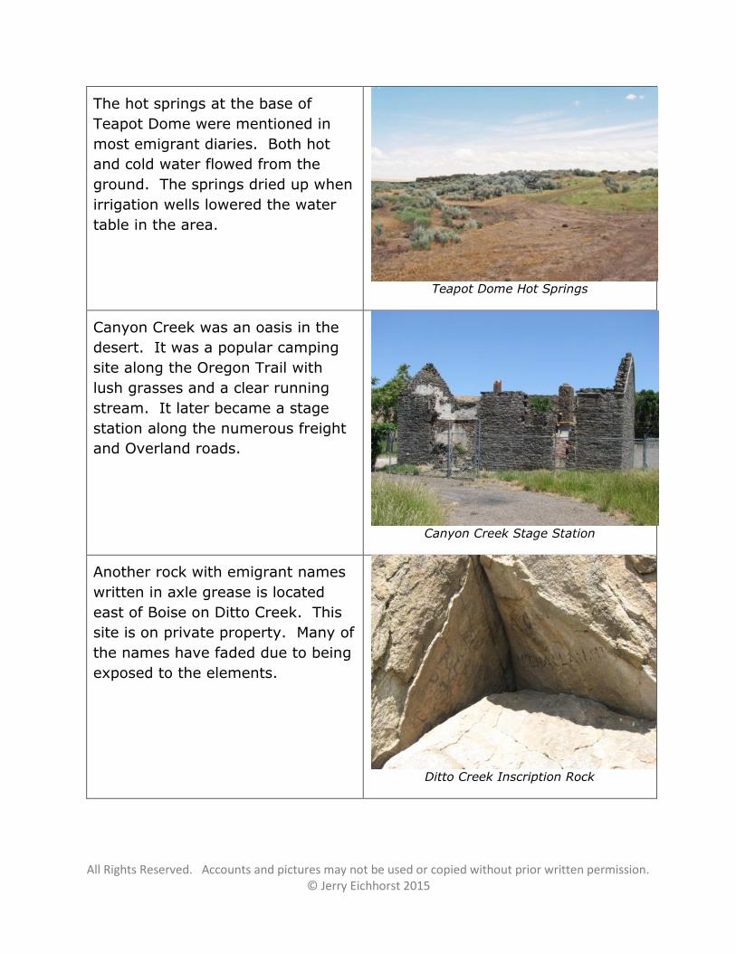
The hot springs at the base of
Teapot Dome were mentioned in
most emigrant diaries. Both hot
and cold water flowed from the
ground. The springs dried up when
irrigation wells lowered the water
table in the area.
Teapot Dome Hot Springs
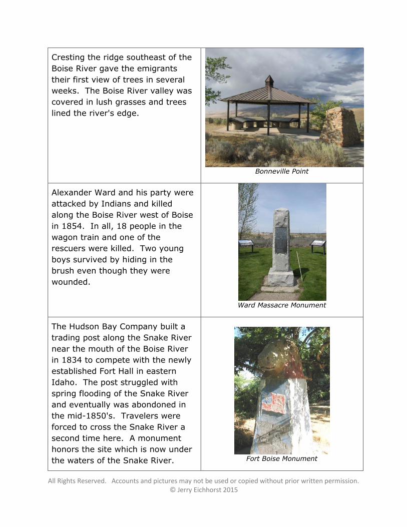
Canyon Creek was an oasis in the
desert. It was a popular camping
site along the Oregon Trail with
lush grasses and a clear running
stream. It later became a stage
station along the numerous freight
and Overland roads.
Canyon Creek Stage Station
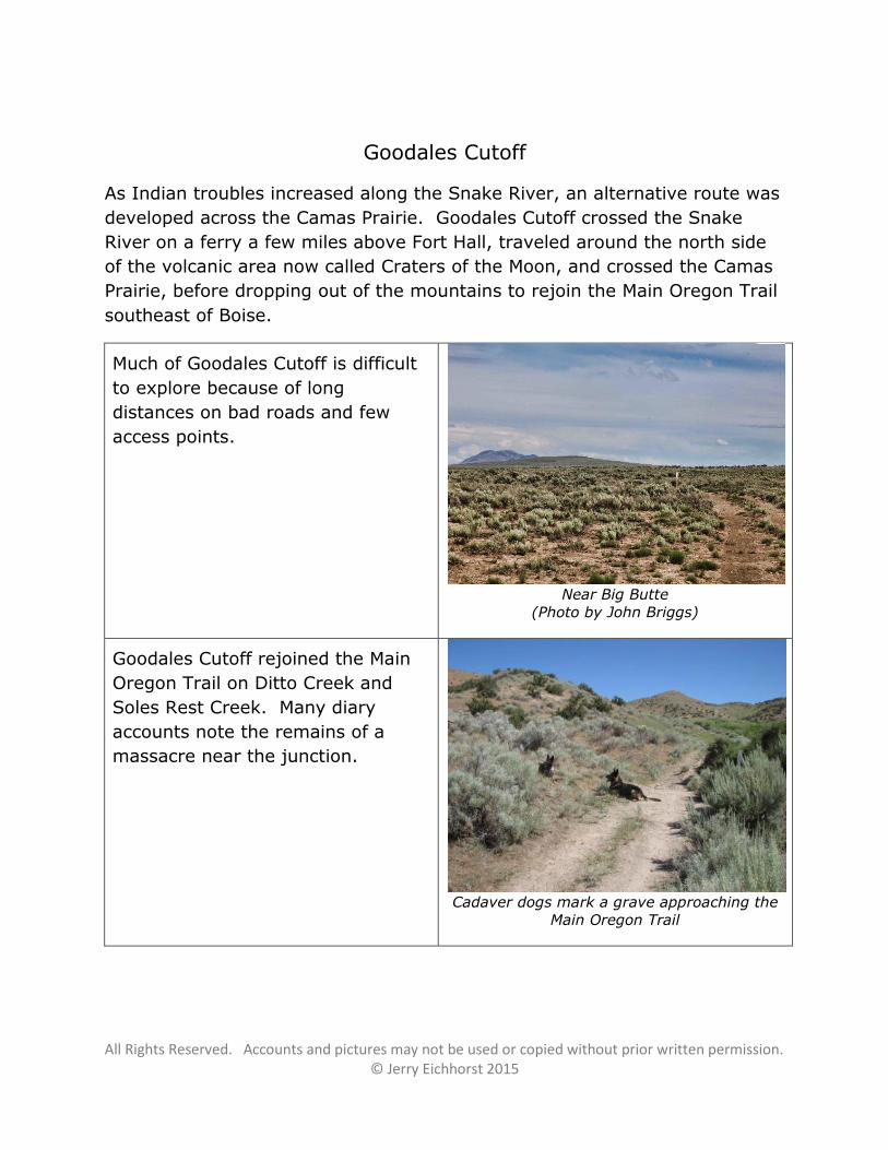
Another rock with emigrant names
written in axle grease is located
east of Boise on Ditto Creek. This
site is on private property. Many of
the names have faded due to being
exposed to the elements.
Ditto Creek Inscription Rock
All Rights Reserved. Accounts and pictures may not be used or copied without prior written permission. © Jerry Eichhorst 2015
Cresting the ridge southeast of the
Boise River gave the emigrants
their first view of trees in several
weeks. The Boise River valley was
covered in lush grasses and trees
lined the river's edge.
Bonneville Point
Alexander Ward and his party were
attacked by Indians and killed
along the Boise River west of Boise
in 1854. In all, 18 people in the
wagon train and one of the
rescuers were killed. Two young
boys survived by hiding in the
brush even though they were
wounded.
Ward Massacre Monument
The Hudson Bay Company built a
trading post along the Snake River
near the mouth of the Boise River
in 1834 to compete with the newly
established Fort Hall in eastern
Idaho. The post struggled with
spring flooding of the Snake River
and eventually was abondoned in
the mid-1850's. Travelers were
forced to cross the Snake River a
second time here. A monument
honors the site which is now under
the waters of the Snake River.
Fort Boise Monument
All Rights Reserved. Accounts and pictures may not be used or copied without prior written permission. © Jerry Eichhorst 2015
Goodales Cutoff
As Indian troubles increased along the Snake River, an alternative route was
developed across the Camas Prairie. Goodales Cutoff crossed the Snake
River on a ferry a few miles above Fort Hall, traveled around the north side
of the volcanic area now called Craters of the Moon, and crossed the Camas
Prairie, before dropping out of the mountains to rejoin the Main Oregon Trail
southeast of Boise.
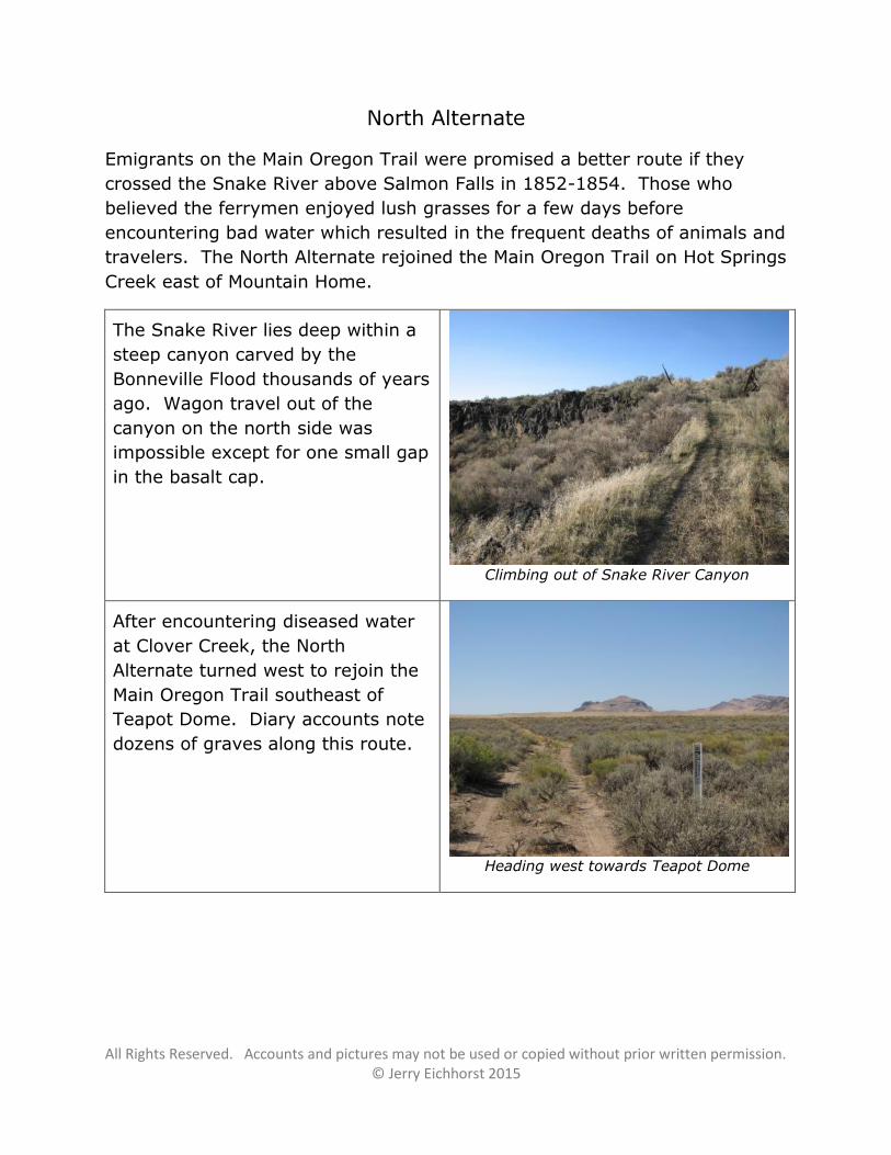
Much of Goodales Cutoff is difficult
to explore because of long
distances on bad roads and few
access points.
Near Big Butte
(Photo by John Briggs)
Goodales Cutoff rejoined the Main
Oregon Trail on Ditto Creek and
Soles Rest Creek. Many diary
accounts note the remains of a
massacre near the junction.
Cadaver dogs mark a grave approaching the
Main Oregon Trail
All Rights Reserved. Accounts and pictures may not be used or copied without prior written permission. © Jerry Eichhorst 2015
North Alternate
Emigrants on the Main Oregon Trail were promised a better route if they
crossed the Snake River above Salmon Falls in 1852-1854. Those who
believed the ferrymen enjoyed lush grasses for a few days before
encountering bad water which resulted in the frequent deaths of animals and
travelers. The North Alternate rejoined the Main Oregon Trail on Hot Springs
Creek east of Mountain Home.
The Snake River lies deep within a
steep canyon carved by the
Bonneville Flood thousands of years
ago. Wagon travel out of the
canyon on the north side was
impossible except for one small gap
in the basalt cap.
Climbing out of Snake River Canyon
After encountering diseased water
at Clover Creek, the North
Alternate turned west to rejoin the
Main Oregon Trail southeast of
Teapot Dome. Diary accounts note
dozens of graves along this route.
Heading west towards Teapot Dome
All Rights Reserved. Accounts and pictures may not be used or copied without prior written permission. © Jerry Eichhorst 2015
South Alternate
Emigrants on the Main Oregon Trail who did not cross the Snake River at
Three Island Crossing were forced to follow the south side of the Snake
River, a route which was drier, rougher, and often dangerous.
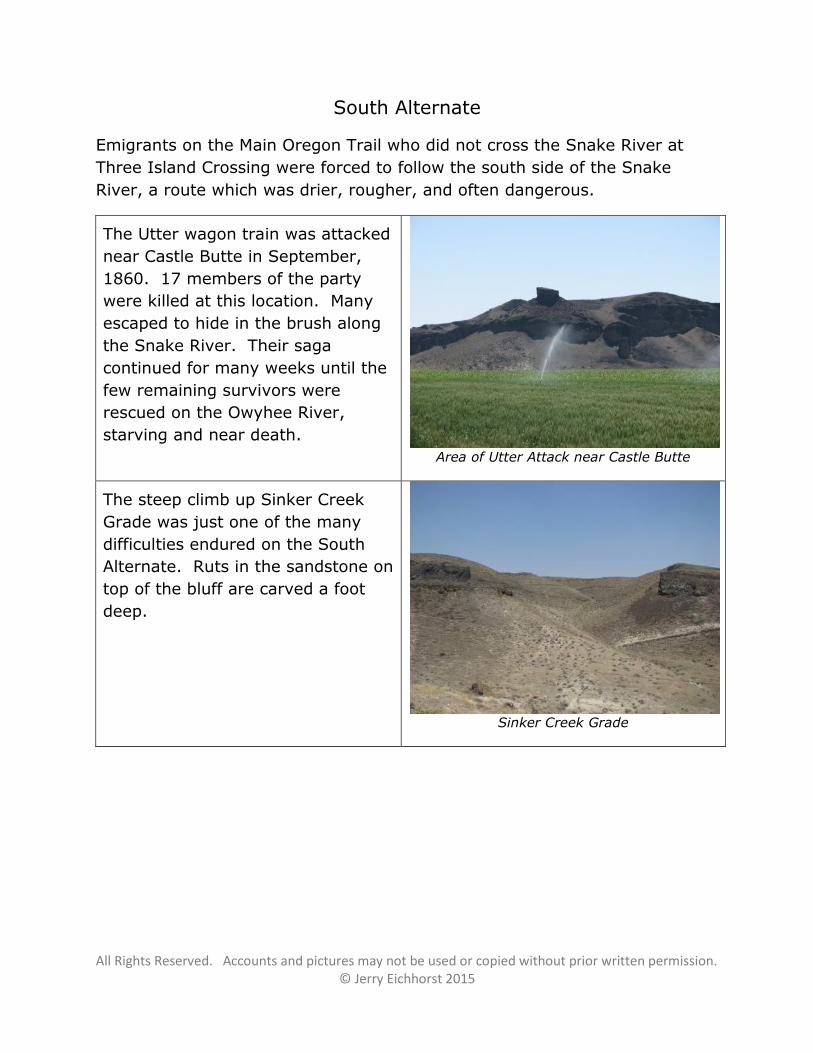
The Utter wagon train was attacked
near Castle Butte in September,
1860. 17 members of the party
were killed at this location. Many
escaped to hide in the brush along
the Snake River. Their saga
continued for many weeks until the
few remaining survivors were
rescued on the Owyhee River,
starving and near death.
Area of Utter Attack near Castle Butte
The steep climb up Sinker Creek
Grade was just one of the many
difficulties endured on the South
Alternate. Ruts in the sandstone on
top of the bluff are carved a foot
deep.
Sinker Creek Grade
All Rights Reserved. Accounts and pictures may not be used or copied without prior written permission. © Jerry Eichhorst 2015
California Trail / Hudspeth Cutoff / Salt Lake Alternate
Emigrants heading to California had several options within Idaho. The
original route headed south from the Oregon Trail at Raft River. In 1849, a
new route called the Hudspeth Cutoff branched west a few miles west of
Soda Springs. Another route took emigrants through Salt Lake City to rejoin
the California Trail just west of City of Rocks. The combined route traveled
over Granite Pass as it left Idaho heading southwest to the Humbolt River
and California.
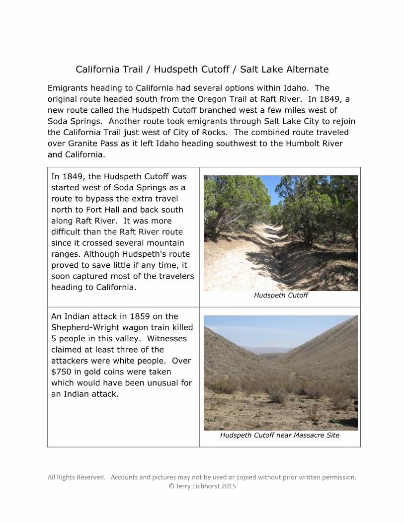
In 1849, the Hudspeth Cutoff was
started west of Soda Springs as a
route to bypass the extra travel
north to Fort Hall and back south
along Raft River. It was more
difficult than the Raft River route
since it crossed several mountain
ranges. Although Hudspeth's route
proved to save little if any time, it
soon captured most of the travelers
heading to California.
Hudspeth Cutoff
An Indian attack in 1859 on the
Shepherd-Wright wagon train killed
5 people in this valley. Witnesses
claimed at least three of the
attackers were white people. Over
$750 in gold coins were taken
which would have been unusual for
an Indian attack.
Hudspeth Cutoff near Massacre Site
All Rights Reserved. Accounts and pictures may not be used or copied without prior written permission. © Jerry Eichhorst 2015
Many emigrants stopped to write
their names on the huge granite
rock formations at City of Rocks.
There are several such rocks in the
area.
City of Rocks Emigrant Names
The Salt Lake Alternate traveled
northwest from Salt Lake City until
it joined the California Trail west of
City of Rocks. Many travelers
commented on the steep granite
peaks they saw near the junction.
A stage station was built in the area
to serve the Kelton Road, a freight
road from Kelton, Utah, to Boise.
Twin Sisters as seen from Salt Lake Alternate
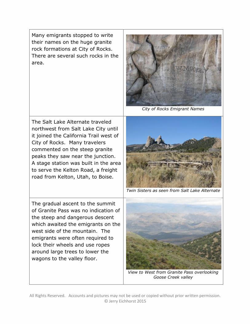
The gradual ascent to the summit
of Granite Pass was no indication of
the steep and dangerous descent
which awaited the emigrants on the
west side of the mountain. The
emigrants were often required to
lock their wheels and use ropes
around large trees to lower the
wagons to the valley floor.
View to West from Granite Pass overlooking
Goose Creek valley
All Rights Reserved. Accounts and pictures may not be used or copied without prior written permission. © Jerry Eichhorst 2015
Lander Road
Frederick Lander was authorized by the US government to build a wagon
road from South Pass to the Humbolt River. Known as the Lander Road, this
route was popular in the early 1860's. After crossing through mountains in
eastern Idaho, the route continued west to Fort Hall. From Fort Hall, the
traditional routes to California and Oregon were followed, as well as a route
north to the Montana mines.
The grave of J. W. Lane, an
emigrant who died in 1859.
"…at this camp Mr. Lane passed
away… We marked it as best we
could by putting a rather flat stone
on which we put his name."
Joel Barnett
Lanes Grave
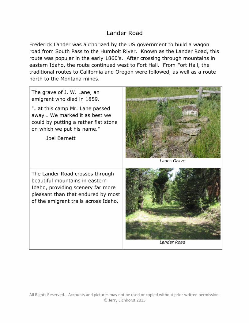
The Lander Road crosses through
beautiful mountains in eastern
Idaho, providing scenery far more
pleasant than that endured by most
of the emigrant trails across Idaho.
Lander Road