Embed Size (px)
Citation preview
The overall classification of this presentation is:
Classified by:
Derived from:
Declassify on:
Mike Jeffe, Contractor
May 4, 2016
Hootenanny: Creating an Open Source Conflation
Engine
Approved for Public Release, 16-374
“The age of free public and open source geospatial feature data has significantly increased the opportunity to conflate such
data to create enhanced products.”
Source: Proc. SPIE 8747, Geospatial InfoFusion III, 874703 (23 May 2013)
Approved for Public Release, 16-374
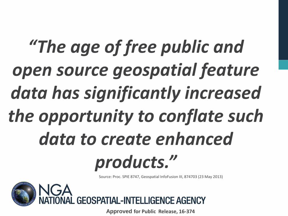
Lots of Disparate Data Sources
• Large amounts of overlapping data from various sources
Government
Commercial
Crowdsource
• Leverage best parts of multiple sources to build a best-of-breed conflated map that is superior to any one input source
Source: Vector Data Sources: OpenStreetMap (OSM) public data; NGA Feature Foundation Data (FFD)
Approved for Public Release, 16-374
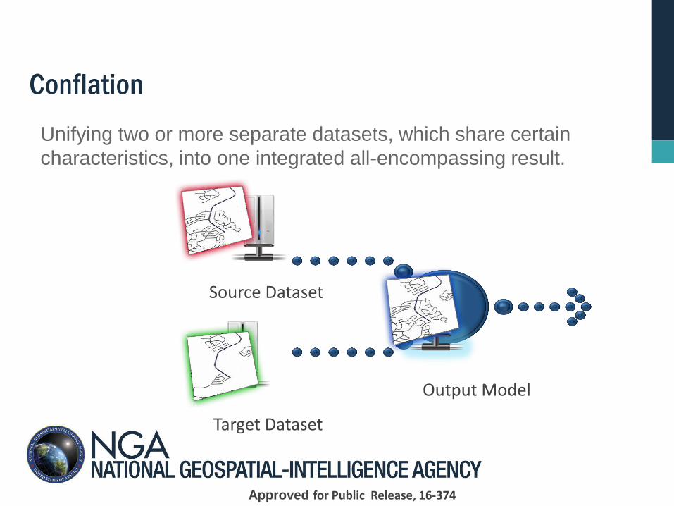
Unifying two or more separate datasets, which share certain
characteristics, into one integrated all-encompassing result.
Target Dataset
Source Dataset
Output Model
Conflation
Approved for Public Release, 16-374
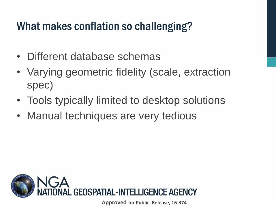
What makes conflation so challenging?
• Different database schemas
• Varying geometric fidelity (scale, extraction
spec)
• Tools typically limited to desktop solutions
• Manual techniques are very tedious
Approved for Public Release, 16-374
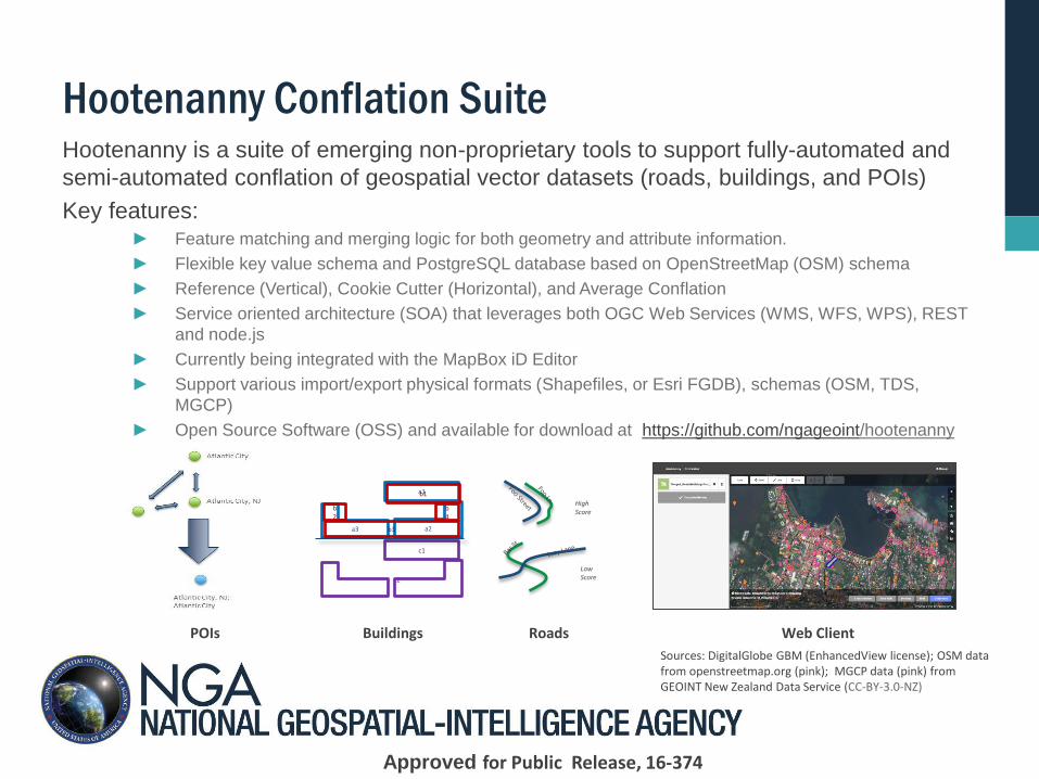
Hootenanny Conflation Suite Hootenanny is a suite of emerging non-proprietary tools to support fully-automated and
semi-automated conflation of geospatial vector datasets (roads, buildings, and POIs)
Key features: ► Feature matching and merging logic for both geometry and attribute information.
► Flexible key value schema and PostgreSQL database based on OpenStreetMap (OSM) schema
► Reference (Vertical), Cookie Cutter (Horizontal), and Average Conflation
► Service oriented architecture (SOA) that leverages both OGC Web Services (WMS, WFS, WPS), REST
and node.js
► Currently being integrated with the MapBox iD Editor
► Support various import/export physical formats (Shapefiles, or Esri FGDB), schemas (OSM, TDS,
MGCP)
► Open Source Software (OSS) and available for download at https://github.com/ngageoint/hootenanny
c1
c2*
a3
b2
a2 b3
b4
a1 b1
High Score
Low Score
Roads Buildings POIs Web Client
Sources: DigitalGlobe GBM (EnhancedView license); OSM data from openstreetmap.org (pink); MGCP data (pink) from GEOINT New Zealand Data Service (CC-BY-3.0-NZ)
Approved for Public Release, 16-374
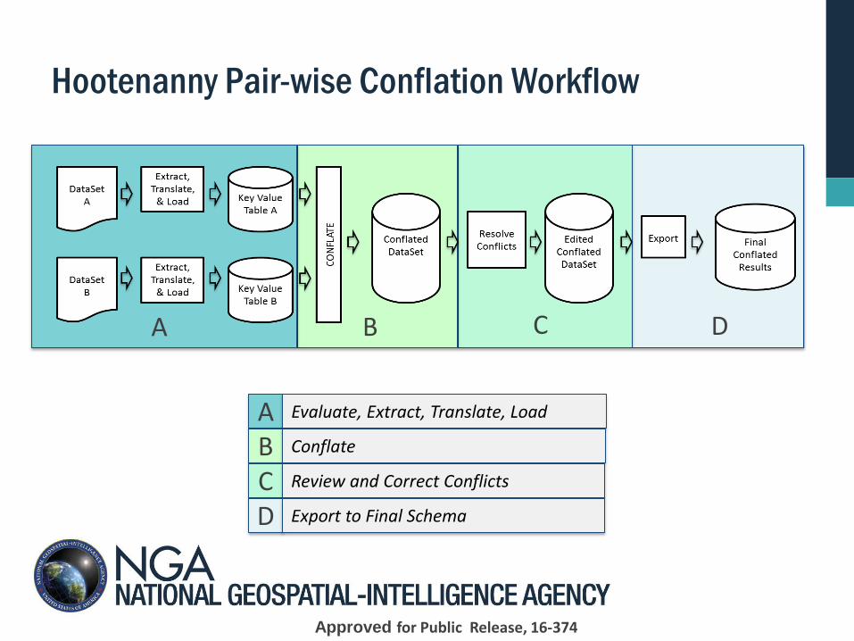
Hootenanny Pair-wise Conflation Workflow
A B C D
A Evaluate, Extract, Translate, Load
B Conflate
C Review and Correct Conflicts
D Export to Final Schema
Approved for Public Release, 16-374
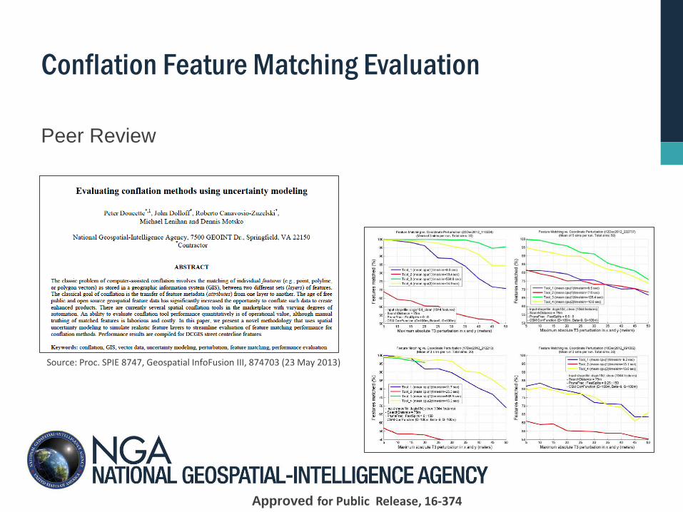
Conflation Feature Matching Evaluation
Peer Review
Source: Proc. SPIE 8747, Geospatial InfoFusion III, 874703 (23 May 2013)
Approved for Public Release, 16-374
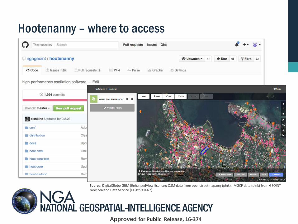
Hootenanny – where to access
Source: DigitalGlobe GBM (EnhancedView license); OSM data from openstreetmap.org (pink); MGCP data (pink) from GEOINT New Zealand Data Service (CC-BY-3.0-NZ)
Approved for Public Release, 16-374
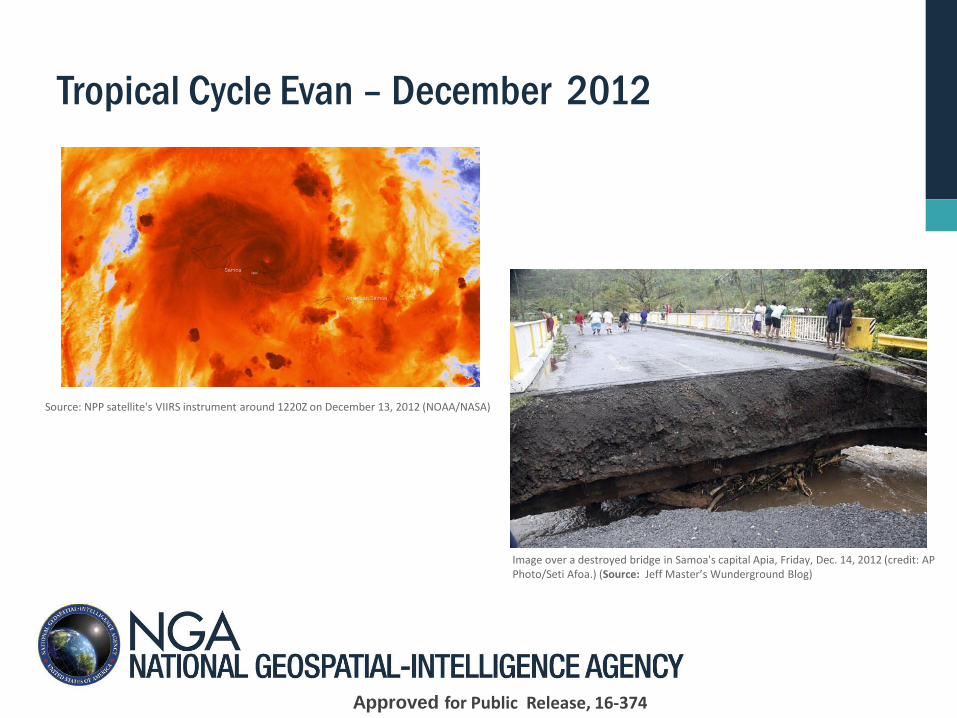
Tropical Cycle Evan – December 2012
Source: NPP satellite's VIIRS instrument around 1220Z on December 13, 2012 (NOAA/NASA)
Image over a destroyed bridge in Samoa's capital Apia, Friday, Dec. 14, 2012 (credit: AP Photo/Seti Afoa.) (Source: Jeff Master’s Wunderground Blog)
Approved for Public Release, 16-374
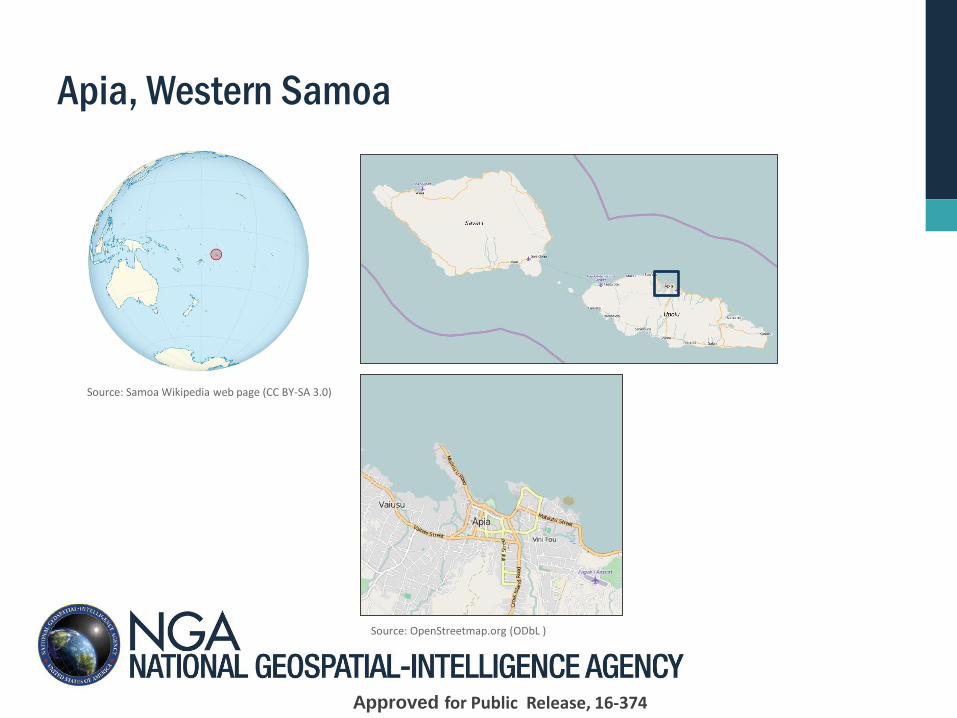
Apia, Western Samoa
Source: Samoa Wikipedia web page (CC BY-SA 3.0)
Source: OpenStreetmap.org (ODbL )
Approved for Public Release, 16-374
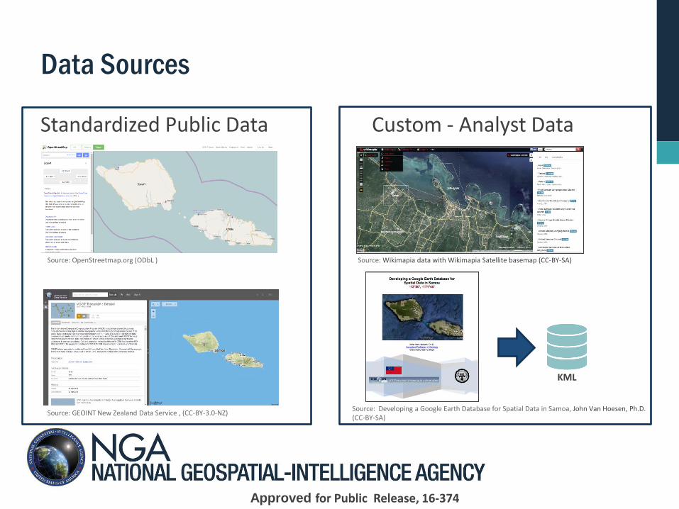
Data Sources
Source: OpenStreetmap.org (ODbL )
Source: GEOINT New Zealand Data Service , (CC-BY-3.0-NZ)
Source: Wikimapia data with Wikimapia Satellite basemap (CC-BY-SA)
Source: Developing a Google Earth Database for Spatial Data in Samoa, John Van Hoesen, Ph.D. (CC-BY-SA)
KML
Standardized Public Data Custom - Analyst Data
Approved for Public Release, 16-374
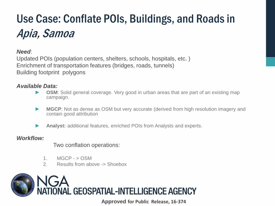
Use Case: Conflate POIs, Buildings, and Roads in
Apia, Samoa
Need:
Updated POIs (population centers, shelters, schools, hospitals, etc. )
Enrichment of transportation features (bridges, roads, tunnels)
Building footprint polygons
Available Data: ► OSM: Solid general coverage. Very good in urban areas that are part of an existing map
campaign.
► MGCP: Not as dense as OSM but very accurate (derived from high resolution imagery and contain good attribution
► Analyst: additional features, enriched POIs from Analysts and experts.
Workflow:
Two conflation operations:
1. MGCP - > OSM
2. Results from above -> Shoebox
Approved for Public Release, 16-374
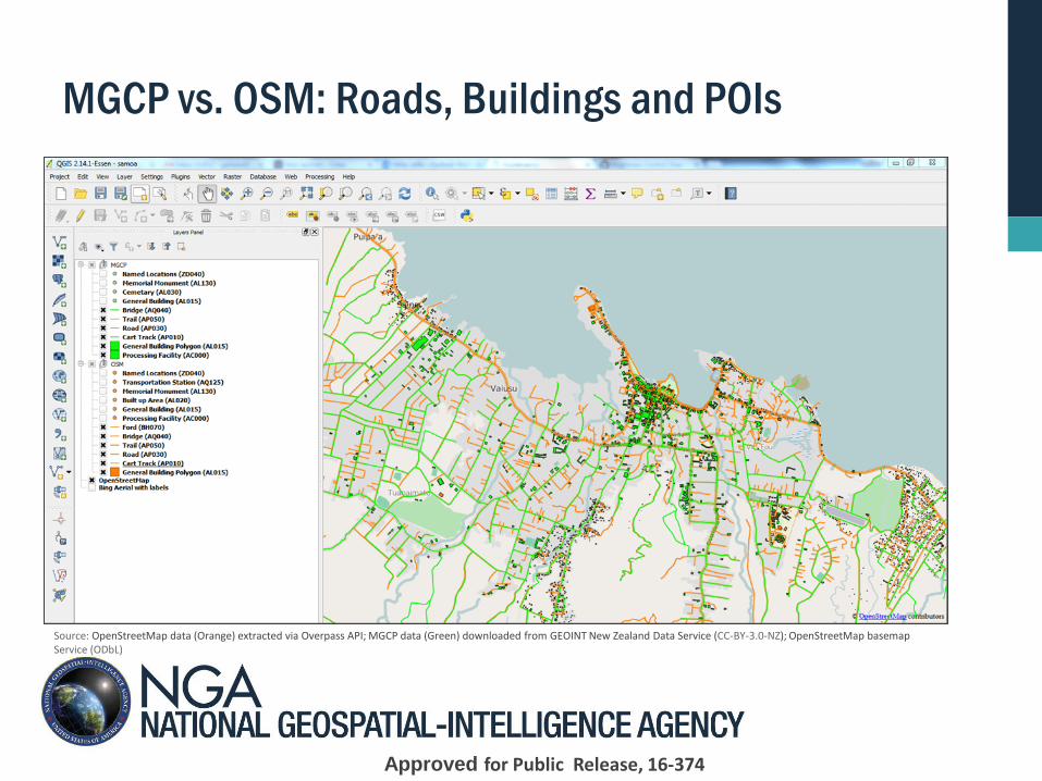
MGCP vs. OSM: Roads, Buildings and POIs
Source: OpenStreetMap data (Orange) extracted via Overpass API; MGCP data (Green) downloaded from GEOINT New Zealand Data Service (CC-BY-3.0-NZ); OpenStreetMap basemap Service (ODbL)
Approved for Public Release, 16-374
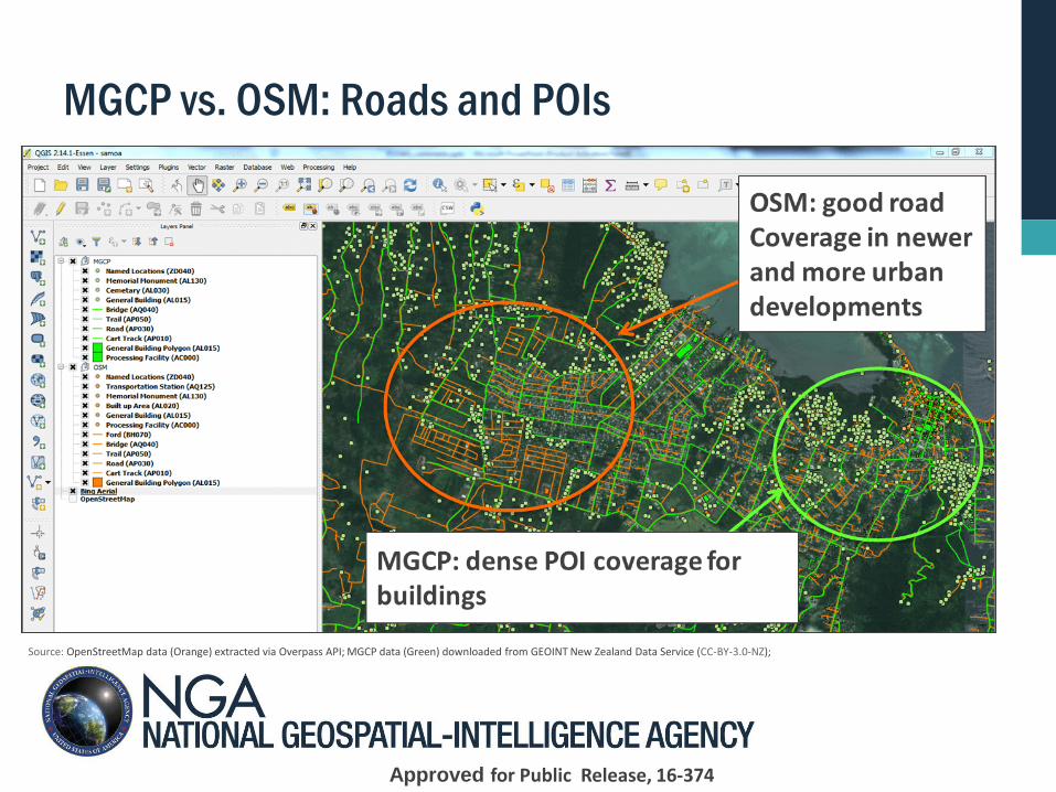
MGCP vs. OSM: Roads and POIs
Source: OpenStreetMap data (Orange) extracted via Overpass API; MGCP data (Green) downloaded from GEOINT New Zealand Data Service (CC-BY-3.0-NZ);
Approved for Public Release, 16-374
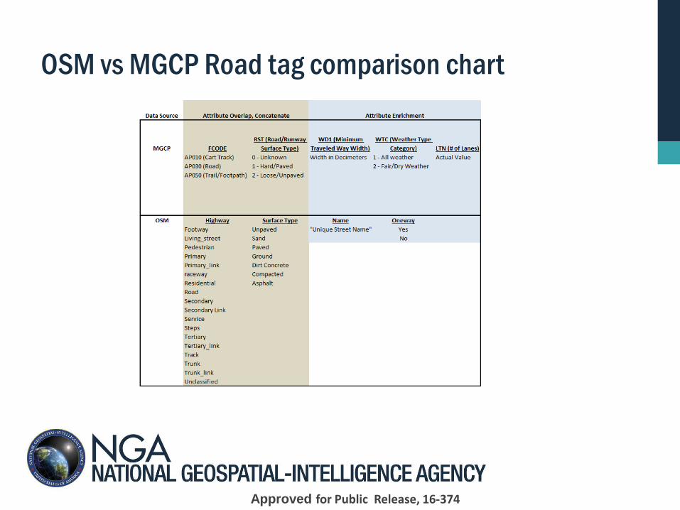
OSM vs MGCP Road tag comparison chart
Approved for Public Release, 16-374
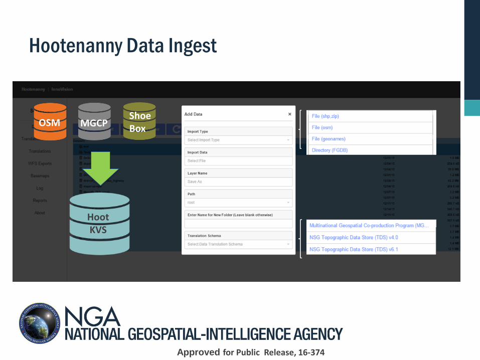
Hootenanny Data Ingest
Hoot KVS
OSM Shoe Box
MGCP
Approved for Public Release, 16-374
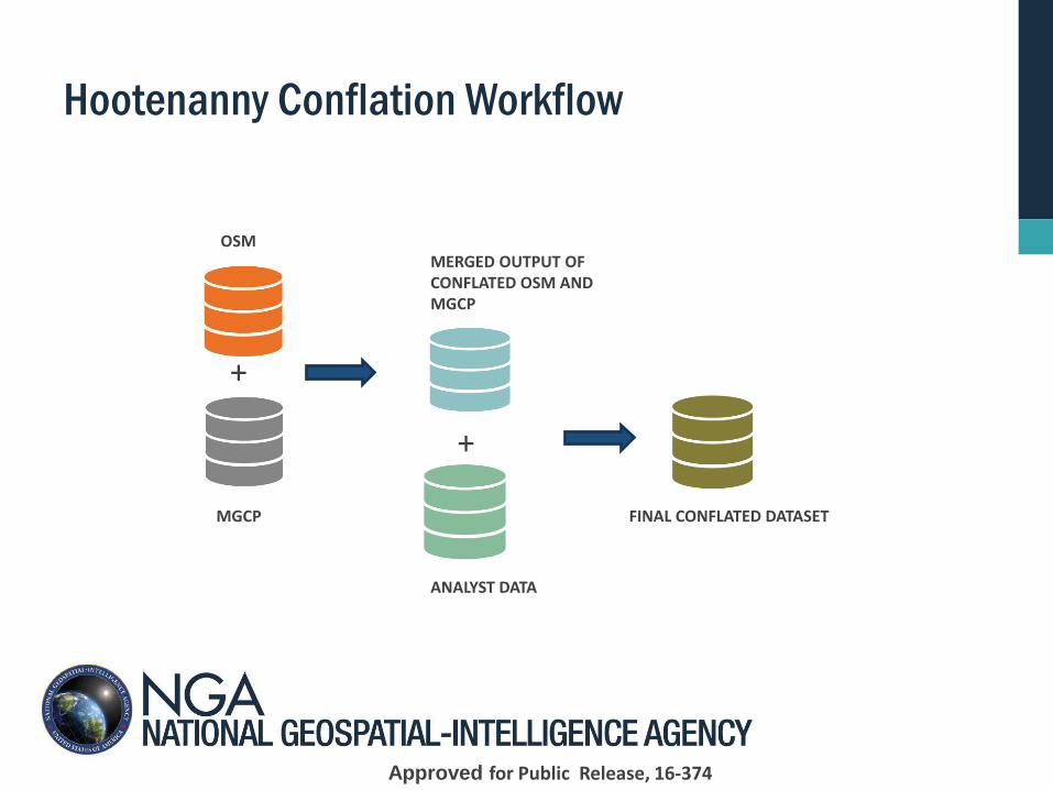
Hootenanny Conflation Workflow
OSM
MGCP
+
+
MERGED OUTPUT OF CONFLATED OSM AND MGCP
ANALYST DATA
FINAL CONFLATED DATASET
Approved for Public Release, 16-374
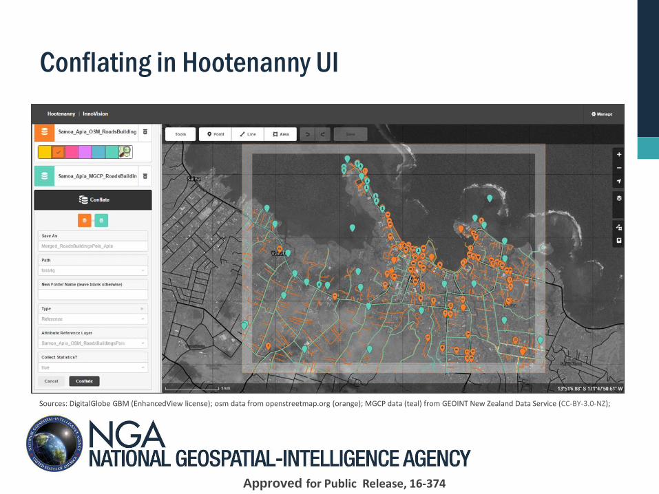
Conflating in Hootenanny UI
Sources: DigitalGlobe GBM (EnhancedView license); osm data from openstreetmap.org (orange); MGCP data (teal) from GEOINT New Zealand Data Service (CC-BY-3.0-NZ);
Approved for Public Release, 16-374
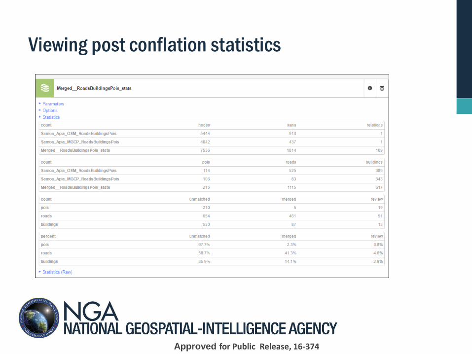
Viewing post conflation statistics
Approved for Public Release, 16-374
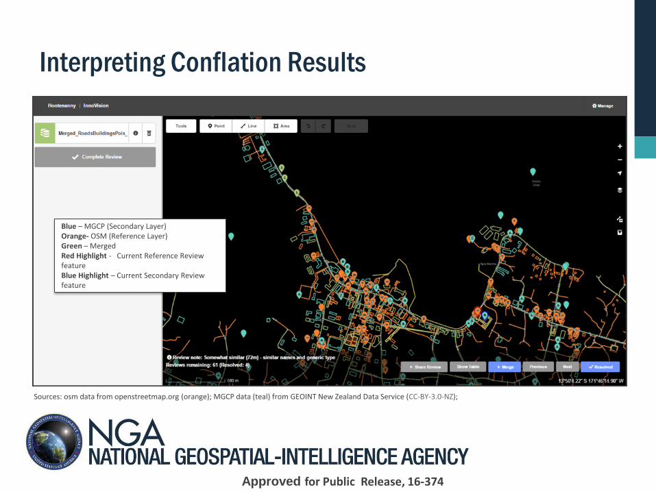
Interpreting Conflation Results
Blue – MGCP (Secondary Layer) Orange- OSM (Reference Layer) Green – Merged Red Highlight - Current Reference Review feature Blue Highlight – Current Secondary Review feature
Sources: osm data from openstreetmap.org (orange); MGCP data (teal) from GEOINT New Zealand Data Service (CC-BY-3.0-NZ);
Approved for Public Release, 16-374
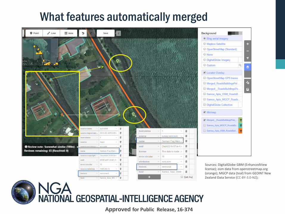
What features automatically merged
Sources: DigitalGlobe GBM (EnhancedView license); osm data from openstreetmap.org (orange); MGCP data (teal) from GEOINT New Zealand Data Service (CC-BY-3.0-NZ);
Approved for Public Release, 16-374
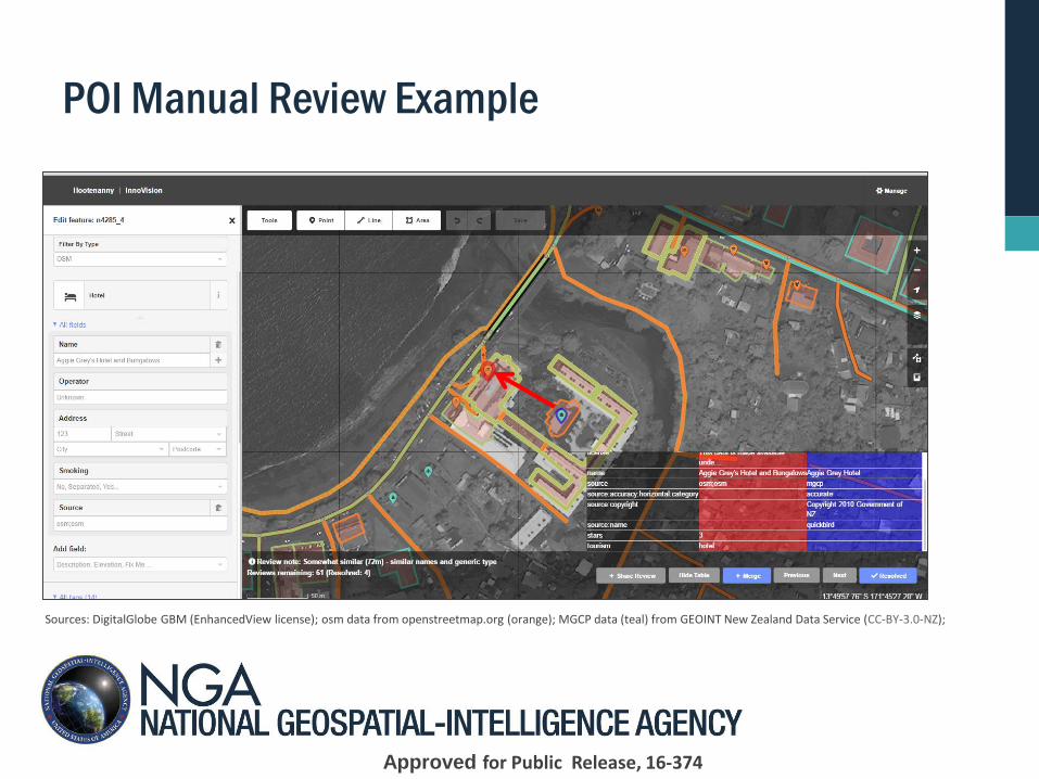
POI Manual Review Example
Sources: DigitalGlobe GBM (EnhancedView license); osm data from openstreetmap.org (orange); MGCP data (teal) from GEOINT New Zealand Data Service (CC-BY-3.0-NZ);
Approved for Public Release, 16-374
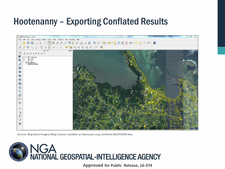
Hootenanny – Exporting Conflated Results
Sources: Bing Aerial Imagery (Bing License) available on OpenLayers.org; Conflated MGCP/OSM data.
Approved for Public Release, 16-374
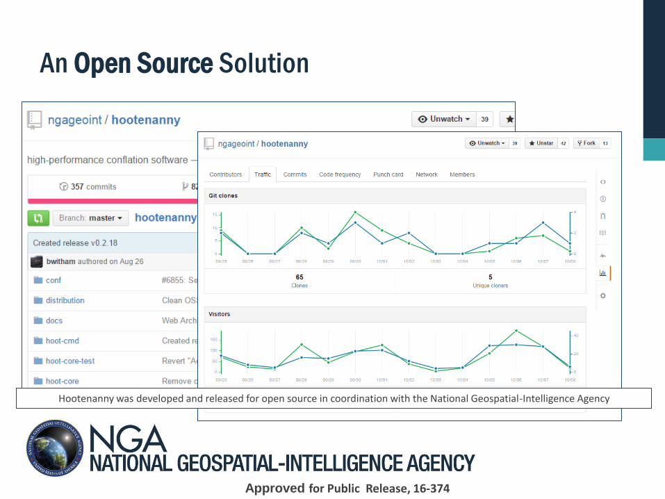
An Open Source Solution
Hootenanny was developed and released for open source in coordination with the National Geospatial-Intelligence Agency
Approved for Public Release, 16-374
Current Efforts
Automated, RPM, Deployment
R&D:
► Intersection matching
► Conflation change sets
Build and refine existing conflation workflows
Join us:
► Backlog: https://github.com/ngageoint/hootenanny/issues
► Fork and submit a pull request:
https://github.com/ngageoint/hootenanny/pulls
Approved for Public Release, 16-374
Summary
► Conflation provides the ability to leverage best parts, geometry and
attributes, of input sources to build a superior best-of-breed conflated map
► Hootenanny developed to conflate geospatial vector datasets, roads (polylines), buildings (polygons), POI’s (points)
► Built around OSM key value pair attribute schema and PostgreSQL database for robust attribute mapping to standardized schema
► Translation support for standard schemas, TDS, MGCP, and UTP. Other data sources can be supported with the Translation Assistant
► Built upon Mapbox iD Editor software to provide a streamlined, intuitive, web enabled, standards based approach to conflation
► Hootenanny’s open source model provides flexible licensing requirements, shareable, customizable, and ability to leverage user contributions. It is available at https://github.com/ngageoint/hootenanny/.
Approved for Public Release, 16-374
Questions?
Approved for Public Release, 16-374


![Convergence and Conflation in Online Copyright · 2020. 3. 29. · A2_COTROPIA_GIBSON (DO NOT DELETE) 3/20/2020 1:10 PM 2020] CONVERGENCE AND CONFLATION 1029 uniformity, replacing](https://img.pdfslide.net/doc/110x75/5fec7e59ac96790fa509c774/convergence-and-conflation-in-online-copyright-2020-3-29-a2cotropiagibson.jpg)