Embed Size (px)
Citation preview
HYDRODYNAMIC SIMULATION, OF THE BRACKISH WATERS DISCHARGE FROM THE DARDANELLES
STRAITS INTO THE NORTH AEGEAN SEA
Kyriakos I. Kopasakis, Panagiotis B. Angelidis, Anastasios N. Georgoulas,
Nikolaos E. Kotsovinos
Laboratory of Hydraulics and Hydraulic Structures Democritus University of Thrace 67100 Xanthi, Greece
1
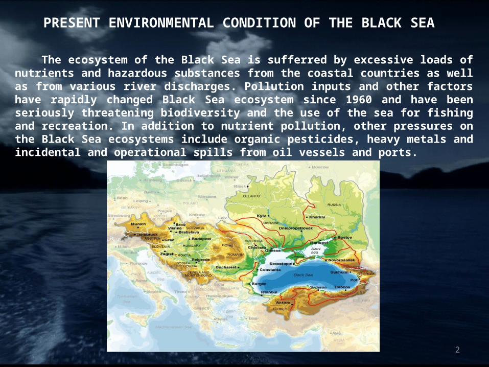
PRESENT ENVIRONMENTAL CONDITION OF THE BLACK SEA
The ecosystem of the Black Sea is sufferred by excessive loads of nutrients
and hazardous substances from the coastal countries as well as from various river discharges. Pollution inputs and other factors have rapidly changed Black Sea ecosystem since 1960 and have been seriously threatening biodiversity and the use of the sea for fishing and recreation. In addition to nutrient pollution, other pressures on the Black Sea ecosystems include organic pesticides, heavy metals and incidental and operational spills from oil vessels and ports.
2
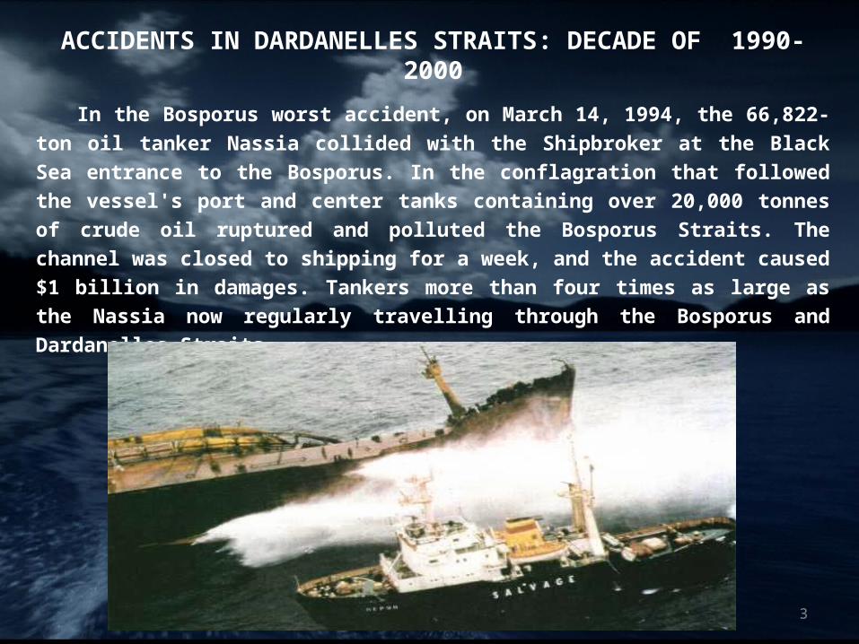
ACCIDENTS IN DARDANELLES STRAITS: DECADE OF 1990-2000
In the Bosporus worst accident, on March 14, 1994, the 66,822-ton oil
tanker Nassia collided with the Shipbroker at the Black Sea entrance to
the Bosporus. In the conflagration that followed the vessel's port and
center tanks containing over 20,000 tonnes of crude oil ruptured and
polluted the Bosporus Straits. The channel was closed to shipping for a
week, and the accident caused $1 billion in damages. Tankers more than
four times as large as the Nassia now regularly travelling through the
Bosporus and Dardanelles Straits.
3
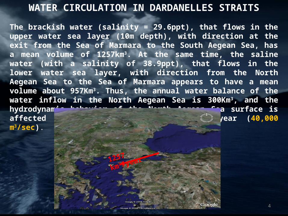
WATER CIRCULATION IN DARDANELLES STRAITS
The brackish water (salinity = 29.6ppt), that flows in the upper water sea layer (10m depth), with direction at the exit from the Sea of Marmara to the South Aegean Sea, has a mean volume of 1257km3. At the same time, the saline water (with a salinity of 38.9ppt), that flows in the lower water sea layer, with direction from the North Aegean Sea to the Sea of Marmara appears to have a mean volume about 957Km3. Thus, the annual water balance of the water inflow in the North Aegean Sea is 300Km3, and the hydrodynamic behavior of the North Aegean Sea surface is affected by the water inflow of 1257Km3/year (40,000 m3/sec).
1257 km3 /year
4
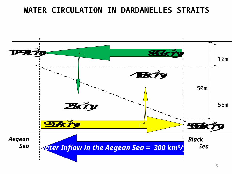
WATER CIRCULATION IN DARDANELLES STRAITS
Ακρ. Έλλη Bosporus
Aegean Sea
Black Sea
10m
50m
55m
3866km yr
325km yr
3957km yr
3416km yr
31257km yr
3566km yr
Water Inflow in the Aegean Sea = 300 km3/yr
5
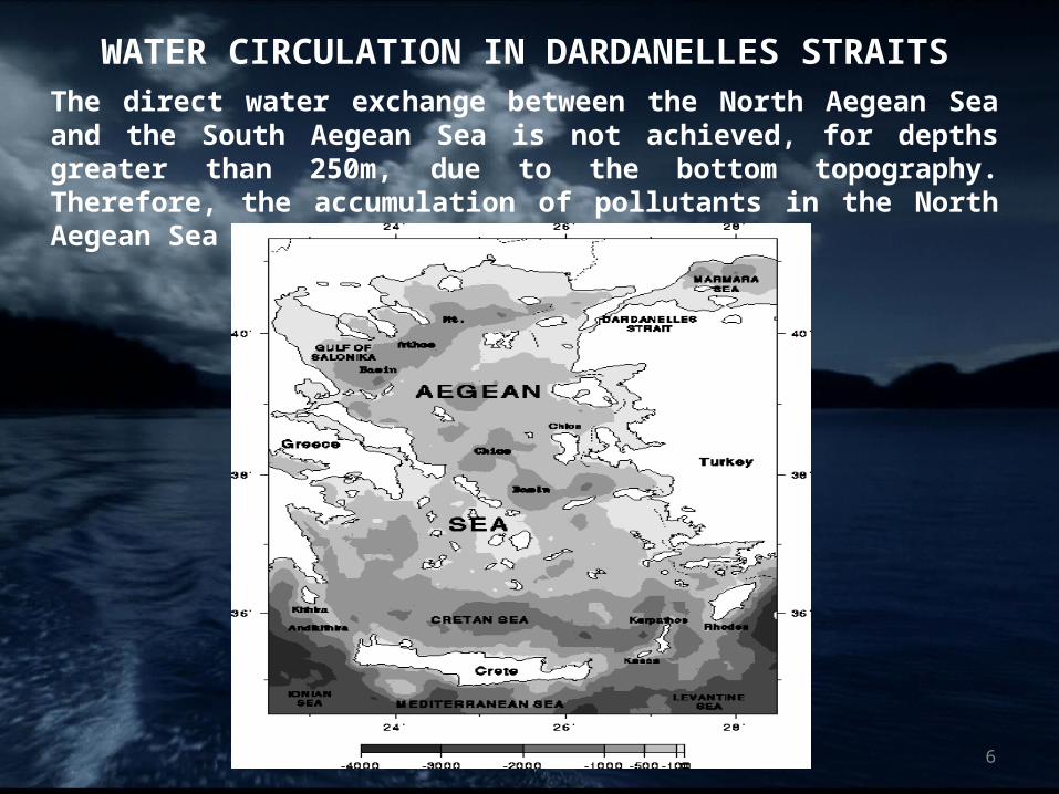
WATER CIRCULATION IN DARDANELLES STRAITSThe direct water exchange between the North Aegean Sea and the South Aegean Sea is not achieved, for depths greater than 250m, due to the bottom topography. Therefore, the accumulation of pollutants in the North Aegean Sea is further increased.
6
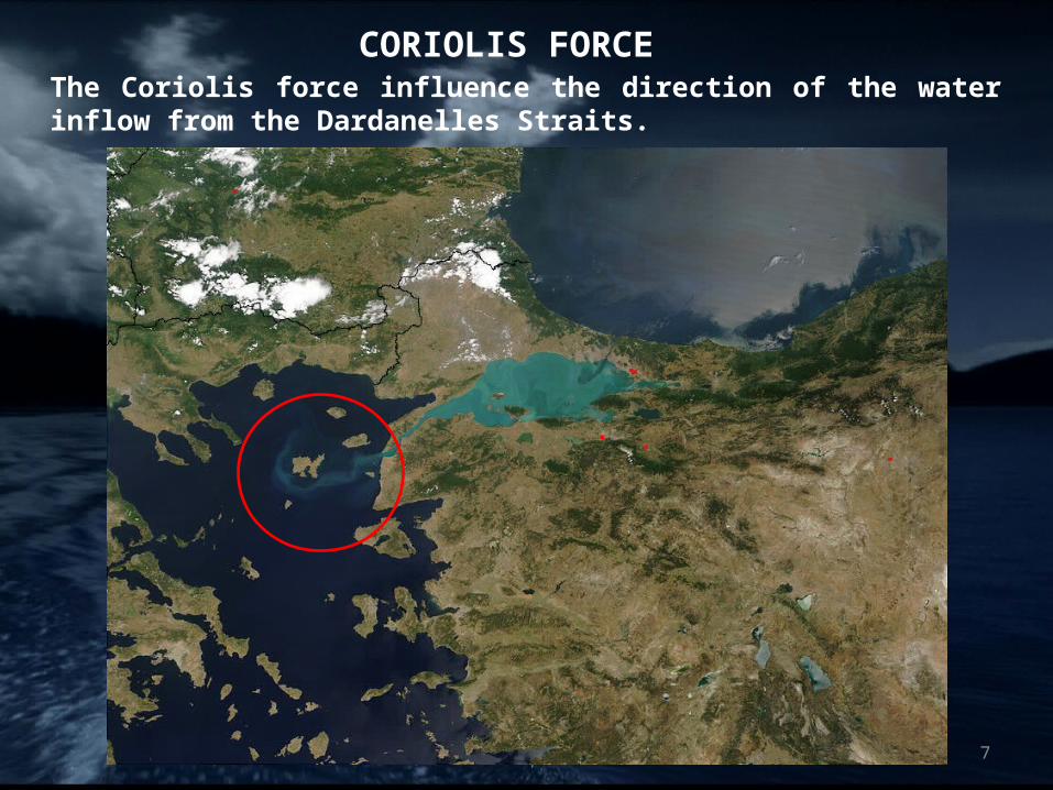
CORIOLIS FORCEThe Coriolis force influence the direction of the water inflow from the Dardanelles Straits.
7
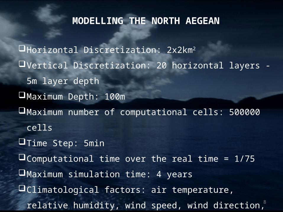
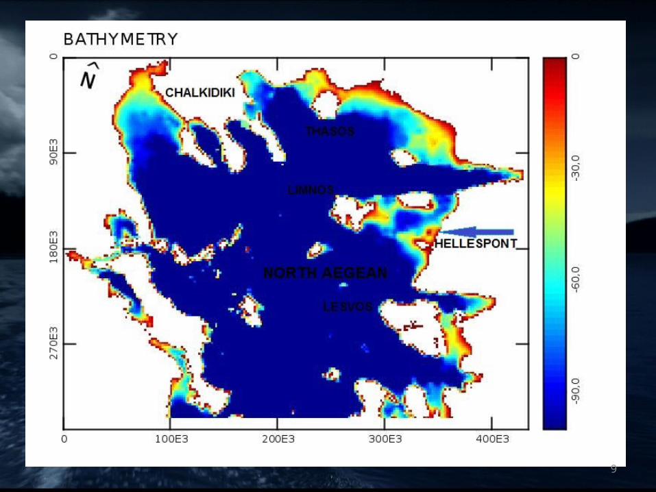
MODELLING THE NORTH AEGEAN
Horizontal Discretization: 2x2km2
Vertical Discretization: 20 horizontal layers - 5m layer depth
Maximum Depth: 100m
Maximum number of computational cells: 500000 cells
Time Step: 5min
Computational time over the real time = 1/75
Maximum simulation time: 4 years
Climatological factors: air temperature, relative humidity, wind
speed, wind direction, solar radiation, atmospheric pressure and
rainfall8
9
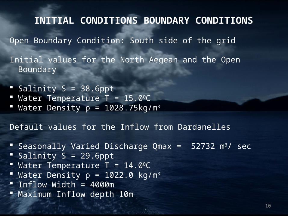
INITIAL CONDITIONS BOUNDARY CONDITIONS
Open Boundary Condition: South side of the grid
Initial values for the North Aegean and the Open Boundary
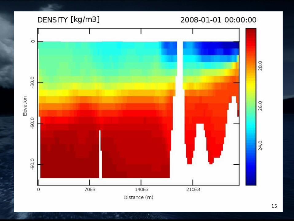
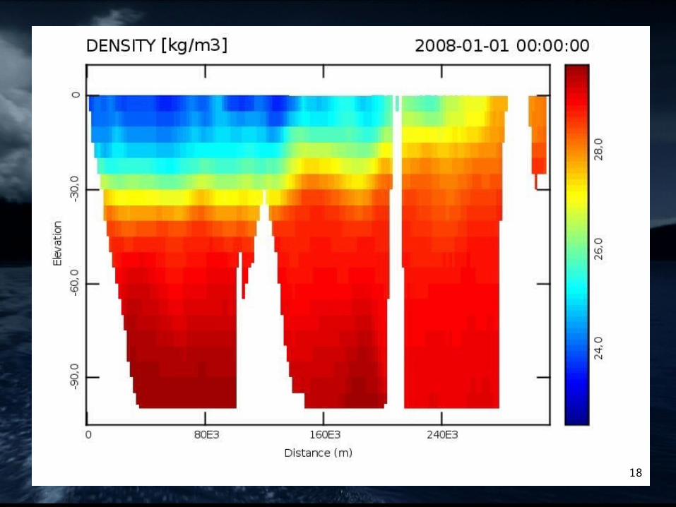
Salinity S = 38.6ppt Water Temperature Τ = 15.0OC Water Density ρ = 1028.75kg/m3
Default values for the Inflow from Dardanelles
Seasonally Varied Discharge Qmax = 52732 m3/ sec Salinity S = 29.6ppt Water Temperature T = 14.0OC Water Density ρ = 1022.0 kg/m3
Inflow Width = 4000m Maximum Inflow depth 10m
10
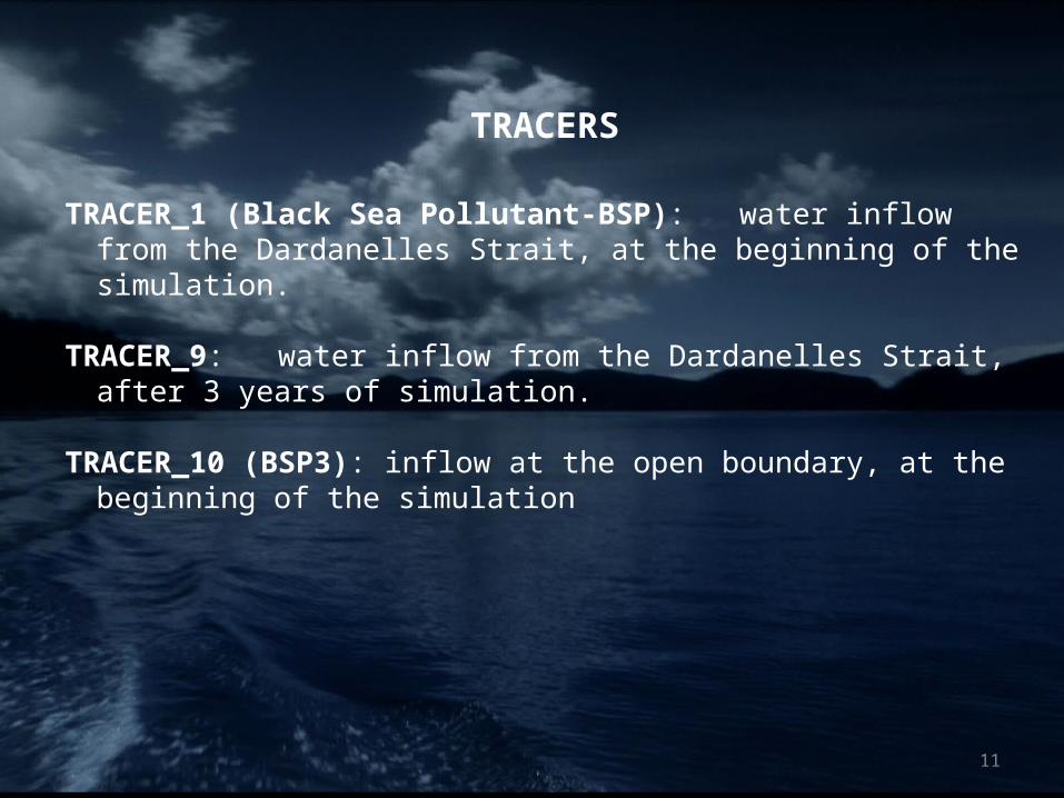
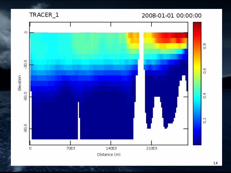
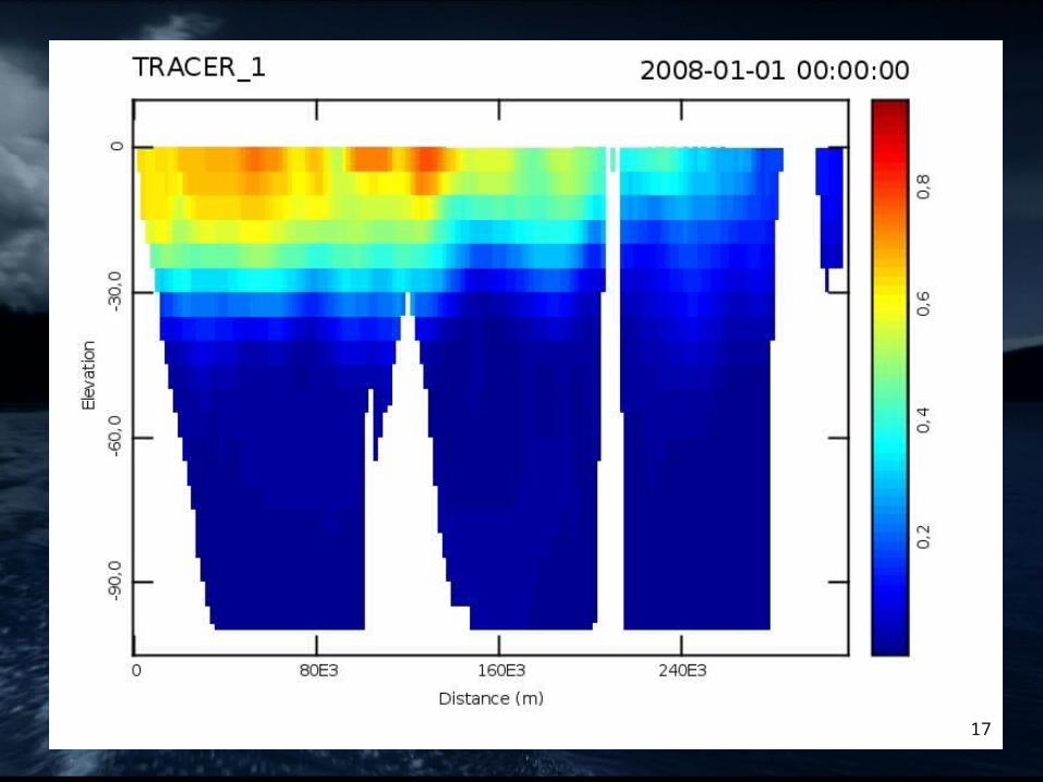
TRACERS
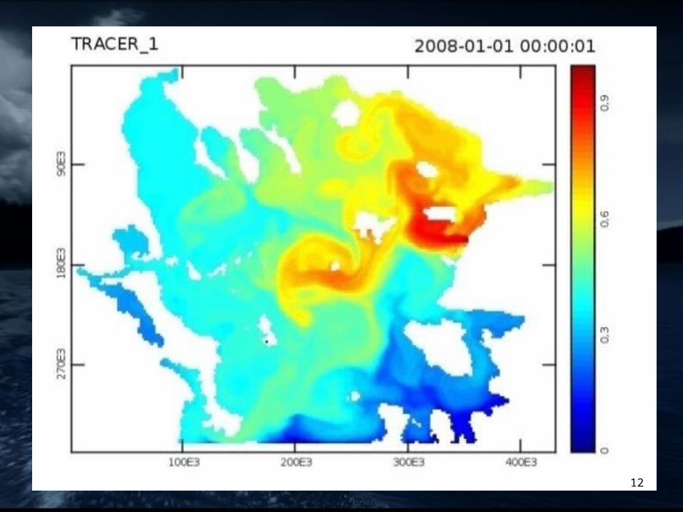
TRACER_1 (Black Sea Pollutant-BSP): water inflow from the Dardanelles Strait, at the beginning of the simulation.
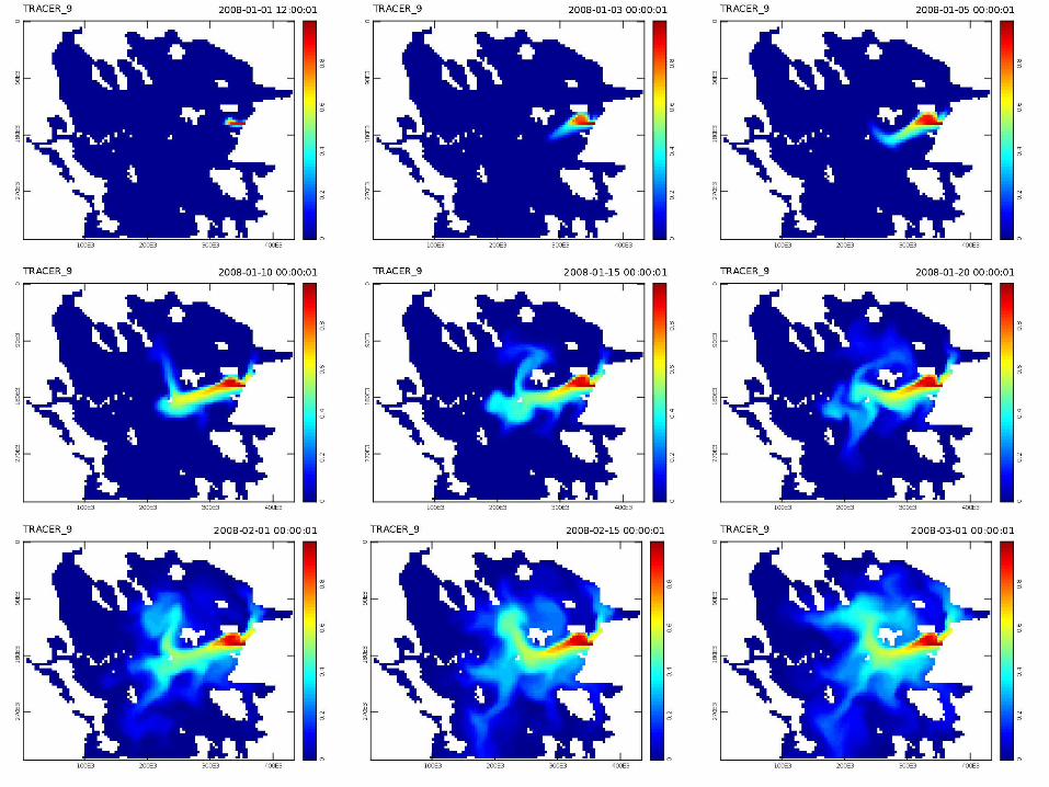
TRACER_9: water inflow from the Dardanelles Strait, after 3 years of simulation.
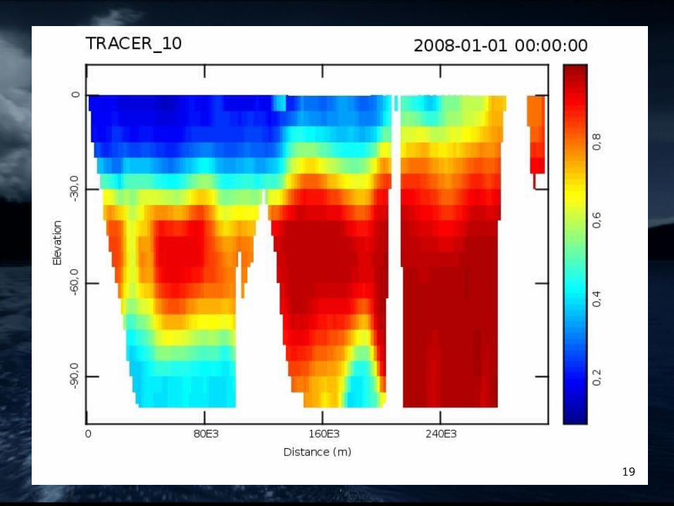
TRACER_10 (BSP3): inflow at the open boundary, at the beginning of the simulation
11
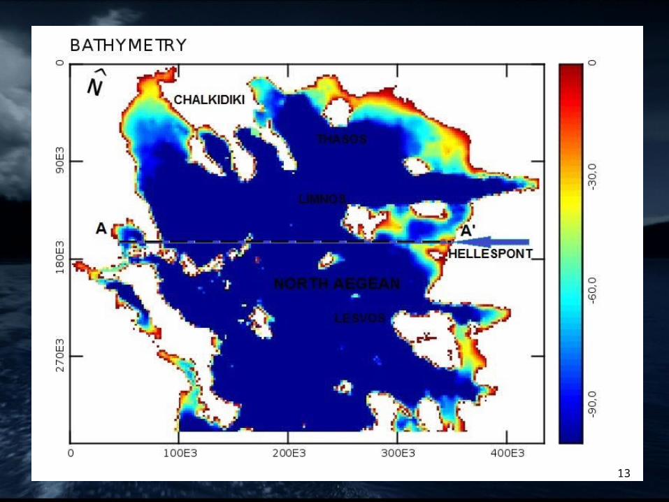
12
13
14
15

16
17
18
19
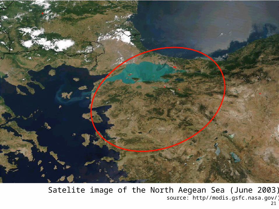
Satelite image of the North Aegean Sea (June 2003)source: http//modis.gsfc.nasa.gov/)
21
FURTHER INVESTIGATION
Simulation with river outfows model calibration and validation with field measurements or other
computational models Parallel execution of ELCOM with the environmental model
CAEDYM.
22

23
THANK YOU!!!