Embed Size (px)
Citation preview

IMPACT OF INTERLINKING
OF RIVERS IN PENINSULAR
INDIA-A RESORCESAT-1
STUDY B.S. Prakasa Rao1, N.Bhaskara Rao2
1Department of Geo-Engineering, College of Engineering
2National Institute of Rural Development and Panchayati Raj, Hyderabad
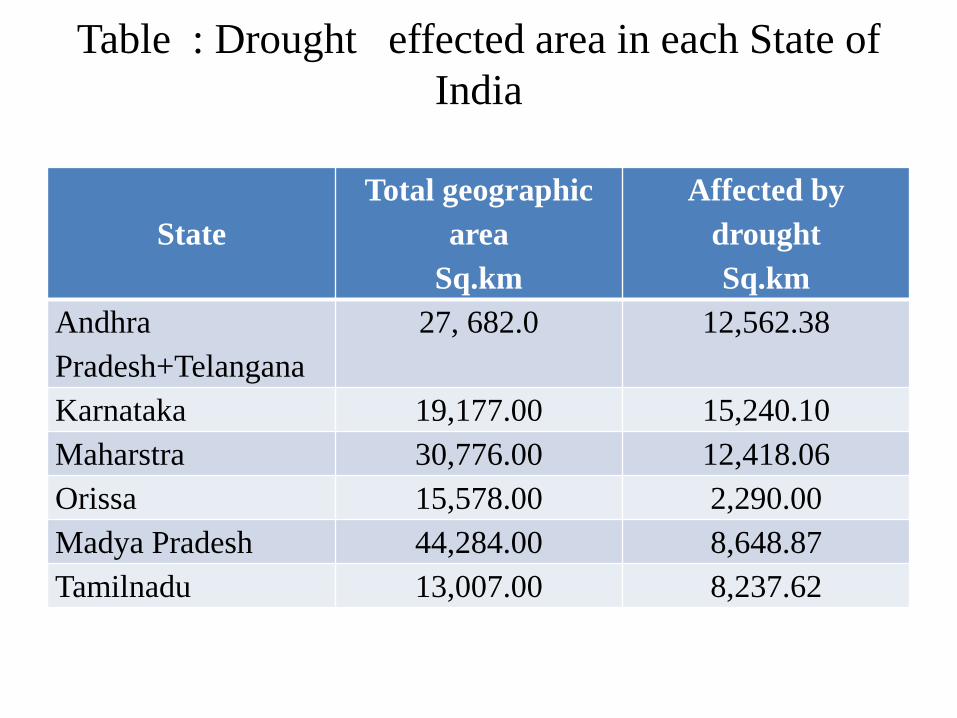
Table : Drought effected area in each State of
India
State
Total geographic
area
Sq.km
Affected by
drought
Sq.km
Andhra
Pradesh+Telangana
27, 682.0 12,562.38
Karnataka 19,177.00 15,240.10
Maharstra 30,776.00 12,418.06
Orissa 15,578.00 2,290.00
Madya Pradesh 44,284.00 8,648.87
Tamilnadu 13,007.00 8,237.62
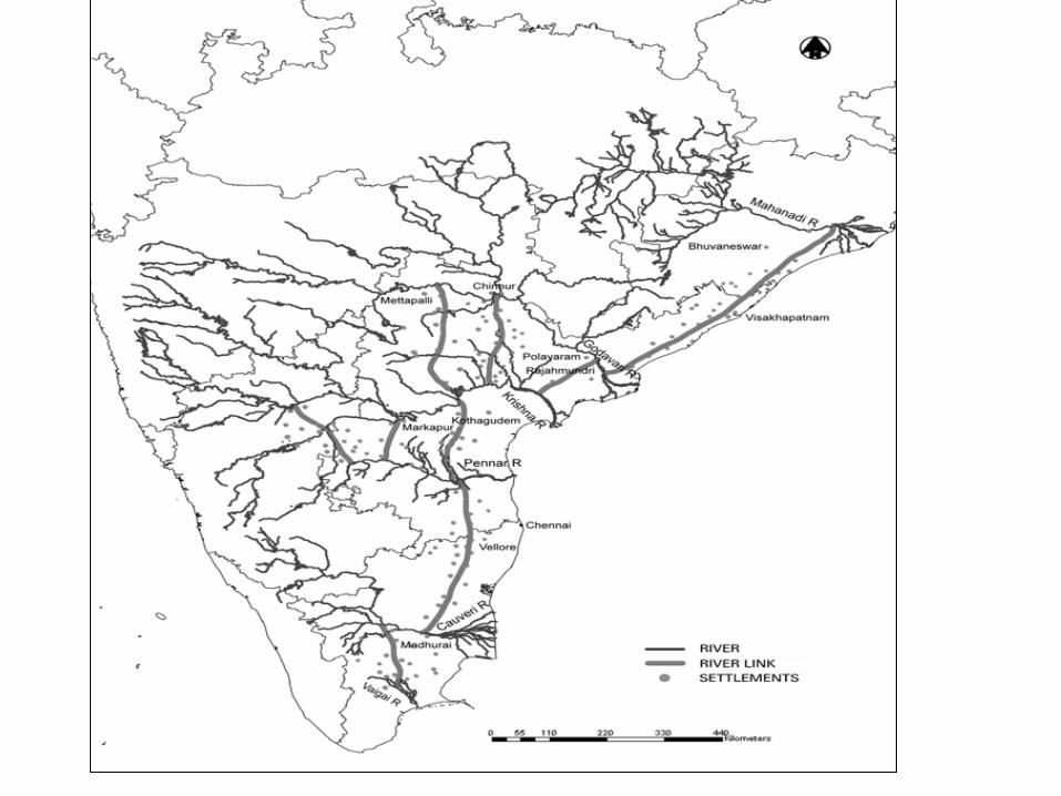
The study Area
• The study area is covered in 24 scenes of IRS-P6 LISS-III data as shown in the above table. The digital database is created from Survey of India toposheets of 1:50,000 scale(nos. 400)
• The linking canals under study lie between 90
to 200 N. latitude and 750 to 900 E. longitude.
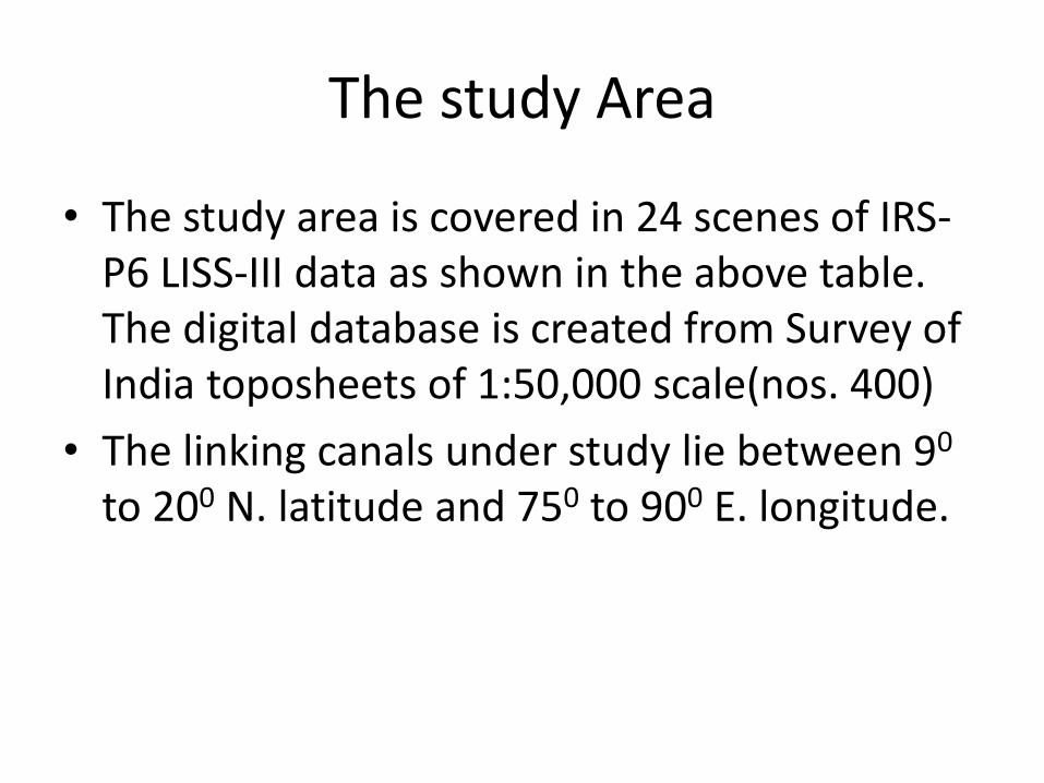
Link Name of the link Length
(km)
Rock Hills
/ Area
Distance
(km)
Villages to
be
rehabilitate
d
Lat/Long
Starting
Lat/Long
Ending
1 Mhanadi – Godavari 820.71 174.403 205 200 26’ 25” 160 57’00”
850 45’ 14” 810 47’00”
2 Godavari(Polavaram)
–Prakasam Barriage 184.58 10.386 51
170 18’ 54” 160 30’12”
810 38’ 08” 800 36’12”
3 Ichampalli low dam –
Pulichintala 304.74 66.295 63
190 04’ 07” 160 44’07”
780 51’ 09” 79045’15”
4 Ichampalli –
Nagarjunasagar 299.61 66.004 46
180 47’ 55” 160 36’00”
790 55’ 07” 790 5’ 00”
5 Nagajunasagar –
Somasila 393.64 49.353 107
160 19’ 17” 140 30’00”
790 14’ 13” 79 6’00”
6 Srisailam – Pennar low
dam 204.31 39.684 45
150 52’ 46” 140 58’12”
780 10’ 35” 770 55’48”
7 Almatti – Pennar 587.17 - 80 140 26’ 20” 140 52’12”
790 14’ 56” 770 21 36”
8 Somasila – Grandi
anicut 472.52 57.823 244
160 12’ 41” 100 54’00”
760 21’ 47” 780 36’00”
9 Cauvery – Vaigai 256.2 18.039 82 110 04’ 40” 90 38’ 24”
770 53’ 57” 780 8’ 24”
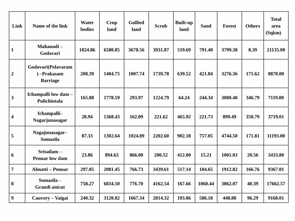
Link Name of the link Water
bodies
Crop
land
Gullied
land Scrub
Built-up
land Sand Forest Others
Total
area
(Sqkm)
1 Mahanadi –
Godavari 1824.86 6580.85 3678.56 3931.87 519.69 791.40 3799.38 8.39 21135.00
2
Godavari(Polavaram
) –Prakasam
Barriage
208.39 1404.75 1007.74 1739.78 639.52 421.84 3276.36 171.62 8870.00
3 Ichampalli low dam –
Pulichintala 165.88 1778.59 293.97 1224.79 64.24 244.34 3000.40 346.79 7119.00
4 Ichampalli–
Nagarjunasagar 28.94 1368.43 162.09 221.62 465.92 221.73 899.49 350.79 3719.01
5 Nagajunasagar–
Somasila 87.33 1302.64 1024.89 2202.60 902.18 757.05 4744.50 171.81 11193.00
6 Srisailam –
Pennar low dam 23.86 894.63 866.00 200.52 412.00 15.21 1001.03 20.56 3433.80
7 Almatti – Pennar 297.85 2081.45 766.73 3439.61 517.14 184.65 1912.82 166.76 9367.01
8 Somasila –
Grandi anicut 758.27 6834.50 776.70 4162.54 167.66 1060.44 3862.07 40.39 17662.57
9 Cauvery – Vaigai 240.32 3120.82 1667.34 2814.32 193.86 586.18 448.88 96.29 9168.01
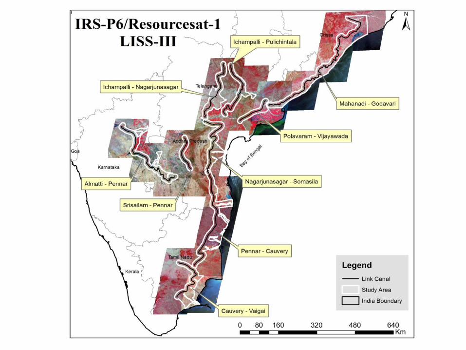
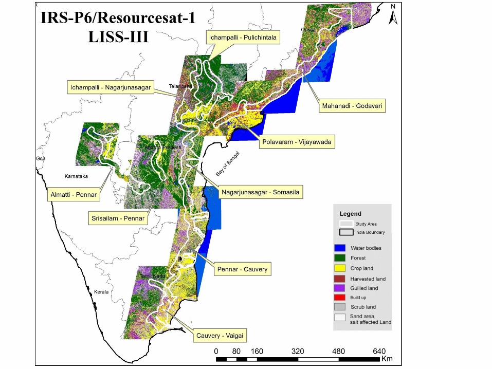
•The study area includes 20 km carridor and the command
area proposed by NWDA
•Remote sensing study using IRSP6 LISS-III scenes of
2010 have been used to study the link canals.
•The studies indicated that a huge area of wastelamd can
be brought under command area of the link canals
besides meeting present cropland
requirements.
•Domestic water requirements of a number of towns and
villages enroute and industrial and forest around .
•The proposed canals mostly traverse fallow land and
deciduous forest area.the link canal -1,8 and 9
have about 10,000 km each under this class with
cropland..
Conclusions
Conclusions
• It is concluded form the study that the link canals will bring most of the waste land into agriculture land convert dry land into irrigated land, supply water to the towns and improve the ground water table villages enroute and reduce floods in the donor basin.
• It involves minor displacement and rehabilitation in this mega project, which is inevitable in this kind of development activities of sustainability
• High resolution RS data will immense use in this type of mega project giving present condition of the ground and time saving with great accuracy