Embed Size (px)
Citation preview
Integrate Laserfiche ECM with ESRI
ArcGIS
What is GeoDocs?
Web services tool that connects Laserfiche documents/data with existing ESRI maps
Integrates ESRI ArcGIS Server with Laserfiche Web Services
Add and upload images directly from the map interface
Store geo-referencing data into Laserfiche template metadata automatically
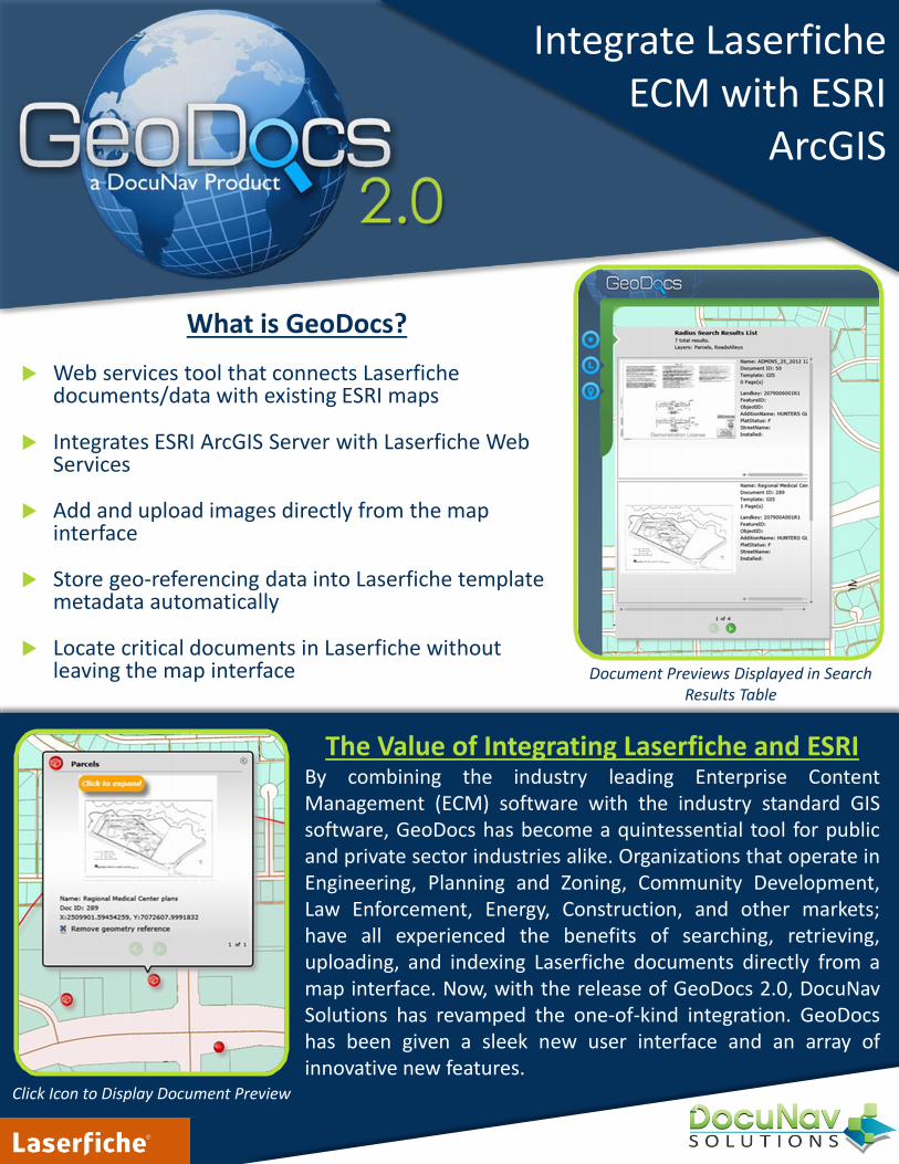
Locate critical documents in Laserfiche without leaving the map interface Document Previews Displayed in Search
Results Table
The Value of Integrating Laserfiche and ESRIBy combining the industry leading Enterprise ContentManagement (ECM) software with the industry standard GISsoftware, GeoDocs has become a quintessential tool for publicand private sector industries alike. Organizations that operate inEngineering, Planning and Zoning, Community Development,Law Enforcement, Energy, Construction, and other markets;have all experienced the benefits of searching, retrieving,uploading, and indexing Laserfiche documents directly from amap interface. Now, with the release of GeoDocs 2.0, DocuNavSolutions has revamped the one-of-kind integration. GeoDocshas been given a sleek new user interface and an array ofinnovative new features.
Click Icon to Display Document Preview
Requirements
Laserfiche Server: v9.0 or newer1) Template for Geo referencing
2) Folder structure created in Laserfiche
3) Laserfiche user account for GeoDocs
4) Laserfiche WebLink or WebAccess
ESRI ArcGIS Server: v9.2 or newer1) ArcGIS Service Directory
2) ArcGIS Server Manager
3) ArcGIS Administrator
4) ArcGIS Map Geometry Web Service
Platform Requirements
Silverlight:• ASP .Net 4.0• SQL 2008 (Need security
rights to add user and create database)
• Microsoft Silverlight 5
Contact:(800) 353-2320 x2
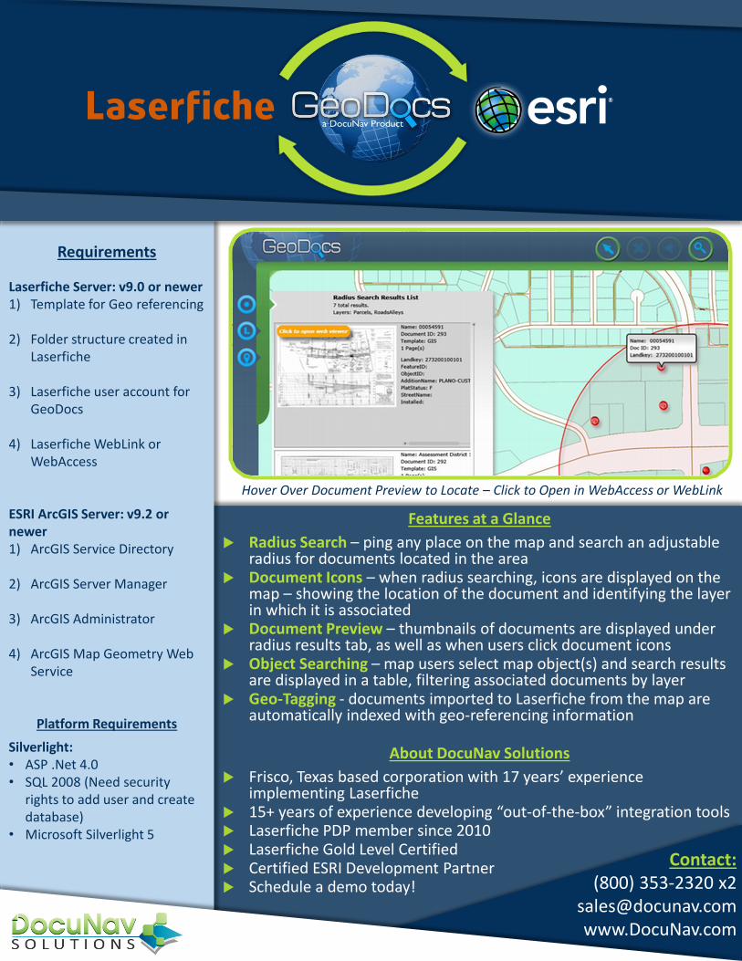
Hover Over Document Preview to Locate – Click to Open in WebAccess or WebLink
About DocuNav Solutions
Frisco, Texas based corporation with 17 years’ experience implementing Laserfiche
15+ years of experience developing “out-of-the-box” integration tools Laserfiche PDP member since 2010 Laserfiche Gold Level Certified Certified ESRI Development Partner Schedule a demo today!
Features at a Glance
Radius Search – ping any place on the map and search an adjustable radius for documents located in the area
Document Icons – when radius searching, icons are displayed on the map – showing the location of the document and identifying the layer in which it is associated
Document Preview – thumbnails of documents are displayed under radius results tab, as well as when users click document icons
Object Searching – map users select map object(s) and search results are displayed in a table, filtering associated documents by layer
Geo-Tagging - documents imported to Laserfiche from the map are automatically indexed with geo-referencing information