Embed Size (px)
Citation preview
International Charter on“Space and Major Disasters”
A point of contact for Civil Protection Authorities to access co-ordinated space means in case of major disaster world-wide
Charter operation
Imagery productionUser products

Charter member agencies
CSACSACanadaCanada
CNESCNESFranceFrance
ESAESAEuropeEurope
ISROISROIndiaIndia
NOAANOAAUSAUSA
CONAEArgentina
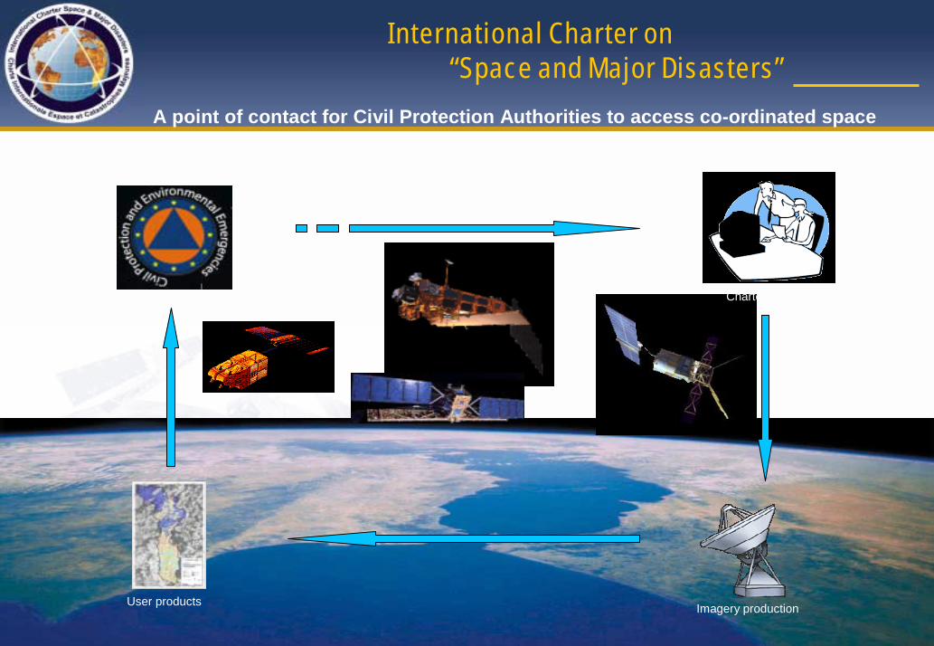
Project Manager (PM)
Emergency on-Call Officer (ECO)
ESA ERS-2
CNES SPOT
CSA RADARSAT
On Duty Operator(ODO)
Charter operations
Authorized User (AU)
Project Manager (PM)
Emergency on-Call Officer (ECO)
ESA ERS-2
CNES SPOT
CSA RADARSAT
On Duty Operator(ODO)
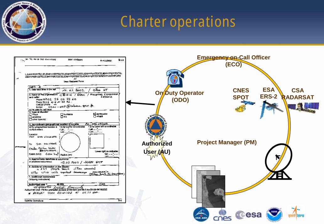
Role of the Authorized Users (AU)
• They are the only Bodies authorised to request services
• They usually represent the national Civil Protection Authorities (CPA) of the partner agencies
• If not member of the Charter a bilateral agreement with these CPAs is needed
Authorized User (AU)
Project Manager (PM)
Emergency on-Call Officer (ECO)
ESA ERS-2
CNES SPOT
CSA RADARSAT
On Duty Operator(ODO)
Authorized User (AU)
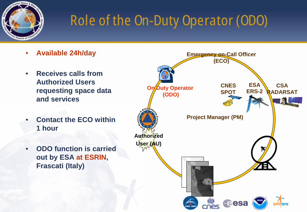
Role of the On-Duty Operator (ODO)
• Available 24h/day
• Receives calls from Authorized Users requesting space data and services
• Contact the ECO within 1 hour
• ODO function is carried out by ESA at ESRIN, Frascati (Italy)
Project Manager (PM)
Emergency on-Call Officer (ECO)
ESA ERS-2
CNES SPOT
CSA RADARSAT
On Duty Operator(ODO)
Authorized User (AU)
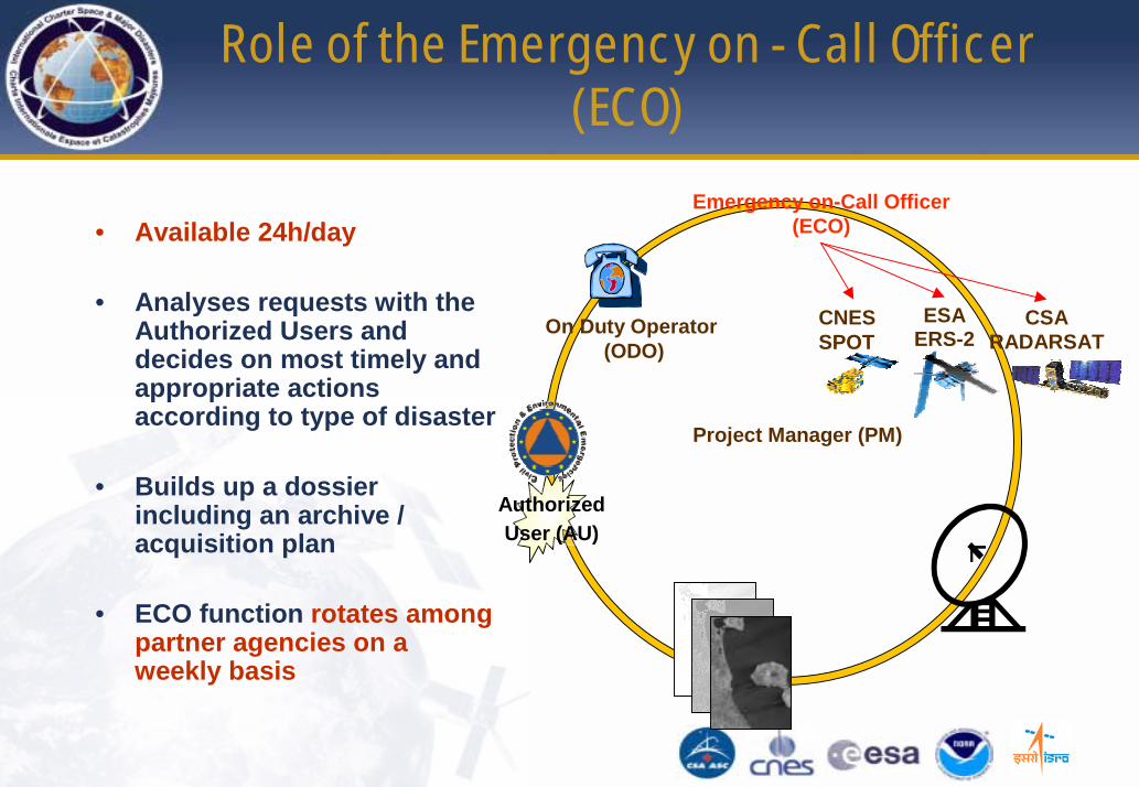
Role of the Emergency on - Call Officer (ECO)
• Available 24h/day
• Analyses requests with the Authorized Users and decides on most timely and appropriate actions according to type of disaster
• Builds up a dossier including an archive / acquisition plan
• ECO function rotates among partner agencies on a weekly basis

Role of the Project Manager (PM)
• Takes over during normal working hours
• Conducts a pre-defined scenario procedure according to type of disaster
• Ensures the data sent corresponds to what the user expects
• Writes up a final operation report
• PM is designated by the Executive Secretariat according to location, type of disaster and expertise
Project Manager (PM)
Emergency on-Call Officer (ECO)
ESA ERS-2
CNES SPOT
CSA RADARSAT
On Duty Operator(ODO)
PROBA?
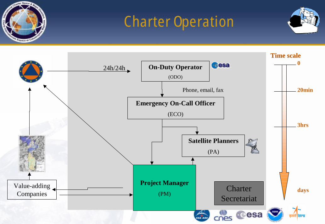
Charter Operation
On-Duty Operator(ODO)
24h/24h
Emergency On-Call Officer(ECO)
Project Manager(PM)
Satellite Planners(PA)
Phone, email, fax
CharterSecretariat
Time scaleTime scale0
20min
3hrs
daysValue-addingCompanies
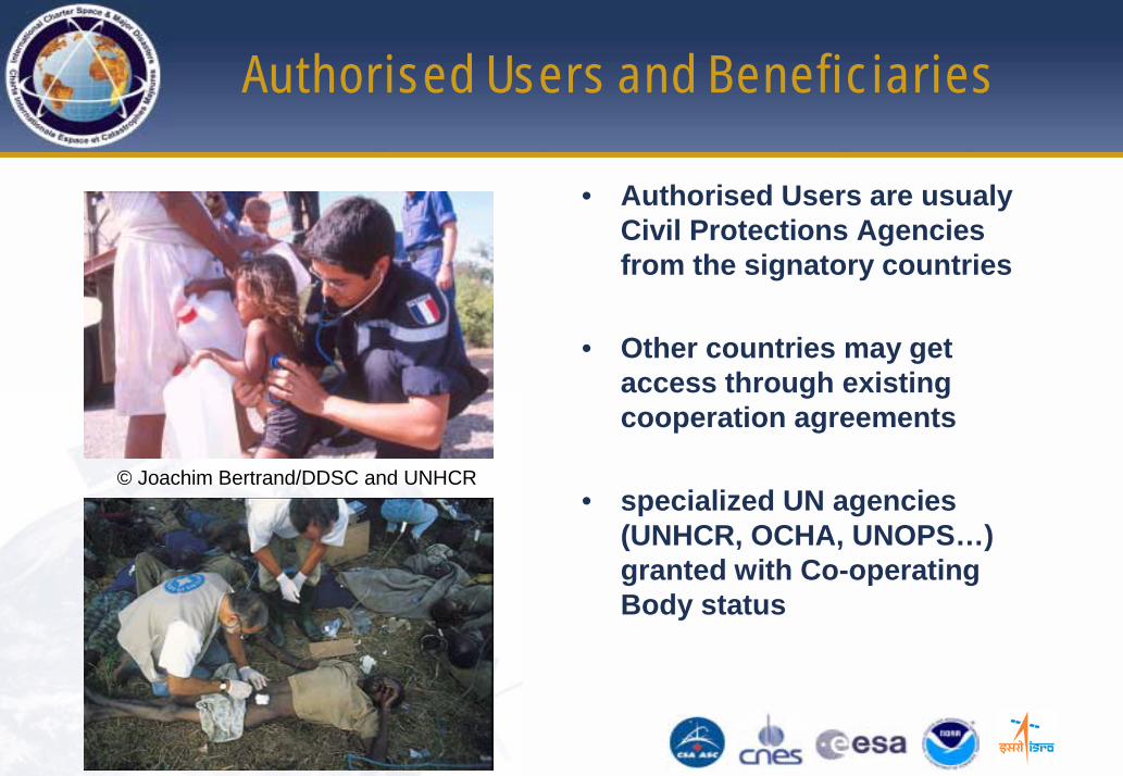
Authorised Users and Beneficiaries
• Authorised Users are usualyCivil Protections Agencies from the signatory countries
• Other countries may get access through existing cooperation agreements
• specialized UN agencies (UNHCR, OCHA, UNOPS…) granted with Co-operating Body status
© Joachim Bertrand/DDSC and UNHCR
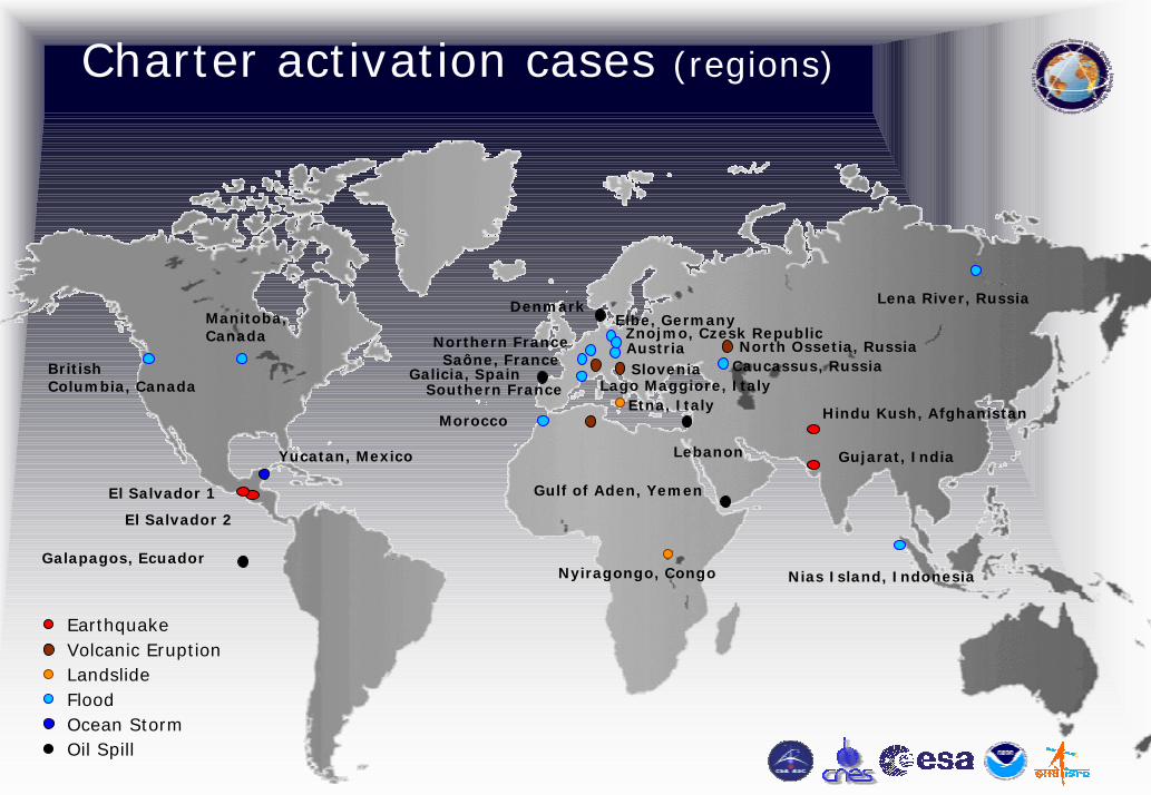
Charter activation cases (regions)
Volcanic Eruption
Nyiragongo, Congo
Southern France
Caucassus, Russia
Manitoba, Canada
AustriaZnojmo, Czesk Republic
Elbe, Germany
British Columbia, Canada
Etna, Italy
Lena River, Russia
Earthquake
Oil Spill
Galapagos, Ecuador
El Salvador 1
Yucatan, Mexico Gujarat, India
Hindu Kush, Afghanistan
Northern FranceSaône, France
Denmark
SloveniaLago Maggiore, Italy
Nias Island, Indonesia
Gulf of Aden, Yemen
North Ossetia, Russia
Lebanon
Galicia, Spain
Morocco
El Salvador 2
LandslideFloodOcean Storm
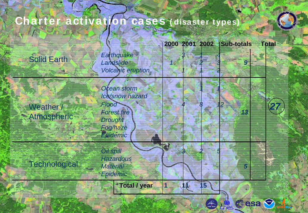
Charter activation cases (disaster types)
Solid Earth
Weather / Atmospheric
Technological
Earthquake 3 1 4Landslide 1 2 3 9Volcanic eruption 1 1 2
Ocean storm 1 1Ice/snow hazardFlood 4 8 12Forest fire 13DroughtFog/hazeEpidemic
Oil spill 3 2 5HazardousMaterial 5Epidemic
2000 2001 2002 Sub-totals Total
Total / year 1 11 15
27
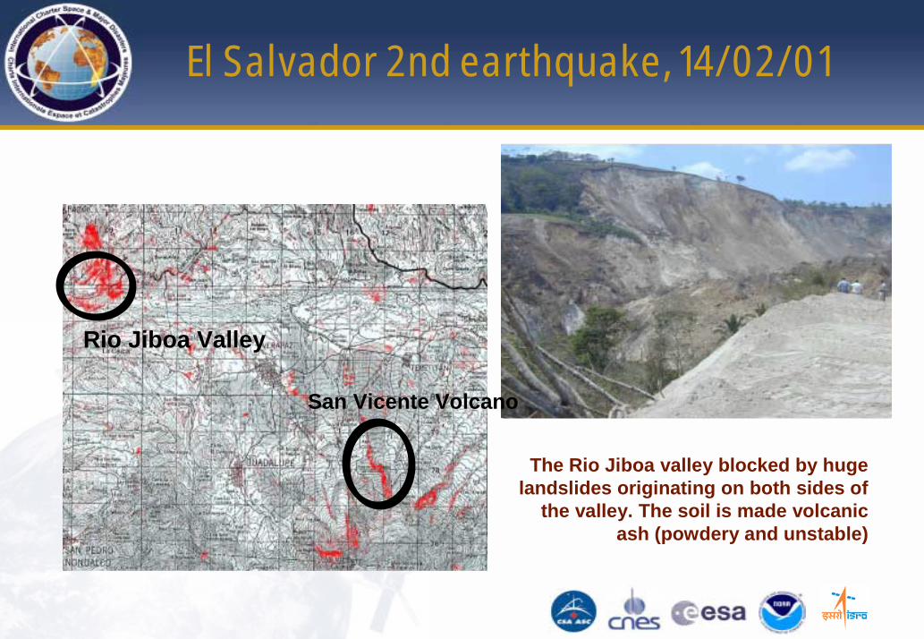
El Salvador 2nd earthquake, 14/02/01
Ortho-rectification SPOT done at IGN Espace
The Rio Jiboa valley blocked by huge landslides originating on both sides of
the valley. The soil is made volcanic ash (powdery and unstable)
Rio Jiboa Valley
San Vicente Volcano
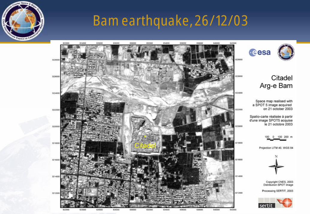
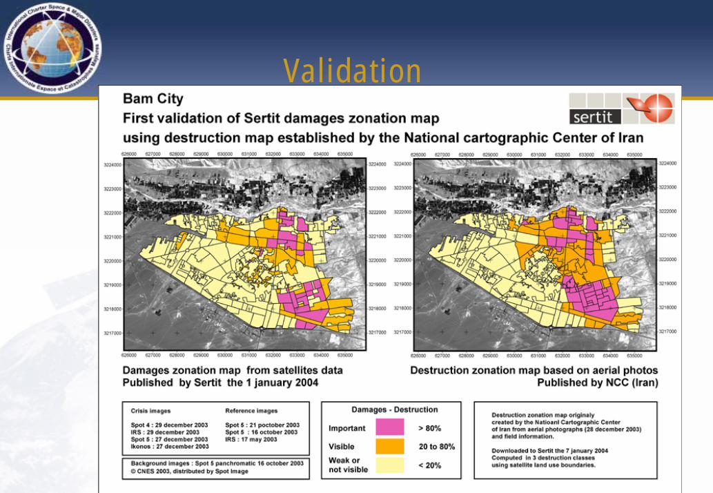
Bam earthquake, 26/12/03
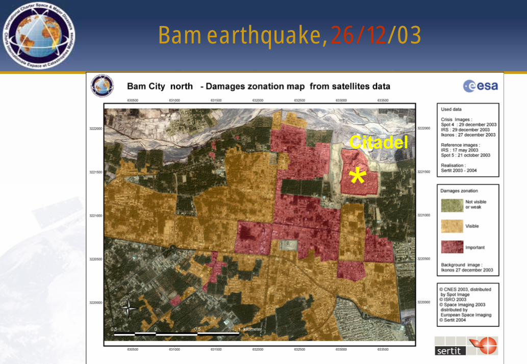
Bam earthquake, 26/12/03
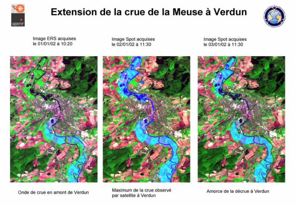
France Meuse, Jan 2002
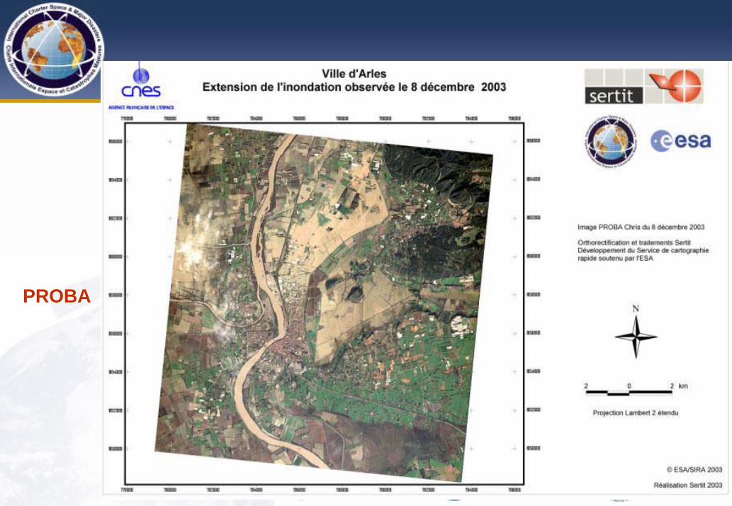
PROBA
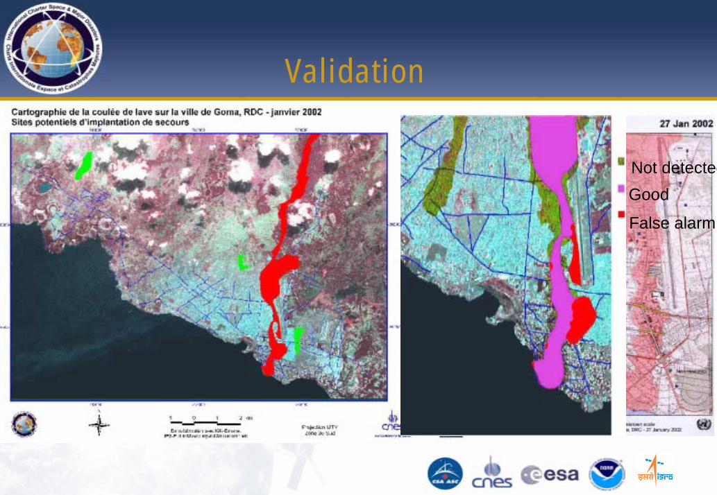
Validation
Not detectedGood
False alarm
Validation
PROBA and the Charter
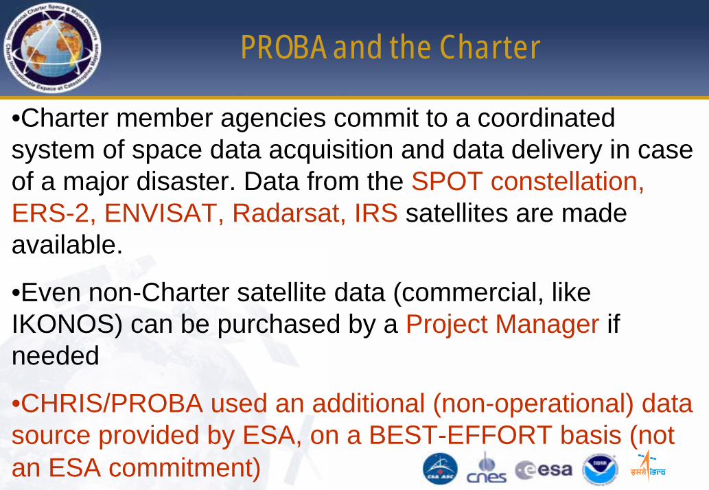
•Charter member agencies commit to a coordinated system of space data acquisition and data delivery in case of a major disaster. Data from the SPOT constellation, ERS-2, ENVISAT, Radarsat, IRS satellites are made available.
•Even non-Charter satellite data (commercial, like IKONOS) can be purchased by a Project Manager if needed
•CHRIS/PROBA used an additional (non-operational) data source provided by ESA, on a BEST-EFFORT basis (not an ESA commitment)

Charter Operation
Charter activation
ESRIN Mission Planning and Users Services
PROBA Planning facility (ESA/Redu)
Request details (location, date, type of event)
Value-addingCompanies
Acquisition / acq. details if successful (best-effort basis)
ECO PM
Value-addingCompanies
PROBA and the Charter
In order to be useful for Disaster Management utilisation (such as in the Charter): FAST DELIVERY to the End User of the “PRODUCT” after an activation•All-time (week-end, holidays) channel for planning of both instruments (HRC, CHRIS) at PM and ECO’srequest
•Rapid (few hours) FTP transfer of data from station just after an acquisition
•Near-RT available processed data or processing capability availability
Wo rst ca se eva luatio n
of d elay ?
1/3
PROBA and the Charter
In order to be useful for Disaster Management utilisation (such as in the Charter):FAST DELIVERY to the E.U. of the “PRODUCT” after an activation
•Space maps: geo-referenced image, with a cartographic (IGN) layer, on a user-known reference system. Required a few HOURS after the activation. Based on (recent) archive data
•Damage maps: result of an expert interpretation of detected changes between “before&after” data. A few days (3-4) delay after activation still acceptable (cont.)
2/3
PROBA and the Charter
Damage maps -> Change Detection between
“before (archive) &after (PROBA)” data
(for damage mapping) requires:•Availability of a (CHRIS, HRC) - comparable archive (SPOT5, IRS?) : in terms of space resolution, spectral bands, ….
• Capability to georeference data and perform superpositionbetween acquisitions and archive (processing capability, knowledge of instrument model and acquisition parameters)
• Capability to perform inter-sensor calibration desirable
3/3