Embed Size (px)
Citation preview
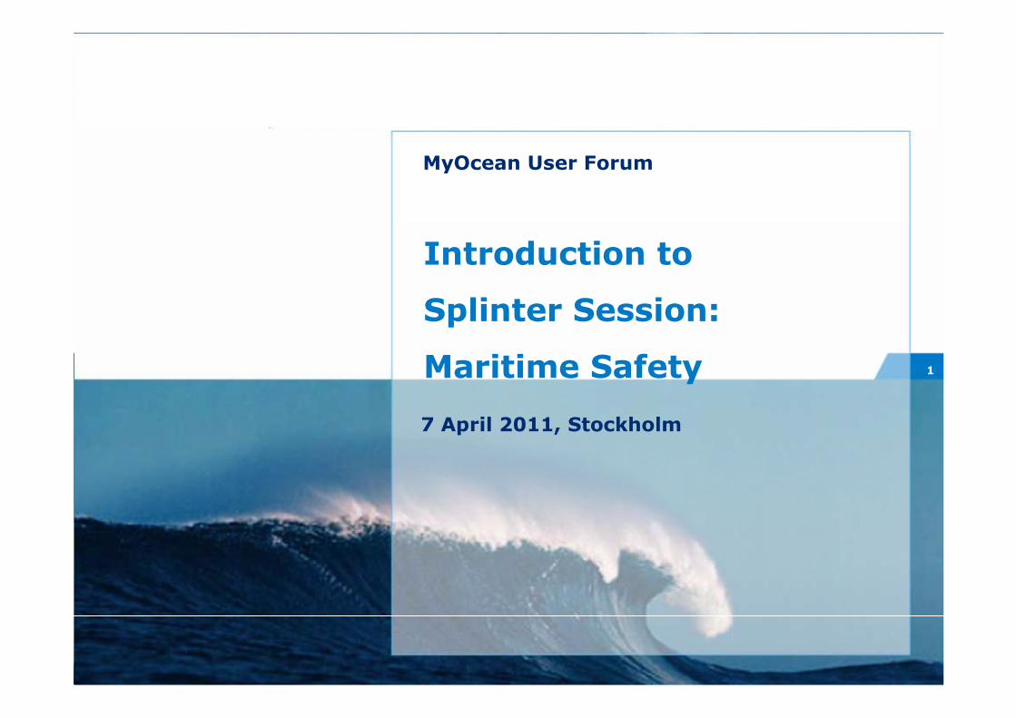
1
Introduction to
Splinter Session:
Maritime Safety
MyOcean User Forum
7 April 2011, Stockholm
2
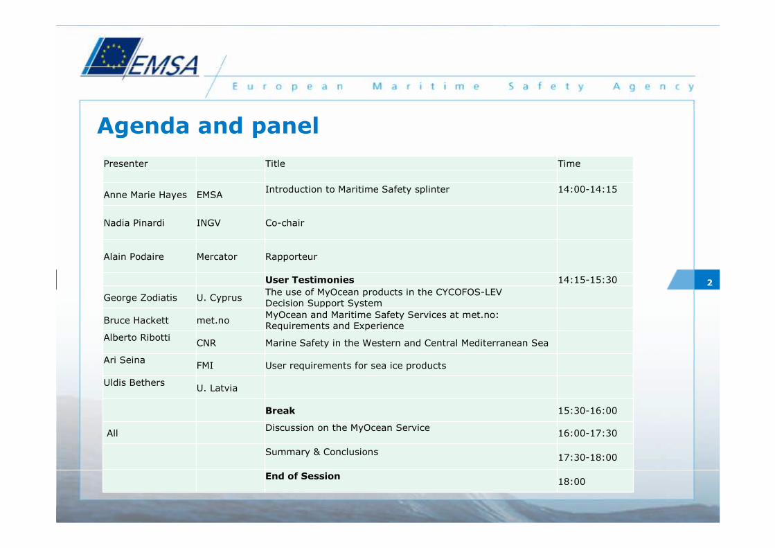
Agenda and panel
Presenter Title Time
Anne Marie Hayes EMSAIntroduction to Maritime Safety splinter 14:00-14:15
Nadia Pinardi INGV Co-chair
Alain Podaire Mercator Rapporteur
User Testimonies 14:15-15:30
George Zodiatis U. CyprusThe use of MyOcean products in the CYCOFOS-LEV Decision Support System
Bruce Hackett met.noMyOcean and Maritime Safety Services at met.no: Requirements and Experience
Alberto RibottiCNR Marine Safety in the Western and Central Mediterranean Sea
Ari SeinaFMI User requirements for sea ice products
Uldis BethersU. Latvia
Break 15:30-16:00
AllDiscussion on the MyOcean Service
16:00-17:30
Summary & Conclusions17:30-18:00
End of Session18:00
3
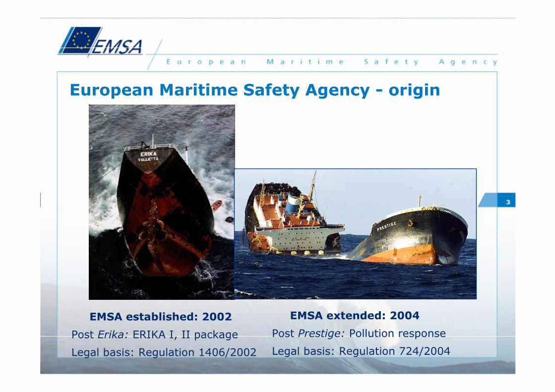
European Maritime Safety Agency - origin
EMSA established: 2002
Post Erika: ERIKA I, II package
Legal basis: Regulation 1406/2002
EMSA extended: 2004
Post Prestige: Pollution response
Legal basis: Regulation 724/2004
4
Areas: maritime safety, preventing pollution from ships ship security, vessel traffic monitoring
• Ensure proper implementation of EU maritime legislationby Member States e.g. through inspections
• Provide technical advice to the Commission and Member States, e.g. to prepare coordinated positions for IMO
• Foster technical cooperation, e.g. systems for maritime surveillance
• Specific operational tasks, in the fields of pollution response, maritime surveillance and third country inspections
EMSA objectives
5
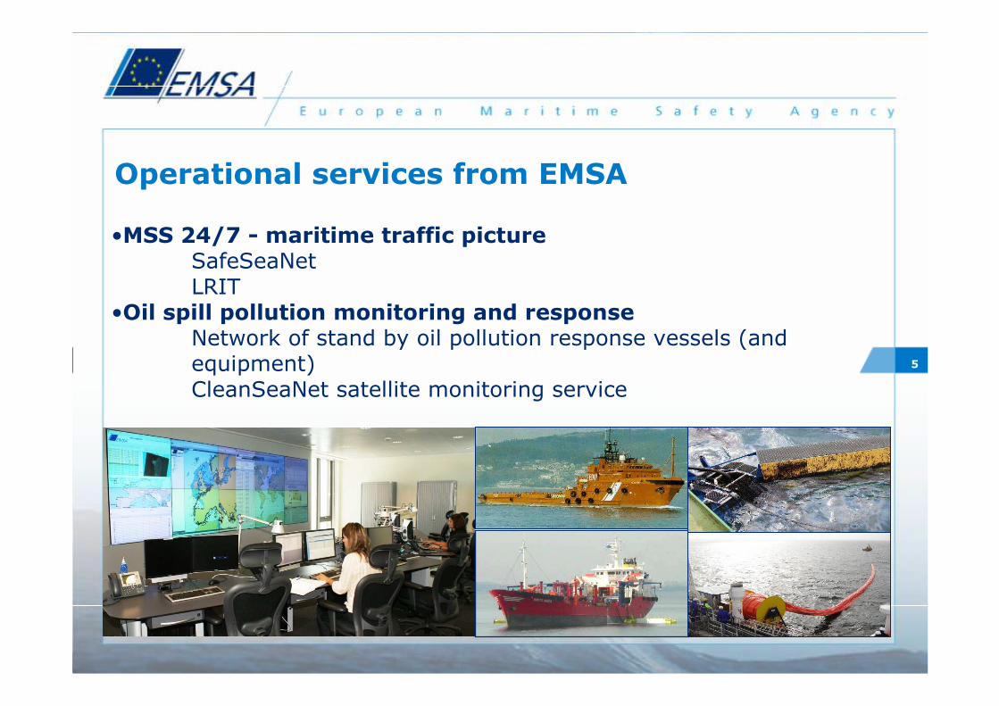
•MSS 24/7 - maritime traffic picture SafeSeaNetLRIT
•Oil spill pollution monitoring and response Network of stand by oil pollution response vessels (and equipment)CleanSeaNet satellite monitoring service
Operational services from EMSA
6
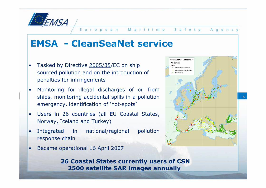
• Tasked by Directive 2005/35/EC on ship
sourced pollution and on the introduction of
penalties for infringements
• Monitoring for illegal discharges of oil from
ships, monitoring accidental spills in a pollution
emergency, identification of ‘hot-spots’
• Users in 26 countries (all EU Coastal States,
Norway, Iceland and Turkey)
• Integrated in national/regional pollution
response chain
• Became operational 16 April 2007
26 Coastal States currently users of CSN2500 satellite SAR images annually
EMSA - CleanSeaNet service
7
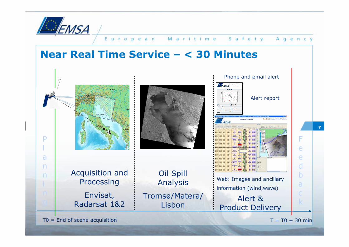
Near Real Time Service – < 30 Minutes
Acquisition and Processing
Envisat, Radarsat 1&2
Oil Spill Analysis
Tromsø/Matera/Lisbon
Alert &Product Delivery
T0 = End of scene acquisition T = T0 + 30 min
Alert report
Phone and email alert
Web: Images and ancillary
information (wind,wave)
Planning
Feedback
8
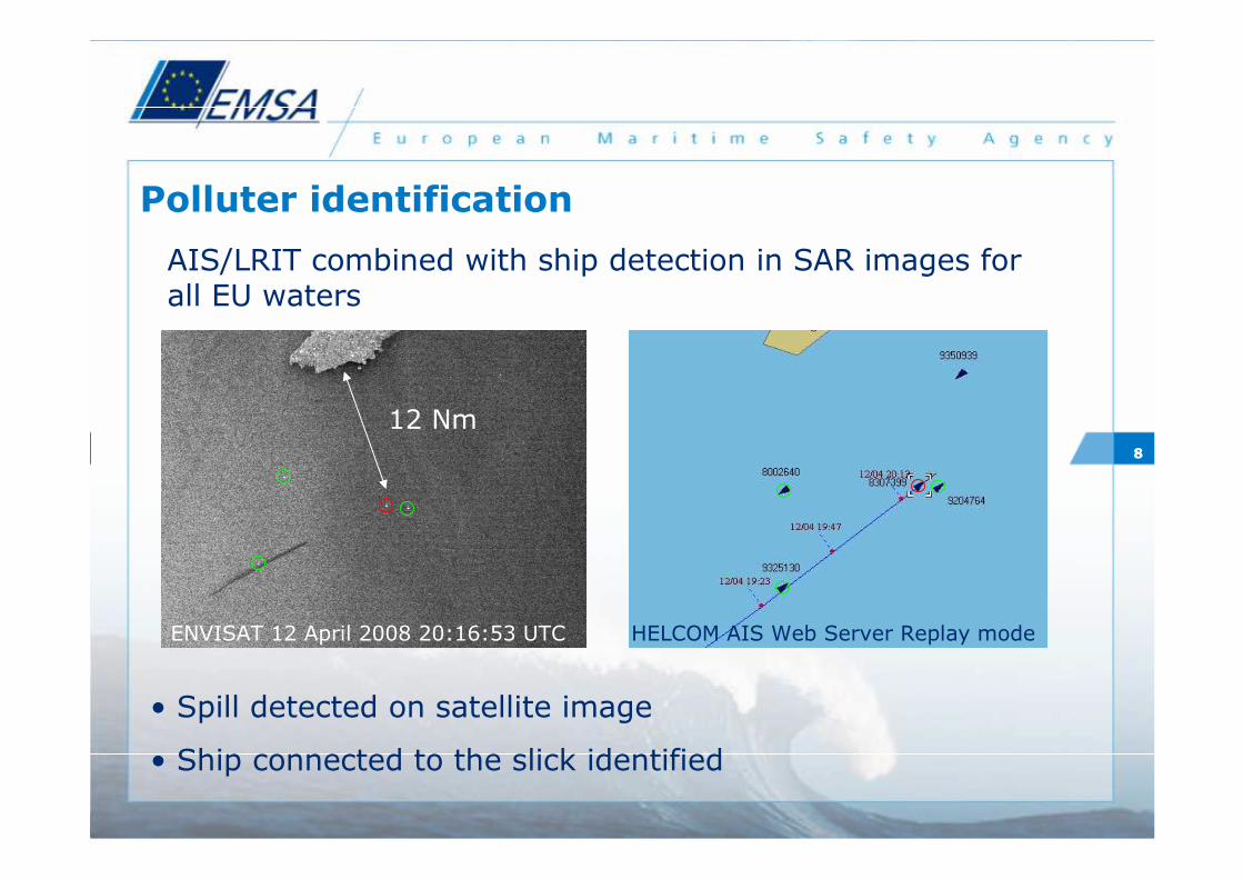
Polluter identification
• Spill detected on satellite image
• Ship connected to the slick identified
12 Nm
ENVISAT 12 April 2008 20:16:53 UTC HELCOM AIS Web Server Replay mode
8
AIS/LRIT combined with ship detection in SAR images for all EU waters
9
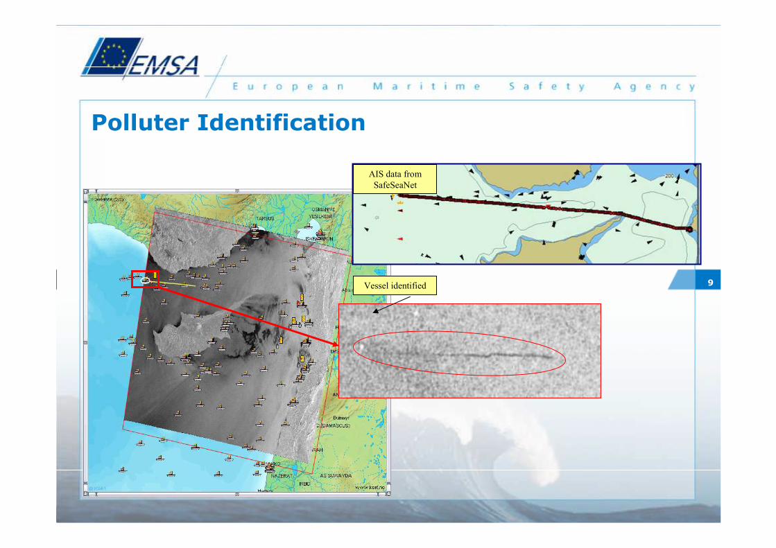
Polluter Identification
Vessel identified
AIS data from
SafeSeaNet
1010
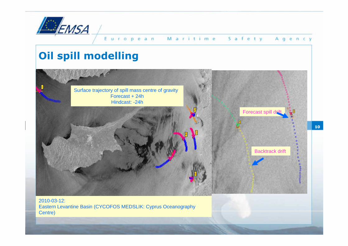
Oil spill modelling
Forecast spill drift
Backtrack drift
Surface trajectory of spill mass centre of gravityForecast + 24h Hindcast: -24h
2010-03-12: Eastern Levantine Basin (CYCOFOS MEDSLIK: Cyprus Oceanography Centre)
1111
10:00
10:00
9:00
8:00
9:00
7:00
7:008:00
9:00
10:00
10:00
8:00
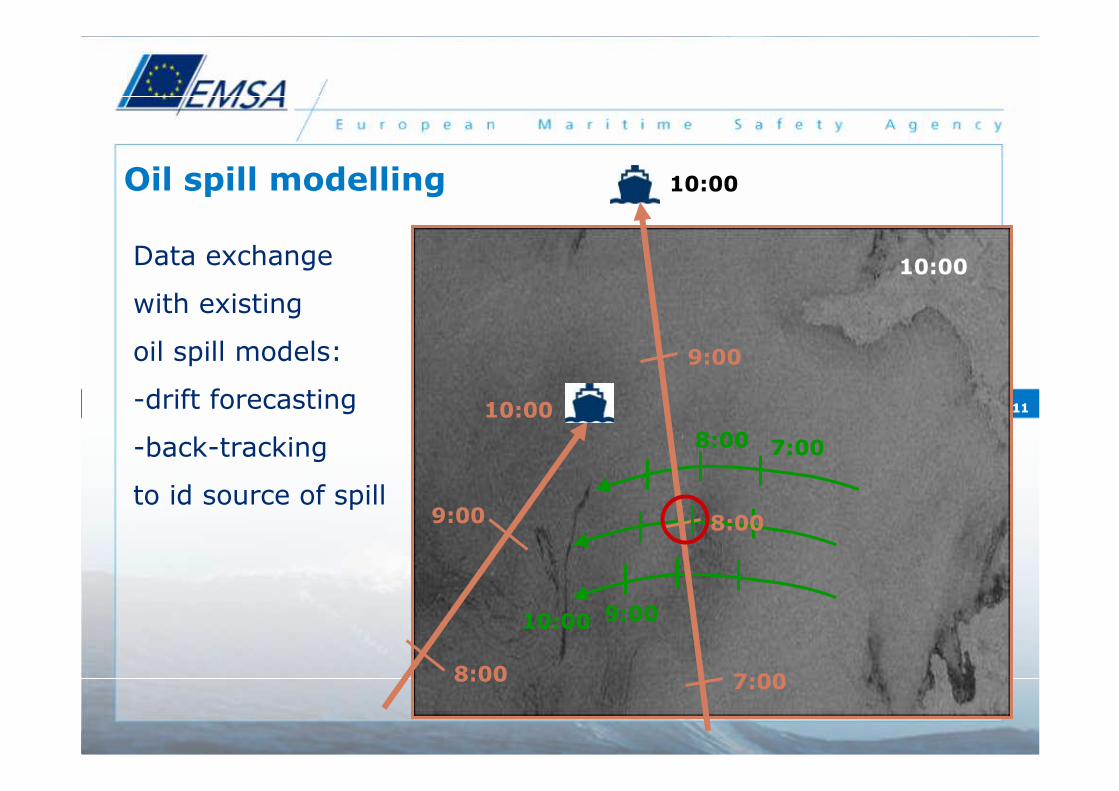
Oil spill modelling
Data exchange
with existing
oil spill models:
-drift forecasting
-back-tracking
to id source of spill
12
Experience of MyO products and services so far
13
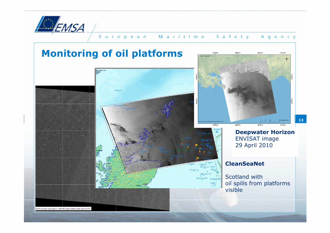
Monitoring of oil platforms
Deepwater HorizonENVISAT image 29 April 2010
CleanSeaNet
Scotland with oil spills from platforms visible
14
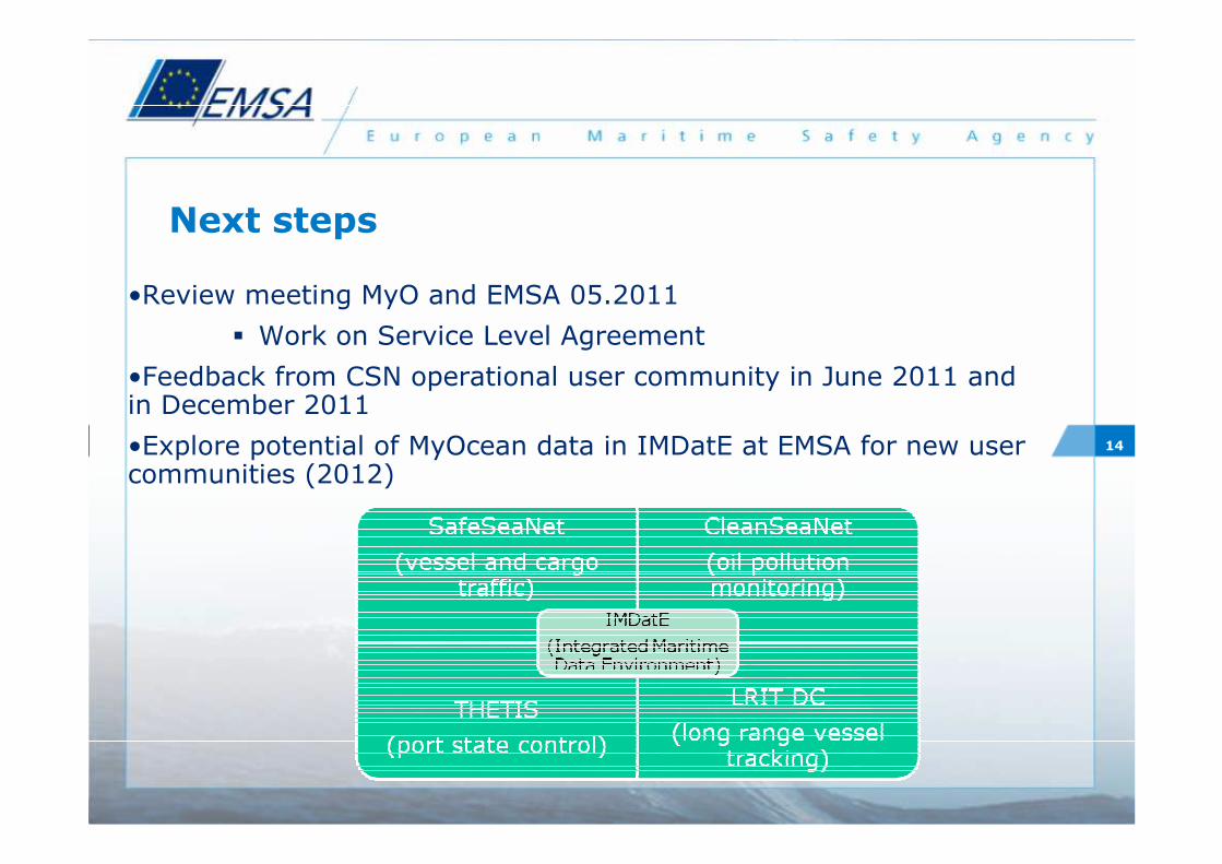
•Review meeting MyO and EMSA 05.2011
� Work on Service Level Agreement
•Feedback from CSN operational user community in June 2011 and in December 2011
•Explore potential of MyOcean data in IMDatE at EMSA for new usercommunities (2012)
Next steps
15
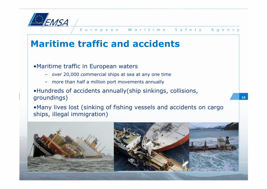
Maritime traffic and accidents
•Maritime traffic in European waters
– over 20,000 commercial ships at sea at any one time
– more than half a million port movements annually
•Hundreds of accidents annually(ship sinkings, collisions, groundings)
•Many lives lost (sinking of fishing vessels and accidents on cargo ships, illegal immigration)
16
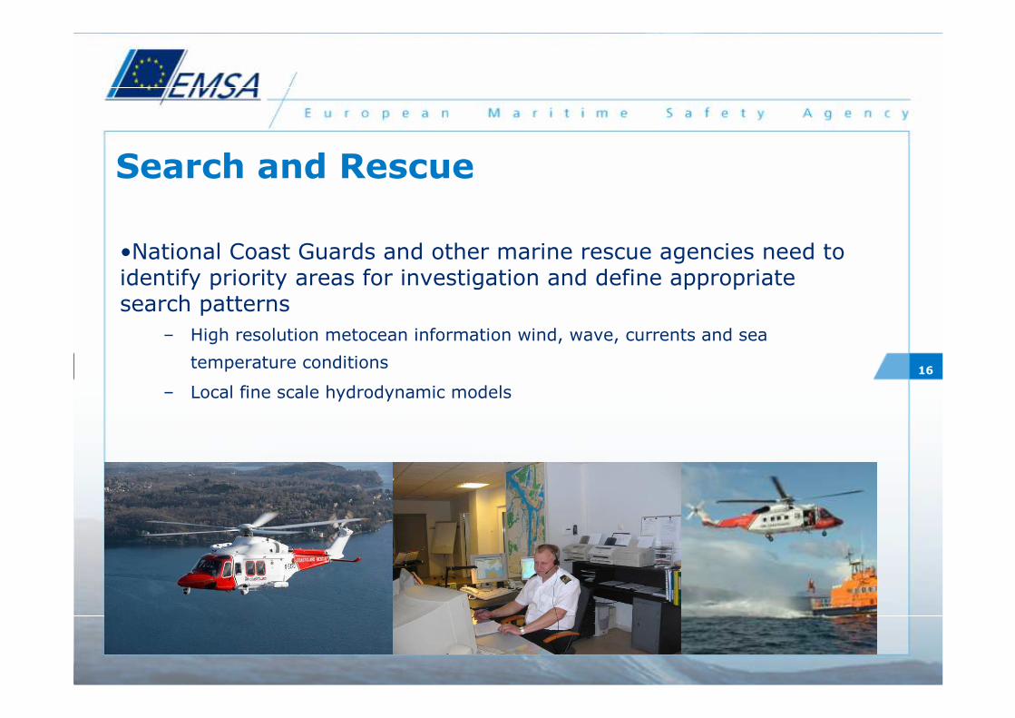
Search and Rescue
•National Coast Guards and other marine rescue agencies need to identify priority areas for investigation and define appropriatesearch patterns
– High resolution metocean information wind, wave, currents and sea
temperature conditions
– Local fine scale hydrodynamic models

17
Sea Ice services
• Ice breaker operators use detailed information on open water location, ice concentration and ice type to identify the optimal ice breaking route
• High resolution, real time and forecast information for sea ice conditions are vital for safe passage
• Opening up of the ‘Northern Route’ between Europe and East Asia/China
– Increased exploitation of oil and gas in Arctic regions
– Increased traffic near sensitive Arctic eco systems
18
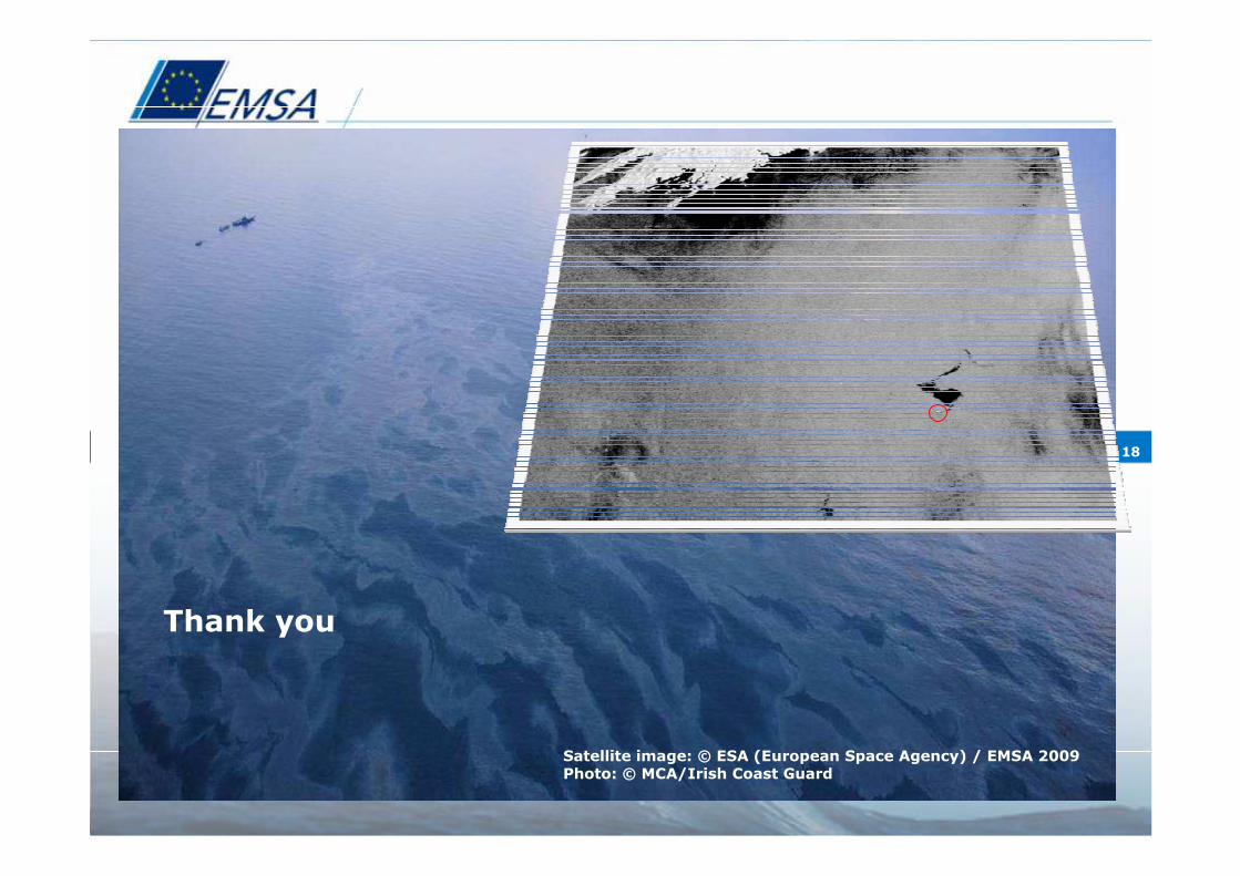
© CSA/MDA/EMSA 2008
Satellite image: © ESA (European Space Agency) / EMSA 2009Photo: © MCA/Irish Coast Guard
Thank you

![Eerste hulp Les 7 Huidwonden.ppt [Compatibiliteitsmodus] · Les 7 –Rode Kruis-Vlaanderen Specifieke huidwonden Splinter Stap 4: Verleen verdere eerste hulp Voorwaarden Kleine splinter](https://img.pdfslide.net/doc/110x75/5edd5405ad6a402d6668611b/eerste-hulp-les-7-compatibiliteitsmodus-les-7-arode-kruis-vlaanderen-specifieke.jpg)