Embed Size (px)
Citation preview
Kenyatta University GIS day: Discovering the World through GIS.18th
November.2015
Kenyatta University GIS day: Discovering the World through GIS.18th
November.2015
Introduction
World GIS Day is a culmination of a weeklong Geography Week to sensitize people about the
importance of geography and to raise awareness on the use of geographic information which is
held annually around the world. It is celebrated every third week of November every year and it
brings together GIS professionals to showcase what spatial technology is capable of doing to
solve global problems. The theme of 2015 GIS day was Discovering the World through GIS and
Kenyatta University, a beneficiary of Esri 100 African Universities Programme, joined the other
GIS users in the world to commemorate the day.
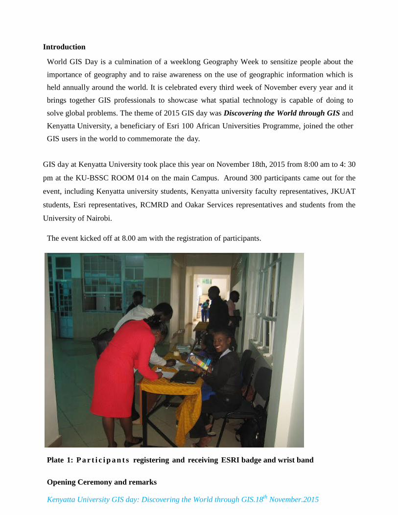
GIS day at Kenyatta University took place this year on November 18th, 2015 from 8:00 am to 4: 30
pm at the KU-BSSC ROOM 014 on the main Campus. Around 300 participants came out for the
event, including Kenyatta university students, Kenyatta university faculty representatives, JKUAT
students, Esri representatives, RCMRD and Oakar Services representatives and students from the
University of Nairobi.
The event kicked off at 8.00 am with the registration of participants.
Plate 1: P a r t i c i p a n t s registering and receiving ESRI badge and wrist band
Opening Ceremony and remarks
Kenyatta University GIS day: Discovering the World through GIS.18th
November.2015
Dr. Fidelis Kilonzo was the Master of Ceremony of the GIS DAY event. He welcomed the
guests and the participants to the GIS day’s celebrations. In his brief remarks he informed the
participants about the importance of using GIS technology to demonstrate real-world applications
that are making a difference in our society.
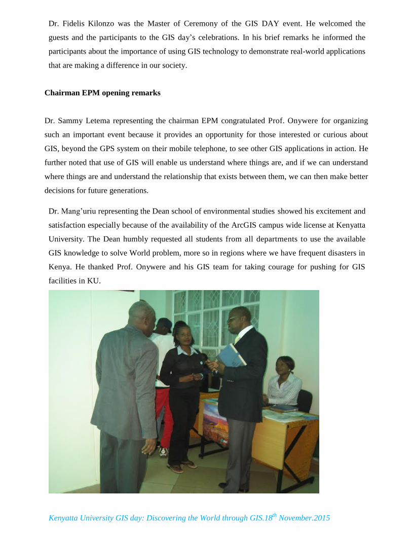
Chairman EPM opening remarks
Dr. Sammy Letema representing the chairman EPM congratulated Prof. Onywere for organizing
such an important event because it provides an opportunity for those interested or curious about
GIS, beyond the GPS system on their mobile telephone, to see other GIS applications in action. He
further noted that use of GIS will enable us understand where things are, and if we can understand
where things are and understand the relationship that exists between them, we can then make better
decisions for future generations.
Dr. Mang’uriu representing the Dean school of environmental studies showed his excitement and
satisfaction especially because of the availability of the ArcGIS campus wide license at Kenyatta
University. The Dean humbly requested all students from all departments to use the available
GIS knowledge to solve World problem, more so in regions where we have frequent disasters in
Kenya. He thanked Prof. Onywere and his GIS team for taking courage for pushing for GIS
facilities in KU.
Kenyatta University GIS day: Discovering the World through GIS.18th
November.2015
Plate 2: Dr. Manguriu representing the Dean SES welcomes Registrar
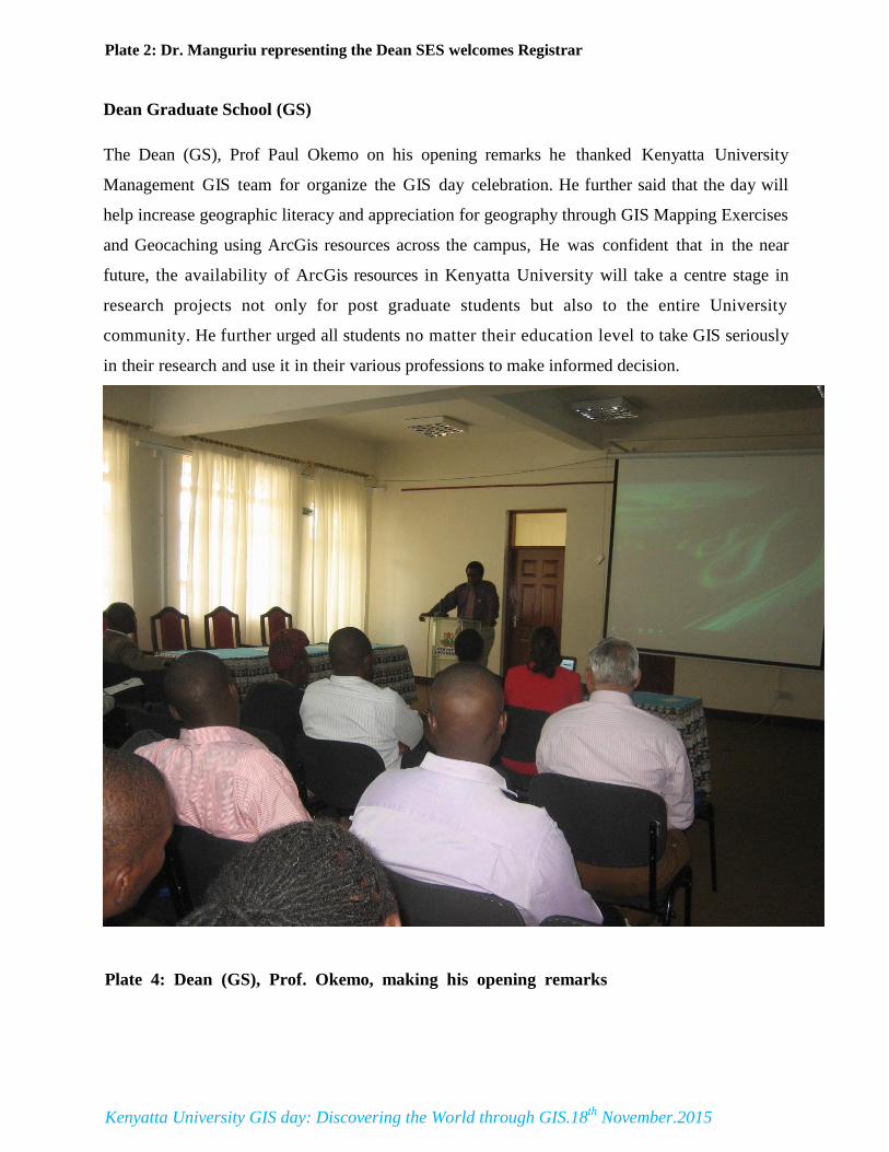
Dean Graduate School (GS) The Dean (GS), Prof Paul Okemo on his opening remarks he thanked Kenyatta University
Management GIS team for organize the GIS day celebration. He further said that the day will
help increase geographic literacy and appreciation for geography through GIS Mapping Exercises
and Geocaching using ArcGis resources across the campus, He was confident that in the near
future, the availability of ArcGis resources in Kenyatta University will take a centre stage in
research projects not only for post graduate students but also to the entire University
community. He further urged all students no matter their education level to take GIS seriously
in their research and use it in their various professions to make informed decision.
Plate 4: Dean (GS), Prof. Okemo, making his opening remarks
Kenyatta University GIS day: Discovering the World through GIS.18th
November.2015
Vice Chancellor opening remarks
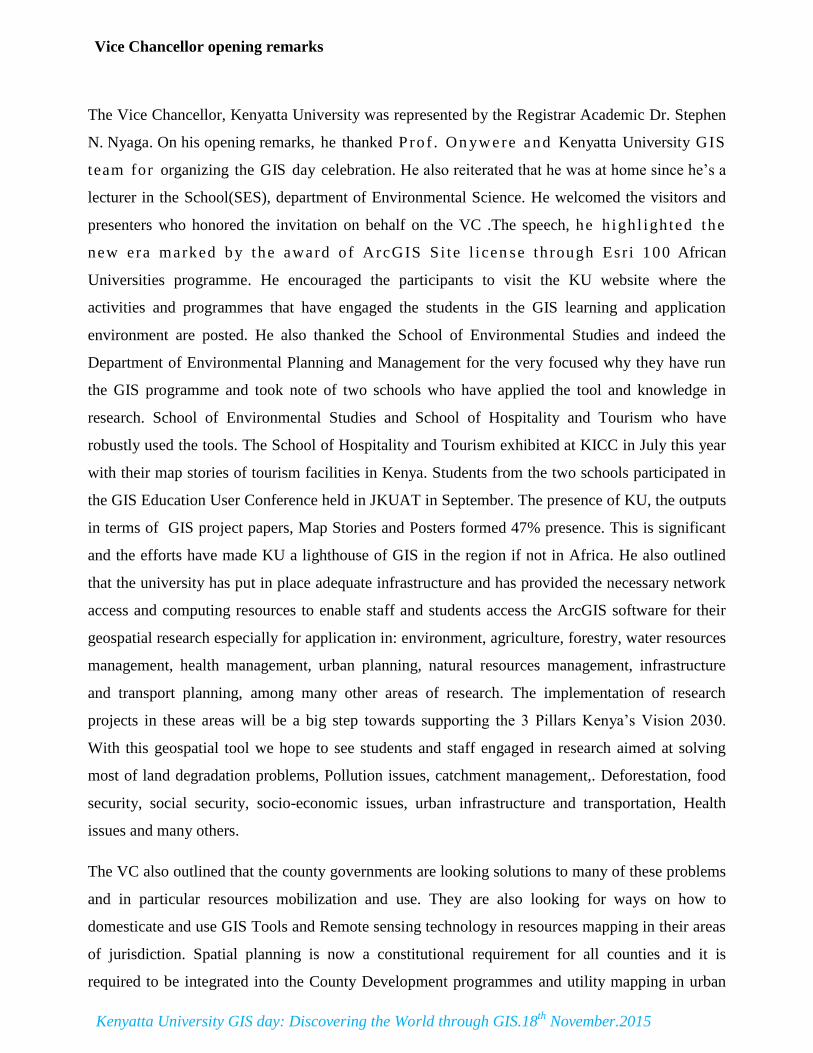
The Vice Chancellor, Kenyatta University was represented by the Registrar Academic Dr. Stephen
N. Nyaga. On his opening remarks, he thanked P ro f . On yw ere and Kenyatta University GIS
team for organizing the GIS day celebration. He also reiterated that he was at home since he’s a
lecturer in the School(SES), department of Environmental Science. He welcomed the visitors and
presenters who honored the invitation on behalf on the VC .The speech, he h ighl ighted the
new era marked by the award of ArcGIS S i te l i cen se through Esr i 100 African
Universities programme. He encouraged the participants to visit the KU website where the
activities and programmes that have engaged the students in the GIS learning and application
environment are posted. He also thanked the School of Environmental Studies and indeed the
Department of Environmental Planning and Management for the very focused why they have run
the GIS programme and took note of two schools who have applied the tool and knowledge in
research. School of Environmental Studies and School of Hospitality and Tourism who have
robustly used the tools. The School of Hospitality and Tourism exhibited at KICC in July this year
with their map stories of tourism facilities in Kenya. Students from the two schools participated in
the GIS Education User Conference held in JKUAT in September. The presence of KU, the outputs
in terms of GIS project papers, Map Stories and Posters formed 47% presence. This is significant
and the efforts have made KU a lighthouse of GIS in the region if not in Africa. He also outlined
that the university has put in place adequate infrastructure and has provided the necessary network
access and computing resources to enable staff and students access the ArcGIS software for their
geospatial research especially for application in: environment, agriculture, forestry, water resources
management, health management, urban planning, natural resources management, infrastructure
and transport planning, among many other areas of research. The implementation of research
projects in these areas will be a big step towards supporting the 3 Pillars Kenya’s Vision 2030.
With this geospatial tool we hope to see students and staff engaged in research aimed at solving
most of land degradation problems, Pollution issues, catchment management,. Deforestation, food
security, social security, socio-economic issues, urban infrastructure and transportation, Health
issues and many others.
The VC also outlined that the county governments are looking solutions to many of these problems
and in particular resources mobilization and use. They are also looking for ways on how to
domesticate and use GIS Tools and Remote sensing technology in resources mapping in their areas
of jurisdiction. Spatial planning is now a constitutional requirement for all counties and it is
required to be integrated into the County Development programmes and utility mapping in urban
Kenyatta University GIS day: Discovering the World through GIS.18th
November.2015
areas cutting across security, transportation, marketing, business, water supply, waste management,
disaster risk management especially for fire and flood risk management among many others.
The recognition of the efforts led to the award of the Special Achievement in GIS Award (SAG
Award) at a function in San-Diego in July 2015. Kenyatta University was among just about 180
institutions that were recognized this year. This has placed KU on the world map as a geospatial
centre and the University is investing more to develop a GIS lab that will give better access to GIS
and Remote Sensing tools to everybody on our Main campus and satellite campuses. It was also
noted that the application of the GIS tools in research has landed scholarships to the students. The
VC thanked the organizers of the even and wished the participants a fruitful celebration.
Plate 4: Registrar Academic Dr. Stephen N. Nyaga delivering the VC‘s opening remarks
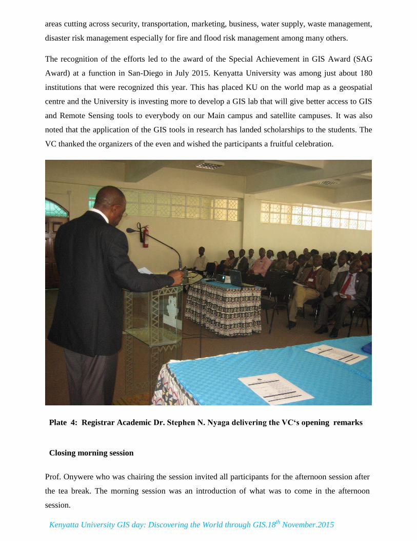
Closing morning session
Prof. Onywere who was chairing the session invited all participants for the afternoon session after
the tea break. The morning session was an introduction of what was to come in the afternoon
session.
Kenyatta University GIS day: Discovering the World through GIS.18th
November.2015
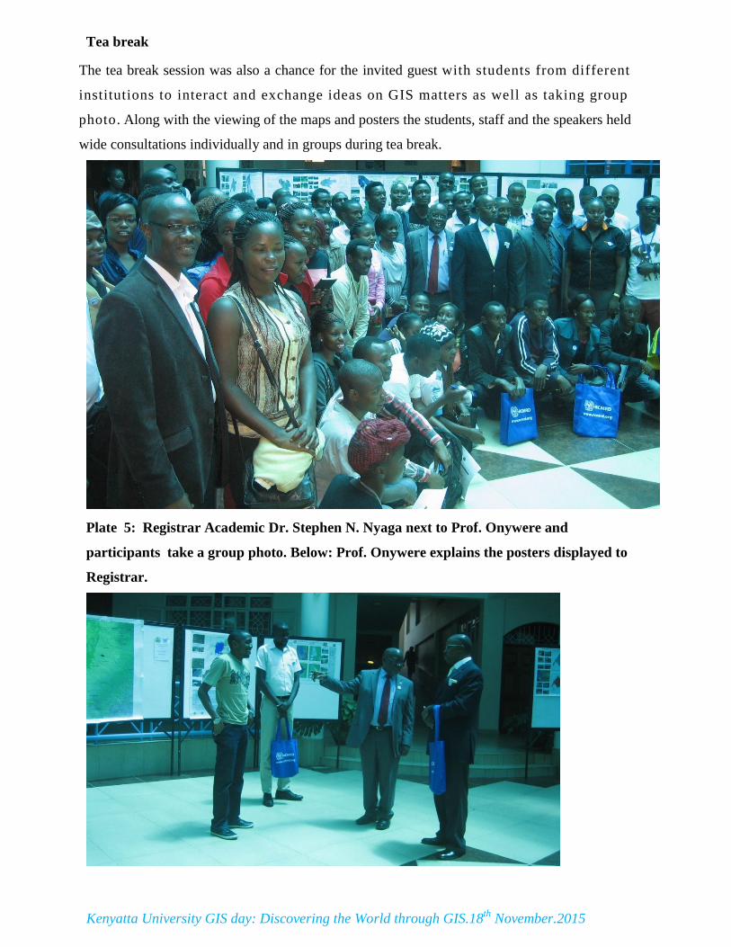
Tea break The tea break session was also a chance for the invited guest with students from different
institutions to interact and exchange ideas on GIS matters as well as taking group
photo. Along with the viewing of the maps and posters the students, staff and the speakers held
wide consultations individually and in groups during tea break.
Plate 5: Registrar Academic Dr. Stephen N. Nyaga next to Prof. Onywere and
participants take a group photo. Below: Prof. Onywere explains the posters displayed to
Registrar.
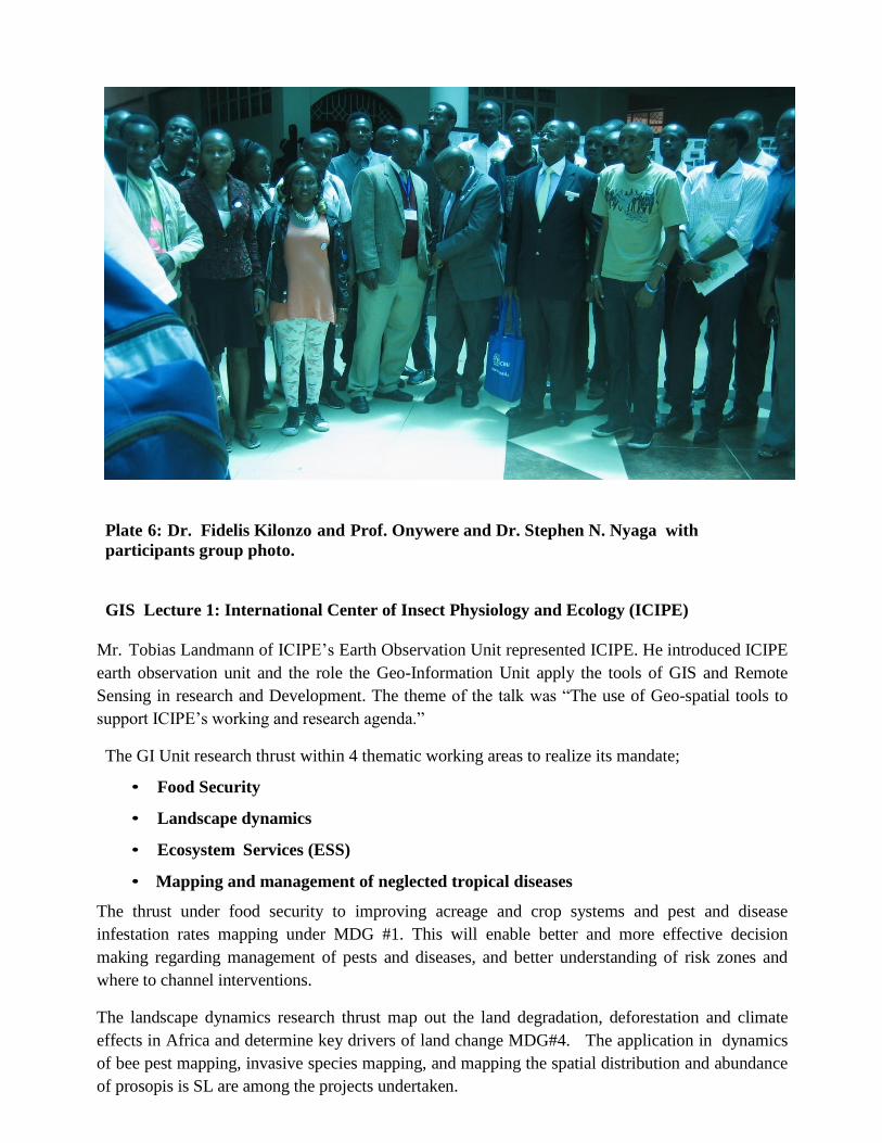
Plate 6: Dr. Fidelis Kilonzo and Prof. Onywere and Dr. Stephen N. Nyaga with
participants group photo.
GIS Lecture 1: International Center of Insect Physiology and Ecology (ICIPE)
Mr. Tobias Landmann of ICIPE’s Earth Observation Unit represented ICIPE. He introduced ICIPE
earth observation unit and the role the Geo-Information Unit apply the tools of GIS and Remote
Sensing in research and Development. The theme of the talk was “The use of Geo-spatial tools to
support ICIPE’s working and research agenda.”
The GI Unit research thrust within 4 thematic working areas to realize its mandate;
• Food Security
• Landscape dynamics
• Ecosystem Services (ESS)
• Mapping and management of neglected tropical diseases
The thrust under food security to improving acreage and crop systems and pest and disease
infestation rates mapping under MDG #1. This will enable better and more effective decision
making regarding management of pests and diseases, and better understanding of risk zones and
where to channel interventions.
The landscape dynamics research thrust map out the land degradation, deforestation and climate
effects in Africa and determine key drivers of land change MDG#4. The application in dynamics
of bee pest mapping, invasive species mapping, and mapping the spatial distribution and abundance
of prosopis is SL are among the projects undertaken.
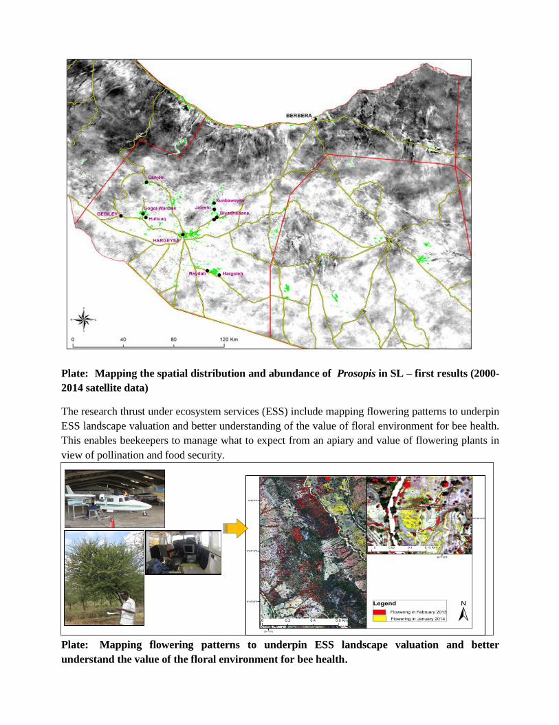
Plate: Mapping the spatial distribution and abundance of Prosopis in SL – first results (2000-
2014 satellite data)
The research thrust under ecosystem services (ESS) include mapping flowering patterns to underpin
ESS landscape valuation and better understanding of the value of floral environment for bee health.
This enables beekeepers to manage what to expect from an apiary and value of flowering plants in
view of pollination and food security.
Plate: Mapping flowering patterns to underpin ESS landscape valuation and better
understand the value of the floral environment for bee health.
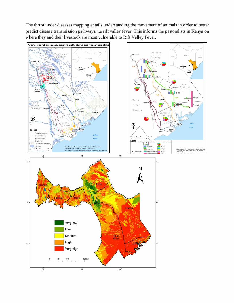
The thrust under diseases mapping entails understanding the movement of animals in order to better
predict disease transmission pathways. i.e rift valley fever. This informs the pastoralists in Kenya on
where they and their livestock are most vulnerable to Rift Velley Fever.
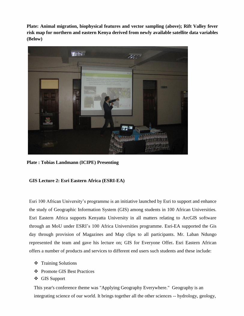
Plate: Animal migration, biophysical features and vector sampling (above); Rift Valley fever
risk map for northern and eastern Kenya derived from newly available satellite data variables
(Below)
Plate : Tobias Landmann (ICIPE) Presenting
GIS Lecture 2: Esri Eastern Africa (ESRI-EA)
Esri 100 African University’s programme is an initiative launched by Esri to support and enhance
the study of Geographic Information System (GIS) among students in 100 African Universities.
Esri Eastern Africa supports Kenyatta University in all matters relating to ArcGIS software
through an MoU under ESRI’s 100 Africa Universities programme. Esri-EA supported the Gis
day through provision of Magazines and Map clips to all participants. Mr. Laban Ndungo
represented the team and gave his lecture on; GIS for Everyone Offer. Esri Eastern African
offers a number of products and services to different end users such students and these include:
Training Solutions
Promote GIS Best Practices
GIS Support
This year's conference theme was "Applying Geography Everywhere." Geography is an
integrating science of our world. It brings together all the other sciences -- hydrology, geology,
climatology, sociology, anthropology, and all of the ---ologies rest on the spatial dimension.
This framework provides rich content and also a context for understanding everything which is
the key that will help us address and take on the big challenges of our world today and that is
what this community is all about.
GIS in its digital manifestation of geography, goes beyond just the science. It provides us a
framework and a process for applying geography, bringing together observational science,
measurement, and integrates it with modeling and prediction, and analysis, and interpretation,
so that we can understand things. This can be integrated into designing and planning and
making decisions, and ultimately action.
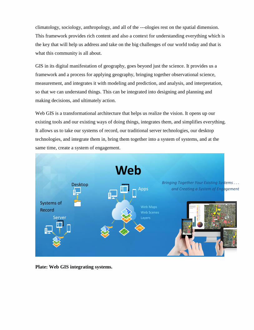
Web GIS is a transformational architecture that helps us realize the vision. It opens up our
existing tools and our existing ways of doing things, integrates them, and simplifies everything.
It allows us to take our systems of record, our traditional server technologies, our desktop
technologies, and integrate them in, bring them together into a system of systems, and at the
same time, create a system of engagement.
Plate: Web GIS integrating systems.
Bringing Together Your Existing Systems . . .
and Creating a System of Engagement
Web Maps
Layers
Apps
Systems of
Record
Desktop
Server
Web Scenes
Web GIS
He encouraged the students to take advantage of the availability of ArcGIS license on
campus to do solve environmental problems spatially.
PHOTO missing
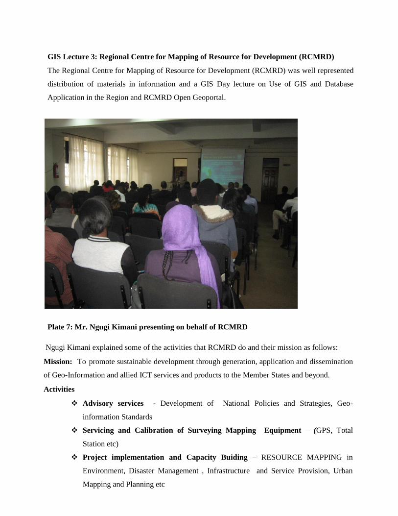
Lecture 3: Regional Centre for Mapping of Resource for Development (RCMRD)
The Regional Centre for Mapping of Resource for Development (RCMRD) was well represented
distribution of materials in information and a GIS Day lecture from Mr. Ngugi Kimani who
made a presentation on Use of GIS and Database Application in the Region and RCMRD Open
Geoportal.
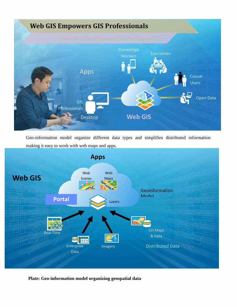
Geo-information model organize different data types and simplifies distributed information
making it easy to work with web maps and apps.
Plate: Geo-information model organizing geospatial data
Web GIS Empowers GIS Professionals
Expanding Your Impact Across the Organization
Web GIS
Knowledge
Workers
Open Data
Community
Desktop
GIS
Professionals
Casual
Users
Apps
Executives
Apps
Layers
Distributed Data
Geoinformation Model
Web GIS
Real-Time
Enterprise
Data
Imagery
Web
Maps
Web
Scenes
GIS Maps
& Data
Portal
GIS Lecture 3: Regional Centre for Mapping of Resource for Development (RCMRD)
The Regional Centre for Mapping of Resource for Development (RCMRD) was well represented
distribution of materials in information and a GIS Day lecture on Use of GIS and Database
Application in the Region and RCMRD Open Geoportal.
Plate 7: Mr. Ngugi Kimani presenting on behalf of RCMRD
Ngugi Kimani explained some of the activities that RCMRD do and their mission as follows:
Mission: To promote sustainable development through generation, application and dissemination
of Geo-Information and allied ICT services and products to the Member States and beyond.
Activities
Advisory services - Development of National Policies and Strategies, Geo-
information Standards
Servicing and Calibration of Surveying Mapping Equipment – (GPS, Total
Station etc)
Project implementation and Capacity Buiding – RESOURCE MAPPING in
Environment, Disaster Management , Infrastructure and Service Provision, Urban
Mapping and Planning etc
Data and information Dissemination – Acquisition, usage, sharing and discovery.
Research and Development - Land cover mapping, Crop yield estimation, Water
resources management, Land Degradation and Habitat conservation & Disaster
management.
Training: Short -term Training, Workshops and Seminars and applied programmes
for GIS experts
The training opportunities offered by the RCMRD attracted a lot of interest from the GIS Day
participant and include; Land management: GPS Course; aimed at assisting participants
understand the principles of GPS positioning methods; GIS and Mapping: Introduction to
basics and advanced course in GIS/RS; Information technology: Certificate and diploma in I.T.
This enlightened students from various discipline on how GIS and Remote Sensing has a wide
scope of applications. They also offer Geo-information services such as
Biodiversity Map Viewer- It provides access to high quality information on species distribution
in a given locality. (Amphibians, reptiles, birds, fish, plants.
Monitoring of the Environment for Security in Africa- To enhance the assessment and
monitoring of land degradation, natural habitats and forest resources for sustainable land
management.
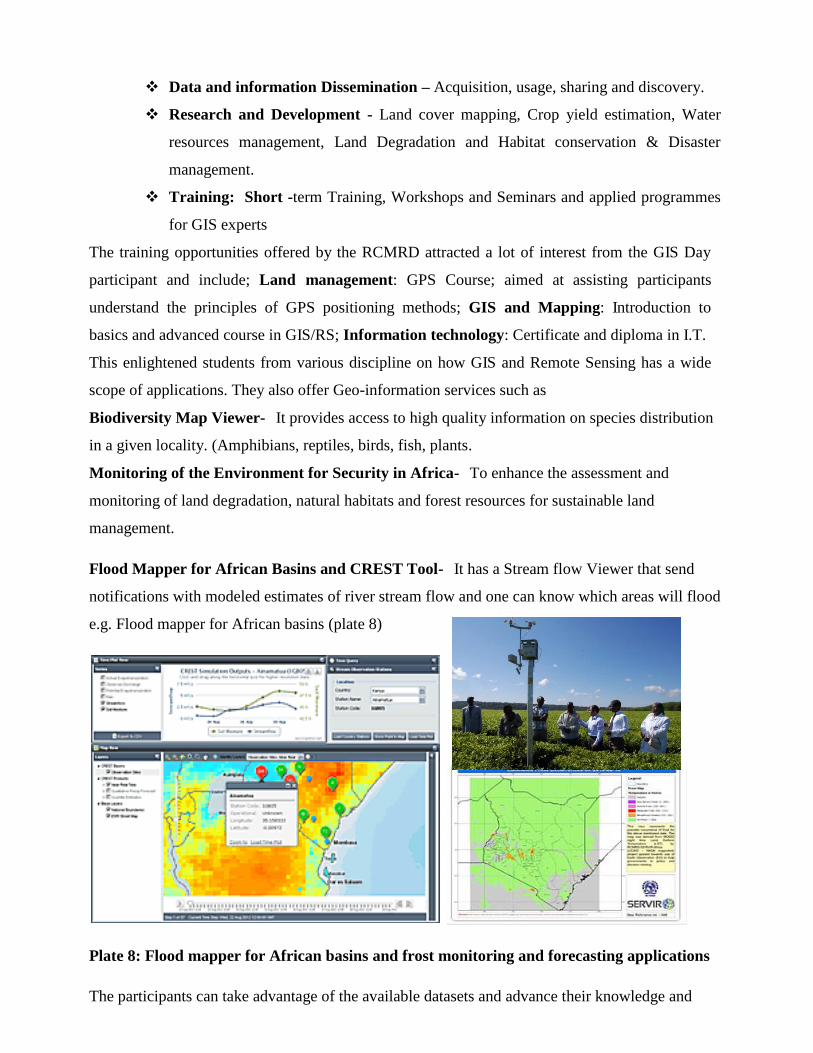
Flood Mapper for African Basins and CREST Tool- It has a Stream flow Viewer that send
notifications with modeled estimates of river stream flow and one can know which areas will flood
e.g. Flood mapper for African basins (plate 8)
Plate 8: Flood mapper for African basins and frost monitoring and forecasting applications
The participants can take advantage of the available datasets and advance their knowledge and
skill to exploit the opportunities that lie in GIS. The data available through the RCMRD apps
studio through link; apps.rcmrd.org, downloading GIS / RS datasets from the geo-portal through
link ;geoportal.rcmrd.org, and portal fo aces to all applications and maps through the link: metacatalog.rcmrd.org:8080/geonetwork.
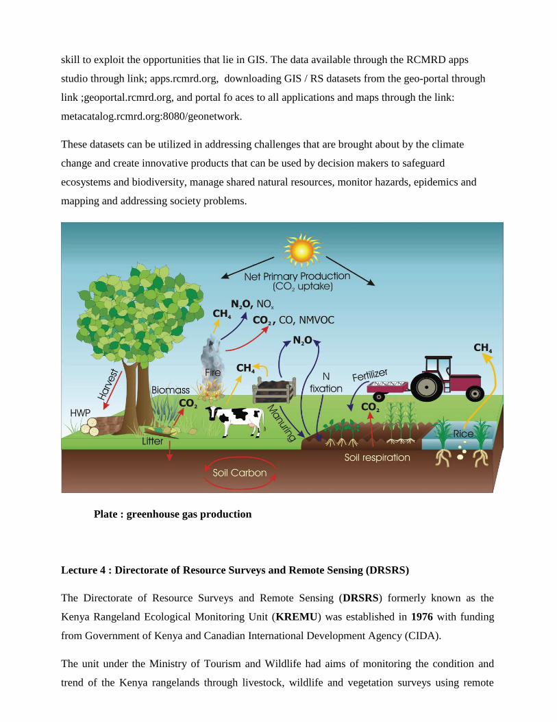
These datasets can be utilized in addressing challenges that are brought about by the climate
change and create innovative products that can be used by decision makers to safeguard
ecosystems and biodiversity, manage shared natural resources, monitor hazards, epidemics and
mapping and addressing society problems.
Plate : greenhouse gas production
Lecture 4 : Directorate of Resource Surveys and Remote Sensing (DRSRS)
The Directorate of Resource Surveys and Remote Sensing (DRSRS) formerly known as the
Kenya Rangeland Ecological Monitoring Unit (KREMU) was established in 1976 with funding
from Government of Kenya and Canadian International Development Agency (CIDA).
The unit under the Ministry of Tourism and Wildlife had aims of monitoring the condition and
trend of the Kenya rangelands through livestock, wildlife and vegetation surveys using remote
sensing, aerial surveys and ground sampling techniques.
VISION
To become a National Focal Centre of Excellence in Development of National Geo-spatial
Databases on the Environment and Natural Resources for Sustainable Development.
MISSION
To promote sustainable development of Geo-spatial Information Databases for sustainable
development.
MANDATE
Collection, analysis, updating, storage and dissemination of geo-spatial information on the most
renewable natural resources to facilitate informed decision-making for sustainable environmental
management with the major aim of alleviating poverty.
Data collected forms the basis for policies formulation and development plans for various sectors
in the county and national government ministries and agencies.
OBJECTIVES
The main objectives of DRSRS are:
Generation of data for sustainable management and conservation of wildlife and livestock
resources, and the associated environment/ecological attributes in the Kenya Rangelands;
Generation of data for sustainable utilization and conservation of plant biodiversity
(vegetation including forests);
Generation of data for sustainable management of resources (land cover and land use);
Development of early warning systems for food security planning and management (crop
forecast and seasonal vegetation biomass production);
Development of Environmental Information Management System (EIMS) from databases
collected since 1976; and
Coordination of application of remote sensing technology in the Government of Kenya.
Mr. Gordon Ojwang presented on Geo-Spatial Information Development for Sustainable
Environmental Management & Poverty Reduction in Kenya.
DRSRS activities and application of Geo-Spatial Information range from;
Ground Surveys Division: Plant Biodiversity (Vegetation) Assessment and Ecological
Monitoring;
Aerial Surveys Division: Animal Biodiversity (Livestock/wildlife) Assessment and
Ecological Monitoring;
Remote Sensing Division: Land-use / Land-cover Assessment and Change Monitoring, and
Early Warning Systems Development;
Data Management Division: Natural Resource Geo-spatial Database Development on all of
the above.
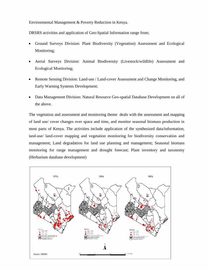
The vegetation and assessment and monitoring theme deals with the assessment and mapping
of land use/ cover changes over space and time, and monitor seasonal biomass production in
most parts of Kenya. The activities include application of the synthesized data/information,
land-use/ land-cover mapping and vegetation monitoring for biodiversity conservation and
management; Land degradation for land use planning and management; Seasonal biomass
monitoring for range management and drought forecast; Plant inventory and taxonomy
(Herbarium database development)
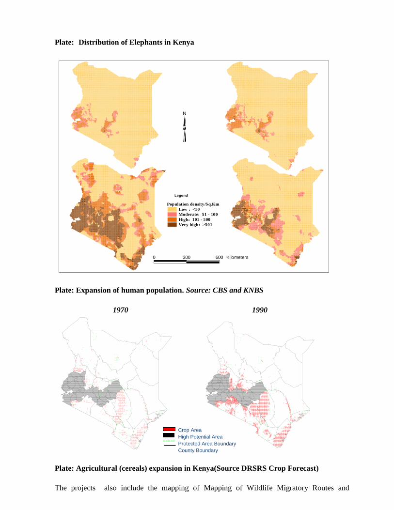
Plate: Distribution of Elephants in Kenya
Plate: Expansion of human population. Source: CBS and KNBS
1970 1990
1970
Plate: Agricultural (cereals) expansion in Kenya(Source DRSRS Crop Forecast)
The projects also include the mapping of Mapping of Wildlife Migratory Routes and
Population density/Sq.Km
Low : <50
Moderate: 51 - 100
High: 101 - 500
Very high: >501
0 300 600 Kilometers
N
Legend
Crop Area High Potential Area Protected Area Boundary County Boundary
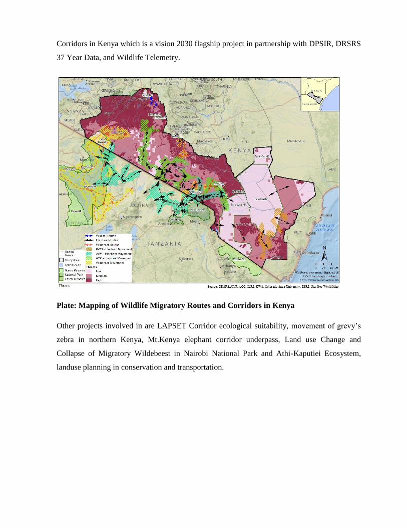
Corridors in Kenya which is a vision 2030 flagship project in partnership with DPSIR, DRSRS
37 Year Data, and Wildlife Telemetry.
Plate: Mapping of Wildlife Migratory Routes and Corridors in Kenya
Other projects involved in are LAPSET Corridor ecological suitability, movement of grevy’s
zebra in northern Kenya, Mt.Kenya elephant corridor underpass, Land use Change and
Collapse of Migratory Wildebeest in Nairobi National Park and Athi-Kaputiei Ecosystem,
landuse planning in conservation and transportation.
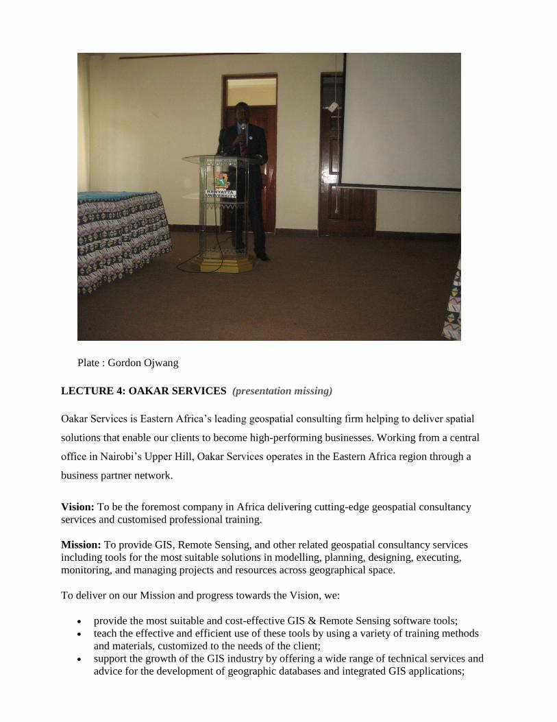
Plate : Gordon Ojwang
LECTURE 4: OAKAR SERVICES (presentation missing)
Oakar Services is Eastern Africa’s leading geospatial consulting firm helping to deliver spatial
solutions that enable our clients to become high-performing businesses. Working from a central
office in Nairobi’s Upper Hill, Oakar Services operates in the Eastern Africa region through a
business partner network.
Vision: To be the foremost company in Africa delivering cutting-edge geospatial consultancy
services and customised professional training.
Mission: To provide GIS, Remote Sensing, and other related geospatial consultancy services
including tools for the most suitable solutions in modelling, planning, designing, executing,
monitoring, and managing projects and resources across geographical space.
To deliver on our Mission and progress towards the Vision, we:
provide the most suitable and cost-effective GIS & Remote Sensing software tools;
teach the effective and efficient use of these tools by using a variety of training methods
and materials, customized to the needs of the client;
support the growth of the GIS industry by offering a wide range of technical services and
advice for the development of geographic databases and integrated GIS applications;
Innovatively apply GIS & Remote Sensing in all sectors of the economy to deliver
integrated and cutting-edge spatial solutions to clients, who may be decision-makers in
government and private sector, professionals, or citizens at large;
Carry out internal capacity development and support industrial attachment; and
Continuously research on emerging knowledge and technology frontiers and network
extensively to remain current and competitive.
Values
We work together as a team
We value and respect each other
We drive innovation and discovery
We are committed to achieving excellent results.
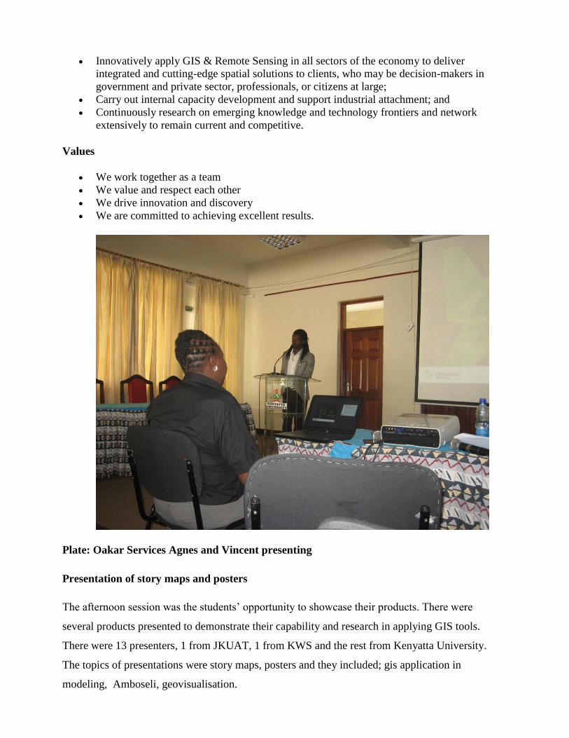
Plate: Oakar Services Agnes and Vincent presenting
Presentation of story maps and posters
The afternoon session was the students’ opportunity to showcase their products. There were
several products presented to demonstrate their capability and research in applying GIS tools.
There were 13 presenters, 1 from JKUAT, 1 from KWS and the rest from Kenyatta University.
The topics of presentations were story maps, posters and they included; gis application in
modeling, Amboseli, geovisualisation.
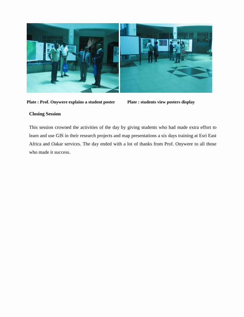
Plate : Prof. Onywere explains a student poster Plate : students view posters display
Closing Session This session crowned the activities of the day by giving students who had made extra effort to
learn and use GIS in their research projects and map presentations a six days training at Esri East
Africa and Oakar services. The day ended with a lot of thanks from Prof. Onywere to all those
who made it success.