Embed Size (px)
Citation preview
City of Alexandria, Virginia
KING, STRAND, AND UNION STREETS
Park & Recreation Commission
NOVEMBER 15, 2012
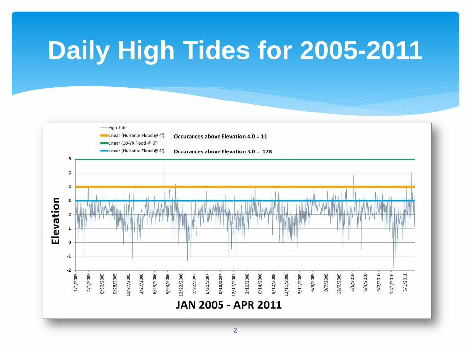
Daily High Tides for 2005-2011
2
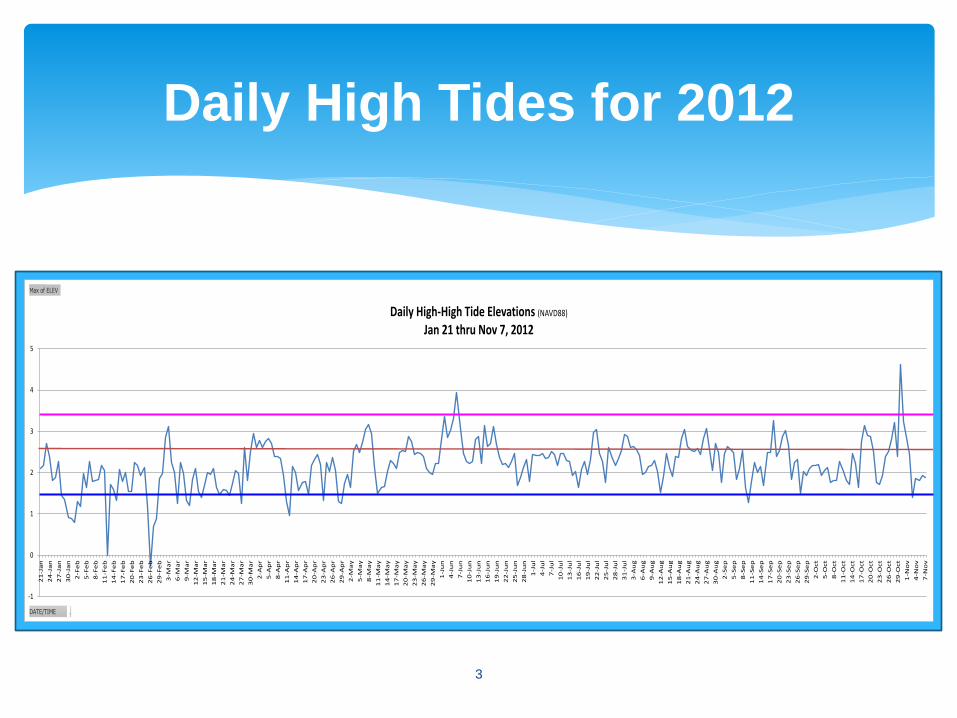
Daily High Tides for 2012
3
-1
0
1
2
3
4
5
21-Jan
24-Jan
27-Jan
30-Jan
2-Feb
5-Feb
8-Feb
11-Feb
14-Feb
17-Feb
20-Feb
23-Feb
26-Feb
29-Feb
3-M
ar
6-M
ar
9-M
ar
12-M
ar
15-M
ar
18-M
ar
21-M
ar
24-M
ar
27-M
ar
30-M
ar
2-Apr
5-Apr
8-Apr
11-Apr
14-Apr
17-Apr
20-Apr
23-Apr
26-Apr
29-Apr
2-M
ay
5-M
ay
8-M
ay
11-M
ay
14-M
ay
17-M
ay
20-M
ay
23-M
ay
26-M
ay
29-M
ay
1-Jun
4-Jun
7-Jun
10-Jun
13-Jun
16-Jun
19-Jun
22-Jun
25-Jun
28-Jun
1-Jul
4-Jul
7-Jul
10-Jul
13-Jul
16-Jul
19-Jul
22-Jul
25-Jul
28-Jul
31-Jul
3-Aug
6-Aug
9-Aug
12-Aug
15-Aug
18-Aug
21-Aug
24-Aug
27-Aug
30-Aug
2-Sep
5-Sep
8-Sep
11-Sep
14-Sep
17-Sep
20-Sep
23-Sep
26-Sep
29-Sep
2-Oct
5-Oct
8-Oct
11-Oct
14-Oct
17-Oct
20-Oct
23-Oct
26-Oct
29-Oct
1-Nov
4-Nov
7-Nov
Daily High-High Tide Elevations (NAVD88)Jan 21 thru Nov 7, 2012
DATE/TIME
Max of ELEV
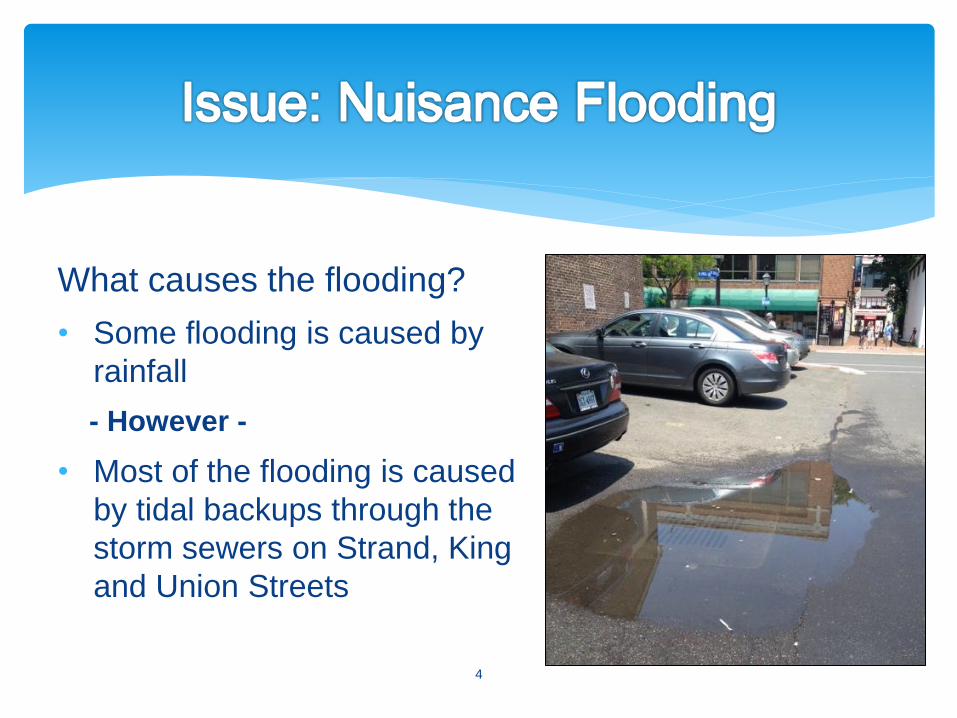
What causes the flooding?
• Some flooding is caused by
rainfall
- However -
• Most of the flooding is caused
by tidal backups through the
storm sewers on Strand, King
and Union Streets
4
5
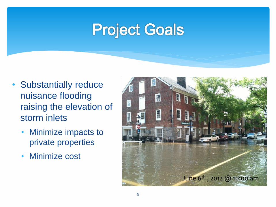
• Substantially reduce
nuisance flooding
raising the elevation of
storm inlets
• Minimize impacts to
private properties
• Minimize cost
June 6th , 2012 @ 10:00 am
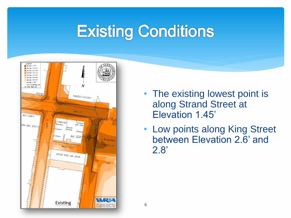
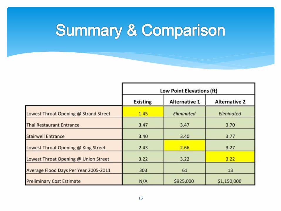
• The existing lowest point is along Strand Street at Elevation 1.45’
• Low points along King Street between Elevation 2.6’ and 2.8’
6

• Potomac River water surface elevations
• Elevations of existing building entrances
• Minimum slopes required for drainage
• Road and sidewalk design standards
• ADA compliance
• Cost
7
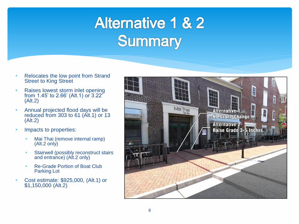
• Relocates the low point from Strand Street to King Street
• Raises lowest storm inlet opening from 1.45’ to 2.66’ (Alt.1) or 3.22’ (Alt.2)
• Annual projected flood days will be reduced from 303 to 61 (Alt.1) or 13 (Alt.2)
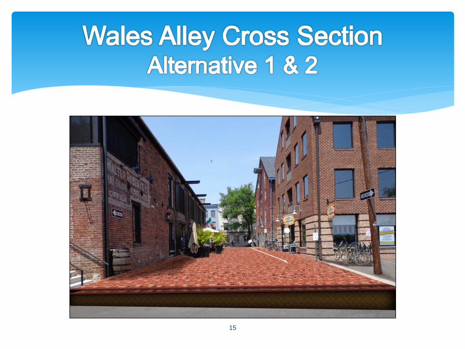
• Impacts to properties:
• Mai Thai (remove internal ramp) (Alt.2 only)
• Stairwell (possibly reconstruct stairs and entrance) (Alt.2 only)
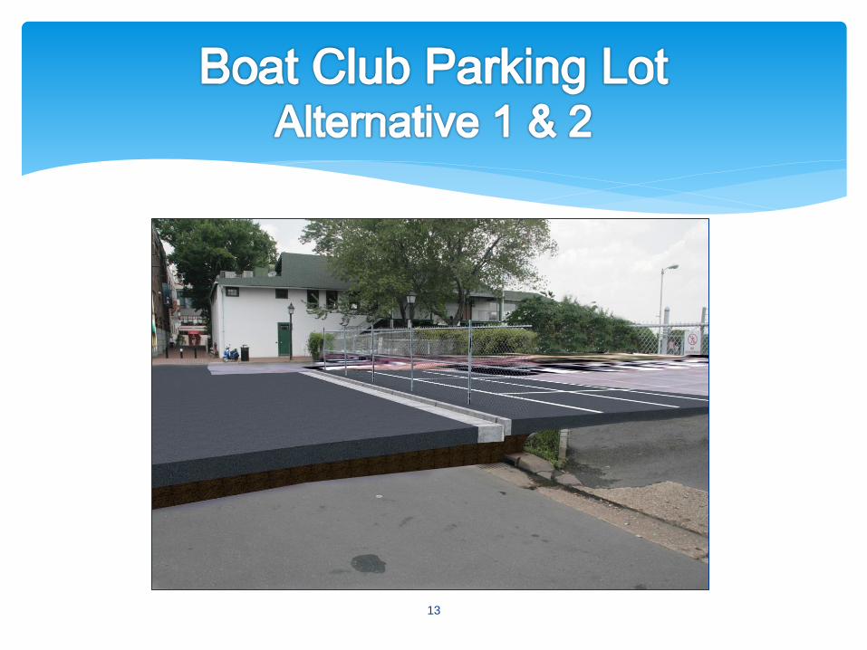
• Re-Grade Portion of Boat Club Parking Lot
• Cost estimate: $925,000, (Alt.1) or $1,150,000 (Alt.2)
8
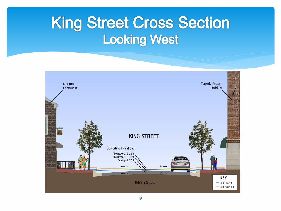
9
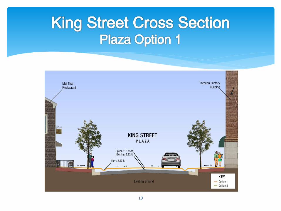
10
11
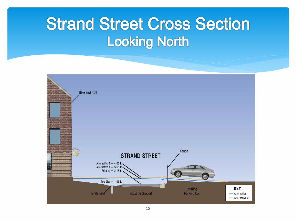
12
13

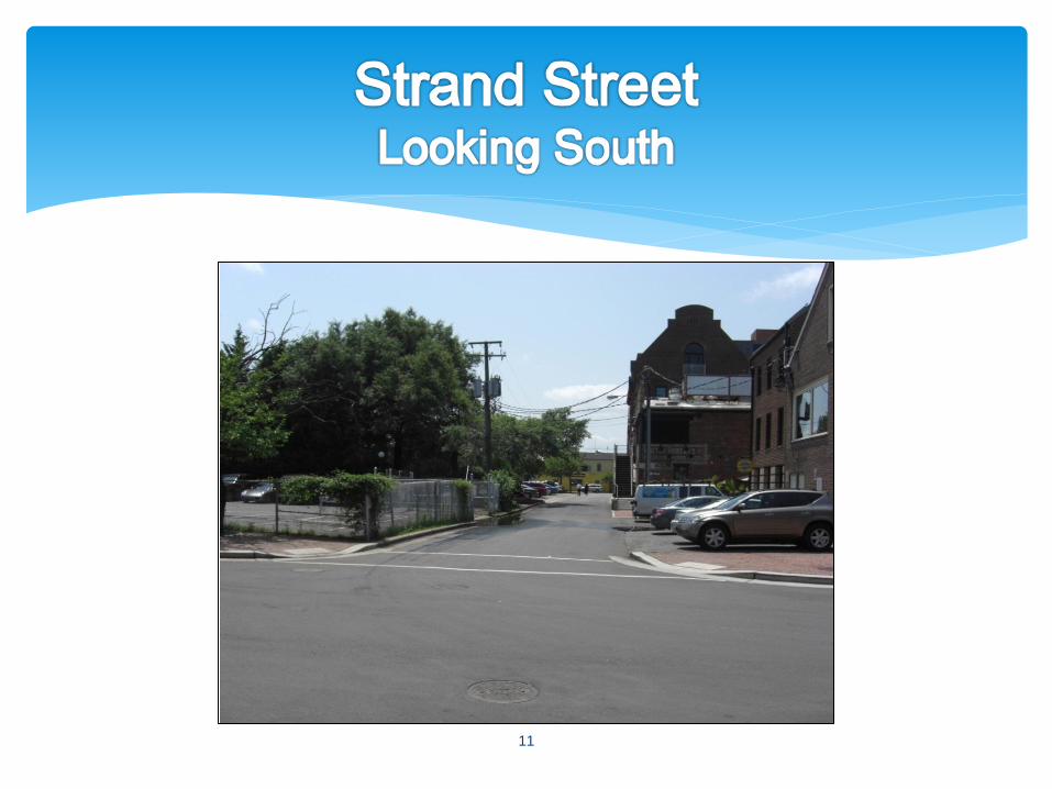
Flooding on the Strand
14
15
16
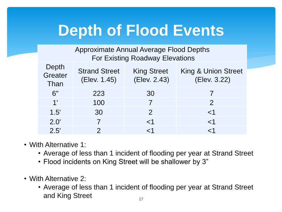
Depth of Flood Events
17
Approximate Annual Average Flood Depths
For Existing Roadway Elevations
Depth
Greater
Than
Strand Street
(Elev. 1.45)
King Street
(Elev. 2.43)
King & Union Street
(Elev. 3.22)
6" 223 30 7
1' 100 7 2
1.5' 30 2 <1
2.0' 7 <1 <1
2.5' 2 <1 <1
• With Alternative 1:
• Average of less than 1 incident of flooding per year at Strand Street
• Flood incidents on King Street will be shallower by 3”
• With Alternative 2:
• Average of less than 1 incident of flooding per year at Strand Street
and King Street