Embed Size (px)
Citation preview
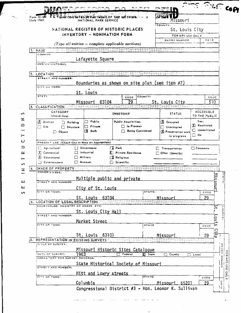
NATIONAL REGISTER OF HISTORIC PLACES
INVENTORY - NOMINATION FORM
(Type all entries — complete applicable sections)
St. Louis City
FOR NPS USE ONLY
Lafayette Square
2. LOCATION
3.
Boundaries as shown on site plan (see item #7)
St. LouisSTATE CODE COUNTY:
Missouri 63104 29 St. Louis City:LASSIFICATION .' !•• : -; :: -^ •-.;:"/•• /,,>::;• ^-,^-^K ? ^'•m$,??t&3;i^. ?• : ' : -
CATEGORY
(Check One)
[X] District Q Building
D Site Q Structure
D Object
OWNERSHIP
D Public Public Acquisition:
D Private d In Process
[>; Both Q Being Considered
STATUS
(JS Occupied
Q Unoccupied '
in progress L.
PRESENT USE (Check One or More as Appropriate)
G Agricultural fj Government CX Pork Q
X] Commercial D Industriol ^ P'ivote Residence Q
[X] Educational D Militory rj( Religious
n Entertainment D Ml)
CODE
510
ACCESSIBLE
0 THE PUBLIC
Yes;
] Restricted
] Unrestricted
] No
Other (Sperlfy)
seum [~1 Scientific
[t. OWNER OF PROPERTY
[T~
F^
OWNER'S NAME:
Multiple public and privateSTREET AND NUMBER: ' l !
City of St. LouisCl TY OH TOWN:
St. Louis 63104uOCATION OF LESAL DESCRIPTION < : :: : : : :
St. Louis City HallSTREET AND NUMBER:
Market Street
St. Louis 63101REPRESENTATION IN EXISTING iuRVEYS
STATE:
Missouri'.',r'!i": l:~K*f :''..' '.:,:•'••'' •.•.•'"
STATE
Missouri
CODE
29
CODE
29
TITLE OF SURVEY:
Missouri* Historic Sites CatalogueDATE OF SURVEY: 1963 Q Federal QQ State Q County Q Loco
. State Historical Society of MissouriSTREET AND NUMBER:
Hitt and Lowry streets
Columbia
STATE: CODE
Missouri 65201 |29~
i S
•
o
tfl
o
-1
0
c zH
:
Congressional District #3 - Hon. Leonor K. Sullivan | |~|
Form 10-3000
(July 1969)
UNITED STATES DEPARTMENT OF THE INTERIOR
NATIONAL PARK SERVICE
NATIONAL REGISTER OF HISTORIC PLACES
INVENTORY - NOMINATION FORM
(Continuation Sheet)
Missouri
St. Louis CityFOR NPS USE ONLY
,11 ,„„!,,)
6. #1 LAFAYETTE SQUARE
(local)Building Art in St. Louis, Two Centuries1964 and 1967George McCueSt. Louis Chapter, American Institute of Architects
107 North Seventh StreetSt. Louis, Missouri 63101 Code: 29
Missouri State Historical Survey T972—————————————————
Missouri State Park Board Box 1761204 Jefferson Building
Jefferson City, Missouri 65101
(state)
Code: 29
7. DESCRIPTION
(Check One)
Q Exc.ll.nl D Good )Q Foif Q Deteriorated
(Check One)
Altered
(Check One)
D «ov.d flj Orioir
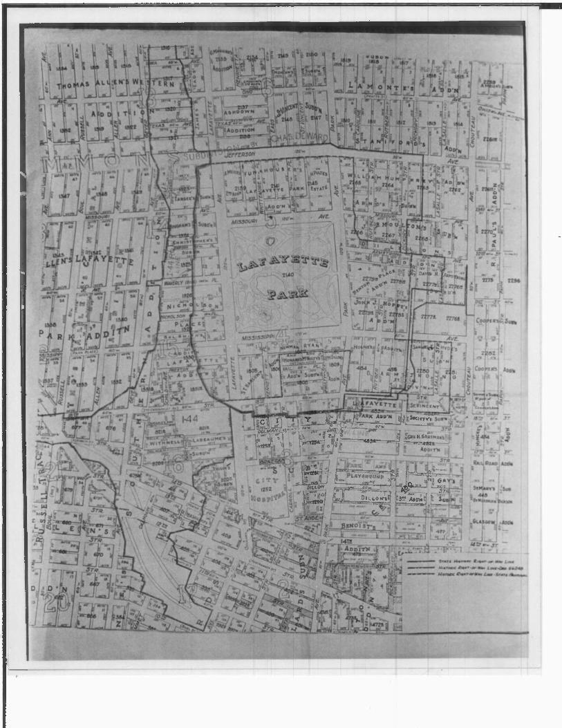
Lafayette Square is bounded on the west by the east line of Jefferson Avenue extending.from the north edge of the Interstate 44 right-of- way to the service alley Immediately north of Park Avenue. The south boundary of Lafayette Square is formed by the north border of the Interstate 44 right-of-way from Jefferson Avenue to the west line of South Eighteenth Street. The east boundary is formed by a line along the west side of South Eighteenth Street from the Interstate 44 right-of-way to the service alley immediately north of Kennett Place, thence west along that alley to the intersection of the service alley behind Mississippi Avenue, thence north to Park Avenue. The boundary then extends eastward along the north side of Park Avenue to South Eighteenth Street, thence north along the west line of South Eighteenth to the northwest corner of Hickory Street, thence east on the north line of Hickory Street to the east alley behind South Eighteenth Street, thence north on that alley to the inter-section of South Eighteenth Street. The north boundary of Lafayette Square is formed by the north alley of LaSalle Street from South Eighteenth Street to Mississippi' Avenue, thence south along the east line of Mississippi Avenue to the north alley- of Rutger Street. The north boundary con tinues westward from that point to the east alley of Benton Place, thence north to the south line of Hickory Street, and west to the west line of Armstrong and south to the south lire of Hickory Street. The north boundary thence continues west to the west alley of Arm strong Street and southward to a point corresponding to the eastward extension of the alley immediately north of Park Avenue, thence west ward along the Park Avenue alley to Jefferson Avenue. The boundaries of Lafayette Square have been drawn to include the neighborhood fronting Lafayette Park and to encompass nearby residential streets which exhibit an architectural similarity with the structures adjacent to the Park.
Two independent neighborhood boundary surveys of Lafayette Square were undertaken in 1969 and 1971, respectively, by the Landmarks Association of St. Louis (in cooperation with the St. Louis Chapter, American Institute of Architects), and the St. Louis City Plan Commission. The proposed'boundary limits were approximately coin cidental, however, the survey by the City Plan Commission included certain industrial structures on the eastern periphery of Lafayette Square which the Landmarks Association did not recognize to be of particular historic importance. Specifically, Vail Place and McNulty Street were discounted in the Landmarks Survey. Similarly, tne residential neighborhood in the 2200 and 2300 blocks of Hickory and Rutger streets (from Jefferson Avenue to Armstrong) has been included for redevelopment purposes in the City Plan Commission report, but the area was not sited for historic recognition because of a weaker visual continuity with the balance of the district.
Lafayette Square contains approximately 400 buildings constructed during various decades of the middle-to-late nineteenth century.
Form 10.300a
(July 1969)
UNITED STATES DEPARTMENT OF THE INTERIOR
NATIONAL PARK SERVICE
NATIONAL REGISTER OF HISTORIC PLACES
INVENTORY - NOMINATION FORM
(Continuation Sheet)
Missouri
St. Louis City
FOR NPS USE ONLY
ENTRY NUMBER
1 . #1 LAFAYETTE SQUARE
Residential uses account for 44% of the land use, and Lafayette Park occupies 30% of the total area. (St. Louis City Plan Commission, Lafayette Square Restoration Plan, 1971, 7). Commercial development is not excessive in Lafayette Square, and major non-residential blocks within the historic district are concentrated near the peri meter of the Square. Semi-public uses, primarily churches, account
for 5% of the total land occupancy. In the case of Lafayette Square, the presence of well-established churches has contributed to the stability of the neighborhood, since major denominations have con tinually maintained their buildings, providing an incentive for home-
owners to do likewise.
The City Plan Commission reported that 5,058 persons resided in Lafayette Square in 1960, and a 1970 census estimate indicated a pop
ulation of 3,255. Although the decline in the number of inhabitants has been significant, as of 1971, the City Plan Commission estimated that only 3.5% of structures were not restorable. (An additional
14.7% were rehabilitate only as part of an overall plan.) (St. Louis City Plan Commission, 1971, 11). Building conditions vary significantly within each neighborhood, but those buildings facing Lafayette Park
are generally less deteriorated, and conversely, the most extensively blighted residences occur at the perimeter of the historic district.
Lafayette Park is the locus of the Square. The existence of the Park stimulated development of the Lafayette Square neighborhood and con
tributed to the unique character of the district. The physical expanse of the Park, circumvented by the 120-foot-wide streets, pro duces an impression of spaciousness in the center of Lafayette Square.
Furthermore, the strong vertical polarity of many homes, a design compatable with premium park-frontage lot values, creates an aesthetic sensation unique in the City of St. Louis. Although the height of the buildings and size of the lots generally decreases with distence from the Park, many blocks removed from the public square express the vertical orientation on a more modest scale. (St. Louis City Plan Commission, 1971, 13). William T. Harris Row (1100-1124 South Eighteenth Street), and the 1800-1900 blocks of Hickory and LaSalle streets (between South Eighteenth Street and Mississippi Avenue) express particularly well a design relationship with the larger homes on the Park. However, the uniformity and compactness of the structures on the back streets conveys an impression of intimacy and contrasts sharply with the expansiveness of the park perimeter.
The City Plan Commission identified two independent commercial areas within Lafayette Square: 1) on Jefferson Avenue, at the western
.Form 10-300o
(July 1969)
UNITED STATES DEPARTMENT OF THE INTERIOR
NATIONAL PARK SERVICE
NATIONAL REGISTER OF HISTORIC PLACES
INVENTORY • NOMINATION FORM
(Continuation Sheet)
Missouri
St. Louis CitvFOR NPS USE ONLY
(Number ell entries)
7. #2 LAFAYETTE SQUARE
edge of the historic district, and 2) on Park Avenue, east of Mississippi Avenue. The former shopping district is not particularly associated with Lafayette Square, since it attracts a motoring clientele, primarily from Jefferson Avenue, a north-south artery which does not facilitate circulation through the Square. Furthermore, the width of Jefferson Avenue inhabits pedestrian intercourse especially to the west side of the street. In addition, most businesses are not of a "neighborhood character", but instead offer larger durable goods to a city-wide market. The other commercial zone within Lafayette Square is the traditional shopping district of the neighborhood. Sit uated on Park Avenue, it has offered essentially local necessities such as grocery stores and immediate consumer needs of the community. The City Plan Commission suggests strengthening Park Avenue as a shopping district for a restored Lafayette Square.
There are two basic designs predominant in the residential architecture of Lafayette Square: 1) the townhouses, concentrated in the north east portion of the district and adjacent to Lafayette Park, and 2) the later Romanesque-revival homes, usually situated upon corner lots. The townhouses, providing the vertical character to Lafayette Square, were the earliest homes on the Square and occur throughout the neigh borhood. These buildings are generally two- or three- story brick homes, faced with stone, and constructed on deep lots with narrow street frontages. Although many of these structures employ the mansard roof, flat and hipped roofs occur, and extensive variations in plan are to be found. The townhouses contain approximately nine to twelve rooms, and main access is provided through a double-door occupying an entire bay in the front facade. These homes are usually removed from the sidewalk by a small yard the size of which reflects the inflated property values at the time the homes were constructed. Most of the Lafayette Square townhouses were built between 1850 and 1875, and represent an adaptation of a "French Second Empire" style to an urban environment. The mansard roof, introduced to St. Louis in 1860, was especially popular and widely copied during the early Victorian era. (John Albury Bryan, former resident of Lafayette Square, interviewed by Stephen J. Raiche, staff, Missouri State Historical Survey and Planning Office, February 22, 1972).
The Romanesque-revival homes situated within Lafayette Square, are, with
out exception, of a more recent construction than the townhouses. These massive brick and stone buildings were erected between approximately
1885 and 1910 and greatly enhance the architectural diversity of
Lafayette Square.' Generally, the Romanesque-Revival homes are char
acterized by construction of brick or rock masonry with decorative
Fora 10-300a
(July 19S9)
UNITED STATES DEPARTMENT OF THE INTERIOR
NATIONAL PARK SERVICE
NATIONAL REGISTER OF HISTORIC PLACES
INVENTORY NOMINATION FORM
(Continuation Sheet)
Missouri
St. Louis City
FOR NPS USE ONLY
7. #3 LAFAYETTE SQUARE
embellishments in stone of contrasting type and color. The resulting sense of weight is reinforced by the use of massive corner towers, heavy stone lintels and belt courses, and in many cases, a brick or
stone porch supported by columns. The horizontal orientation of the Romanesque-revival .homes provides a marked contrast with the tall and narrow townhouses in Lafayette Square.
Outstanding examples of the townhouse occur throughout Lafayette Square, but of particular interest are the William T. Harris Row, a similar group at 1418-1424 Mississippi Avenue, and individual homes at 2107, 2115 Park,and 2018 Lafayette Avenue. William T. Harris Row, named for an influential Superintendent of Schools, a resident during the 1880's, is a uniform row of thirteen two-story, three-bay, stone faced townhouses, separated by small airshafts. With the exception of the three structures on the southern end, the houses in William T.
Harris row are identical, including uniform widow, door and chimney placement, and coincidental roofUnes and cornice. The compactness
of the row and similarity of the houses is especially noteworthy. A smaller cluster of four townhouses exists on Mississippi Avenue opposite the east side of the Park. This group is especially interesting since it includes significant variations of the vertical townhouse. Two companion structures are two-story homes with gabled mansard roofs adapted to provide a third floor. In addition, both front facades are
accentuated with a bay window on the level of the main living floor. Situated also within this group is a three-story, flat-roof townhouse, which, because of its elevation and the application of tall, rect
angular window and door openings, conveys an impression of extreme height and domination over the adjacent structures. A fourth building, a two-story townhouse, has a mansard roof sufficiently high to create only an attic or half-story. The unembellished front facade of this particualr building conveys simplicity and austerity in comparison to its companion buildings. In contrast to the homogeneity of William T. Harris Row, the diversity of the houses in this row contributes to the variety and complexity of Lafayette Square.
Two adaptations of the townhouse occur on the north side of Lafayette Park. These companion structures, at 2107 and 2115 Park Avenue, were designed about 1870 by George I. Barnett, a St. Louis architect. The residence at 2107 Park was built for John Jackson, President of the Pacific Railroad. Both homes are situated on relatively spacious lots. Each house utilizes a mansard roof to provide an additional living floor, and the western bay (one of three) of each building is pro jected in bay fashion on all floors. Perhaps the most conspicuous of the townhouses in Lafayette Square is situated at 2018 Lafayette
Form 10-300o
(July 1969)
UNITED STATES DEPARTMENT OF THE INTERIOR
NATIONAL PARK SERVICE
NATIONAL REGISTER OF HISTORIC PLACES
INVENTORY NOMINATION FORM
(Continuation Sheet)
Missouri
St. Louis CityFOR NPS USE ONLY
(Number all entries)
1. #4 LAFAYETTE SQUARE
Avenue. A massive, three-story structure, this home is expecially unique because of its height and treatment of window and door fenes- tration. The windows and recessed double-door are framed by decorative wooden molding and the use of a heavy cornice emphasizes the high roofline. Although located on a twenty-five foot frontage, the build ing is nearly seventy-five feet deep, and is one of the tallest houses in Lafayette Square. Other notable examples of the townhouse occur at 1550 and 1725 Mississippi, 2317 and 2043 Park Avenue, 1421 Missouri Avenue, 2321 Albion Place, and in a row, 1821-1900 Lafayette Avenue. An interesting townhouse variation employing a cut-stone facade occurs at 1800-02 Kennett Place, and an apartment-house adaptation, con structed as such, is situated at 1826-34 Lafayette.
Outstanding examples of the Romanesque-revival home in Lafayette Square include 2323 Lafayette and 2031 Park Avenue. The former, home of Dr. George Sieb, was designed by St. Louis architect Otto 0. Wilhelmi Constructed in 1900, this home resembles many of Wilhelmi's designs in Compton Heights, and was built on the site of a house destroyed by the tornado in 1896. The residence at 2031 Park is believed to have been designed by Theodore Link, the architect of St. Louis Union Station. This massive stone building was completed the day of the cyclone in 1896 and survived the onslaught of the storm. Unique to Lafayette Square by its application of twin flanking corner towers, the home is of typical Romanesque-revival residential construction in the use of a rounded-arch stone entranceway and cut-stone facade. The strong horizontal axis of Link's design also provides a contrast to the townhouse architecture on Lafayette Square. Other noteworthy variations of the Romanesque-revival style occur at 1605 and 1718 Missouri Avenue, 2138 Lafayette, 1520 Mississippi, 2315 Park Avenue, and 1843 Kennett Place.
Although it is possible to cite two predominant architectural modes in Lafayette Square, nevertheless, significant structures exist which cannot be grouped into one of the prevalent traditions. Most notable, the Chateauesque, or "German Baroque" home built for Mr. George C. Nulsen at 1631 Missouri Avenue has no counter part in Lafayette Square. Designed by the German architect, Frederick Raeder, the home is of Drick and stone construction, with a high hipped-roof rising to a flat ~op. The placement and design of the wall dormers particularly suggests a Baroque influence. (John Albury Bryan, Lafayette Square, '969, 19). Other unique buildings include a classic revival house at ^GOO-02 Rutger Street which displays perfect symmetry of plan, including ;he pedimented roofline and projected central bays typical of this style. This classical influence is noticable to a varying degree among
Frtrm 10-3000
(July 1969)
UNITED STATES DEPARTMENT OF THE INTERIOR
NATIONAL PARK SERVICE
NATIONAL REGISTER OF HISTORIC PLACES
INVENTORY - NOMINATION FORM
(Continuation Sheet)
Missouri
St. Louis CityFOR NFS USE ONLY
(Number all entries)
7. K LAFAYETTE SQUARE
ma.r/ homes in Rutger Street, especially in the 2000 block. In addition, an atypical row-house apartment dwelling stands at 1215-17-19 Armstrong Avenue. These buildtngs, quite similar to older and less opulent buildings in St. Louis nineteenth-century working-class districts, has no companion in Lafayette Square and could possibly re present a relic of an earlier period.
SIGNIFICANCE
ecfc One or More a« Appropriate)
Pre-Columbian I D 16th Century
15th Century O '7'h Century
D 18th Century
Q( 19th Century
D 20th Century
•n) _1850-1910_j AREAS OF SiGNiFiCANCE rCI>ec* One or M
Abof iginol
Q Prehistoric
Q Historic
Q Aflricultvre
JTJ Architecture
D Art
[~] Commerc*
Q Communicatioi
Q Conservation
D
aCI l-du
D ln».
D Lar,
A
a Lit. a MilD «"
r aa Approprlmtrr)
cape
hirectui
twre
D Politicol
n Religion/Phi.
losophy
0 Science
n Sculpture
1 i Social/Human
n Theater
D Tron.portatio!
}Q Urban Planning
Q Other fspeci/y;
Z
O
a:
i-
UJ
L-J
Lafayette Square, in St. Louis, Missouri, is significant as a mid- nineteenth century neighborhood of the affluent, and represents certain residential styles of architecture in vogue in St. Louis from the time of the Civil War to the end of the nineteenth-century. The establishement of large homes around the perimeter of Lafayette Park, furthermore, typified a desire of the wealthy to be removed from the urban milieu but to maintain proximity to the commercial district in an era of relatively poor transportation facilities. Prior to the development of an efficient streetcar system during the late-nineteenth century, it was fashionable to construct town- houses on park, peripheries or upon exclusive private "Places" near the downtown district. It is significant that Lafayette Square developed around the largest of St. Louis' City Parks (prior to Forest Park, opened in 1875), that the Square contained the first of the City's many "Places," and that so many of the original homes remain today in relatively stable condition. (John Albury Bryan, Lafayette Square, 1969, 3; St. Louis Daily Globe. November 6, 1887; Andrew Oackson Downing, "Out Country Villages" [(1850)], in Weimer, David R. City and Country in America. New York: Appleton-Century- Crofts, 1962, 162-169; Frederick Law Olmstead, "Public Parks and the Enlargement of Towns" [(1870)], in Weimer, 1962, 180-187).
Lafayette Park was the first public park in St. Louis. Established by statute in 1836, Lafayette Park consists of that portion of the old city commons retained in municipal ownership at the time of the subdivision of the public pastureland. During 1836, the City Council stipulated that "the Square formed and bounded by Lafayette, Park, Mississippi, arid Missouri Avenues shall be reserved as a public square 1,' and furthermore, the ordinance directed that the major throughways fronting the park be maintained at a width of not less than 120-feet, with other arteries to be not less than sixty-feet wide. (Ordinances of the City of St. Louis. #315, March 25, 1836). Therefore, as early as 1836, Lafayette Square was considered desirable for residential development since the area afforded residence on a wide street near a projected park, and the Square was sufficiently close to the commercial district of St. Louis.
Form 10-300 =
(July 1969)
UNITED STATES DEPARTMENT OF THE INTERIOR
NATIONAL PARK SERVICE
NATIONAL REGISTER OF HISTORIC PLACES
INVENTORY NOMINATION FORM
(Continuation Sheet)
Missouri
St. Louis CityFOR NPS USE ONLY
(Number ell entries)
8. #1 LAFAYETTE SQUARE
Although eligible for subdivision after 1836, there is little evidence
that construction of homes occurred near Lafayette Park until the 1850's, after several prominent St. Louisans had purchased tracts of land. Many speculators who had bought park frontage in the 1830's subsequently lost their holdings in the recession of 1837, and it was not until 1850 that title disputes involving these lands were re solved in the city courts. (John Albury Bryan, 1962, 4). Subdivision of Lafayette Square began following the passage of municipal ordinance in 1851 which established a Board of .Improvements for Lafayette Park and instructed the Mayor to grade and improve the streets surrounding the Square. (Ordinances of the City of St. Louis, 12741, November 20, 1851). That ordinance did not, however, appropriate city money to develop the Park, but instead specified that public expenditures would be withheld pending the donation of at least $5000 from neighbor hood property owners. By 1855, the Board of Improvements had received
subscriptions totalling $8,173.26 "to build a fence and plant trees." (Minute Book of the Board of Improvements for Lafayette Park, 1851- 1876, 6|.Although it is certain there were permanent residents on
Lafayette Square by 1851, it was not until 1856 that St. Louis news papers carried auction notices advertising Lafayette Park frontage. During that year, the Belt and Priest Real Estate Agency conducted the
"first public sale" of lands on the Park (Missouri Republican, June 4, 1856) and from that time property transfers occurred frequently on the
Square.
By 1858, the eastern side of Lafayette Park had especially begun to develop. Stephen D. Barlow, President of the St. Louis, Iron Mountain, and Southern Railroad, platted a subdivision along Kennett Place from Mississippi Avenue to Second Carondelet Avenue (South Eighteenth Street). Various other additions on the east side were subdivided before 1860. (John Albury Bryan, 1969, 5). Similarly, several lots on the south perimeter of Lafayette Square were platted in the late 1850's, and sold at auction during 1859. The auction notice, in the Missouri Republican, May 13, 1859, indicated the quality of residential development demanded by the property owners, since not only were forty-
foot lots mandatory, but each title deed was to encourage the erection of "dram shops, iron foundaries, soap, candle or vitriol manufactories,
hemp factories, livery stables, places of public entertainment, &c,
&c..." The construction of an affluent neighborhood on Lafayette Square certainly hastened development of the Park, for which a $2000 municipal appropriation was granted to the Board of Improvements during 1857, followed by a similar stipend in 1858. (Ordinances of the City of St. Louis, #3847, April 3, 1857; #4164, April 13. 1858. Minute Book of the Board of Improvements.. .7-8). During the late 1850's William Maurice purchased a lot on the north side of Lafayette Park and
Form 10-30QQ
(July 1969)
UNITED STATES DEPARTMENT OF THE INTERIOR
NATIONAL PARK SERVICE
NATIONAL REGISTER OF HISTORIC PLACES
INVENTORY NOMINATION FORM
(Continuation Sheet)
Missouri
St. Louis City
FOR NPS USE ONLY
ENTRY NUMBER
(Number all entries)
8. #2 LAFAYETTE SQUARE
commissioned his brother, John Maurice, architect, to design his home. John Maurice subsequently built the Lafayette Park Presbyterian Church, and several other residences, especially on Benton Place, Unfor tunately, little is known of John Maurice, although his domestic designs are adequately represented in Lafayette Square. (John Albury Bryan, former resident of Lafayette Square, interviewed by Stephen J. Raiche, staff, Missouri State Historical Survey and Planning Office, February 22, 1972).
By the time of the Civil War, Lafayette Square had become a flourishing residential neighborhood. The restrictions imposed by the original subdividers apparently had been respected, since by 1859, St. Louis newspapers claimed of Lafayette that "every dwelling...is a model of tasty architecture and every yard a charming grove." (St. Louis Daily Evening News, April 16, 1858). The Republican, furthermore, commented that "this great Square occupies a high and central position, is tastefully laid out and beautifully ornamented." The magnificence of Lafayette Square was also recognized by the Missouri General Assembly. In 1863, the Legislature defined the boundaries of Lafayette Park and granted the Board of Improvements authority of issue bonds in the name of the City of St. Louis for improvements in the Park. (Laws of Missouri, 1863, 467-469). As a result, Lafayette Park is believed to be the only park in Missouri to enjoy such protection.
The Civil War interrupted the development of Lafayette Square, but with the return of peace and the removal of martial law from St. Louis, residential construction continued primarily on side streets near the Square. Benton and Waverly Places were opened in 1867 and 1884 respectively, and many previously undeveloped lots on existing streets were improved during these years. Benton Place, located opposite the north gate of the Park, is the oldest private "Place" in St. Louis, and has remained within the jurisdiction of its residents to this day. Unlike Vandeventer, Portland, Westmoreland, and other late "Places" on St. Louis' west-end, Benton Place has continuously been administered as a private street (John Albury Bryan, 1969, 9). Stimulated by the development of the neighborhood, the Board of Improve ments for Lafayette Park issued municipal bonds in the amount of $30,000 in June, 1864, most of which were purchased by residents or other "friends of the park." (Minute Book of the Board of Improvements... 10). Similar improvement bonds were issued in 1868 for the construction of iron fences and gateways around the Park, and Mr. Stephen Barlow, the railroad magnate, donated 202 carloads of mineral blossem for the surfacing of park walkways. (Minute Book of the Board of Improve ments. ..13-15). In 1868, a statue of Thomas Hart Benton was unveiled
form 10-SOOo
(July 1969)
UNITED STATES DEPARTMENT OF THE INTERIOR
NATIONAL PARK SERVICE
NATIONAL REGISTER OF HISTORIC PL ACES
INVENTORY - NOMINATION FORM
(Continuation Sheet)
Missouri
St. Louis City
FOR NPS USE ONLY
(Number all entries)
8. #3 LAFAYETTE SQUARE
by the former Senator's daughter, Mrs. John C. Fremont, and during the following year a similar statue of George Washington was dedicated
in Lafayette Park. With the installation of iron fencing and a park police station, Lafayette Park was completely developed by 1870. (John Albury Bryan, 1969, 9-10. "Lafayette Park." St. Louis Illustrated,
1876, 63-66. Head, Historical and Interesting Places of St. Louis, 1909, 89-90. St. Louis Republican, May 28, 1868). One writer commented
that...
the beauty of the grounds, the elevation above the city, the character of the buildings, the beautiful shade trees, wide streets, and accessibility to the city by two lines of horse cars, the restrictions (by statute) upon the erection
of objectionable buildings or the carrying on of objection able businesses, all combined should make this quarter the most desirable in the city for residence. (St. Louis Daily
Democrat, June 27, 1870).
As late as 1884, Lafayette Square continued to be favorably compared to Boston Common as an area "encompassed by the most eminently respectable class of homes" (Harpers, Vol. 68, [(March, 1884)], 512), but there had appeared indications that the neighborhood was in
transition. Although the Pictorial Atlas of St. Louis, (Dry and Compton, 1876), shows the existence of many undeveloped lots in the Square, at least one influential homeowner, Stephen D. Barlow, a prime-
mover in the development of Lafayette Square, sold his property at the southeast corner of Mississippi Avenue and Kennett Place to escape the constant clamor of park visitors. By 1880, the City Limits has been extended to their present boundaries, thus facilitating the westward expansion of St. Louis and consequently augmenting traffic and congestion around Lafayette Square. Jefferson and Lafayette Avenues had especially become major trafficways. The construction of Forest Park in 1875 on St. Louis' west-end heralded the demise of
Lafayette Park as the City's principal recreation area and signalled the ascendency of fashionable neighborhoods west of Grand Avenue and north of Forest Park. Likewise, during the 1890's, the development
of Compton Heights, near Grand and Russell Avenues, provided a newer, more spacious alternative to Lafayette Square merely a few blocks southwest of the Park. In 1877, the same year Stephen Barlow moved
from Lafayette Square, the home of former Mayor James Thomas, 2029 Park Avenue, was converted to a private school, thus ending the exclusively residential quality of the Park periphery. (John Albury Bryan, 1969, 15). However, it was not until the devastating tornado of May, 1896, that Lafayette Square began to be recognized as a less fashionable area. The cyclone struck at the corner of Lafayette and
Fohn 10-300o
(July 1969)
UNITED STATES DEPARTMENT OF THE INTERIOR
NATIONAL PARK SERVICE
NATIONAL REGISTER OF HISTORIC PLACES
INVENTORY - NOMINATION FORM
(Continuation Sheet)
Missouri
St. Louis CityFOR NFS USE ONLY
I (Number all entries)
8. #4 LAFAYETTE SQUARE
Missouri Avenues and proceeded toward the Mississippi River. In its wake, the tornado destroyed many Lafayette Square homes, and ruined most of the facilities in the Park. (St. Louis Globe-Democrat, May 28, 29, 30, 1896). Although subsequently most of the homes in the
Square were rebuilt, many older families sold their property and moved to the west end. Real estate values in Lafayette Square never fully recovered after the 1896 tornado. Furthermore, by 1900, public
transportation had developed sufficiently to allow commuting to the central city from points several miles removed, thereby rendering obsolete the advantageous location of Lafayette Square. The ascendency
of Forest Park and the west end had caused the depreciation of the old, high-density neighborhood surrounding Lafayette Park, and the commercial aid industrial expansion of the city's core, especially along Jefferson, Hickory, and Mississippi Avenues, hastened the relative decline of property values.
The St. Louis Zoning Code of 1918 recognized the commercial nature of Lafayette Square by assigning non-residential uses to many blocks in Jefferson, Mississippi, and South Eighteenth streets. (Ordinances
of the City of St. Louis, #30199, July 15, 1918). The remainder of the Square was zoned for multi-family dwellings, including hospitals,
churches, and schools. Although the zoning ordinance, the first for the City of St. Louis served to check the expansion of businesses into Lafayette Square, a shoe factory had previously been established at Hickory and Mississippi Avenues, and many smaller firms were con ducting business, especially on Mississippi Avenue east of South Eighteenth Street. When the Missouri Supreme Court declared the St. Louis Zoning Ordinance unconstitutional in 1923, there was a rush of business interests to purchase the valuable land near Lafayette Square. By the time a new ordinance was enacted in 1926, several gasoline
stations, grocery stores, and small storefront enterprises had been opened in the neighborhood. Unfortunately, many homes in Lafayette Square have deteriorated to such a state that extensive rehabilitation
will be mandatory. But there are positive signs that Lafayette Square will be renovated. The St. Louis City Plan Commission issued a comprehensive Restoration Plan for Lafayette Square in 1971, and several homes have been purchased by younger families intending to re furbish them. The "corner-stone" of the neighborhood, Lafayette Park, is still in place, and the Square is within walking-distance of down town St. Louis. Schools and shopping facilities are accessible, and will become more available as the quality of the neighborhood is im proved. The restoration of historic Lafayette Square will prove that central-city blight can be reversed, and, through proper planning, this urban neighborhood can once again become attractive and vital.
Form 10-300o
(July 1969)
UNITED STATES DEPARTMENT OF THE INTERIOR
NATIONAL PARK SERVICE
NATIONAL REGISTER OF HISTORIC PLACES
INVENTORY - NOMINATION FORM
(Continuation Sheet)
Missouri
St. Louis City
FOR NPS USE ONLY
NTRY NUMBER
fJVuoib«r till onrrJeaj
LAFAYETTE SQUARE
The survey of Missouri's sites of historical and architectural significance is based on the selection of sites as they relate to theme studies in Missouri history as outlined in Missouri's "Comprehensive Statewide Historic Preservation Plan." Lafayette Square is, therefore, being nominated to the National Register of Historic Places because (1) it is a mid-nineteenth century neighborhood of the urban affluent, and (2) the neighborhood contains certain significant residential architectural styles in vogue in St. Louis from the Civil War to the end of the nineteenth-century, including works by George I. Barnett and Theodore Link.
9. MAJOR BIBLIOGRAPHICAL REFERENCES : f ' • '., .< : i. ; v : 'A< :'.'. : '•'•.; i :''•= ' : :;::: ••.:": '•'•,..'.' :
1 . "An Act for the Improvement of I 1863, Jefferson City, Missouri:467-474.
2. , Art Work of St. Loui
afayette Park," Laws of Missouri -W. A. Curry, Public Printer, 1864,
s, Part VII. St. Louis: W. H. ParrishPublishing Co., 1895.
3. "The Benton Statue," The Missouri Republican (St. Louis), May 28, 1868.
10. GEOGRAPHICAL DATA • - :— p— ———— • ————————— — —— • —————————— • — • —— • — [ -
^ 1
————— 1 —————————————— 1 —————————————— 'CORNER LATITUDE LONGITUDE
Degrees Minutes Seconds Degrees Minutes Seconds
NW 38° 37. 17- 90o 13- 08- NE 38° 37- 10- 90 » 12. 34-
SE 38° 36. 43- 90 - 12' 42- sw 38" 36- 50- 90° 13- 17-
'••:;.£^'-. •".".•• .-... ' • ••.•• • : : -.. '..:.• - .:. ' " •'.:,..
LATITUDE LONGI TUDE
Degrees Minutes Seconds Degrees Minutes Seconds
O « « o • »
.PPROX.M.TE ACREAGE OP NOM,NAT ED PROPERTY: 129f48
STATE: ' CODE
STATE: CODE
STATE: CODE
STATE: CODE
COUNTY CODE
COUNTY: CODE
COUNTY: CODE
COUNTY: CODE
•!!-• FORM PREPARED BY- ::>-- :: ' :- : ,.- • ' :':'' ::;:: :..' : '•.^•- • '- -,:•' - lj / • •->':^^^1^:^.:^N^^^MS^^^;!^V:" : 0 :1 T>-^ ^ "$ ••'"••'•
NAME AND T( TLE:
Stephen J, Raiche, Chief Research HistorianOR G AN,ZAT,ON M i ssouri- state Park Board
State Historical Survey--and Planning Office June 12, 1972STREET AND NUMBER;
1204 Jefferson Building, Box 176CITY OR TOWN;
Jefferson Citv12. '..STATE LIAISON OFFICER CERTIf ICATIOW':;-. ". ^W\<
As the designated State Liaison Officer for the Na
tional Historic Preservation Act of 1966 (Public Law
89-665), I hereby nominate this property for inclusion
evaluated according to the criteria and procedures set
forth by the National Park Service. The recommended
level of significance of this nomination is:
National £j State Q .Local Q
1
Name
Joseph Jaeger, Jr.
rule Director, State Park BoardState Liaison Officer
Date
STATE CODE
Missouri fiSim 29-:!:::;:: NATIONAL REGISTER 1 VERIFICATION
I hereby certify that this property is included in the
National Register.
Chief, Office of Archeology and Historic Preservation
Date
ATTEST:
Keeper of The National Register
Date
Form 10.300=
(July 1969)
UNITED STATES DEPARTMENT OF THE INTERIOR
NATIONAL PARK SERVICE
NATIONAL REGISTER OF HISTORIC PLACES
INVENTORY - NOMINATION FORM
(Continuation Sheet)
Missouri
St..I niiis CityFOR NFS USE ONLY
(Number all entrlee)
9. #1
LAFAYETTE SQUARE
4. Bryan, John Albury, Lafayette Square, St. Louis: Landmarks Association of St. Louis, Incorporated. 1969.
5. Bryan, John Albury, former resident of Lafayette Square, inter viewed by Stephen J. Raiche, staff member, Missouri State Historical Survey and Planning Office, February 22, 1972. On file at Missouri State Park Board, P.O. Box 176, 1204 Jefferson Building, Jefferson City, Missouri 65101.
6. ______, Commercial and Architectural St. Louis. St. Louis: G.W. Orear, 1888, 162.
7. Compton, Rich J., and Dry, Camille, Pictorial St. Louis...A Topo graphical Survey. St. Louis: Compton and Company, 1876.
8. Dacus, J.D. and Buel , James W., A Tour of St. Louis, or the Inside Life of a Great City. St. Louis: Western Publishing Company, 1875.
9. Daily Missouri Republican (St. Louis), May 13, 1859.
10.Head, Idress, Historical and Interesting Places of St. Louis.
St. Louis: The Missouri Historical Society, 1909, 89-90.'
11.Hopkins, G.M. Atlas of the City of St. Louis. St. Louis: G.M. Hopkins, 1883.
12."Inauguration of the Music Pavilion in Lafayette Park", The St.Louis Republican, July 26, 28, 1876.
13."Lafayette Park", Central Magazine, (May, 1873), 275.
14."Lafayette Park", Harpers, Vol. 68, (March, 1864), 512.
15."Lafayette Park", The Missouri Republican, (St. Louis), February 13, 1870.
16. _, "Lafayette Park", St. Louis Illustrated, St. Louis:Will Conk!in Publisher, 1876, 63-66.
17.Minute Book of the Board of Improvements of Lafayette Park, 1851- 1876. Manuscript in Reference Section, St. Louis Public Library, St. Louis, Missouri.
Form 10.3000 UNITED STATES DEPARTMENT OF THE INTERIOR
(July 1969) NATIONAL PARK SERVICE
NATIONAL REGISTER OF HISTORIC PLACES
INVENTORY - NOMINATION FORM_______FOR NPS USE ONLY
(Continuation Sheet)
(Number all entries)
9. #2
18. Missouri Republican (St. Louis), June 4, 1856.
19. "An Ordinance Concerning the Common", Ordinances of the City of St. Louis. #315, (March 25, 1835).
20. "An Ordinance Dedicating Lafayette Square", Ordinances of the City
of St. Louis #2741,'(November 20, 1851.).
21. Ordinances of the City of St. Louis, #30199, (July 15, 1918).
22. ______, Photographic Views of the Great Cyclone at St. Louis, St. Louis: I. Haas Publishing and Engraving Company, 1896.
23. "Points about Places", St. Louis Daily Globe-Democrat, November 6, 1887.
24. Rader, Perry S., Reporter, Reports of Cases Determined by the Supreme Court of the State of Missouri. Vol. 301. Columbia, Mo.: E. W. Stephens Publishing Co., 1924, 715-718.
25. Reavis, L. U., St. Louis: The Future Great City of the World. St. Louis: C. R. Barns, 1897, 494-495.
26. "Ruin of Lafayette Park", St. Louis Daily Globe-Democrat, May 28, 29, 30, 1896.
27. St. Louis City Plan Commission, Lafayette Square Restoration Plan. St. Louis: 1971.
28. "St. Louis Piaster", Harper's Weekly, Vol. 40, (June 13, 1896), 568-570, 585-586.
29. St. Louis Post-Dispatch, July 2, 1971.
30. VanRavenswaay, Charles, "Lafayette Park", Bulletin of the Missouri Historical Society, Vol. XIV, (April, 1958), 369-377.
'JNITED STAGES DEPARTMENT OF THE INTERIOR
NATIONAL PARK SERVICE Missouri
NATIONAL REGISTER OF HISTORIC PLACES COUNTV
_____St. Louis City PROPERTY PHOTOGRAPH FORM FOR NFS USE ONLY
(Type all entries - attach to or enclose with photograph)
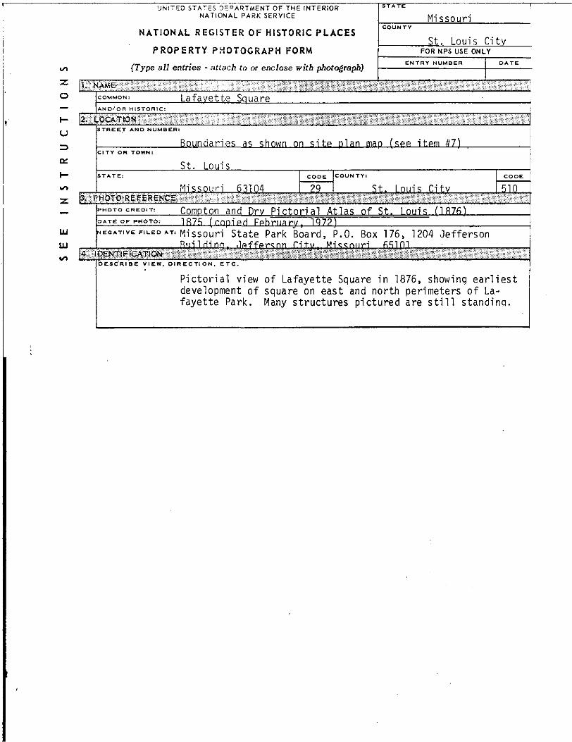
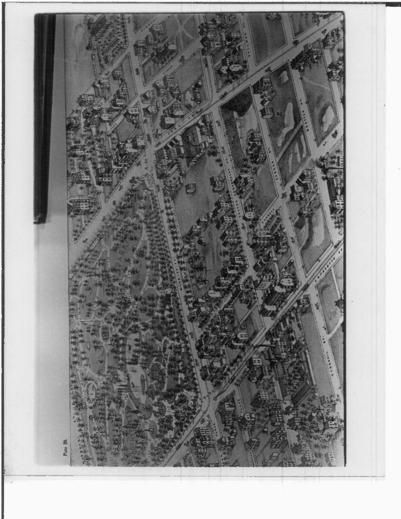
o COMMON, _____Lafayette Square________________________
STOR1C:__________________________________________________________________________
_j __________Boundaries as shown on site plan mag (see item #7}CITY OR TOWN:
** __________St. Louis^~ STATE: CODE COL1NTY! CODE
Missouri 6.1104____ 29 _____St. Louis City______ 510
JfwgtMsRlIlSiSSlilii________________________________
Compton and Dry Pictorial Atlas of St.. Louis (1876) 1875 (copied Fphruary, 1Q7?) _____
ai NEGATIVE FILED »T, mi ssour -j state Park Board, P.O. Box 176, 1204 Jefferson
LU .__ ,_,
| eigisPiaiQE_____________________________________
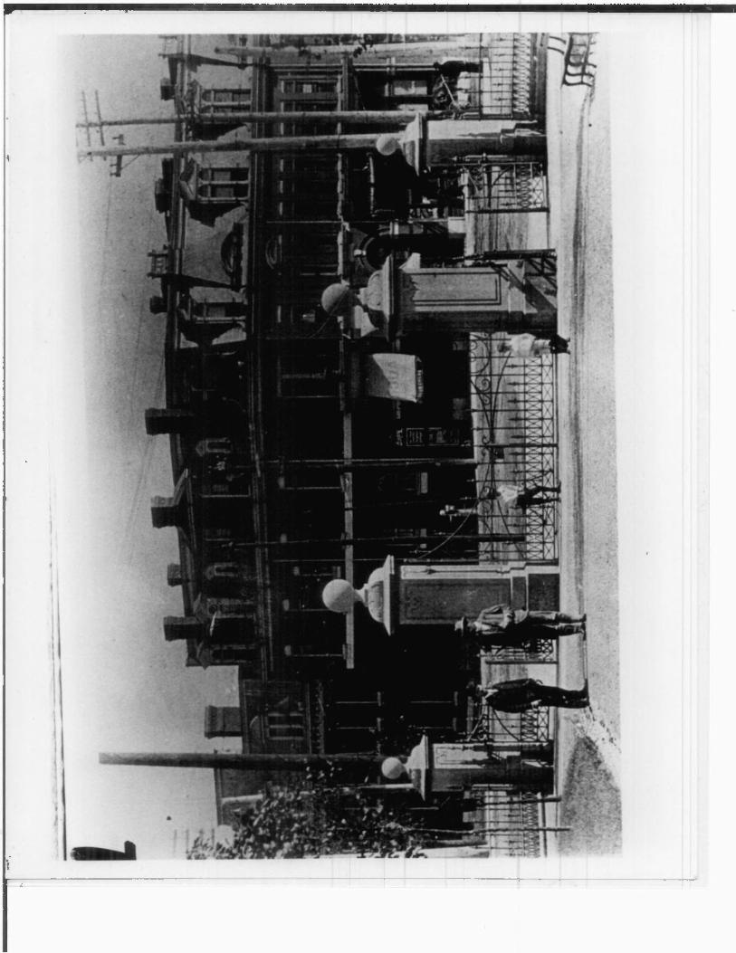
Pictorial view of Lafayette Square in 1876, showing earliest
development of square on east and north perimeters of La
fayette Park. Many structures pictured are still standing.
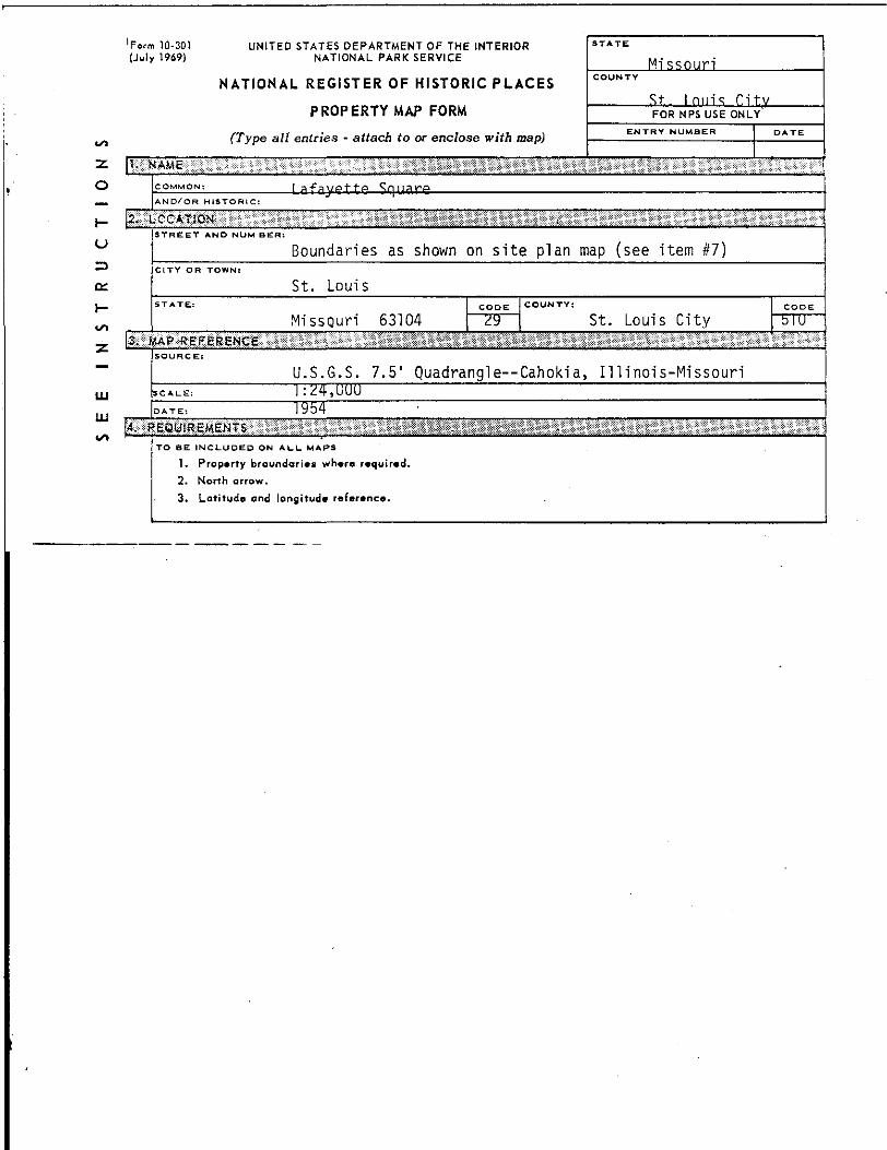
'Form 10-301
(July 1969)
UNITED STATES DEPARTMENT OF THE INTERIOR
NATIONAL PARK SERVICE
NATIONAL REGISTER OF HISTORIC PLACES
PROPERTY MAP FORM
(Type all entries - attach to or enclose with map)
Missouri
St.. I mil's C1 tvFOR N PS USE ONLY
ENTRY NUMBER
2
oAND/OR HISTORIC:
STREET AND MUM BER
Boundaries as shown on site plan map (see item #7)CITY OR TOWN
St. Louis
Missouri 63104 St. Louis City
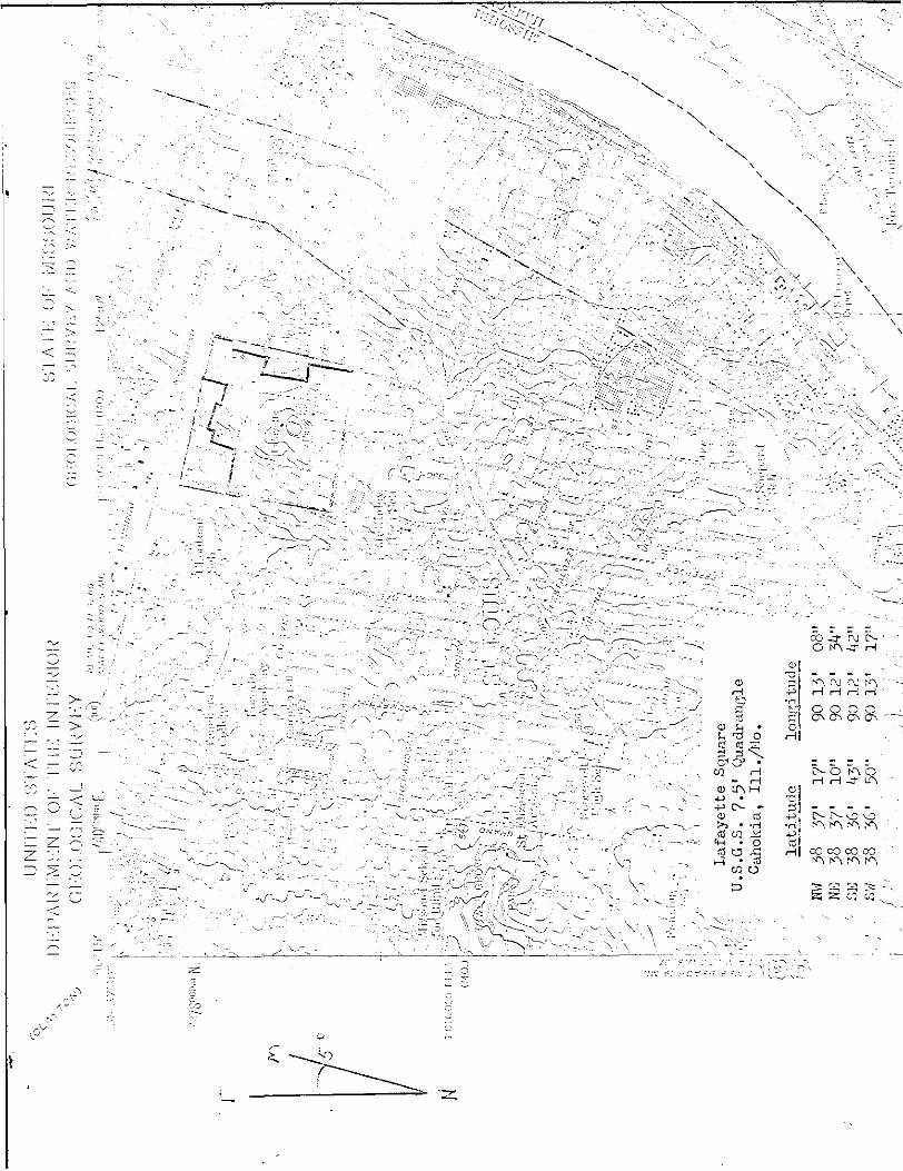
U.S.G.S. 7.5' Quadrangle—Cahokia, Illinois-Missouri
1. Property broundaries where required.
2. North arrow.
3. Latitude and longitude reference.
\,U
NIT
I-0
ST
AT
ICS
DK
PA
UT
MK
NT
O
K
II !!•:
IN
I'K
K'IO
U'
Ol.-O
l.O
GIO
AL
S
UK
VK
Y
latitude
' .. «W
38
57'
i?"
90 15'
08"
NE
38
57'
10"
90 12
' 54"
'• su
38
56'
.45"
90 12
' 42"
' sw
38
56'
50"
90 13
' 17"
' • /
•"
•• ,;
• '••
.'i •/•
'.•
•:
\m M ̂ ilJ^J&^^^-^i:^,
F^r'^w-^^ji fcsfEUZ. J !: |!«»«f.1j; "" "Hi i="=«
*£»H iLjiiiiy ta-um'j E si
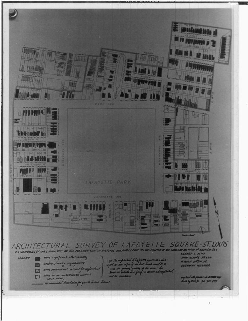
ARCHITECTURAL SURVEY OF LAFAYETTE SQUARE-ST. LOUIS
UNiTcO STATES DEPARTMENT OF THE INTERIOR
NATIONAL PARK SERVICE
NATIONAL REGISTER OF HISTORIC PLACES
PROPERTY PHOTOGRAPH FORM
(Type all entries - attach to or enclose with photograph)
Mi ssnuri
St. Louis CitvFOR NFS USE ONLY
COMMON. Lafavette Square
I-
(J
o:
H
LU
UJ
Boundaries as shown on site plan mao fsee item #7)
St. Louis
Missouri 63104 29
CODE COUNTY:
St. Louis Citv 510
$. j. Raiche, State Historical Survey and Plannina OfficeFeb r ua rv . 1 9 72
Riqlrlinq, .Ipffersgn City, Mipsnufj 65101i!:gEMBfjg^nq!i;:;
Park Avenue, opposite north side of Lafayette Park. View shows various structures including adaptations of the prevalent townhouse
and Romanesque styles. Southeast facing northwest.
u
=>
t-
*s*
Z
UNITED STATES DEPARTMENT OF THE INTERIOR
NATIONAL PARK SERVICE
NATIONAL REGISTER OF HISTORIC PLACES
PROPERTY PHOTOGRAPH FORM
(Type all entries - attach to or enclose with photograph)
|?«
(«
COMMON, lafayette SquareAND/OR HISTORIC:
STREET AND NUMBER:
Rnnndarips a? shnwn nn sitp planCITY OR TOWN:
<;t 1 nin<;STATE: CODE COUNTY:
MicQnnri fi^lQ4 ?°l
«ffla^Bffii^^(^^^*S^^^i«^»«^P«^i^^^>!^W^m!:>:«^.i'.'»-.--=:- 1,.,'~,>-.--^ ! :', ...•-. .
STATE
MissouriCOUNTY
St.. LnuisFOR NPS USE ONLY
ENTRY NUMBER DATE
SHfSlil^W^KS'^&sSSWS'!'
man (SPP itpm #71
CODE
S.t-. Imps Titv 51Q
PHOTO CREDIT: s. J. Raiche, State Historical Survey and Plannina OfficeDATE OF PHOTO. February, 1972
NECAT.VE FILED AT: Missouri State Park Board, P.O. Box 176, 1204 Jefferson Rililrling, .Ipffprsqr) Citv, Mi^nurj 65101
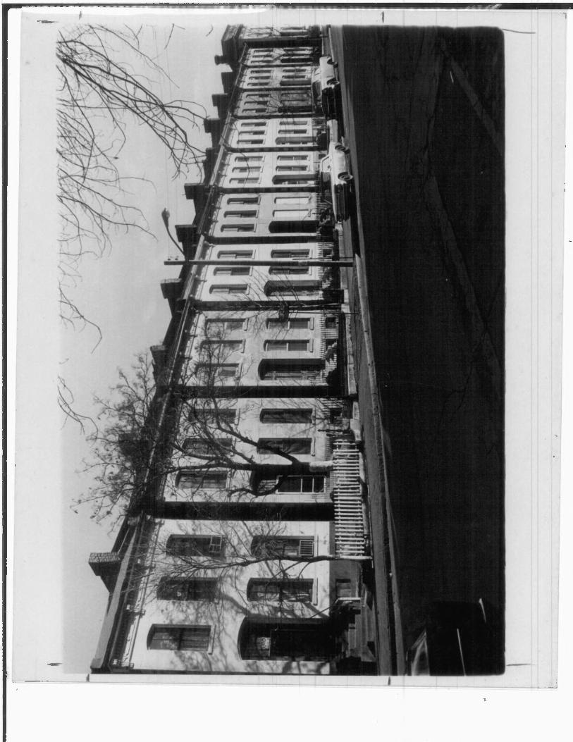
Whittemore Place: view from Missouri to Jefferson Avenue, showing street facades and illustrating various applications of the verti cal townhouse. East facing west.
NATIONAL PARK SERVICE
NATIONAL REGISTER OF HISTORIC PLACES
PROPERTY PHOTOGRAPH FORM
(Type all entries - attach to or enclose with photograph)
Missouri
St. Louis CityFOR NPS USE ONLY
Lafayette Square
toaglj>H:i
Boundaries as shown on site plan mao (see item #7)
K
t-
UJ
111
CITY OR TOW
St. Louis
Missouri 63104
CODE COUNTYl
29 St. Louis City 510
PHOTOCREOIT: $. J.-Raiche. State Historical Survey and Planninq OfficeFebruary, 1972
Missouri State Pa rk Board, P.O. Box 176, 1204 Jefferson Rip'lriipq ,1pffpr<inn Hif/ Mi^<;oi|ri BJjlOl
i BgnmiBfflsfi
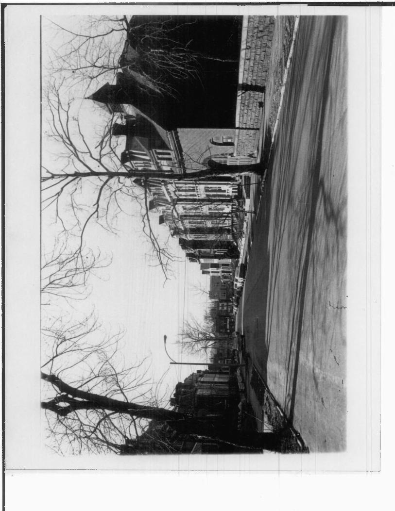
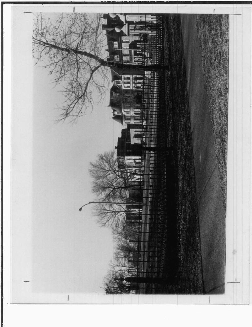
Row of townhouses on Mississippi Avenue, facing Lafayette Park. Homes in this row demonstrate significant variations in the vertical townhouse form. Northeast facing southwest.
UNITED STATES DEPARTMENT OF THE INTERIOR
NATIONAL PARK SERVICE
NATIONAL REGISTER OF HISTORIC PLACES
PROPERTY PHOTOGRAPH FORM
(Type all entries ~ attach to or enclose with photograph)
2
O
Missouri
St. Louis City
FOR NPS USE ONLY
Lafavette Square/OR HISTORIC:
RnnndariPS as shnwn nn sitp plan map (SPP itpm #7}CITY OR TOWN
It 1 nuis
St.. r.itv sin
HOTO CREDIT, <; _ ,] R a i rhp, St.atp HistnHral ^nrvpy and Planninq OffirpDATE OF PHOTO, Fohfi^r 1 Q 7?
1U
in
Missouri State Park Board, P.O. Box 176, 1204 Jefferson Building. ^Jefferson City. Missouri 65101____________
^ {ililgEgapiipfflcfgi
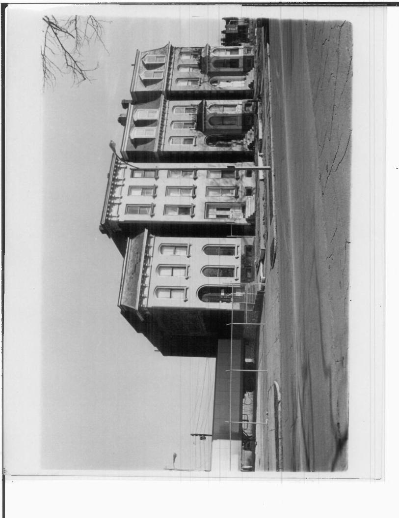
William T. Harris Row, South 18th Street, near north-east boundary of Lafayette Square. Row demonstrates a high degree of design con tinuity and is an adaptation of the townhouse prevalent on the
perimeter of Lafayette Park, northwest facing southeast.
2
O
I-
o
=3
o:
UNITED STATES DEPARTMENT OF THE INTERIOR
NATIONAL PARK SERVICE
NATIONAL REGISTER OF HISTORIC PLACES
PROPERTY PHOTOGRAPH FORM
(Type all entries - attach to or enclose with photograph)
\- .* :;'|
IMI
t»
fit
COMMON: Lafavette Square
STATE
MissouriCOUNTY
St. Louis CityFOR NPS USE ONLY
ENTRY NUMBER DATE
"" il"-"""-'" i -" 1 "" "•""""": ""'"" li "" 1 "-
AND/OR HISTORIC:
Rnundaries as shown nn site planCITY OR TOWN:
.St. Innis
Missm;ri fj31Q4 ?<?
map (see item #7)
CODE
St. Loyis Citv 510
PHOTO CREDIT: <; ,1 _ R 3 i rhe t State Historical Survev and Planning OfficeDATE OF PHOTO: FphrlMVy, 1Q7?
< "»T,VEF,'- E OAT: Missouri State Park Board, P.O. Box 176, 1204 Jeffersonpi|j]rHnn .Ip-ffpy^Qp P-f ty Mi^cnjiyf f)Rim
ssftHSiSHQlfllllliiSiBSIfSHiilHili^^
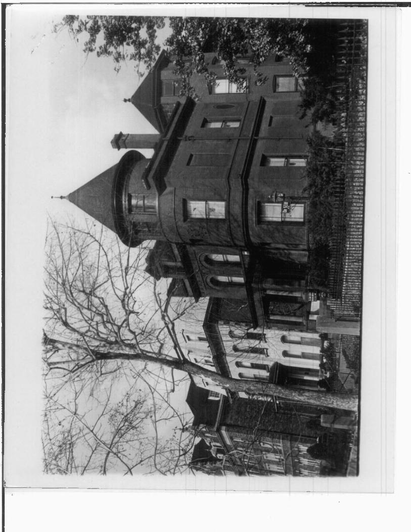
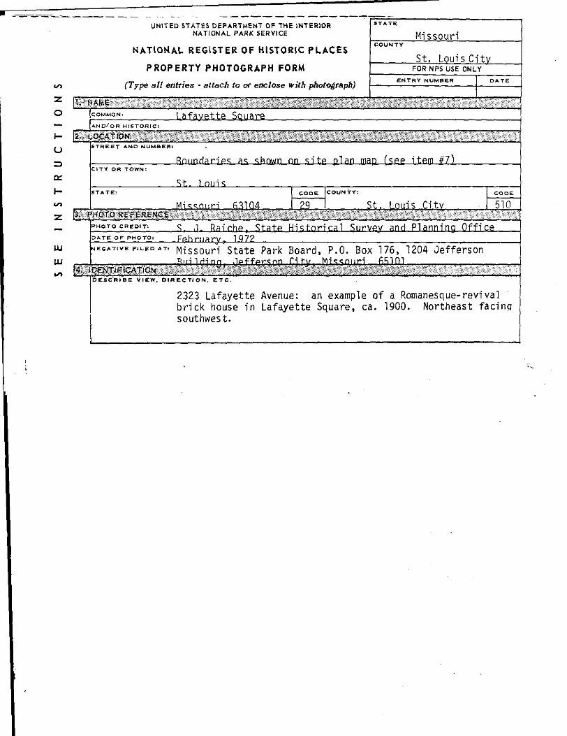
2323 Lafayette Avenue: an example of a Romanesque- revival brick house in Lafayette Square, ca. 1900. Northeast facinq southwest.