Embed Size (px)
Citation preview
Land Cover – Land Use
Methods Problems Perspectives
Chris Schmullius, FSU Jena
Def
initi
on
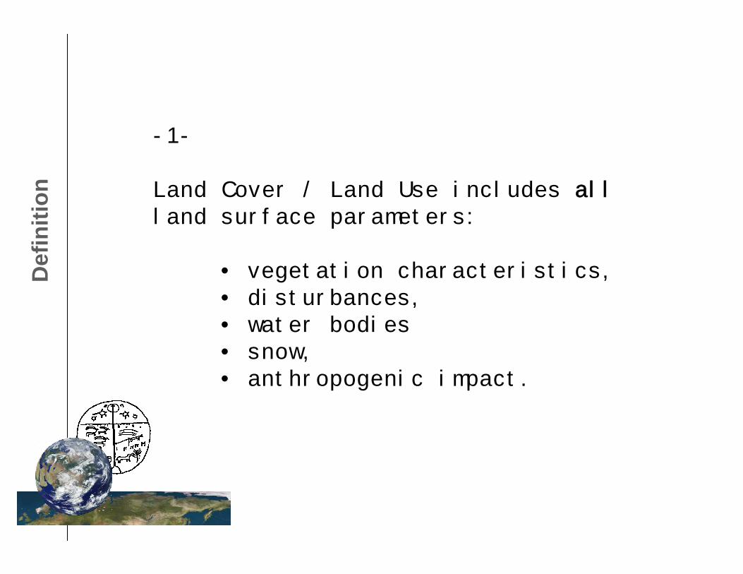
-1-
Land Cover / Land Use includes allland surface parameters:
• vegetation characteristics,• disturbances,• water bodies• snow,• anthropogenic impact.
Use
rs-2-
Who is the user?
- Carbon Community: GCMs, DGVMs, flux towers, Kyoto implementation,…
- Water Community: water re-charge, run-off, permafrost,…
- Forest Community: FRA, state inventories, logging industry, NGOs,…
- Human Dimension: infrastructure, env.protection, exploration,…
Met
hods
-3-
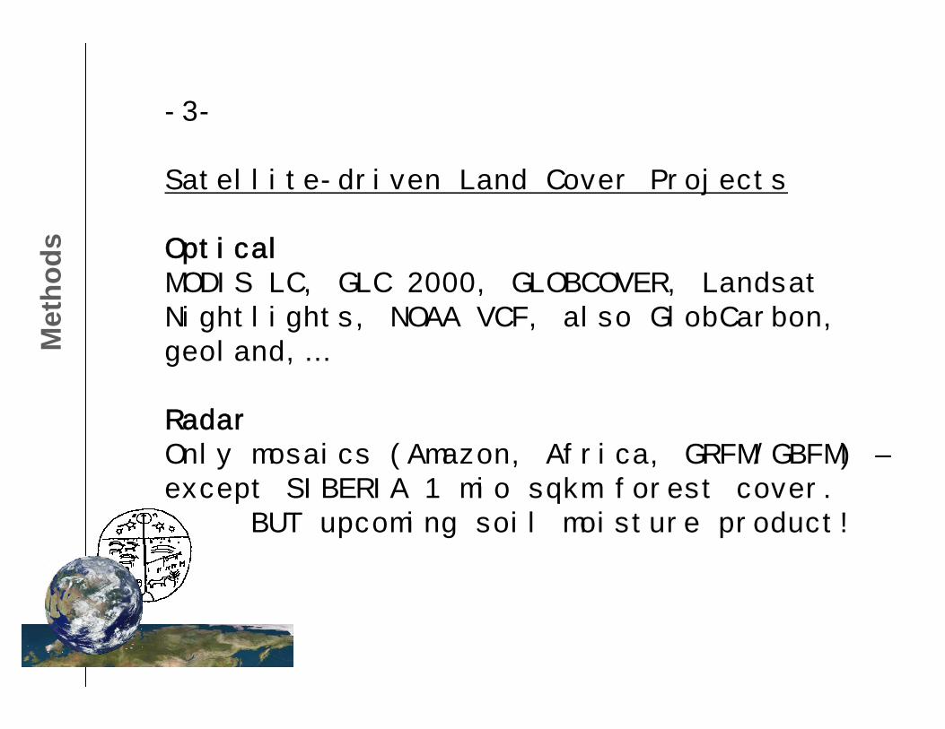
Satellite-driven Land Cover Projects
OpticalMODIS LC, GLC 2000, GLOBCOVER, Landsat Nightlights, NOAA VCF, also GlobCarbon, geoland,…
RadarOnly mosaics (Amazon, Africa, GRFM/GBFM) –except SIBERIA 1 mio sqkm forest cover.
BUT upcoming soil moisture product!
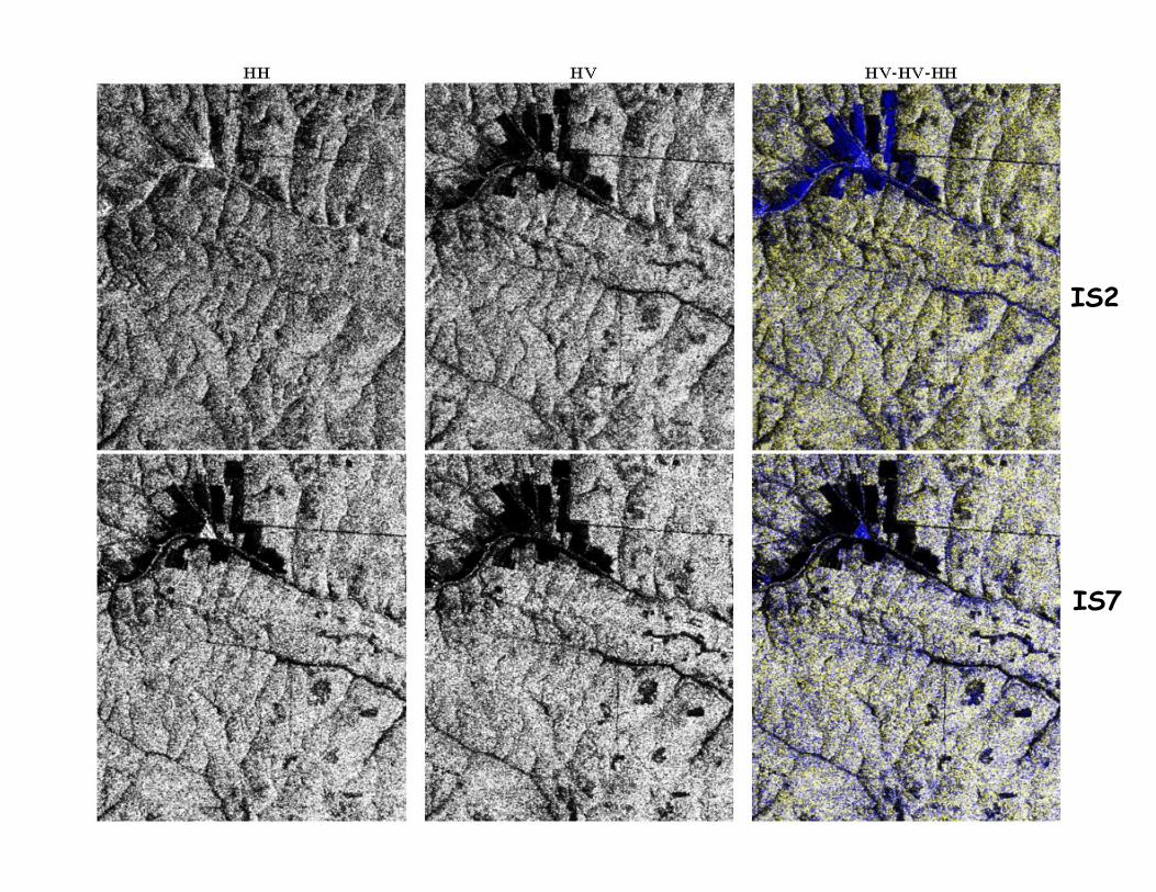
IS2
IS7
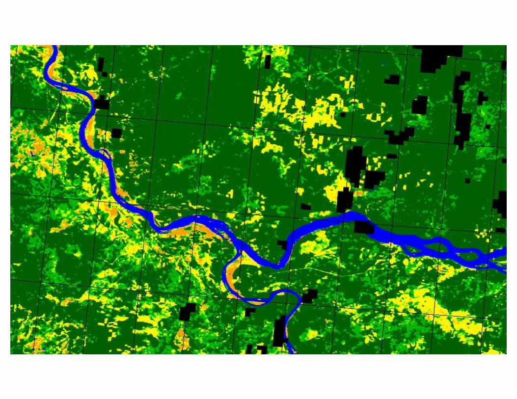
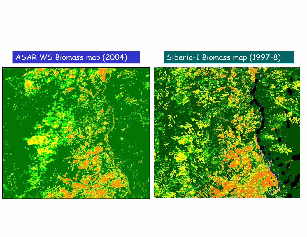
ASAR WS Biomass map (2004) Siberia-1 Biomass map (1997-8)

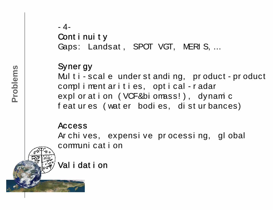
Prob
lem
s-4-ContinuityGaps: Landsat, SPOT VGT, MERIS,…
SynergyMulti-scale understanding, product-product complimentarities, optical-radar exploration (VCF&biomass!), dynamic features (water bodies, disturbances)
AccessArchives, expensive processing, global communication
Validation
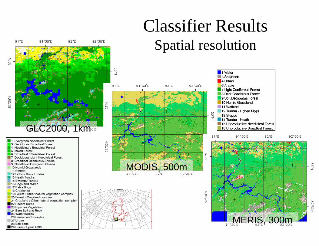
Classifier ResultsSpatial resolution
MODIS, 500m
MERIS, 300m
GLC2000, 1km
Pers
pect
ives
-5-
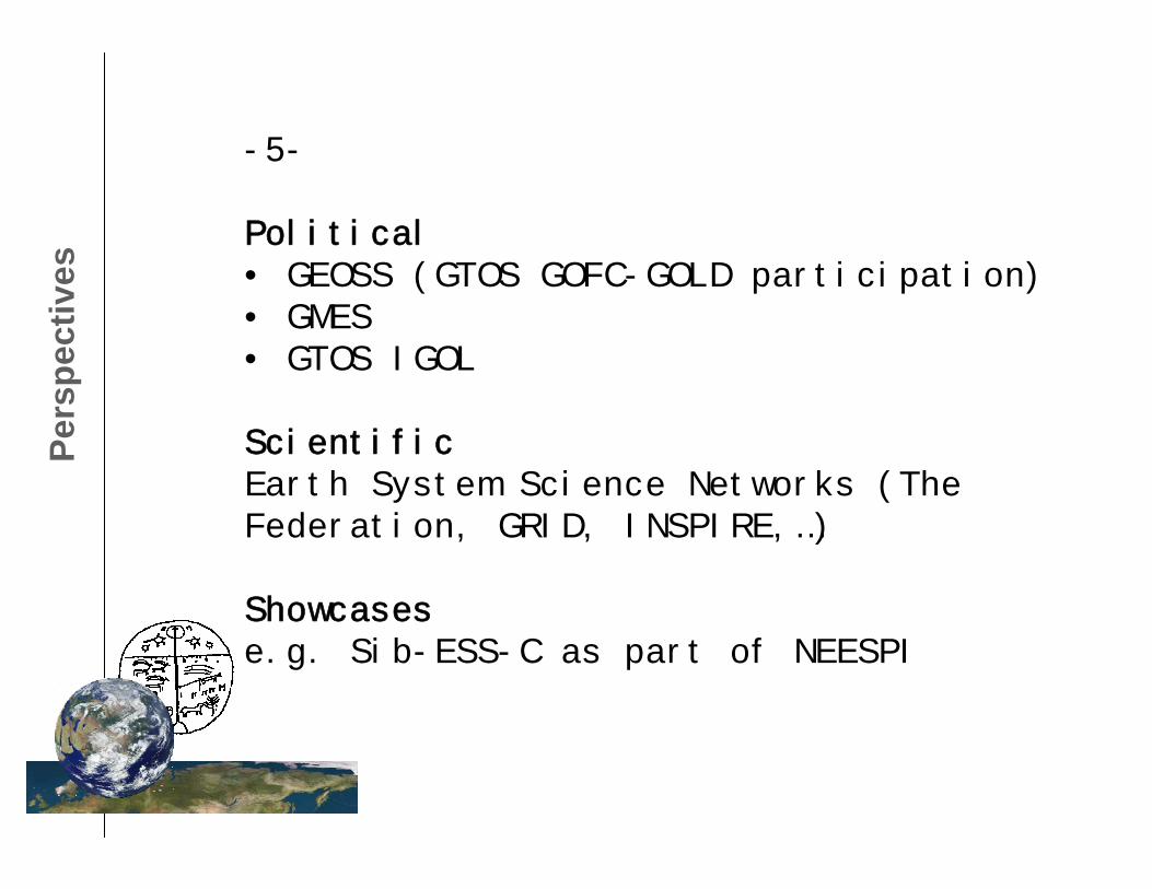
Political• GEOSS (GTOS GOFC-GOLD participation)• GMES• GTOS IGOL
ScientificEarth System Science Networks (The Federation, GRID, INSPIRE,…)
Showcasese.g. Sib-ESS-C as part of NEESPI
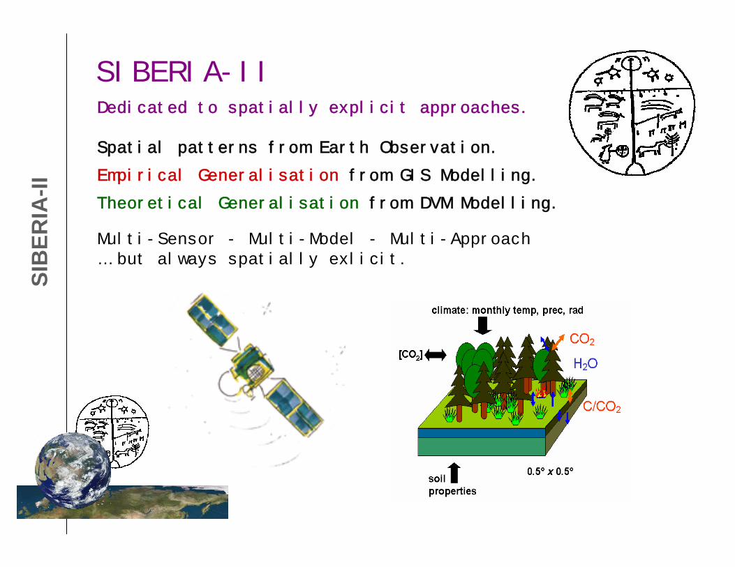
SIB
ERIA
-IISIBERIA-IIDedicated to spatially explicit approaches.
Spatial patterns from Earth Observation.
Empirical Generalisation from GIS Modelling.
Multi-Sensor - Multi-Model - Multi-Approach… but always spatially exlicit.
Theoretical Generalisation from DVM Modelling.
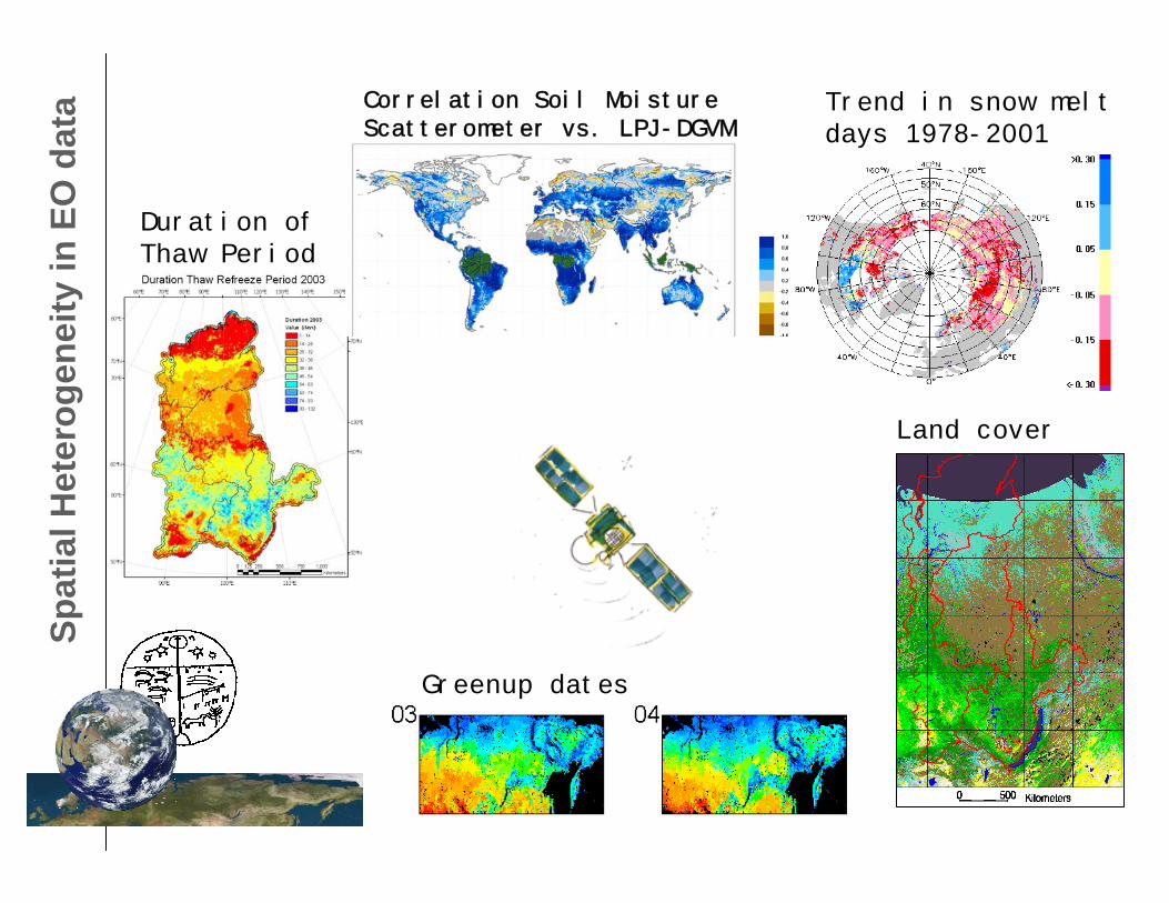
Spat
ial H
eter
ogen
eity
in E
O d
ata Trend in snow melt
days 1978-2001
Duration ofThaw Period
Greenup dates
Land cover
Correlation Soil MoistureScatterometer vs. LPJ-DGVM
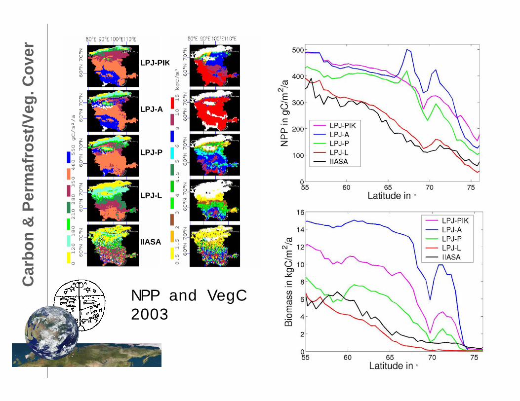
Car
bon
& P
erm
afro
st/V
eg. C
over
LPJ-PIK
LPJ-A
LPJ-P
LPJ-L
IIASA
NPP and VegC 2003
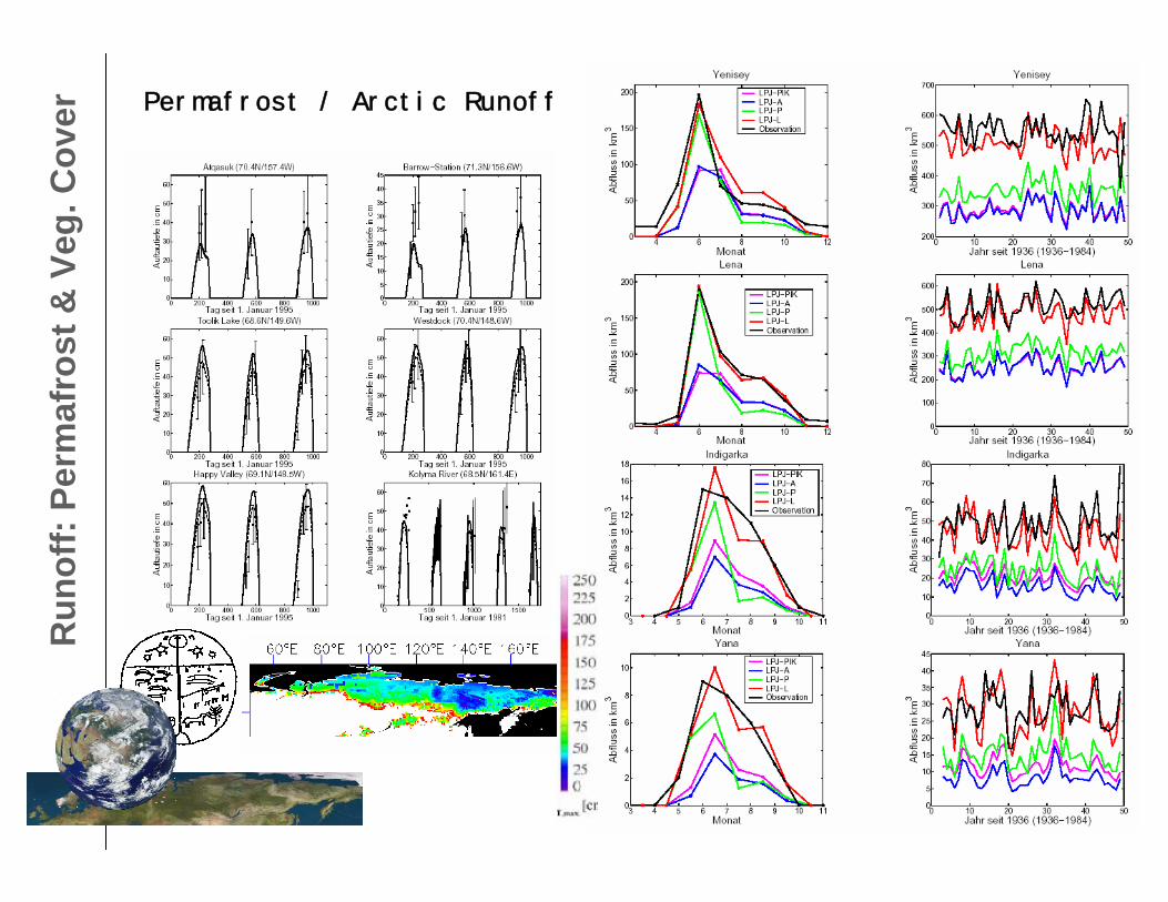
Run
off:
Perm
afro
st &
Veg.
Cov
er
Permafrost / Arctic Runoff
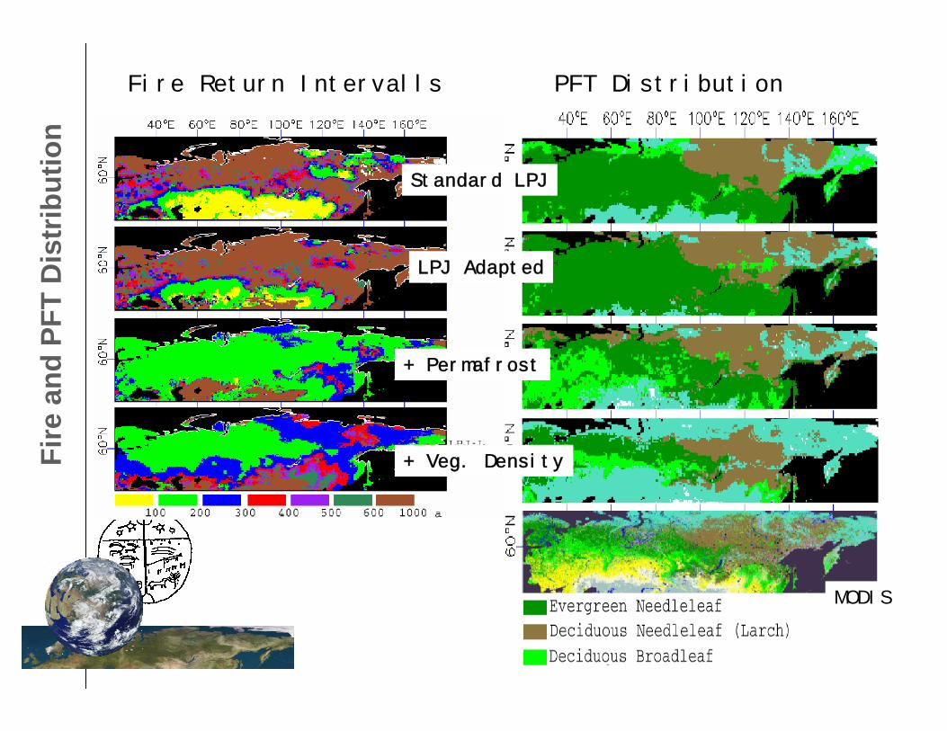
Fire
and
PFT
Dis
trib
utio
nFire Return Intervalls PFT Distribution
MODIS
Standard LPJ
LPJ Adapted
+ Permafrost
+ Veg. Density
SIBERIA II „SIBERIA II „TheThe last last yearyear...“, UWS: ...“, UWS: GregynogGregynog, 22, 22--24 April 200424 April 2004
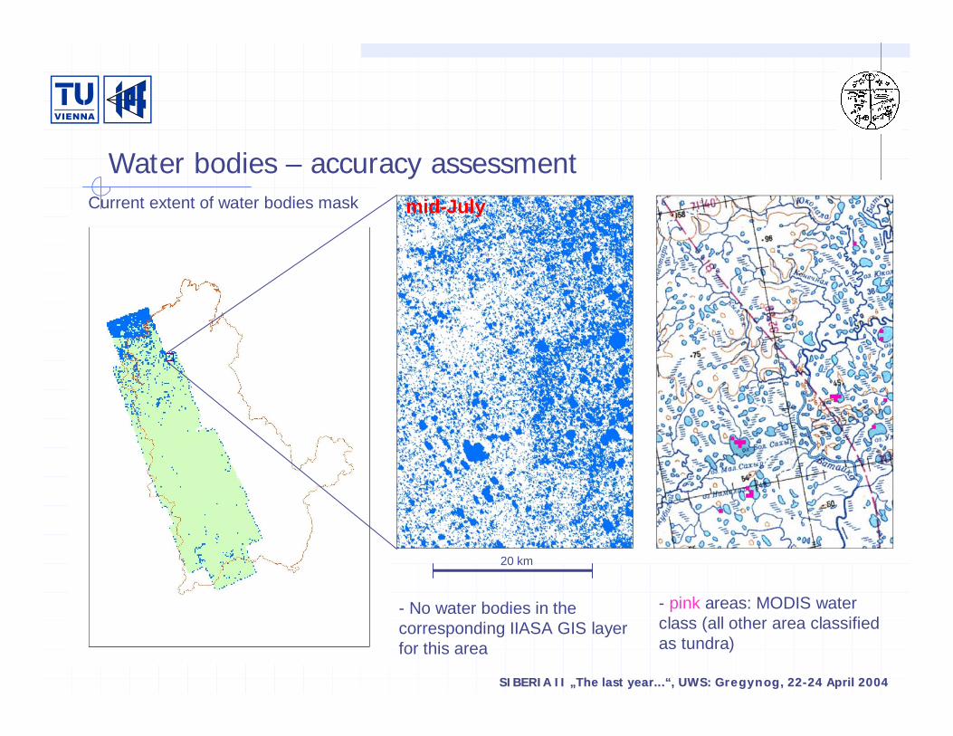
Current extent of water bodies mask
- pink areas: MODIS water class (all other area classified as tundra)
20 km
mid-July
- No water bodies in the corresponding IIASA GIS layer for this area
Water bodies – accuracy assessment
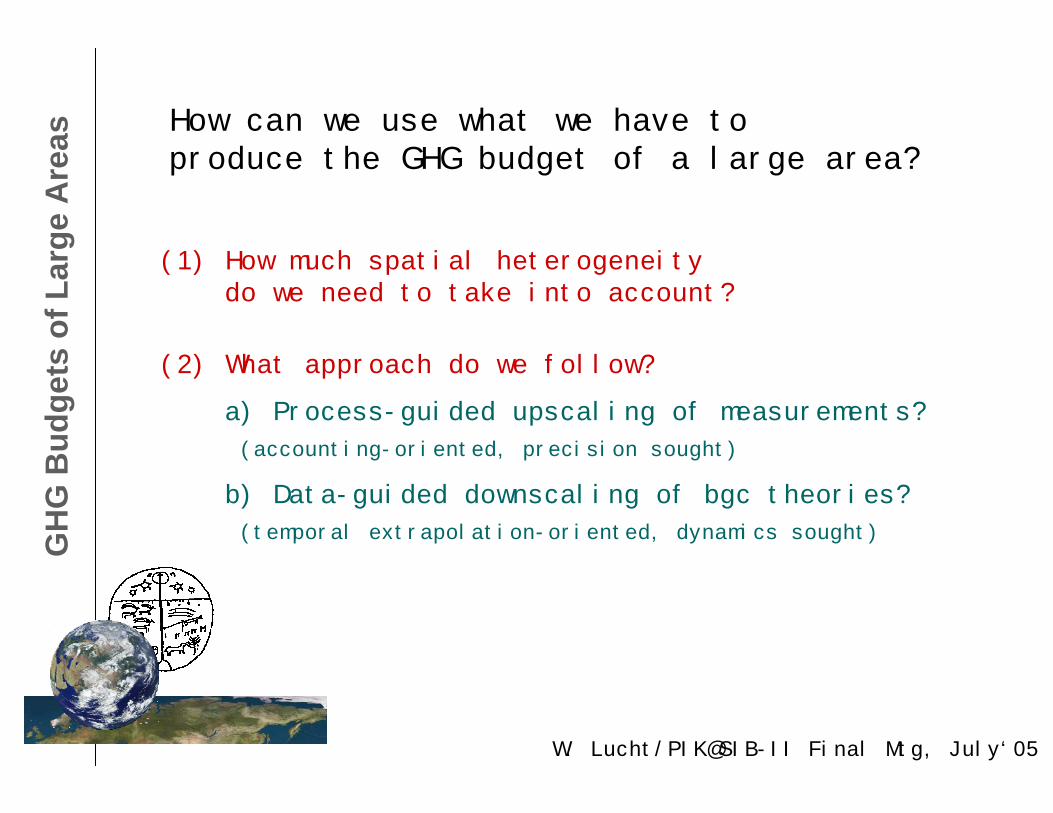
(1) How much spatial heterogeneity do we need to take into account?
How can we use what we have toproduce the GHG budget of a large area?
(2) What approach do we follow?
a) Process-guided upscaling of measurements?
(accounting-oriented, precision sought)
b) Data-guided downscaling of bgc theories?
(temporal extrapolation-oriented, dynamics sought)GH
G B
udge
ts o
f Lar
ge A
reas
W. Lucht/PIK@SIB-II Final Mtg, July‘05
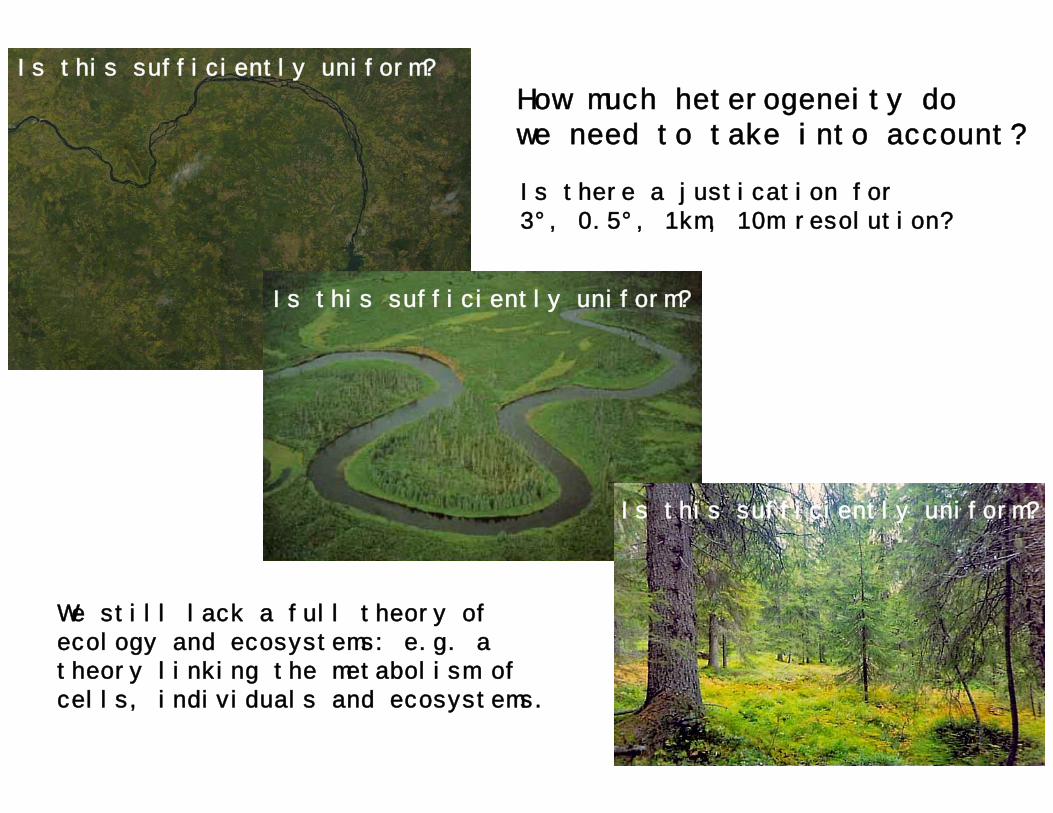
Is this sufficiently uniform?
Is this sufficiently uniform?
Is this sufficiently uniform?
We still lack a full theory ofecology and ecosystems: e.g. a theory linking the metabolism of cells, individuals and ecosystems.
How much heterogeneity dowe need to take into account?
Is there a justication for3°, 0.5°, 1km, 10m resolution?
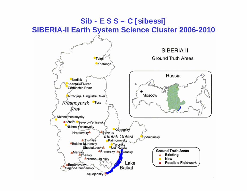
Sib - E S S – C [sibessi]SIBERIA-II Earth System Science Cluster 2006-2010
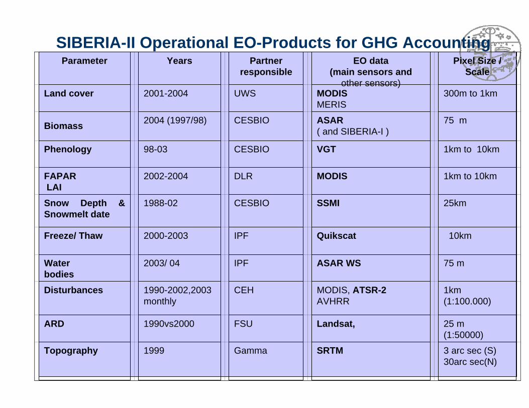
Parameter Years Partner responsible
EO data(main sensors and
other sensors)
Pixel Size / Scale
Land cover 2001-2004 UWS MODISMERIS
300m to 1km
Biomass 2004 (1997/98) CESBIO ASAR( and SIBERIA-I )
75 m
Phenology 98-03 CESBIO VGT 1km to 10km
FAPAR LAI
2002-2004 DLR MODIS 1km to 10km
Snow Depth & Snowmelt date
1988-02 CESBIO SSMI 25km
Freeze/ Thaw 2000-2003 IPF Quikscat 10km
Waterbodies
2003/ 04 IPF ASAR WS 75 m
Disturbances 1990-2002,2003 monthly
CEH MODIS, ATSR-2AVHRR
1km(1:100.000)
ARD 1990vs2000 FSU Landsat, 25 m(1:50000)
Topography 1999 Gamma SRTM 3 arc sec (S)30arc sec(N)
SIBERIA-II Operational EO-Products for GHG Accounting
Prob
lem
s-4-ContinuityGaps: Landsat, SPOT VGT, MERIS,…
SynergyMulti-scale understanding, product-product complimentarities, optical-radar exploration (VCF&biomass!), dynamic features (water bodies, disturbances)
AccessArchives, expensive processing, global communication
Validation


![Simulating global and local surface temperature changes ... · (LPJ DGVM) output [Sitch et al., 2003]. PFT cover fractions were then regrouped into PFT categories used by CCSM. The](https://img.pdfslide.net/doc/110x75/608ddccfb7f8e8020a7a558f/simulating-global-and-local-surface-temperature-changes-lpj-dgvm-output-sitch.jpg)


![Originally published as - edoc.gfz-potsdam.deedoc.gfz-potsdam.de/pik/get/3093/0/0837ffccae19fedf50bf6729a2a8d921/... · The LPJmL model is based on the LPJ-DGVM [Sitch et al., 2003],](https://img.pdfslide.net/doc/110x75/5e0f4424ef63e216d5205af0/originally-published-as-edocgfz-the-lpjml-model-is-based-on-the-lpj-dgvm-sitch.jpg)