Embed Size (px)
Citation preview
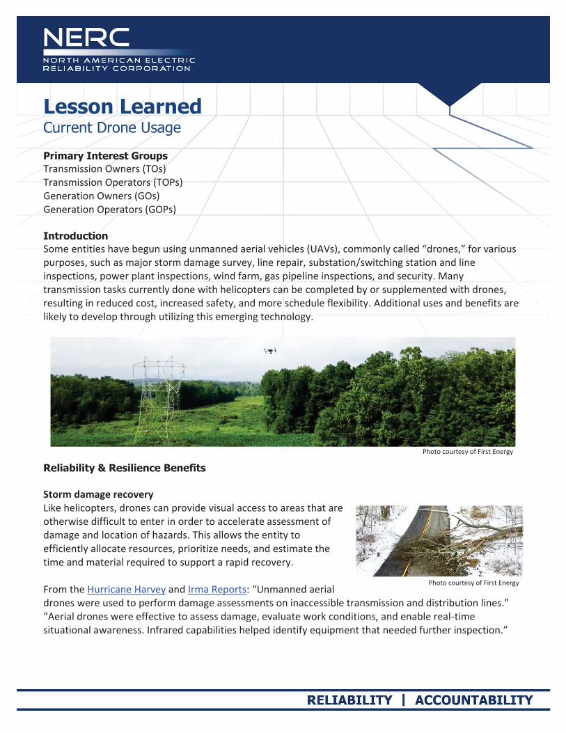
Lesson Learned Current Drone Usage Primary Interest Groups Transmission Owners (TOs) Transmission Operators (TOPs) Generation Owners (GOs) Generation Operators (GOPs) Introduction Some entities have begun using unmanned aerial vehicles (UAVs), commonly called “drones,” for various purposes, such as major storm damage survey, line repair, substation/switching station and line inspections, power plant inspections, wind farm, gas pipeline inspections, and security. Many transmission tasks currently done with helicopters can be completed by or supplemented with drones, resulting in reduced cost, increased safety, and more schedule flexibility. Additional uses and benefits are likely to develop through utilizing this emerging technology.
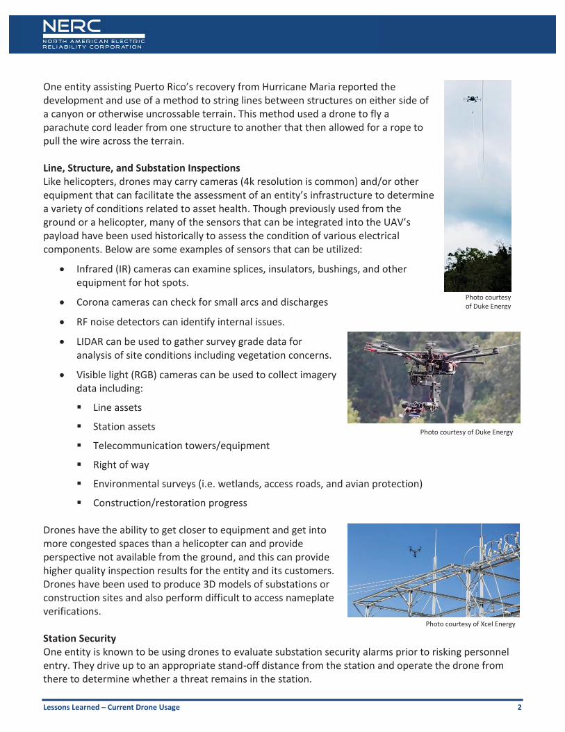
Reliability & Resilience Benefits Storm damage recovery Like helicopters, drones can provide visual access to areas that are otherwise difficult to enter in order to accelerate assessment of damage and location of hazards. This allows the entity to efficiently allocate resources, prioritize needs, and estimate the time and material required to support a rapid recovery. From the Hurricane Harvey and Irma Reports: “Unmanned aerial drones were used to perform damage assessments on inaccessible transmission and distribution lines.” “Aerial drones were effective to assess damage, evaluate work conditions, and enable real-time situational awareness. Infrared capabilities helped identify equipment that needed further inspection.”
Photo courtesy of First Energy
Photo courtesy of First Energy
Lessons Learned – Current Drone Usage 2
One entity assisting Puerto Rico’s recovery from Hurricane Maria reported the development and use of a method to string lines between structures on either side of a canyon or otherwise uncrossable terrain. This method used a drone to fly a parachute cord leader from one structure to another that then allowed for a rope to pull the wire across the terrain. Line, Structure, and Substation Inspections Like helicopters, drones may carry cameras (4k resolution is common) and/or other equipment that can facilitate the assessment of an entity’s infrastructure to determine a variety of conditions related to asset health. Though previously used from the ground or a helicopter, many of the sensors that can be integrated into the UAV’s payload have been used historically to assess the condition of various electrical components. Below are some examples of sensors that can be utilized:
Infrared (IR) cameras can examine splices, insulators, bushings, and other equipment for hot spots.
Corona cameras can check for small arcs and discharges
RF noise detectors can identify internal issues.
LIDAR can be used to gather survey grade data for analysis of site conditions including vegetation concerns.
Visible light (RGB) cameras can be used to collect imagery data including:
Line assets
Station assets
Telecommunication towers/equipment
Right of way
Environmental surveys (i.e. wetlands, access roads, and avian protection)
Construction/restoration progress Drones have the ability to get closer to equipment and get into more congested spaces than a helicopter can and provide perspective not available from the ground, and this can provide higher quality inspection results for the entity and its customers. Drones have been used to produce 3D models of substations or construction sites and also perform difficult to access nameplate verifications. Station Security One entity is known to be using drones to evaluate substation security alarms prior to risking personnel entry. They drive up to an appropriate stand-off distance from the station and operate the drone from there to determine whether a threat remains in the station.
Photo courtesy of Duke Energy
Photo courtesy of Duke Energy
Photo courtesy of Xcel Energy

Lessons Learned – Current Drone Usage 3
The entity reported a large reduction in CIP-014 assessment time for difficult locations (including a manned hydro plant, which has a hard to access station above the dam; another case involved accessing a station across a river with no nearby bridges). The entity also occasionally assists local law enforcement and other first responders with aerial viewing to assess situations in real time. Infrared cameras can see people, warm vehicles, and animals at night. (Note: night flight requires a waiver from the Federal Aviation Administration (FAA)) Generation Inspections Drones can inspect dams, spillways, solar farms, and wind turbines faster and safer than people on rigging or helicopters. (Note: indoor use of drones is permitted without regulation (e.g., internal boiler inspections, confined spaces, etc.)) Lesson Learned Current and potential drone uses are still being explored, so don’t overpromise–drones have model-specific capabilities and limitations, as do operators. Government regulations and entity processes also impose limits.
Decision Makers Need Informed of Cost/Benefit
To get approval to pursue a drone program there needs to be a determination of likely costs and benefits. Unless there is some experience to reference, the accuracy of those determinations are questionable.
One entity reports a very high return on investment when it used drones for survey photos (e.g., station new build and modification and other project planning, GIS overlay). Also, survey photo sharing with emergency preparedness personnel provides more current info than Google Maps.
Having an internal governance policy and procedures for drone use is important to stand up an effective, well managed drone program.
Rules one entity set for itself
For determining causes of line outages, if unable to have a helicopter patrol a line, a drone can be used to patrol one mile sections of a line using visual line-of-sight methods.
During tower restoration, use drones to take pictures of each tower before and after replacement.
o Provide updates to management on restoration progress
o Show that access roads were removed and that the property was restored after they are no longer needed
Photo courtesy of Duke Energy
Lessons Learned – Current Drone Usage 4
o Drones provide a safer method of viewing equipment that may otherwise need to be viewed by helicopter.
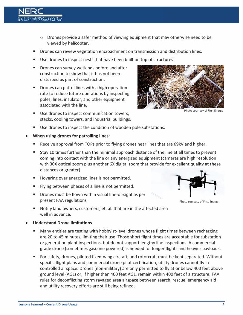
Drones can review vegetation encroachment on transmission and distribution lines.
Use drones to inspect nests that have been built on top of structures.
Drones can survey wetlands before and after construction to show that it has not been disturbed as part of construction.
Drones can patrol lines with a high operation rate to reduce future operations by inspecting poles, lines, insulator, and other equipment associated with the line.
Use drones to inspect communication towers, stacks, cooling towers, and industrial buildings.
Use drones to inspect the condition of wooden pole substations.
When using drones for patrolling lines:
Receive approval from TOPs prior to flying drones near lines that are 69kV and higher.
Stay 10 times further than the minimal approach distance of the line at all times to prevent coming into contact with the line or any energized equipment (cameras are high resolution with 30X optical zoom plus another 6X digital zoom that provide for excellent quality at these distances or greater).
Hovering over energized lines is not permitted.
Flying between phases of a line is not permitted.
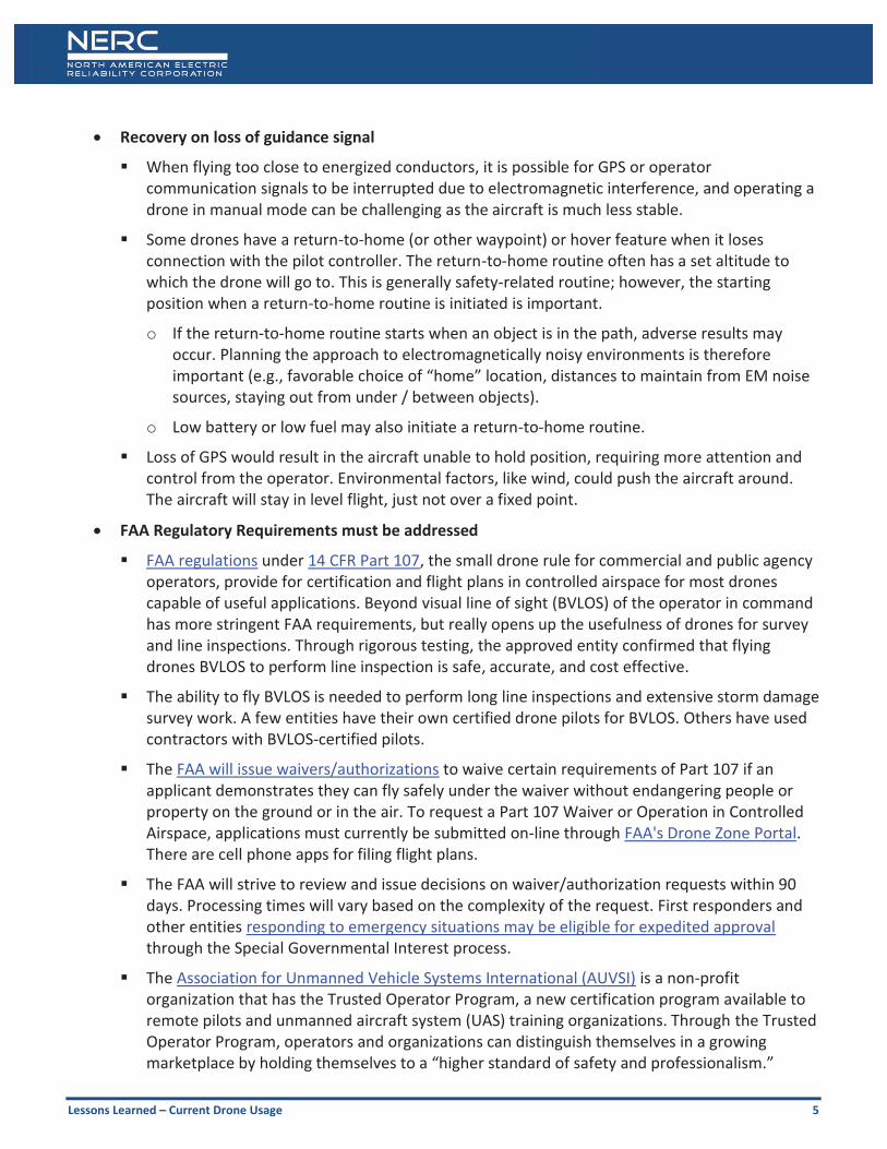
Drones must be flown within visual line-of-sight as per present FAA regulations
Notify land owners, customers, et. al. that are in the affected area well in advance.
Understand Drone limitations
Many entities are testing with hobbyist-level drones whose flight times between recharging are 20 to 45 minutes, limiting their use. Those short flight times are acceptable for substation or generation plant inspections, but do not support lengthy line inspections. A commercial-grade drone (sometimes gasoline powered) is needed for longer flights and heavier payloads.
For safety, drones, piloted fixed-wing aircraft, and rotorcraft must be kept separated. Without specific flight plans and commercial drone pilot certification, utility drones cannot fly in controlled airspace. Drones (non-military) are only permitted to fly at or below 400 feet above ground level (AGL) or, if higher than 400 feet AGL, remain within 400 feet of a structure. FAA rules for deconflicting storm ravaged area airspace between search, rescue, emergency aid, and utility recovery efforts are still being refined.
Photo courtesy of First Energy
Photo courtesy of First Energy
Lessons Learned – Current Drone Usage 5
Recovery on loss of guidance signal
When flying too close to energized conductors, it is possible for GPS or operator communication signals to be interrupted due to electromagnetic interference, and operating a drone in manual mode can be challenging as the aircraft is much less stable.
Some drones have a return-to-home (or other waypoint) or hover feature when it loses connection with the pilot controller. The return-to-home routine often has a set altitude to which the drone will go to. This is generally safety-related routine; however, the starting position when a return-to-home routine is initiated is important.
o If the return-to-home routine starts when an object is in the path, adverse results may occur. Planning the approach to electromagnetically noisy environments is therefore important (e.g., favorable choice of “home” location, distances to maintain from EM noise sources, staying out from under / between objects).
o Low battery or low fuel may also initiate a return-to-home routine.
Loss of GPS would result in the aircraft unable to hold position, requiring more attention and control from the operator. Environmental factors, like wind, could push the aircraft around. The aircraft will stay in level flight, just not over a fixed point.
FAA Regulatory Requirements must be addressed
FAA regulations under 14 CFR Part 107, the small drone rule for commercial and public agency operators, provide for certification and flight plans in controlled airspace for most drones capable of useful applications. Beyond visual line of sight (BVLOS) of the operator in command has more stringent FAA requirements, but really opens up the usefulness of drones for survey and line inspections. Through rigorous testing, the approved entity confirmed that flying drones BVLOS to perform line inspection is safe, accurate, and cost effective.
The ability to fly BVLOS is needed to perform long line inspections and extensive storm damage survey work. A few entities have their own certified drone pilots for BVLOS. Others have used contractors with BVLOS-certified pilots.
The FAA will issue waivers/authorizations to waive certain requirements of Part 107 if an applicant demonstrates they can fly safely under the waiver without endangering people or property on the ground or in the air. To request a Part 107 Waiver or Operation in Controlled Airspace, applications must currently be submitted on-line through FAA's Drone Zone Portal. There are cell phone apps for filing flight plans.
The FAA will strive to review and issue decisions on waiver/authorization requests within 90 days. Processing times will vary based on the complexity of the request. First responders and other entities responding to emergency situations may be eligible for expedited approval through the Special Governmental Interest process.
The Association for Unmanned Vehicle Systems International (AUVSI) is a non-profit organization that has the Trusted Operator Program, a new certification program available to remote pilots and unmanned aircraft system (UAS) training organizations. Through the Trusted Operator Program, operators and organizations can distinguish themselves in a growing marketplace by holding themselves to a “higher standard of safety and professionalism.”
Lessons Learned – Current Drone Usage 6
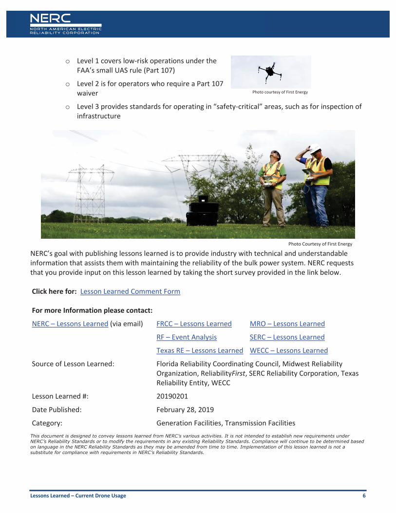
o Level 1 covers low-risk operations under the FAA’s small UAS rule (Part 107)
o Level 2 is for operators who require a Part 107 waiver
o Level 3 provides standards for operating in “safety-critical” areas, such as for inspection of infrastructure
NERC’s goal with publishing lessons learned is to provide industry with technical and understandable information that assists them with maintaining the reliability of the bulk power system. NERC requests that you provide input on this lesson learned by taking the short survey provided in the link below. Click here for: Lesson Learned Comment Form For more Information please contact:
NERC – Lessons Learned (via email) FRCC – Lessons Learned MRO – Lessons Learned
RF – Event Analysis SERC – Lessons Learned
Texas RE – Lessons Learned WECC – Lessons Learned
Source of Lesson Learned: Florida Reliability Coordinating Council, Midwest Reliability Organization, ReliabilityFirst, SERC Reliability Corporation, Texas Reliability Entity, WECC
Lesson Learned #: 20190201
Date Published: February 28, 2019
Category: Generation Facilities, Transmission Facilities This document is designed to convey lessons learned from NERC’s various activities. It is not intended to establish new requirements under NERC’s Reliability Standards or to modify the requirements in any existing Reliability Standards. Compliance will continue to be determined based on language in the NERC Reliability Standards as they may be amended from time to time. Implementation of this lesson learned is not a substitute for compliance with requirements in NERC’s Reliability Standards.
Photo courtesy of First Energy
Photo Courtesy of First Energy


![Learned cross-domain descriptors (LCD) for drone navigation · 2021. 5. 2. · Learned cross-domain descriptors (LCD) for drone ... cross-domain descriptor for 2D-3D matching[1] and](https://img.pdfslide.net/doc/110x75/61366ade0ad5d20676480353/learned-cross-domain-descriptors-lcd-for-drone-navigation-2021-5-2-learned.jpg)