Embed Size (px)
Citation preview
Machine Learning and Decision
Making for Sustainability
Stefano Ermon
Department of Computer Science
Stanford University
IJCAI - July 13
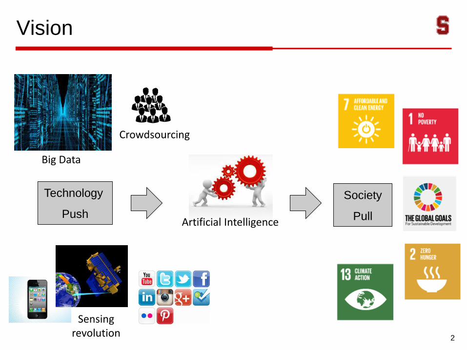
Vision
2
Technology
Push
Society
Pull
Big Data
Artificial Intelligence
Sensing revolution
Crowdsourcing
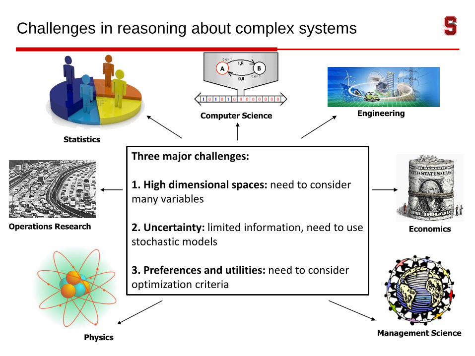
Challenges in reasoning about complex systems
Operations Research
Management Science
Economics
Three major challenges:
1. High dimensional spaces: need to consider many variables
2. Uncertainty: limited information, need to use stochastic models
3. Preferences and utilities: need to consider optimization criteria
Statistics
Computer Science Engineering
Physics
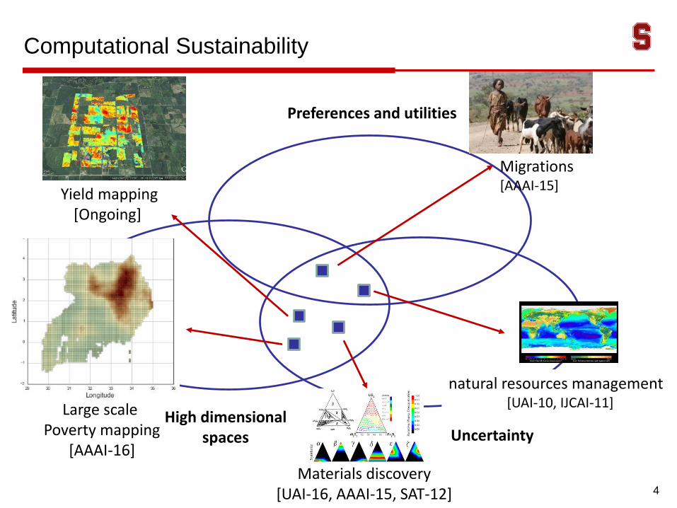
Yield mapping [Ongoing]
Computational Sustainability
Uncertainty
Materials discovery[UAI-16, AAAI-15, SAT-12]
Large scale Poverty mapping
[AAAI-16]
High dimensional spaces
Preferences and utilities
4
Migrations[AAAI-15]
natural resources management [UAI-10, IJCAI-11]
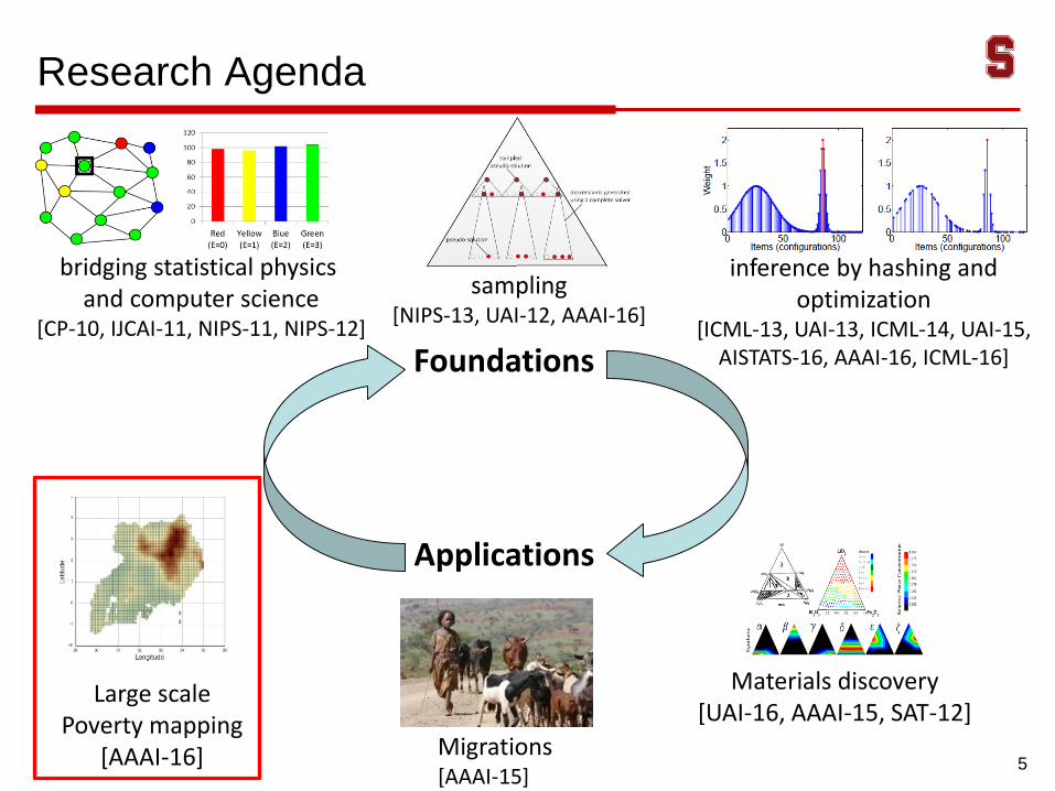
Research Agenda
5
Foundations
Applications
inference by hashing and optimization
[ICML-13, UAI-13, ICML-14, UAI-15, AISTATS-16, AAAI-16, ICML-16]
bridging statistical physics and computer science
[CP-10, IJCAI-11, NIPS-11, NIPS-12]
sampling[NIPS-13, UAI-12, AAAI-16]
Materials discovery[UAI-16, AAAI-15, SAT-12]
Large scale Poverty mapping
[AAAI-16] Migrations[AAAI-15]
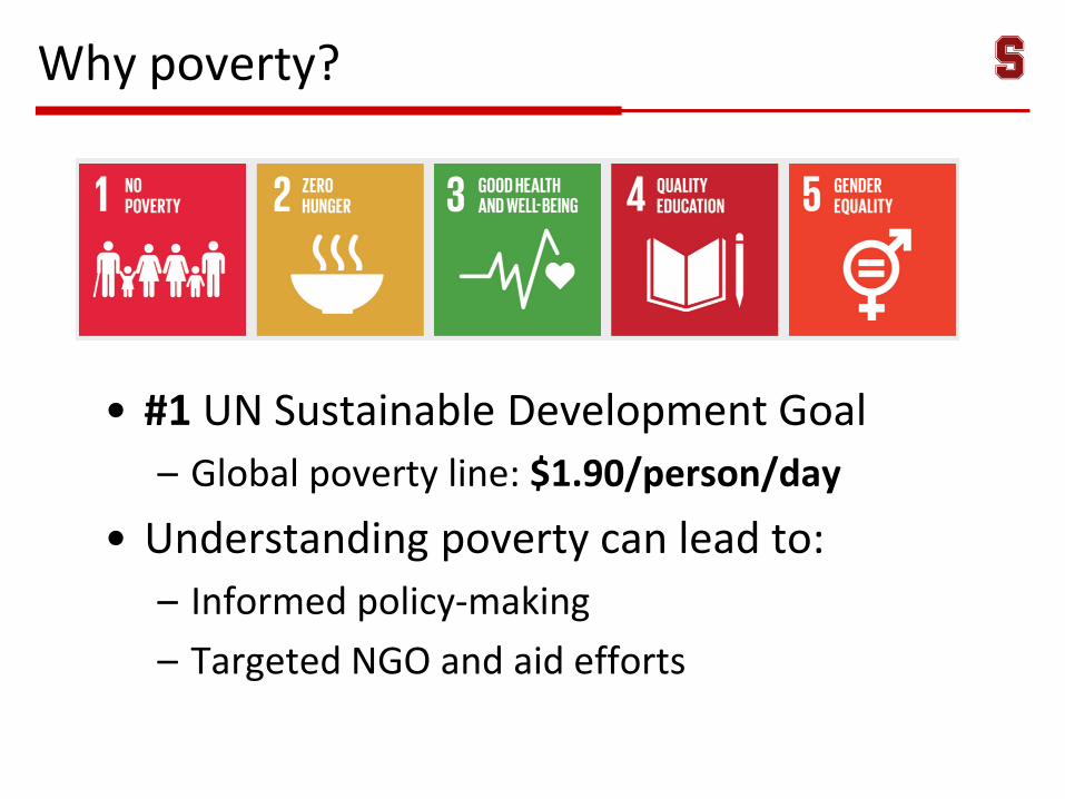
Why poverty?
• #1 UN Sustainable Development Goal
– Global poverty line: $1.90/person/day
• Understanding poverty can lead to:
– Informed policy-making
– Targeted NGO and aid efforts
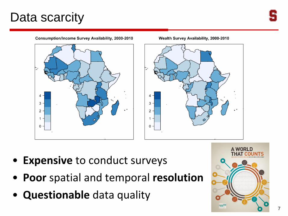
Data scarcity
7
• Expensive to conduct surveys
• Poor spatial and temporal resolution
• Questionable data quality
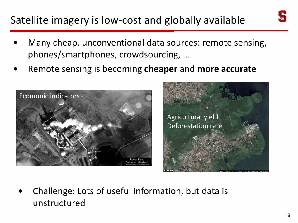
Satellite imagery is low-cost and globally available
8
• Challenge: Lots of useful information, but data is unstructured
Shipping recordsInventory estimates
Agricultural yieldDeforestation rate
• Many cheap, unconventional data sources: remote sensing, phones/smartphones, crowdsourcing, …
• Remote sensing is becoming cheaper and more accurate
Economic indicators
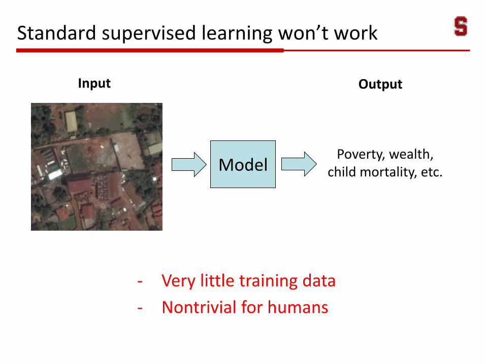
Standard supervised learning won’t work
- Very little training data
- Nontrivial for humans
Poverty, wealth, child mortality, etc.Model
Input Output
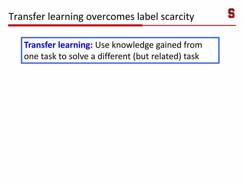
Transfer learning overcomes label scarcity
Transfer learning: Use knowledge gained from one task to solve a different (but related) task
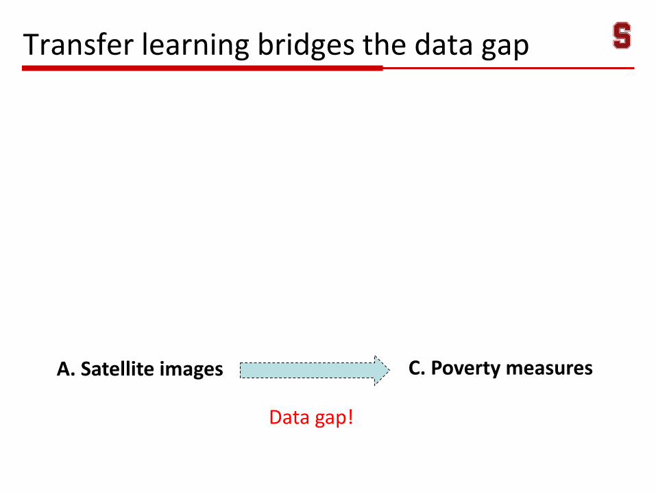
Transfer learning bridges the data gap
A. Satellite images C. Poverty measures
Data gap!
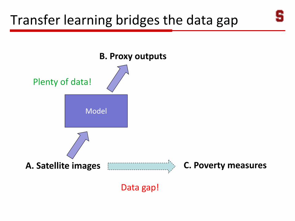
Transfer learning bridges the data gap
A. Satellite images C. Poverty measures
Data gap!
B. Proxy outputs
Model
Plenty of data!
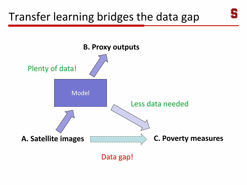
Transfer learning bridges the data gap
A. Satellite images C. Poverty measures
Data gap!
B. Proxy outputs
Model
Plenty of data!
Less data needed
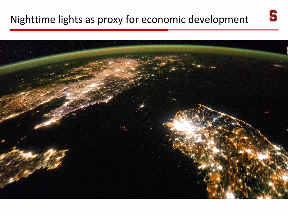
Nighttime lights as proxy for economic development
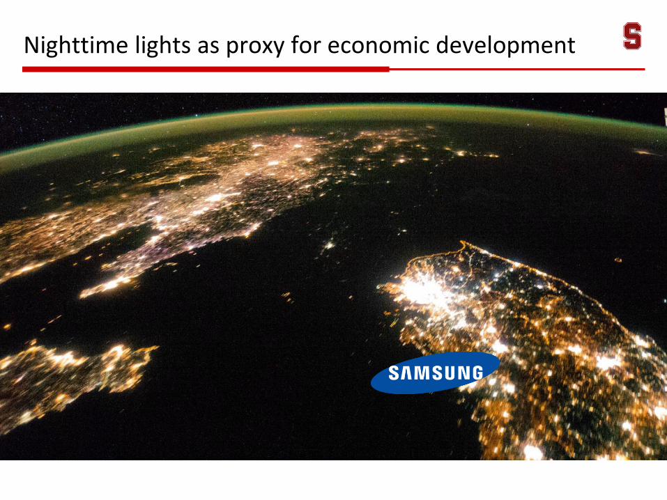
Nighttime lights as proxy for economic development
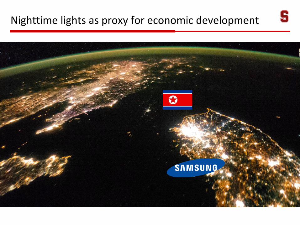
Nighttime lights as proxy for economic development
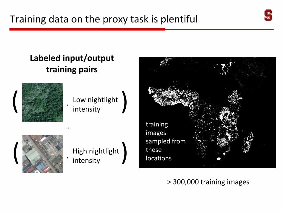
Training data on the proxy task is plentiful
> 300,000 training images
training images sampled from these locations
Low nightlight intensity
,
High nightlight intensity
,
…
(
(
)
)
Labeled input/output training pairs
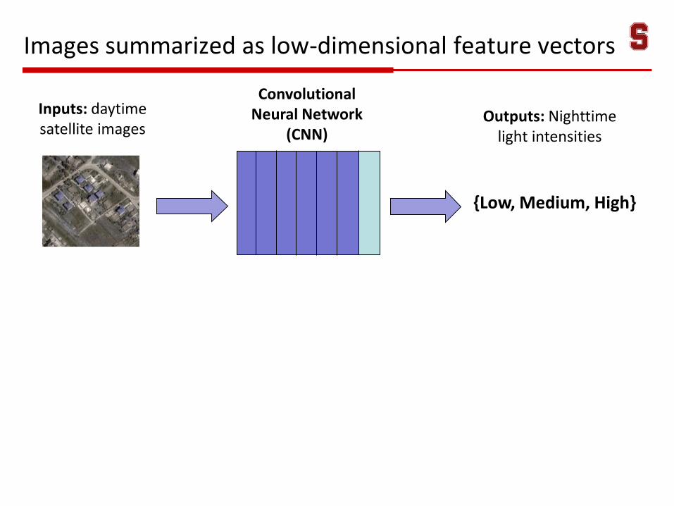
Images summarized as low-dimensional feature vectors
Inputs: daytime satellite images
{Low, Medium, High}
Outputs: Nighttime light intensities
Convolutional Neural Network
(CNN)
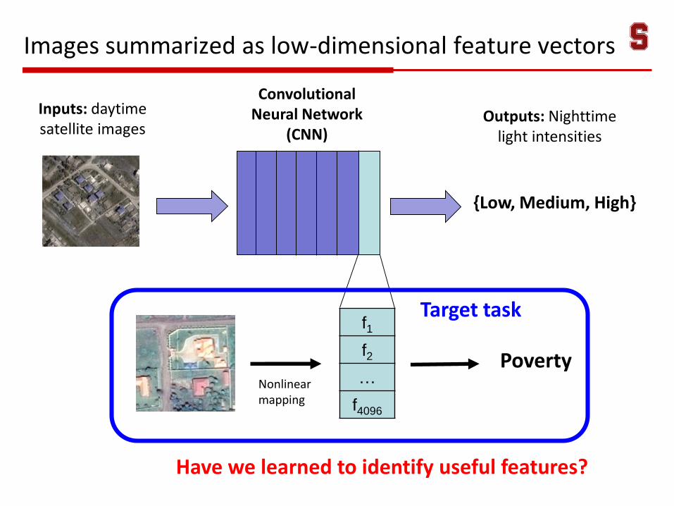
Images summarized as low-dimensional feature vectors
Have we learned to identify useful features?
f1
f2
…
f4096
PovertyNonlinear mapping
Inputs: daytime satellite images
{Low, Medium, High}
Outputs: Nighttime light intensities
Convolutional Neural Network
(CNN)
Target task
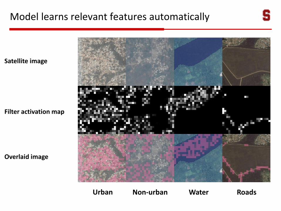
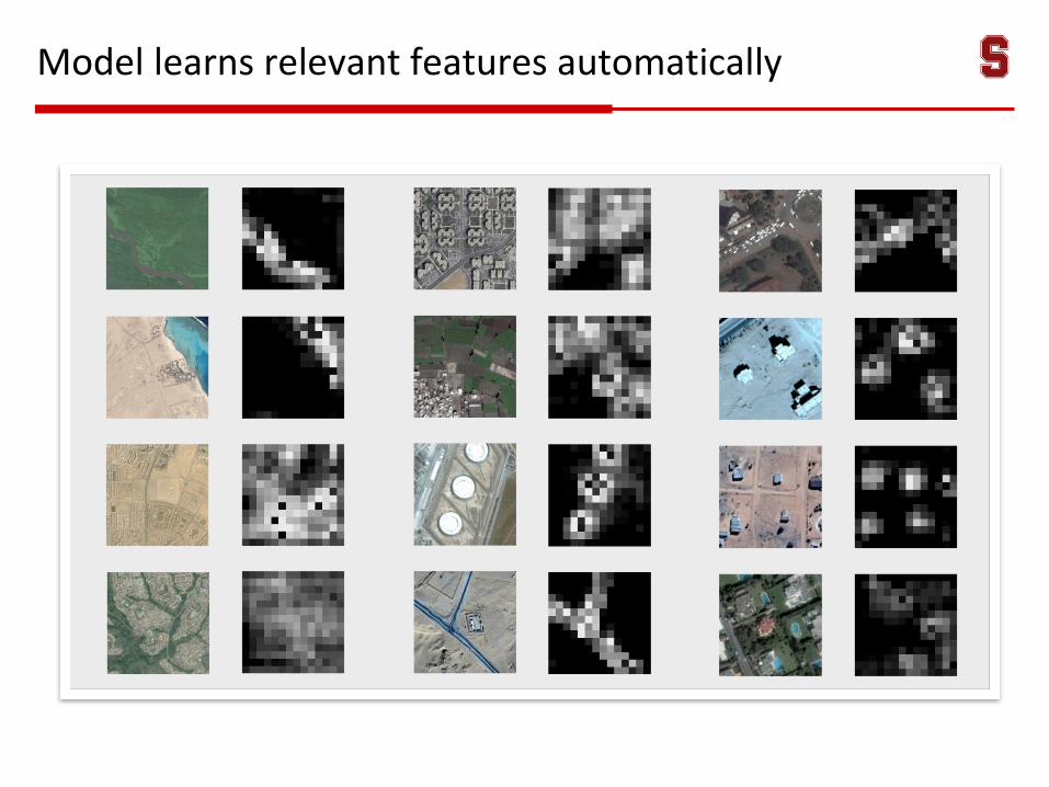
Model learns relevant features automatically
Satellite image
Filter activation map
Overlaid image
Urban Non-urban Water Roads
Model learns relevant features automatically
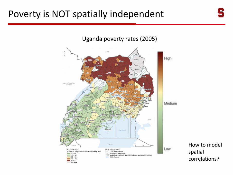
Poverty is NOT spatially independent
Uganda poverty rates (2005)
How to model spatial correlations?
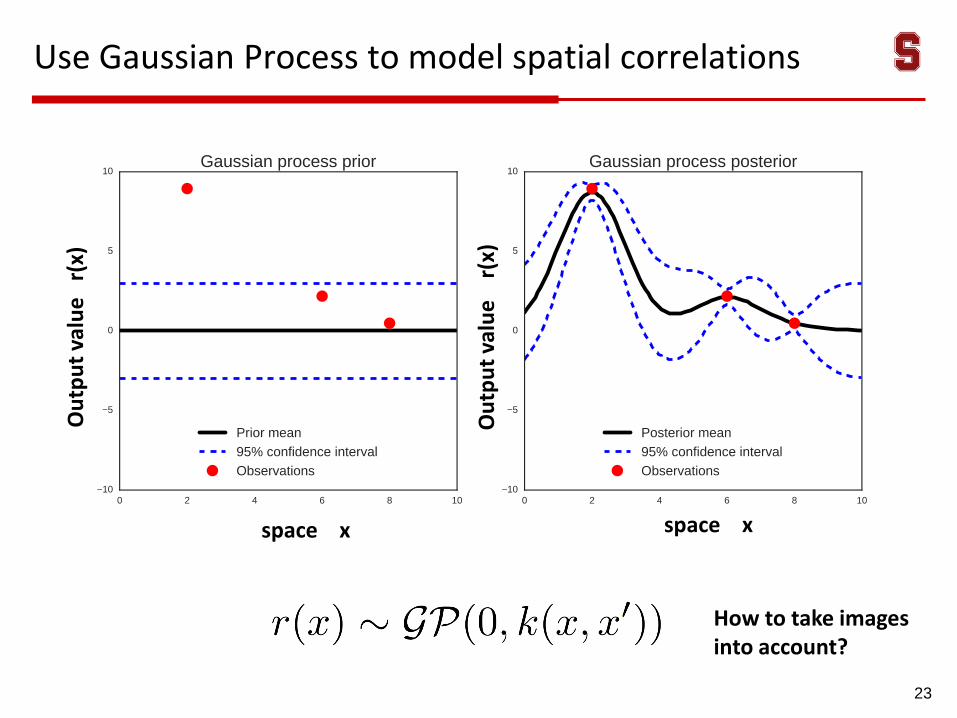
Use Gaussian Process to model spatial correlations
23
Ou
tpu
t va
lue
r(
x)
space xspace x
Ou
tpu
t va
lue
r
(x)
How to take images into account?
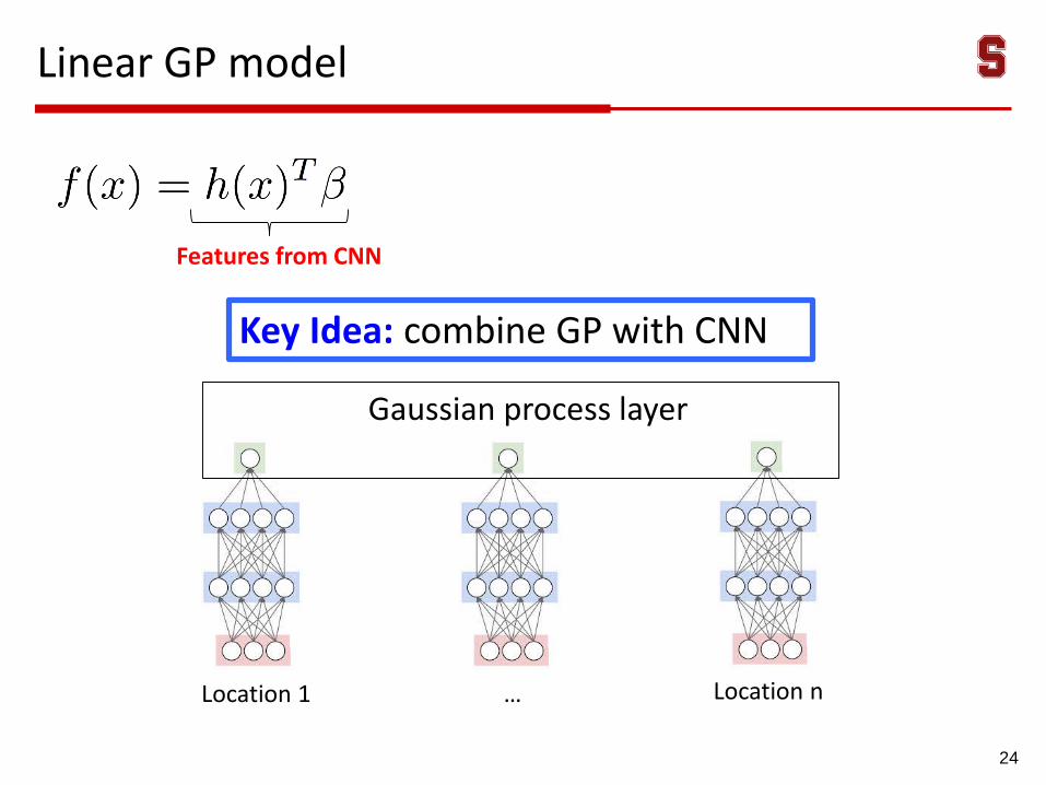
Linear GP model
24
Key Idea: combine GP with CNN
Features from CNN
Gaussian process layer
Location 1 Location n…
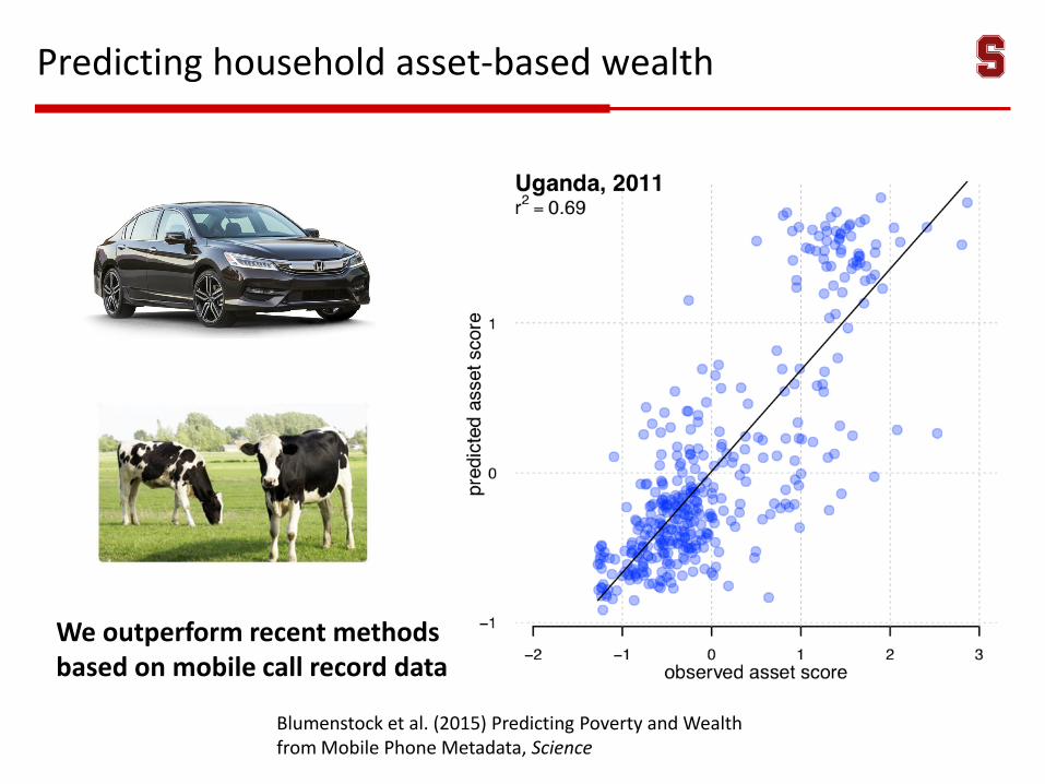
Predicting household asset-based wealth
We outperform recent methods based on mobile call record data
Blumenstock et al. (2015) Predicting Poverty and Wealth from Mobile Phone Metadata, Science
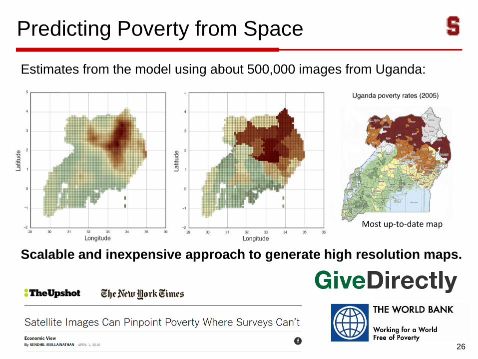
Predicting Poverty from Space
26
Estimates from the model using about 500,000 images from Uganda:
Scalable and inexpensive approach to generate high resolution maps.
Most up-to-date map
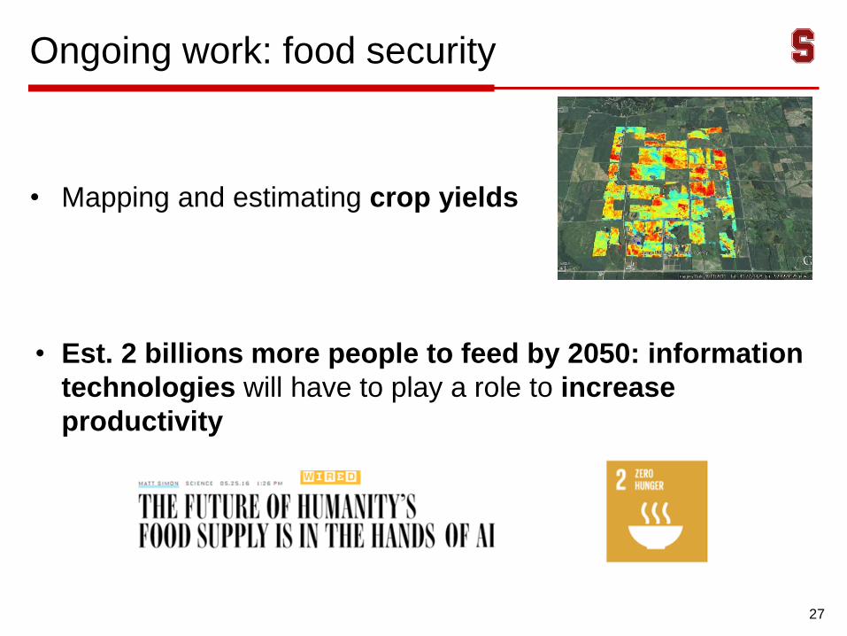
Ongoing work: food security
• Mapping and estimating crop yields
• Est. 2 billions more people to feed by 2050: information
technologies will have to play a role to increase
productivity
27
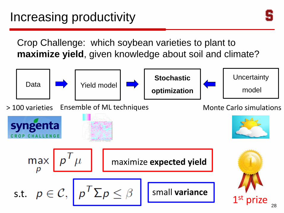
Increasing productivity
Crop Challenge: which soybean varieties to plant to
maximize yield, given knowledge about soil and climate?
28
Stochastic
optimization
maximize expected yield
small variances.t.
Data
> 100 varieties
Uncertainty
model
Monte Carlo simulations
Yield model
Ensemble of ML techniques
1st prize
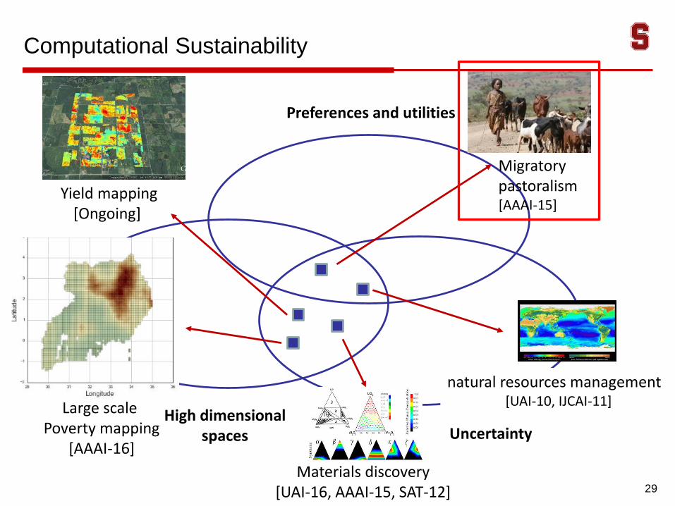
Yield mapping [Ongoing]
Computational Sustainability
Uncertainty
Materials discovery[UAI-16, AAAI-15, SAT-12]
Large scale Poverty mapping
[AAAI-16]
High dimensional spaces
Preferences and utilities
29
Migratory pastoralism[AAAI-15]
natural resources management [UAI-10, IJCAI-11]
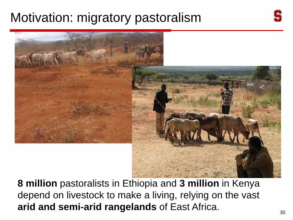
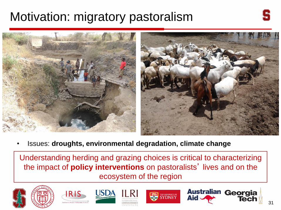
Motivation: migratory pastoralism
30
8 million pastoralists in Ethiopia and 3 million in Kenya
depend on livestock to make a living, relying on the vast
arid and semi-arid rangelands of East Africa.
Motivation: migratory pastoralism
• Issues: droughts, environmental degradation, climate change
31
Understanding herding and grazing choices is critical to characterizing
the impact of policy interventions on pastoralists’ lives and on the
ecosystem of the region
Motivation: migratory pastoralism
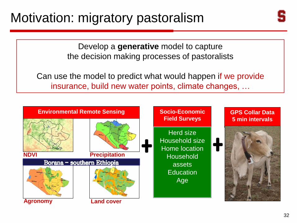
32
Develop a generative model to capture
the decision making processes of pastoralists
Can use the model to predict what would happen if we provide
insurance, build new water points, climate changes, …
GPS Collar Data
5 min intervals
NDVI Precipitation
Land coverAgronomy
Environmental Remote Sensing Socio-Economic
Field Surveys
Herd size
Household size
Home location
Household
assets
Education
Age

Migratory pastoralism: Ethiopia data
33
Camp
Water point
Trajectories(color varies by household)
GPS collar traces
Anonymized for privacy
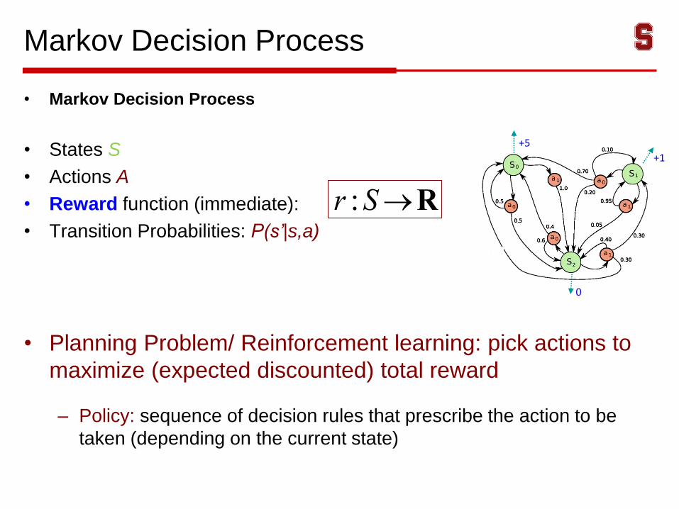
Markov Decision Process
• Markov Decision Process
• States S
• Actions A
• Reward function (immediate):
• Transition Probabilities: P(s’|s,a)
• Planning Problem/ Reinforcement learning: pick actions to
maximize (expected discounted) total reward
– Policy: sequence of decision rules that prescribe the action to be
taken (depending on the current state)
r :S®R
+5
+1
0
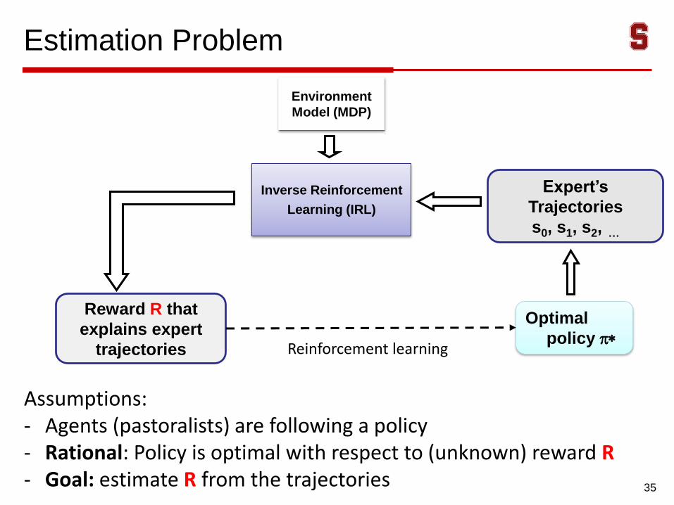
Estimation Problem
35
Inverse Reinforcement
Learning (IRL)
Optimal
policy p*
Environment
Model (MDP)
Expert’s
Trajectories
s0, s1, s2, …
Reward R that
explains expert
trajectories
Assumptions:- Agents (pastoralists) are following a policy- Rational: Policy is optimal with respect to (unknown) reward R- Goal: estimate R from the trajectories
Reinforcement learning
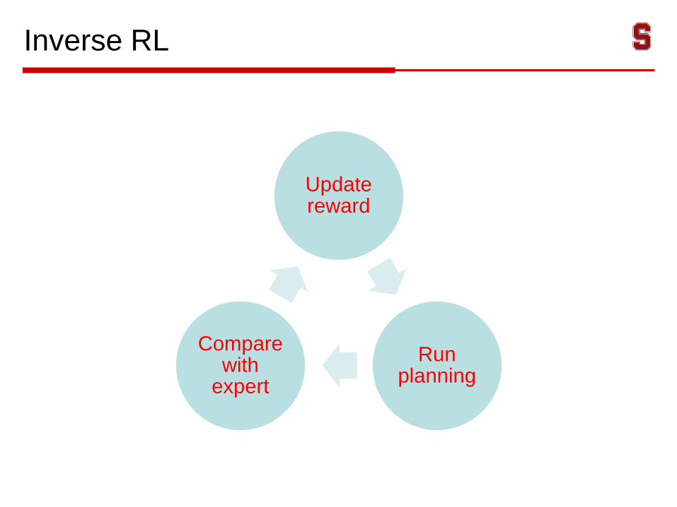
Inverse RL
Update reward
Run planning
Compare with
expert
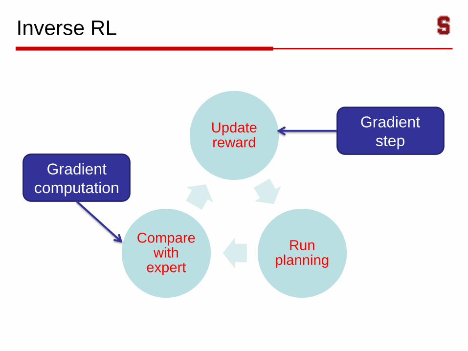
Inverse RL
Update reward
Run planning
Compare with
expert
Gradient
step
Gradient
computation
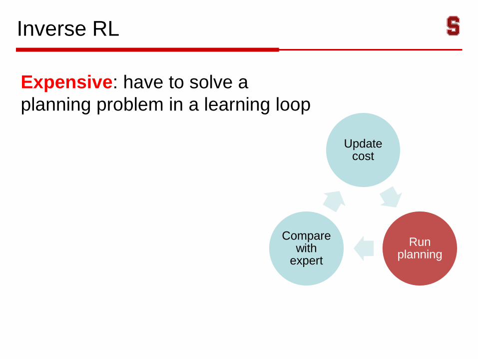
Inverse RL
Expensive: have to solve a
planning problem in a learning loop
Update cost
Run planning
Compare with
expert
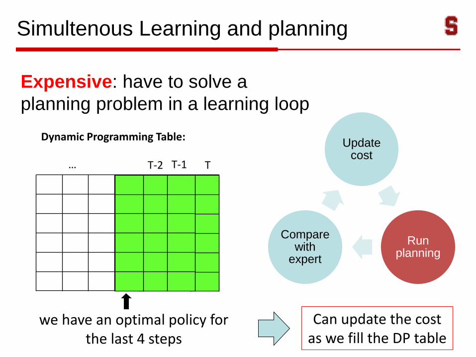
Simultenous Learning and planning
Expensive: have to solve a
planning problem in a learning loop
Update cost
Run planning
Compare with
expert
TT-1T-2…
Dynamic Programming Table:
we have an optimal policy for the last 4 steps
Can update the cost as we fill the DP table
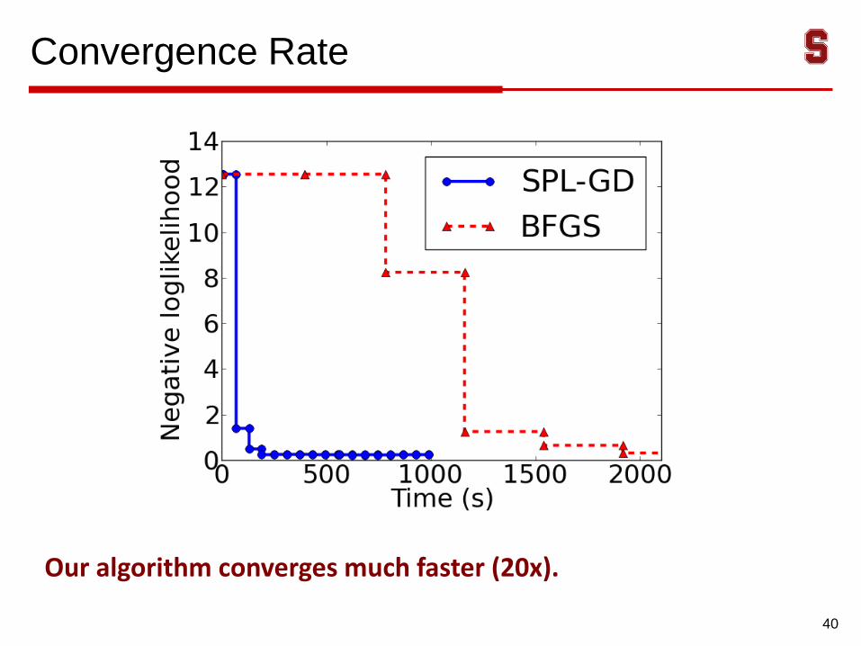
Convergence Rate
40
Our algorithm converges much faster (20x).
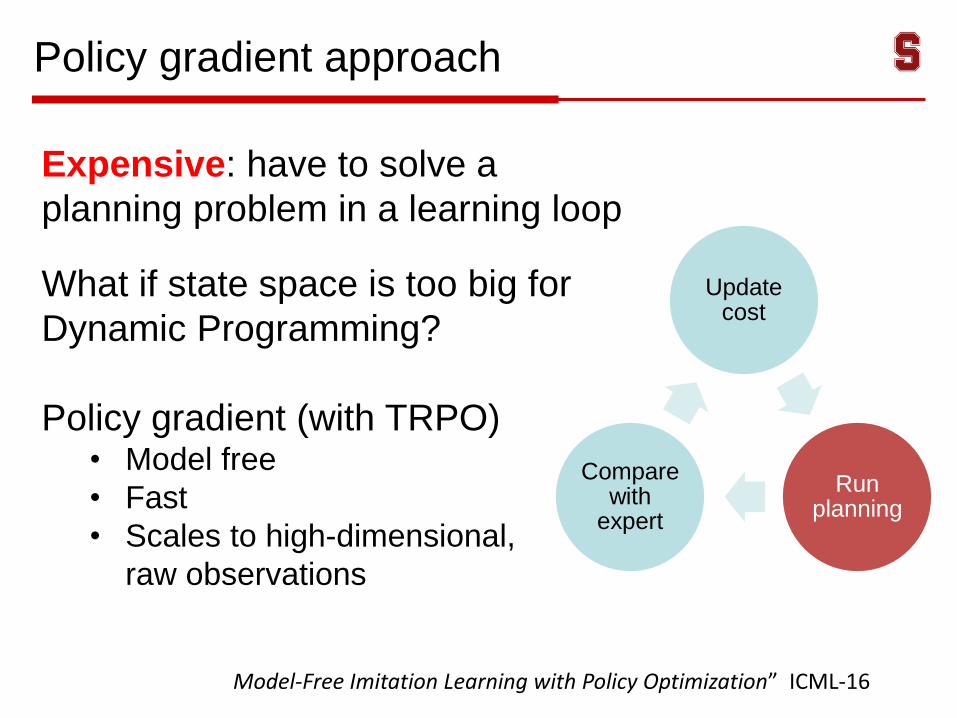
Policy gradient approach
Expensive: have to solve a
planning problem in a learning loop
Update cost
Run planning
Compare with
expert
What if state space is too big for
Dynamic Programming?
Policy gradient (with TRPO)• Model free
• Fast
• Scales to high-dimensional,
raw observations
Model-Free Imitation Learning with Policy Optimization” ICML-16
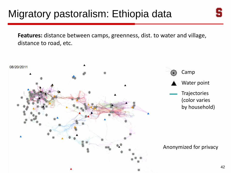
Migratory pastoralism: Ethiopia data
42
Camp
Water point
Trajectories(color varies by household)
Features: distance between camps, greenness, dist. to water and village, distance to road, etc.
Anonymized for privacy
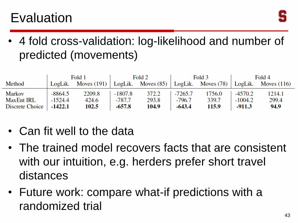
Evaluation
• 4 fold cross-validation: log-likelihood and number of
predicted (movements)
• Can fit well to the data
• The trained model recovers facts that are consistent
with our intuition, e.g. herders prefer short travel
distances
• Future work: compare what-if predictions with a
randomized trial43

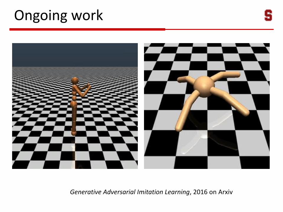
Generative Adversarial Imitation Learning, 2016 on Arxiv
Ongoing work
Conclusions
46
• Growing concerns about the threats of AI to the future of
humanity
• Recent advances in AI also create enormous opportunities
for having deeply beneficial influences on society
(healthcare, education, sustainability, …)
• New opportunities for CS research
Computational Sciences
Sustainability
Sciences
Computational
Sustainability