Embed Size (px)
Citation preview
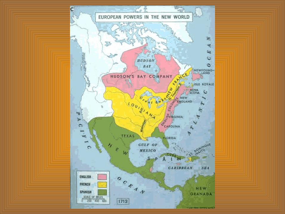
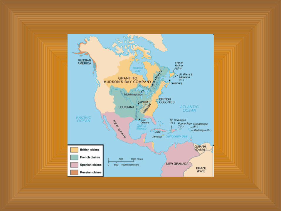
Map of Mexico in 1777
What do you see that you recognize from a Texas map today?
What do you see that looks different?
List some words or names that you recognize?
List some words or names that you do NOT recognize.
Native Americans
Served
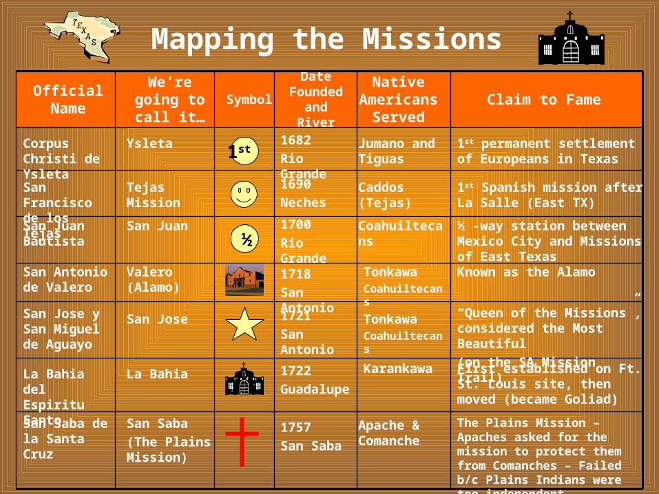
Date Founded and River
Official Name SymbolWe’re going to call it…
Claim to Fame
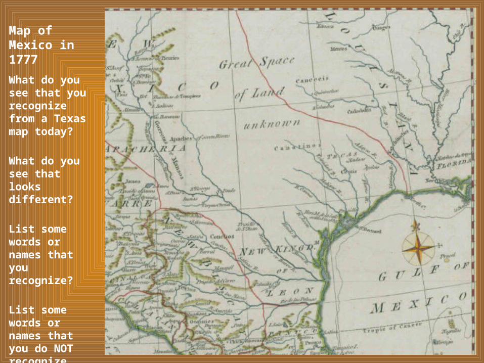
San Saba de la Santa Cruz
Mapping the Missions
Ysleta 1st permanent settlement of Europeans in Texas
Jumano and Tiguas
1682Rio Grande
1st Corpus Christi de Ysleta
Tejas Mission
1st Spanish mission after La Salle (East TX)
Caddos (Tejas)
1690Neches
San Francisco de los Tejas
San Juan ½ -way station between Mexico City and Missions of East Texas
Coahuiltecans
1700Rio Grande
San Juan Bautista ½
Known as the AlamoTonkawaCoahuiltecans
1718San Antonio
Valero (Alamo)
San Antonio de Valero
“Queen of the Missions”, considered the Most Beautiful (on the SA Mission Trail)
TonkawaCoahuiltecans
1721San Antonio
San JoseSan Jose y San Miguel de Aguayo
La Bahia First established on Ft. St. Louis site, then moved (became Goliad)
Karankawa
1722Guadalupe
La Bahia del Espiritu Santo
San Saba(The Plains Mission)
The Plains Mission – Apaches asked for the mission to protect them from Comanches – Failed b/c Plains Indians were too independent
Apache & Comanche
1757San Saba
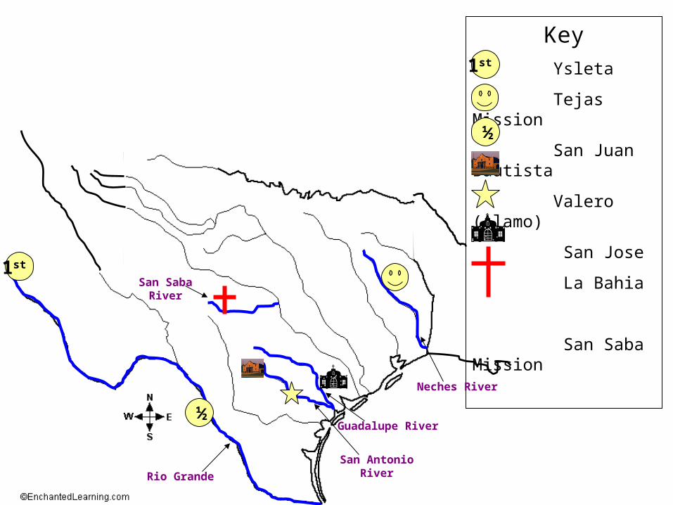
Key
Ysleta
Tejas Mission
San Juan Bautista
Valero (Alamo)
San Jose
La Bahia
San Saba Mission
Neches River
San Antonio River
Guadalupe River
Rio Grande
San Saba River1st
1st
½
½