Embed Size (px)
Citation preview
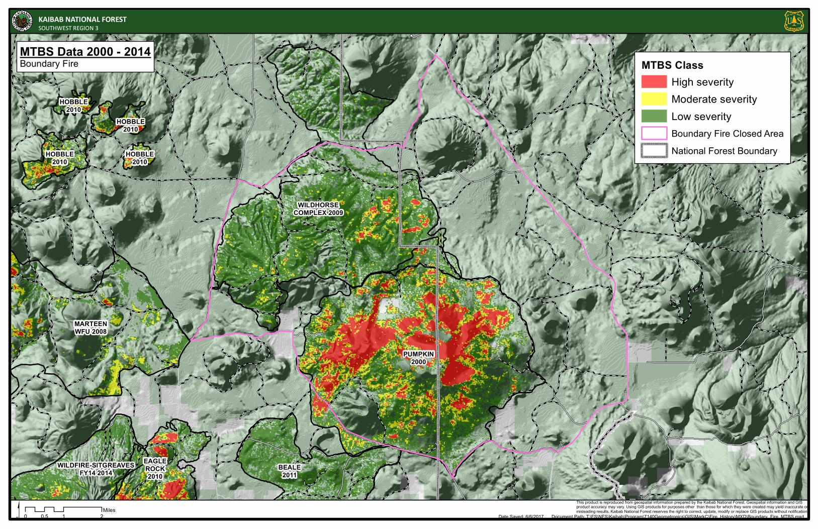
EAGLEROCK2010
MARTEENWFU 2008
HOBBLE2010
HOBBLE2010
HOBBLE2010
HOBBLE2010
BEALE2011
WILDFIRE-SITGREAVESFY14 2014
WILDHORSECOMPLEX 2009
PUMPKIN2000
This product is reproduced from geospatial information prepared by the Kaibab National Forest. Geospatial information and GIS product accuracy may vary. Using GIS products for purposes other than those for which they were created may yield inaccurate ormisleading results. Kaibab National Forest reserves the right to correct, update, modify or replace GIS products without notification.
0 1 20.5Miles
Date Saved: 6/6/2017 Document Path: T:\FS\NFS\Kaibab\Program\7140Geometronics\GIS\MarkC\Fire_History\MXD\Boundary_Fire_MTBS.mxd$
KAIBAB NATIONAL FORESTSOUTHWEST REGION 3
MTBS Data 2000 - 2014Boundary Fire MTBS Class
High severityModerate severityLow severityBoundary Fire Closed AreaNational Forest Boundary