Embed Size (px)
Citation preview
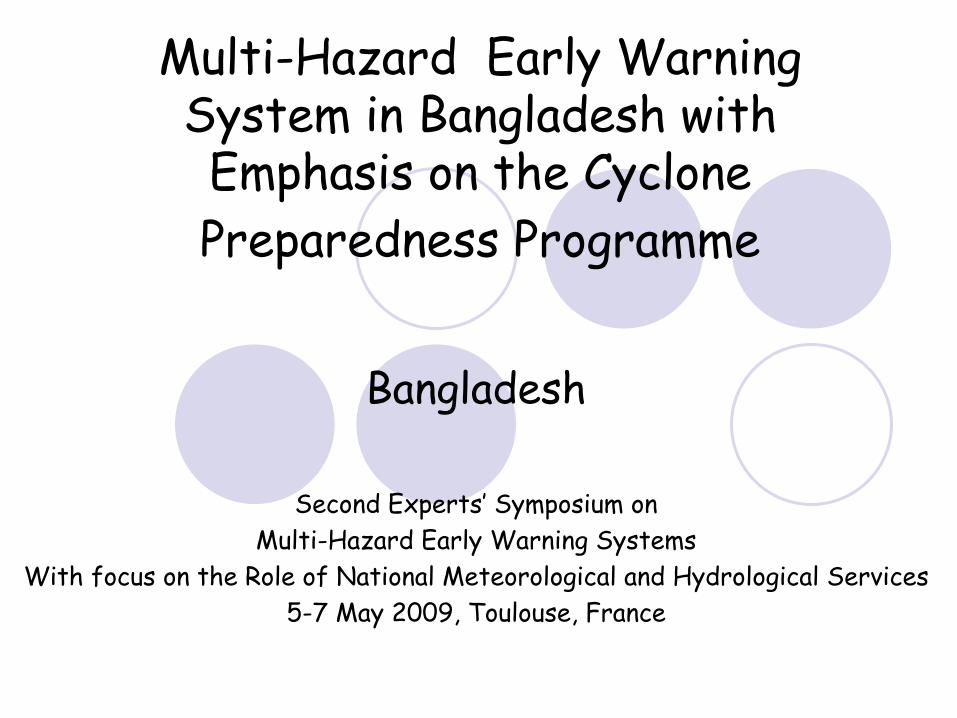
Multi-Hazard Early Warning System in Bangladesh with Emphasis on the Cyclone Preparedness Programme
Bangladesh
Second Experts’
Symposium on Multi-Hazard Early Warning Systems
With focus on the Role of National Meteorological and Hydrological Services5-7 May 2009, Toulouse, France
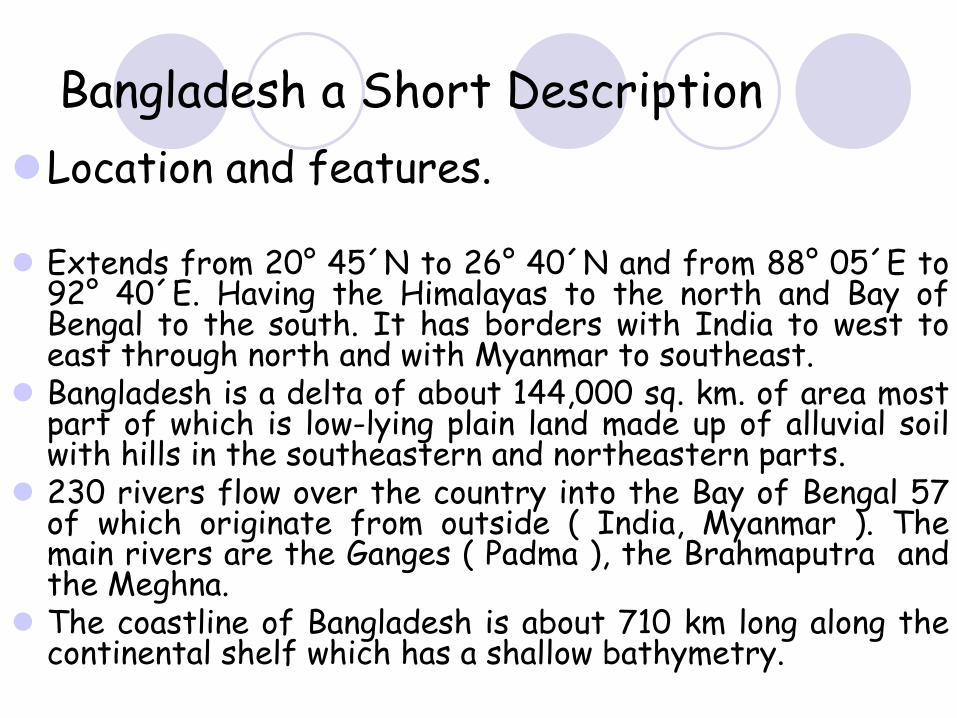
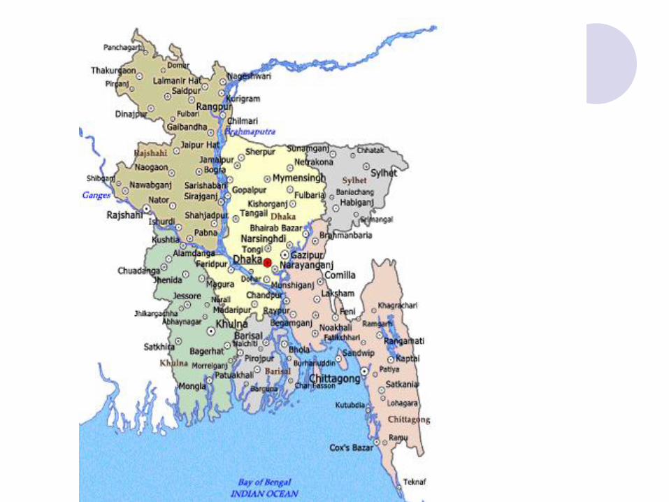
Bangladesh a Short Description Location and features.
Extends from 20° 45´N to 26° 40´N and from 88° 05´E to 92° 40´E. Having the Himalayas to the north and Bay of Bengal to the south. It has borders with India to west to east through north and with Myanmar to southeast.Bangladesh is a delta of about 144,000 sq. km. of area most part of which is low-lying plain land made up of alluvial soil with hills in the southeastern and northeastern parts.230 rivers flow over the country into the Bay of Bengal 57 of which originate from outside ( India, Myanmar ). The main rivers are the Ganges ( Padma ), the Brahmaputra and the Meghna.The coastline of Bangladesh is about 710 km long along the continental shelf which has a shallow bathymetry.
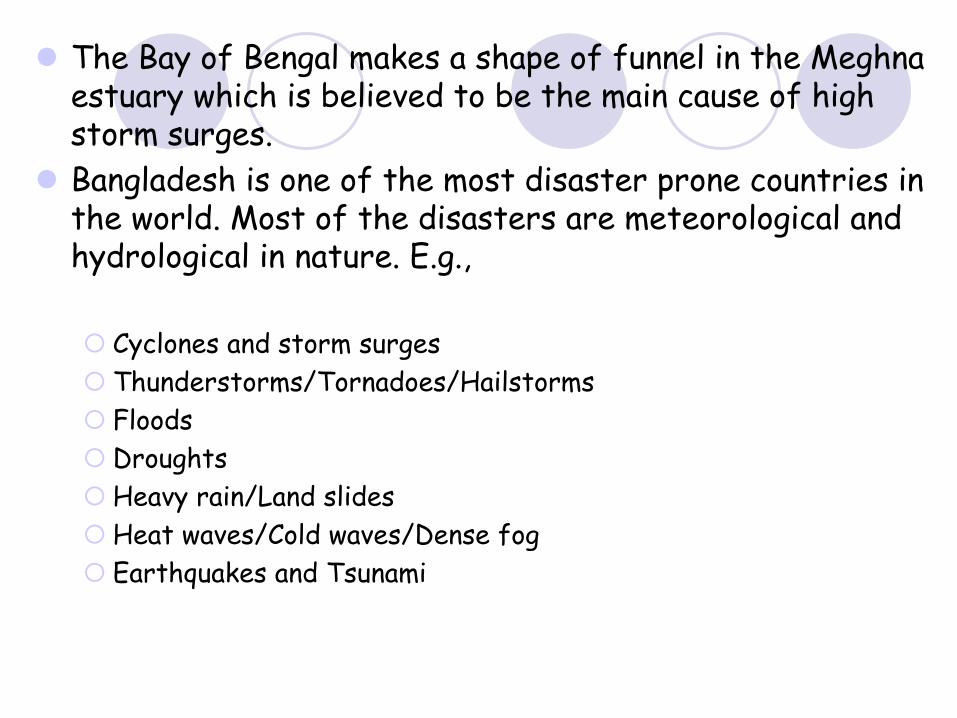
The Bay of Bengal makes a shape of funnel in the Meghnaestuary which is believed to be the main cause of high storm surges.Bangladesh is one of the most disaster prone countries in the world. Most of the disasters are meteorological and hydrological in nature. E.g.,
Cyclones and storm surgesThunderstorms/Tornadoes/HailstormsFloodsDroughtsHeavy rain/Land slidesHeat waves/Cold waves/Dense fogEarthquakes and Tsunami
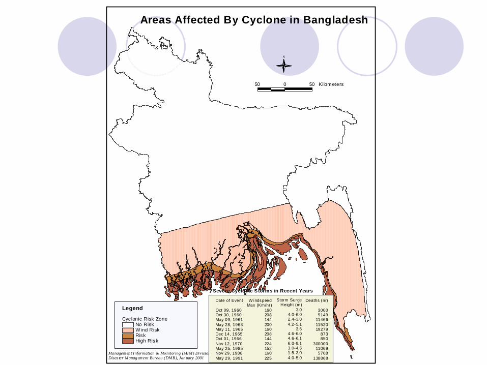
50 0 50 Kilometers
N
Areas Affected By Cyclone in Bangladesh
Management Information & Monitoring (MIM) DivisionDisas ter Management Bureau (DMB), January 2001
Cyclonic Risk ZoneNo RiskWind RiskRiskHigh Risk
Legend
Severe Cyclonic S torms in Recent Years
Date of Event
Oct 09, 1960Oct 30, 1960May 09, 1961May 28, 1963May 11, 1965Dec 14, 1965Oct 01, 1966Nov 12, 1970May 25, 1985Nov 29, 1988May 29, 1991
W indspeedMax (Km/hr)
160208144200160208144224152160225
Storm SurgeHeight (m)
3.04.0-6.02.4-3.04.2-5.1
3.64.6-6.04.6-6.16.0-9.13.0-4.61.5-3.04.0-5.0
Deaths (nr)
30005149
114661152019279
873850
300000110695708
138868
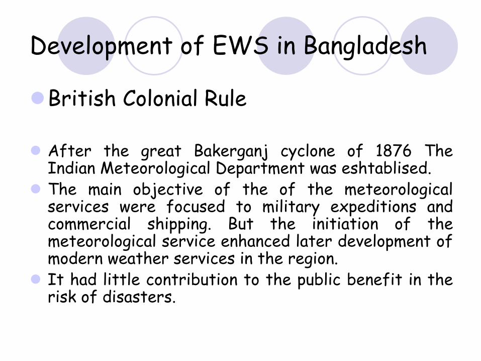
Development of EWS in Bangladesh
British Colonial Rule
After the great Bakerganj cyclone of 1876 The Indian Meteorological Department was eshtablised.The main objective of the of the meteorological services were focused to military expeditions and commercial shipping. But the initiation of the meteorological service enhanced later development of modern weather services in the region.It had little contribution to the public benefit in the risk of disasters.
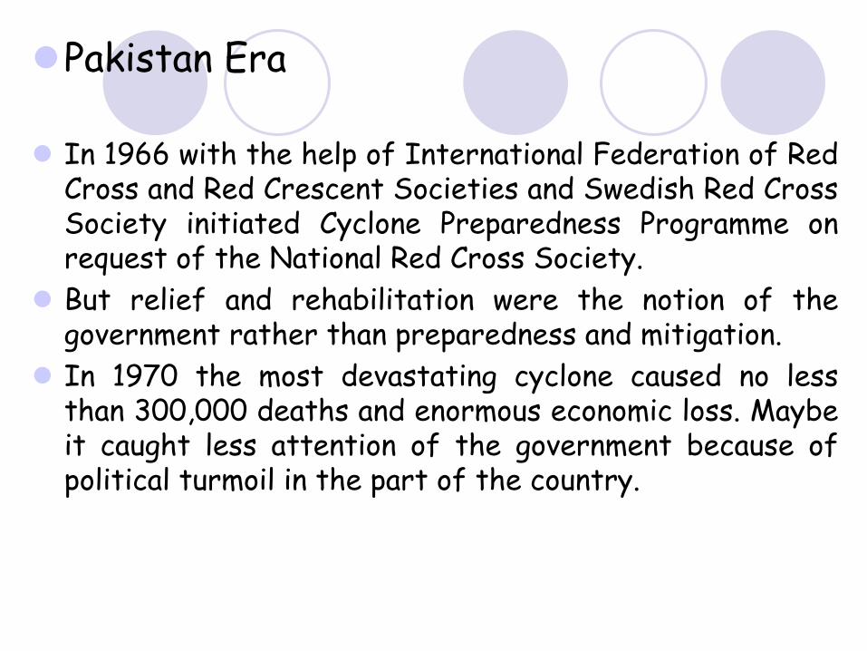
Pakistan Era
In 1966 with the help of International Federation of Red Cross and Red Crescent Societies and Swedish Red Cross Society initiated Cyclone Preparedness Programme on request of the National Red Cross Society.But relief and rehabilitation were the notion of the government rather than preparedness and mitigation.In 1970 the most devastating cyclone caused no less than 300,000 deaths and enormous economic loss. Maybe it caught less attention of the government because of political turmoil in the part of the country.
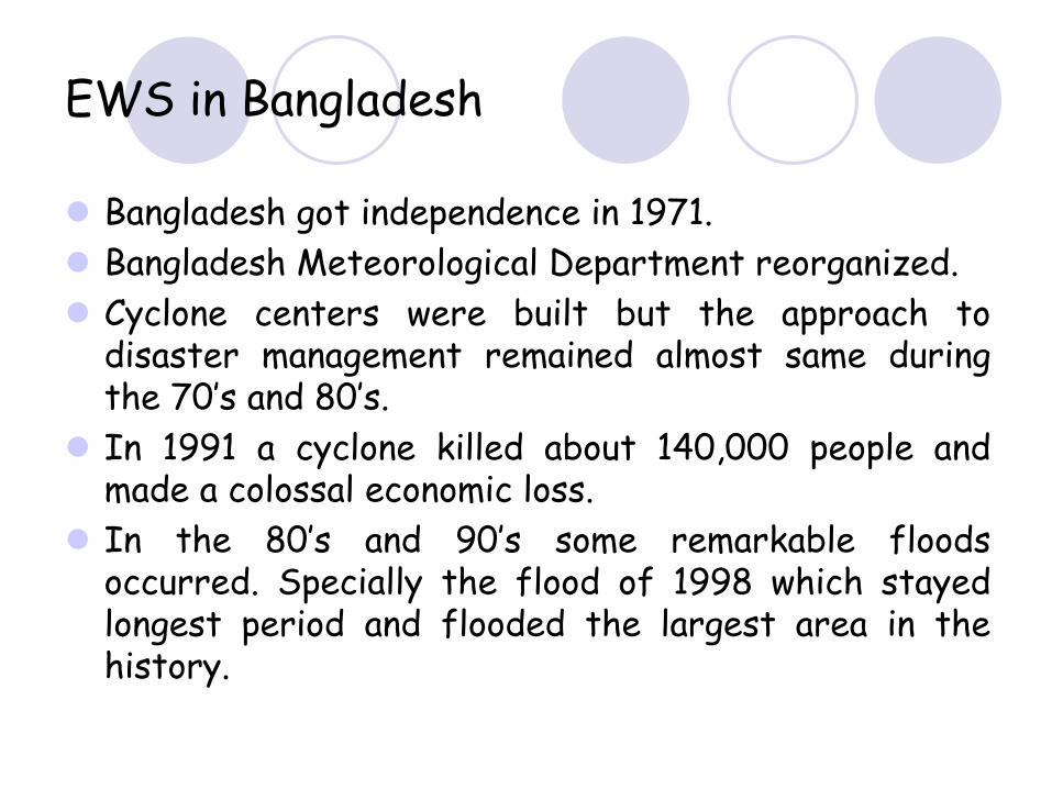
EWS in Bangladesh
Bangladesh got independence in 1971.Bangladesh Meteorological Department reorganized.Cyclone centers were built but the approach to disaster management remained almost same during the 70’s and 80’s.In 1991 a cyclone killed about 140,000 people and made a colossal economic loss. In the 80’s and 90’s some remarkable floods occurred. Specially the flood of 1998 which stayed longest period and flooded the largest area in the history.
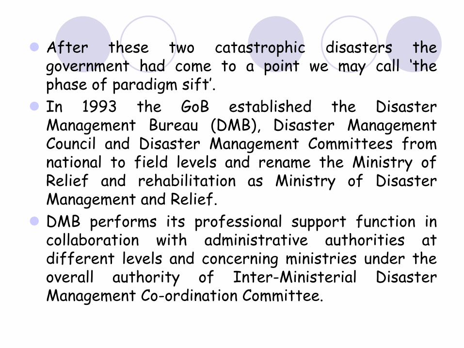
After these two catastrophic disasters the government had come to a point we may call ‘the phase of paradigm sift’.In 1993 the GoB established the Disaster Management Bureau (DMB), Disaster Management Council and Disaster Management Committees from national to field levels and rename the Ministry of Relief and rehabilitation as Ministry of Disaster Management and Relief.DMB performs its professional support function in collaboration with administrative authorities at different levels and concerning ministries under the overall authority of Inter-Ministerial Disaster Management Co-ordination Committee.
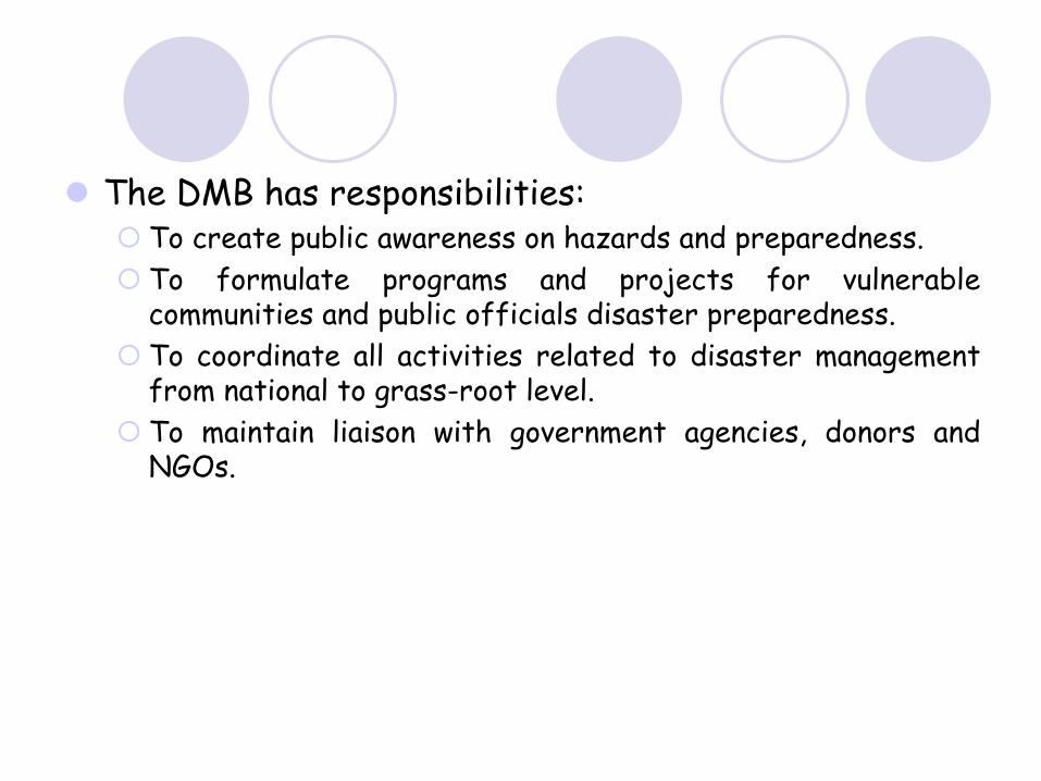
The DMB has responsibilities:To create public awareness on hazards and preparedness.To formulate programs and projects for vulnerable communities and public officials disaster preparedness.To coordinate all activities related to disaster management from national to grass-root level.To maintain liaison with government agencies, donors and NGOs.
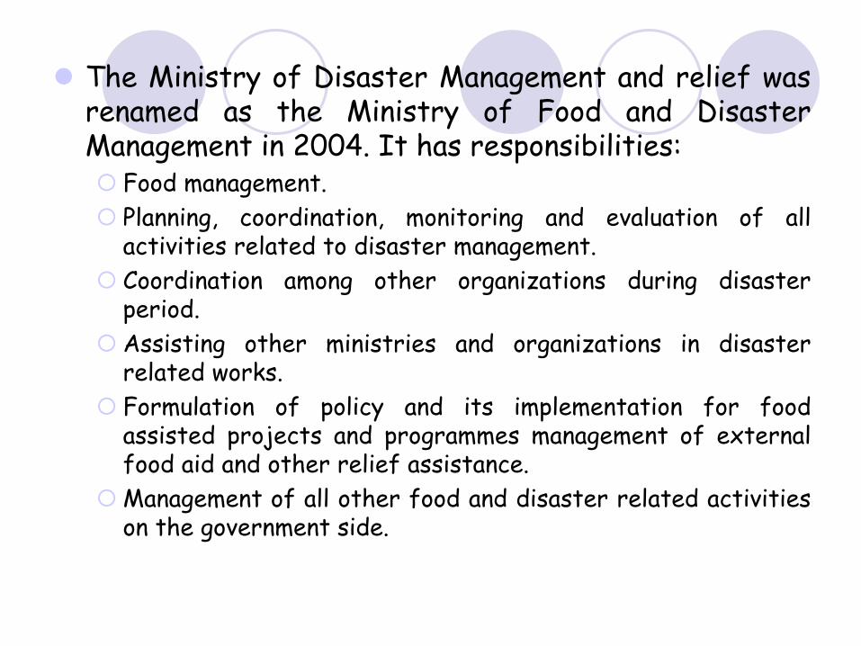
The Ministry of Disaster Management and relief was renamed as the Ministry of Food and Disaster Management in 2004. It has responsibilities:
Food management.Planning, coordination, monitoring and evaluation of all activities related to disaster management.Coordination among other organizations during disaster period.Assisting other ministries and organizations in disaster related works.Formulation of policy and its implementation for food assisted projects and programmes management of external food aid and other relief assistance.Management of all other food and disaster related activities on the government side.
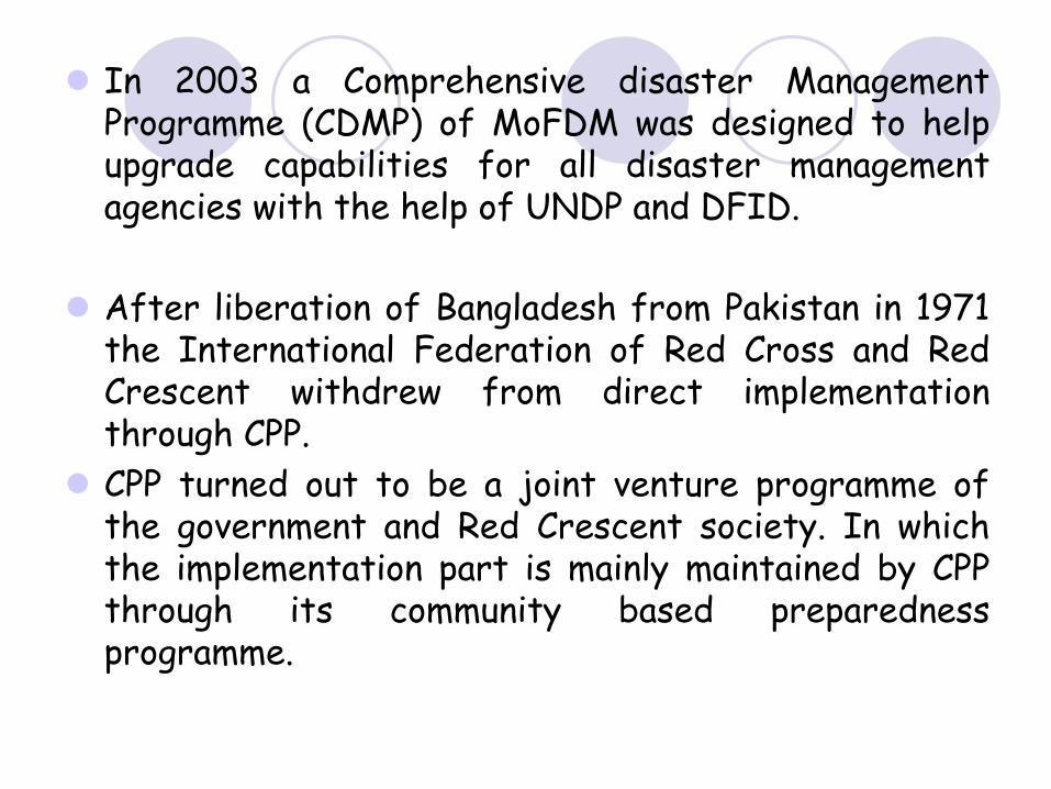
In 2003 a Comprehensive disaster Management Programme (CDMP) of MoFDM was designed to help upgrade capabilities for all disaster management agencies with the help of UNDP and DFID.
After liberation of Bangladesh from Pakistan in 1971 the International Federation of Red Cross and Red Crescent withdrew from direct implementation through CPP.CPP turned out to be a joint venture programme of the government and Red Crescent society. In which the implementation part is mainly maintained by CPP through its community based preparedness programme.
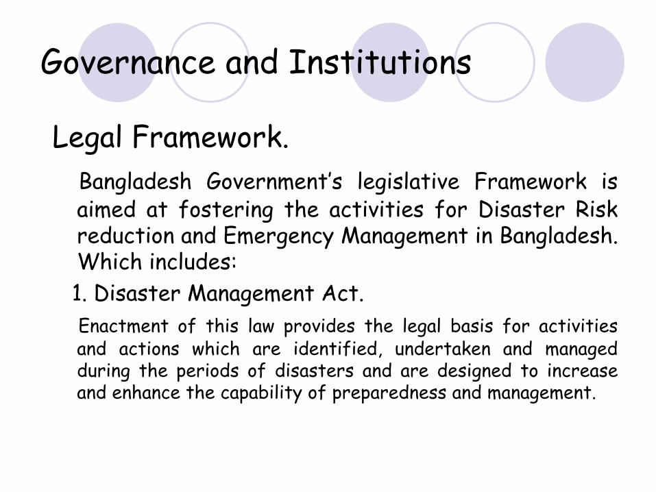
Governance and Institutions
Legal Framework.Bangladesh Government’s legislative Framework is
aimed at fostering the activities for Disaster Risk reduction and Emergency Management in Bangladesh. Which includes:1. Disaster Management Act.Enactment of this law provides the legal basis for activities and actions which are identified, undertaken and managed during the periods of disasters and are designed to increase and enhance the capability of preparedness and management.
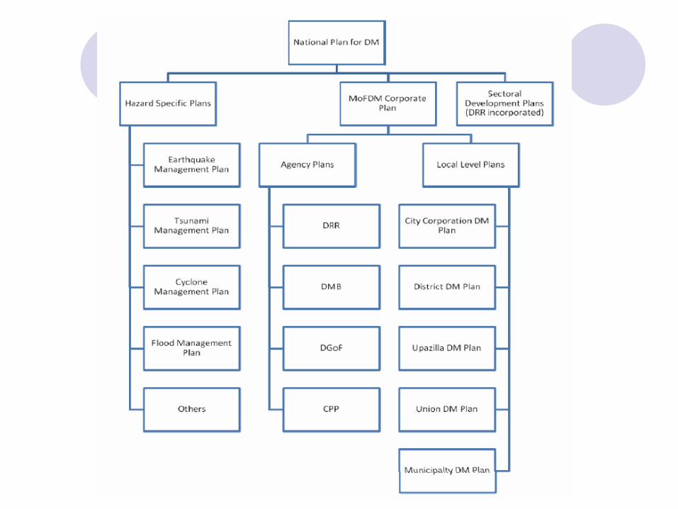
2. National Plan for Disaster Management.The National Plan for Disaster Management is prepared by MoFDM. This plan incorporates public awareness building and development of planning procedures from top level to grass root levels in a community based participatory manner.
3. National Disaster management policy.It is a strategic Framework which reflects the national perspective and principle of risk reduction and emergency and disaster management.
4. Standing Orders on Disaster (SOD).SOD describes in detail the roles and responsibilities of different committees, ministries and other organizations involved in disaster related activities. It is key document which is followed by all concerned organizations in Bangladesh.
5. Guidelines for government at all Levels.Guidelines for Government are implemented and used and are used to assist Ministries and all other organizations (Govt. & NGOs) for disaster risk management.
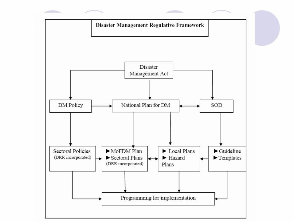
6.National to local emergency planning.It is an umbrella plan which provides overall guideline for all
concerned sectors and institutions at all levels to prepare and implement their area of roles specific plans. The MoFdM takes the lead role in disaster risk reduction and emergency management planning. There would be
a. Hazard specific plans.b. Area at different levels (administrative unit)
specific plans.
7.
Disaster Management Plans
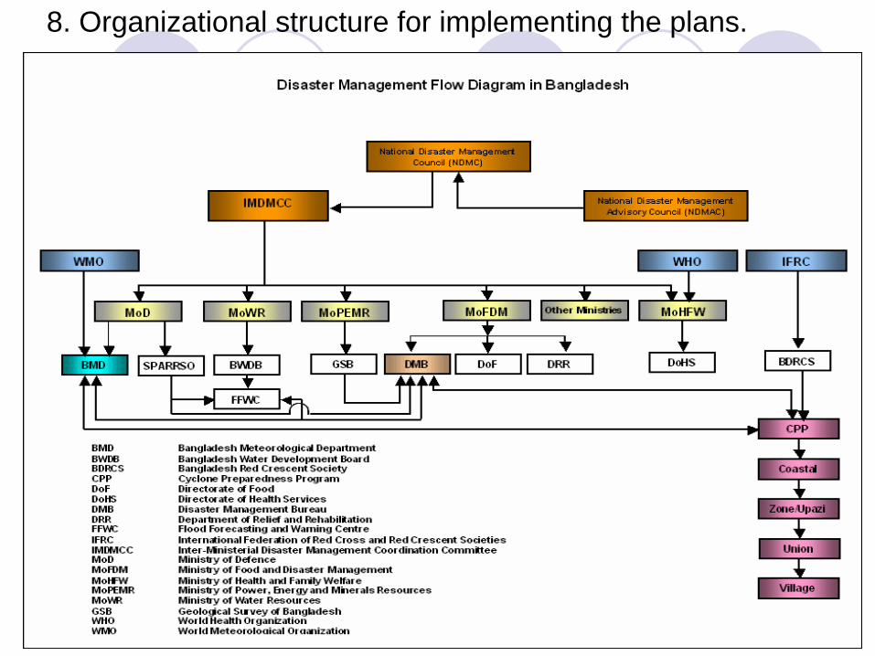
8. Organizational structure for implementing the plans.
Risk Information in emergency Planning and Warning.
Currently there is no proper disaster risk map in use in EWS in the country. But the NDMC understands the utility of risk information and is developing risk map for using in EWS.Mainly information of vulnerability and potential exposure are used widely in EWS & DM.BMD & BWDB keep hydro meteorological and climatological data and information and send to BBS which is mandated to all maintain national data including demographic and other data.
Hazard Monitoring, Forecasting and Mandates of Warning Generation.
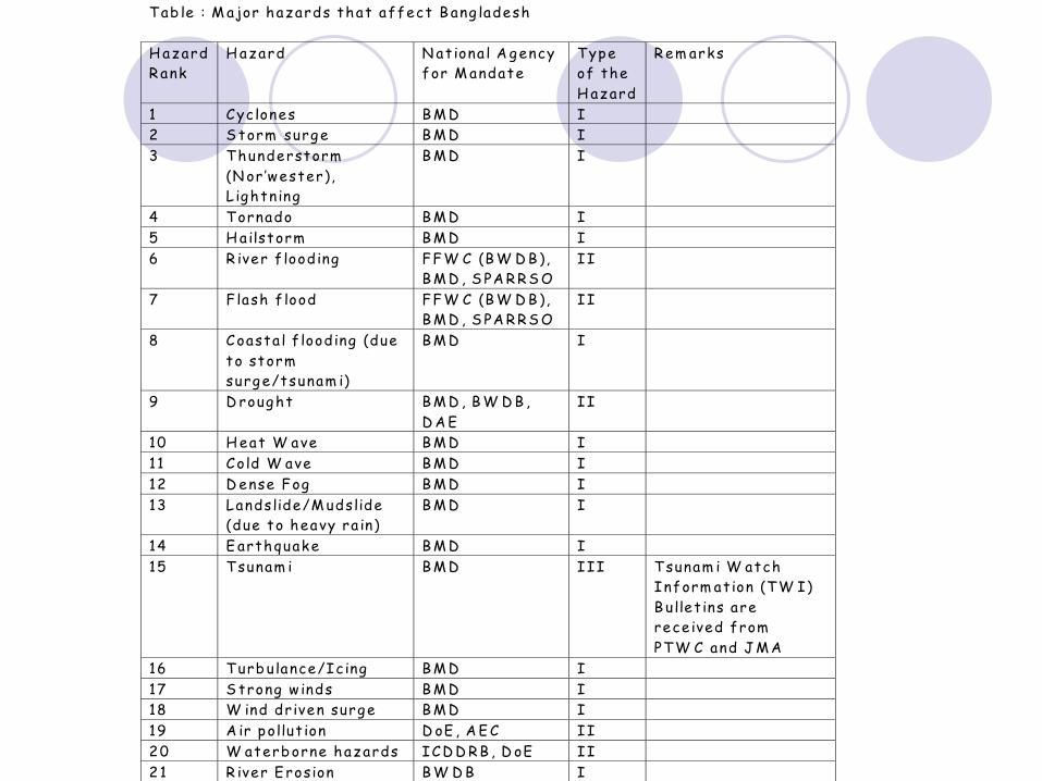
Tab le : M ajor hazards that affect B ang ladesh H azard R ank
H azard N at iona l A gency for M andate
Type of the H azard
R em arks
1 Cyc lones B M D I 2 S torm surge B M D I 3 T hunderstorm
(N or ’wester), L ightn ing
B M D I
4 Tornado B M D I 5 H a ilstorm B M D I 6 R iver f lood ing FFW C (B W D B ),
B M D , S PA R R S O II
7 F lash f lood FFW C (B W D B ), B M D , S PA R R S O
II
8 Coasta l f lood ing (due to storm surge/tsunam i)
B M D I
9 D rought B M D , B W D B , D A E
II
10 H eat W ave B M D I 11 Cold W ave B M D I 12 D ense Fog B M D I 13 Landslide/M udslide
(due to heavy ra in) B M D I
14 E arthquake B M D I 15 Tsunam i B M D III Tsunam i W atch
Inform at ion (TW I) B u llet ins are rece ived from PTW C and J M A
16 T urb ulance/Ic ing B M D I 17 S trong w inds B M D I 18 W ind dr iven surge B M D I 19 A ir pollut ion D oE , A E C II 20 W aterb orne hazards ICD D R B , D oE II 2 1 R iver E rosion B W D B I

Note:
Hazard rank is based on the historical figures of casualties and
economic losses attributed to the respective hazards.
AEC Atomic Energy CommissionBMD Bangladesh Meteorological DepartmentBWDB
Bangladesh Water Development BoardDAE Department of Agriculture ExtensionDoE
Department of Environment FFWC
Flood Forecasting and Warning
CentreICDDRB
International
Centre
for
Diarrheal
Diseases Research, BangladeshJMA
Japan Meteorological Agency
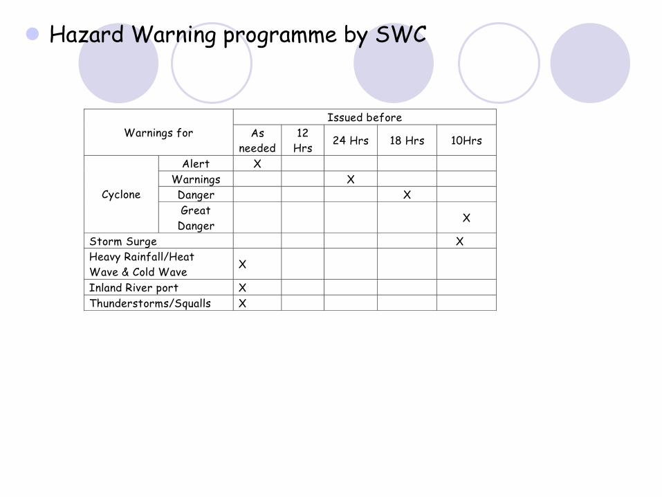
Hazard Warning programme by SWC
Issued before Warnings for As
needed 12
Hrs 24 Hrs 18 Hrs 10Hrs
Alert X Warnings X Danger X Cyclone Great
Danger X
Storm Surge X Heavy Rainfall/Heat Wave & Cold Wave
X
Inland River port X Thunderstorms/Squalls X
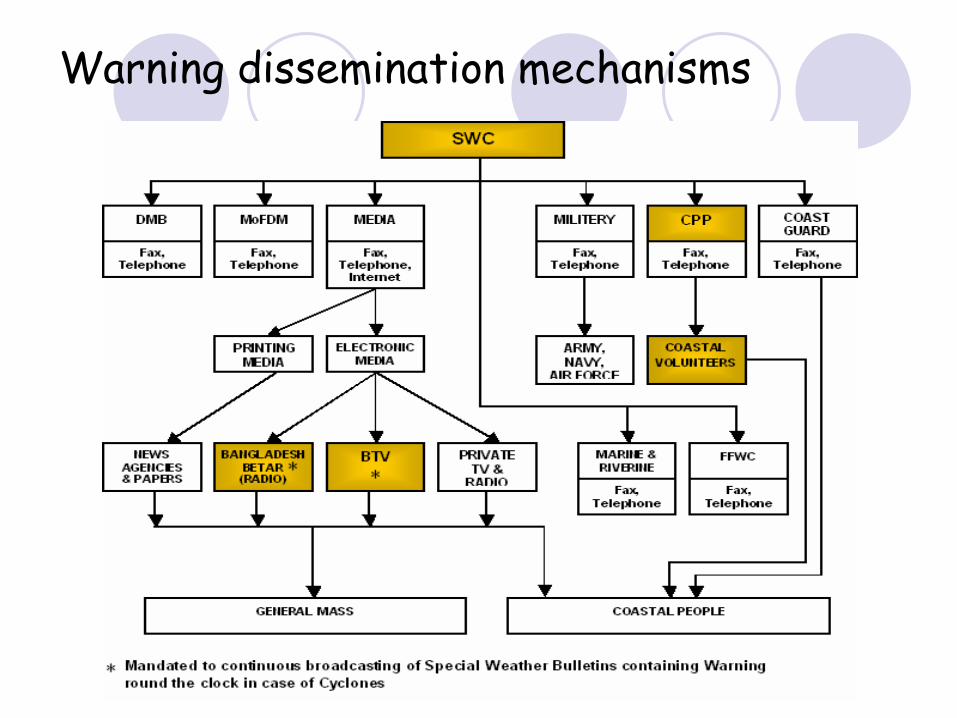
Warning dissemination mechanisms
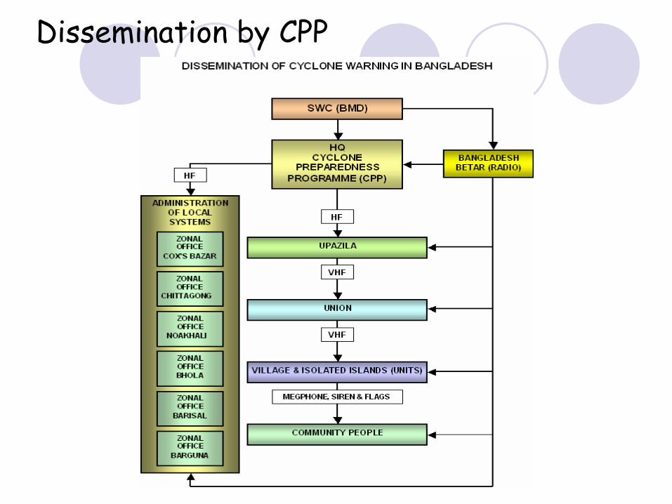
Dissemination by CPP
Emergency Preparedness and response activities
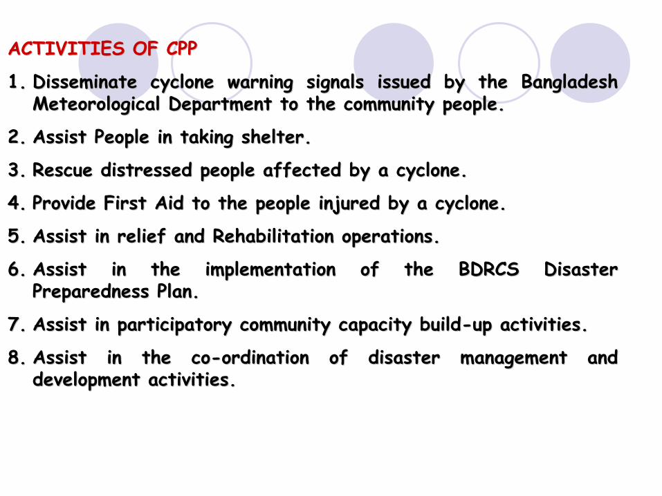
ACTIVITIES OF CPPACTIVITIES OF CPP
1.1.
Disseminate cyclone warning signals issued by the Bangladesh Disseminate cyclone warning signals issued by the Bangladesh Meteorological Department to the community people.Meteorological Department to the community people.
2.2.
Assist People in taking shelter.Assist People in taking shelter.
3.3.
Rescue distressed people affected by a cyclone.Rescue distressed people affected by a cyclone.
4.4.
Provide First Aid to the people injured by a cyclone.Provide First Aid to the people injured by a cyclone.
5.5.
Assist in relief and Rehabilitation operations.Assist in relief and Rehabilitation operations.
6.6.
Assist in the implementation of the BDRCS Disaster Assist in the implementation of the BDRCS Disaster Preparedness Plan.Preparedness Plan.
7.7.
Assist in participatory community capacity buildAssist in participatory community capacity build--up activities.up activities.
8.8.
Assist in the coAssist in the co--ordination of disaster management and ordination of disaster management and
development activities.development activities.
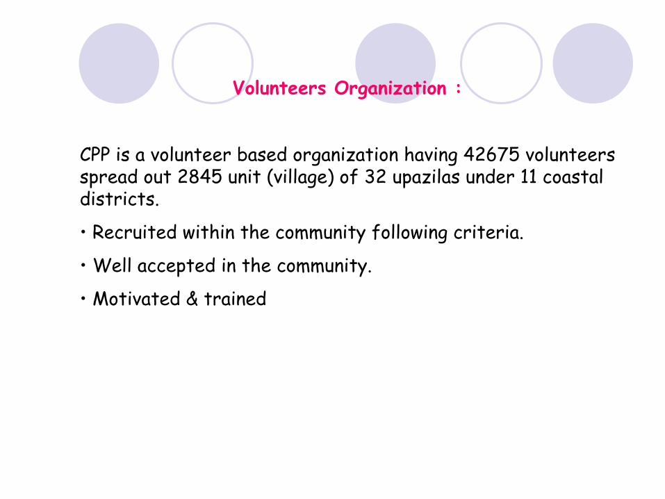
Volunteers Organization :
CPP is a volunteer based organization having 42675 volunteers spread out 2845 unit (village) of 32 upazilas
under 11 coastal districts.
• Recruited within the community following criteria.
• Well accepted in the community.
• Motivated & trained
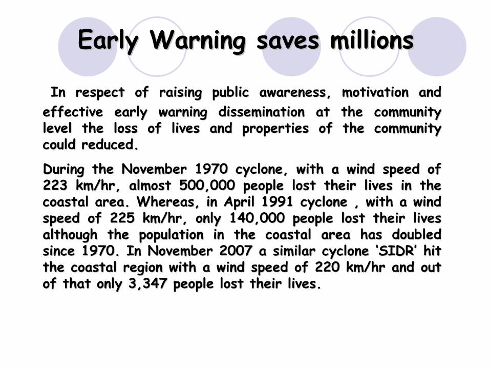
Early Warning saves millionsEarly Warning saves millions
In respect of raising public awareness, motivation and In respect of raising public awareness, motivation and effective early warning dissemination at the community effective early warning dissemination at the community level the loss of lives and properties of the community level the loss of lives and properties of the community could reduced.could reduced.
During the November 1970 cyclone, with a wind speed of During the November 1970 cyclone, with a wind speed of 223 km/hr, almost 500,000 people lost their lives in the 223 km/hr, almost 500,000 people lost their lives in the coastal area. Whereas, in April 1991 cyclone , with a wind coastal area. Whereas, in April 1991 cyclone , with a wind speed of 225 km/hr, only 140,000 people lost their lives speed of 225 km/hr, only 140,000 people lost their lives although the population in the coastal area has doubled although the population in the coastal area has doubled since 1970. In November 2007 a similar cyclone since 1970. In November 2007 a similar cyclone ‘‘SIDRSIDR’’
hit hit the coastal region with a wind speed of 220 km/hr and out the coastal region with a wind speed of 220 km/hr and out of that only 3,347 people lost their lives.of that only 3,347 people lost their lives.
Conclusion
Very recently the GoB has taken DMS in a comprehensive way.Which includes MDG and Climate Change Issues in every step of strategic planning.We have to go a long way to make EWS for DMS which might adjust to the sustainable economic development efforts.

Thank You