Embed Size (px)
Citation preview
National Marine Sanctuaries
January 24, 2013Bodega Bay Grange
Dan HowardSanctuary Superintendent
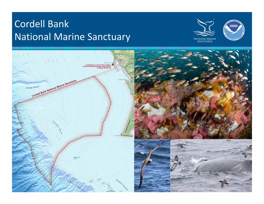
Cordell Bank National Marine Sanctuary
(CBNMS)
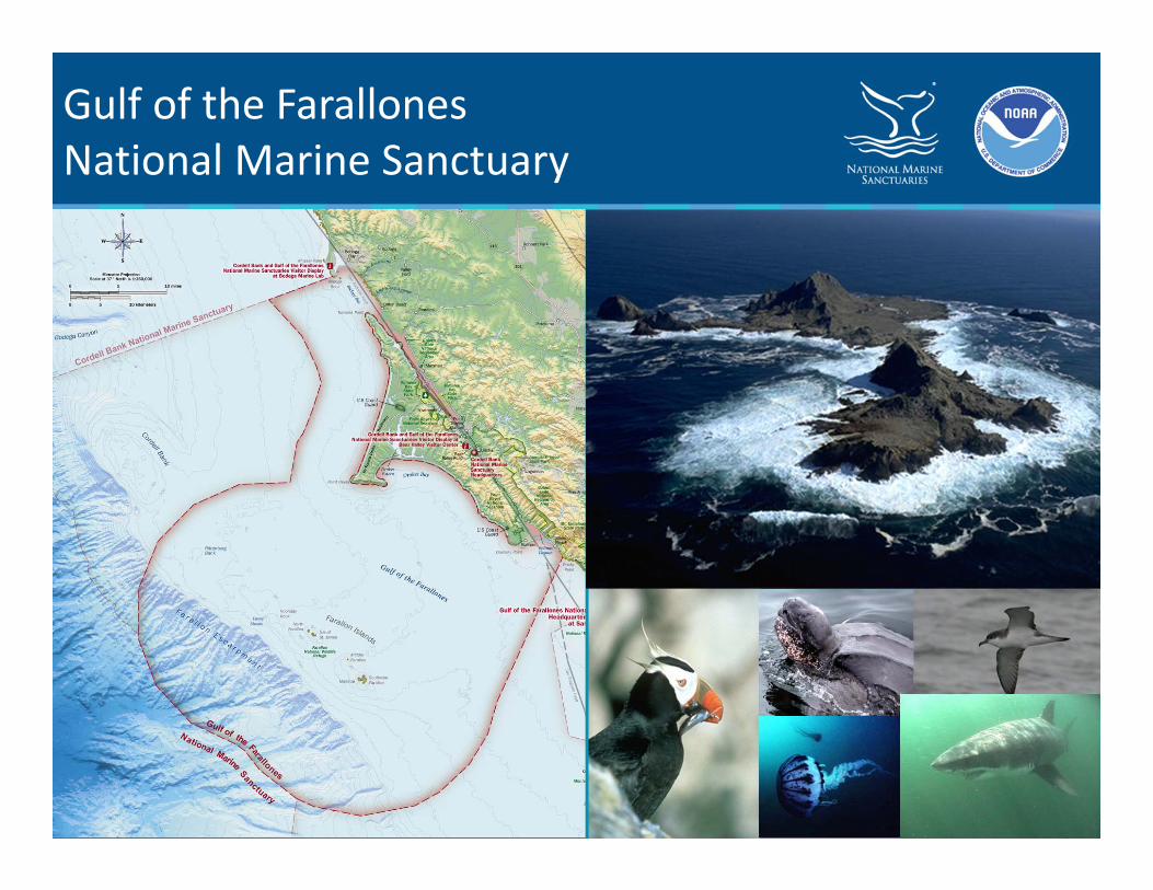
Maria BrownSanctuary SuperintendentGulf of the Farallones
National Marine Sanctuary (GFNMS)
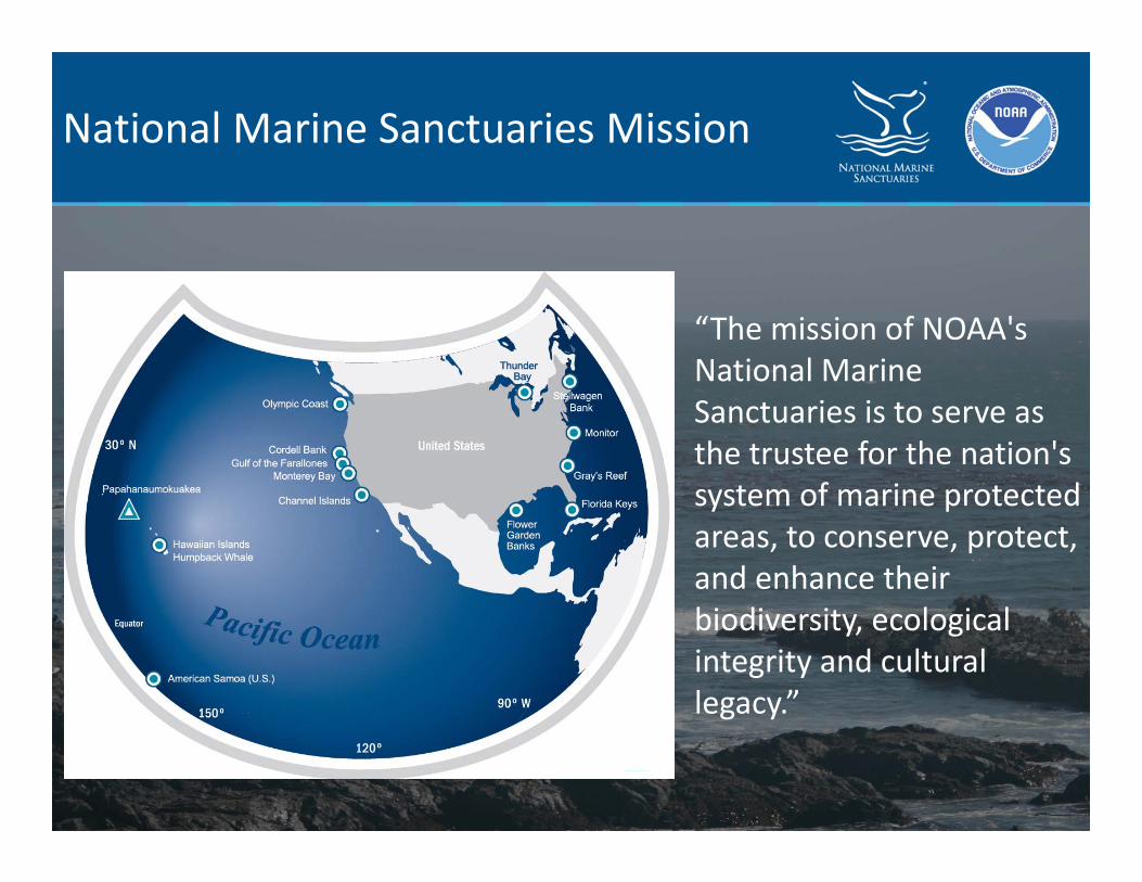
National Marine Sanctuaries Mission
“The mission of NOAA's National Marine Sanctuaries is to serve as the trustee for the nation's system of marine protected areas, to conserve, protect, and enhance their biodiversity, ecological integrity and cultural legacy.”
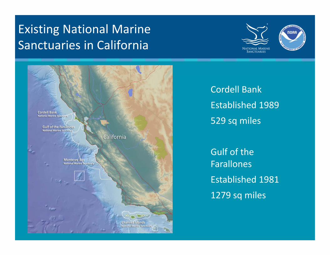
Existing National Marine Sanctuaries in California
Cordell BankEstablished 1989529 sq miles
Gulf of the Farallones Established 19811279 sq miles
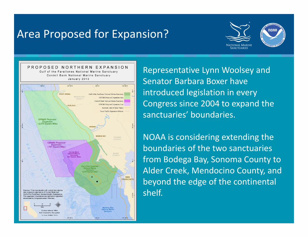
Area Proposed for Expansion?
Representative Lynn Woolsey and Senator Barbara Boxer have introduced legislation in every Congress since 2004 to expand the sanctuaries’ boundaries.
NOAA is considering extending the boundaries of the two sanctuaries from Bodega Bay, Sonoma County to Alder Creek, Mendocino County, and beyond the edge of the continental shelf.
Cordell Bank National Marine Sanctuary
Gulf of the Farallones National Marine Sanctuary
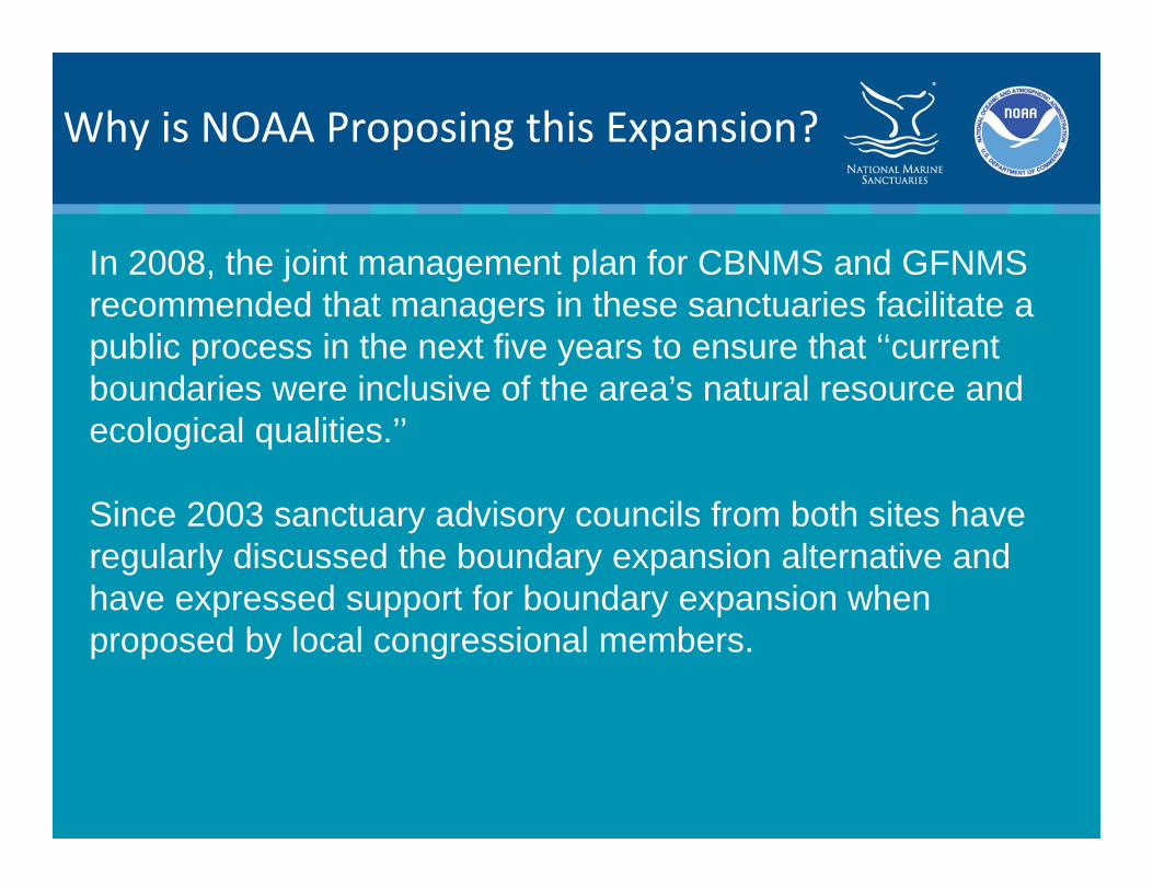
Why is NOAA Proposing this Expansion?
In 2008, the joint management plan for CBNMS and GFNMS recommended that managers in these sanctuaries facilitate a public process in the next five years to ensure that ‘‘current boundaries were inclusive of the area’s natural resource and ecological qualities.’’
Since 2003 sanctuary advisory councils from both sites have regularly discussed the boundary expansion alternative and have expressed support for boundary expansion when proposed by local congressional members.
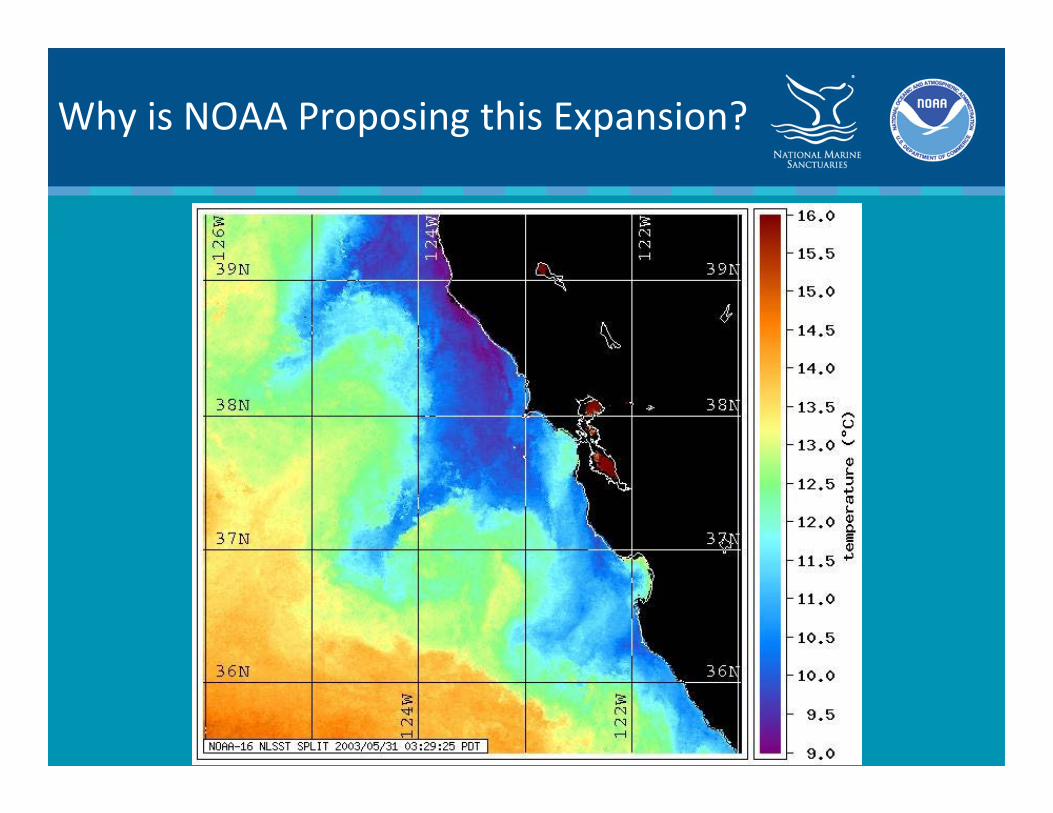
Why is NOAA Proposing this Expansion?
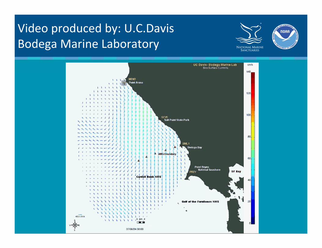
Video produced by: U.C.Davis Bodega Marine Laboratory
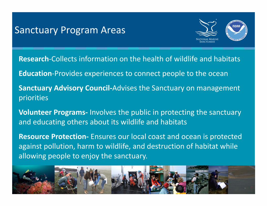
Sanctuary Program Areas
Research‐Collects information on the health of wildlife and habitats
Education‐Provides experiences to connect people to the ocean
Sanctuary Advisory Council‐Advises the Sanctuary on management priorities
Volunteer Programs‐ Involves the public in protecting the sanctuary and educating others about its wildlife and habitats
Resource Protection‐ Ensures our local coast and ocean is protected against pollution, harm to wildlife, and destruction of habitat while allowing people to enjoy the sanctuary.
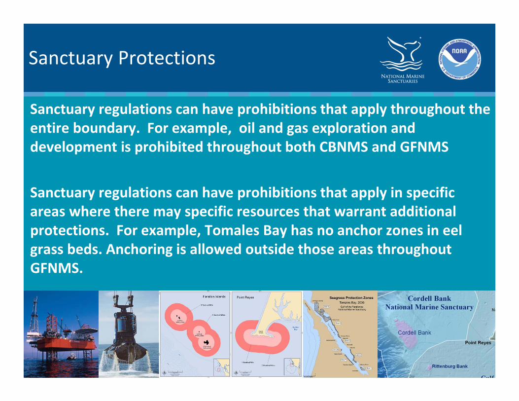
Sanctuary Protections
Sanctuary regulations can have prohibitions that apply throughout the entire boundary. For example, oil and gas exploration and development is prohibited throughout both CBNMS and GFNMS
Sanctuary regulations can have prohibitions that apply in specific areas where there may specific resources that warrant additional protections. For example, Tomales Bay has no anchor zones in eel grass beds. Anchoring is allowed outside those areas throughout GFNMS.
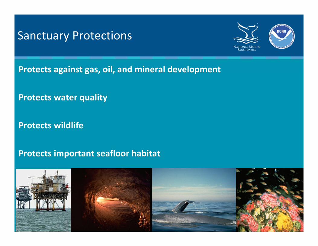
Sanctuary Protections
Protects against gas, oil, and mineral development
Protects water quality
Protects wildlife
Protects important seafloor habitat
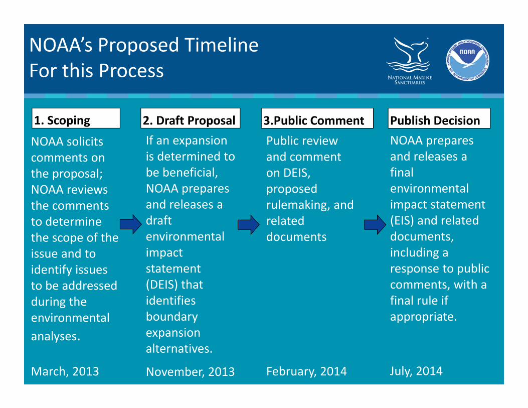
3.Public Comment 2. Draft Proposal1. ScopingIf an expansion is determined to be beneficial, NOAA prepares and releases a draft environmental impact statement (DEIS) that identifies boundary expansion alternatives.
November, 2013
NOAA solicits comments on the proposal; NOAA reviews the comments to determine the scope of the issue and to identify issues to be addressed during the environmental analyses.
March, 2013
Publish DecisionNOAA prepares and releases a final environmental impact statement (EIS) and related documents, including a response to public comments, with a final rule if appropriate.
July, 2014
Public review and comment on DEIS, proposed rulemaking, and related documents
February, 2014
NOAA’s Proposed Timeline For this Process
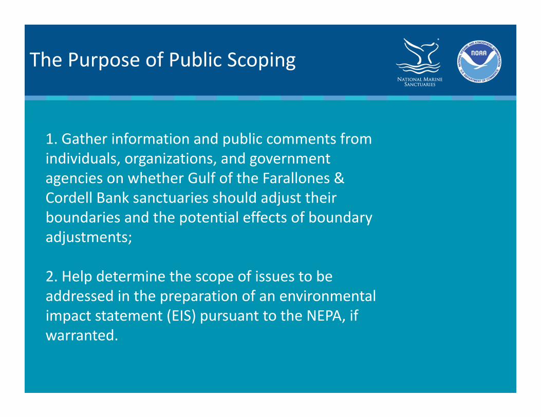
1. Gather information and public comments from individuals, organizations, and government agencies on whether Gulf of the Farallones & Cordell Bank sanctuaries should adjust their boundaries and the potential effects of boundary adjustments;
2. Help determine the scope of issues to be addressed in the preparation of an environmental impact statement (EIS) pursuant to the NEPA, if warranted.
The Purpose of Public Scoping
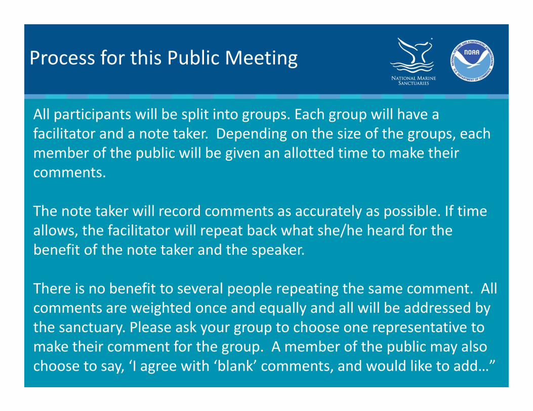
Process for this Public Meeting
All participants will be split into groups. Each group will have a facilitator and a note taker. Depending on the size of the groups, each member of the public will be given an allotted time to make their comments.
The note taker will record comments as accurately as possible. If time allows, the facilitator will repeat back what she/he heard for the benefit of the note taker and the speaker.
There is no benefit to several people repeating the same comment. All comments are weighted once and equally and all will be addressed by the sanctuary. Please ask your group to choose one representative to make their comment for the group. A member of the public may also choose to say, ‘I agree with ‘blank’ comments, and would like to add…”
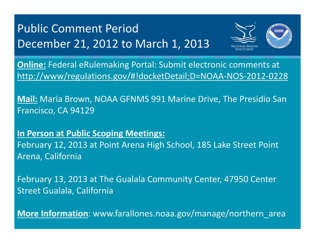
Public Comment Period December 21, 2012 to March 1, 2013
Online: Federal eRulemaking Portal: Submit electronic comments at http://www/regulations.gov/#!docketDetail;D=NOAA‐NOS‐2012‐0228
Mail:Maria Brown, NOAA GFNMS 991 Marine Drive, The Presidio San Francisco, CA 94129
In Person at Public Scoping Meetings:February 12, 2013 at Point Arena High School, 185 Lake Street Point Arena, California
February 13, 2013 at The Gualala Community Center, 47950 Center Street Gualala, California
More Information: www.farallones.noaa.gov/manage/northern_area
http://farallones.noaa.gov/manage/northern_area.html
Media Inquiries:[email protected] 415‐561‐6622 x205
GFNMS Inquiries: [email protected] 415‐561‐6622 x236
CBNMS Inquiries:[email protected] 415‐663‐1437
For More Information:
![National Marine Sanctuaries Act · National Marine Sanctuaries Act 1 SEC. 301. [16 U.S.C. 1431] FINDINGS, PURPOSES, AND POLICIES; ESTABLISHMENT OF SYSTEM (a) FINDINGS.—The Congress](https://img.pdfslide.net/doc/110x75/60022edba04cf4577540bed6/national-marine-sanctuaries-act-national-marine-sanctuaries-act-1-sec-301-16.jpg)