Embed Size (px)
Citation preview
1
november 2012
Author: Hallam GoadEditor: Nora LindströmrESEArCh tEAM: Hallam Goad Meas Kimseng
Cover Photo: Conor Wall
With thanks to everyone who supported this research, and special thanks to Conor Wall and Keith Kelly for supplying photographs
The Urban Initiative is an independent project under Sahmakum Teang Tnaut
Supported by a grant from Norwegian People’s Aid
www.teangtnaut.org
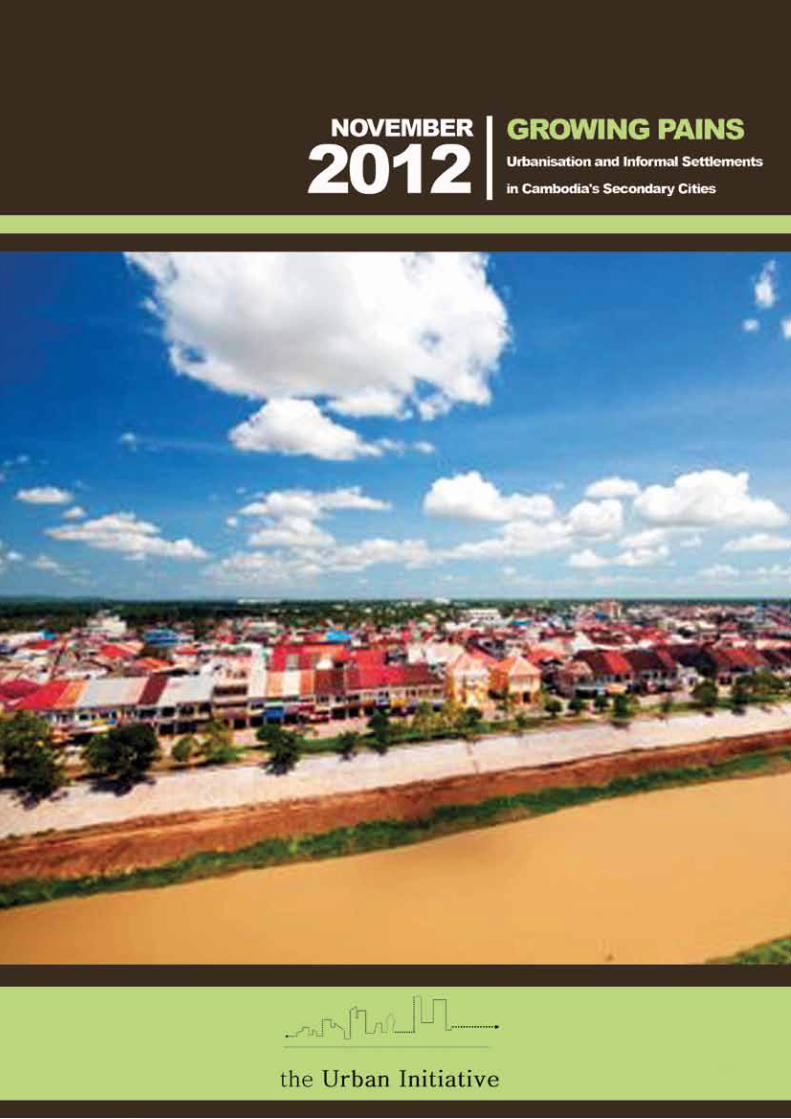
growing painsUrbanisation and informal settlements in
Cambodia's secondary Cities
acronyms
introduction
snapshot of Battambang
snapshot of siem reap
snapshot of sihanoukville
Discussion The Planning System: largely irrelevant? Planned enclaves, unplanned cities? Urban poor settlements: a labyrinthine game? Donor assistance: the winds of change? Where are the CSOs?
conclusion
List of contacts
Bibliography
ConTEnTs
1
25
1320
27
323334
aDB Asian Development Bank
aDHoC Cambodian Human Rights & Development Association
ausaiD Australian International Aid
CEDT Community Empowerment and Development Team
CBo Community Based Organisation
CDF Community Development Foundation
CMDp Community Managed Development Partners
Cnro Cambodian national research organization
Cso Civil Society Organisation
DED Deutscher Entwicklungsdienst
giZ Gesellschaft für Internationale Zusammenarbeit
gTZ Deutsche Gesellschaft für Technische Zusammenarbeit
JiCa Japan International Cooperation Agency
LasED Land Allocation for Social and Economic Development
Lassp Land Administration Sub Sector Programme
LiCaDHo Cambodian League for the Defense and Promotion of Human Rights
LMap Land Management and Administration Project
MLMUpC Ministry of Land Management Urban Planning and Construction
ngo Non Governmental Organisation
sLg Samreth Law Group
UnCHs United Nations Centre for Human Settlements
aCronyMs
Growing Pains: Urbanisation and Informal Settlements in Cambodia’s Secondary Cities
32
introduction
‘Instead of consolidating these important tenure documents through schemes such as LMAP and LASSP the urban poor have been alternately ignored, excluded and/or evicted from their homes’
While Phnom Penh continues to consolidate its role as the primary city of Cambodia, the country’s secondary cities are continuing to act and expand as regional centres in their own right. This study takes a snapshot1 look at how urbanisation has impacted three of these cities - Sihanoukville, Battambang, and Siem Reap - and, in particular, their urban poor settlements.
At first impression, all three cities are characterized by strong infrastructural growth and expansion. In comparison to the UN Habitat (UNCHS) survey conducted in 1992 which noted that the “infrastructure in each of the towns is in extremely poor condition”2, the situation has improved beyond recognition. Water supply, roads, education and almost all forms of infrastructure have improved significantly over the past two decades.
At the core of this growth are very distinct economic drivers for each city - Sihanoukville has its port and tourism, Battambang a strong provincial agricultural base, while growth in Siem Reap, home to the Angkor Temples, is driven by tourism. Following the national trend, all three cities have seen almost uninterrupted growth reflected in population increases of up to 5% per year3. City limits have been expanded and all three cities are expecting to see further growth. The rate of urbanisation (for which no official data is available) and the relatively small size of the cities has meant that local Government departments have been able to maintain an overview on the expansion, although this has been confined more to the levying of fees rather than managing growth within a particular vision or master plan. The urban poor settlements contained within these cities are also of a very manageable size - nowhere near the large volumes facing municipal authorities in regional secondary cities such as Bangalore and Yogyakarta. In many ways Sihanoukville, Battambang, and Siem Reap are in an enviable position with strong growth and investment forecasted in both public and private sectors. A one way story? Inevitably, it is not.
Alongside impressive growth these cities are also witnessing many of the problems associated with urbanisation in developing countries, albeit at a less intense rate. In particular, the urban poor continue to be marginalised with limited access to health, education4 and most significantly, to tenure security. Although they are key actors in enabling, some argue subsidising, the impressive growth of the cities, the urban poor continue to be viewed as ‘unsightly’ and ‘illegal’, and removal of their homes and shelters has been carried out sporadically over the past twenty years.
A typical example of tenure insecurity is manifested among families who settled on state private land in the aftermath of the genocide and civil war years. Many have now lived on their plots since 1979 and have local authority documents recognising their address and status which under the 2001 Land Law provides them with robust cases for receiving land titles. However, instead of consolidating these important tenure documents through schemes such as Land Management & Administration Project (LMAP) and Land
1 1Publicly available material on city planning is, at best, sparse, and therefore we would emphasise the ‘snapshot’ nature of this document.2 UNCHS (1992) Needs assessment mission in light of imminent influx of returnees in Cambodia3 Siem Reap 5.2%,Sihanoukville 2.98% & Battambang 3.28% (Ministry of Planning (2008) National Census Data)4 Battambang Municipality (2010) Informal Settlements survey 2009
Administration Sub Sector Programme (LASSP)5 the urban poor have been alternately ignored, excluded and/or evicted from their homes.6 Legislative directives such as Circular 03, while potentially benign and even beneficial, have so far only succeeded in bolstering the perception that the urban poor settlements are ‘illegal’. As Yin Mengly, Director of the ADHOC Battambang office, commented, ‘When people came here after the war (in 1993) they settled where they could. Now they call it “squatting” even though they have documents acknowledging their address.’ This subtle reinforcement of the ‘illegality’ of urban poor settlements has had a limited impact on the outward signs of urbanisation in the three secondary cities, but its unseen effects in terms of retaining a destabilised and vulnerable sector of society is of long term concern. Underpinning this situation is an age-old dynamic deeply ingrained into the fabric of Cambodian society. It is the dynamic of patronage and control, perhaps best portrayed in David Chandler’s History of Cambodia7. What we see today is a modern version of this which, to all extents and purposes, drives and directs urbanisation - and many other issues. Anyone who wants to do or build anything significant needs to appreciate and work through this nexus – the tight linkage of government bodies, top political figures and key business actors. Municipal authorities exist and have various departments of planning and administration who work ‘independently’, yet are quietly but fundamentally under the authority of this nexus. This dynamic was illustrated by a town planner who stated in reference to Circular 03: ”[I]f the authorities want this to move fast, it will move fast.” While this type of dynamic is by no means confined to Cambodia, its prevalence in and impact on the country and its cities cannot be overlooked.
5 The Land Management & Administration Project (LMAP) operated from 2002-9 funded by bilateral donors Canada, Germany, and Finland and by the World Bank in order to implement key parts of the 2001 Land Law and further develop the legal framework. In 2009 the Land Administration Sub Sector Programme (LASSP) was established largely as an extension of LMAP and funded by bilateral donors Germany, Finland and Canada.6 Henderson N, Grimsditch M (2009) Untitled 7 For centuries urban areas (and indeed all areas) have been controlled by powerful actors some of whom were royally appointed as oknyas (an honorific title) as part of the monarch’s komlang or strength. ‘These men enjoyed considerable freedom and considerable power’ (Chandler, D (1996) A History of Cambodia pp110).
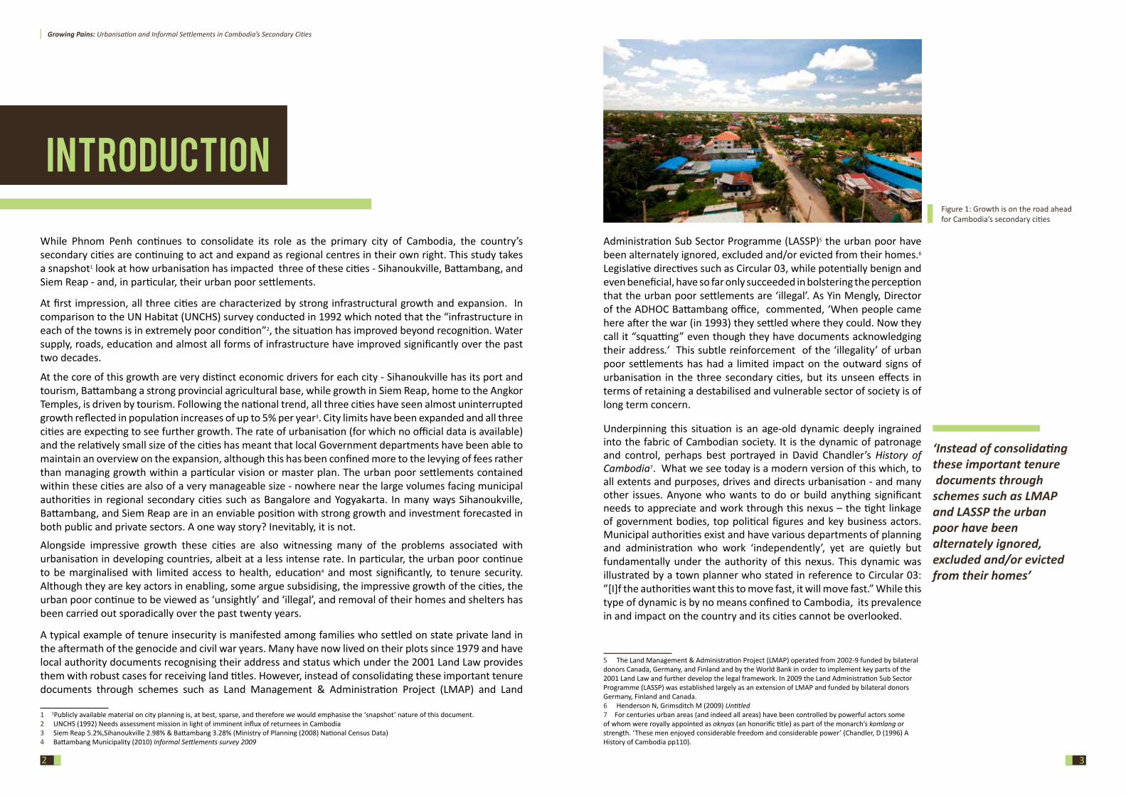
Figure 1: Growth is on the road ahead for Cambodia’s secondary cities
Growing Pains: Urbanisation and Informal Settlements in Cambodia’s Secondary Cities
4
BaTTaMBang
With this in mind, the study identifies some of the questions emerging from this current form of urbanisation, including: the relevance of planning; the role and future of poor settlements; and the role of civil society and other actors. However, before turning to these questions, we will look at each city in turn.
Methodology An initial desk review was made of available material on urbanisation and informal settlements in the three cities; it emerged that data on urbanisation and urban planning in particular is very limited. Field studies were subsequently carried out - to Sihanoukville in January 2012 and to Battambang and Siem Reap in February. During these field trips, the research team met with representatives of local communities, government officers, and CSO contacts. Informal and formal interviews were carried out and additional information was obtained by email correspondence and interview. Finally the data was reviewed and analysed and a first draft was shared with peers for comment and editing followed by the final version.
A note on language: The term “urban poor settlements” is used in this report to denote communities or areas that are distinctly poorer than the surroundings, as identified e.g. by inferior housing and services. In the majority of the cases, these settlements have insecure tenure, although it does not follow that all settlements lack legal possession rights; given the lack of a publicly accessible state land database it is not possible to conclusively assess the legal status of many poor settlements. When discussing the Battambang Municipality’s Informal Settlements Survey 2009, settlements identified in the report are however termed “informal settlements” following terminology adopted in the report.
5
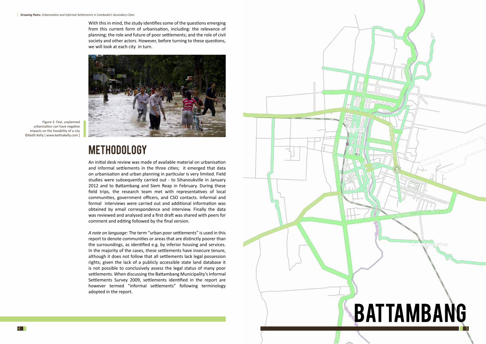
Figure 2: Fast, unplanned urbanisation can have negative
impacts on the liveability of a city ©Keith Kelly [ www.keithakelly.com ]
Growing Pains: Urbanisation and Informal Settlements in Cambodia’s Secondary Cities
76
UrbanplanningOf all three cities, Battambang contains the most documentation and history on urban planning and some limited references to urbanisation. For over a decade, German development cooperation agency Gesellschaft für Internationale Zusammenarbeit (GIZ)10 has supported various initiatives in Battambang, including a heritage project for buildings within the historic core of the city and a survey of informal settlements. In the context of the RGC’s de-concentration and decentralization efforts11, German development assistance also supported the development of a spatial planning framework for the city, culminating in a 2009 Land Use Plan. With these basic structures in place Battambang can confidently claim to have some credible urban planning and more significantly that these processes have had some tangible results within the city. Nevertheless, the reality is that Battambang does not have tightly enforced building code and construction in the periphery is evidence to the random state of development apparent throughout much of Cambodia’s urban areas.
10 GIZ was formed in January 2011 following the merger of Deutsche Gesellschaft für Technische Zusammenarbeit (GTZ), Deutscher Entwicklungsdienst (DED) and Internationale Weiterbildung und Entwicklung (nWEnt). DED was the main active agency involved in Battambang11 Diepart, Jean-Christoph (2008) Developing a Spatial Planning Framework for Sustainable Land and Natural Resources Management. A perspective from Battambang Province, Cambodia, www.gisdevelopment.net
BaCKgroUnD HisToryBattambang was established as an important trading city with around 2,500 inhabitants in the 18th century. Residents lived mostly along a single road parallel to the Sangke River. In 1795 Thailand annexed much of north-western Cambodia including the provinces of Battambang and Siem Reap. The Abhaiwongse family ruled Battambang until 1907 when the province was ceded to the French as part of their Indochina colony. The French colonial administration developed an urban layout which enlarged the size of the town. In the first phase of development, a grid pattern of well-defined streets was developed, and in 1917 three main streets parallel to the Sangke River were built, together two bridges connecting the banks. In 1936 a second urban development plan created a new railway link to Phnom Penh. The town was extended to the west with the axis orientated on the railway station, and many outstanding public and residential buildings were constructed.
Several large infrastructures and public facilities were built under the modernisation program of the government under Prince Sihanouk in the 1960s. Textile and garment factories were built by French and Chinese investors, Battambang Airport was constructed and the railway line was developed to reach Poipet. Numerous schools, public buildings and a university were built as well as a sports centre, museum and exhibition hall to serve the cultural needs of the growing population. During the conflict years Battambang like most others urban centres sustained widespread damage and neglect and the reconstruction of the city continues to this day.
The town’s current population is approximately 180,0008 making it Cambodia’s second largest city after Phnom Penh. Its size is a reflection of its strong agricultural base; Battambang is known as the “Rice Bowl of Cambodia” and accounts for over 10% of Cambodia’s wet season rice crop production and is the country’s largest commercial miller of rice9.
8 151,656 according to the NCDD Data Book 2009 and 180,318 according to the Census 20089 USAID (2010) Battambang Investment Profile
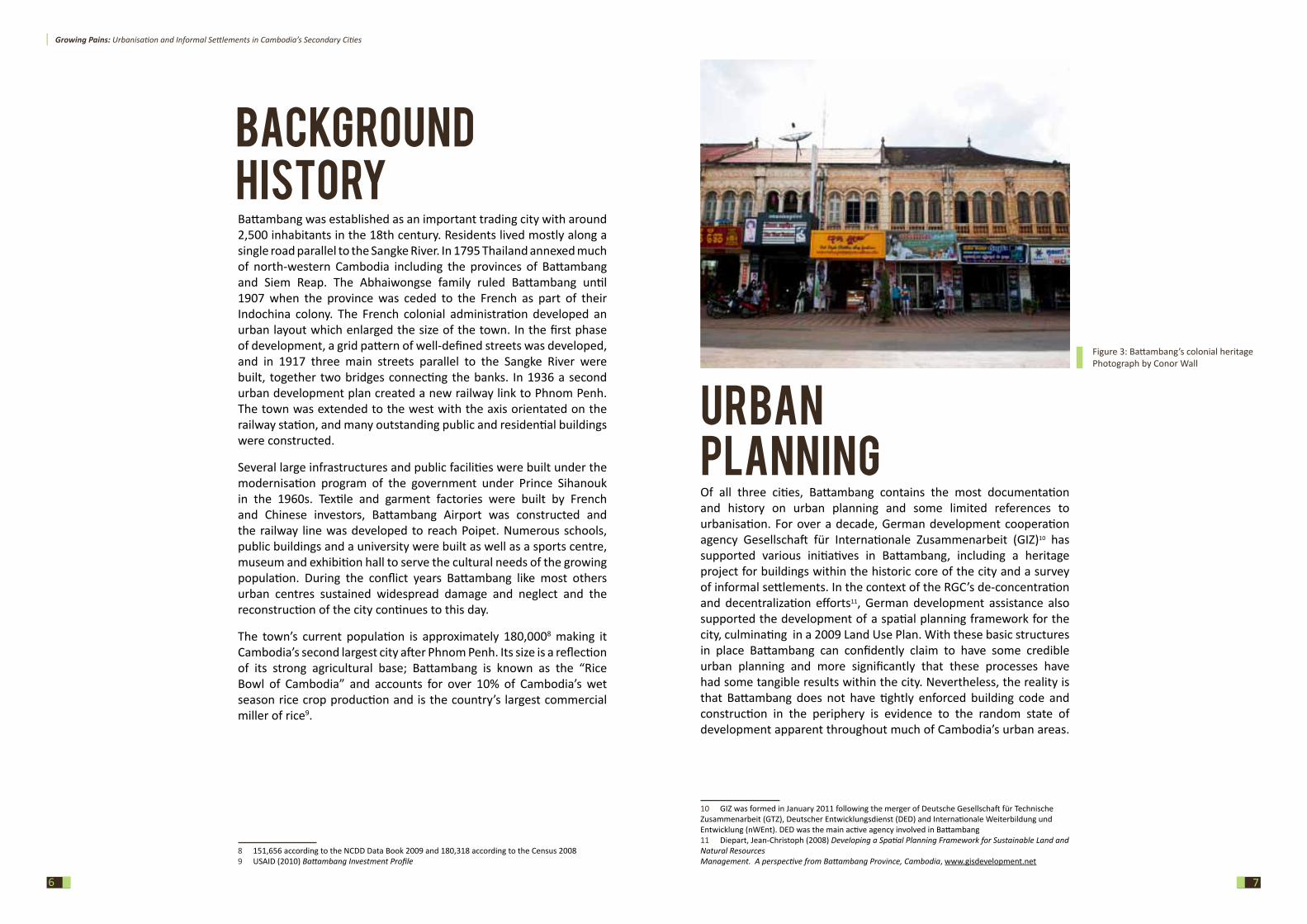
Figure 3: Battambang’s colonial heritagePhotograph by Conor Wall
Growing Pains: Urbanisation and Informal Settlements in Cambodia’s Secondary Cities
98
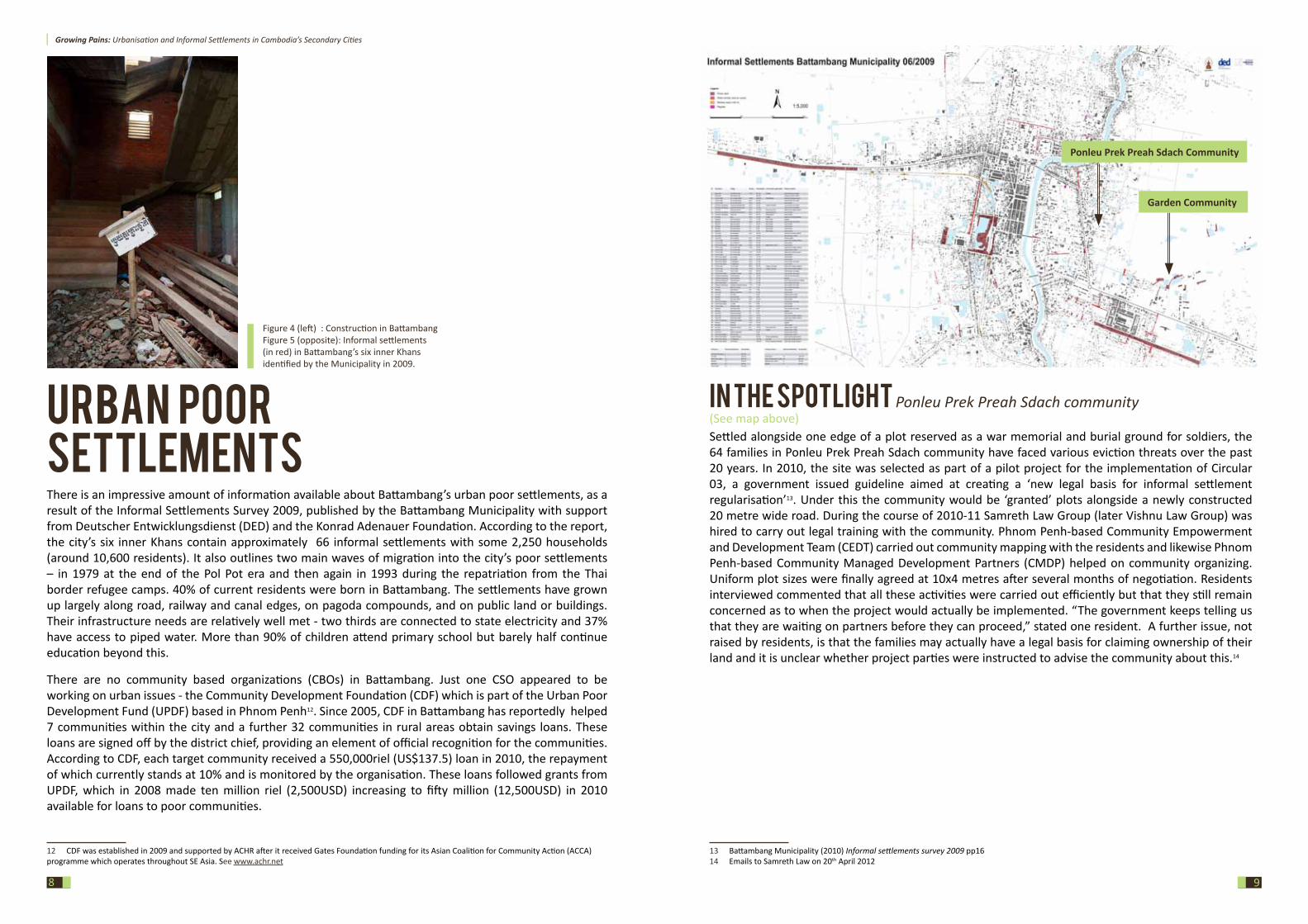
Urban poor settlementsThere is an impressive amount of information available about Battambang’s urban poor settlements, as a result of the Informal Settlements Survey 2009, published by the Battambang Municipality with support from Deutscher Entwicklungsdienst (DED) and the Konrad Adenauer Foundation. According to the report, the city’s six inner Khans contain approximately 66 informal settlements with some 2,250 households (around 10,600 residents). It also outlines two main waves of migration into the city’s poor settlements – in 1979 at the end of the Pol Pot era and then again in 1993 during the repatriation from the Thai border refugee camps. 40% of current residents were born in Battambang. The settlements have grown up largely along road, railway and canal edges, on pagoda compounds, and on public land or buildings. Their infrastructure needs are relatively well met - two thirds are connected to state electricity and 37% have access to piped water. More than 90% of children attend primary school but barely half continue education beyond this.
There are no community based organizations (CBOs) in Battambang. Just one CSO appeared to be working on urban issues - the Community Development Foundation (CDF) which is part of the Urban Poor Development Fund (UPDF) based in Phnom Penh12. Since 2005, CDF in Battambang has reportedly helped 7 communities within the city and a further 32 communities in rural areas obtain savings loans. These loans are signed off by the district chief, providing an element of official recognition for the communities. According to CDF, each target community received a 550,000riel (US$137.5) loan in 2010, the repayment of which currently stands at 10% and is monitored by the organisation. These loans followed grants from UPDF, which in 2008 made ten million riel (2,500USD) increasing to fifty million (12,500USD) in 2010 available for loans to poor communities.
12 CDF was established in 2009 and supported by ACHR after it received Gates Foundation funding for its Asian Coalition for Community Action (ACCA) programme which operates throughout SE Asia. See www.achr.net
in THE spoTLigHT Ponleu Prek Preah Sdach community (See map above) Settled alongside one edge of a plot reserved as a war memorial and burial ground for soldiers, the 64 families in Ponleu Prek Preah Sdach community have faced various eviction threats over the past 20 years. In 2010, the site was selected as part of a pilot project for the implementation of Circular 03, a government issued guideline aimed at creating a ‘new legal basis for informal settlement regularisation’13. Under this the community would be ‘granted’ plots alongside a newly constructed 20 metre wide road. During the course of 2010-11 Samreth Law Group (later Vishnu Law Group) was hired to carry out legal training with the community. Phnom Penh-based Community Empowerment and Development Team (CEDT) carried out community mapping with the residents and likewise Phnom Penh-based Community Managed Development Partners (CMDP) helped on community organizing. Uniform plot sizes were finally agreed at 10x4 metres after several months of negotiation. Residents interviewed commented that all these activities were carried out efficiently but that they still remain concerned as to when the project would actually be implemented. “The government keeps telling us that they are waiting on partners before they can proceed,” stated one resident. A further issue, not raised by residents, is that the families may actually have a legal basis for claiming ownership of their land and it is unclear whether project parties were instructed to advise the community about this.14
13 Battambang Municipality (2010) Informal settlements survey 2009 pp1614 Emails to Samreth Law on 20th April 2012
Ponleu Prek Preah Sdach Community
Garden Community
Figure 4 (left) : Construction in Battambang Figure 5 (opposite): Informal settlements (in red) in Battambang’s six inner Khans identified by the Municipality in 2009.
Growing Pains: Urbanisation and Informal Settlements in Cambodia’s Secondary Cities
1110
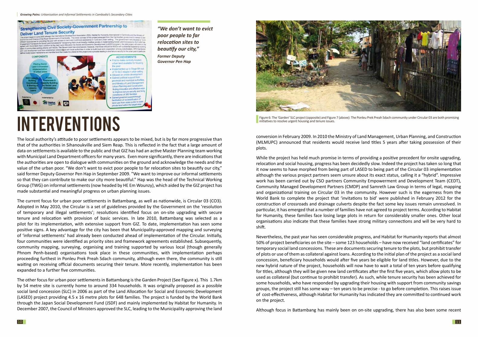
interventions The local authority’s attitude to poor settlements appears to be mixed, but is by far more progressive than that of the authorities in Sihanoukville and Siem Reap. This is reflected in the fact that a large amount of data on settlements is available to the public and that GIZ has had an active Master Planning team working with Municipal Land Department officers for many years. Even more significantly, there are indications that the authorities are open to dialogue with communities on the ground and acknowledge the needs and the value of the urban poor. “We don’t want to evict poor people to far relocation sites to beautify our city,” said former Deputy Governor Pen Hap in September 2009. ”We want to improve our informal settlements so that they can contribute to make our city more beautiful.” Hap was the head of the Technical Working Group (TWG) on informal settlements (now headed by HE Em Wounzy), which aided by the GIZ project has made substantial and meaningful progress on urban planning issues.
The current focus for urban poor settlements in Battambang, as well as nationwide, is Circular 03 (CO3). Adopted in May 2010, the Circular is a set of guidelines provided by the Government on the ‘resolution of temporary and illegal settlements’; resolutions identified focus on on-site upgrading with secure tenure and relocation with provision of basic services. In late 2010, Battambang was selected as a pilot for its implementation, with extensive support from GIZ. To date, implementation has seen some positive signs. A key advantage for the city has been that Municipality-approved mapping and surveying of ‘informal settlements’ had already been conducted ahead of implementation of the Circular. Initially, four communities were identified as priority sites and framework agreements established. Subsequently, community mapping, surveying, organising and training supported by various local (though generally Phnom Penh-based) organisations took place in these communities, with implementation perhaps proceeding furthest in Ponleu Prek Preah Sdach community, although even there, the community is still waiting on receiving official documents securing their tenure. More recently, implementation has been expanded to a further five communities.
The other focus for urban poor settlements in Battambang is the Garden Project (See Figure x). This 1.7km by 54 metre site is currently home to around 334 households. It was originally proposed as a possible social land concession (SLC) in 2006 as part of the Land Allocation for Social and Economic Development (LASED) project providing 4.5 x 16 metre plots for 648 families. The project is funded by the World Bank through the Japan Social Development Fund (JSDF) and mainly implemented by Habitat for Humanity. In December 2007, the Council of Ministers approved the SLC, leading to the Municipality approving the land
conversion in February 2009. In 2010 the Ministry of Land Management, Urban Planning, and Construction (MLMUPC) announced that residents would receive land titles 5 years after taking possession of their plots.
While the project has held much promise in terms of providing a positive precedent for onsite upgrading, relocation and social housing, progress has been decidedly slow. Indeed the project has taken so long that it now seems to have morphed from being part of LASED to being part of the Circular 03 implementation although the various project partners seem unsure about its exact status, calling it a “hybrid”. Impressive work has been carried out by CSO partners Community Empowerment and Development Team (CEDT), Community Managed Development Partners (CMDP) and Samreth Law Group in terms of legal, mapping and organizational training on Circular 03 in the community. However such is the eagerness from the World Bank to complete the project that ‘invitations to bid’ were published in February 2012 for the construction of crossroads and drainage culverts despite the fact some key issues remain unresolved. In particular, it has emerged that a number of families have not agreed to project terms. According to Habitat for Humanity, these families face losing large plots in return for considerably smaller ones. Other local organisations also indicate that these families have strong military connections and will be very hard to shift.
Nevertheless, the past year has seen considerable progress, and Habitat for Humanity reports that almost 50% of project beneficiaries on the site – some 123 households – have now received “land certificates” for temporary social land concessions. These are documents securing tenure to the plots, but prohibit transfer of plots or use of them as collateral against loans. According to the initial plan of the project as a social land concession, beneficiary households would after five years be eligible for land titles. However, due to the new hybrid nature of the project, households will now have to wait a total of ten years before qualifying for titles, although they will be given new land certificates after the first five years, which allow plots to be used as collateral (but continue to prohibit transfer). As such, while tenure security has been achieved for some households, who have responded by upgrading their housing with support from community savings groups, the project still has some way – ten years to be precise - to go before completion. This raises issue of cost-effectiveness, although Habitat for Humanity has indicated they are committed to continued work on the project.
Although focus in Battambang has mainly been on on-site upgrading, there has also been some recent
Figure 6: The ‘Garden’ SLC project (opposite) and Figure 7 (above): The Ponleu Prek Preah Sdach community under Circular 03 are both promising initiatives to resolve urgent housing and tenure issues.
“We don’t want to evict poor people to far relocation sites to beautify our city,” Former Deputy Governor Pen Hap
Growing Pains: Urbanisation and Informal Settlements in Cambodia’s Secondary Cities
12
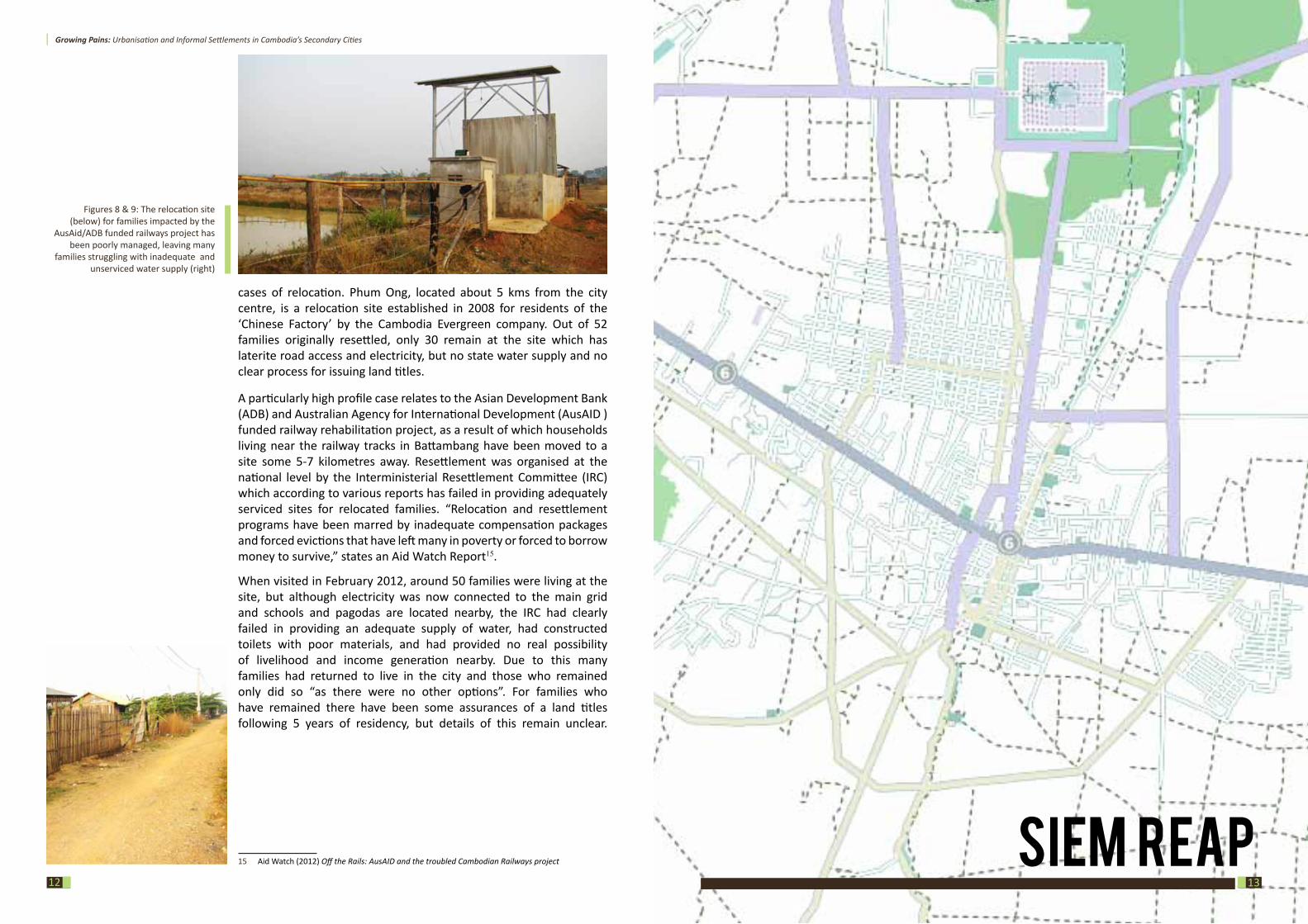
cases of relocation. Phum Ong, located about 5 kms from the city centre, is a relocation site established in 2008 for residents of the ‘Chinese Factory’ by the Cambodia Evergreen company. Out of 52 families originally resettled, only 30 remain at the site which has laterite road access and electricity, but no state water supply and no clear process for issuing land titles.
A particularly high profile case relates to the Asian Development Bank (ADB) and Australian Agency for International Development (AusAID ) funded railway rehabilitation project, as a result of which households living near the railway tracks in Battambang have been moved to a site some 5-7 kilometres away. Resettlement was organised at the national level by the Interministerial Resettlement Committee (IRC) which according to various reports has failed in providing adequately serviced sites for relocated families. “Relocation and resettlement programs have been marred by inadequate compensation packages and forced evictions that have left many in poverty or forced to borrow money to survive,” states an Aid Watch Report15.
When visited in February 2012, around 50 families were living at the site, but although electricity was now connected to the main grid and schools and pagodas are located nearby, the IRC had clearly failed in providing an adequate supply of water, had constructed toilets with poor materials, and had provided no real possibility of livelihood and income generation nearby. Due to this many families had returned to live in the city and those who remained only did so “as there were no other options”. For families who have remained there have been some assurances of a land titles following 5 years of residency, but details of this remain unclear.
15 Aid Watch (2012) Off the Rails: AusAID and the troubled Cambodian Railways project
Figures 8 & 9: The relocation site (below) for families impacted by the
AusAid/ADB funded railways project has been poorly managed, leaving many
families struggling with inadequate and unserviced water supply (right)
siEM rEap13
Growing Pains: Urbanisation and Informal Settlements in Cambodia’s Secondary Cities
1514
BackgroundHistoryThe name Siem Reap means the ‘Defeat of Siam’ — today’s Thailand — and refers to the victory of Cambodia’s King Ang Chan over the Thais in the 16th century. It also alludes to the centuries-old conflict between the Siamese and Khmer peoples; in the 18th century the Siamese were to return and rule Siem Reap until an agreement with the French in 1907 put the area back under Cambodian territory16. In 1901 the École Française d’Extrême Orient (EFEO) began its long association with Angkor by funding an expedition to the Bayon temple. The EFEO took responsibility for clearing and restoring the whole site. In the same year, the first tourists arrived in Angkor – two hundred of them within the space of three months.
Siem Reap itself was little more than a village when the first French explorers re-discovered Angkor in the 19th century. According to Vann Molyvann, the town was “probably only a group of houses which sprung up around the various Wats or temple complexes found in the area”17. With the acquisition of Angkor by the French in 1907, Siem Reap began to develop along colonial, Haussmannian concepts that imposed the structure of the grid, a form both easy to administer and oversee. This was the start of further growth; the Grand Hotel d’Angkor opened its doors in 1929 and the temples of Angkor remained one of Asia’s leading draws until the late 1960s.
In 1975, the 10,00018 strong population of Siem Reap, along with the country’s other towns and cities, was evacuated by the Khmer Rouge and driven into the countryside. As with the rest of the country, Siem Reap’s history and the memories of its people is coloured by the shadow of this brutal regime. During the Vietnamese occupation much of the town centre was used as a military garrison, pushing development out to the east of the city towards psar leu or the upper market. It wasn’t until the early 1990s that the city re-emerged as a major tourist hub; today, Siem Reap is a vibrant town of around 170,000 residents19 that in 2011 hosted 1.4 million foreign visitors20.
16 Thailand reclaimed Siem Reap briefly in 1941 during the Japanese incursion into Indochina only for it to be handed back to Cambodia in 194517 Molyvann V (2003) Modern Khmer Cities, pp8818 ibid pp9819 The town’s current population is 230,000 according to Deputy Governor So Platong, 191,149 according to the NCDD district data book (2009) and 172,843 according to the Census of 2008 making it the nation’s third largest urban centre. The population is contained within 13 Sangkats and 108 villages. Its annual growth of 5.2% is one of the fastest in the country , largely due to the tourism growth related to the Angkor temples20 Reuy R (2011) Tourists to Siem Reap jump 23 percent for the year Phnom Penh Post
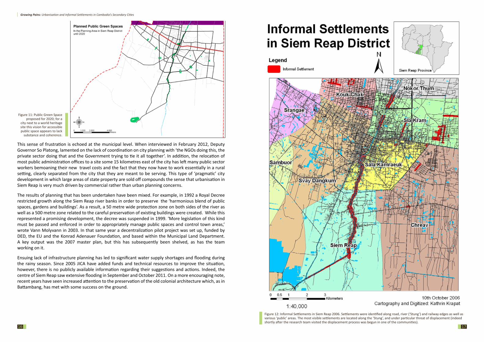
Urban planningUrban development in Siem Reap ostensibly follows a five year master plan for the period 2011-15. According to municipal authorities, elements of the 2011-15 plan include ‘resolutions’ for urban poor settlements, as well as JICA-supported upgrades to the water supply, ADB assistance for sewage systems, and improvements to the roads and other infrastructure. However, the plan is not publicly available. The last publicly available plan, developed with funding from GIZ, dates from 2007. According to this plan, the city’s growth is largely defined by the presence of the Angkor temples, which prevent development to the north and favours it to the south and the west. The plan also outlines some development to the east where the city’s new administrative centre has been established, albeit at a considerable distance from the main urban centre.
Coordinated planning is however hampered by the rapidity of development which is creating many varied and conflicting pressures on the city. According to a report by the Cambodian Research and Development Institute (CDRI) “in Phnom Penh, and to a lesser extent Siem Reap and Serei Saophoan […]the private sector has been largely determining land use patterns in the absence of master plans and zoning regulations. This represents potential inefficiencies associated with distortions in the distribution of public utilities and services that serve private interests rather than the public interest”21. Similarly to the 2007 master plan, the CDRI report indicates that growth of the city would likely be to the east and south-east as areas to the north and west are constrained by the conservation remit of the Apsara Authority, which continues to strictly enforce zoning regulations. 22
Nevertheless, a ‘Hotel City Zone’ has been planned in the immediate north of the city to accommodate the rapid growth in tourism. The proliferation of poorly designed hotels, particularly along the airport road, has led to criticism from a number of quarters. According to Vann Molyvann, who has held a number of senior government positions since the 1960s; ‘the biggest difficulties I encountered in these positions was lawless speculators who attempted to contort or blatantly disobey rules and legislation which I had worked to create and implement. In particular, during my tenure as Director of APSARA, I saw how the region of Siem Reap was undergoing a dramatic expansion […] hotels were built without proper authorization, properties belonging to the Government were bought and sold by private speculators and land was used for purposes that were clearly illegal.’23
Since Molyvann’s time this has continued, and others have also expressed concerns about contemporary development destroying the city’s heritage (and major draw). The Final Report of the 2008 Annual Forum Of The Pacific Rim Council On Urban Development24 notes: “Siem Reap is growing extremely rapidly and with very few development controls. The center is expanding and ribbon development is spreading rapidly across the region. Tourism is a major driver of this urban expansion. If this form of development is allowed to proceed in this fashion then—within the next five years—the heritage and environmental assets of Siem Reap/Angkor will be irreparably damaged.”
21 CDRI (2007) Cambodia Land Titling Urban Baseline report22 ibid23 Molyvann V (2003) Modern Khmer Cities24 Rabe P (2008) Final Report of the 2008 Annual Forum Of The Pacific Rim Council On Urban Development
Figure 10 :Siem Reap has suffered from extensive flooding in recent years
©Keith Kelly [ www.keithakelly.com ]
Growing Pains: Urbanisation and Informal Settlements in Cambodia’s Secondary Cities
1716
Figure 11: Public Green Space proposed for 2020; for a
city next to a world heritage site this vision for accessible public space appears to lack
substance and coherence.
This sense of frustration is echoed at the municipal level. When interviewed in February 2012, Deputy Governor So Platong, lamented on the lack of coordination on city planning with ‘the NGOs doing this, the private sector doing that and the Government trying to tie it all together’. In addition, the relocation of most public administration offices to a site some 15 kilometres east of the city has left many public sector workers bemoaning their new travel costs and the fact that they now have to work essentially in a rural setting, clearly separated from the city that they are meant to be serving. This type of ‘pragmatic’ city development in which large areas of state property are sold off compounds the sense that urbanisation in Siem Reap is very much driven by commercial rather than urban planning concerns.
The results of planning that has been undertaken have been mixed. For example, in 1992 a Royal Decree restricted growth along the Siem Reap river banks in order to preserve the ‘harmonious blend of public spaces, gardens and buildings’. As a result, a 50 metre wide protection zone on both sides of the river as well as a 500 metre zone related to the careful preservation of existing buildings were created. While this represented a promising development, the decree was suspended in 1999. ‘More legislation of this kind must be passed and enforced in order to appropriately manage public spaces and control town areas,’ wrote Vann Molyvann in 2003. In that same year a decentralization pilot project was set up, funded by DED, the EU and the Konrad Adenauer Foundation, and based within the Municipal Land Department. A key output was the 2007 master plan, but this has subsequently been shelved, as has the team working on it.
Ensuing lack of infrastructure planning has led to significant water supply shortages and flooding during the rainy season. Since 2005 JICA have added funds and technical resources to improve the situation, however, there is no publicly available information regarding their suggestions and actions. Indeed, the centre of Siem Reap saw extensive flooding in September and October 2011. On a more encouraging note, recent years have seen increased attention to the preservation of the old colonial architecture which, as in Battambang, has met with some success on the ground.
Figure 12: Informal Settlements in Siem Reap 2006. Settlements were identified along road, river (‘Stung’) and railway edges as well as various ‘public’ areas. The most visible settlements are located along the ‘Stung’, and under particular threat of displacement (indeed shortly after the research team visited the displacement process was begun in one of the communities).
Growing Pains: Urbanisation and Informal Settlements in Cambodia’s Secondary Cities
1918
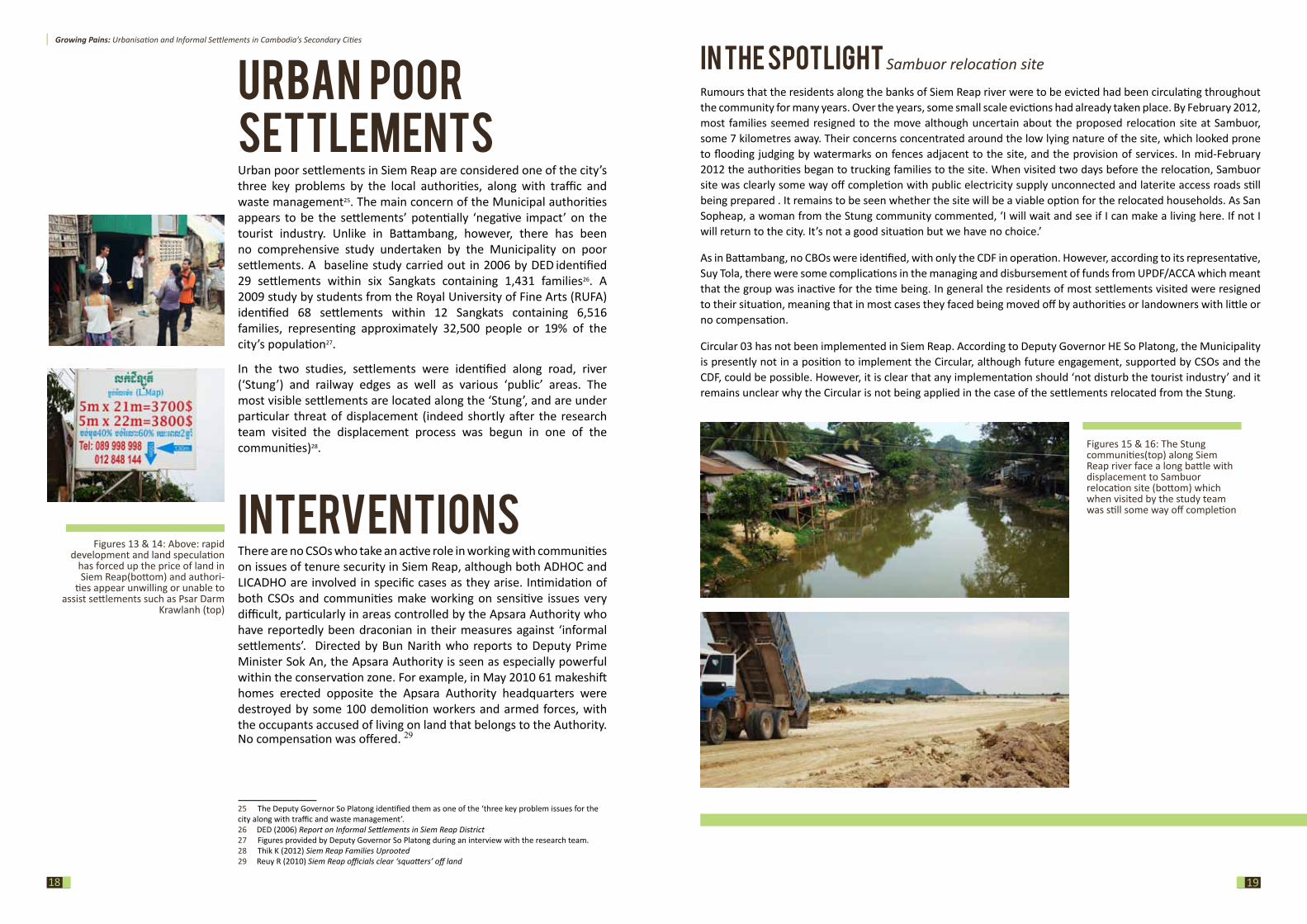
Figures 15 & 16: The Stung communities(top) along Siem Reap river face a long battle with displacement to Sambuor relocation site (bottom) which when visited by the study team was still some way off completion
in THE spoTLigHT Sambuor relocation site
Rumours that the residents along the banks of Siem Reap river were to be evicted had been circulating throughout the community for many years. Over the years, some small scale evictions had already taken place. By February 2012, most families seemed resigned to the move although uncertain about the proposed relocation site at Sambuor, some 7 kilometres away. Their concerns concentrated around the low lying nature of the site, which looked prone to flooding judging by watermarks on fences adjacent to the site, and the provision of services. In mid-February 2012 the authorities began to trucking families to the site. When visited two days before the relocation, Sambuor site was clearly some way off completion with public electricity supply unconnected and laterite access roads still being prepared . It remains to be seen whether the site will be a viable option for the relocated households. As San Sopheap, a woman from the Stung community commented, ‘I will wait and see if I can make a living here. If not I will return to the city. It’s not a good situation but we have no choice.’
As in Battambang, no CBOs were identified, with only the CDF in operation. However, according to its representative, Suy Tola, there were some complications in the managing and disbursement of funds from UPDF/ACCA which meant that the group was inactive for the time being. In general the residents of most settlements visited were resigned to their situation, meaning that in most cases they faced being moved off by authorities or landowners with little or no compensation.
Circular 03 has not been implemented in Siem Reap. According to Deputy Governor HE So Platong, the Municipality is presently not in a position to implement the Circular, although future engagement, supported by CSOs and the CDF, could be possible. However, it is clear that any implementation should ‘not disturb the tourist industry’ and it remains unclear why the Circular is not being applied in the case of the settlements relocated from the Stung.
Figures 13 & 14: Above: rapid development and land speculation
has forced up the price of land in Siem Reap(bottom) and authori-
ties appear unwilling or unable to assist settlements such as Psar Darm
Krawlanh (top)
Urban poorsettlementsUrban poor settlements in Siem Reap are considered one of the city’s three key problems by the local authorities, along with traffic and waste management25. The main concern of the Municipal authorities appears to be the settlements’ potentially ‘negative impact’ on the tourist industry. Unlike in Battambang, however, there has been no comprehensive study undertaken by the Municipality on poor settlements. A baseline study carried out in 2006 by DED identified 29 settlements within six Sangkats containing 1,431 families26. A 2009 study by students from the Royal University of Fine Arts (RUFA) identified 68 settlements within 12 Sangkats containing 6,516 families, representing approximately 32,500 people or 19% of the city’s population27.
In the two studies, settlements were identified along road, river (‘Stung’) and railway edges as well as various ‘public’ areas. The most visible settlements are located along the ‘Stung’, and are under particular threat of displacement (indeed shortly after the research team visited the displacement process was begun in one of the communities)28.
interventions There are no CSOs who take an active role in working with communities on issues of tenure security in Siem Reap, although both ADHOC and LICADHO are involved in specific cases as they arise. Intimidation of both CSOs and communities make working on sensitive issues very difficult, particularly in areas controlled by the Apsara Authority who have reportedly been draconian in their measures against ‘informal settlements’. Directed by Bun Narith who reports to Deputy Prime Minister Sok An, the Apsara Authority is seen as especially powerful within the conservation zone. For example, in May 2010 61 makeshift homes erected opposite the Apsara Authority headquarters were destroyed by some 100 demolition workers and armed forces, with the occupants accused of living on land that belongs to the Authority. No compensation was offered. 29
25 The Deputy Governor So Platong identified them as one of the ‘three key problem issues for the city along with traffic and waste management’.26 DED (2006) Report on Informal Settlements in Siem Reap District27 Figures provided by Deputy Governor So Platong during an interview with the research team. 28 Thik K (2012) Siem Reap Families Uprooted29 Reuy R (2010) Siem Reap officials clear ‘squatters’ off land
Growing Pains: Urbanisation and Informal Settlements in Cambodia’s Secondary Cities
21
siHanoUKviLLE
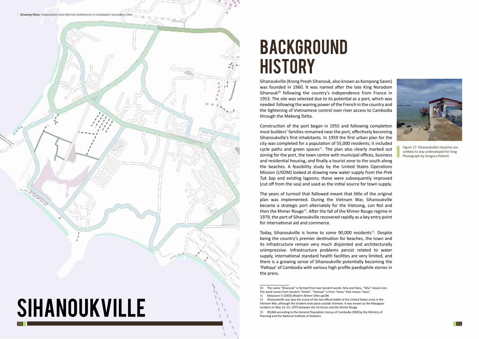
BackgroundhistorySihanoukville (Krong Preah Sihanouk, also known as Kampong Saom) was founded in 1960. It was named after the late King Norodom Sihanouk30 following the country’s independence from France in 1953. The site was selected due to its potential as a port, which was needed following the waning power of the French in the country and the tightening of Vietnamese control over river access to Cambodia through the Mekong Delta.
Construction of the port began in 1955 and following completion most builders’ families remained near the port, effectively becoming Sihanoukville’s first inhabitants. In 1959 the first urban plan for the city was completed for a population of 55,000 residents; it included cycle paths and green spaces31. The plan also clearly marked out zoning for the port, the town centre with municipal offices, business and residential housing, and finally a tourist zone to the south along the beaches. A feasibility study by the United States Operations Mission (USOM) looked at drawing new water supply from the Prek Tuk Sap and existing lagoons; these were subsequently improved (cut off from the sea) and used as the initial source for town supply.
The years of turmoil that followed meant that little of the original plan was implemented. During the Vietnam War, Sihanoukville became a strategic port alternately for the Vietcong, Lon Nol and then the Khmer Rouge32. After the fall of the Khmer Rouge regime in 1979, the port of Sihanoukville recovered rapidly as a key entry point for international aid and commerce.
Today, Sihanoukville is home to some 90,000 residents33. Despite being the country’s premier destination for beaches, the town and its infrastructure remain very much disjointed and architecturally unimpressive. Infrastructure problems persist related to water supply, international standard health facilities are very limited, and there is a growing sense of Sihanoukville potentially becoming the ‘Pattaya’ of Cambodia with various high profile paedophile stories in the press.
30 The name “Sihanouk” is formed from two Sanskrit words: Siha and Hanu. “Siha” means Lion. The word comes from Sanskrit “Simha”. “Hanouk” is from “Hanu” that means “Jaws”. 31 Molyvann V (2003) Modern Khmer Cities pp19632 Sihanoukville was also the scene of the last official battle of the United States army in the Vietnam War, although the incident took place outside Vietnam. It was known as the Mayagüez incident on May 12–15, 1975 between the US forces and the Khmer Rouge33 89,846 according to the General Population Census of Cambodia 2008 by the Ministry of Planning and the National Institute of Statistics
20
Figure 17: Sihanoukville’s beaches are unlikely to stay undeveloped for longPhotograph by Gregory Pellechi
Growing Pains: Urbanisation and Informal Settlements in Cambodia’s Secondary Cities
2322
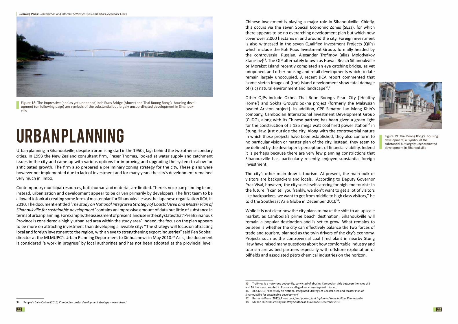
Figure 18: The impressive (and as yet unopened) Koh Puos Bridge (Above) and Thai Boong Rong’s housing devel-opment (on following page) are symbols of the substantial but largely uncoordinated development in Sihanouk-ville
Urban planningUrban planning in Sihanoukville, despite a promising start in the 1950s, lags behind the two other secondary cities. In 1993 the New Zealand consultant firm, Fraser Thomas, looked at water supply and catchment issues in the city and came up with various options for improving and upgrading the system to allow for anticipated growth. The firm also prepared a preliminary zoning strategy for the city. These plans were however not implemented due to lack of investment and for many years the city’s development remained very much in limbo.
Contemporary municipal resources, both human and material, are limited. There is no urban planning team, instead, urbanization and development appear to be driven primarily by developers. The first team to be allowed to look at creating some form of master plan for Sihanoukville was the Japanese organization JICA, in 2010. The document entitled ‘The study on National Integrated Strategy of Coastal Area and Master Plan of Sihanoukville for sustainable development’ contains an impressive amount of data but little of substance in terms of urban planning. For example, the assessment of present land use in the city states that ‘Preah Sihanouk Province is considered a highly urbanized area within the study area’. Indeed, the focus on the plan appears to be more on attracting investment than developing a liveable city; “The strategy will focus on attracting local and foreign investment to the region, with an eye to strengthening export industries” said Pen Sophal, director at the MLMUPC’s Urban Planning Department to Xinhua news in May 2010.34 As is, the document is considered ‘a work in progress’ by local authorities and has not been adopted at the provincial level.
34 People’s Daily Online (2010) Cambodia coastal development strategy moves ahead
Figure 19: Thai Boong Rong’s housing development, a symbol of the substantial but largely uncoordinated development in Sihanoukville
Chinese investment is playing a major role in Sihanoukville. Chiefly, this occurs via the seven Special Economic Zones (SEZs), for which there appears to be no overarching development plan but which now cover over 2,000 hectares in and around the city. Foreign investment is also witnessed in the seven Qualified Investment Projects (QIPs) which include the Koh Puos Investment Group, formally headed by the controversial Russian, Alexander Trofimov (alias Molodyakov Stanislav)35. The QIP alternately known as Hawaii Beach Sihanoukville or Morakot Island recently completed an eye catching bridge, as yet unopened, and other housing and retail developments which to date remain largely unoccupied. A recent JICA report commented that ‘some sketch images of (the) island development show fatal damage of (sic) natural environment and landscape36.’
Other QIPs include Okhna Thai Boon Roong’s Pearl City (‘Healthy Home’) and Sokha Group’s Sokha project (formerly the Malaysian owned Ariston project). In addition, CPP Senator Lao Meng Khin’s company, Cambodian International Investment Development Group (CIIDG), along with its Chinese partner, has been given a green light for the construction of a 135 mega watt coal fired power station37 in Stung Haw, just outside the city. Along with the controversial nature in which these projects have been established, they also conform to no particular vision or master plan of the city. Instead, they seem to be defined by the developer’s perceptions of financial viability. Indeed it is perhaps because there are very few planning constrictions that Sihanoukville has, particularly recently, enjoyed substantial foreign investment.
The city’s other main draw is tourism. At present, the main bulk of visitors are backpackers and locals. According to Deputy Governor Prak Visal, however, the city sees itself catering for high end tourists in the future: ‘I can tell you frankly, we don’t want to get a lot of visitors like backpackers, we want to get from middle to high class visitors,’’ he told the Southeast Asia Globe in December 201038.
While it is not clear how the city plans to make the shift to an upscale market, as Cambodia’s prime beach destination, Sihanoukville will remain a popular destination and is set to grow. What remains to be seen is whether the city can effectively balance the two forces of trade and tourism, planned as the twin drivers of the city’s economy. Projects such as the controversial coal fired plant in nearby Stung Haw have raised many questions about how comfortable industry and tourism are as bed partners especially with offshore exploitation of oilfields and associated petro chemical industries on the horizon.
35 Trofimov is a notorious pedophile, convicted of abusing Cambodian girls between the ages of 6 and 16. He is also wanted in Russia for alleged sex crimes against minors. 36 JICA (2010) ‘The study on National Integrated Strategy of Coastal Area and Master Plan of Sihanoukville for sustainable development’ 37 Bernama Press (2012) A new coal fired power plant is planned to be built in Sihanoukville38 Mullen D (2010) Paving the Way Southeast Asia Globe December 2010
Growing Pains: Urbanisation and Informal Settlements in Cambodia’s Secondary Cities
2524
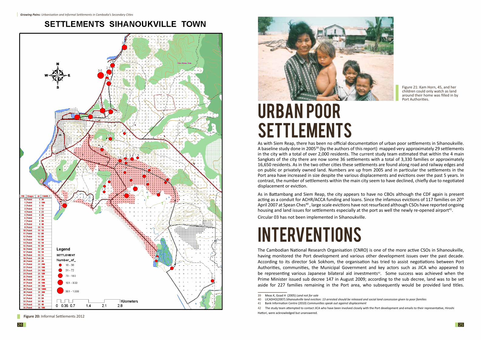
Figure 20: Informal Settlements 2012
Urban poorsettlementsAs with Siem Reap, there has been no official documentation of urban poor settlements in Sihanoukville. A baseline study done in 200539 (by the authors of this report) mapped very approximately 29 settlements in the city with a total of over 2,000 residents. The current study team estimated that within the 4 main Sangkats of the city there are now some 36 settlements with a total of 3,330 families or approximately 16,650 residents. As in the two other cities these settlements are found along road and railway edges and on public or privately owned land. Numbers are up from 2005 and in particular the settlements in the Port area have increased in size despite the various displacements and evictions over the past 5 years. In contrast, the number of settlements within the main city seem to have declined, chiefly due to negotiated displacement or eviction.
As in Battambang and Siem Reap, the city appears to have no CBOs although the CDF again is present acting as a conduit for ACHR/ACCA funding and loans. Since the infamous evictions of 117 families on 20th April 2007 at Spean Ches40 , large scale evictions have not resurfaced although CSOs have reported ongoing housing and land issues for settlements especially at the port as well the newly re-opened airport41.Circular 03 has not been implemented in Sihanoukville.
interventions The Cambodian National Research Organisation (CNRO) is one of the more active CSOs in Sihanoukville, having monitored the Port development and various other development issues over the past decade. According to its director Sok Sokhom, the organisation has tried to assist negotiations between Port Authorities, communities, the Municipal Government and key actors such as JICA who appeared to be representing various Japanese bilateral aid investments42. Some success was achieved when the Prime Minister issued sub decree 147 in August 2009; according to the sub decree, land was to be set aside for 227 families remaining in the Port area, who subsequently would be provided land titles.
39 Meas K, Goad H (2005) Land not for sale 40 LICADHO(2007) Sihanoukville land eviction: 13 arrested should be released and social land concession given to poor families41 Bank Information Centre (2010) Communities speak out against displacement42 The study team attempted to contact JICA who have been involved closely with the Port development and emails to their representative, Hiroshi Hattori, were acknowledged but unanswered.
Figure 21: Kam Horn, 45, and her children could only watch as land around their home was filled in by Port Authorities.
Growing Pains: Urbanisation and Informal Settlements in Cambodia’s Secondary Cities
2726
DisCUssionA review of the three secondary cities reveals a number of common issues related to history, infrastructure, planning controls, urban poor settlements and power dynamics. At the same time, each city has its own distinct character and flavour. What makes each city’s economy tick, the role of the local authorities, and the influence of outside actors are all very diverse. Following a review of each city, the following key points emerge; The planning system: largely irrelevant?
It is an unfortunate irony in a country that boasts one of the most impressive urban planning feats of the second millennium that there appears to be little appetite for planned cities. It seems it is only the urgings of international donors – and a handful of notable Cambodian practitioners - that keeps urban planning on the agenda at all. For example, it appears no coincidence that two impressive planning documents, the French funded Livre Blanc44for Phnom Penh and the German funded Final Draft Land Use Plan for Siem Reap (both published in 2007) met with an appreciative but ultimately muted response. Neither document has been adopted. Sihanoukville also has no masterplan to speak of and it is only in Battambang that the concept of urban planning has gained any real footing - although again largely thanks to substantial aid assistance from Germany.
The underlying issue is that the concept of a well-defined planning system that dictates development patterns is anathema to how decision-making has operated in the recent era of Cambodia. Indeed, a master plan that would constrict or challenge the changing needs of the main nexus of top political and business officers would be not only undesirable but unthinkable. As is apparent particularly in Siem Reap and Sihamoukville, those with power dictate what gets built and where. This appears to be one of the key areas in which many foreign agencies, often accustomed to quite rigid planning regulations in their own countries, have either misread the situation or chosen to push ahead with programmes that are unwanted and/or unconnected to the core decision making process. The misunderstanding, obliviousness, or wilful ignorance of this key concept seems to be the default mode of a number of CSOs too.
Although a lack of overall planning remains the most common state of affairs, other options are slowly emerging. The emphasis of these emerging options is however on flexibility and lack of rigidity. For example, JICA has increased its involvement in urban planning with publications such as the 2010 Study on national integrated strategy of coastal area and masterplan of Sihanoukville for sustainable development. Although visually pleasing, the document remains light on real meaning, is regarded by provincial authorities as ‘work in progress’, and is practically impossible to access for the general public. The report is, in many ways, symbolic of where planning is mostly likely headed in Cambodia for the foreseeable future - well researched, attractive publications but short on meaningful and enforceable content.
44 In October 2007 the Bureau des Affaires Urbaines in collaboration with the Municipality of Phnom Penh published a comprehensive urban planning document for the city entitled ‘Livre Blanc du developpement et de l’amenagement de Phnom Penh’. To date the document has not been adopted by the authorities.
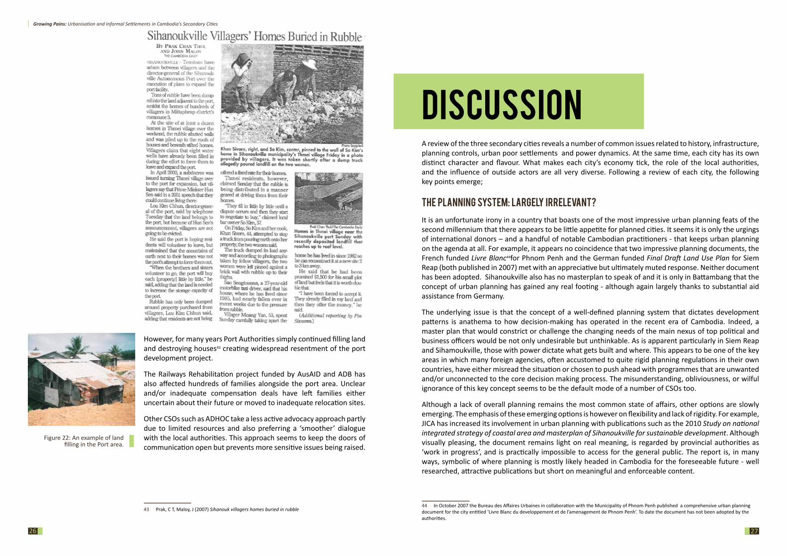
However, for many years Port Authorities simply continued filling land and destroying houses43 creating widespread resentment of the port development project.
The Railways Rehabilitation project funded by AusAID and ADB has also affected hundreds of families alongside the port area. Unclear and/or inadequate compensation deals have left families either uncertain about their future or moved to inadequate relocation sites.
Other CSOs such as ADHOC take a less active advocacy approach partly due to limited resources and also preferring a ‘smoother’ dialogue with the local authorities. This approach seems to keep the doors of communication open but prevents more sensitive issues being raised.
43 Prak, C T, Maloy, J (2007) Sihanouk villagers homes buried in rubble
Figure 22: An example of land filling in the Port area.
Growing Pains: Urbanisation and Informal Settlements in Cambodia’s Secondary Cities
2928
The one counter-current to this is the Battambang Municipality’s engagement with planning issues, partly reflected in its production of a Technical Report on the Land Use Plan for Battambang Municipality published in 2009 which, although not a master plan, provides some helpful planning guidelines. Most significantly, in the years following its publication, it has had real impact on the ground in terms of influencing where roads have been built and development encouraged. Another positive indicator is the small but dedicated GIZ-funded urban master plan team. Based at the Municipal Land Department office, the team are integrally involved in urbanisation issues, particularly in relation to poor settlements.
plan n ed en claves, u n plan n ed citi es?
A common trend in Sihanoukville, Battambang, and Siem Reap is that new developments, best described as enclaves, are not part of a wider master plan but stand alone. The developer has almost complete discretion as to what, where, and how they build, which provides an attractive scenario for developers but leaves these cities facing largely uncoordinated and rambling growth. A prime example of this is Okhna Thai Boong Rong’s ‘Pearl City’ or ‘Health Home’, a 60 hectare development in Sihanoukville which provides a clear master plan for its specific site, but sits in isolation with no real connection to its surroundings or its place within the city as a whole. In Phnom Penh these types of development projects are already common, with Camko City and Grand Phnom Penh exemplifying bold, but fundamentally disconnected enclaves.
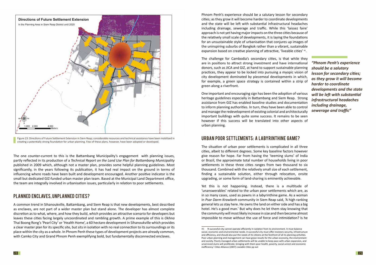
Figure 23: Directions of Future Settlement Extension in Siem Reap; considerable resources and technical assistance have been mobilized in creating a potentially strong foundation for urban planning. Few of these plans, however, have been adopted or developed.
Phnom Penh’s experience should be a salutary lesson for secondary cities; as they grow it will become harder to coordinate developments and the state will be left with substantial infrastructural headaches including drainage, sewerage and traffic. While this ‘laissez faire’ approach is not yet having major impacts on the three cities because of the relatively small scale of developments, it is laying the foundations for an unsustainable style of urbanisation that conjures up images of the uninspiring suburbs of Bangkok rather than a vibrant, sustainable expansion based on creative planning of attractive, ‘liveable cities’ 45.
The challenge for Cambodia’s secondary cities, is that while they are in positions to attract strong investment and have international donors, such as JICA and GIZ, at hand to support sustainable planning practices, they appear to be locked into pursuing a myopic vision of city development dominated by piecemeal developments in which, for example, a green space strategy is contained within a strip of green along a riverfront.
One important and encouraging sign has been the adoption of various heritage guidelines especially in Battambang and Siem Reap. Strong assistance from GIZ has enabled baseline studies and documentation to inform planning authorities. In turn, they have been able to control and manage the redevelopment of existing colonial and architecturally important buildings with quite some success. It remains to be seen however if this success will be translated into other aspects of urban planning.
U rban poor settlem ents: a labyri nth i n e gam e?
The situation of urban poor settlements is complicated in all three cities, albeit to different degrees. Some key baseline factors however give reason for hope. Far from having the ‘teeming slums’ of India or Brazil, the approximate total number of households living in poor settlements in these three cities ranges from two thousand to six thousand. Combined with the relatively small size of each settlement, finding a sustainable solution, either through relocation, onsite upgrading, or some form of land-sharing is eminently achievable.
Yet this is not happening. Instead, there is a multitude of ‘unanswerables’ related to the urban poor settlements which are, as in so many cases, used as pawns in a labyrinthine game. As a woman in Psar Darm Krawlanh community in Siem Reap said, ‘A high ranking general lets us stay here. He owns the land on either side and has a big hotel. He’s a good man.’ But why does he let them stay knowing that the community will most likely increase in size and then become almost impossible to move without the use of force and intimidation? Is he
45 ‘A successful city cannot operate efficiently in isolation from its environment. It must balance social, economic and environmental needs. A successful city must offer investors security, infrastructure and efficiency, and should also put the needs of its citizens at the forefront of all its planning activities. Poor urban planning and management can have grave results for the urban economy, the environment and society. Poorly managed urban settlements will be unable to keep pace with urban expansion, and unserviced slums will proliferate, bringing with them poor health, poverty, social unrest and economic inefficiency.’ Cities Alliance (2007) Liveable Cities pp xvii
“Phnom Penh’s experience should be a salutary lesson for secondary cities; as they grow it will become harder to coordinate developments and the state will be left with substantial infrastructural headaches including drainage, sewerage and traffic”
Growing Pains: Urbanisation and Informal Settlements in Cambodia’s Secondary Cities
3130
‘a good man’ or are there other forces at play? In another case homes that were burnt down along the main river in Siem Reap were allowed to be rebuilt despite the fact that for many years the authorities had been looking to remove all the families along the Stung to a relocation site. At this level it becomes, as one observer pointed out, ‘something of a surrealist painting.’
One reason for this situation is that poor settlements can be good money. The renting of plots, the number of which can run into the hundreds, at even US$5-10 per month can provide a handy annual income, especially when monopolisation of the electricity and water supply are added with a mark-up of two to five times the state price.
While the majority of the urban poor in all three cities continue to live with insecure tenure, the standard authority response on poor settlements is that it is “a difficult situation, there is no money or land to help them”46. Alternately, the authorities argue that the residents are opportunistic squatters who move from one site to the next looking for compensation. While some officials express interest in resolving the situation sustainably, there are no planned approaches in either Siem Reap or Sihanoukville. Battambang forms an exception, where it seems Circular 03 has entered the municipal planning agenda, albeit with strong GIZ and other donor support, and the Garden Project appears to be finally gaining some ground. Yet even in Battambang, where Circular 03 implementation has met with some success, it has to date fallen short of the Circular’s key primary step concerning the adjudication of land, i.e. confirming whether residents have possession rights or are in fact illegal. As such, the majority of communities in Battambang continue to live with insecure tenure.
Undoubtedly, urban poor settlements form a complex and ongoing issue. Widespread implementation of Circular 03 in accordance with the Land Law could provide a basis for systematically and transparently addressing and resolving the various housing and tenure issues of the urban poor. Yet the Circular is generally perceived as ‘a benevolent act’ by the authorities, and there appears to be little interest among authorities to develop a more coherent framework for addressing the needs of the urban poor in the manner required by Cambodia’s laws and international treaties the country is signatory to.
The one missing piece in the jigsaw is political will. Any initiative that sits outside the governance nexus will gain little traction– a simple fact that is often either ignored or misunderstood by donors and CSOs. The bottom line is that while the numbers of urban poor in Cambodia’s secondary cities continue to be ‘manageable’, the current approach by the authorities to assisting and improving the situation remains unconvincing. Simultaneously, despite the widespread abuse of land and housing rights meaningful resolution of the issue remains surprisingly absent from international donors’ indicators and requirements.
46 Interview with Deputy Governor of Siem Reap, So Platong
Donor assistance: th e wi n ds of change?
As Cambodia’s secondary cities find their economic legs, they are also inevitably finding greater confidence to determine their own form of governance. Increasingly, local authorities are making their own plans and setting their own agendas. A potentially positive sign, and indeed many millions of dollars in aid have been poured into nationwide initiatives such as the ‘Demand for Good Governance’ based at the Ministry of Interior. Yet the reality is that although greater self reliance and confidence can be good news, there is a distinct danger that the increased decision-making power at the local and provincial levels will lead those authorities to resort to more traditional forms of patronage governance.
Simultaneously, Cambodia is increasingly dominated by one political party, which has led to a subtle re-positioning among many donors and CSOs over recent years. While the Government continues to encourage both donors and CSOs to ‘join in partnership’, the underlying message is that those who remain ‘outside’ the partnership are ‘against’ the Government. Many now understand that there is a choice between ‘cooperation’ with the Government or ‘isolation’. As an extension of this government authorities are increasingly able to ‘cherry pick’ the type of donors who assist city planning. Development partners focused on developing ‘traditional’ master plans with strong emphasis on zoning and enforceable codes have met with few supporters while those plans that encourage maximum flexibility are given greater consideration. As a result, JICA’s pragmatic approach is finding favour, while the influence of the French Bureau des Affaires Urbaines (BAU) has all but evaporated and the progress of GIZ’s more robust planning documents have also foundered. The other rising major player is, of course, the Chinese whose very direct and pragmatic approach has no specific planning element but will be a major impact on the skylines of many Cambodian cities over the coming years.
wh ere are th e Csos?
The final question emerging from this study concerns the general lack of community based organisations and NGOs involved in urban poor issues, community organizing and urban planning. Neither Sihanoukville, Battambang, or Siem Reap appear to have any genuine CBOs, a situation also reflected in Phnom Penh, where two key CBOs started in the 1990s, Solidarity for the Urban Poor Federation (SUPF) and Urban Sector Group (USG), have quietly folded since 2005. The only network now existing is the quasi Government controlled CDF, and its sister organisation in Phnom Penh, UPDF. Chaired by the Deputy Governor of Phnom Penh Municipality and funded by the Gates Foundation, the CDF is the only option nationally for networking among urban communities but its close ties to the Government leave questions over its impartiality and particularly over its ability to assist communities facing eviction issues.
In addition to the lack of CBOs, all three secondary cities also lack CSO involvement in urban issues; Battambang forms an exception, although even there the majority of organisations involved are based in Phnom Penh and carry out specific consultancies or projects in the city. Both communities and Municipalities in all three cities however welcomed CSO assistance, meaning there could be ample work and potential opportunities for CSOs to engage on urban planning and development issues.
“The one missing piece in the jigsaw is political will.
Any initiative that sits outside the governance
nexus will gain little traction– a simple fact
that is often either ignored or misunderstood
by donors and CSOs.”
Growing Pains: Urbanisation and Informal Settlements in Cambodia’s Secondary Cities
3332
ConCLUsion The snapshot nature of this report is intended as a starting point for further research. As urbanisation in Battambang, Sihanoukville, and Siem Reap seems set to continue for the foreseeable future, a better understanding of the dynamics – economic, environmental, social, political - in each of the three cities is necessary to guide future interventions.
Further efforts to manage urbanisation are also needed. Battambang shows most promise in terms of planned growth, largely thanks to extensive GIZ involvement in the city. It is however also the least contentious of the three cities; growth in Siem Reap, but also to some extent in Sihanoukville, is driven by tourism, which puts significant pressure on land use planning. In Sihanoukville in particular, Chinese funds for large-scale developments also continue to pour in, thus strengthening demands for a “flexible” approach. Hence, while Battambang could be an example to emulate, the strength of the private sector in driving growth is likely to continue undermining urban planning in Siem Reap and Sihanoukville. Ironically, unchecked, commercially-driven development may ultimately deplete its very own sources – the cultural heritage of Siem Reap and the natural legacy of Sihanoukville.
Whereas urban planning faces significant challenges related to lack of capacity and resources vis-à-vis the power of the political and business elite, the housing situation for the urban poor in Cambodia’s secondary cities can and should be improved. Pressure on land in the three cities is as yet no match to the scramble for land unfolding in Phnom Penh and the poor settlements themselves are relatively small in size. As a result, equitable, and notably legal, solutions for urban poor settlements are eminently achievable. Certainly, in a country with substantial foreign aid and growing investment there is no justification for violent forced eviction, intimidation, cut-rate compensation and substandard relocation. As such, now is the time to secure tenure for the urban poor in Cambodia’s secondary cities. An increased focus by both CSOs and donors on urban poor settlements in these cities could go a long way in improving living standards, strengthening tenure security, and preventing future evictions. Whether or not this is achieved through the implementation of Circular 03 is a moot point, the key to success for any intervention is political will, or, as the difficult experience in Phnom Penh shows, strong community organising and solidarity in the face of adversity. The good news for the poor of Battambang, Sihanoukville, and Siem Reap, is that some political will may just exist, which combined with added resources could lead to real, positive outcomes on the ground.
BattambangMr Adrian Klaus Senior Adviser GIZ/ Municipality of BattambangMr Tam Chan Borei Technical Officer GIZ/ Municipality of BattambangMr Andreas Reinsch Senior Adviser/ Good Governance and
Public AdministrationGIZ/ Municipality of Battambang
Mr Chan Kranh Committee member Community Development Foundation (CDF)Ms Chim Bunchenda Provincial Director Banteay Srei BattambangMr Yin Mengly Provincial Director ADHOC BattambangMr Sun Tek Provincial Director LICADHO BattambangMr Srei Aem Community member Ponleu Prek Preah Sdach community, Battambang
Ms Khur Ny Community member Railways relocation siteMr Ieng Hoa Director Community managed development partners (CMDP)
Mr Tep Neth Director Samreth Law Group (SLG)Ms Sath Yara Director Community empowerment and
development (CEDT)
siem reapHE So Platong Deputy Governor Municipality of Siem ReapMr Frank Wiesemann
Former Senior Advisor/ Good Governance and Public Administration
GIZ/ Municipality of Siem Reap
Ms Keo Kanika Community Organiser Habitat for Humanity CambodiaMr Yen Sokha HIV/Aids Program Manager Caritas CambodiaMs Suy Tola Committee member Community Development Foundation (CDF)Mr Nu Puthy Provicial Director LICADHO Siem ReapMr Mao Yin Provincial Director ADHOC Siem ReapMs San Sopheap Community member Stung/ Sambuor communitiesSr Denise Coghlan Director Metta Karuna centre/JSC
sihanoukvilleMr Prak Visal Deputy Director of Administration Division Sihanoukville Provncial OfficeMr Sok Sokhom President Cambodian National Research Organisation (CNRO)
Ms Chap Sotheary Provincial Director ADHOC SihanoukvilleMr Chum Panith Provincial Director FACTMs Maggie Eno Founder Mlop TapangMr Hiroshi Hattori Adviser JICAMs Chab Vanna Committee member Community Development Foundation (CDF)
ConTaCTs
“equitable, and notably legal,
solutions for urban poor settlements are
eminently achievable”
Growing Pains: Urbanisation and Informal Settlements in Cambodia’s Secondary Cities
3534
BiBLiograpHy
Aid Watch (2012) Off the Rails: AusAID and the troubled Cambodian Railways project
Bank Information Centre (2010) Communities speak out against displacement http://www.bicusa.org/en/Article.11896.aspx
Battambang Municipality (2009) Technical Report on the Land Use Plan for Battambang Municipality Battambang Municipality in cooperation with DED and KAS
Battambang Municipality (2010) Informal Settlements Survey 2009, Battambang Municipality in cooperation with DED
Bernama Press (2012) A new coal fired power plant is planned to be built in Sihanoukville http://www.bernama.com/bernama/v6/newsbusiness.php?id=659796
CDRI (2007) Cambodia Land Titling Urban Baseline Survey Report http://www.cdri.org.kh/webdata/confpap/landtitlingrural.htm
Chandler, D (1996) A History of Cambodia, Westview Press 2nd edition Cities Alliance (2007) Liveable Cities http://www.unep.org/urban_environment/PDFs/LiveableCities.pdf
DED (2006) Report on Informal Settlements in Siem Reap District
Diepart, Jean-Christoph (2008) Developing a Spatial Planning Framework for Sustainable Land and Natural Resources Management. A perspective from Battambang Province, Cambodia, www.gisdevelopment.net
District Master Plan Team Siem Reap/ DED (2007) Technical Report on the Final Draft Land-Use Plan for Siem Reap DistrictGrimsditch M, Henderson N (2009) Untitled BABC, COHRE, JRS http://www.babcambodia.org/reports/docs/UNTITLED_Land_Tenure_Cambodia_LMAP_FINAL.pdf
LICADHO(2007) Sihanoukville land eviction: 13 arrested should be released and social land concession given to poor families http://www.licadho-cambodia.org/pressrelease.php?perm=151
Ministry of Planning, National Institute of Statistics (2011) General Population Census of Cambodia 2008
MLMUPC, JICA, Nippon Koei, Value Planning International (2010) The study on national integrated strategy of coastal area and masterplan of sihanouk-ville for sustainable development
Meas K, Goad H (2005) Land Not for Sale Sahmakum Teang Tnaut
Molyvann V (2003) Modern Khmer Cities Reyum
Mullen D (2010) Paving the Way Southeast Asia Globe December 2010
NCDD (2009) Siem Reab Krong Data Book 2009
NCDD (2009) Battambang Krong Data Book 2009
People’s Daily Online (2010) Cambodia coastal development strategy moves ahead http://english.people.com.cn/90001/90777/90851/7005811.html
Prak C T, Maloy J (2007) Sihanouk villagers homes buried in rubble Cambodia Daily
Rabe P (2008) Final Report of the 2008 Annual Forum Of The Pacific Rim Council On Urban Development
http://www.getty.edu/conservation/our_projects/education/sea/final_report_2008_pacrim.pdf
Reuy R (2010) Siem Reap officials clear ‘squatters’ off land Phnom Penh Post
Reuy R (2011) Tourists to Siem Reap jump 23 percent for the year Phnom Penh Post
Thik K (2012) Siem Reap Families Uprooted Phnom Penh Post
UNCHS (1992) Needs assessment mission in light of imminent influx of returnees in Cambodia
USAID (2010) Battambang Investment Profile http://www.cambodiamsme.org/userfiles/file/Investment-Profiles/Battambang-en.pdf

Growing Pains: Urbanisation and Informal Settlements in Cambodia’s Secondary Cities
36